Search Results for: rock lake
Jamesville Rock Query
Aggregate mining is an inherently destructive act, one that involves removing non-renewable resources like limestone, sand, and gravel, from deep within the earth. This comes at a heavy cost to the environment and local communities.
Open-pit mining, the type of mining used at the Jamesville Quarry, is exactly what it sounds like — a gaping pit carved out of the land. In the case of the Jamesville Quarry, the land formerly consisted of pristine lakes, gorges, ice caves, and other unique geological features. Now the land is little more than a 1,174 acre trench. Another 1,064 acres is considered part of the quarry.
Agricultural Area around Lake Champlain
I was noticing on the National Land Cover Dataset how relatively narrow the fertile agricultural land around Lake Champlain is on the map. You don't get very far from the lake before the hills and mountains turn the fantastic soil for growing into infertile rock and sand.
Deja Vu – – The Adirondack Almanack
Recent news stories on both sides of Lake Champlain reported a huge, dark cloud of smoke rising above northern Clinton County. A section of the Altona Flat Rock was afire, and within a day, more than 300 acres were scorched.
Dry conditions across the North Country were cited as the reason it spread so quickly, but there were other factors I happen to be familiar with because the first book I wrote, back in 1980, was titled A History of the Altona Flat Rock. The area in question comprises fifteen square miles of uninhabited wildlands which, by nature, is a very dry environment.
Two chapters in the book help explain the volatility of the Flat Rock when it comes to fire. It is classified as a sandstone-pavement barrens: nearly level bedrock, forming a surface similar to pavement; jack pines as the dominant tree (fire is required for them to regenerate, exploding the cones and spreading the seeds); blueberry and huckleberry plants as the dominant shrubs; and lichens and mosses as the dominant ground cover. There is variation in each category, of course, but that is a near-perfect description of the Altona Flat Rock. Only 20 similar sites have been identified worldwide, five of which are in New York State.
In an enhanced, 25th-anniversary edition of my book, there is reference to “the early days of man’s history on the rock, when vast tracts were intentionally burned to produce huge crops of blueberries…. An area that had become unproductive because of an overgrowth of brush and shrubs was set afire. These ‘burn-overs’ were controlled as much as possible.” Because of natural conditions and sparse, primitive equipment, containing them was dicey at best.
In the late 1800s and early 1900s, burn-overs were common practice at the end of a berry season, leading to roughly a decade of explosive blueberry growth. This was important to the region’s economy, which was similar to parts of Maine and Quebec, where large, flat-rock blueberry tracts generated sales into the millions of dollars.
Campsites and Lean-Tos in the Pharaoh Lake Wilderness π
Name |
Asset |
Latitude |
Longitude |
Pharaoh Lake #6 Lean-To |
Lean-To |
43.7968645799076 |
-73.6453393000723 |
Pharaoh Lake #1 Lean-To |
Lean-To |
43.7945783124509 |
-73.6458567829525 |
Pharaoh Lake #2 Lean-To |
Lean-To |
43.7966550549719 |
-73.6403349621639 |
Pharaoh Lake #5 Lean-To |
Lean-To |
43.8021964675395 |
-73.6391689121333 |
Pharaoh Lake #3 Lean-To |
Lean-To |
43.8049450667974 |
-73.624008537146 |
Pharaoh Lake #4 Lean-To |
Lean-To |
43.8138781587361 |
-73.6298196296567 |
Grizzle Ocean Lean-To |
Lean-To |
43.8223693680754 |
-73.5906397884625 |
Berrymill Pond Lean-To |
Lean-To |
43.8145480146987 |
-73.5808194788279 |
Clear Pond Lean-To |
Lean-To |
43.8384100123378 |
-73.5916749096727 |
Lillypad Pond Lean-To |
Lean-To |
43.8492027144111 |
-73.6180024104682 |
Little Rock Pond Lean-To |
Lean-To |
43.8500028765659 |
-73.5895397841294 |
Rock Pond Lean-To |
Lean-To |
43.8505590668051 |
-73.592294909266 |
Tubmill Marsh Lean-To |
Lean-To |
43.8581713274059 |
-73.6264837116145 |
Oxshoe Pond Lean-To |
Lean-To |
43.8405296775845 |
-73.6501782299231 |
Primitive Campsite |
Primitive Tent Site |
43.7948836587562 |
-73.6474883666327 |
Primitive Campsite |
Primitive Tent Site |
43.7999648334882 |
-73.6434422391773 |
|
Primitive Tent Site |
43.8010952837628 |
-73.6408309573217 |
|
Primitive Tent Site |
43.8117705334837 |
-73.6375426391986 |
|
Primitive Tent Site |
43.8121707849735 |
-73.6341143149531 |
|
Primitive Tent Site |
43.8136706560322 |
-73.633048112762 |
|
Primitive Tent Site |
43.8030516237735 |
-73.6297348572877 |
|
Primitive Tent Site |
43.8193354996829 |
-73.65747804896 |
|
Primitive Tent Site |
43.8556083933363 |
-73.6526454340756 |
|
Primitive Tent Site |
43.8553560492636 |
-73.6434934209565 |
|
Primitive Tent Site |
43.853420940198 |
-73.6443087043536 |
|
Primitive Tent Site |
43.8516091992566 |
-73.6525115349884 |
|
Primitive Tent Site |
43.8483564865511 |
-73.6561304820428 |
|
Primitive Tent Site |
43.8486433463009 |
-73.6598563784851 |
|
Primitive Tent Site |
43.850773876634 |
-73.6595722738751 |
|
Primitive Tent Site |
43.8507194001727 |
-73.6618378580291 |
|
Primitive Tent Site |
43.8331021423051 |
-73.7097323540105 |
|
Primitive Tent Site |
43.8124799577657 |
-73.7050524609 |
|
Primitive Tent Site |
43.7747284324473 |
-73.6589052716234 |
|
Primitive Tent Site |
43.7956403917561 |
-73.6485369956501 |
|
Primitive Tent Site |
43.7885754431502 |
-73.5936825866447 |
|
Primitive Tent Site |
43.7885154200448 |
-73.5981036241442 |
|
Primitive Tent Site |
43.8266003548121 |
-73.5455675180987 |
Mill Brook Site #2 |
Primitive Tent Site |
43.7731745678092 |
-73.6873067700498 |
Mill Brook Site #1 |
Primitive Tent Site |
43.7741611592771 |
-73.6880013816841 |
|
Primitive Tent Site |
43.8566601341087 |
-73.6484122890764 |
|
Primitive Tent Site |
43.8151061584018 |
-73.6321296287074 |
|
Primitive Tent Site |
43.8159091584052 |
-73.6297756291354 |
Primitive Campsite |
Primitive Tent Site |
43.7981027995837 |
-73.639049610409 |
Primitive Campsite |
Primitive Tent Site |
43.7993326475457 |
-73.637242399798 |
|
Primitive Tent Site |
43.8435148029027 |
-73.6820672971608 |
|
Primitive Tent Site |
43.8433169752042 |
-73.6795131679241 |
|
Primitive Tent Site |
43.8433308551291 |
-73.676555649628 |
|
Primitive Tent Site |
43.8272204500655 |
-73.5436849973277 |
|
Primitive Tent Site |
43.8225268634159 |
-73.5417697318413 |
Water levels are quite a bit higher in Indian Lake
No walking the rocky shorelines this time of year compared in late September of last year.
Taken on Sunday May 16, 2021 at Indian Lake.Kayaking Hitchens Pond & Lows Lake, Aug 13
The Bog River Flow, also known as Lows Lake is a spectacular wilderness/primitive area located in South-East Saint Lawerence County. It consists of two dams, Lows Upper and Lows Lower, that create to massive man-made lakes. It is home to over 100 paddle in campsites along with some amazing views and wildlife.
Here is a downloadable map.
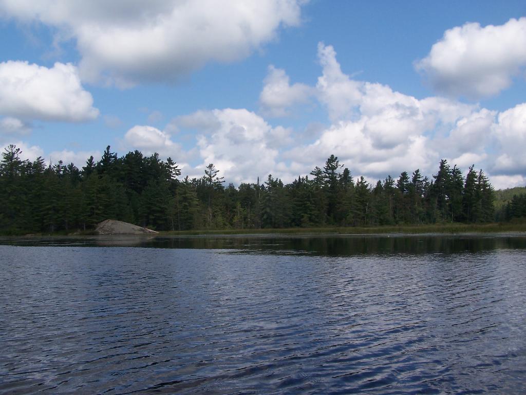
Above Lower Lows Dam. Paddling up the “flooded” Bog River, in the lower portion of Bog River flow, right above the Lower Lows Dam. If this area was not flooded by dams, it would be rapids, unaccessible by canoe or kayak.
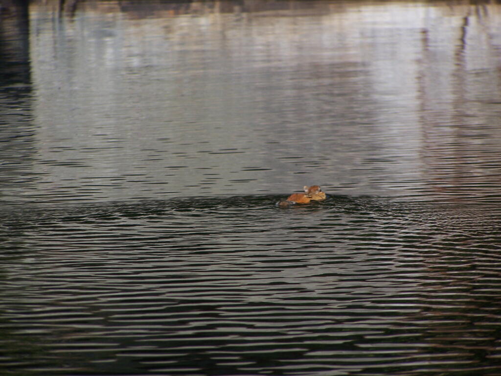
Chimpmunk Swims. This was taken about a mile above the Lower Lows Dam.
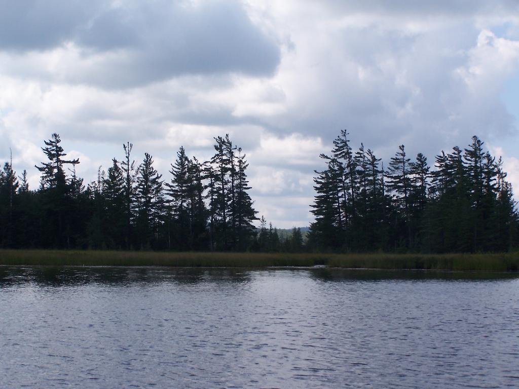
Bog River Flow Narrows. The Lower portion of the Bog River, is pretty narrow in part, due to the rocky terrain that it covers. You can easily bottom out a canoe or kayak in these parts, and other parts appear quite deep. There are a couple of paddle-in campsites along here.
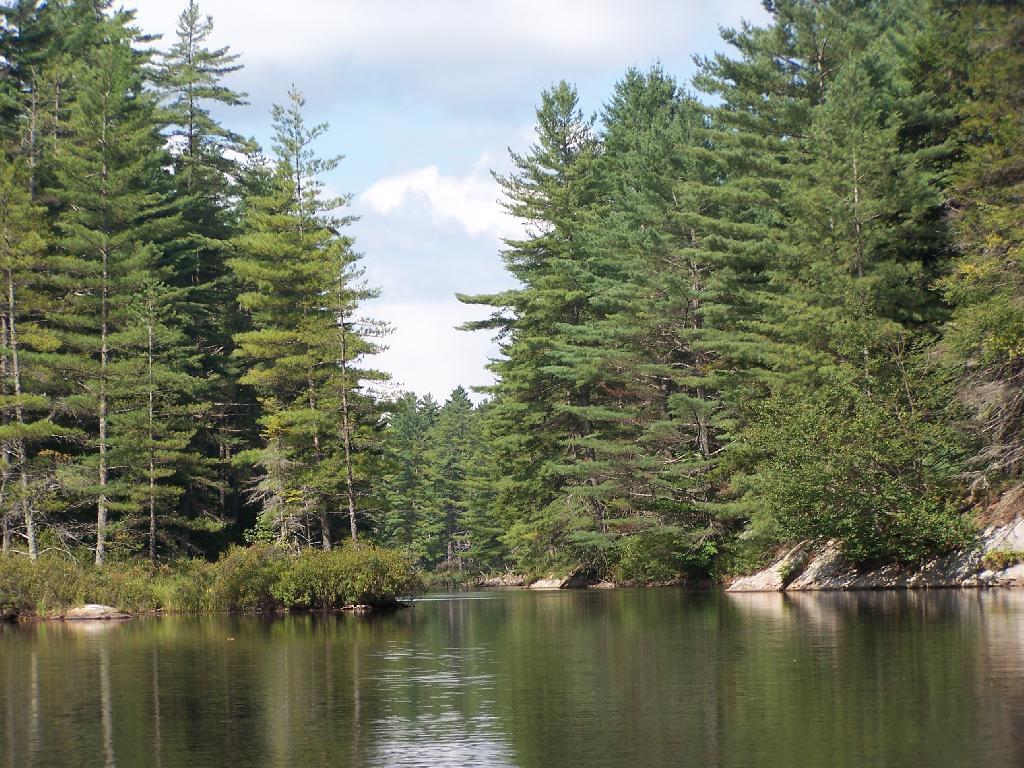
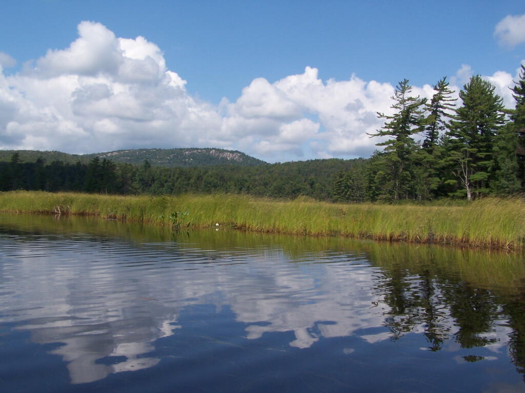
Bog River Open Up A Little Bit. The first mile or so of the Bog River Flow is mostly flooded stream. But as you get closer to Hitchens Pond, it starts to widen a bit.
Entering Hitchens Pond. Just past here, is a hairpin turn, as the flooded River, winds a bit, and becomes a much larger lake, in the form of a series of bays and marshes.
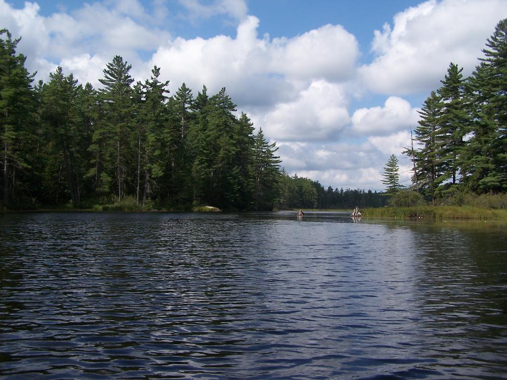
Hitchens Pond. Here things open up quite bit.
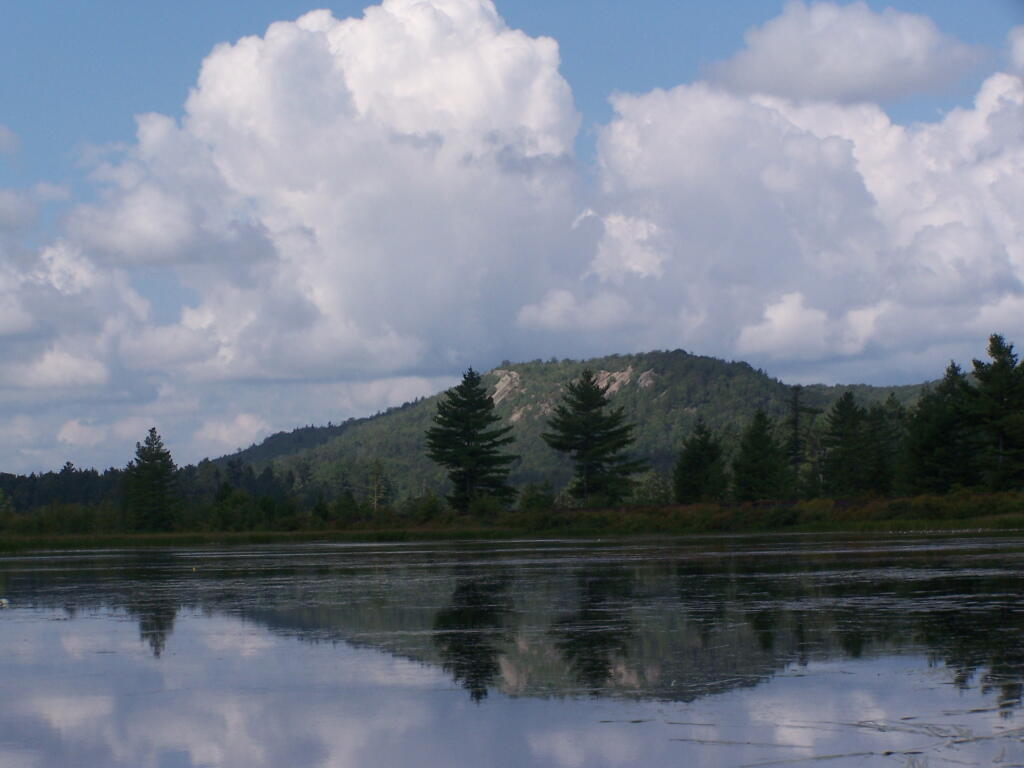
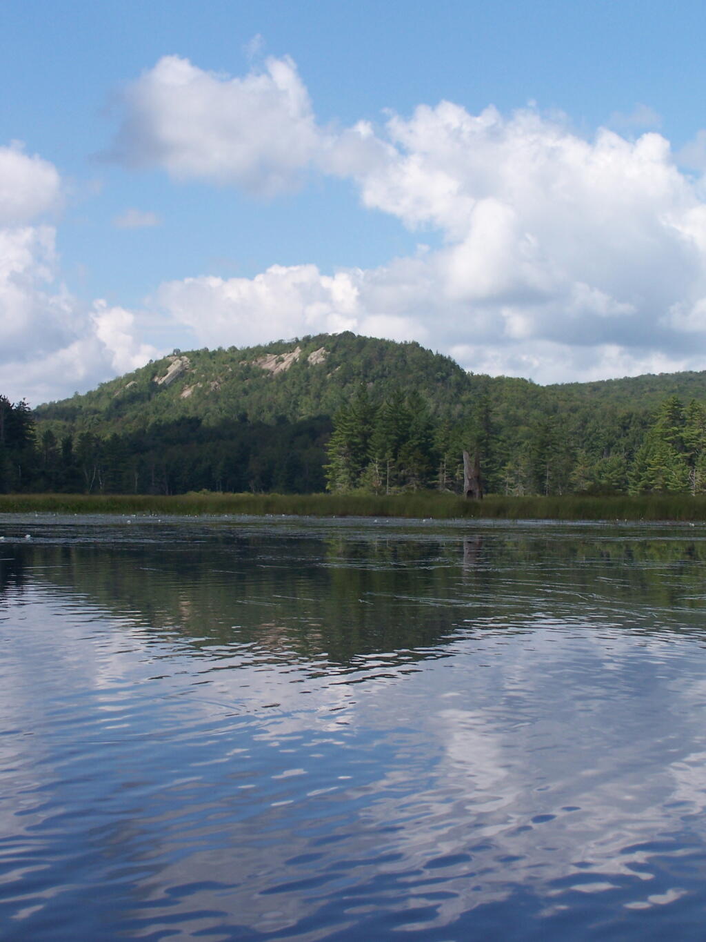
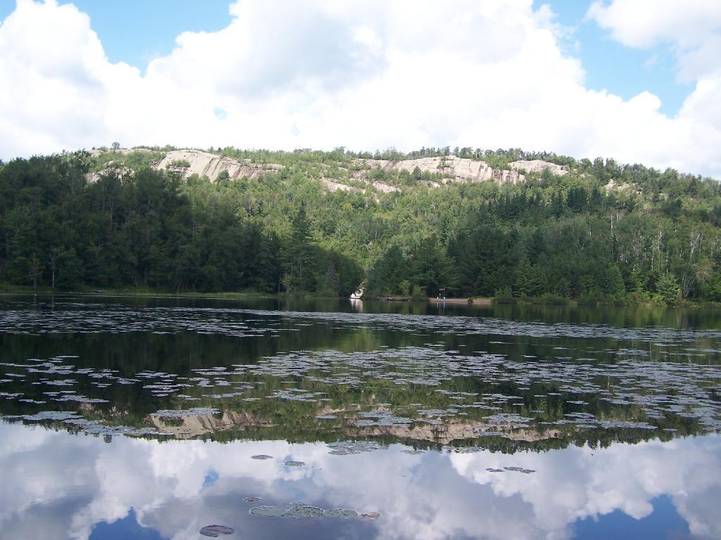
Lows Ledge. Here is Lows Ledge reflecting into Hitchins Pond. It’s much larger in person then it appears in this picture, unless you have a very big computer monitor.
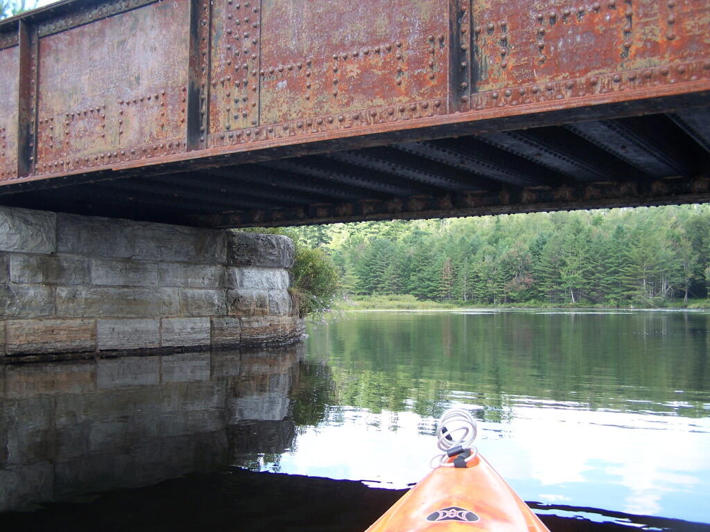
Railroad Bridge. About two miles into Bog River Flow, you cross under a relatively low railroad bridge. It’s actually about 5 or 6 feet above the flow, and doesn’t feel at all cramped in a canoe or kayak.
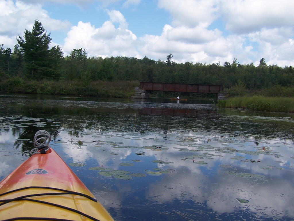
Under the Railroad Bridge. This shouldn’t be too bad to clear.
Trees Along Hitchens Pond. This picture can’t even reflect the beauty of this portion of Bog River Flow.
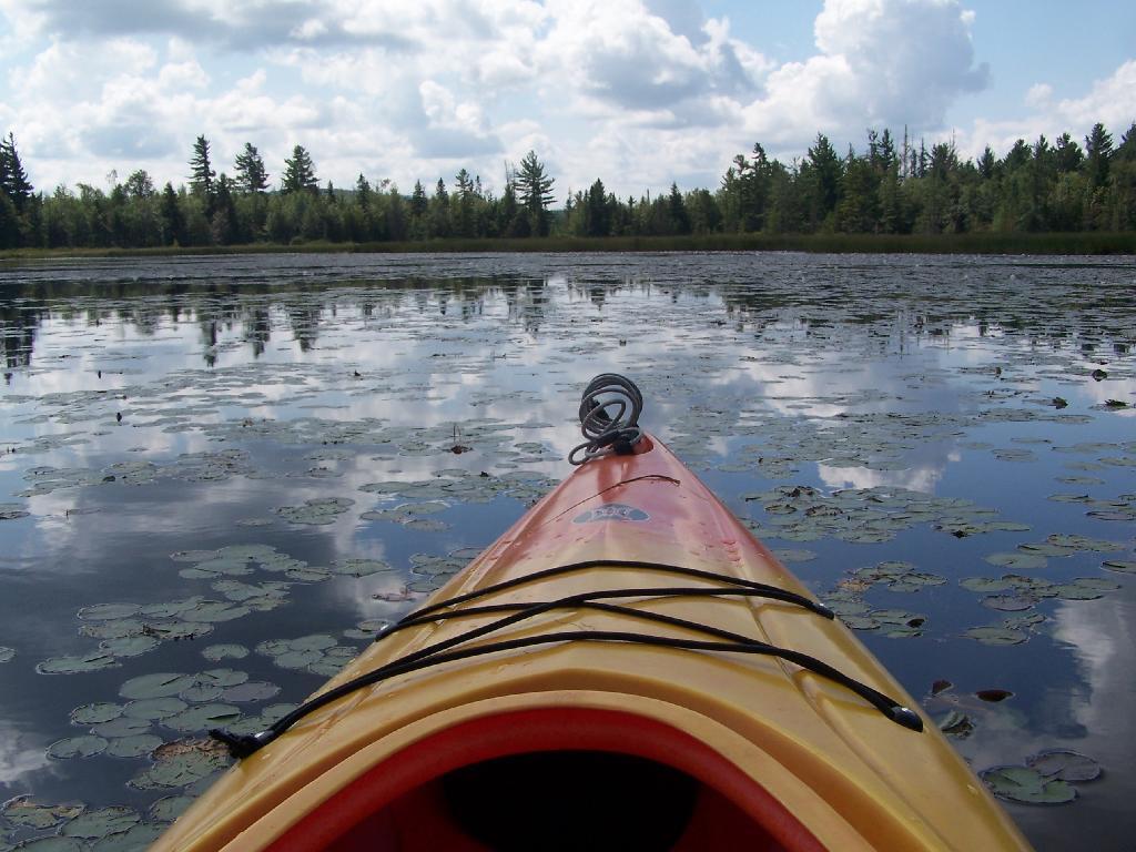
Break Time. Drinking all that beer, meant I had to find a place along the Flow to get out, stretch, and take a piss. Things being so boggy and soft in parts, meant there wasn’t a lot of open area to take a break.
Lows Ledge. I’m now about halfway between Lows Lower Dam and Lows Upper Dam, as the ledge reflects beautifully into the lake. It’s a very spiritual thing for sure, paddling along through this lake.
Clouds Rolling Out. To the south, it looked still quite cloudy. But there was something quiet spiritual about the area, and quiet vast. Something also spoke to me as being Saint Lawrence County, and as vast as one would expect the biggest county in the state to be.
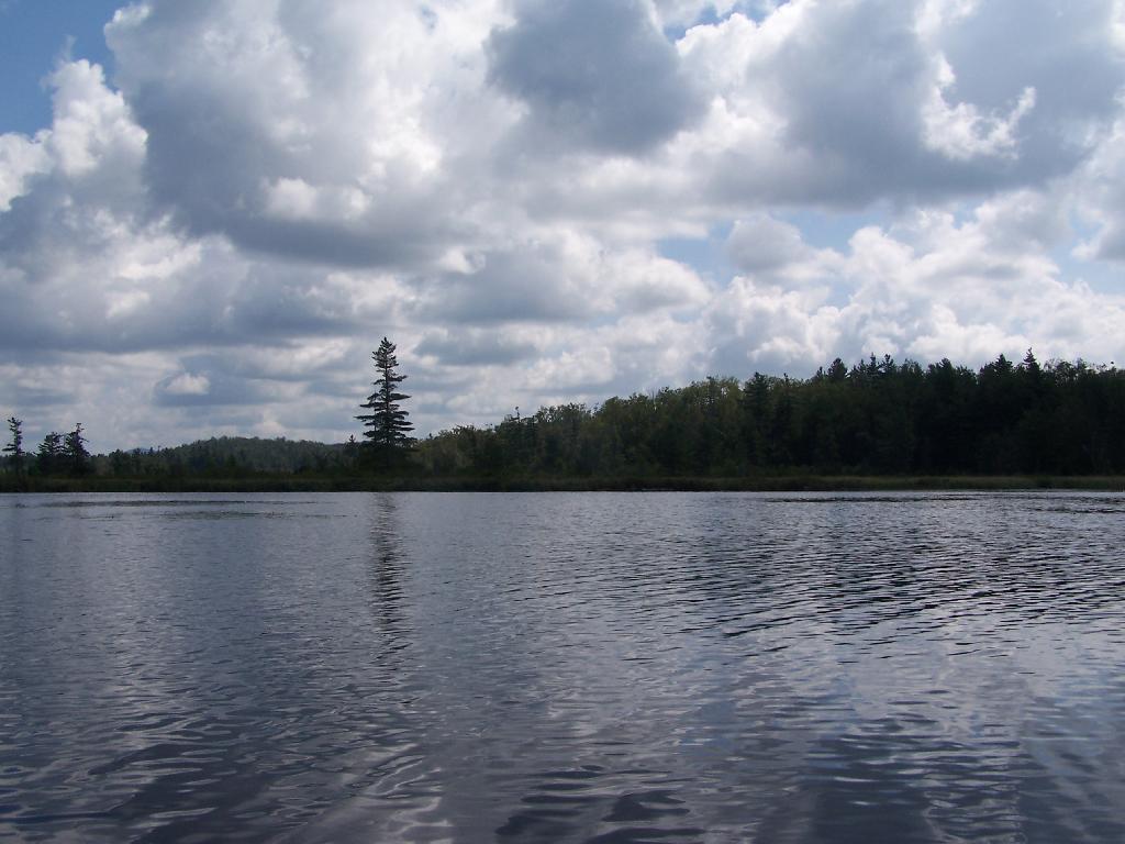
The Channel. The lake turns once again, with beautiful marsh lands along the edge of the lake.
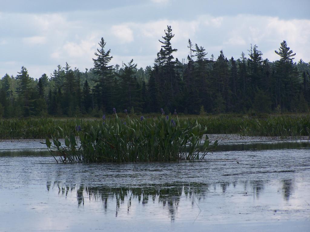
Marshy. Portions of Hitchens Pond are quite marshy, and can be tough going, especially if one gets out of the channel.
Trees. These trees line the last big turn at Hitchens Pond, where you finally get into the main bay, as you head towards the Upper Lows Dam.
Marshland. Along Hitchens Pond as we get closer to Lows Upper Dam.
Lows Ledge. Now we are almost up to the portage for Lows Upper Dam. Quite purty I must say.
Kayakers Pull Out. You have to pull your boat out of the water, and carry it over the Lows Lake Upper Dam, about a 10 feet elevation, and maybe a 50 foot portage.
Bog River Area Pull Off. A lot of people pull out here, for lunch. Or they can be fools, and not use the channel to bottom of the dam, and carry their canoes, an additional 1/4 mile for no real purpose, to get it over the Lows Upper Dam. Not like I would be that stupid, now right? Of course, I just covered my camera with beer, so I shouldn’t be opening my mouth.
Lows Upper Dam. This is the last picture I got for the day, because I dropped the camera in a pool of beer in kayak, and things go wet. Eventually the camera dried out and started to work fine, but for now, we have to go pictureless. From here, the bottom portion of Lows Lake proper, above the Upper Lows dam, is much like the bottom part of Hitchens Pond, narrow, deep channel, that widens up.
Above Upper Lows Dam. This is the channel above the Upper Lows Dam, which technically is Lows Lake now. About a mile up from here, the lake gets shallow, and you must portage up into the more open Lows Lake main section. Yes, the camera lens has beer in it, that now has to dry out before I can take any more pictures. Nothing until tomorrow. It’s my Friday the 13th luck and stupidity of leaving the camera in the kayak, not in it’s protective case, as I pull out, and spilled beer soaks everything.