Search Results for: photo the beautiful albany pine bush

May 18, 2019 Night

Good evening! Mostly cloudy and 61 degrees โ˜ in Delmar. Calm wind. The dew point is 45 degrees. The skies will clear tomorrow around 9 am.

It was a nice day, the Lupine Festival went well and I followed it up with a couple miles walking ๐Ÿšถ around Blueberry Hill. Not a lot of lupine in bloom now but some is starting and I think I saw a couple of Karner Blue Butterflies on my walk but they are sure tiny, fast moving and hard to capture on the camera. ๐Ÿ“ท

Yes, I had a lot of fun with the crayons โœand coloring our coloring book. I really like coloring. Maybe it’s a kid thing but it’s a fun way to pass the time. I’m actually thinking about getting some colored pencils and printing out some pictures, maybe using the trace edges function in Inkscape and playing with coloring like up at camp. It could be very therapeutic. Might be fun with nature study, another activity I really enjoy but not in black fly season.

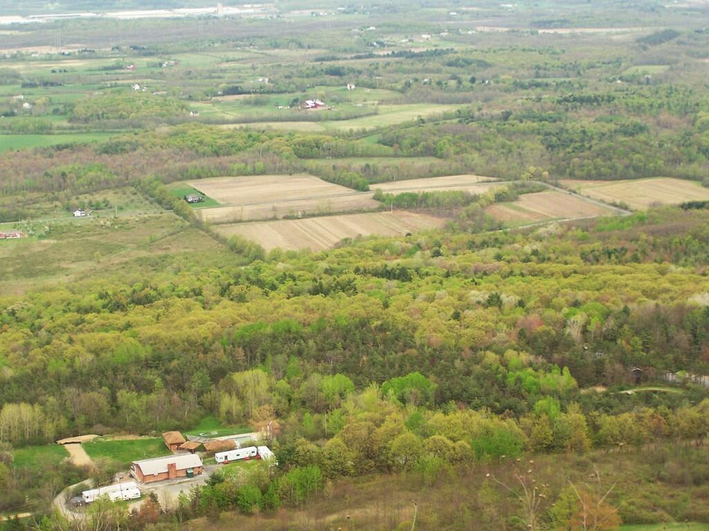
The Pine Bush is such an asset to Albany ๐ŸŒฒthat so many people overlook. A wilderness in a city. It is a bit noisy in parts though due to the traffic. They are really doing a good job of maintaining the beautiful unique ecosystem – they are burning ๐Ÿ”ฅ 250 acres a year with a hope of getting closer to 500 acres although it’d tough to get favorable enough conditions and days when they can control the smoke from the burn. That’s a lot of acreage for sure. I don’t know about how they do it in the preserve but it’s fascinating to watch videos ๐Ÿ“น of farmers and ranchers burn pastures out west. Fire is a powerful tool when used respectfully.

Tonight will have a slight chance of showers before 4am, then a slight chance of showers after 5am. Mostly cloudy ๐ŸŒง, with a low of 52 degrees at 5am. Four degrees above normal, which is similar to a typical night around May 30th. Maximum dew point of 47 at 6am. Calm wind. Chance of precipitation is 20%. In 2018, we had mostly clear skies in the evening, which became light rain by the early hours of the morning. It got down to 49 degrees. The record low of 29 occurred back in 1981.

Tonight will have a Waning Gibbous Moon ๐ŸŒ– with 98% illuminated. The moon will set at 6:14 am. The Last Quarter Moon is next Saturday with partly cloudy skies. The Strawberry Moon ๐ŸŒ is on Sunday, June 16th. The sun will rise at 5:29 am with the first light at 4:56 am, which is 56 seconds earlier than yesterday. ๐ŸŒ„ Tonight will have 9 hours and 14 minutes of darkness, a decrease of one minute and 55 seconds over last night.

Tomorrow will have a chance of showers, mainly after noon. Partly sunny ๐ŸŒฆ, with a high of 78 degrees at 3pm. Eight degrees above normal, which is similar to a typical day around June 14th. I’ll take some June weather. Best weather of the day tomorrow is expected in the morning. A touch of humidity tomorrow too. Maximum dew point of 62 at 5pm. South wind 13 to 15 mph. Chance of precipitation is 40%. New precipitation amounts between a tenth and quarter of an inch possible. A year ago, we had mostly sunny skies. The high last year was 58 degrees. The record high of 91 was set in 1989. There was a dusting of snow in 1976.โ„

I got two more HC-05 Bluetooth modules in the mail from China today. โœ‰ They came so quickly. Hopefully I can get these to talk together properly. I’ll use the current ones for other projects like the smart solar panel charge relay I want to build for my truck eventually. It would be nice to check the voltage of my batteries right from my phone. ๐Ÿ”‹ Hopefully I’ll find some time to work on those projects in the near future.

Speaking of batteries, I brought my extra battery and swapped it in my phone which kept it going all day strong ๐Ÿ’ช. I’m thinking of getting one of those battery banks to use while wilderness camping but just swapping out the battery in my phone is a nice lightweight alternative. ๐Ÿ“ฑ

The long range for Memorial Day Weekend looks to be fairly sunny โ˜€ with temperatures that are seasonable. A few chances for rain but generally the forecast for next weekend is quite positive but not real warm. But that’s to be expected in late May. Remember, the weather in late May is closest to mid September in Albany. ๐ŸŒธ

In four weeks on June 15 the sun will be setting at 8:35 pm,๐ŸŒ„ which is 20 minutes and 54 seconds later then tonight. In 2018 on that day, we had partly sunny, rain showers and temperatures between 75 and 56 degrees. Typically, you have temperatures between 78 and 57 degrees. The record high of 96 degrees was set back in 1988.

Looking ahead, June ๐Ÿน is in 2 weeks, Average High is 80 ๐Ÿ– is in 5 weeks, Hottest Time of the Year ๐Ÿ˜… is in 8 weeks, Ugly Truck Day ๐Ÿšš is in 9 weeks, Average High Falls To 79 ๏ธDegrees โ›ฑ๏ธ๏ธ๏ธ is in 14 weeks and Average High 70 ๐ŸŽ‘ is in 18 weeks.

Camel's Hump

March 24, 2019 Morning

Good morning! Happy Sunday. Two weeks to 7:30 PM Sunset ๐ŸŒ‡. Sunny around the freezing point in Delmar, NY. ๐ŸŒž There is a southwest breeze at 6 mph. ๐Ÿƒ. No real snow left to report in the Delmar area.

Just got done with my waffles for breakfast ๐Ÿด and now I’m baking brownies to bring out to the folks house later. Just waiting for them to finish up. I was hoping they’d be done by nine but they still were uncooked in the middle. That Pyrex pan I use takes a long time to fully heat up. I hope it’s done soon, I’m biting at the chomp to get out on my walk ๐Ÿšถ to Five Rivers.

Today will have increasing clouds โ˜, with a high of 54 degrees at 3pm. Six degrees above normal, which is similiar to a typical day around April 5th. I like April weather this time of year. West wind 6 to 11 mph. A year ago, we had partly cloudy in the morning, which became cloudy by afternoon. The high last year was 43 degrees. The record high of 69 was set in 1976. 5.5 inches of snow fell back in 1956.โ„

Right now it’s a beautiful morning with the birds ๐Ÿฆ a chirping. This morning before it gets cloudy I’m going hiking out to Five Rivers Environmental Education Center for a morning hike before it clouds โ›… up. I enjoy the walk out there almost as much as the preserve although part of the road is pretty narrow. ๐Ÿšถ

Later on today, I’m hoping it will be warm enough to unpack my camping gear from my truck and get into the crawl space in my apartment. โ›บ Left my truck pulled in for easy access for unpacking . Just really needs to be above fifty degrees to do that.

The sun will set at 7:12 pm with dusk around 7:40 pm, which is one minute and 9 seconds later than yesterday. ๐ŸŒ‡ At sunset, look for partly cloudy skies ๐ŸŒƒ and temperatures around 48 degrees. There will be a west breeze at 7 mph. Today will have 12 hours and 22 minutes of daytime, an increase of 2 minutes and 54 seconds over yesterday.

Tonight will be mostly cloudy ๐ŸŒฅ, with a low of 30 degrees at 6am. One degree above normal, which is similiar to a typical night around March 27th. West wind 3 to 7 mph. In 2018, we had partly cloudy in the evening, which became mostly sunny by the early hours of the morning. It got down to 28 degrees. The record low of 0 occurred back in 1875.

Tomorrow will be mostly sunny ๐ŸŒž, with a high of 41 degrees at 4pm. Seven degrees below normal, which is similiar to a typical day around March 9th. Northwest wind 8 to 11 mph. A year ago, we had partly cloudy in the morning, which became cloudy by afternoon. The high last year was 44 degrees. The record high of 74 was set in 1910. 1.9 inches of snow fell back in 1960.โ„

Earlier in the day yesterday I went and visited my niece in Saratoga on her birthday. ๐ŸŽ‚ It was nice to see her but she was tired ๐Ÿ˜ด and kind of fell asleep. Then I went down to the library and uploaded the updated blog code. Turned out to be a sunny day but bitterly cold for late March. I got two shirts at JC Penny, I probably should have tried one on at the store but it matched the size I wrote down โœ’ so hopefully they’ll fit. I’ll try them on tomorrow and have the receipt but they looked like the Oxford shirts I like. Hopefully they’ll work out well and I’ll have enough clean shirts for six session days or maybe more next week.

Definitely that nighttime hike ๐ŸŒƒ in the Albany Pine Bush Preserve was the highlight of yesterday. It was fairly cold โ„ with the wind but I enjoyed it a lot. Didn’t see a lot of wildlife but I did hear some birds in the trees and the sunset followed by dusk then the stars were pretty. ๐Ÿ˜ Driving ๐Ÿš˜ home after dark wasn’t bad but it’s a dark night for sure but the headlights are well aimed on my truck.

Friday night I awoke with a bad Charlie horse ๐Ÿด in my leg and it was a bit stiff yesterday but it didn’t slow me down when I walked those 3 or so miles at the Pine Bush Preserve. Ouch. ๐Ÿ˜ฉNot sure what caused it but I didn’t have issues last night, but I made sure to be well hydrated before bed. โ˜•Maybe it was riding the exercise bike then kneeling for a while after getting tired of my hard chair working on code the other night. ๐Ÿ’ฃI don’t know or maybe I twisted my legs while in bed. At least now I’m feeling better.

I finally also need to go shopping this week – it’s been three weeks since I bought any major groceries or supplies. I didn’t shop at all last week except for milk ๐Ÿฎ and the previous week I only got $18 in groceries. ๐Ÿ It’s good, I’ve really cleaned out the pantry but now there are many things that I need to get to ensure that I have food ๐Ÿฒ during those long days and nights at work. I’m not super involved in the budget process but I have to be available when needs arises. I’m planning to buy things like frozen ravioli and pasta,๐Ÿ— chicken paddies, pasta, ๐Ÿฒhot dogs to cut up with beans ๐Ÿฃ for good eats. Always try to buy the biggest possible package in bulk and use my reusable containers both to reduce waste and save money ๐Ÿ’ต.

Spent more time last night some time making minor fixes and improvements to the backend of the blog. ๐Ÿ’ป Little things that make my life easier or improve the speed and usability of the blog. I also adjusted the code for my VMS sign to make it more ordered and useful to me.

Next Saturday looks to be quite nice in the long range for the Pine Bush Hike. ๐Ÿ˜ŽSaturday, partly sunny, with a high near 62. Maximum dew point of 43 at 1pm. Typical average high for the weekend is 51 degrees.๐Ÿšถ

In four weeks on April 21 the sun will be setting at 7:44 pm,๐ŸŒ„ which is 31 minutes and 56 seconds later then today. In 2018 on that day, we had sunny and temperatures between 60 and 34 degrees. Typically, you have temperatures between 61 and 39 degrees. The record high of 89 degrees was set back in 1923.

Looking ahead, 7:30 PM Sunset ๐ŸŒ‡ is in 2 weeks, Palm Sunday ๐ŸŒด is in 3 weeks, Easter ๐Ÿฐ is in 4 weeks, Cinco de Mayo ๐Ÿค  is in 6 weeks, Mothers Day ๐Ÿ‘ฉโ€ is in 7 weeks, Memorial Day Weekend Starts ๐Ÿ•๏ธ is in 2 months, Fathers Day ๐Ÿ‘จ is in 12 weeks, Latest Sunset ๐ŸŒ† is in 3 months, National Nude Day ๐Ÿ‘ฑ is in 16 weeks, Average High Falls To 79 ๏ธDegrees โ›ฑ๏ธ๏ธ๏ธ is in 5 months, Sunset Before 7:30 PM ๐ŸŒ† is in 23 weeks, Autumn ๐Ÿ‚ is in 26 weeks and Average High is 60 ๐Ÿ‚ is in 29 weeks.

8 Feet Snow Banks

Gorging on Gorges, An Adventure, Day 1

About a month ago, I took a trip I gave the name โ€œGorging on Gorgesโ€. As the name would suggest, most of the trip involved visiting various gorges, taking photographs of them, and otherwise exploring them. About half of them I had previously been to, while the rest were new. I also visited several other state parks, state forests, and national forests โ€“ and did something I havenโ€™t done in a long time โ€“ camped one night in a developed campground.

Towards the Park

I started out my trip from Albany, taking US Route 20 West from I-88. I really wanted to avoid expressways for the bulk of my trip, is my general view is that expressways are the best way to get across America without really seeing anything. Itโ€™s more then a philosophical argument for me โ€“ whatโ€™s the purpose of a vacation if your rushing from point โ€œAโ€ to point โ€œBโ€.

The first part of the trip, I drove to Chittenango Falls State Park via Nelson and beautiful farm country so high above. I walked down into the gorge, and up and around the falls. The color was somewhat muted, but it still was quite pretty. Then I headed off, taking some side roads as recommended by my GPSโ€™s most direct route, and ended up passing a few miles from Labrador Hollow and the beautiful Labrador Pond, and said, heck, I got to stop on by there.

I drove down to Labrador Pond parking area, and hiked down to the pond. The colors were still not fully-turned on Jones Hill, but on Labrador Mountain were well past peak. Despite the crowds of fall foliage peepers from Syracuse, crowding the area, there were adequate opportunities for solitude. I walked down to the lake, snapped a few photos, then hiked the nature trail/boardwalk. It was nice. It also was great to see the boardwalk being used by a disabled man โ€“ he could get out and enjoy nature, despite his difficulties he had walking. One of the large dairies in the area was spreading something on fields nearby, and it sure stunk โ€“ it seemed nastier then fermented grain, although thatโ€™s probably what it was. Didnโ€™t stick around too long, as I had places to go.

Somewhat Faded Colors

Drove down through Prebles, another deep, rich agricultural valley, dotted by large dairies that take advantage of the areaโ€™s rich soils for producing many bushels of corn on each acre. Got held up for about 5 minutes during a paving job, where they had the road restricted to one lane, for what had to been a half mile or so. Noticed how most of remaining trash burning barrels had disappeared from the landscape, that might have only been there 3 or 4 years ago.

Then it was off to Homer, where I passed a moose, made out of welded scrap metal along the road. It was kind of a neat roadside attraction, and I really should have stopped and got a picture, but I had a tight schedule and was burning daylight. I would come to later regret not getting that picture, but heck, I figure I can probably find a picture of it on the Internet using Google Images or Flickr. If not, it will certainly be there, the next time I find myself going through this roadside wilderness.

Millard Fillmore Historic Marker

I got lost on my way to Moravia. Not really lost, because I was following the GPS, but because I had programmed the โ€œmost direct routeโ€ rather then โ€œfastest routeโ€, the GPS.decided to take me up a rough dirt road through Hewitt State Forest. I declined, and eventually the GPS found a new route, that happened to take me past Milton Fillmoreโ€™s birthplace. There is now a picnic pavilion and a some landscaping in that location. I turned around, snapped a few pictures, and explored it briefly. I wanted to a get a picture for dad for his historical markers collection.

Then it was off to Fillmore Glen. I was running a bit late at this point, but itโ€™s a pleasant drive down to Filmore. The landscape is pretty rural until you drop, rather quickly into Moravia. Moravia is a pretty, small rural town; the glen is located at far southernly end of the town. There was a bridge being replaced in town, and you had to wait, for what seemed like an eternity for the light to green on the on-one lane bridge.

Finally, I got to the park entrance. The older guy there, grumbled when I said I had an Empire Pass. He was like โ€œwhere is it โ€“ I canโ€™t see itโ€. The rear window on my truck where the Empire Pass is tinted, but not that dark. I was slightly annoyed that the park entrance guy wasnโ€™t friendly, and I forgot to ask for a map. I was kind of rushing. Got parked, and there was a big wedding going on, complete with horse drawn carriage. Crossed the โ€œDry Creekโ€ and started up the trail, first to the Cow Shed falls, then decided to take the Northern Rim Trail. It wasnโ€™t apparent at first that it was the rim trail, but I didnโ€™t have a map. I actually printed up a map, and had it my truck, but I of course forgot it.

Small Waterfall in Gorge

The Northern Rim climbs a fair bit, then runs along the rim, with very limited and occasional views. It crosses a pretty little creek that tumbles down the gorge, and eventually leads to a path down to the gorge trail, three-quarters the way up the gorge. I decided to hike down to the gorge trail, and then head back down the gorge towards the parking area. I missed a bit of the gorge trail, and the overlook, but so be it, time was tight.

The Gorge trail was scenic, but certainly not the most scenic of gorges. There were several small waterfalls, and some stairs and bridges, although most of the trail was gravel along the edge. The โ€œDry Creekโ€ had plenty of water, but in general, the gorges was smaller then other Finger Lake gorges. There were several glens of interest, but the most beautiful portion of the glen was the Cow Sheds in the button of the gorge. Cow Sheds falls, are the wider portion of the gorge, where at one time, historically, cows would gather for shelter in severe or cold weather.

Cow Sheds Falls

Snapped a few more pictures of Fillmore Glen, and it was off to Ithaca. I made pretty good time to Ithaca, although I admit I certainly wasnโ€™t poking along. I really should have stopped more places, but I wanted to get to the Finger Lakes National Forest relatively early so I could set up camp and/or make alternative plans should my desired campsite on Chicken Coop Road be unavailable. Passed a giant bull statue on a farm, along NY 38, a few miles south of Moravia. I really should have stopped for a picture, but I was burning daylight, and the Finger Lakes National Forest, was over an hour away. I think this is the one, that the farmer paid like $10,000 to haul from an abandoned Steakhouse in Binghamton to the farm. I am sure the bull will be there for a long time โ€“ in case anybody forgot what is raised on farms.

Then it was down to Freeville.. The only thing real remarkable about that town, was the pine barrens and swamps, consisting of heading into it. When you think of the Finger Lakes, you tend to think open landscapes and farms, at least until you get mostly south of them of them, or in the highest points to the west. But not here. The Finger Lakes Trust owns some land, on the north side, where it the land is mostly the backwaters of the Oswaco Inlet.

Finally made it to Ithaca by 4:45 PM. I was lucky at this hour that traffic wasnโ€™t too much of a slog by Ithaca standards, then I was off heading up Trumansberg Road. It seemed like an endless drive. Finally made it to Perry City, and then to the Finger Lakes National Forest. There was no sign of the government closure when I got there, but a bit disappointed, my favorite campsite on Chicken Coop Road was already taken. It was off to campsite on Potamac Road, just past the hunting camp.

I wasnโ€™t thrilled by campsite, a big field campsite, but it had some trees along one edge for hanging the flag and lights. It was pretty good site for observing the stars, although there was a hunting camp down the road a little ways, so I had to keep the music down. I really donโ€™t want to piss off the hunters. I gathered up some firewood from the woods, and got a fire started. The sun was fading fast, but so be it. I wired up my lights, some Christmas lights, and got the spot light on the flag.

It got dark, and I tuned into the Ithaca Progressive Radio Station, and gazed on the stars for a couple of hours. Nibbled on some snacks, cracked open a beer or two. Tossed some more wood on fire, and was happy to finally be on vacation.

It was a good first day… more adventures to come.

My Concerns with a Nine County Solid Waste Authority

Dear Decision Maker:

I am writing you to express my concerns with the Regional Solid Waste Management Authority Study, recently completed by Albany County. I became concerned with solid waste issues back in 2003 when I was a college student studying part-time at SUNY Albany, and stumbled upon the Albany Pine Bush, and discovered how wasteful our urban societies really are.

I grew up on my parents land out in Westerlo in Hilltowns of Albany County. We never had trash pick up, in part because we never had a lot of trash. My parents where working class, they struggled to find good paying work after the early-1990s recession. We grew or raised a lot of our food, burned and composted what “waste” we could on our little farm. It was a sin to toss a recyclable can or bottle in with the burnable trash, and food scraps and other organics wasn’t just something to be wasted in burn barrel. Some see a carved up animal carcass, I see valuable organic materials. On my parents farm, trips to transfer station where rare. We often took more home from the Westerlo transfer station, then we sent to the Albany landfill.

Plowing Day's Trash

This was totally different then what I saw going on in the city, where food waste was “just garbage”, recycling was at best window dressing or a political statement, and people didn’t really care much about the impact of their garbage output. I saw this urban garbage was being dumped in beautiful Albany Pine Bush — are rare ecological oasis in an urban waste land. This landfill will close soon due to this wastefulness. I couldn’t believe city folk would even dream of tossing a valuable aluminum can in the trash.

Today, I also am very aggressive in avoiding waste myself, bringing organic waste out to my parents farm, and hauling the carefully separated recyclables and a minimal amount of trash to the Rupert Road Transfer Station a couple of times of year. I don’t have weekly trash pickup here. Just following what I learned growing up, I know it’s wrong to be wasteful and generate a lot of trash.

I believe we must change how we deal with waste in our cities.

We Recycle

Since becoming a resident of Town of Bethlehem in 2007, I have voted in all elections including primaries and school board, and are involved in numerous local political campaigns, particularly when there are true progressive leaders fighting to change our community for the better. I am an active member of Save the Pine Bush, and are constantly advocating for more conservation of the Albany Pine Bush, and for better recycling and especially organic waste recovery policies in our cities.

Below are my comments on the “Regional Solid Waste Management Authority Study”, please review them carefully. Thank you for your consideration! If you have questions, please don’t hesitate to call my cell at 518-281-9873 or email andy@andyarthur.org.

Sincerely,

Andy Arthur

“The policy of the state shall be to conserve and protect its natural resources and scenic beauty and encourage the development and improvement of its agricultural lands for the production of food and other agricultural products.”
— Article XIV Section 4, NY State Constitution

Point 1: Study Should Analyze Best Way to Get to Zero Waste

  • Study spends too much time considering how to build and construct a disposal facility. There are more then adequate trash landfills and incinerators to dispose of waste within our state for the foreseeable future.
  • Study should define best practices for maximizing recycling and organics recovery, not disposal.
  • Many studies have shown that large disposal facilities — incinerators or landfills — are expensive to run and cannibalize recycling efforts.
  • If a solid waste agency builds a 1,000 ton per day incinerator or landfill, it will require that much trash. If it can’t find that amount of trash, it will reduce recycling efforts to have enough trash to fill the incinerator or landfill. This undermines efforts to get to zero waste or near zero waste by increasing recycling and composting of organic materials.
  • The study should include a 20-year plan similar to that of the recently submitted Albany Solid Waste Management Plan that proposes steady reductions in disposal of waste in favor of recycling.
  • The study should have a Zero Waste goal, where nearly all waste is recycled and organics are recovered. Many communities across the country have adopted a Zero Waste goal and are vastly more aggressive in recycling and organics recovery then what this study is proposing.

Point 2: Public Authorities Are Anti-democratic

  • The study fails to acknowledge the benefits of competition, and how having competing transfer stations or disposal facilities could lower disposal costs.
  • Authorities are anti-democratic. Citizens have the right to influence their leaders on what solid waste facilities are build and what solid waste laws are implemented. The study should not call for the authority to decide on disposal facilities — it’s up to elected officials to decide.
  • The lack of competition with an Authority will lead to large bureaucratic overhead, waste, fraud, and abuse.
  • Citizens and elected officials have a right to know ahead of time what kind of disposal facilities if any would be constructed prior to creation of an authority.
  • Local communities should have a voice in process and all decisions should be made by consensus of all communities. A large governmental body makes consensus impossible.
  • Communities named in an authority’s legislation are stuck in the authority until the legislature amends the law or allows it sunset, regardless of democratic choice. Any solid waste agency should be democratic in nature, and allow communities to freely join or leave it with sufficient notice (e.g. 90 days).

Point 3: Study Fails to Acknowledge Alternatives

  • The study does not analysis the effectiveness of a Solid Waste District similar to those in Vermont. A Solid Waste District would have no employees or bureaucracy, but is a consistent set of regulations and permitting guidelines administered by multiple towns.
  • The study fails to show what is wrong with the current ANSWERS structure. While the current ANSWERS disposal facility will close shortly, ANSWERS for many years has relied on communities contracting with private recycling brokers. Why can’t communities also contract with private disposal brokers, while maintaining a coordination of solid waste planning through the current ANSWERS board?
  • Citizens should be free to choose what hauler and disposal or recycling facility they use. Some may choose a landfill for disposal of their waste, while others seeking a more different option, may prefer extra to have waste hauled to an incinerator. The choice of disposal facility should be a key part of a any plan, to allow citizens weight costs and benefits of different facilities.
  • Consider creating a “Green Rating” system for trash haulers. Let consumers choose if what lower-value materials they wish to be recycled, and what kind of disposal facility they wish to pay for.

Point 4: Town of Colonie, 8 Other Counties Have Not Expressed Interest in this Proposed Authority

  • The study claims to be on behalf of a 9-county region. However, only ANSWERS Communities have given resolutions in support of this study, and most notably the Town of Colonie has not given a resolution of support of the study. No other town or county, has formally stated their support or opposition to creation of a regional authority. Why not?
  • Would Saratoga or Rensselaer Counties want to join the Authority, if they knew a massive 1,000 tons per day incinerator or landfill was going to built in their county, and all of the trash from Albany County through Otsego County was going to be hauled there?
  • If other counties and non-ANSWERS towns are interested in creating an authority, they should be at the table now, and their citizens and elected officials should be kept fully informed. All counties, all towns, and all regions MUST have regular meetings on this topic, and a full debate in each community must occur prior joining any solid waste agency.

Point 5: 9 County Regional Authority Would Ignore Need for Rural Area Flexibility, Differences in Urban vs Rural Waste Stream

  • Waste compositions varies by town and by county. Different regions have different disposal needs. For example, farmers and rural residents may burn or bury some of their wastes on site rather then needing a centralized facility. Wastes generated on a farm are significantly different then those generated by a commercial center or urban resident.
  • In rural communities, it may make sense to have town owned and operated source-separated organics composting facilities or even disposal facilities for non-toxic farm and household trash. Decentralized composting and disposal facilities (e.g. less then 20 tons per day) will have a far lower impact on surrounding communities then large facilities.
  • Recycling programs should be tailored towards large generators of waste in a community. An centralized authority could not adequately focus on need to recycle agricultural plastics and agricultural chemicals, while also focusing on recycling of urban organic wastes or electronic waste.

Point 6: Polluter Pays, No Taxpayer Subsidies

  • Any disposal program should operate without taxpayer subsidies. Polluter pays. There should be no volume discounts — a person who disposes 10 lbs of trash should pay the same proportional rate as a corporation who disposes of 200 tons of trash.
  • Those who do not use the services of ANSWERS should not pay for it. For example a farmer or rural resident who burns or buries non-toxic waste on their property, should not be charged for disposal of that waste. Those who compost on their property should not pay for commercial composting operations.
  • No taxpayer subsidies for waste disposal, all services administered by ANSWERS should come from those who seek to recycle or dispose of a material.

Point 7: Small is Beautiful

  • Study over states the benefits of scaling up facilities and bureaucracy.
  • Numerous political science studies show that larger bureaucracies are less efficient, more subject to waste, fraud, and abuse. If a bureaucracy employees hundreds of persons it is difficult to maximize productivity and keep employees from watching Youtube at work.
  • Avoiding the bureaucracy of an authority, by simply using existing structures reduces cost and waste.
  • Large landfills, trash incinerators, recycling plants are more polluting. While large facilities may have better pollution controls then small facilities, large facilities inherently release more pollution in aggregate, have more truck traffic, and more potential for serious harm.
  • A 1,000 tons per day incinerator puts out 1,000 tons per day of carbon dioxide. That’s 365,000 tons per year of carbon dioxide, that could be avoided — or possibly a multiple of the number, by increasing recycling or organics composting.
  • Ask yourself, would you prefer to live next door to a 20-tons per day unlined town landfill, only consisting of local household trash and farm waste, or a massive 1,000 tons per day incinerator burning unsorted and largely unregulated mixed waste next door? How about being downwind of a neighboring farm’s burn barrel vs living next to a 1,000 tons per day incinerator burning mixed waste from far away? Again, while some pollutants may be better controlled by a mega-facility, the reality is other pollutants will increase and be particularly burdensome to the host community.
  • No disposal or recycling facility should be larger then 100 tons per day, and all facilities should be decentralized and close to sources of waste generation. Where scale is necessary to overcome costs of pollution control, it must be as small as possible and use the least toxic processes possible.
  • A large incinerator or landfill would incur significant costs and would require a large amount of trash to be disposed on it. This would undermine attempts at expanding recycling efforts.
  • Least desirable facilities (incinerators, landfills, recycling plants, composting plants) should be spread over as many communities as possible to be fair and democratic. It should not just target poor rural or urban communities, but include facilities in wealthy suburban communities too.
  • No one community should have the burden of disposal of waste for a nine-county region. It is especially obscene to site a large disposal facility in a rural or farming region, where many farmers may have traditionally disposed of their own waste on-farm, and are not responsible for the entire region’s long-term solid waste problem.

Thatcher Park

The Experience.

Nice Sunday afternoon. A bit cloudy, but warmish out. Decided to hike on OSI Preserve parcel as on May 1 they had already started to charge to parking at Thatcher Park. This area in many open fields and nice places for hiking, and indeed the start of the hike was quite enjoyable.

 Trail to Hanger Glider Cliff

I was quite surpised on how there where many new trails now open in the OSI preserve, including trails to both High Point and Hang Glider’s Point. High Point previously was privately owned, but was purchased by OSI.

Both points had great views of Altamont and towards Schenectady, which was drowned in haze.

Altamont

These crosses where at Hang Glider’s Point. Sad. Who died here? Why? Suicide? I’m sure somebody will write about the tragic story.

Crosses

The trails are all well labeled, escape for an unmarked, but well maintained trail along the edge of the Escarptment, which you can see I took from High Point to Hang Glider’s Cliff. That escarpment trail was close to the edge in many places, but perfectly safe to watch.

It was raining in Albany.

More about these these beautiful lands.

The Route.

Parked at trail head on Ryan Rd. Hiked via. Yellow Trail to Carrick Road. Took Hang Glider Rd along with White Trail to Long Path. Took Long Path north to Red Trail. To Red Trail to Escarpment. Took Unmarked Escarpment Trail to High Point. Took Long Path to Red Trail. Took Red Trail back to Escarpment. Took Unmarked Escarpment Trail to Hang Glider’s Cliff. Took Hang Glider Road to Carrick Road to Yellow Trail to Ryan Road trail head.

Flyover

The Map.

Hikers – Carrick Road Trailhead
Red Balloons – Overlooks
Red Trail – Hike on May 3, 2008


View Thatcher Park OSI Hike in a larger map