Search Results for: photo pine bush center

Albany Pine Bush – 1893, 1940, 1956, 1984, 1994 Topo Maps and a 2013 Aerial Photo

I thought it would be interesting to get some of the same views of the Albany Pine Bush using a variety of old maps from 1893, 1940, 1956, 1984, and 1994, plus a contemporary aerial photo. The first two maps were drawn at the 1:62,500 scale while the later ones are 1:24,000.

For comparison sake, I have scaled them exactly the same — just the lower resolution maps may appear blocky or their features more crude. The latitude and longitude lines in the later maps appear to be slightly off due to a minor projection issue (most likely an incorrect earth model).albany-pine-bush-1893

albany-pinebuush-1940

albany-pine-bush

albany-pine-bush-1984

albany-pine-bush-1994

albany-pinebush-aerial-photo-2013o

I thought it would be interesting to get some of the same views of the Albany Pine Bush using a variety of old maps from 1893, 1940, 1956, 1984, and 1994, plus a contemporary aerial photo. It is shown below.

Bulldozing Sand Dunes in Albany Pine Bush is Vulgur

Tearing Down a Sand Dune

Like Fuck.
Like Fuck You Guilderland.
Like Fuck You Wealthy Folk.

We’ve all probably uttered that word, sometimes more then we’d be proud of it. Yet, sometimes somethings are just truly vulgur like tearing down sand dunes to build McMansions.

New Mini-McMansions in Pine Bush

The first part of any housing development in the Albany Pine Bush appears to be the leveling of the land, and the carting off the sand to fill in other areas. To make the landscape flat and boring, so a suburban street grid, driveways, and foundations can be laid.

It involves tearing down tall beautiful pitch pines, removing habitat that might be restored if fire were to touch it once again, to sterlize the landscape for generations to come.

Welcome! To the Flattened Pine Bush.

People need places to live, places to farm, places to use. But do they really need to tear down magnificent sand dunes? If they had to build, couldn’t they have left more of the trees standing, and built on the dunes, and preserved the terrian?

Untitled

It might be easy and cheap to bulldoze sand. There is no rocks to blast away at. But making it all flat, just to stick tacky, plastic and plywood houses for the wealthy just seems so vulgur and awful.

The New Albany Pine Bush Trail System

Recently, the Albany Pine Bush underwent several controversial changes to trail system that included closing off most interior trails, with a preference to route trails on the outskirts of the property along other right-of-aways.

While this decreases the user experience, the argument presented by commission was to reduce hiker use and increase the virtue of wildlife habitat. Sportsmen with licenses are free to continue to traverse the land freely, however the general public is restricted to these trails.

 Mount Hayden State Forest

One of the biggest changes was the over milage of trails at the preserve has increased greatly, with better connections to many of the nearby communities, at least to the extent that public right aways allowed such connections. While trails in the western portion of the Albany Pine Bush are not yet built, connections from Schenectady all the way to Rennselear Lake are planned.

Betty Brook

For the sake of the current map, I only included parcels that the Pine Bush Commission owns or are public Right-of-Ways or public Roadways. Some private parcels, such as the Albany Rapp Road Landfill Trail, are a long way off into the future, so the connection to Rennselear Lake from more westerly portions of the Pine Bush are further off.

Now let’s take a look at specific areas…

East Barriens / Commission Headquarters.

The trail along Vista Dune remains (Blue Trail), as do parts of the perimeter trail, but along the easterly portion of this area, the new trail runs much closer to the closed Greater Albany Landfill, and will eventually include a connection over the landfill to Rensselear Lake.

Old Trails …

Stairs

New Trails …

Tinker Falls

The White “Shortcut” Trails are removed, replaced by a major loop consisting of the Red and Yellow Trails, with a portion moved closer to landfill to avoid Karner Blue Habitat.

Blueberry Hill.

Removed are several of the loops in favor of bigger loops and more mileage in other parts of the preserve.

Old Trails …

Stairs

New Trails …

Syracuse

West Barriens and Kiakout Kill.

Some of smaller trails were closed, but for the most part a large expansion to trails in this area.

Old Trails …

The start of the day

New Trails …

 Mount Hayden State Forest

Why is NYSERDA in the Pine Bush?

One of the things that bothers me is that NYSERDA, the New Yor State Energy Research and Development Corporation is located in the Albany Pine Bush in Corporate Circle, in a location primarily serviced by automobiles with minimal if any bus service through the CDTA ShuttleBee. Based on NYSERDA’s location, it is highly unlikely that any employees or visitors ever come to it using mass-transit. Most employees use gas guzzling private automobiles.

NYSERDA in the Pine Bush

Plenty of Real Estate Downtown,
Much Free to Use…

At the same time, there is a large amount of vacant office space downtown, that should be put into use. It’s quite possible that there would be sufficient room to move all of NYSERDA’s operations to a portion of 625 Broadway, home to the Department of Environmental Conservation and Environmental Facilities Corporation. With recent layoffs and the hiring freeze, there probably is ample space in there.

If not, as New York Times recently documented, the 12 floors of the Corning Tower that are currently sitting vacant would be an ideal place for NYSERDA. Quite a bit of scientific research and bureaucratic work gets done in the Corning Tower by the Health Department and Health Services Corporation, and it seems only natural for a public corporation like NYSERDA to consider locating to this location.

Alternatively, NYSERDA could consider renting a private building downtown like the Arcade Building. Many of these buildings have been vacant for a long time, and it’s possible that the rent they could get is far below what they paid for the sprawl rent in the Albany Pine Bush. While they wouldn’t get the parking spaces next to their offices downtown, what they would trade that in for would be less air pollution and lower energy consumption.

NYSERDA's Green Building

NYSERDA Should Be Setting an Example …

Rather then focusing on super-cars that only wealthy state bureaucracies can afford, they should be focusing on promoting compact communities serviced by mass-transit. While NYSERDA can’t force it’s employees to live in Albany, nor should it necessarily do as such, it can promote the benefit of having a workforce that works downtown in a highly energy efficient fashion.

The agency can promote the ease and convenience of working downtown, along with the energy and time savings. By not including significant parking in their relocation, they encourage employees and visitors to come using mass transit. NYSERDA could go farther and educate all existing and new employees about the many Park and Ride sites and bus service in the Capital Region, along with providing discount or free bus passes to all employees and visitors.

We need to think seriously about investing more into mass-transit . Transit is the future for our urban-areas, and all large employers of the future need to be located near transit lines that are regularly serviced, and reduce employee’s commuting distances.

… NYSERDA: It’s About Making Smart Energy Choices.

Gazing at Beautiful Columbia Circle

Open Pine Bush

Home Savings Bank Buildings

Pine Cobble

Two weekends ago, I went for a hike up Pine Cobble outside Williamstown, MA. This is the first time I’ve really been hiking in the Berkshires, formally, and not just on the New York-Massachusetts line on the Taconic Crest Trail. That said, the Taconic Crest trails runs on such a high ridge compared to the rest of the Taconics, and is closer to the height of the Berkshires, that it is probably in the Berkshires and not the Taconics, regardless of where the state line may rest.

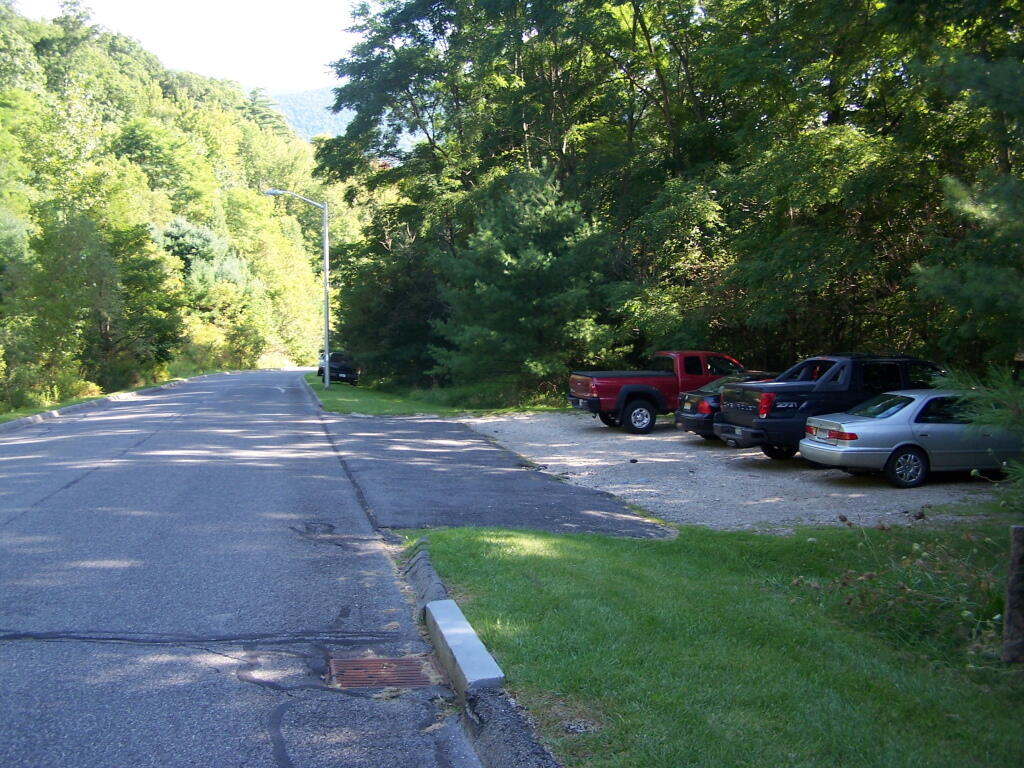
The Pine Cobble starts off a steep road that has the Pine Cobble private development on it. It’s not a gated community, but as close as one can get to it. The parking is limited here, with a lot for seven cars, so if it’s full, as it was on this beautiful Sunday morning on labor day, you will be forced to park on the shoulder.

There is a six-inch asphalt curb you have to jump to get on the grass sholder, but if you have a truck, it shouldn’t be a problem. They didn’t give me a ticket, and lots other did it, so I guess it’s legal. They do have a sign, just past the parking lot, as you go into the development, that says NO PARKING on ROADWAY and it’s posted, but downhill from the lot, seems okay.

Limited Parking

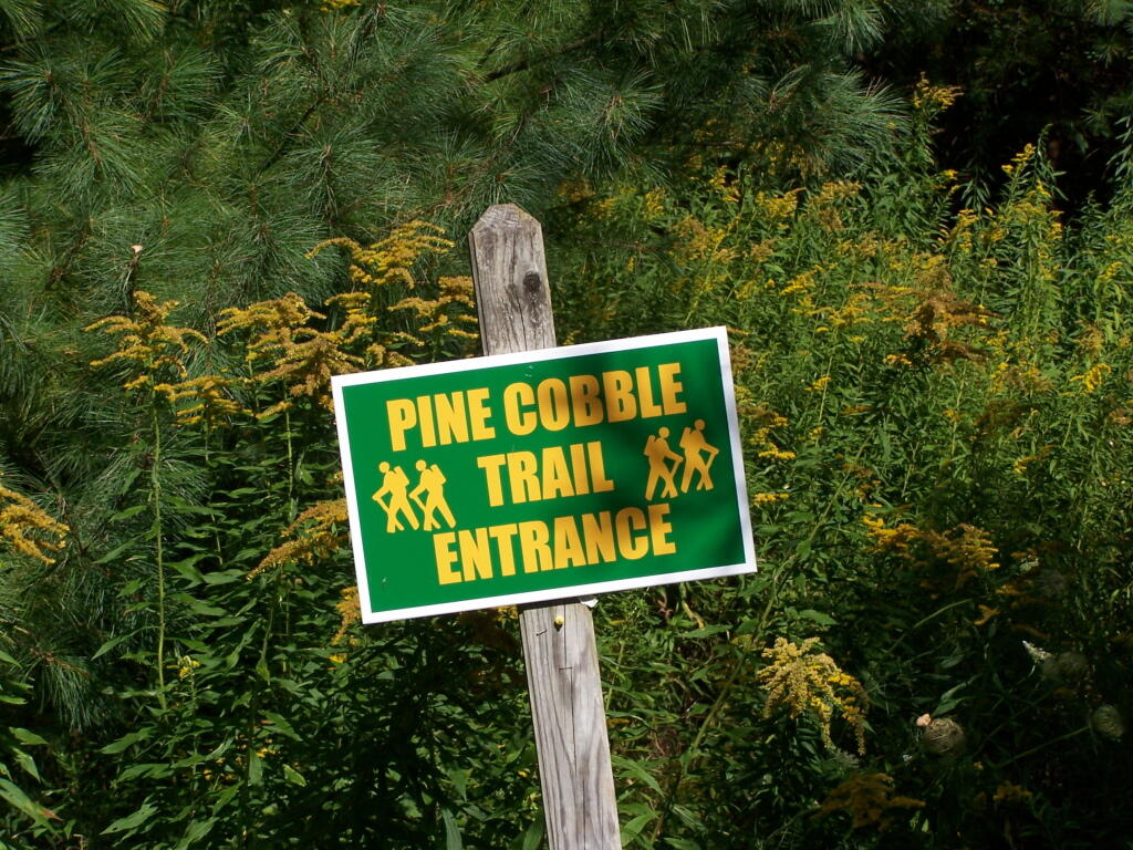
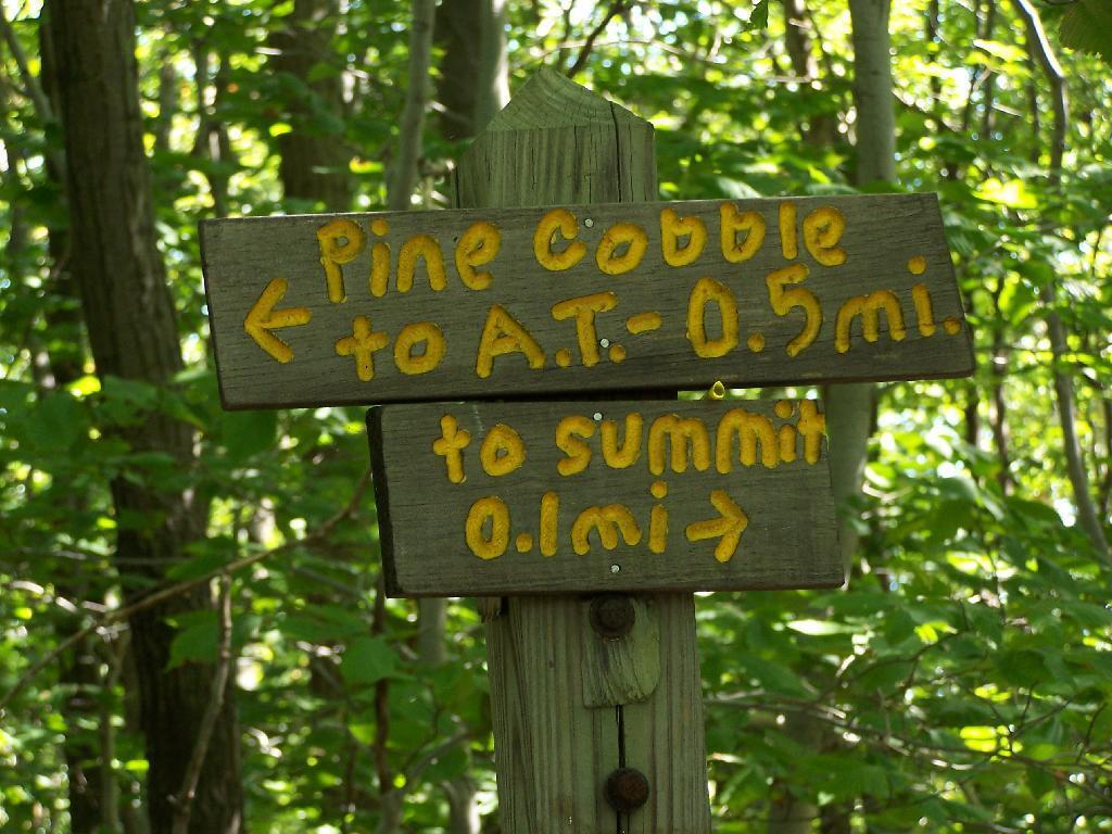
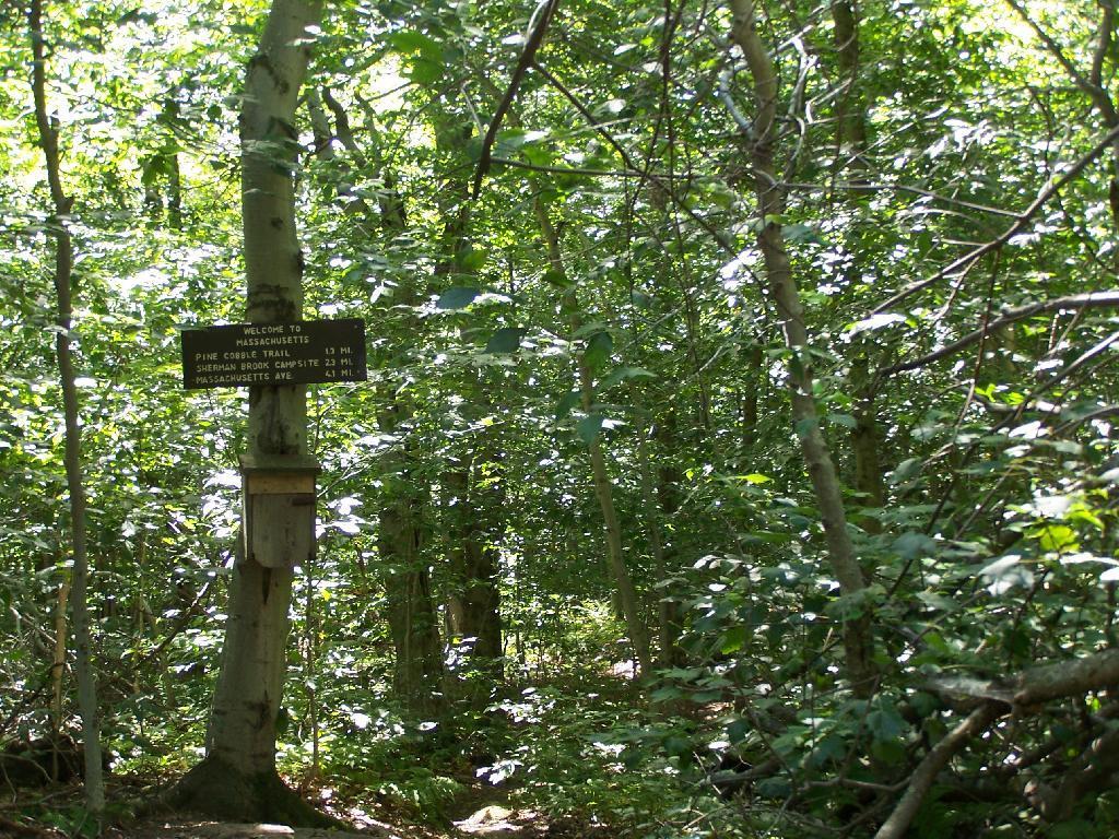
The trail head is very well signed. The entire trail is well worn, and the occassional Williamstown Trail Blazes makes it easy to follow the trail.

Pine Cobble Trail Entrance

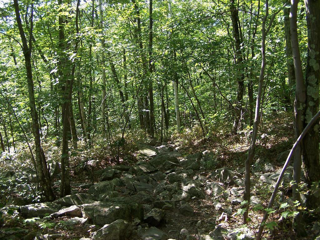
Parts of the trail are either relatively smooth or steep and rocky. It’s called Pine Cobble, so you would expect to be walking on a lot of rock cobble. It’s not nice small stuff, but big enough that you have to keep a careful eye on where you step.

Rough on the Feet

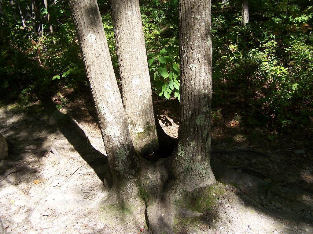
Three quarters of the way to the top there is this oak tree with three shoots up that provides a perfect little pool where water accumulates throughout the year. It’s quite neat looking. Talking to other people, this is actually quite a common occurance with a certain type of oak.

Three Oaks form a Pool

A top Pine Cobble, looking at East Mountain.

East Mountain

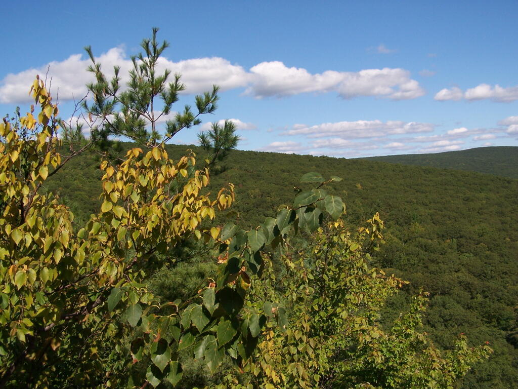
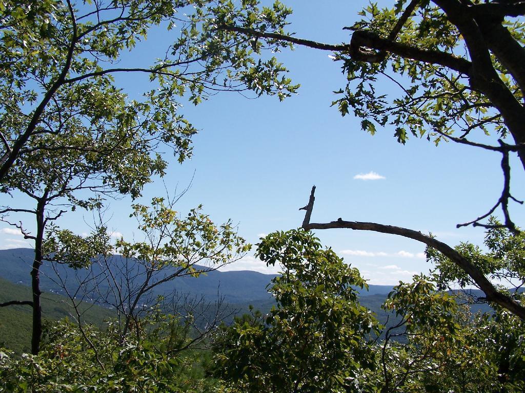
You’ve almost made it to the top of Pine Cobble. Once you’ve checked it, make sure to take the trail up East Mountain for a 1/2 mile to get some awesome westerly views.

Trail Up East Mountain

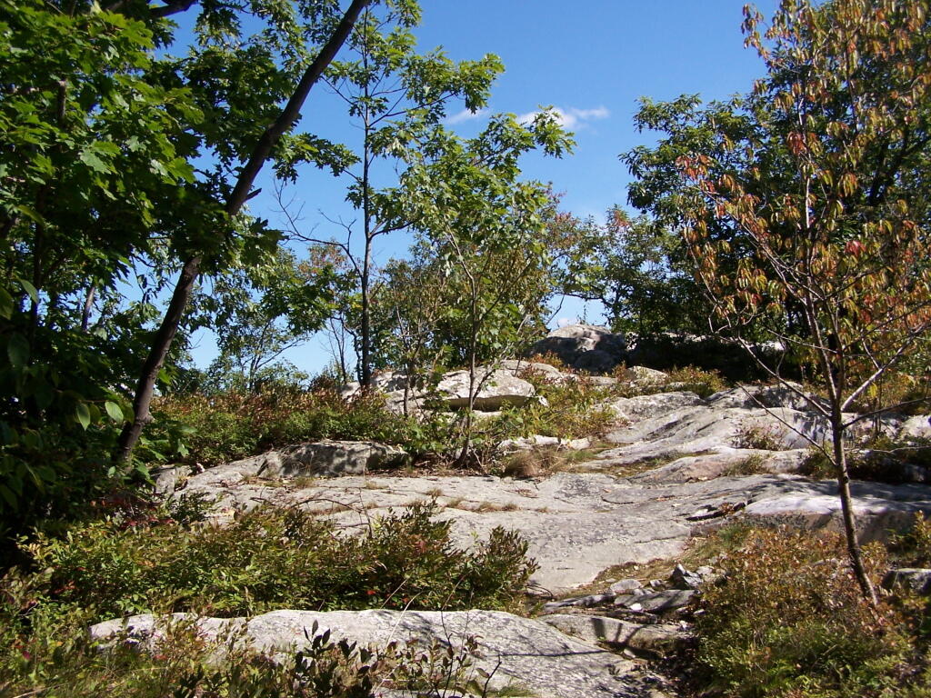
Here is the summit of Pine Cobble. It’s not the most impressive summit, and indeed the best views are along the edges of Pine Cobble, where there are several to be enjoyed.

Summit

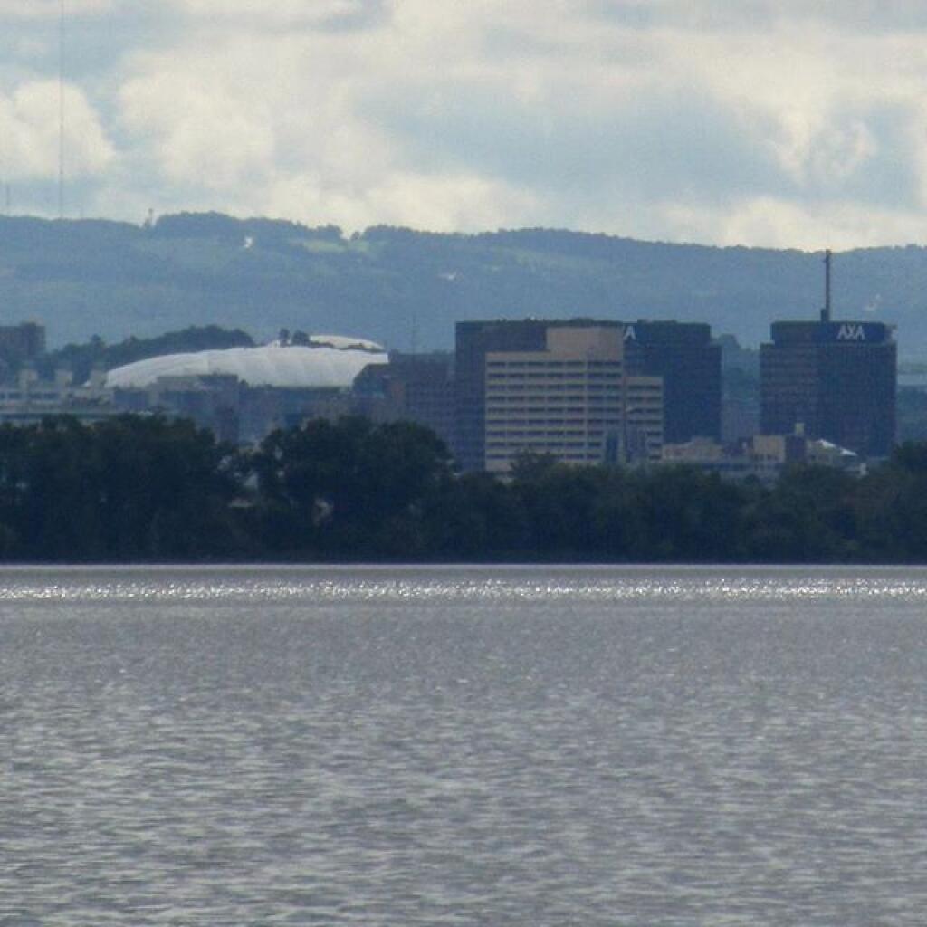
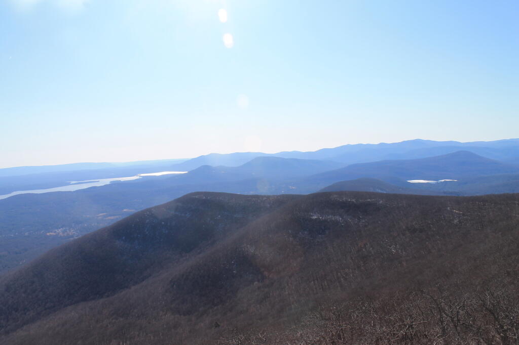
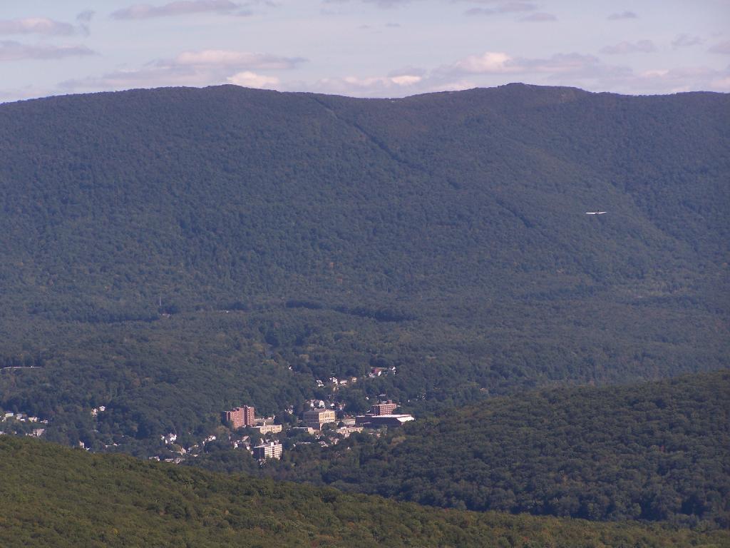
Looking down at North Adams from Pine Cobble. The city’s high rises are surrounded by the mountains that form Hoosic Valley where the river runs north through Williamstown, Pownal, Vermont, and ultimately Rensselear County, New York into the Hudson.

North Adams

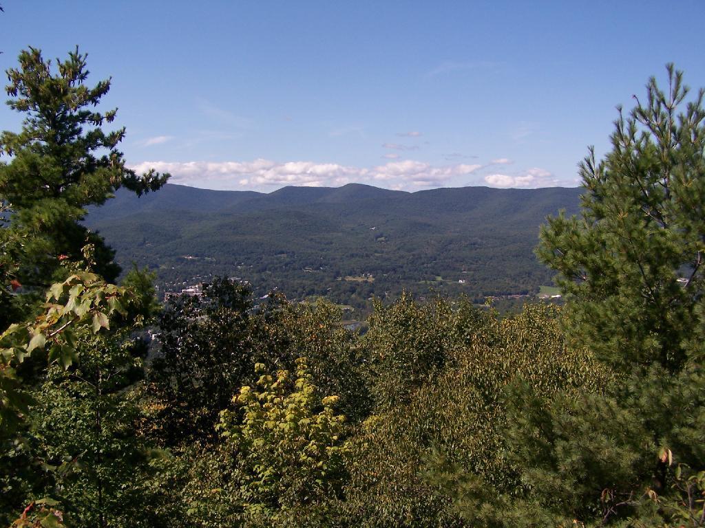
Here is the Pownal Valley, where the Hoosic River heads up through the corner of Vermont and back into New York State.

Pownal Valley

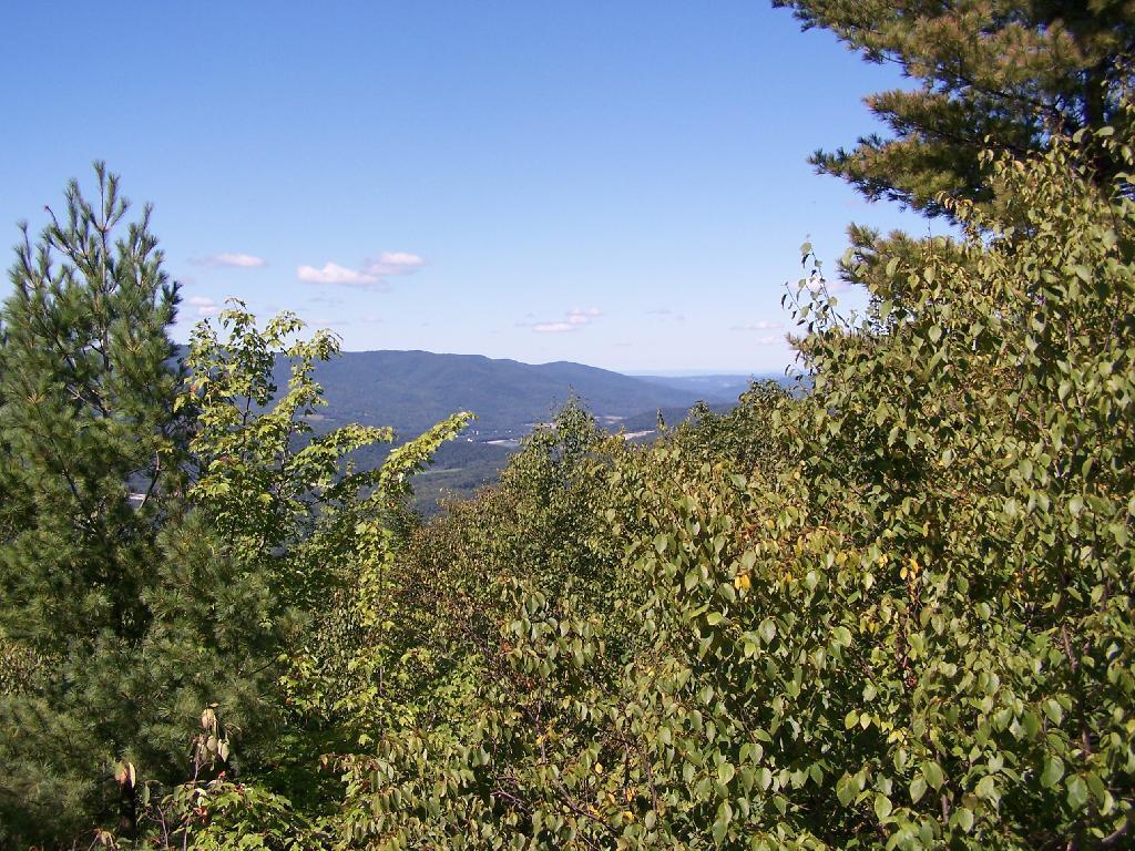
West from Pine Cobble, you can see the last range of the Taconics / first of Berkshires, where Berlin Mountain and Mount Raimer. Also in the foreground is a little bit of Williamstown.

West

On East Mountain there are these exciting views of that same range, but with the addition of lots of bright white marble rock, cairns, and at least on this blue day, a deep blue sky.

Exciting Views

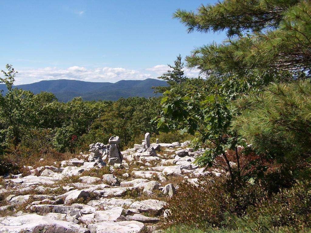
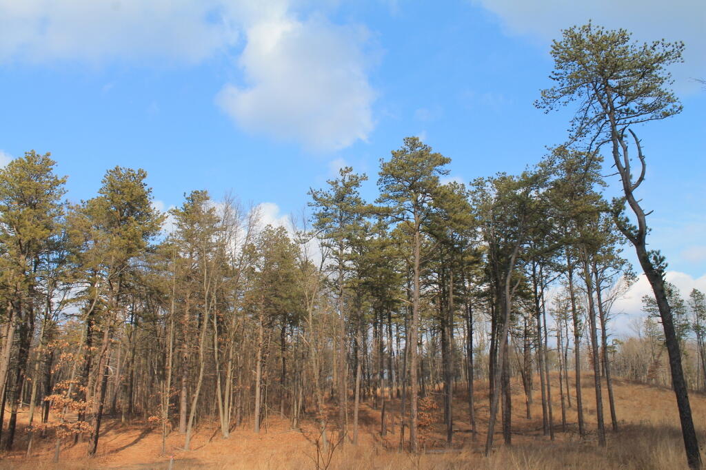
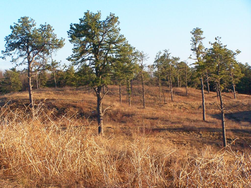
When you reach the top of East Mountain, there is sections of the Appalachian Trail that remind me a lot of the look of Albany Pine Bush, minus the sandy soils. The Berlin Mountain range in the distance pull some kind of emotion into my heart, just like looking at the Heldebergs from the Albany Pine Bush.

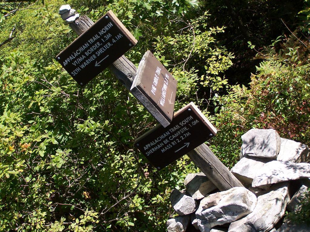
The Applachian Trail sign on East Mountain.

East Mountain at A.T.

At the Massachussets and Vermont (Green Mountain National Forest & Long Trail) border.

A.T. Log Book

A beautiful day for sure.

Looking East off Pine Cobble

Here is a map of the hike.

Made it to Saturday – what a week 😩

I tried to sleep well last night, but now I’m fried. I’m trying to get up and moving — but it’s tough. My head is just spinning from the week that was. Nothing serious, but it’s just so much to learn at my new job, more stupid little bull-sheet that’s just left me fried after the week that was.

Good morning! Partly sunny and 45 degrees in Delmar, NY. 😎 There is a south breeze at 6 mph. 🍃. Temperatures will drop below freezing at Monday around noontime. ☃️

Definitely enjoying not having the heat on this morning. ⏹ I opened up the kitchen window and the one in my bedroom that don’t require removing the storm windows. The fresh air was so refreshing. Tonight though will be cool enough, I’ll probably need to close the windows before bed, but I’m enjoying the fresh air as I can.

Breakfast this morning was a big pan of eggs 🍳 with lots of onions, broccoli, corn, and peas. Probably too much tumeric but that’s a given. I’ve been avoiding going to the store to get milk, ☕ and cutting back on my coffee consumption, so only one pot — I mean cup of coffee this morning as that is all that my milk supply would allow. This afternoon I’ll have to get more milk at Stewart’s. 🐮

Today will have a chance of showers and thunderstorms, then showers likely and possibly a thunderstorm after 4pm. Some of the storms could produce small hail. Partly sunny 🌞, with a high of 63 degrees at 2pm. 28 degrees above normal, which is similar to a typical day around April 22nd. South wind 6 to 9 mph becoming west in the afternoon. Chance of precipitation is 60%. New rainfall amounts of less than a tenth of an inch, except higher amounts possible in thunderstorms. If it gets that warm, it will blow through many previous records. A year ago, we had cloudy skies. The high last year was 51 degrees. Almost record breaking warmth. The record high of 53 was set in 1955. That said, during the second half of February we’ve had a few 70 degree records in the past. 4.0 inches of snow fell back in 1892. 🌨 Not much of a record for winter.

Today is going to be a nice day and I want to maximize it. 🛠 I’ve continued to tweak the derailer on my bike 🚲, a constant source of frustration but I have it working pretty smooth now. ⚙ I’m learning a lot about bike mechanics. I do need to get it to the mechanic for a good tune up before the spring rush. 📞 I should call about an appointment so it get serviced before the spring rush. Knowing how mechanics are these days, probably won’t get an appointment to late March.

I have a list 📃 of things to do today but heading out for a bike ride to Voorheesville 🚲 in the nice weather followed by maybe visiting Five Rivers Environmental Education Center for a walk is high on that list. The best weather is going to be earlier so I should get an early start. 🌥 More clouds and ultimately rain later.

High on my list for today is finishing up the draft of the map 🗺 I’m making for Save the Pine Bush as they’re looking for it but I’ve been busy and just so tired 😴 lately that I’ve not spent much time working on it. But it would be good to have a, draft presented of the map as they’ve been looking for it. Every revision it gets a little better. 🔍

Solar noon 🌞 is at 12:11 pm with sun having an altitude of 32.9° from the due south horizon (-37.9° vs. 6/21). A six foot person will cast a 9.3 foot shadow today compared to 2.2 feet on the first day of summer. The golden hour 🏅 starts at 4:40 pm with the sun in the west-southwest (244°). 📸 The sunset is in the west-southwest (251°) with the sun dropping below the horizon at 5:20 pm after setting for 3 minutes and 4 seconds with dusk around 5:49 pm, which is one minute and 19 seconds later than yesterday. 🌇 At dusk you’ll see the Waxing Crescent 🌒 Moon in the west-southwest (247°) at an altitude of 5° from the horizon, 226,440 miles away. 🚀 The best time to look at the stars is after 6:23 pm. At sunset, look for rain 🌧 and thunderstorms 🌩 and temperatures around 53 degrees. There will be a west breeze at 8 mph with gusts up to 20mph. Today will have 10 hours and 23 minutes of daytime, an increase of 2 minutes and 35 seconds over yesterday.

I got to go to the post office 📬 to give them $3.52 to bail out the USB cable ⌨️ I bought that didn’t come with the USB keyboard switch I bought last week. Yes, a different seller scammed me again on EBay 🖱️ this time sending me the cable that I was supposed to come with USB keyboard switch I bought. This time they couldn’t be bothered to put sufficient payment on the package so my choice was to refuse the package 📦 and probably never get the cable or hand over the money to the post office. I’m only $17 in the hole for what should have been a $8.65 refurbished switch had Ebay not screwed me over twice. 😡 I was angry as duck 🦆 last night 🌃 but for $3.52 more I’ll have closure once I get to the post office later. I can be angry but it’s stupid, not that much money. I’m constantly broke these days with inflation but whatever, I’m also making good money.

Tonight will have a chance of showers, mainly before 9pm. Mostly cloudy 🌧, with a low of 35 degrees at 6am. 18 degrees above normal, which is similar to a typical night around April 10th. Southwest wind 6 to 11 mph becoming northwest in the evening. Chance of precipitation is 50%. New precipitation amounts of less than a tenth of an inch possible. In 2023, we had partly cloudy skies. It got down to 23 degrees. The record low of -18 occurred back in 1962.

Too bad it’s going to rain this evening 🌃, I’d love to sit out back with the mild weather. It’s fine I promised mom and dad to bake bread 🍞 this evening for Sunday dinner. Then I want to get to bed 🛏 early so I can be up and rising early to go grocery shopping 🛒 tomorrow. I tell myself my pantry is well enough stocked that I won’t have another big grocery bill but with inflation I know thats a lie. 🍏 It’s so hard to get ahead today even with what most people would consider to be a good job.

Looking ahead, next Saturday is 5:30 PM Sunset 🌇 when the sun with dusk at 5:57 pm. I’m excited about that as it means I can ride my bike home after work, once the snow is off the bike path. No bus fare for you, Mr. Bus Serivice. On that day in 2023, we had mostly cloudy, mild, rain showers and temperatures between 55 and 23 degrees. Typically, the high temperature is 36 degrees. We hit a record high of 60 back in 1981.

Ashokan Reservior and Ashokan Mountain