Search Results for: photo hills along pond

August 11, 2020 Evening

Good evening! Partly clear and 74 degrees at the Finger Lakes National Forest. 🌃 There is a west breeze at 8 mph. 🍃. The dew point is 65 degrees. The muggy weather ends tomorrow around 10 am. 😓

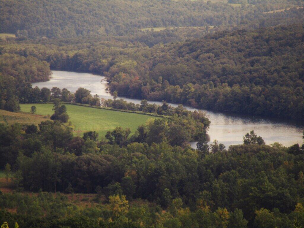
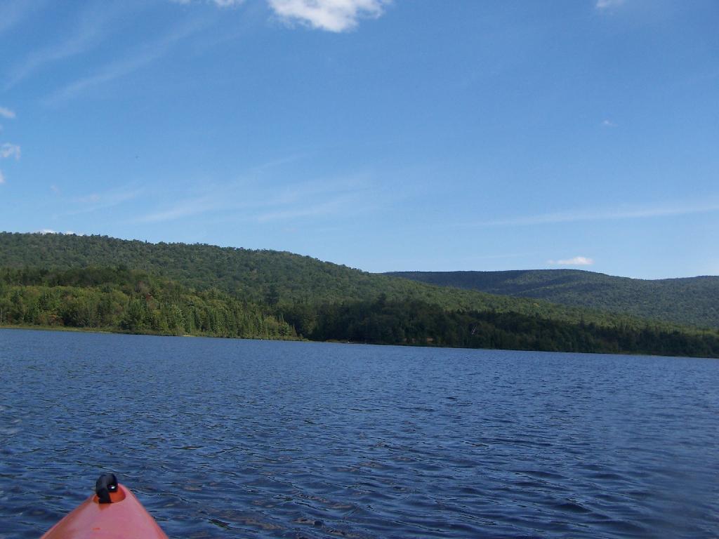
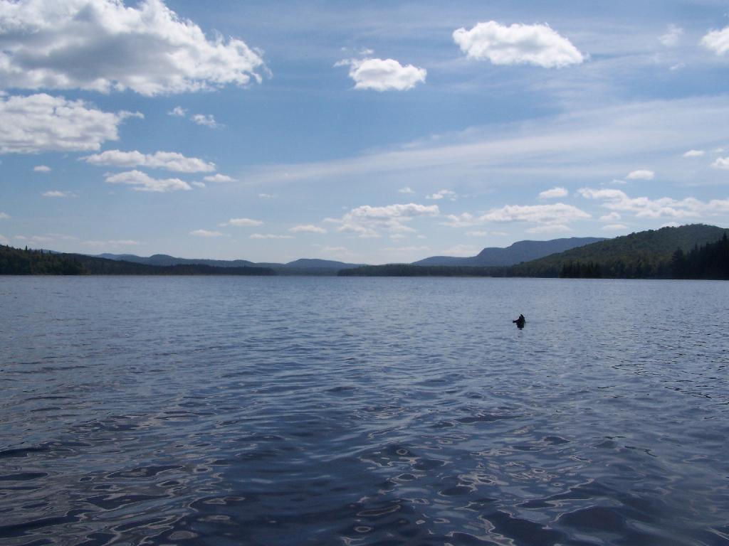
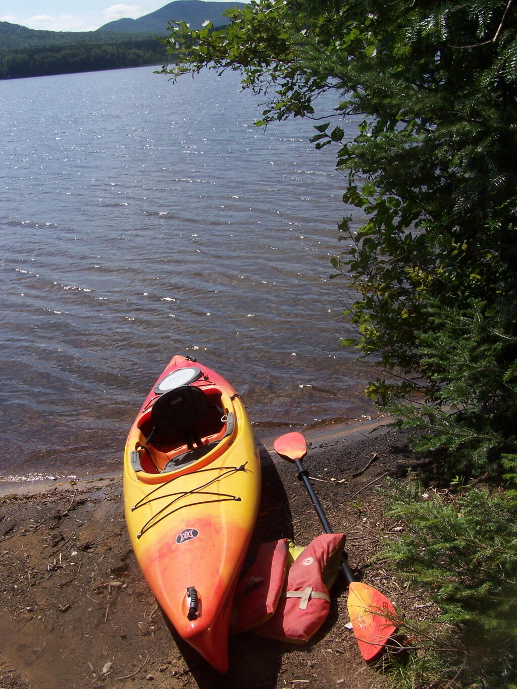
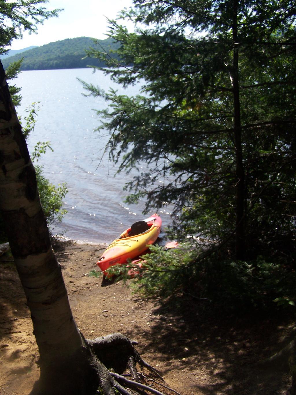
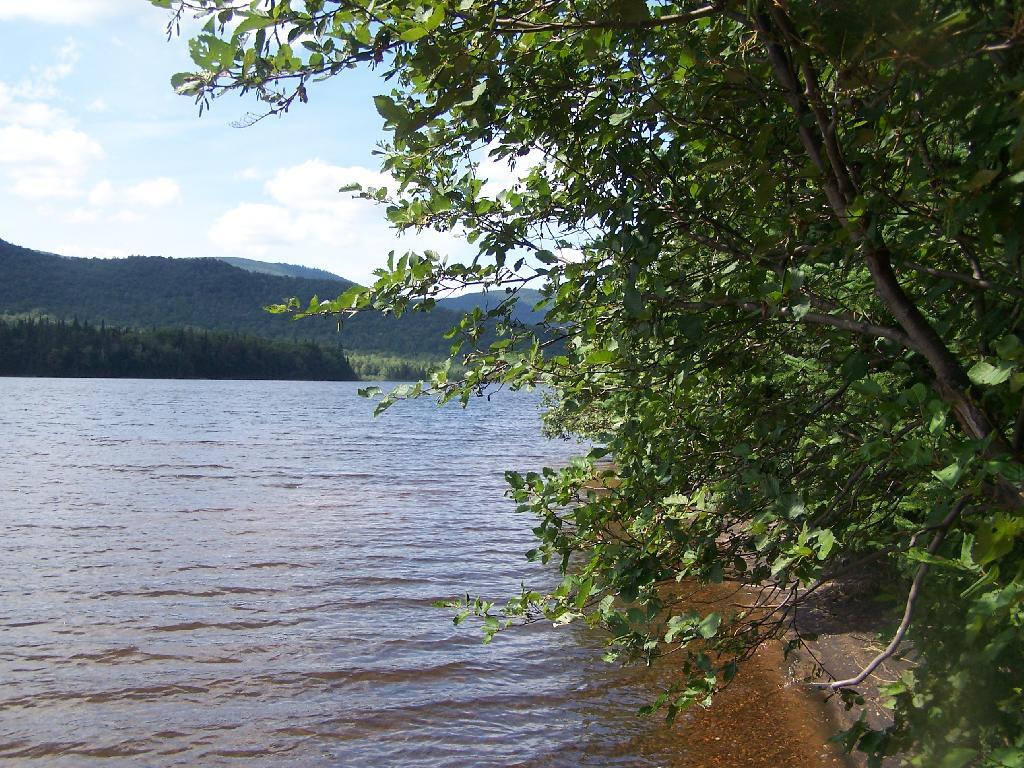
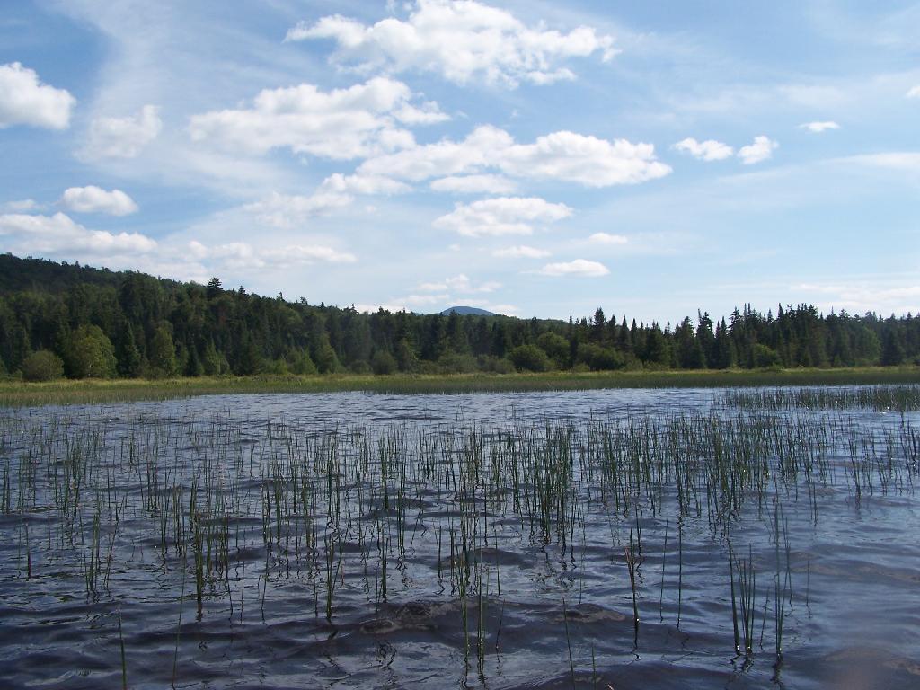
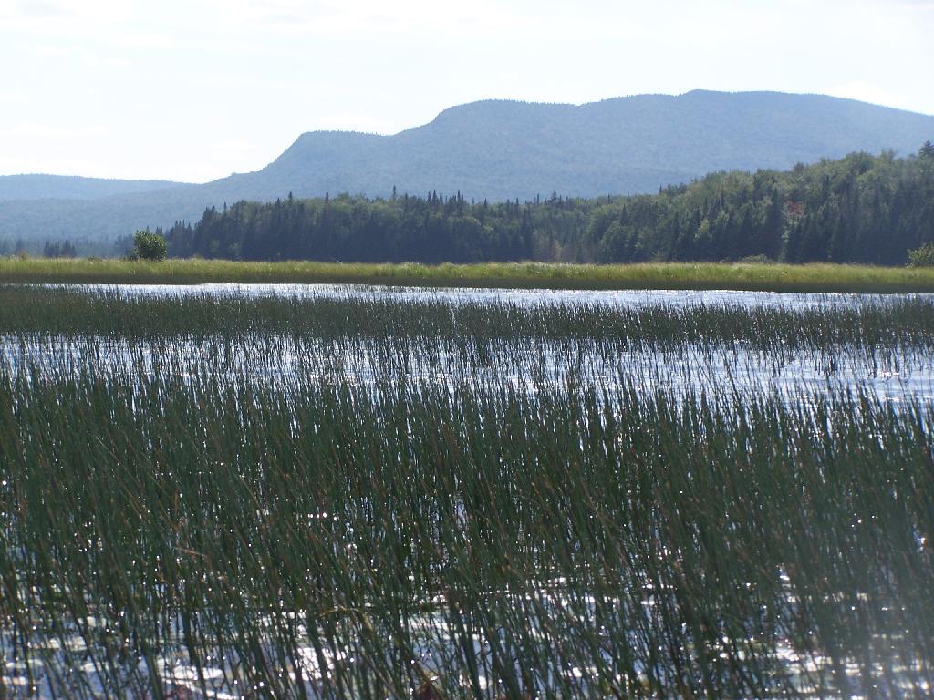
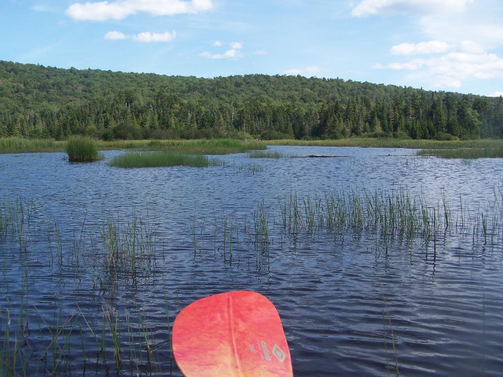
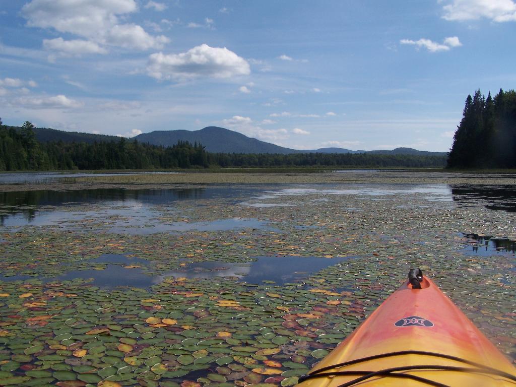
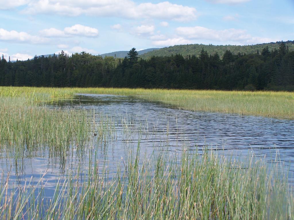
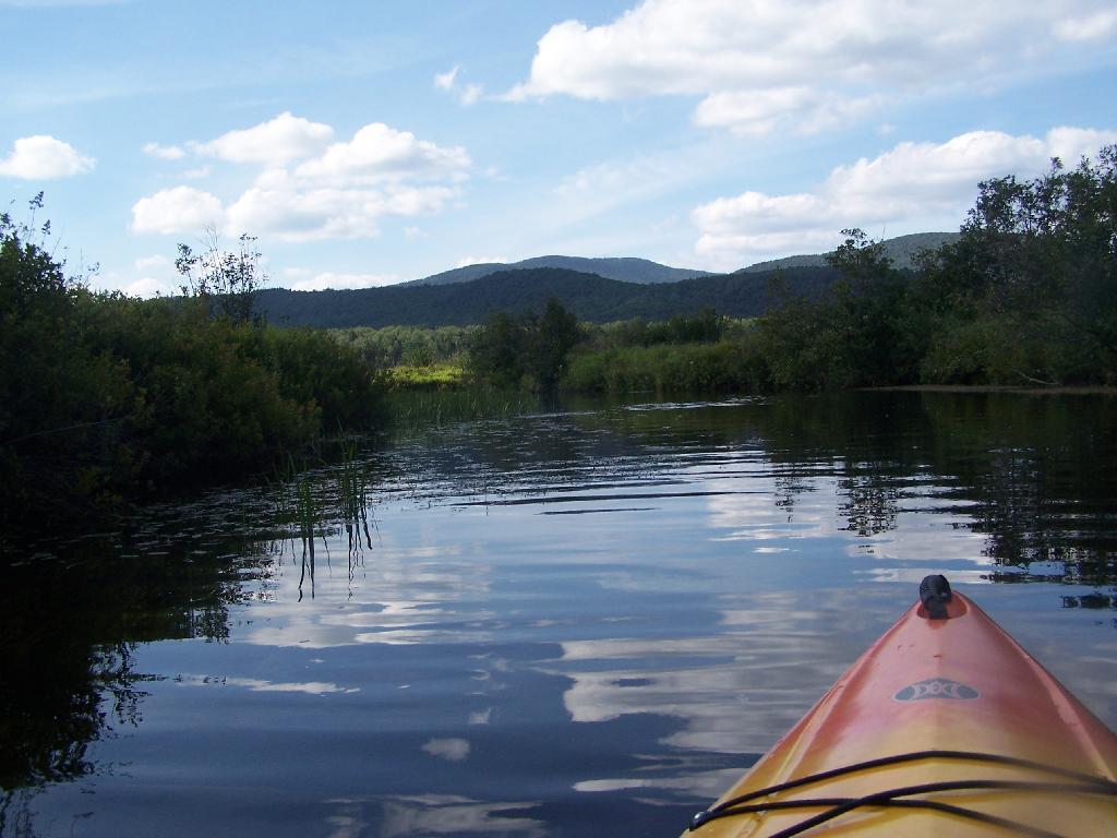
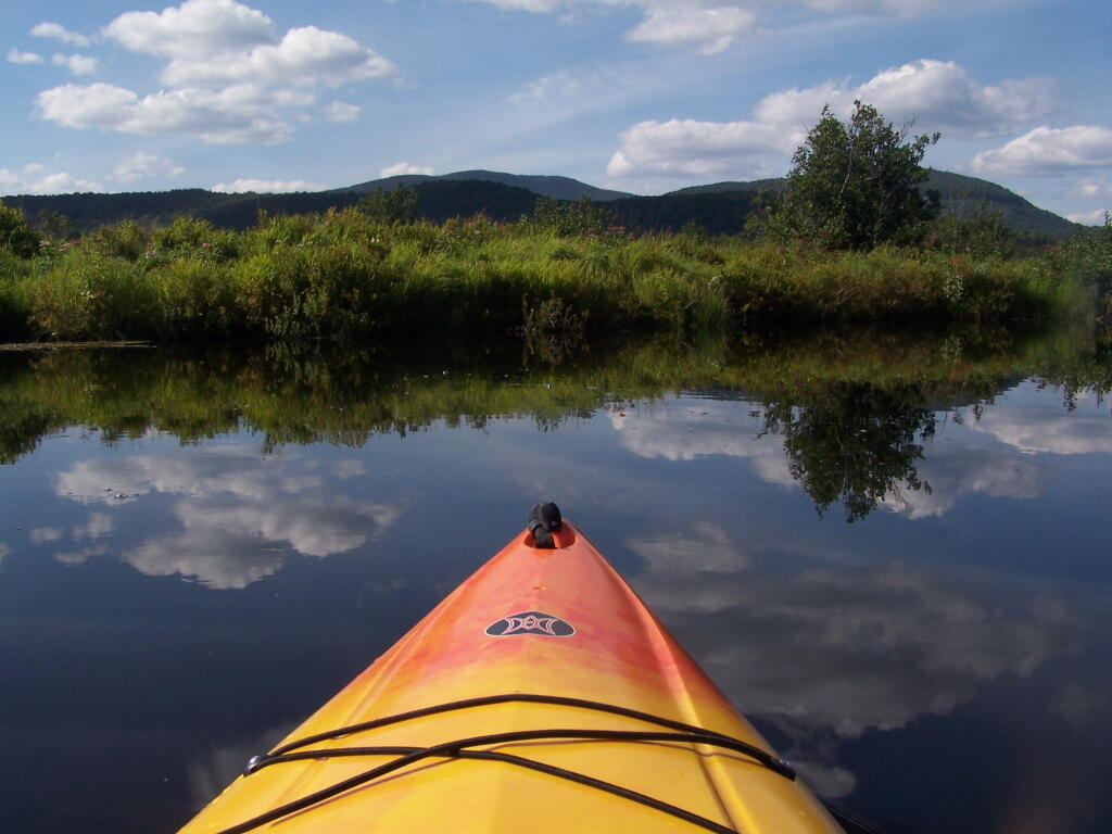
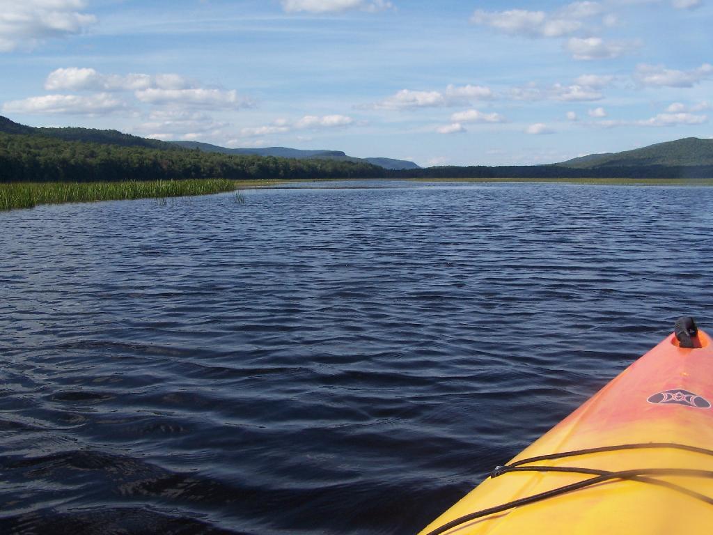
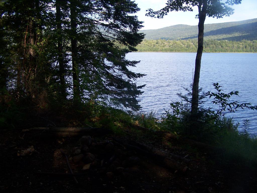
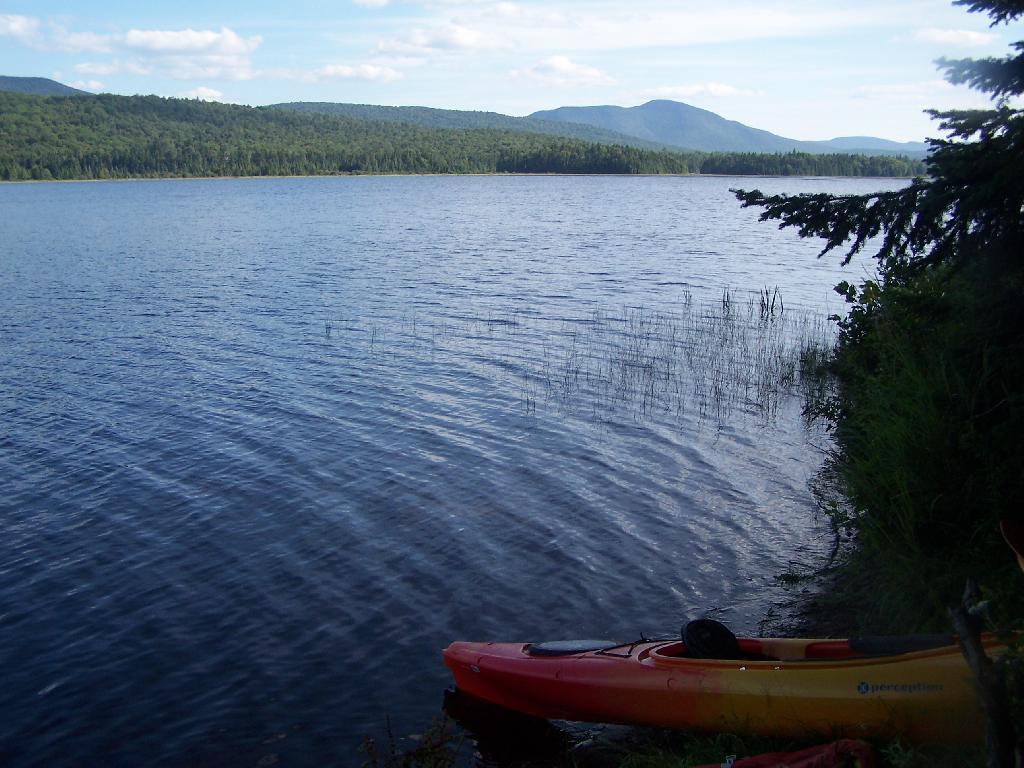
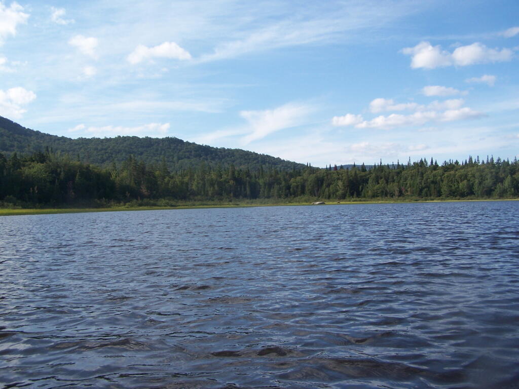
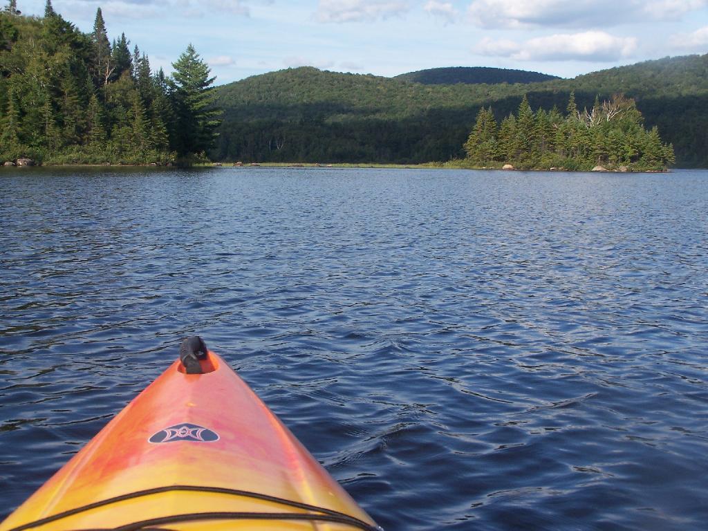
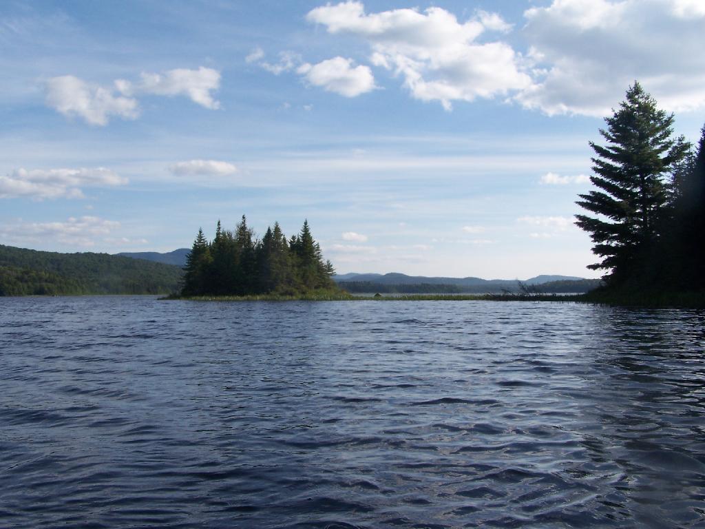
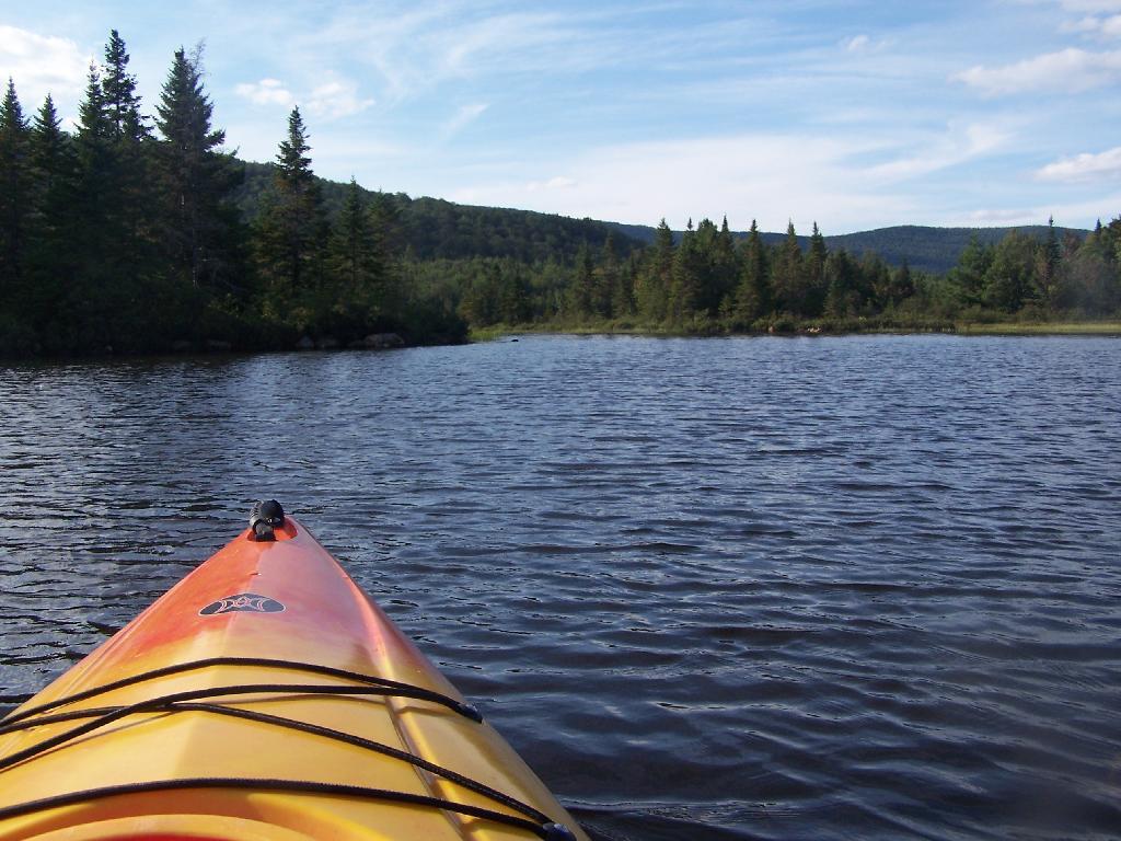
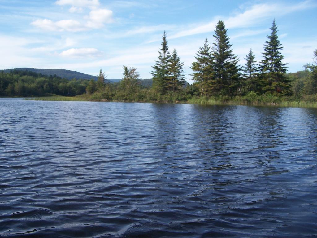
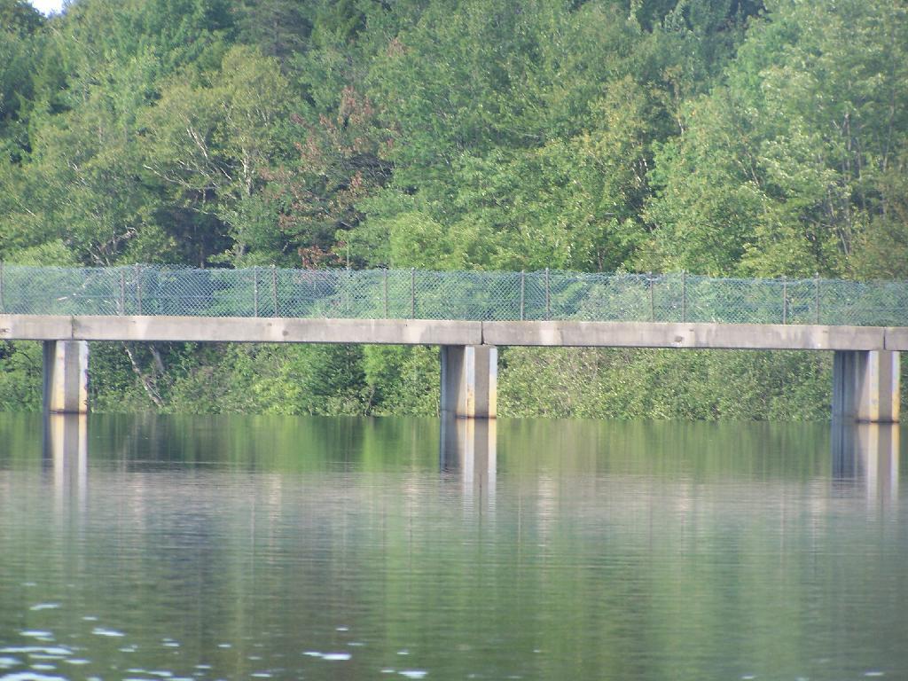
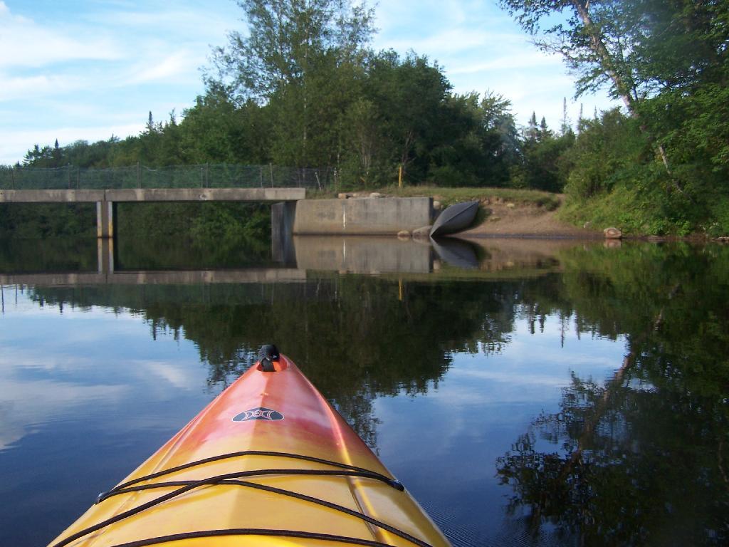
To end the first half of summer vacation 🏖 I thought things went remarkably well. I spent about six hours at the pool 🏊🏻‍♂️ and two paddling the Montour Falls canal. 🛶 While it was a bit choppy at the end of the day on Seneca Lake for the most part it wasn’t bad. 🌊 A 38 mile lake, even if across its relatively narrow and sat below tall hills is always going to be somewhat rough. Might be even less windy tomorrow – I left the kayak 🛥 on the truck and come morning I might decide to do more paddling tomorrow.

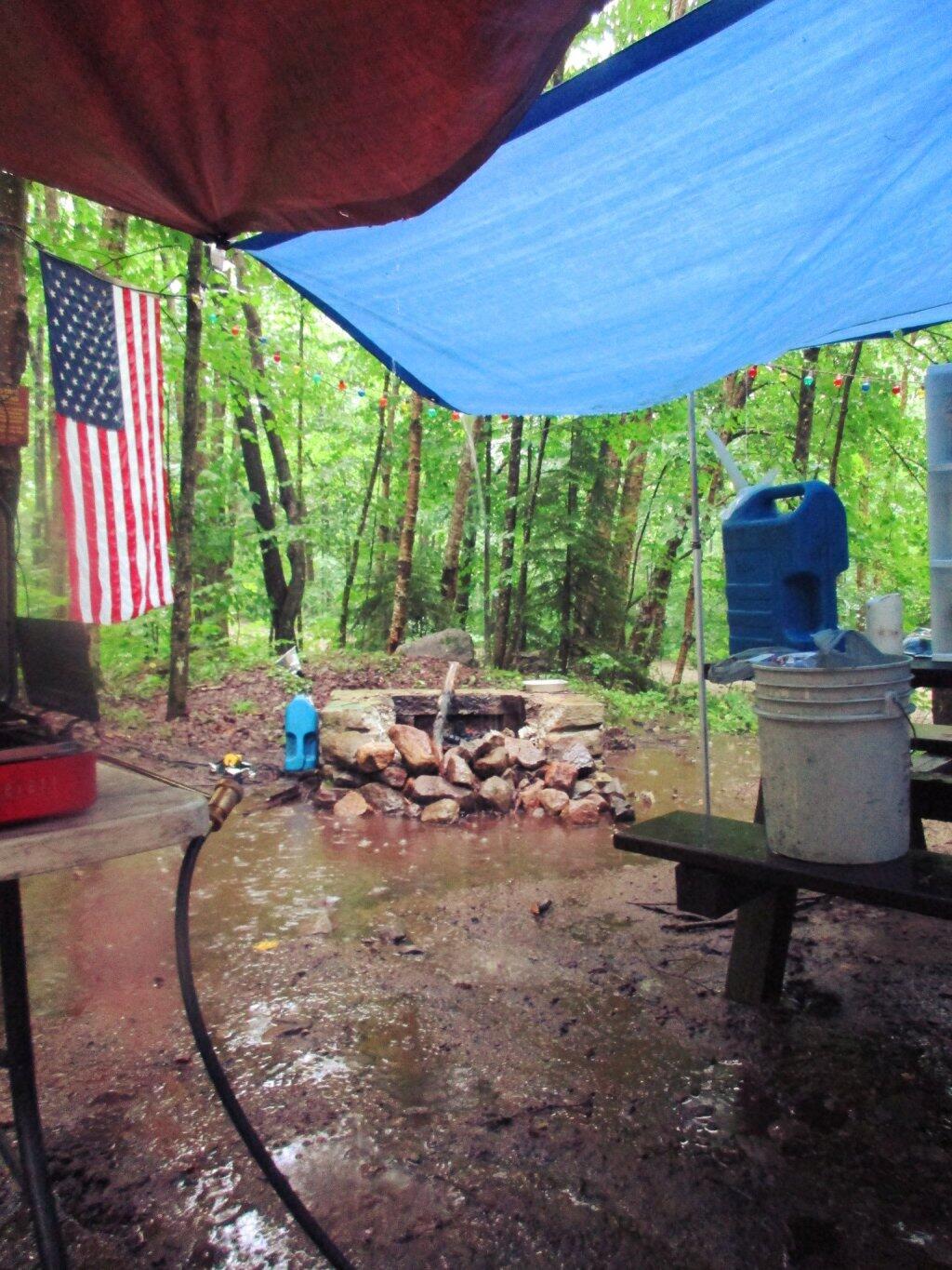
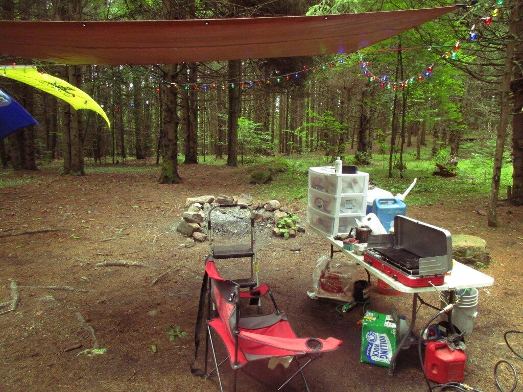
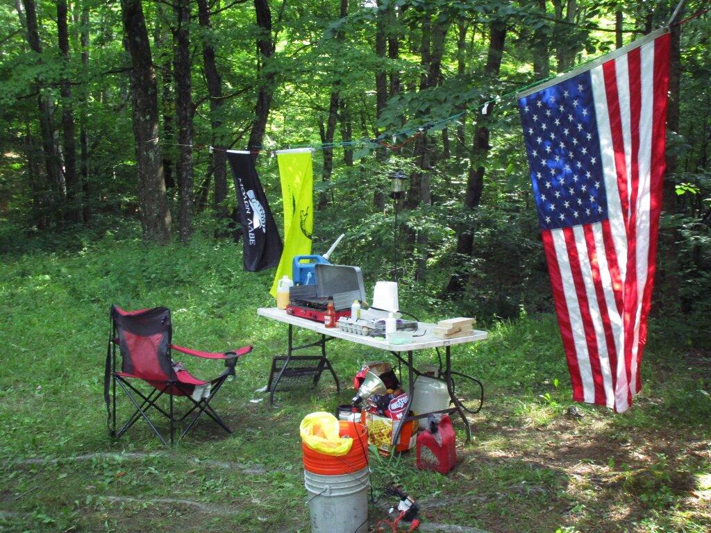
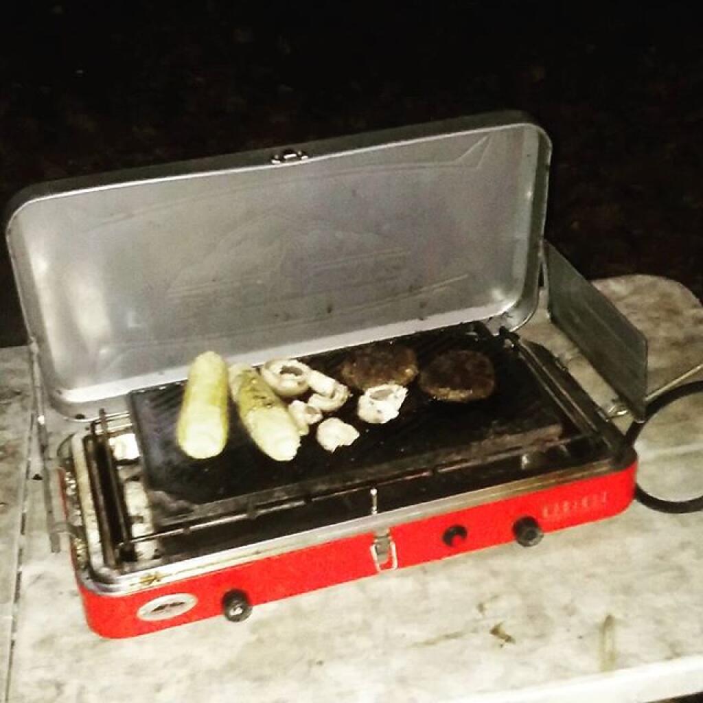
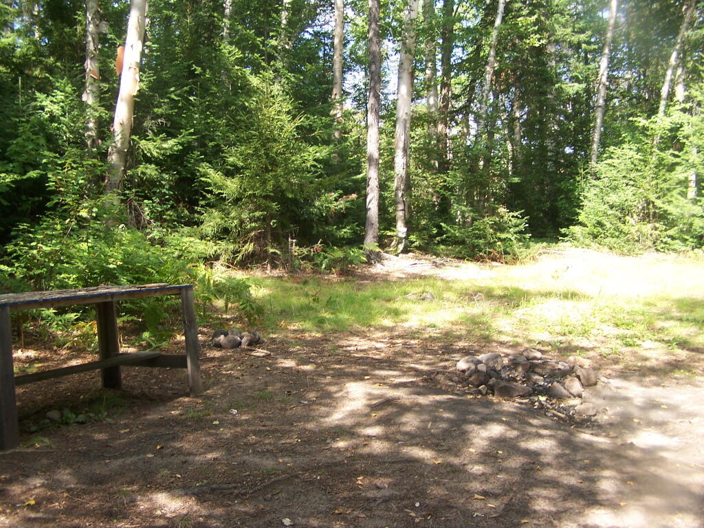
That caramel sundae 🍧I got from the Glen Dairy Bar was pretty good today. I will have to get there a few more times before I leave the Finger Lakes for a few more options. It’s fun having good ice cream when you camp. Had more of those sausage paddies with cheese and ketchup on a hard role for dinner. 🍔 They’re a nice easy treat. I have two more to finish off tomorrow maybe for lunch and then I’ll figure out what is next for camp meals 🍴.

Tonight will be partly cloudy ☁️, with a low of 65 degrees at 6am. Four degrees above normal. Maximum dew point of 68 at 8pm. West wind 5 to 8 mph becoming light and variable in the evening. In 2019, we had mostly clear skies. It became somewhat humid as the night progressed. It got down to 56 degrees. The record low of 46 occurred back in 1987.

Tonight will have a Last Quarter 🌗 Moon with 46% illuminated. The darkest hour is at 1:13 am, followed by dawn at 5:41 am, and sun starting to rise at 6:12 am in the east-northeast (69°) and last for 3 minutes and 6 seconds. Sunrise is one minute and 4 seconds later than yesterday. 🌄 The golden hour ends at 6:51 am with sun in the east-northeast (75°). Tonight will have 9 hours and 58 minutes of darkness, an increase of 2 minutes and 26 seconds over last night.

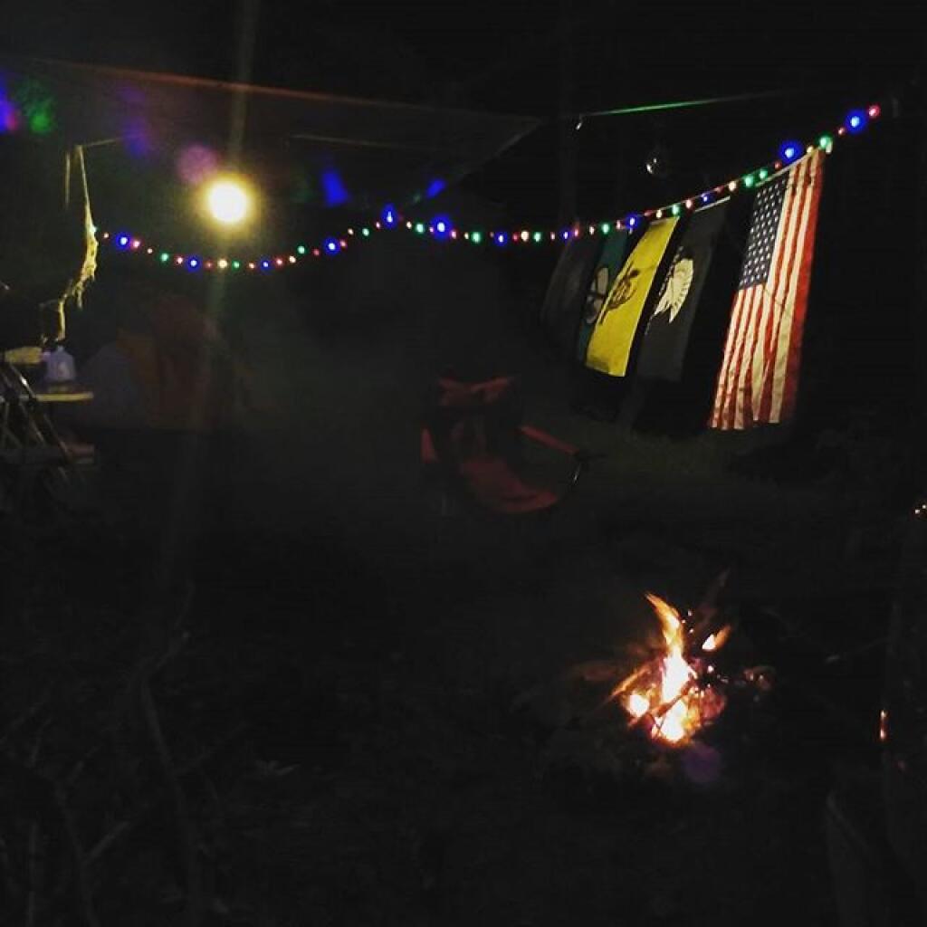
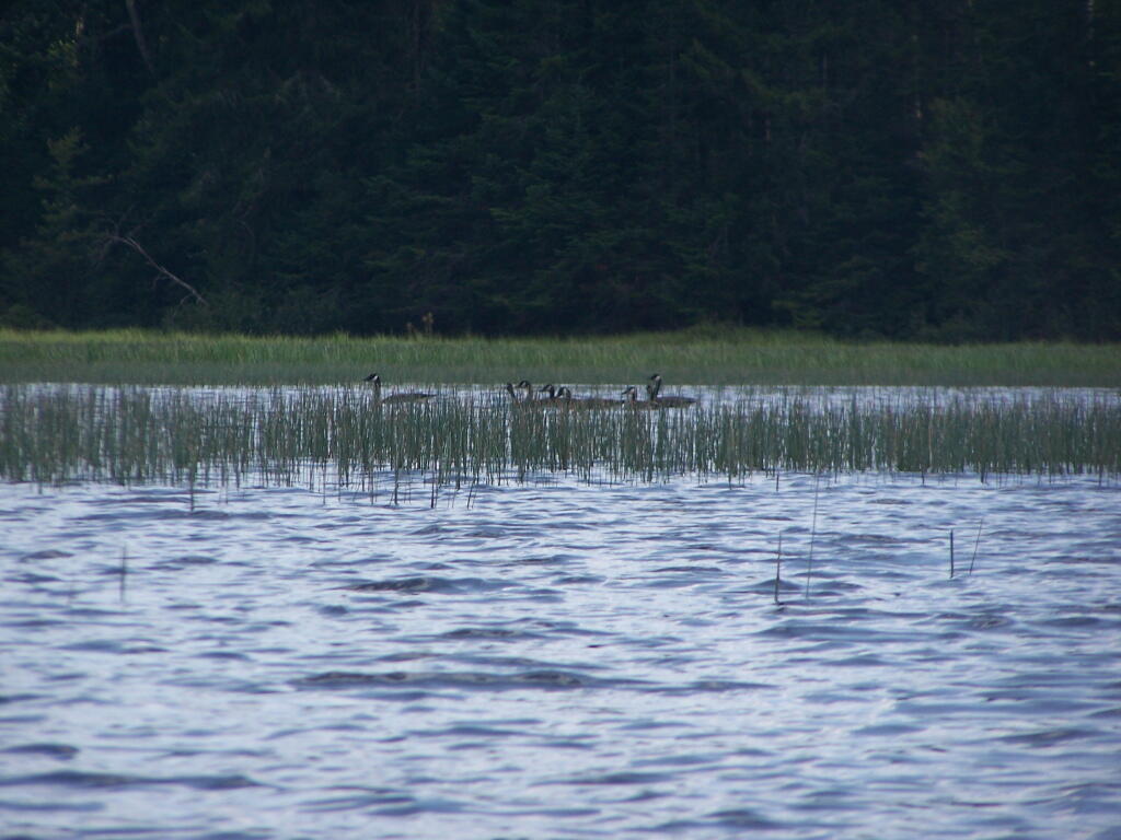
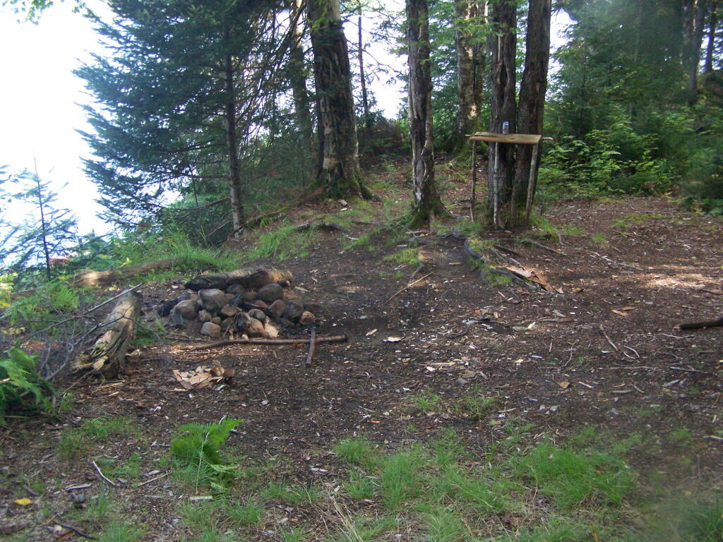
I hiked back to Foster Pond this evening to watch the percid metriod showers 🌠but stayed only for about fifteen minutes when there was what appeared to be a very wild party 🎉 on the one end of the lake disturbing the solitude. Based on the noise and the late arrivers it seemed like an under age drinking 🍻 party. I wasn’t going to get mixed up with that and honestly myself I wasn’t that sober after having a few drinks with dinner to toast off the day and wash down those sausage paddies. That said, in the brief time I was there I saw two shooting stars and by the time I was heading back it had clouded up.

Tomorrow will be mostly sunny 🌞, with a high of 85 degrees at 3pm. Four degrees above normal. Maximum dew point of 64 at 6am. Northwest wind 3 to 7 mph. A year ago, we had partly cloudy skies in the morning with some clearing in the afternoon. The high last year was 86 degrees. The record high of 99 was set in 1944.

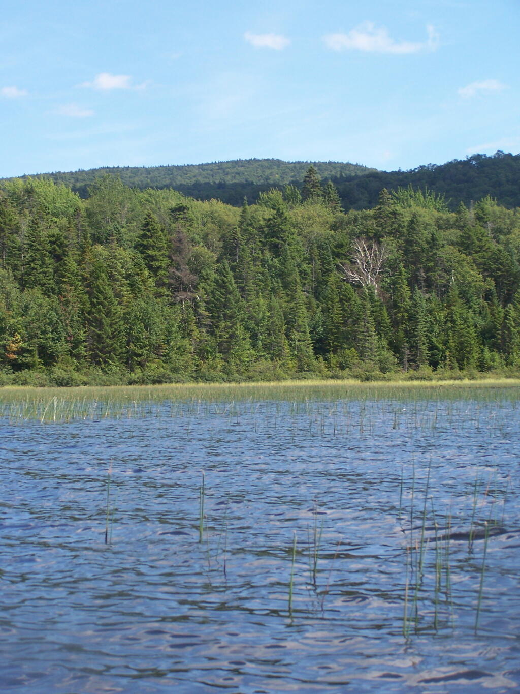
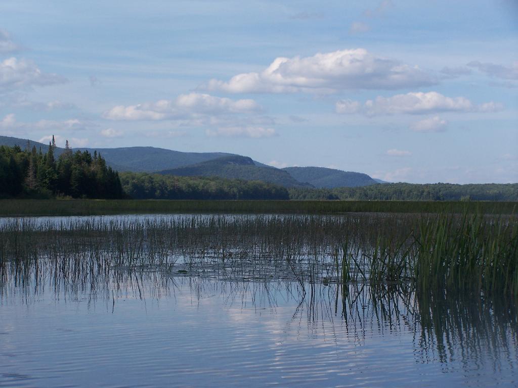
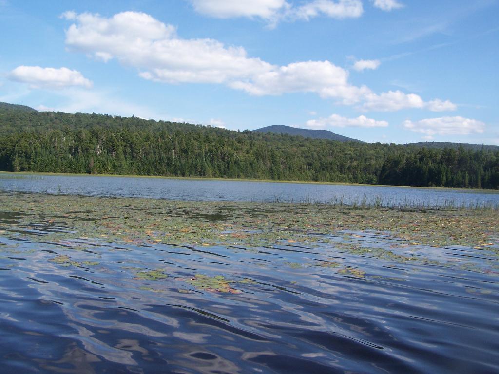
It should be another nice day tomorrow. ☀ I am not going to rush to get going tomorrow though as I need to try to get some more sleep tonight. 💤 I am thinking about more kayaking tomorrow 🛶, maybe off of Hector Park boat launch or maybe the Watkins Glen boat launch and paddling up along the shoreline of Seneca Lake to Hector Point. I don’t think I’ll do more of the Montour Canal – I found it kind of boring and it stunk of raw or partially treated sewage and was kind of green from pollution. I was hoping I could get off the canal to explore Bad Indian Marsh but there wasn’t a lot of navigable streams – I saw only one and it didn’t look very promising. 🛑

In four weeks on September 8 the sun will be setting in the west (278°) at 7:29 pm,🌄 which is 44 minutes and 56 seconds earlier then today. In 2019 on that day, we had partly cloudy and temperatures between 73 and 52 degrees. Typically, you have temperatures between 75 and 55 degrees. The record high of 94 degrees was set back in 2015.

Looking ahead, September 🍎 is in 3 weeks, September 11th 🇸 is a month away, Autumn 🍂 is in 6 weeks, Election Day 2019 🗳️ is in 12 weeks, Average High is 50 🍂 is in 13 weeks, Veterans Day 🇺🇸 is in 3 months, Regular Deer Season in Southern Zone 🦌 is in 14 weeks, December 🎄 is in 16 weeks, Bill of Rights Day 📜 is in 18 weeks, Days are Getting Longer ☀️ is in 19 weeks, Cold Moon 🌕 is in 20 weeks, National Bird Day 🐧 is in 21 weeks, 5:30 PM Dusk 🌆 is in 24 weeks, Ground Hog Day 🐻 is in 25 weeks and Don’t Cry over Spilled Milk Day 🥛 is in 6 months.

 Mohawk River

August 9, 2020 Morning

Good morning! Happy Sunday. Six weeks to Average High 70 🎑 . Sunny and 71 degrees at the Finger Lakes National Forest. Tree🌲🌞 Calm wind. The dew point is 64 degrees.

Went for a walk 🚶 again this morning on the Interlaken Trail and to Foster Pond. Definitely a nice morning, 🌞 lots of sun and wildflowers. 🌻Had a nice pan of corned beef hash and cheese for breakfast. 🍳 Some eggs 🥚 would be nice but I’ll have to get them today.

Wildflowers are definitely better this time of year 🌻🌼🦋🐝 compared to earlier in the summer when I often take my vacation. It just makes my vacation a little more enjoyable seeing the road sides in bloom, the butterflies and bees. And yes, all that field corn 🌽 is getting tall.

Been quite busy up here 👩‍👩‍👦‍👦👨‍👨‍👧, with so many things closed during the pandemic based on the number of cars 🚘 I’ve seen on the road. Fortunately, my campsite is quite remote and quiet 🤫 so nobody is bothering me. Seen more equestrians 🐴 than normal – in part because the Upper Assembly Area is closed at Sugar Hill. 🔐

Today will be sunny 🌞, with a high of 82 degrees at 4pm. Typical for today. Maximum dew point of 66 at 6pm. Light and variable wind becoming west 5 to 8 mph in the morning. A year ago, we had partly cloudy skies in the morning with some clearing in the afternoon. The high last year was 81 degrees. The record high of 96 was set in 2001.

Kind of breezy up here on the backbone 🗻 but I’m hoping the breeze will die down later and I can get out on Seneca Lake and the Montour Canal later. 🛶 I’m excited about all the wildlife I might see there. 🐦🦆🕊️🐸🐢🦎🐟 I just don’t want to go on Seneca Lake if it’s at all breezy 🚣🏻‍♂️ because it’s a big lake and can be very choppy. 🌊

Solar noon 🌞 is at 1:13 pm with sun having an altitude of 63.1° from the due south horizon (-7.6° vs. 6/21). A six foot person will cast a 3 foot shadow today compared to 2.2 feet on the first day of summer. The golden hour 🏅 starts at 7:38 pm with the sun in the west-northwest (286°). 📸 The sunset is in the west-northwest (292°) with the sun dropping below the horizon at 8:17 pm after setting for 3 minutes and 8 seconds with dusk around 8:46 pm, which is one minute and 21 seconds earlier than yesterday. 🌇 The best time to look at the stars is after 9:26 pm. At sunset, look for partly cloudy skies 🌃 and temperatures around 77 degrees. The dew point will be 67 degrees. There will be a west breeze at 5 mph. Today will have 14 hours and 8 minutes of daytime, a decrease of 2 minutes and 25 seconds over yesterday.

Tonight will be partly cloudy 🌤, with a low of 68 degrees at 5am. Seven degrees above normal. Maximum dew point of 67 at 7pm. Southwest wind 3 to 5 mph. In 2019, we had light rain in the evening, which became partly cloudy by the early hours of the morning. It got down to 57 degrees. The record low of 48 occurred back in 1955.

Been reading 📖 more of the Real Goods Solar Living Handbook. Half marketing catalog, half pseudo green living for rich folk, it sure seems like it’s gotten real dated fast. 🌎 Still an interesting read even if it’s more ideological and about marketing over-priced organic crap and green products for the landfill 🗑 then practical realities of providing for one’s self and obeying the laws of nature.

I was noticing how much of the forest along Potomac Road was ash trees. 🌳It’s only a matter of time before much of the forest is going to be dying than gone. I see they have an Emerald Ash Boerer trap on the road to detect the invaders but I doubt they’ll treat all of the trees. Already as little as 50 miles south of here in Wellsboro you can see the devestation of the forests from EAB. 🐛 Forests are always in a state of decline – thats entropy – but they’re always changing with the land and introduced species.

One week from now I’ll be taking down camp and heading back to Albany. 🏡 Or at least heading closer to that direction. But there is a lot more reading 📖, hiking 🚶 and paddling to do before then. Vacation really is just beginning – today is my first full day in the Finger Lakes.

I am still thinking I want to go the way I came 🤔 although I would want to avoid that rough seasonal use only road. If it’s really nice a week from Sunday I might overnight at Cherry Ridge 🍒 and then head back home through Madison County. I like seeing the rough dairy country. 🐮 The hills, the cows, the rundown shacks and hollows. 🗻

I really like the wild country 🐏 and wish I could live out here full time. Somehow I like it even better than the Adirondacks. Redneck country life is fun, even if at times it’s dirty and smelly. 💩 But alas I’m making good money at my job 💵 and are able to save a lot of it for a better tomorrow. It’s nice having some professional success in life and knowing it will lead to a better tomorrow, especially as I try to live frugally as possible. Some days I’ll live in a small town, have land and be able to listen 👂 to the moos of cattle full time. 🐄

Looking ahead, there are 6 weeks until Average High 70 🎑 when the sun will be setting at 7:06 pm with dusk at 7:34 pm. On that day in 2019, we had partly sunny, patches of fog and temperatures between 79 and 42 degrees. Typically, the high temperature is 71 degrees. We hit a record high of 90 back in 1946.

View from Former CC Camp on West Branch of the White River

Camping Areas in Central Adirondacks ⛺

Cascade Lake – Scenic lake known for Cascade Falls, about a 1/4 mile north of the lake outside of Big Moose and Inlet. Tent campsites that are about a mile back from the road.

Eatonville Road and Otter Creek Area – Otter Creek State Forest and the portion of Independence River Wild Forest that is home to Confusion Flats, is a popular place for equestrians, but the Eatonville Road area is set aside for those who don’t have horses but want to explore the mix of sandy hills that make up the Western Adirondacks.

Francis Lake – If your looking for a campsite you can paddle to on a lake that isn’t so choppy or large near Stillwater Reservoir, consider camping at Francis Lake. Parking is on the shoulder of Number 4 Road outside of Lowville, there also is two designated handicap sites here.

Lester Flow and Cheney Pond – Scenic lake that is popular for paddling. The 1/2 mile road down from Boreas Road as of June 2020 is closed due to washouts. Tent sites exist along the lake, along with one drive-to site on the road down there. No cell service.

Independence River Wild Forest – Not only is there dozens of boat-only sites along Stillwater Reservoir, consider camping on Smith Road or Basket Factory Road which have numerous sites. Cell services is limited, good at certain sites, especially Smith Road Number 1 (Old Firetower Site).

Mason Lake – Small lake located about 10 miles north of Speculator and 5 miles south of Lewey Lake that has several tent and drive-in campsites along it’s shore. Good to fair cell service here. Nice to hear loons, one of the best bass ponds in the area.

Moss Lake – Scenic sandy lake outside of Big Moose/Inlet in the Western Adirondacks. The lake is ringed by an old carriageway and is a popular place to camp and paddle. There is a sign in / peg board when you get to the lake’s parking area to know which sites are available.

Moose River Plains – The state’s largest wilderness drive-to camping area, with over 150 campsites spread out over 35 miles of dirt road.

Northwood Club Road – In Minerva, this road crosses the Boreas River and has several roadside campsites, and passes by Huntley Pond, the NL Tahawus Railroad (which can be hiked to the Boreas River at Hudson River), and the Blue Ledges on the Hudson trailhead. No cell service.

Vanderwhacker Road -Five or six campsites exist along Vanderwhacker Road, which can be muddy in the spring and icy in late autumn. Additional designates campsites exist near where NY 28N crosses the Vanderwhacker River. Near the trail to the Vanderwhacker Firetower, No cell service.

Woodhull Lake Reservoir – Off of NY 28 in McKeevers, about 10 miles south of Old Forge. Not only is this beautiful reservoir to paddle, there are some campsites along the shore, with drive-to campsites along Wolf Lake Landing Road which leads to it. Part of Wolf Lake Landing Road is erroded, but other parts are fresh stone-dust. It’s remote wilderness but there good cell service in mcuh of the area.

November 8, 2019 8 AM Update

Good morning! Yeah, it’s Friday! Three weeks to Buy Nothing Day 🛍️. Mostly sunny and 25 degrees at the Elm Ave Park & Ride – CDTA. There is a northwest breeze at 8 mph. 🍃. Things will start to thaw out at around 10 am. 🌡️

Walked down to the Park and Ride 🚏, it’s a nice day but it certainly feels more like a winter day then early November. The high in Delmar is going to only be in the mid 30s which is more common in December or January than November. The mountains and hills aren’t expected to break the freezing mark although the sun and the breeze should melt away most of the snow. ❄ Bus driver gave me a ride part of the way down to the Park and Ride which is nice on this cold morning although I still enjoy my walk. 🚶 Windy though downtown. 🌬

So the heat is on in my apartment ♨ which definitely felt good this morning. Warm enough that the gas heat kept up easily and it was comfortable getting up in the morning – doesn’t take much heat to keep me warm. I was kind of hoping I could wait until November 13th after the meter was read to  turn on the heat, but no luck there. 💸 Cash flow isn’t great right now, after vacation and my truck repair in October but so be it. The shower 🚿 isn’t leaking which is good too after today’s bath 🛀. Feel clean and ready for a good day at work, that bright 🔆 sun is nice although once I’m in my basement office I won’t have much natural light to enjoy.

Today will be mostly sunny 🌞, with a high of 36 degrees at 1pm. 15 degrees below normal, which is similar to a typical day around December 14th. Northwest wind 8 to 14 mph. A year ago, we had cloudy skies in the morning with a few breaks of sun the afternoon. The high last year was 49 degrees. The record high of 75 was set in 1975. 1.7 inches of snow fell back in 1894.❄

The sun will set at 4:40 pm with dusk around 5:10 pm, which is one minute and 8 seconds earlier than yesterday. 🌇 At sunset, look for partly clear skies 🌄 and temperatures around 34 degrees. There will be a northwest breeze at 11 mph. Today will have 10 hours and 2 minutes of daytime, an increase of 2 minutes and 24 seconds over yesterday.

Tonight will be mostly clear 🌃, with a low of 20 degrees at 4am. 13 degrees below normal, which is similar to a typical night around December 18th. Maximum wind chill around 22 at 3am; Northwest wind 5 to 8 mph becoming calm after midnight. In 2018, we had cloudy skies. It got down to 28 degrees. The record low of 11 occurred back in 1971.

Tomorrow will be mostly sunny 🌞, with a high of 39 degrees at 2pm. 12 degrees below normal, which is similar to a typical day around December 6th. South wind 3 to 7 mph. A year ago, we had cloudy skies in the morning with a few breaks of sun the afternoon. The high last year was 42 degrees. The record high of 71 was set in 1975. Ten inches of snow fell back in 1900.❄

Looking ahead to Sunday, a slight chance of snow before 10am, then a slight chance of rain between 10am and 1pm. Mostly cloudy, ☁ with a high near 45. South wind 5 to 7 mph. Chance of precipitation is 20%. Typical average high for the weekend is 51 degrees.

Giving it some thought I think I’ll probably head out to Brookfield this weekend ⛺, and then Sunday drive out to Cazenovia. I was going to camp at Stoney Pond – and I might still if the weather is decent but I’m a bit concerned about the possibility of Lake Effect snow ❄ leaving a few inches of snow unexpectedly and it’s an uphill drive out of there and I don’t want to risk it. It looks fairly white out there from the Hamilton and Cazenovia Webcams I’ve checked, although the snow fall reports are quite modest — and it’s expected to be in the mid-30s by afternoon.

Upper I Brown Road is plowed daily for fire department purposes in Brookfield and while it’s modestly steep its down hill and it should be warm enough that it won’t be icy. I really would prefer to camp at Stoney Pond – maybe I’ll play it by ear, camp there Saturday and Sunday do Brookfield which is sort of on the way back home 🏡. I have fond memories of my time in Nelson and I want to hunt out that way, visit Nelson Swamp and Chittenango State Park. I’ll see how much snow is around heading along the Cherry Valley 🍒 bypass.

Not sure if I’m going to John Wolcott house tonight. 🔍 I am kind of tired and I want to get packed for my weekend adventure. 📂 Honestly, this project is kind of getting rapped up, and I want to put a close on it sooner then later. He says he has more boxes, but I think there are others who could help him out. We’ve done six boxes over the year. 🗃

Next week is my first paycheck at my new job. It will be a little larger then the my previous one, because I’m only doing 15% for retirement versus 20% due to the 401k limit being lower then deferred comp. But I’ll put the remaining money away into more mid-term investments like when I want to buy land and a home. 💰 I was reading that 15% should be enough to save for retirement, but I’d rather save more,  just because I hate paying so much in New York State taxes. I literally pay more each month in taxes then I do on rent. Granted, I don’t have the nicest apartment in all of New York.

As previously noted, there are 3 weeks until Buy Nothing Day 🛍️ when the sun will be setting at 4:23 pm with dusk at 4:55 pm. On that day in 2018, we had partly sunny and temperatures between 56 and 28 degrees. Typically, the high temperature is 42 degrees. We hit a record high of 66 back in 2005.

 Finger Lakes Sunset

26 Nights of Camping

We are now 75 days out from the first day of summer, which began on June 21. Of those 75 summer nights, I spent 26 nights and 34 days total out camping on state and national forests. Nights that are starred it rained at least part of the day or night. It’s been a very wet and cold summer, but at least I got to see a lot of good country.

 Camp

Trip 1: Burnt-Rossman Hills State Forest. Hiked Vromans Nose, got fresh strawberries at Borhinger’s Farm Stand, swam at Mine Kill State Park.

1) Saturday, June 24 – Upper Betty Brook Campsite, Burnt-Rossman Hills State Forest, Summit, NY

 Very Wet Saturday

Trip 2: Independence Day Weekend at Moose River Plains. Hiked back to Cascade Falls in Eagle Bay, paddled on the Cedar River Flow.

2) Friday, June 30 – Campsite 67, Moose River Plains, Inlet, NY *
3) Saturday, July 1 – Campsite 67, Moose River Plains, Inlet, NY *
4) Sunday, July 2 – Campsite 67, Moose River Plains, Inlet, NY
5) Monday, July 3 – Campsite 67, Moose River Plains, Inlet, NY

 Camp

Trip 3: West River Road outside of Wells near the former “White House” camp. Hiked around “White House”, paddled the Main Branch of the Sacanadaga River on Auger Flats, above Auger Falls, swam at Wells Beach

6) Friday, July 14 – West River Road, Wells, NY
7) Saturday, July 15 – West River Road, Wells, NY

Campsite

Trip 4: Finger Lakes, visited several parks in the Finger Lakes, Montezuma Wildlife Refuge, Paddled and fished Lamoka Lake, climbed Sugar Hill Firetower.

8) Friday, July 21 – Cherry Ridge Camping Area, Charles Baker State Forest, Brookfield, NY
9) Saturday, July 22 – Mathews Road, Finger Lakes National Forest, Hector, NY *
10) Sunday, July 23 – Mathews Road, Finger Lakes National Forest, Hector, NY *
11) Monday, July 24 – Chicken Coop Road, Finger Lakes National Forest, Hector, NY *
12) Tuesday, July 25 – Chicken Coop Road, Finger Lakes National Forest, Hector, NY *
13) Wednesday, July 26 – Chicken Coop Road, Finger Lakes National Forest, Hector, NY *
14) Thursday, July 27 – Chicken Coop Road, Finger Lakes National Forest, Hector, NY *
15) Friday, July 28 – Chicken Coop Road, Finger Lakes National Forest, Hector, NY *
16) Saturday, July 29 – Chicken Coop Road, Finger Lakes National Forest, Hector, NY

 Camp

Trip 5: Burnt-Rossman Hills State Forest. Fished the Schoharie Creek, swam at Mine Kill State Park.

17) Saturday, August 5 – West Kill Road, Burnt-Rossman Hill State Forest, Blenheim, NY

Camp is cleaned up, next stop Erie

Trip 6: Partial Eclipse Viewing trip at Presque Isle State Park in Erie, Penna. Camped at Allegheny National Forest, visited Taughannock Viaduct, French Azulm Historic Site, Colton Point State Park, then went back to Watkins Glen in the Finger Lakes.

18) Saturday, August 19 – Asaph Run Camping Area, Wellsboro, PA *
19) Sunday, August 20 – Forest Road 160, Allegheny National Forest, PA *
20) Monday, August 21 – Forest Road 160, Allegheny National Forest, PA *
21) Tuesday, August 22 – Chicken Coop Road, Finger Lakes National Forest, Hector, NY *

Dinner last night

Trip 7: Weekend trip to Piseco-Powley Road. Hiked back to Spectacle Lake, Good Luck Lake, and Good Luck Cliffs from NY 10. Drove the length of Piseco-Powley Road. Hiked from Piseco-Powley Road along Edick Road Extension, explored the well hidden Edick Road Campsite 1.

22) Friday, August 25 – Piseco-Powley Road, Stratford, NY
23) Saturday, August 26 – Piseco-Powley Road, Stratford, NY

Trip 8: Labor Day Weekend at Branch Pond Road in Kelly Stand, VT. Hiked back to Bourne Pond from Branch Pond. Poured on September 3rd.

24) Friday, September 1 – Branch Pond Road, Kelly Stand, VT
25) Saturday, September 2 – Branch Pond Road, Kelly Stand, VT
26) Sunday, September 3 – Branch Pond Road, Kelly Stand, VT *

Good Morning! Happy Tuesday.

Folks It’s a Tuesday Out There. Or so it would seem. A pretty nice weather one, after a long stretch of sunny, dry weather. That said, we are supposed to be getting some rain tonight into tomorrow. We could use the rain, because it’s starting to get a little dry out in parts, although as not as dry as some of the Albany politicians who want to take away our matches claim it to be.

Fixed My Broken Laptop Screen. 55 bucks later, and a lot of frustration trying to snap the case back together, with all those little snaps back together, and get wires put back together, we are back in business. I could use my laptop at home, plugged into my external monitor and keyboard/mouse, but I really missed not having it at work to listen to the tunes, or being able to check my email on the bus, etc.

A Very Hot Weekend in Adirondacks. So last weekend I went up to the Adirondacks and camped up off of Northwood Clubs Road. I wanted to check out Blue Ledge on the Hudson, but I was kind of disappointed to realize I had been there previously when I was a Boy Scout as part of the rafting trip down the Hudson. Blue Ledge was pretty insane with literally hundreds of rafters from the rafting companies all stopping off there, to take their piss break, before continuing down the Hudson. Got a little bit of Heat Exhaustion on the hike back to Northwoods Club Road, but some cold drinks, and air conditioning fixed that.

Later in the afternoon, hiked down along the Thawaus Railroad from Northwood Clubs Road to where the Boreas River dumps into the Hudson River. There are a handful of campsites there, and a railroad bridge that crosses the fairly mighty Hudson there — with lots of hornets nests hiding under it, and waiting to bite anyone bold enough to cross the bridge. Its remarkably pretty down there are the Boreas River at the Hudson River — at that point the Boreas River is fairly mighty, and so is the Hudson River, with a pretty narrow valley with rolling hills that run along the Hudson River.

Sunday, I paddled around Huntley Pond for about an hour, then hiked up to Balm of Gilead Mountain over Thirteenth Lake. I wanted to paddle around Thirtheenth Lake, but the afternoon was getting late, and I told myself I would leave the Adirondacks right around the 3 PM mark, so to be home by around 5 PM or so. It was a great adventure.

Hope to Have Photos Posted Later in the Day. I’ve already uploaded them, but I have to title, and add locations to them. But probably some time today, if I get a free moment, I will post the photos. We will see how today goes. I know that after work this evening, my priority is to get down to the park for a couple of hours, before the weather turns to rain once again for the rest of the week.

Next Weekend Looks Crappy. But its good to stay in town a bit, and save up a bit of money for other trips. Unless the weekend of the 18th is exceptionally nice, I may stay in town until Memorial Day Weekend. At some point, I do want to go down to the grounds of Olana State Historic Site and do some spring photos down there. I can get in there for free with my Empire Passport.

Kayaking Cedar River Flow, August 2010

The Cedar River Flow is a 3 mile dammed up river, that provides a beautiful area to paddle around in between the Blue Ridge Hills, and other mountains that surround it. There are dozens of campsites along the lake, you can paddle on around in. On August 11th, I camped up at the Cedar River Flow Camping-area in my pickup truck, and paddled around the lake, up into the Cedar River a ways beyond the end of the flow.

Cedar River-Limekiln Lake Road

Hook Near Payne Brook. Where it enters the Cedar River Flow, about a 1/2 mile from the entrance of the Flow.

Hook Near Payne Brook

Across Cedar River Flow. This more open portion was a bit rougher, although the wind was pretty slack on this day. Blue Ridge is in the distance.

Across Cedar River Flow


Wakely Fire Tower. As seen from the middle of Cedar River Flow, over Sturges Hill. I previously hiked it, and it was a nice hike</>.

Wakely Fire Tower

South Over Cedar River Flow. It was pretty bright and glarey on the lake. I had my sunglasses on, and even had enough sunscreen on, along with the cowboy hat, but not putting sunscreen on my legs, left with me with bad burns on the legs.

South Over Cedar River Flow

Parked on Cedar River Flow. At one of the campsites. I really had to take a piss, because that’s what drinking beer does to me, and it’s pretty hard to do in a kayak, without hoping out.

Parked on Cedar River Flow

Campsite on Cedar River Flow. This was one of the less nicer campsites on Cedar River Flow, causally developed and not by the DEC. The nicer paddle in campsites have picnic tables, and outhouses.

Campsite on Cedar River Flow

View from Cedar River Paddle-In Campsite. Quite nice, and a sandy beach for swimming and getting clean.

View from Cedar River Paddle-In Campsite

Edge of Cedar River Flow. This was at the campsite I pulled off at to take a piss.

Edge of Cedar River Flow

Cedar River Flow Becomes Marshier. As you proceed west on Cedar River Flow, it becomes shallower and shallower, until it’s marshland. It can be a little hard to paddle if you get out of the channel, but in the channel, it’s pretty deep.

Cedar River Flow Becomes Marshier

Marshy Flow and Pillsbury Mountain. This is almost the end of the flow, before it becomes all marsh, and you have to follow the Cedar River to get farther west then this.

Marshy Flow and Pillsbury Mountain

Sturges Hills and Wilson Ridge. This is across the marshy end of Cedar River Flow, looking to the north-west.

Sturges Hills and Wilson Ridge

Tougher Paddling. Soon I will find my way onto the Cedar River, which gets much easier, despite a fairly strong current on the river.

Tougher Paddling

Canadian Geese. On the Cedar River Flow.

Canadian Geese

Pond Lillies on the Marsh and Mush. Not fun at all for paddling through on the Flow. That said, if I was in the channel, it wouldn’t be so hard, but I was looking for another stretch and piss spot. All that beer made for tough going in the boat.

Pond Lillies on the Marsh and Mush

End of Cedar River Flow. From here it’s just marshland and the river, flowing to the south west.

End of Cedar River Flow

Paddling Thru Cedar River. The current was pretty strong, but still very much paddle-able from here.

Paddling Thru Cedar River

Down Along the Cedar River. It was a pretty afternoon for paddling, but my arms where starting to feel it against the current of the river.

Salad for the Pine Bush Dinner

Navigating Oxbow in Cedar River.

Navigating Oxbow in Cedar River

Back in the Flow. The low hills of Blue Ridge and Sturges Hills follow along the landscape of the flow.

Back in the Flow

Heading East Along Cedar River Flow. Only a couple miles back to the campsite.

Heading East Along Cedar River Flow

East Across Flow.

East Across Flow

South Across Cedar River Flow.

South Across Cedar River Flow

Kayak in Site on Cedar River Flow. This is one of the beautiful kayak-in sites that the DEC is proposing to close to appease the environmental extermists who believe the public should have no access to public lands.

Kayak in Site on Cedar River Flow

Very Basic Campsite. Still it seemed like some place that would be nice to paddle in one day with a tent.

Very Basic Campsite

A Quick Swim, Then Back in Kayak. This is another nice sandy beach at Cedar River Flow.

A Quick Swim, Then Back in Kayak

Shoreline Near Payne Brook. This is the hook that jets out into Cedar River Flow.

Shoreline Near Payne Brook

Kayaking Pass an Island. On the Cedar River Flow.

Kayaking Pass an Island

Island with Pillsbury Mountain. And several other mountains, looking west down towards the Plains.

Island with Pillsbury Mountain

Past the Payne Brook. On the Cedar River Flow. Almost back to Wakely Dam, and the drive-in campsites.

Past the Payne Brook

Flooded Lake. This portion of the Cedar River Flow, demostrates how very much this area was once open plains, until the DEC flooded the area shortly after obtaining the land from Gould Paper Company in 1967.

Flooded Lake

Back to the Wakely Dam. As you can see, it’s already starting to get dark. By the time I’m out of the water, and cleaned up, it’s already 6:30 PM. I then go for a little drive up to the plains (an hour away), and pick blueberries.

At the door

The Wakely Dam. There are no posted weight restrictions on this dam, and people regularly bring their fifth wheel campers across it. That said, the Albany bureaucrats in the DEC wants to close off vehicular access, because they don’t believe the public should be allowed to camp on their own lands, especially not in something like a pickup truck or an RV.

The Wakely Dam

Getting Ready to Pull Out. I’m camping at the site right next to Wakely Dam</>, namely site No 8.

Getting Ready to Pull Out

Here is a map of the lake. The Wakely Dam is to the North, the Cedar River flows from the south in the West Canada Wilderness.