Search Results for: map dix mountain wilderness

Giant Mountain

About three weeks ago I decided I wanted to go hiking in the Adirondack High Peaks. It was my first time hiking there, and it probably will be the last time I go up there for a while, mainly because of the absurdly bad fear of heights. A 120 mile drive from Albany, it took me about 2 1/2 hours to reach the trail head on NY 73.

Waiting for the bus to Thacher Park

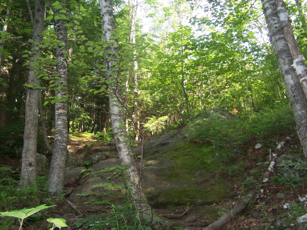
The first part of the trail is steep (as is most of the trail), but with limited views.

Along Trail

After 3/4 mile of a hike, it opens up to a ledge with views of the Keene Valley.

Keene Valley

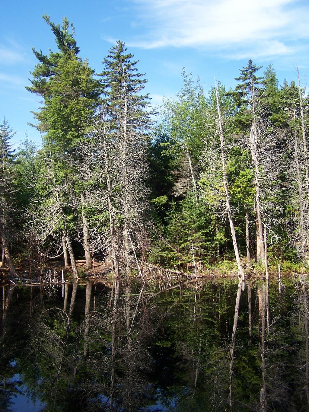
Shortly there after you reach the Giant Washbowl, a mountain pond with interesting views, surrounded by mountains.

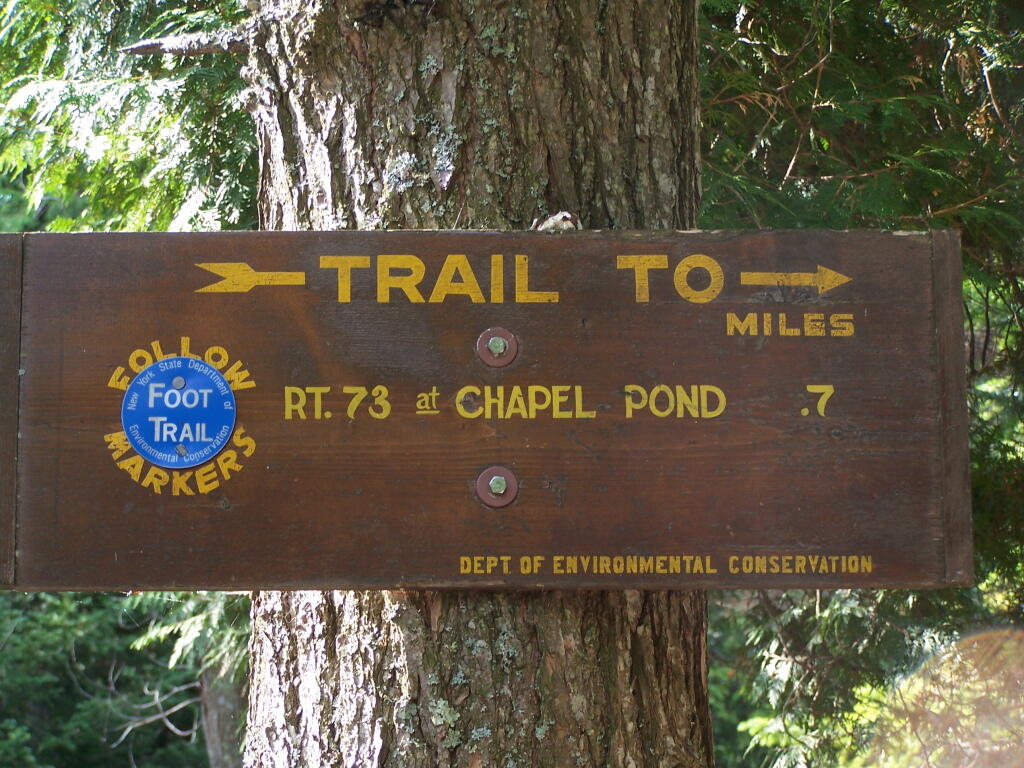
7/10 Mi to NY 73

You also get a neat view of Nubble.

Untitled

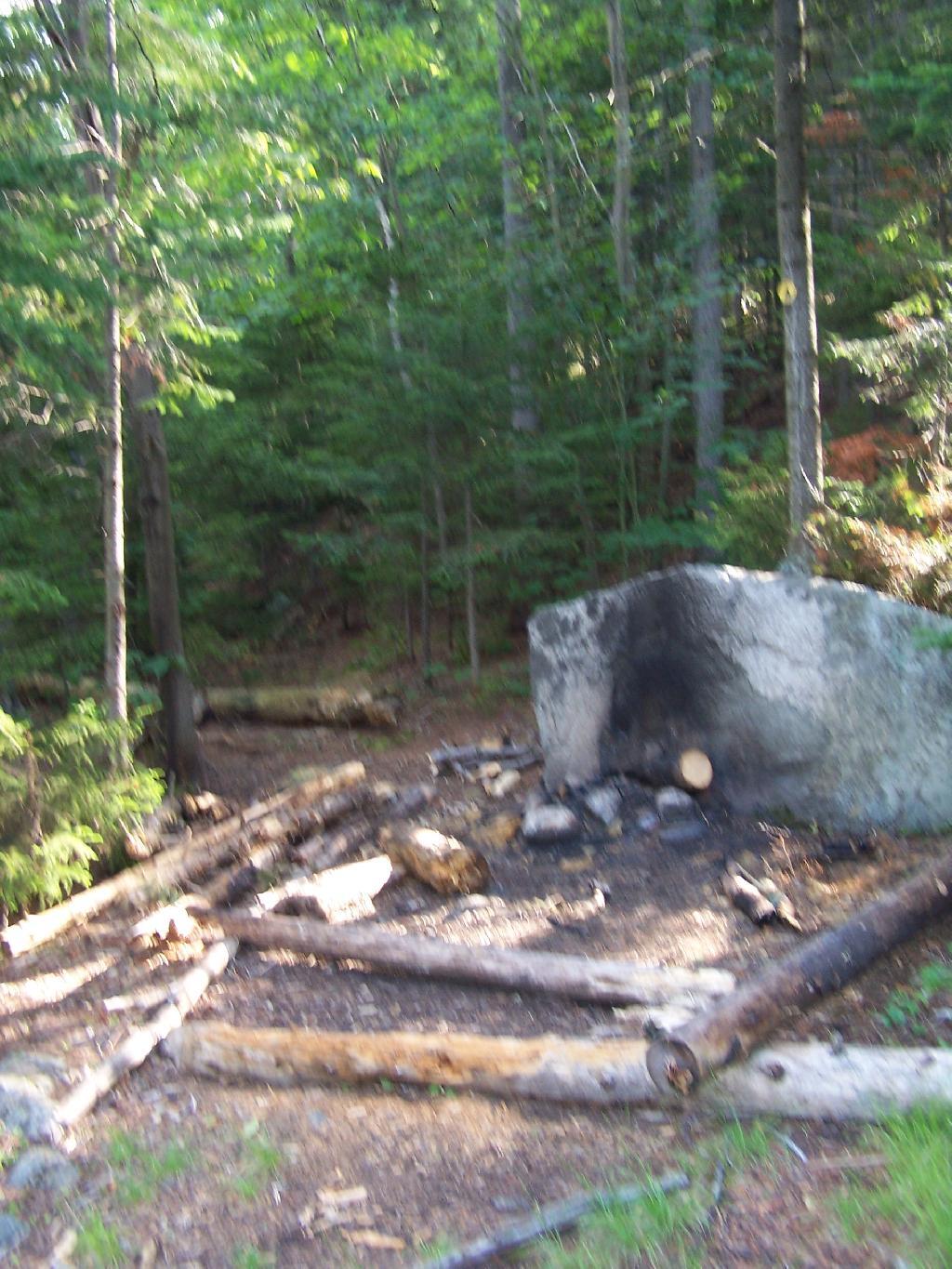
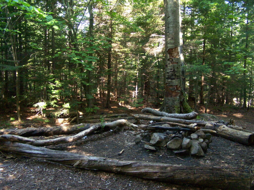
There are two primative campsites along Giants’ Washbowl with no facilities except some logs to sit on.

Campsite

Second Campsite at Washbowl

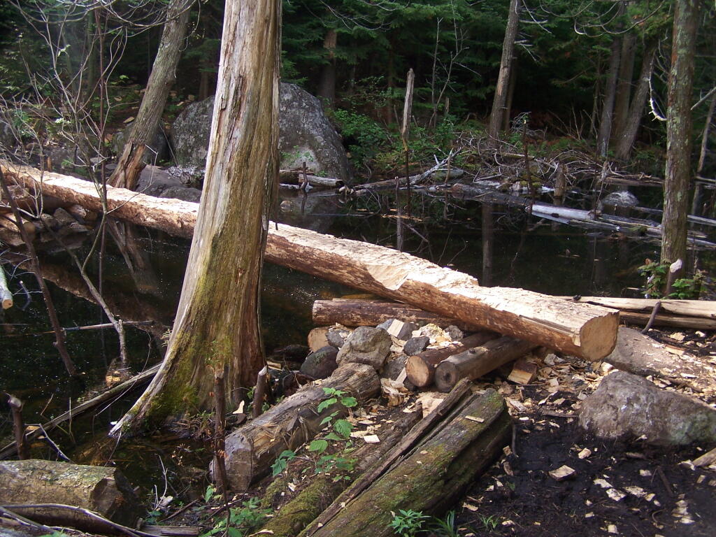
You cross Giants’ Washbowl on a log.

Foot Bridge

With the confirous trees surrounding Giants’ Washbowl you would have no idea what season it was from this picture.

Colors

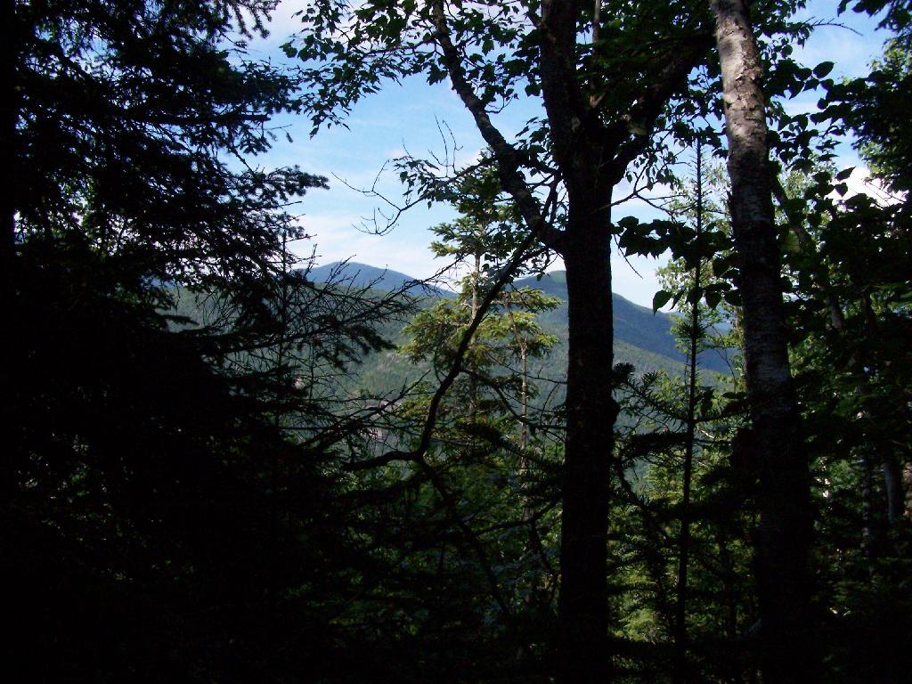
Past Giants’ Washbowl, the trail gets steeper and goes through a series of switch backs as you continue to climb.

View Through Trees

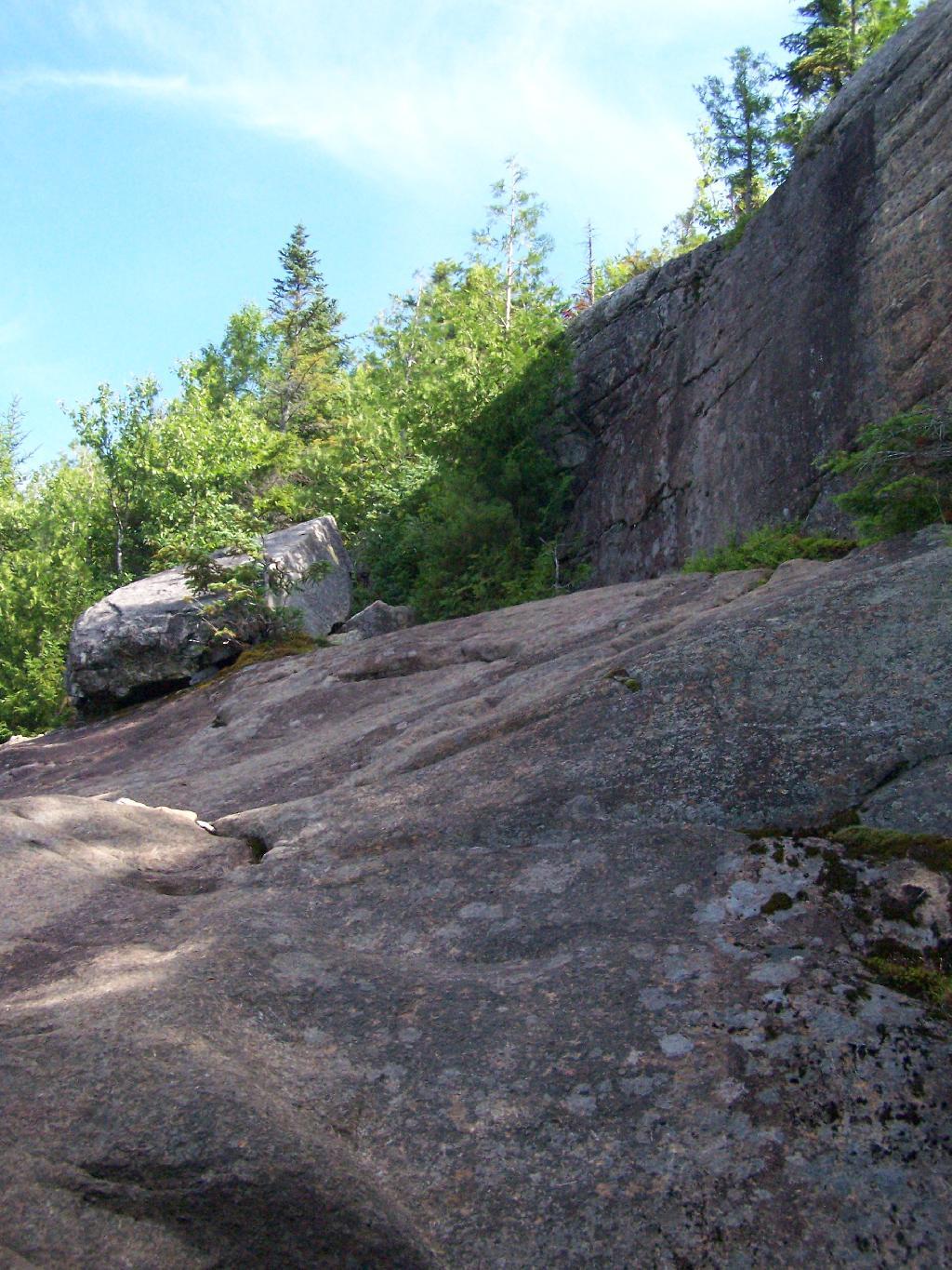
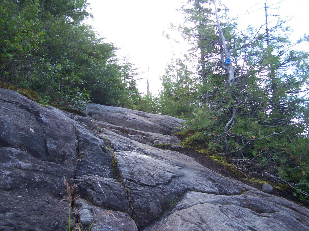
At about 2 miles the trail opens up to a series of open rock scrambles, where you walk along a ledge of sloped rocks. It did nothing for me.

Rock Scrabble

Literally, the trail runs right along this sloped ledge. These open ledges just made me sick. I started to puke, with my fear of heights kicking in as as scrambled along this.

Open Rock Face

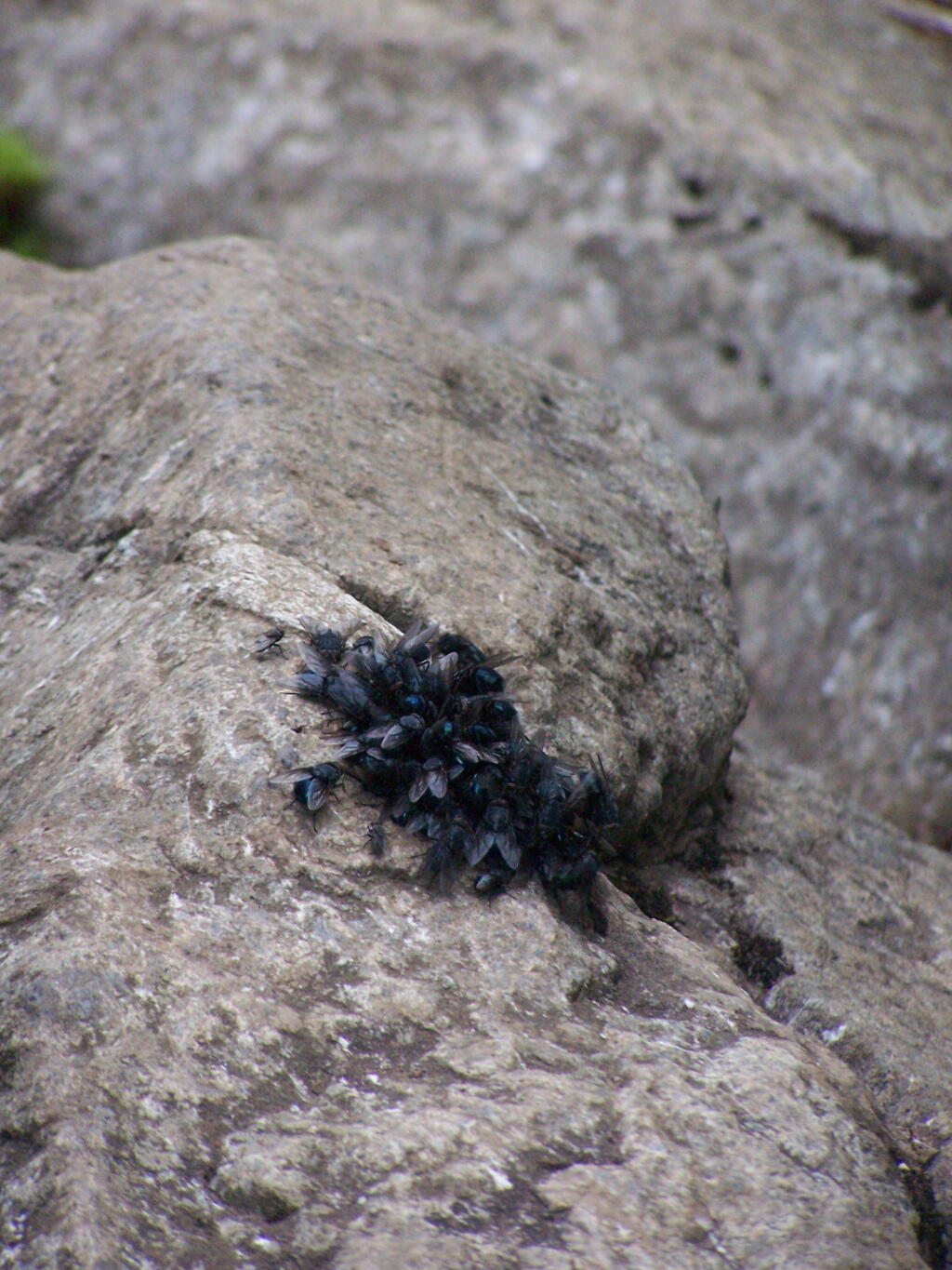
That and seeing the maggots swarming over this piece of dung right on the trail did nothing for me.

Got Maggots

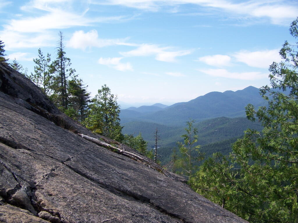
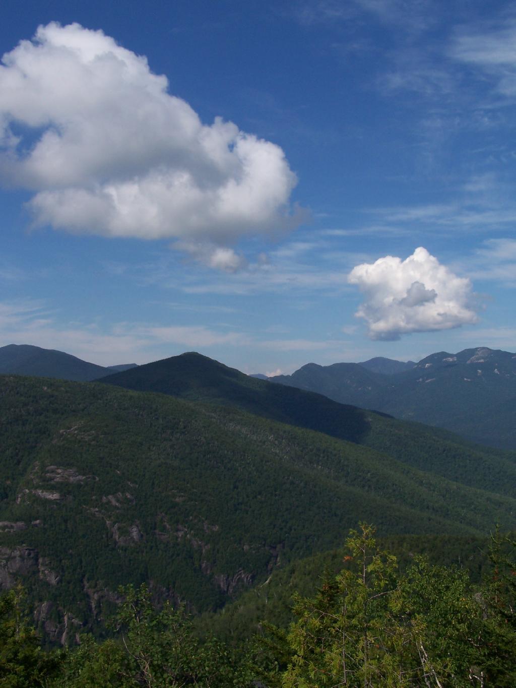
That said, the views from this ledge where spectular.

Looking Across the Valley

I continued to climb another 300 feet or so on the trail, when I decided to go back, but I did get a chance to get some pretty awesome pictures from up above.

Further

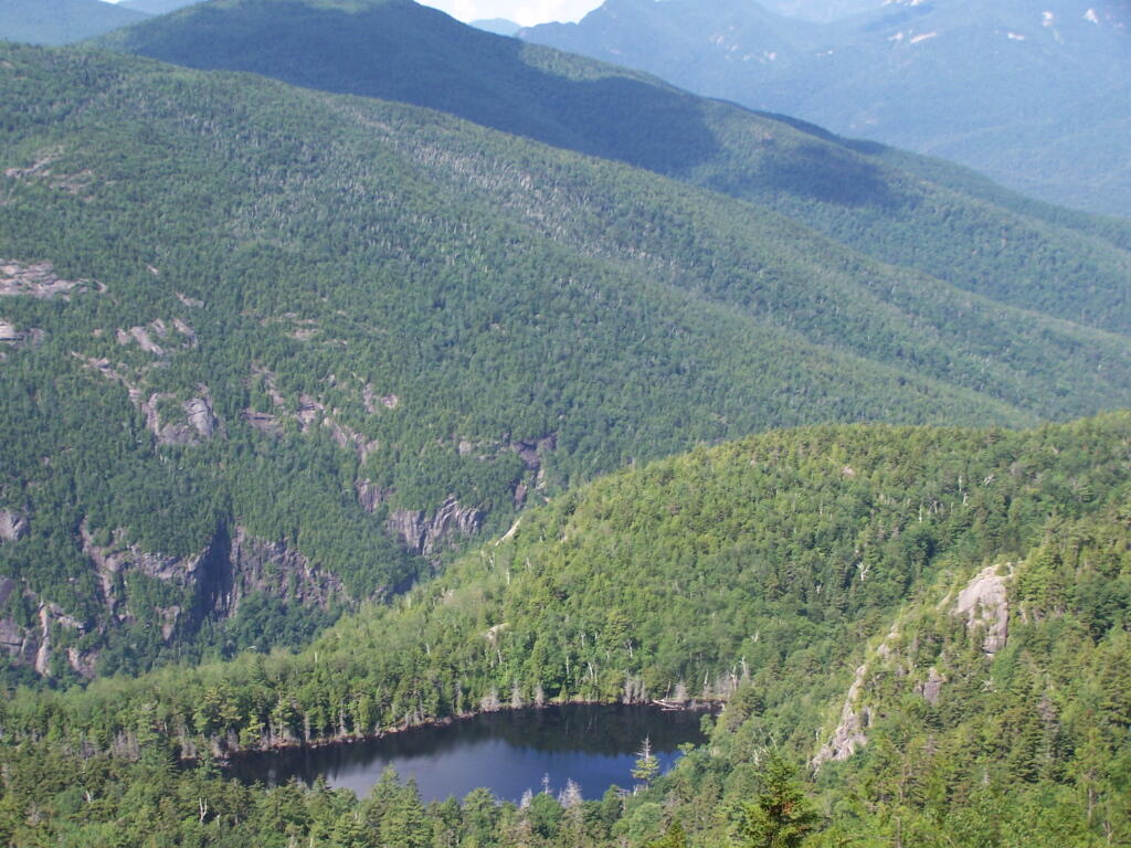
On a rock ledge, looking down at Giants’ Washbowl.

Giants Washbowl from Above

And Noomatic Mountain.

Noomantic Mountain

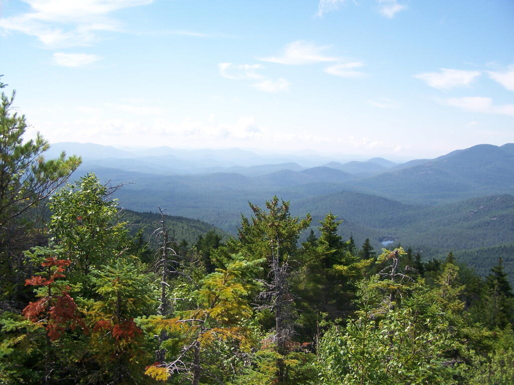
Looking South-West towards Pharoah Mountain Wilderness.

South-West

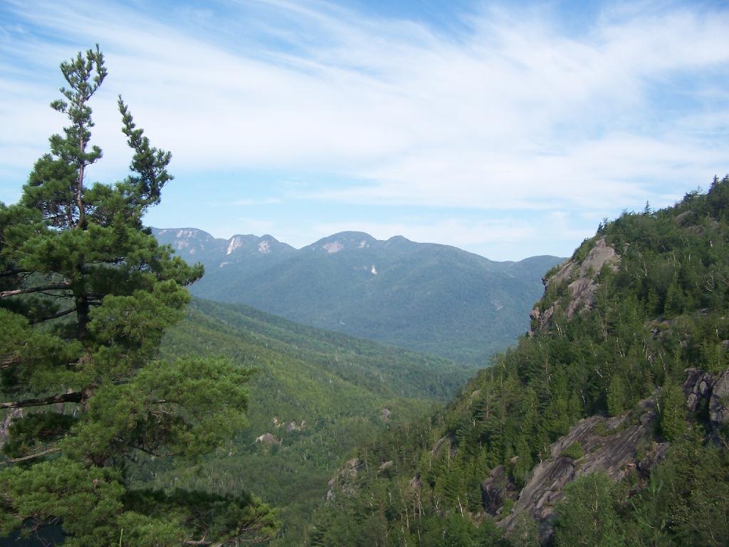
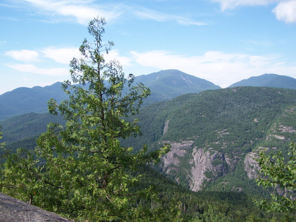
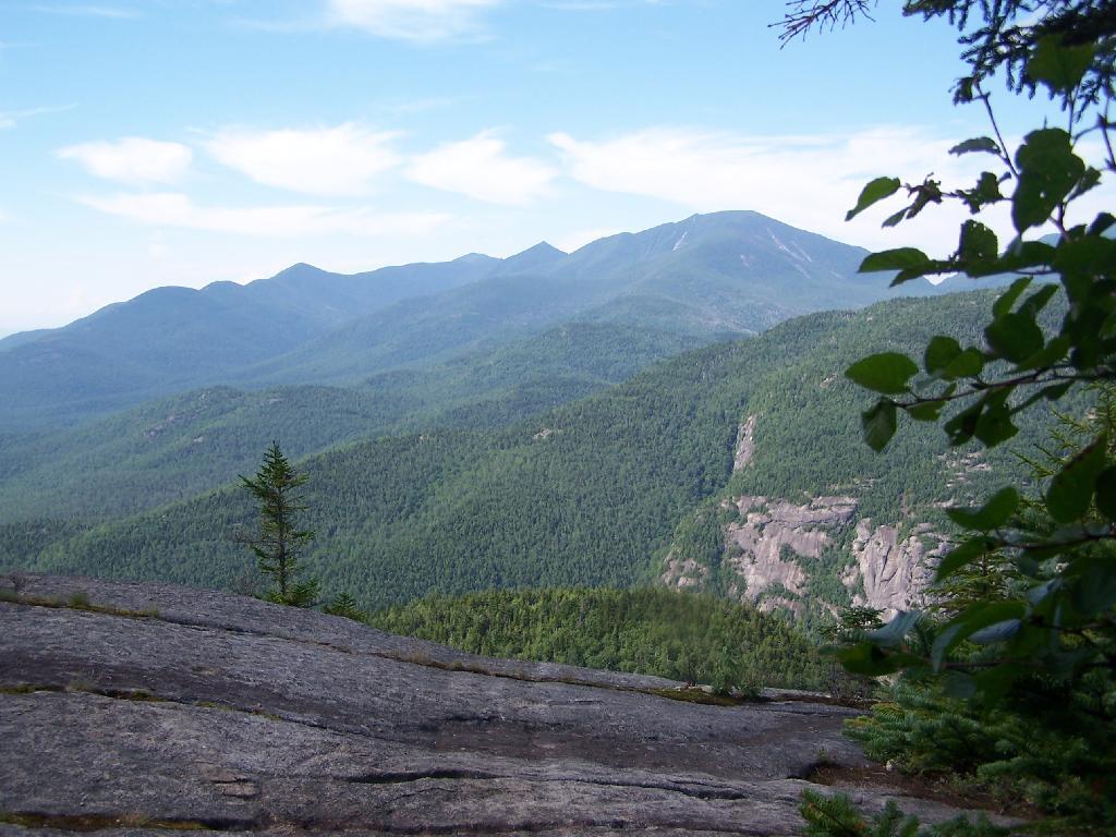
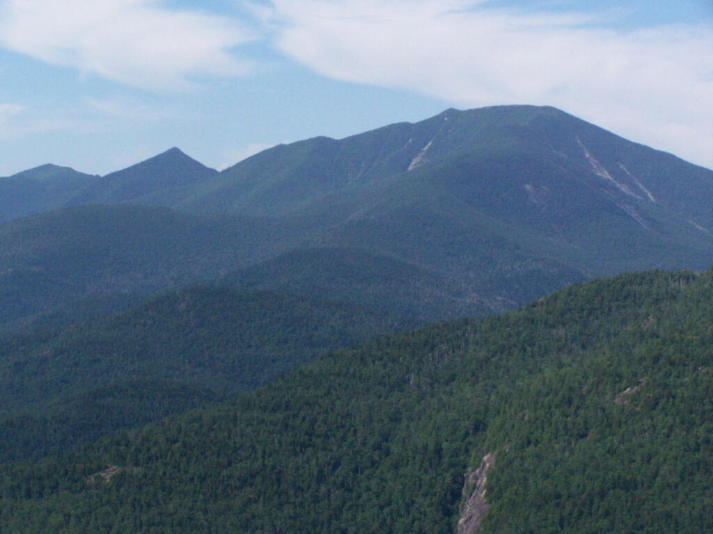
Dix Mountain and surrounding range.

Dix Mountain

At any rate, this kind of hiking did nothing for me. I decided to descend Giant Mountain, and not spend much more time in the High Peaks Range for the foreseeable future. As much as I enjoy spending time outdoors, the High Peaks with their significant ascent and the open faces just is no fun. Just writing about this mountain and looking at the pictures makes me want to barf again!

Untitled

Map of the hike:


View Giant Mountain in a larger map

Peaks Over 3,000 Feet Elevation in New York State

There are 229 summits in New York State greater then 3,000 feet elevation.

Tallest Peak Summit Name Elevation County USGS Topo Map Name State Land Trail Location
1 Mount Marcy 5,344 Essex Mount Marcy High Peaks Wilderness NA 44.112733,
-73.9237833
2 Algonquin Peak 5,105 Essex North Elba High Peaks Wilderness Algonquin Trail 44.1436636,
-73.9865357
3 Mount Haystack 4,924 Essex Mount Marcy High Peaks Wilderness Haystack Trail Via Barklet Ridge 44.1056093,
-73.9004196
4 Mount Skylight 4,908 Essex Mount Marcy High Peaks Wilderness Skylight Trail 44.0994987,
-73.9306986
5 Basin Mountain 4,852 Essex Mount Marcy High Peaks Wilderness State Range Trail 44.1211639,
-73.8862527
6 Iroquois Peak 4,829 Essex North Elba High Peaks Wilderness Iroquois Herd Path Via Boundary Peak 44.1369973,
-73.9982027
7 Boundary Peak 4,826 Essex North Elba High Peaks Wilderness Iroquois Herd Path Via Boundary Peak 44.1397749,
-73.9937582
8 Whiteface Mountain 4,816 Essex Lake Placid Whiteface Mountain Ski Center Whiteface Landing To Whiteface Mtn. Trail 44.3658804,
-73.9026456
9 Dix Mountain 4,813 Essex Dix Mountain High Peaks Wilderness Elk Lake To Dix Mountain Trail 44.0822756,
-73.7862471
10 Gray Peak 4,800 Essex Mount Marcy High Peaks Wilderness Mount Marcy Trail Via Opalescent River 44.1114427,
-73.9348658
11 Schofield Cobble 4,744 Essex Mount Marcy High Peaks Wilderness NA 44.1089427,
-73.9270876
12 Little Marcy 4,728 Essex Mount Marcy High Peaks Wilderness Van Hoevenberg Trail To Marcy 44.1197753,
-73.910976
13 Gothics 4,724 Essex Keene Valley High Peaks Wilderness Beaver Meadow Falls Trail 44.1281079,
-73.8570849
14 Mount Colden 4,708 Essex North Elba High Peaks Wilderness Mount Colden Via Lake Arnold 44.1269976,
-73.9598674
15 Beck-horn 4,695 Essex Dix Mountain High Peaks Wilderness Elk Lake To Dix Mountain Trail 44.0800534,
-73.7845802
16 Little Haystack 4,678 Essex Mount Marcy High Peaks Wilderness Haystack Trail Via Slant Rock 44.1103313,
-73.9004197
17 Giant Mountain 4,623 Essex Rocky Peak Ridge Giant Mountain Wilderness North Trail To Giant Mtn. 44.161165,
-73.720279
18 Mount Redfield 4,603 Essex Mount Marcy High Peaks Wilderness Mt Redfield Trail 44.094777,
-73.949866
19 Santanoni Peak 4,596 Essex Santanoni Peak High Peaks Wilderness Bradley Pond Trail 44.0822811,
-74.1309855
20 Wright Peak 4,564 Essex North Elba High Peaks Wilderness Wright Peak Spur Trail 44.1517187,
-73.9801468
21 Nippletop 4,554 Essex Dix Mountain High Peaks Wilderness Nipple Top Trail 44.0892202,
-73.8159708
22 Saddleback Mountain 4,534 Essex North Elba High Peaks Wilderness State Range Trail 44.1264414,
-73.8748634
23 Panther Peak 4,455 Essex Santanoni Peak High Peaks Wilderness Bradley Pond Trail 44.0983915,
-74.132097
24 Rocky Peak 4,403 Essex Rocky Peak Ridge Giant Mountain Wilderness East Trail To Giant Mtn. Via Rocky Peak Ridge 44.1542177,
-73.7051718
25 Macomb Mountain 4,396 Essex Dix Mountain High Peaks Wilderness Macomb-E. Dix Trail 44.0517211,
-73.7801349
26 Hough Peak 4,393 Essex Dix Mountain High Peaks Wilderness S. Dix-Hough Trail 44.0694981,
-73.7776352
27 Mount Marshall 4,380 Essex Street Mountain High Peaks Wilderness Mt Marshall Trail 44.1275538,
-74.0118142
28 Armstrong Mountain 4,360 Essex Keene Valley High Peaks Wilderness Adk Range Trail 44.1347741,
-73.8490291
29 Seward Mountain 4,327 Franklin Ampersand Lake High Peaks Wilderness Seymour Mountain Herd Path 44.1597799,
-74.1993239
30 Allen Mountain 4,321 Essex Mount Marcy High Peaks Wilderness Mt Redfield Trail 44.0708892,
-73.9395871
31 Table Top Mountain 4,295 Essex North Elba High Peaks Wilderness Table Top Mountain Trail 44.143663,
-73.9070876
32 Big Slide Mountain 4,232 Essex Keene Valley High Peaks Wilderness Big Slide Trail 44.1822721,
-73.8704202
33 Esther Mountain 4,232 Essex Franklin Falls Wilmington Wild Forest Esther Mt Trail 44.3869916,
-73.8898673
34 MacIntyre Mountains 4,193 Essex Street Mountain High Peaks Wilderness Mt Marshall Trail 44.1308868,
-74.008203
35 Lower Wolfjaw Mountain 4,190 Essex Keene Valley High Peaks Wilderness W.a. White Trail 44.1483845,
-73.8326399
36 Upper Wolfjaw Mountain 4,190 Essex Keene Valley High Peaks Wilderness Adk Range Trail 44.1406072,
-73.8451402
37 Slide Mountain 4,167 Ulster Peekamoose Mountain Slide Mountain Wilderness Burroughs Range Trail-Wittenberg-Cornell 41.9987034,
-74.3862617
38 Phelps Mountain 4,137 Essex North Elba High Peaks Wilderness Phelps Mtn. Trail 44.1569957,
-73.9209775
39 Cascade Mountain 4,094 Essex Keene Valley High Peaks Wilderness Casade Mountain Trail 44.2186594,
-73.860143
40 South Dix 4,088 Essex Dix Mountain High Peaks Wilderness Macomb-E. Dix Trail 44.060054,
-73.7743014
41 Lookout Mountain 4,078 Essex Franklin Falls Whiteface Mountain Ski Center Esther Mt Trail 44.3778249,
-73.887645
42 Donaldson Mountain 4,062 Franklin Ampersand Lake High Peaks Wilderness Seymour Mountain Herd Path 44.1539471,
-74.210991
43 Seymour Mountain 4,055 Franklin Ampersand Lake High Peaks Wilderness Seymour Mountain Herd Path 44.1578347,
-74.1721003
44 Colvin Range 4,049 Essex Dix Mountain High Peaks Wilderness Colvin Trail 44.0939424,
-73.8345829
45 Mount Colvin 4,049 Essex Dix Mountain High Peaks Wilderness Colvin Trail 44.0939424,
-73.8345829
46 Hunter Mountain 4,045 Greene Hunter Hunter-West Kill Wilderness Spruceton Trail 42.1778662,
-74.2304216
47 Mount Emmons 4,022 Franklin Ampersand Lake High Peaks Wilderness Northville-Placid Trail 44.1436698,
-74.2140464
48 Street Mountain 4,022 Essex Street Mountain High Peaks Wilderness Street Mountain Trail 44.1797741,
-74.0437616
49 Grace Peak 4,006 Essex Dix Mountain High Peaks Wilderness Macomb-E. Dix Trail 44.0653314,
-73.7573564
50 Yard Mountain 3,999 Essex North Elba High Peaks Wilderness Big Slide Trail Via Yard Mtn. 44.1747725,
-73.8845874
51 MacNaughton Mountain 3,983 Essex Street Mountain High Peaks Wilderness Wall Face Ponds Trail 44.1397768,
-74.064317
52 Dial Mountain 3,980 Essex Dix Mountain High Peaks Wilderness Leach Trail 44.1058859,
-73.7959703
53 Blake Peak 3,976 Essex Dix Mountain High Peaks Wilderness Pinnacle Trail 44.081443,
-73.844583
54 Green Mountain 3,976 Essex Rocky Peak Ridge Giant Mountain Wilderness North Trail To Giant Mtn. 44.182272,
-73.714858
55 Black Dome 3,973 Greene Freehold Windham-Blackhead Range Wilderness Blackhead Range Trail 42.2700864,
-74.1226382
56 Thomas Cole Mountain 3,944 Greene Hensonville Windham-Blackhead Range Wilderness Blackhead Range Trail 42.2709196,
-74.1365275
57 Cliff Mountain 3,940 Essex Mount Marcy High Peaks Wilderness Mount Marcy Trail Via Opalescent River 44.1031102,
-73.9751452
58 McDonnel Mountain 3,940 Essex Mount Marcy High Peaks Wilderness Mt Redfield Trail 44.0803332,
-73.9340315
59 Blackhead 3,930 Greene Freehold Windham-Blackhead Range Wilderness Blackhead Mountain Spur Trail 42.2678644,
-74.1045818
60 West Kill Mountain 3,891 Greene Lexington Hunter-West Kill Wilderness Devil’s Path 42.1678663,
-74.2895904
61 Doubletop Mountain 3,875 Ulster Seager NA Seager Big Indian Trail 42.0275913,
-74.5282095
62 Nye Mountain 3,871 Essex Street Mountain High Peaks Wilderness Nye Mountain Trail 44.1931062,
-74.0240387
63 Kilburn Mountain 3,868 Essex Lake Placid Sentinel Range Wilderness Copperas Owen Pond Trl 44.3028247,
-73.8818114
64 Moose Mountain 3,868 Essex McKenzie Mountain Mckenzie Mountain Wilderness Mckenzie Mtn. Trail 44.3506029,
-74.0032049
65 Howard Mountain 3,852 Essex North Elba High Peaks Wilderness Klondike Notch Trail 44.1583844,
-73.8912539
66 Cornell Mountain 3,848 Ulster Phoenicia Slide Mountain Wilderness Burroughs Range Trail-Wittenberg-Cornell 42.0014812,
-74.3568163
67 Graham Mountain 3,848 Ulster Seager NA Seager Big Indian Trail 42.0392576,
-74.5495986
68 Plateau Mountain 3,845 Greene Hunter Indian Head Wilderness Devil’s Path 42.1378671,
-74.1743088
69 McKenzie Mountain 3,842 Essex McKenzie Mountain Mckenzie Mountain Wilderness Mckenzie Mtn. Trail 44.3361593,
-74.0320951
70 Rist Mountain 3,839 Essex Mount Marcy High Peaks Wilderness Boreas Road 44.027559,
-73.987366
71 Sentinel Mountain 3,835 Essex Keene Sentinel Range Wilderness Winch Pond 44.3061581,
-73.8523658
72 Lyon Mountain 3,829 Clinton Moffitsville Chazy Highlands Wild Forest New Lyon Mountain Trail 44.7036537,
-73.8645877
73 T R Mountain 3,829 Essex North Elba High Peaks Wilderness Lake Arnold Crossover 44.143941,
-73.9354222
74 Snowy Mountain 3,825 Hamilton Snowy Mountain NA Snowy Mt 43.7003432,
-74.3859856
75 Table Mountain 3,819 Ulster Peekamoose Mountain Slide Mountain Wilderness Peekamoose-Table Trail 41.9587036,
-74.4048739
76 Peekamoose Mountain 3,812 Ulster Peekamoose Mountain Slide Mountain Wilderness Peekamoose-Table Trail 41.9531481,
-74.398207
77 Avalanche Mountain 3,809 Essex North Elba High Peaks Wilderness Avalanche Pass Trail 44.1361639,
-73.9695903
78 Averill Peak 3,806 Clinton Lyon Mountain Chazy Highlands Wild Forest New Lyon Mountain Trail 44.6928208,
-73.8809768
79 Sugarloaf Mountain 3,806 Greene Hunter Indian Head Wilderness Devil’s Path 42.1312006,
-74.1501414
80 Couchsachraga Peak 3,793 Essex Santanoni Peak High Peaks Wilderness Cold River Horse Trail 44.0956146,
-74.1601539
81 Boreas Mountain 3,779 Essex Mount Marcy NA Gulf Brook Road 44.0031138,
-73.8806937
82 Wittenberg Mountain 3,766 Ulster Phoenicia Slide Mountain Wilderness Burroughs Range Trail-Wittenberg-Cornell 42.0081478,
-74.3473716
83 Panther Mountain 3,763 Hamilton Snowy Mountain NA Snowy Mt 43.7367317,
-74.3907093
84 Burroughs Range 3,760 Ulster Phoenicia Slide Mountain Wilderness Burroughs Range Trail-Wittenberg-Cornell 42.0084255,
-74.3476494
85 Blue Mountain 3,750 Hamilton Blue Mountain Lake Blue Mountain Wild Forest Blue Mountain Trail 43.8725634,
-74.4009917
86 Porter Mountain 3,750 Essex Keene Valley High Peaks Wilderness Porter Mountain Trail Via Marcy Field 44.2153262,
-73.8434754
87 Wakely Mountain 3,750 Hamilton Wakely Mountain Wakely Mountain Primitive Area Wakely Mountain Trail 43.7358986,
-74.5151595
88 Little Nippletop 3,720 Essex Mount Marcy High Peaks Wilderness Elk Lake To Marcy Trail 44.0853327,
-73.9201422
89 Wallface Mountain 3,720 Essex Street Mountain High Peaks Wilderness Indian Pass Trail 44.1378317,
-74.0365378
90 Panther Mountain 3,714 Ulster Shandaken Slide Mountain Wilderness Giant Ledge-Panther Mountian-Fox Hollow Trail 42.0564799,
-74.3945946
91 Balsam Lake Mountain 3,707 Ulster Seager Balsam Lake Mountain Wild Forest Balsam Lake Mountain Trail 42.0459236,
-74.5940438
92 Henderson Mountain 3,707 Essex Mount Adams High Peaks Wilderness Bradley Pond Trail 44.0978353,
-74.0976509
93 Hoffman Mountain 3,701 Essex Blue Ridge Hoffman Notch Wilderness Hoffman Notch Trail 43.9114489,
-73.8168
94 Lone Mountain 3,697 Ulster Peekamoose Mountain Slide Mountain Wilderness Peekamoose-Table Trail 41.9692592,
-74.3893177
95 Big Indian Mountain 3,694 Ulster Shandaken Big Indian Wilderness Pine Hill West Branch Trail 42.0350915,
-74.4965421
96 Hurricane Mountain 3,688 Essex Rocky Peak Ridge Hurricane Mountain Wilderness East Hurricane Mtn Trial 44.235326,
-73.7106926
97 Friday Mountain 3,681 Ulster West Shokan Slide Mountain Wilderness Burroughs Range Trail-Wittenberg-Cornell 41.9875924,
-74.3620944
98 Rusk Mountain 3,678 Greene Lexington Rusk Mountain Wild Forest Spruceton Trail 42.2006434,
-74.2770897
99 Cheney Cobble 3,674 Essex Mount Marcy High Peaks Wilderness East River Trail 44.0445021,
-73.9648654
100 Lewey Mountain 3,665 Hamilton Snowy Mountain West Canada Lake Wilderness Sucker Brook Trail 43.6642328,
-74.4412649
101 Seward Mountains 3,665 Franklin Ampersand Lake High Peaks Wilderness Calkins Creek Truck Trail 44.1561694,
-74.2148801
102 Santanoni Mountains 3,661 Essex Santanoni Peak High Peaks Wilderness Bradley Pond Trail 44.0881144,
-74.138486
103 Buell Mountain 3,652 Hamilton Snowy Mountain NA Snowy Mt 43.7161764,
-74.4065426
104 High Peak 3,645 Greene Kaaterskill Clove Kaaterskill Wild Forest Kaaterskill High Peak Trail 42.1620334,
-74.0801381
105 Little Whiteface Mountain 3,638 Essex Lake Placid Whiteface Mountain Ski Center Whiteface Landing To Whiteface Mtn. Trail 44.3558804,
-73.891534
106 Burtons Peak 3,632 Essex Keene Valley NA The Brothers Trail 44.1925,
-73.8586111
107 Fir Mountain 3,629 Ulster Shandaken Big Indian Wilderness Pine Hill West Branch Trail 42.0275916,
-74.4690414
108 Twin Mountain 3,629 Greene Hunter Indian Head Wilderness Devil’s Path 42.1256453,
-74.1290294
109 Little Moose Mountain 3,609 Hamilton Wakely Mountain Little Moose Wilderness Otter Brook Trail 43.6700663,
-74.5707151
110 Balsam Mountain 3,606 Ulster Shandaken Big Indian Wilderness Pine Hill West Branch Trail 42.0909235,
-74.4882082
111 Calamity Mountain 3,606 Essex Mount Adams High Peaks Wilderness Calamity Brook Trail 44.1028328,
-74.0043132
112 Sunrise Mountain 3,606 Essex Dix Mountain High Peaks Wilderness Elk Lake To Dix Mountain Trail 44.0247778,
-73.7904124
113 Balsam Cap 3,602 Ulster West Shokan Slide Mountain Wilderness Burroughs Range Trail-Wittenberg-Cornell 41.9770369,
-74.3573722
114 Stewart Mountain 3,602 Essex Keene Sentinel Range Wilderness Winch Pond 44.3261581,
-73.8562549
115 North Dome 3,596 Greene Lexington Hunter-West Kill Wilderness Devil’s Path 42.1734217,
-74.3490366
116 Pillsbury Mountain 3,589 Hamilton Spruce Lake West Canada Lake Wilderness Pillsbury Mountain Trail 43.580901,
-74.5120992
117 Slide Mountain 3,586 Essex Lake Placid Sentinel Range Wilderness Barkeater Cliffs Campsite Trail 44.2767136,
-73.8862561
118 Eagle Mountain 3,573 Ulster Seager Big Indian Wilderness Pine Hill West Branch Trail 42.0620352,
-74.50932
119 Dun Brook Mountain 3,563 Hamilton Dun Brook Mountain NA Deer Pond Road 43.890897,
-74.3187666
120 Saddleback Mountain 3,560 Essex Jay Mountain Jay Mountain Wilderness Jay Mountain Trail 44.2953258,
-73.6676367
121 Indian Head Mountain 3,553 Greene Woodstock Indian Head Wilderness Devil’s Path 42.116201,
-74.1145846
122 Fishing Brook Mountain 3,550 Essex Dun Brook Mountain Blue Mountain Wild Forest Deer Pond Road 43.9342303,
-74.2946002
123 Mount Sherrill 3,550 Greene Lexington Hunter-West Kill Wilderness Devil’s Path 42.1756439,
-74.3729262
124 Gooseberry Mountain 3,540 Essex Keene Valley High Peaks Wilderness Orebed Brook Trail 44.1367187,
-73.8731969
125 Bearpen Mountain 3,530 Delaware Prattsville Bearpen Mountain State Forest Access Trail 42.2734189,
-74.4840396
126 Vly Mountain 3,530 Greene West Kill Bearpen Mountain State Forest Snowmobile Trail 42.2453645,
-74.4459834
127 Windham High Peak 3,527 Greene Hensonville Windham-Blackhead Range Wilderness Escarpment Trail 42.3148069,
-74.1434718
128 Halcott Mountain 3,524 Greene West Kill Halcott Mountain Wild Forest Condon Hollow Rd. 42.1800882,
-74.4379281
129 Mount Adams 3,520 Essex Mount Adams High Peaks Wilderness Mt Adams Trail 44.0867231,
-74.0257027
130 Pitchoff Mountain 3,501 Essex North Elba Sentinel Range Wilderness Pitchoff Mountain Trail 44.2375474,
-73.8776443
131 Noonmark Mountain 3,491 Essex Keene Valley High Peaks Wilderness Stimson Trail 44.1289404,
-73.7720809
132 Rocky Mountain 3,478 Ulster West Shokan Slide Mountain Wilderness Peekamoose-Table Trail 41.9728703,
-74.3726505
133 Little Santanoni Mountain 3,471 Essex Santanoni Peak High Peaks Wilderness Moose Pond Horse Trail 44.0731156,
-74.1670981
134 Spotted Mountain 3,461 Essex Underwood High Peaks Wilderness Macomb-E. Dix Trail 44.0769975,
-73.7440228
135 Manbury Mountain 3,455 Hamilton Wakely Mountain Little Moose Wilderness Otter Brook Trail 43.6653442,
-74.5532143
136 Blue Ridge Mountain 3,451 Essex Blue Ridge Hoffman Notch Wilderness Hoffman Notch Trail 43.9247817,
-73.8148558
137 Roundtop 3,451 Delaware Prattsville Bearpen Mountain State Forest Ski Run Road 42.2939737,
-74.4904283
138 Roundtop Mountain 3,451 Greene Kaaterskill Clove Kaaterskill Wild Forest Kaaterskill High Peak Trail 42.1684222,
-74.094583
139 Olderbark Mountain 3,438 Greene Bearsville Indian Head Wilderness Mink Hollow Trail 42.1142565,
-74.1909765
140 Puffer Mountain 3,438 Hamilton Bullhead Mountain Siamese Ponds Wilderness Puffer Pond Brook Trail 43.6617318,
-74.1993082
141 Morgan Mountain 3,432 Essex Wilmington Wilmington Wild Forest Cooper Kill Trail 44.4186582,
-73.8593108
142 Wolf Pond Mountain 3,425 Essex Cheney Pond NA Gulf Brook Road 43.9892253,
-73.8781933
143 Stoppel Point 3,422 Greene Kaaterskill Clove Windham-Blackhead Range Wilderness Escarpment Trail 42.2250879,
-74.0651364
144 Huntersfield Mountain 3,419 Greene Ashland Huntersfield State Forest Huntersfield Access Trail #8/Long Path Access 42.355638,
-74.3465339
145 Cellar Mountain 3,405 Hamilton Wakely Mountain Moose River Plains Wild Forest Cellar Pond Trail 43.7122879,
-74.5429375
146 Haynes Mountain 3,405 Ulster Seager Big Indian Wilderness Pine Hill West Branch Trail 42.0792571,
-74.5079309
147 Sawtooth Mountains 3,402 Franklin Street Mountain High Peaks Wilderness Northville-Placid Trail 44.1928314,
-74.1134874
148 Bear Den Mountain 3,389 Essex Dix Mountain High Peaks Wilderness Leach Trail 44.1194964,
-73.792915
149 Pinnacle 3,389 Essex Dix Mountain High Peaks Wilderness Pinnacle Trail Spur To Summit 44.0583887,
-73.8640277
150 Vanderwhacker Mountain 3,389 Essex Vanderwhacker Mountain Vanderwhacker Mountain Wild Forest Vanderwhacker Firetower Trail 43.8983963,
-74.0959781
151 Jay Mountain 3,379 Essex Jay Mountain Jay Mountain Wilderness Jay Mountain Trail 44.3125477,
-73.685693
152 Spruce Top 3,379 Greene Hunter NA Devil’s Path 42.1506447,
-74.1679195
153 Spruce Mountain 3,376 Ulster Shandaken Big Indian Wilderness Phoenicia East Branch Trail 42.0175919,
-74.4498744
154 Belle Ayr Mountain 3,373 Ulster Shandaken Belleayre Mountain Ski Center NA 42.1159229,
-74.4979304
155 Evergreen Mountain 3,369 Greene Lexington Rusk Mountain Wild Forest Devil’s Path 42.2117542,
-74.3079238
156 Hedgehog Mountain 3,366 Essex Keene Valley High Peaks Wilderness Rooster Comb And Hedgehog Trail 44.159495,
-73.8109724
157 Balsam Mountain 3,353 Greene West Kill Hunter-West Kill Wilderness Condon Hollow Rd. 42.1836992,
-74.387371
158 Kempshall Mountain 3,350 Hamilton Kempshall Mountain High Peaks Wilderness Northville-Placid Trail 44.0236734,
-74.3271041
159 Buck Mountain 3,346 Hamilton Snowy Mountain West Canada Lake Wilderness Snowy Mt 43.6947879,
-74.4368212
160 Mount Pisgah 3,340 Delaware Margaretville NA Mountain Brook Road 42.2211973,
-74.7357125
161 MacDonough Mountain 3,320 Essex Jay Mountain Jay Mountain Wilderness Jay Mountain Trail 44.3050482,
-73.644025
162 Debar Mountain 3,317 Franklin Debar Mountain Debar Mountain Wild Forest Debar Mountain Trail 44.6033852,
-74.2204351
163 Bullhead Mountain 3,314 Warren Bullhead Mountain Siamese Ponds Wilderness John Pond Crossover Trail 43.7017316,
-74.1804199
164 Laramore Mountain 3,314 Essex Keene Valley High Peaks Wilderness Casade Mountain Trail 44.2258813,
-73.8501427
165 Tripod Mountain 3,307 Essex Rocky Peak Ridge Giant Mountain Wilderness Hopkin Via Direct Trail 44.1983824,
-73.736248
166 Metcalf Mountain 3,304 Hamilton Blue Mountain Lake Blue Ridge Wilderness Gould Road 43.7522873,
-74.4957146
167 Wyman Mountain 3,304 Essex Underwood High Peaks Wilderness Macomb-E. Dix Trail 44.0581093,
-73.7445779
168 Jay Mountains 3,297 Essex Jay Mountain Jay Mountain Wilderness Jay Mountain Trail 44.308659,
-73.6704147
169 Eleventh Mountain 3,294 Warren Bakers Mills Siamese Ponds Wilderness Bog Meadow Trail 43.6142322,
-74.0720783
170 Schultice Mountain 3,284 Delaware Roxbury NA Ski Run Road 42.3186948,
-74.5157062
171 Cellar Mountain 3,281 Hamilton Snowy Mountain West Canada Lake Wilderness Sucker Brook Trail 43.6411776,
-74.4443199
172 Plattekill Mountain 3,268 Delaware Hobart Plattekill State Forest Mountain Brook/ Harold Roberts Access Trail 42.2667522,
-74.6482102
173 South Pond Mountain 3,258 Hamilton South Pond Mountain Siamese Ponds Wilderness County Line Brook Trail 43.5900656,
-74.2204175
174 Hemlock Mountain 3,248 Ulster Shandaken Big Indian Wilderness Phoenicia East Branch Trail 42.0128698,
-74.4390407
175 Peaked Mountain 3,235 Essex Jay Mountain Hurricane Mountain Wilderness Soda Range Trail 44.2656034,
-73.6993039
176 Onteora Mountain 3,232 Greene Hunter NA Blackhead Range Trail 42.2223098,
-74.1679184
177 Kitty Cobble 3,225 Hamilton Wakely Mountain West Canada Lake Wilderness Otter Brook Trail 43.6295111,
-74.6229377
178 Baldwin Hill 3,218 Essex Franklin Falls Mckenzie Mountain Wilderness Esther Mt Trail 44.3847694,
-73.9195905
179 Richmond Mountain 3,218 Greene Ashland Mount Pisgah State Forest Long Path Hiking Trail 42.367582,
-74.270976
180 Squaw Mountain 3,218 Hamilton Indian Lake NA Snowy Mt 43.7270094,
-74.3420956
181 Dug Mountain 3,215 Hamilton Kunjamuk River NA Long Pond Trail 43.583122,
-74.345146
182 Hamilton Mountain 3,215 Hamilton Wells Silver Lake Wilderness West River Road 43.412013,
-74.3673645
183 Mount Alton 3,212 Essex Lake Placid Mckenzie Mountain Wilderness Whiteface Mountain Trail 44.3717139,
-73.9662589
184 Utsayantha Mountain 3,209 Delaware Stamford NA Ward Allen Road 42.3992472,
-74.5895953
185 Van Wyck Mountain 3,202 Ulster Peekamoose Mountain Slide Mountain Wilderness Phoenicia East Branch Trail 41.9523147,
-74.4354304
186 Colonels Chair 3,199 Greene Hunter NA Colonel’s Chair Trail 42.2006434,
-74.2306991
187 Gore Mountain 3,199 Warren Gore Mountain Gore Mountain Ski Center Schaefer Trail 43.6764539,
-74.035134
188 Chase Mountain 3,192 Essex Rocky Peak Ridge Hurricane Mountain Wilderness North Hurricane Trail 44.2417145,
-73.7248599
189 Knob Lock Mountain 3,192 Essex Rocky Peak Ridge Giant Mountain Wilderness Hurricane Trail From 9n 44.2003271,
-73.7073583
190 McGregor Mountain 3,192 Delaware Stamford Stamford Fp Detached Parcel Relay Public Forest Access Road 42.3900808,
-74.5790396
191 Weston Mountain 3,192 Essex Jay Mountain Hurricane Mountain Wilderness Soda Range Trail 44.2642144,
-73.7079152
192 Burnt Knob 3,189 Greene Freehold Windham-Blackhead Range Wilderness Escarpment Trail 42.3020297,
-74.1190264
193 Burgess Mountain 3,189 Hamilton Rock Lake NA Bear Trap Brook Trail 43.7520092,
-74.3565416
194 North Mountain 3,186 Greene Kaaterskill Clove Windham-Blackhead Range Wilderness Escarpment Trail 42.2175881,
-74.0487469
195 Payne Mountain 3,182 Hamilton Snowy Mountain Moose River Plains Wild Forest Northville-Placid Trail 43.7231211,
-74.4951582
196 Hopkins Mountain 3,169 Essex Rocky Peak Ridge Giant Mountain Wilderness Hopkins Mtn. Via Spread Eagle Mtn. 44.1833828,
-73.7490257
197 Spruce Lake Mountain 3,163 Hamilton Spruce Lake Mountain West Canada Lake Wilderness Northville-Placid Trail 43.5120126,
-74.6532121
198 Tongue Mountain 3,159 Hamilton Dun Brook Mountain NA Northville-Placid Trail 43.9114522,
-74.3454349
199 Catamount Mountain 3,153 Clinton Wilmington Taylor Pond Wild Forest Catamount Trail 44.459214,
-73.8723668
200 Wildcat Mountain 3,153 Ulster Peekamoose Mountain Slide Mountain Wilderness Pine Hill West Branch Trail 41.9775924,
-74.4759867
201 White Man Mountain 3,146 Delaware Roxbury NA Access Trail 42.2845295,
-74.5340406
202 Bradley Mountain 3,140 Hamilton Wakely Mountain Blue Ridge Wilderness Cellar Pond Trail 43.7378431,
-74.5546055
203 Overlook Mountain 3,136 Ulster Woodstock Overlook Mountain Wild Forest Firetower Spur 42.0850905,
-74.0931954
204 Mount Tamarac 3,127 Essex McKenzie Mountain Mckenzie Mountain Wilderness Jackrabbit Trail 44.3267144,
-74.0204281
205 Mount Morris 3,117 Franklin Tupper Lake NA Goodman Mountain Trail 44.1595046,
-74.475168
206 Acra Point 3,110 Greene Freehold Windham-Blackhead Range Wilderness Escarpment Trail 42.2964745,
-74.0998591
207 Round Mountain 3,107 Essex Keene Valley High Peaks Wilderness Weston Trail Spur To Round Mt 44.1317179,
-73.7515245
208 Cave Mountain 3,104 Greene Hensonville Elm Ridge Wild Forest North Face Trail 42.2859185,
-74.2462543
209 Pete Gay Mountain 3,097 Warren Gore Mountain NA Schaefer Trail 43.6903427,
-74.0443015
210 Plattekill Mountain 3,091 Greene Woodstock Indian Head Wilderness Overlook Trail 42.1073123,
-74.0865281
211 Mount Andrew 3,081 Essex Mount Adams High Peaks Wilderness Bradley Pond Trail 44.0564482,
-74.093483
212 County Line Mountain 3,081 Hamilton South Pond Mountain Siamese Ponds Wilderness Siamese Ponds Trail 43.6114543,
-74.2006952
213 High Point 3,074 Ulster West Shokan Sundown Wild Forest Ashokan High Point 41.9248149,
-74.2879263
214 Rose Mountain 3,074 Ulster West Kill NA Rochester Hollow 42.1506445,
-74.4379284
215 Cowan Mountain 3,068 Delaware Hobart NA Relay Public Forest Access Road 42.3450825,
-74.6498756
216 Round Top 3,068 Delaware Hobart Plattekill State Forest Mountain Brook/ Harold Roberts Access Trail 42.2714741,
-74.6832109
217 Churchill Mountain 3,064 Delaware Stamford NA Relay Public Forest Access Road 42.388692,
-74.6098738
218 Irish Mountain 3,064 Delaware Roxbury NA Ski Run Road 42.3356386,
-74.5262617
219 Swart Mountain 3,061 Hamilton Lake Pleasant Silver Lake Wilderness West River Road 43.3967355,
-74.3815314
220 Scarface Mountain 3,058 Essex McKenzie Mountain Saranac Lakes Wild Forest Scarface Mountain Trail 44.2647717,
-74.0737646
221 T Lake Mountain 3,058 Hamilton Piseco Lake West Canada Lake Wilderness T Lake Trail 43.4470133,
-74.5770967
222 Bailey Hill 3,054 Essex Cheney Pond Hoffman Notch Wilderness Hoffman Notch Trail 43.9108943,
-73.9026366
223 Bald Peak 3,054 Essex Rocky Peak Ridge Giant Mountain Wilderness East Trail To Giant Mtn. Via Rocky Peak Ridge 44.1597731,
-73.6654114
224 Little Rocky Mountain 3,051 Greene Bearsville Indian Head Wilderness Warner Creek Trail 42.1150898,
-74.2040325
225 Denman Mountain 3,048 Sullivan Claryville NA Denman Mountain Snowmobile Trail 41.90287,
-74.5396005
226 Woodhull Mountain 3,045 Ulster Peekamoose Mountain NA Phoenicia East Branch Trail 41.9459259,
-74.4637647
227 Barkaboom Mountain 3,005 Delaware Arena Dry Brook Ridge Wild Forest Touch-Me-Not-Trail 42.0717554,
-74.7201571
228 Stony Creek Mountain 3,002 Franklin Stony Creek Mountain High Peaks Wilderness Ampersand Mountain Trail 44.222002,
-74.2659949
229 Van Dorrien Mountain 3,002 Franklin Ampersand Lake High Peaks Wilderness Ampersand Mountain Trail 44.2222766,
-74.1704351

Burnt Knob Overlook

An interactive map and listing of the 280 peaks over 3,000 feet elevation listed in the Open Street Map database for New York State.

State Truck Trails and Forest Preserve Roads Over A Half Mile

Looking for state land to wheel on? This list shows all of the conservation department-maintained DEC truck trails and public access roads that are more then a 1/2 mile long. This roads are varied, but most of them are dirt roads that take you through the back country. Town maintained roads through state forests are generally not shown on in this listing.

State Land Road Miles
Albert J. Woodford Memorial State Forest Truck Trail 0.7
Albert J. Woodford Memorial State Forest Janis Road 1.1
Aldrich Pond Wild Forest Powell Road 0.5
Aldrich Pond Wild Forest Mullins Flow Road 0.6
Aldrich Pond Wild Forest Little River Road 0.7
Aldrich Pond Wild Forest Silver Dawn Road 0.7
Aldrich Pond Wild Forest Jackworks Trail 1.1
Aldrich Pond Wild Forest South Creek Lake Road 1.6
Aldrich Pond Wild Forest Tyler Road 3.7
Aldrich Pond Wild Forest Streeter Lake Road 4.8
Allen Lake State Forest George Forest Road 1.5
Ambler State Forest Truck Trail 1.8
Ampersand Primitive Area Ampersand Park Road 3.2
Andersen Hill State Forest Big Pine Public Forest Acess Road 1.5
Arctic China State Forest China Public Forest Access Road 1.1
Arctic China State Forest Shears Public Forest Access Road 2
Arctic China State Forest Dunbar Public Forest Access Road 2.1
Armlin Hill State Forest Truck Trail 1.1
Arnold Lake State Forest Public Forest Access Road 0.9
Arnold Lake State Forest Hartwick Forest Access Road 1
Ashland Pinnacle State Forest Ashland Pinnacle Access Road #2 0.5
Ashland Pinnacle State Forest Haul Road #1/Long Path Hiking Trail 1.4
Avon Regional Office Goodlake Year Entrance Road 0.7
Baker School House State Forest Baker School House Public Forest Acess Road 1.8
Bald Mountain State Forest Howe Forest Road 2.4
Balsam Creek State Forest Briar Hill Road 1.5
Barbour Brook State Forest Barbour Brook Public Forest Access Road 2
Basswood State Forest Burlington Public Forest Access Road 0.5
Basswood State Forest Basswood Pond Public Forest Access Road 1
Basswood State Forest Dr. Crouch Truck Trail 1.3
Bates State Forest Pucker Street 1
Bates State Forest Bates Forest Road 2.6
Battle Hill State Forest Unnamed 1.3
Bear Pond Primitive Area Bear Pond Road 0.8
Bear Swamp State Forest Karsch Haul Road 0.5
Bear Swamp State Forest Joe Chamberlin Public Forest Access Road 1.6
Bear Swamp State Forest Roseboom Public Facility Truck Trail 1.8
Bear Swamp State Forest Snowmobile Trail 8.3
Bearpen Mountain State Forest Ski Run Road 2.1
Beartown State Forest Town Road 0.7
Beartown State Forest Cotton Road 0.8
Beartown State Forest Steam Mill Road 0.8
Beartown State Forest Aspen Hollow Road 2.4
Beaver Creek State Forest Public Forest Access Road 2, Madison 11 0.5
Beaver Creek State Forest Truck Trail -2-12 0.7
Beaver Creek State Forest Public Forest Access Road 1, Madison 11 1.3
Beaver Creek State Forest Truck Trail -1-12 3.6
Beaver Dam State Forest Sears Public Forest Acess Road 1.4
Beaver Meadow State Forest Weir Dam Truck Trail 0.5
Beebe Hill State Forest Barrett Pond Road 1.4
Beebe Hill State Forest Loop Road 2.3
Big Brook State Forest County Line Road Spur 0.6
Big Brook State Forest Walasek Mulcoy Road 0.8
Big Brook State Forest Hanifin Road 0.9
Big Brook State Forest County Line Road 1.4
Birdseye Hollow State Forest Sanford Lake Access Road 0.5
Black Creek State Forest Stanley Road 1.1
Black River Wild Forest Remsen Falls Trail 0.5
Black River Wild Forest Woods Lake Road 0.5
Black River Wild Forest Gull Lake Road 0.6
Black River Wild Forest Flansburg Road 0.7
Black River Wild Forest Party Road 0.7
Black River Wild Forest Black Creek Road 0.8
Black River Wild Forest Cohen Road 1.7
Black River Wild Forest Flansberg Road 2.6
Black River Wild Forest Black Creek Lake Road 3
Black River Wild Forest Haskell Road 3
Black River Wild Forest Mill Creek Road 3.4
Black River Wild Forest Nicks Lake Campground Roads 3.5
Black River Wild Forest Wolf Lake Landing Road 4.8
Black River Wild Forest West Creek Road 6.3
Blenheim Hill State Forest Ward Allen Road 1.1
Blenheim Hill State Forest Quarry Road 1.2
Blue Mountain Wild Forest Deer Pond Road 1.1
Blue Mountain Wild Forest Chain Lakes Road North 1.3
Blue Mountain Wild Forest Polaris Road 1.3
Bombay State Forest Cross Haul Road 0.7
Bombay State Forest Railroad Bed Public Forest Acess Road 1.2
Bombay State Forest Pike Brook Haul Road 3.1
Bonaparte’s Cave State Forest Corbine Road 0.8
Bonaparte’s Cave State Forest Mud Pond Road 0.8
Boutwell Hill State Forest Arab Hill Forest Road, Cha 1 Section 0.8
Boutwell Hill State Forest Arab Hill Forest Road, Cha 7 Section 2.1
Boyce Hill State Forest Jackson Forest Road 0.6
Brasher State Forest Route 53 Haul Road 0.5
Brasher State Forest Beaver Pond Trail 0.6
Brasher State Forest Kennehan Haul Road 0.8
Brasher State Forest Bush Road 1.1
Brasher State Forest Buckley Haul Road 1.2
Brasher State Forest Cc Dam Public Forest Access Road 1.2
Brasher State Forest Mccarthy Public Forest Access Road 1.6
Brasher State Forest Liberty Public Forest Access Road 1.7
Brasher State Forest Hastings Falls Haul Road 2.1
Brasher State Forest Wilson Public Forest Access Road 2.1
Brasher State Forest Camp / Larue Public Forest Access Road 2.2
Brasher State Forest Pascal Haul Road 2.4
Brasher State Forest Bush Public Forest Access Road 2.9
Brasher State Forest Railroad Bed Public Forest Access Road 3.6
Brokenstraw State Forest Brokenstraw Forest Road 1.7
Bryant Hill State Forest Hawk Forest Road 1.4
Buck Hill State Forest Hertz Road 0.7
Buck Hill State Forest Truck Trail 1.5
Buck Hill State Forest Buck Hill Road 3.1
Bucks Brook State Forest Access Trail 0.6
Buckton State Forest Buckton Haul Road 0.8
Bucktooth State Forest Baily Hollow Forest Road 0.6
Bucktooth State Forest Manley Hill Forest Road 1
Bully Hill State Forest Dixon Forest Road 1
Bully Hill State Forest Connection Forest Road 1.6
Bully Hill State Forest Stearns Forest Road 2.1
Burnt-Rossman Hills State Forest Koenig Road 0.5
Burnt-Rossman Hills State Forest Betty Brook Haul Road 0.6
Burnt-Rossman Hills State Forest Eminence Dead End Truck Trail 0.7
Burnt-Rossman Hills State Forest Duck Pond Road 1.2
Burnt-Rossman Hills State Forest Monkey Run Truck Trail East 1.3
Burnt-Rossman Hills State Forest Yankee Street Truck Trail 1.3
Burnt-Rossman Hills State Forest Betty Brook Road 1.4
Burnt-Rossman Hills State Forest Betty Brook Truck Trail 1.5
Burnt-Rossman Hills State Forest Duck Pond Truck Trail 1.5
Burnt-Rossman Hills State Forest Morey Road Truck Trail 1.7
Burnt-Rossman Hills State Forest Eminence Road Truck Trail 2.6
Burnt-Rossman Hills State Forest Burnt Hill Road 2.9
Bush Hill State Forest Fox Cross Forest Road 2
California Hill State Forest Wayawanda Road 0.7
Canacadea State Forest Macduff Road 2.3
Canadaway Creek Wma Dibble Hill Forest Road 2
Canaseraga State Forest Ringelberg Truck Trail 0.5
Canaseraga State Forest Right Fork Truck Trail 1
Canaseraga State Forest Stanley Road 1.1
Canaseraga State Forest Left Fork Truck Trail 1.4
Caroga Lake Campground Campground Road 2
Catherineville State Forest Santamont Access Trail 1.1
Catherineville State Forest Circle Public Forest Access Road 1.8
Charles E. Baker State Forest Truck Trail 5 0.6
Charles E. Baker State Forest Truck Trail 2 0.9
Charles E. Baker State Forest Truck Trail 6 0.9
Charles E. Baker State Forest Truck Trail 4 1.4
Charles E. Baker State Forest Truck Trail 12 1.5
Charles E. Baker State Forest Truck Trail 8 1.9
Charles E. Baker State Forest Truck Trail 7 2.1
Charles E. Baker State Forest Truck Trail 1 3
Charles E. Baker State Forest Truck Trail 13 3.2
Chazy Highlands State Forest Spring Road 0.6
Cherry Valley State Forest Kniskern Public Access Road 1.2
Cherry Valley State Forest Mosse Public Forest Access Road 1.9
Cinnamon Lake State Forest Hornby Road Haul Road 0.7
Clapper Hollow State Forest Clapper Hollow Truck Trail 1
Clark Hill State Forest Abandoned Town Road 0.8
Clark Hill State Forest Truck Trail 0.9
Clark Hill State Forest Access Road North Of Buck Hill Road 0.9
Clark Hill State Forest Class A Truck Trail 1.2
Clark Hill State Forest Haul Road 1.3
Cliffside State Forest Railroad Haul Road 1.3
Cobb Brook State Forest Unnamed Truck Trail 0.6
Cold Creek State Forest Headwaters Forest Road 1.4
Cold Spring Brook State Forest Cold Spring Brook Public Forest Access Road 1.9
Cole Hill State Forest Cr 2 Access Road 0.8
Coyle Hill State Forest Warner Spur Forest Road 0.5
Coyle Hill State Forest Slawson Forest Road 0.8
Coyle Hill State Forest Warner Forest Road 1.8
Cranberry Lake Campground Campground Road 2.5
Cranberry Lake Wild Forest Grass River Railroad 6.1
Cuyler Hill State Forest Jipson Hill Public Forest Acess Road 1.3
Cuyler Hill State Forest Cuyler Hill Public Forest Acess Road 5.1
David A. Sarnoff Preserve Field Access Road 0.8
Debar Mountain Wild Forest Debar Game Refuge Road 0.5
Debar Mountain Wild Forest Debar Meadow Road 0.6
Debar Mountain Wild Forest Vanderwalker Road 0.9
Debar Mountain Wild Forest 4 Mile Road Riffle Season Access Corridor 1.1
Debar Mountain Wild Forest Ny Centrail Railroad Bed 2.2
Deer River State Forest Ccc Road 0.6
Deer River State Forest Hogsback Road 0.6
Deer River State Forest Willow Road 0.6
Deer River State Forest Glaze Road 0.7
Deer River State Forest Avery Lot Road 0.9
Deer River State Forest Esseltine Hill Road 0.9
Deer River State Forest Ricky’s Number Trail 1
Deer River State Forest Horse Barn Road 1.2
Deer River State Forest Laramie Road 1.3
Deer River State Forest Beanville Road 1.4
Deer River State Forest Spruce Road 1.6
Deer River State Forest Loope Road 2
Deer River State Forest Firewood Road 2.6
Degrasse State Forest Burns Flats Road 0.5
Degrasse State Forest Loop Road 1.2
Deruyter State Forest Tromp Road 1.5
Dobbins Memorial State Forest Snowmobile Trail 3.5
Dog Hollow State Forest Brewer Public Forest Acess Road 0.9
Downerville State Forest River Public Forest Access Road 1
Dry Run State Forest Wildcat Hollow 0.8
Dunkin’s Reserve State Forest Access Road 3.5
Dutch Settlement State Forest Haul Road #1 0.6
Dutton Ridge State Forest Dutton Ridge Access Road 1.5
Earlville State Forest Mad 2 Forest Access Road 1.5
East Osceola State Forest Malloy Brook Road 1.1
East Otto State Forest Kriedeman Forest Road 1.7
Edgewood Oak Brush Plains Preserve Edgewood Oak Brush Plains Preserve 0.5
Edgewood Oak Brush Plains Preserve Unpaved Forest Road 0.5
Edgewood Oak Brush Plains Preserve Old Commack Road 1.6
English Hill State Forest Ricketts Forest Road 0.9
Exeter State Forest Exeter Public Forest Access Road 1.3
Fairfield State Forest Jenksville Hill Public Forest Acess Road 2
Fall Brook State Forest Gossner Road 0.6
Fall Brook State Forest Haul Road To B-45 Wetland 0.9
Fall Brook State Forest Access Road From Co. Rt 67A 1
Fall Brook State Forest Forest Access Roaad 1.2
Ferris Lake Wild Forest Meco Lake Trail 0.9
Ferris Lake Wild Forest Sheriff Lake Trail 0.9
Ferris Lake Wild Forest Mud Lake Road 5.5
Fish Creek State Forest Forward Road 0.5
Fish Creek State Forest Trestle Road 0.6
Fish Creek Wma State Highway 184 Access Road 0.9
Five Rivers Education Center Goose Lane 0.5
Flat Rock State Forest Pedobo Road 0.8
Flat Rock State Forest Karsch Haul Road 0.9
Flat Rock State Forest Ampersand Park Road 1.9
Florence Hill State Forest Florence Hill Road 1.9
Fort Jackson State Forest Sheldon Public Forest Access Road 0.5
Frank E. Jadwin Memorial State Forest Keesler Road 0.6
Frank E. Jadwin Memorial State Forest Old Croghan Road 0.7
Frank E. Jadwin Memorial State Forest Henry Road 0.8
Frank E. Jadwin Memorial State Forest Nelson Road 0.8
Frank E. Jadwin Memorial State Forest Wahalula Road 0.8
Frank E. Jadwin Memorial State Forest Q- Road 1.5
Frank E. Jadwin Memorial State Forest Patchin Road 1.7
Frank E. Jadwin Memorial State Forest Blanchard Creek Road 2.7
Frank E. Jadwin Memorial State Forest Wisner Road 2.7
Frank E. Jadwin Memorial State Forest Judy Cole Road 2.8
Frank E. Jadwin Memorial State Forest Loop Road 3.2
Fulton Chain Wild Forest Cary Lake Road 1.8
Furnace Creek State Forest Miller Road East 0.7
Furnace Creek State Forest Powerline Row 0.7
Furnace Creek State Forest Sheehan Road 1.2
Furnace Creek State Forest B-29 Road 1.4
Gates Hill State Forest Coons Den Truck Trail 0.6
Gates Hill State Forest Eviann Road 1.2
Genegantslet State Forest South Loomis Road 0.7
Gillies Hill State Forest Abbey Forest Road 0.9
Gillies Hill State Forest Pettit Forest Road 1.4
Golden Hill State Forest Firelane Forest Road 1.6
Goundry Hill State Forest Guiren Road 1
Goundry Hill State Forest Corbett Hollow Access Road 1.1
Grant Powell State Forest Huck Berry Road 2.1
Grass River Wild Forest Spruce Mountain Road 0.8
Grass River Wild Forest Hollywood Road 2.5
Grass River Wild Forest Railroad Grade Road 2.9
Greenwood Creek State Forest Grass Pond Public Forest Access Road 0.9
Grigg’s Gulf State Forest Grigg’s Gulf Public Forest Acess Road 1.5
Gulf Unique Area Gulf R.O.W. Road 0.5
Gulf Unique Area Old Skid Road 1.1
Hall Island State Forest Unnamed Public Forest Acess Road 0.7
Hammond Hill State Forest Redman Run Public Forest Acess Road 1.1
Hammond Hill State Forest Cannan Public Forest Acess Road 1.3
Hammond Pond Wild Forest Paynes Way 0.7
Harris Hill State Forest Sprague Forest Road 0.8
Harvey Mountain State Forest Harvey Mt Access Road 0.9
Harvey Mountain State Forest East Hill Access Road 2.4
Hatch Creek State Forest Hodge Forest Road 0.6
Hatch Creek State Forest North Forest Road 0.8
Hatch Creek State Forest South Forest Road 0.9
Hemlock-Canadice State Forest South Hemlock Access Road 0.7
Henderson Shores Unique Area Radar Road 0.8
Hewitt State Forest Hewitt Rd 1.1
Hickok Brook Multiple Use Area Spur Road 0.7
Hickok Brook Multiple Use Area Main Road 1.1
High Flats State Forest Chapel Hill Access Trail 0.5
High Flats State Forest Crowley Access Trail 0.5
High Flats State Forest Close Pond Access Trail 0.7
High Flats State Forest Donovan Public Forest Access Road 1.1
High Knob State Forest Shale Pit Road 1.9
High Peaks Wilderness Northville-Placid Trail-Northern Terminus 1.1
Hill Higher State Forest Hill Higher Forest Road 1.1
Hinckley State Forest Elm Flats Road 0.5
Hinckley State Forest Roberts Road 0.5
Hinckley State Forest Lanning Road 0.8
Hinckley State Forest Access Road 1.6
Hinckley State Forest Black Creek Road 2
Hogsback State Forest Forest Access Road 3
Honey Hill State Forest Edwards Public Forest Access Road 1.4
Hooker Mountain State Forest Norton Public Forest Access Road 0.8
Horseshoe Lake Wild Forest Cut Off Road 0.6
Horseshoe Lake Wild Forest Lower Dam Road 0.7
Horseshoe Lake Wild Forest Otter Brook Trail 0.9
Horseshoe Lake Wild Forest Grass River Railroad 1.7
Horseshoe Lake Wild Forest Otter Brook Road 2.2
Hoxie Gorge State Forest Russel Hill Public Forest Acess Road 2.5
Huntersfield State Forest Huntersfield Access Road #2 0.7
Huntersfield State Forest Huntersfield Access Road #1 1.9
Hunts Pond State Forest Truck Trail 1.7
Independence River State Forest Assembly Road 1
Independence River Wild Forest Blue Jog Road 0.5
Independence River Wild Forest Sunday Lake Road 0.5
Independence River Wild Forest Evies Pond Road 0.7
Independence River Wild Forest Burnt Creek Road 0.7
Independence River Wild Forest Elbow Rd 0.7
Independence River Wild Forest Shortcut Road 0.8
Independence River Wild Forest Fish Pond Road 1
Independence River Wild Forest Halfmoon Lake Rd 1
Independence River Wild Forest Little Otter Creek Road 1
Independence River Wild Forest Long Pond Spur 1
Independence River Wild Forest East Loop Road 1.1
Independence River Wild Forest Copper Lake Road 1.2
Independence River Wild Forest Necessary Dam Road 1.2
Independence River Wild Forest Pitcher Pond Road 1.3
Independence River Wild Forest Hinchings Pond Road 1.8
Independence River Wild Forest Basket Factory Road 2.1
Independence River Wild Forest Catspaw Lake Road 2.4
Independence River Wild Forest Confusion Flats Road 2.6
Independence River Wild Forest Big Otter Lake Road 3.1
Independence River Wild Forest Stony Lake Road 3.1
Independence River Wild Forest Florence Pond Road 3.1
Independence River Wild Forest Steam Mill Road 3.5
Independence River Wild Forest Smith Road 3.7
Indian Pipe State Forest Dunes Road 0.7
Indian River Wma Red Lake Road 2
Jackson Hill State Forest Forest Access Road 2.1
Jersey Hill State Forest Scholes Forest Road 1.6
Jessup River Wild Forest Lake Colby Camp Road 0.7
Karr Valley Creek State Forest Frungillo Forest Road 0.8
Karr Valley Creek State Forest Norton Forest Road 1.3
Karr Valley Creek State Forest Davison Forest Road 1.4
Keeney Swamp State Forest Fitch Hill Spur Forest Road 0.7
Keeney Swamp State Forest C3D 0.8
Keeney Swamp State Forest Fitch Hill Forest Road 1.2
Keeney Swamp State Forest Gordon Forest Road 1.4
Kennedy State Forest Courtney Hill Public Forest Acess Road 0.7
Kennedy State Forest Cotton-Hanlon Public Forest Acess Road 1
Kennedy State Forest Kennedy Public Forest Acess Road 2.5
Kenneth Wilson Campground Campground Road 9.7
Ketchumville State Forest Ketchumville Public Forest Acess Road 1
Keyserkill State Forest Guinea Road Truck Trail 1
Keyserkill State Forest Keyserkill Truck Trail #1 1.3
Klipnocky State Forest Emery Forest Road 1.2
Klipnocky State Forest Marble Forest Road 1.6
Klondike State Forest Klondike Public Forest Acess Road 1.7
Lafayetteville Multiple Use Area Wilbur Flats Road 0.9
Lake Durant Campground Scott Public Forest Acess Road 0.9
Lake George Wild Forest Jabe Pond Road 1
Lake George Wild Forest Dacy Clearing Road 1.6
Lake George Wild Forest Lily Pond Road 2.1
Lake George Wild Forest Gay Pond Road 4
Lake Harris Campground Campground Road 0.9
Lakeview Marsh Wma Skinner Road 0.7
Leonard Hill State Forest Leonard Hill Access Road #1 0.7
Leonard Hill State Forest Leonard Hill Access Road #3 1.2
Leonard Hill State Forest Leonard Hill Access Road #2 1.6
Lesser Wilderness State Forest Gomer Hill Road 0.5
Lesser Wilderness State Forest Toole Road 0.6
Lesser Wilderness State Forest Alguire Road 0.7
Lesser Wilderness State Forest Smith Road 0.8
Lesser Wilderness State Forest Nob Road 0.9
Lesser Wilderness State Forest Seelman Road 1.3
Lesser Wilderness State Forest Mcgoldrick Road 3
Lesser Wilderness State Forest #9 Road 4.7
Limekiln Lake Campground Lime Kiln Lake Campground Trails 3.9
Linda Gronlund Memorial At Barcelona Neck Trustee Road West 1
Linda Gronlund Memorial At Barcelona Neck Trustee Road East 1.7
Lonesome Bay State Forest Alamogin Public Forest Access Road 2.2
Long Pond State Forest Access Road 0.5
Long Pond State Forest Truck Trail 0.7
Long Pond State Forest Long Pond Snowmobile Trail 0.8
Lookout State Forest Ball Road 0.6
Lost Nation State Forest Brookdale Road / Jenkins Corners Rd / Red Barn Rd 2.5
Lost Valley State Forest Lost Valley Haul Road 1.2
Lowville Demonstration Area Dadville Road 0.6
Ludlow Creek State Forest Trail Road 1.3
Lutheranville State Forest Access Road #1 0.5
Lutheranville State Forest Access Road #2 1.2
Lyon Brook State Forest Lyon Brook Truck Trail 1.2
Mad River State Forest Thompson Corners Florence Road 0.5
Mad River State Forest Bartlett Road 0.6
Mad River State Forest Rehm Road 0.6
Mad River State Forest Phalen Road South 1.9
Mad River State Forest Mcspirit Road 2.1
Madawaska Flow – Quebec Brook Primitive Area Benz Pond Road 2.2
Mallet Pond State Forest Cemetery Road Truck Trail 2
Maxon Creek State Forest Pease Hill Public Forest Acess Road 1
Mccarthy Hill State Forest Main Access Road 0.5
Mccarty Hill State Forest Ccc Forest Road 1.5
Mccarty Hill State Forest Mccarty Hill East Forest Road 2
Mcdonough State Forest Ccc Trail 1
Mcdonough State Forest Truck Trail 4 1.1
Mcdonough State Forest Finger Lakes Trail 1.8
Mcdonough State Forest Truck Trail 3 2
Melondy Hill State Forest Public Forest Access Road 2.5
Montrose Point State Forest Through Trail 0.6
Moose River Plains Wild Forest Loop Road 1.2
Moose River Plains Wild Forest Indian Lake Road 3.4
Moose River Plains Wild Forest Otter Brook Road 3.4
Moose River Plains Wild Forest Rock Dam Road 4.2
Moose River Plains Wild Forest Lime Kiln Lake – Cedar River Road 16.9
Morgan Hill State Forest Herlihy Haul Road 0.6
Morgan Hill State Forest Keith Gutchess Haul Road 0.7
Morrow Mountain State Forest Mollie Road 2.8
Mount Hunger State Forest Whalen Road 0.6
Mount Pisgah State Forest Mt Pisgah Access Road #1 1.3
Mount Pleasant State Forest Beck Forest Road 0.6
Mount Pleasant State Forest Brumagin Forest Road 0.7
Mount Pleasant State Forest Spruce Forest Road 0.8
Mount Tom State Forest Notch Lane Access Road 1.4
Mount Tom State Forest Shaker Hollow Access Trail 1.4
Muller Hill State Forest Davenport Road 1.4
Muller Hill State Forest Bliss Road 1.5
New Forge State Forest New Forge Access Road #2 0.5
New Forge State Forest New Forge Access Road #3 0.6
New Forge State Forest New Forge Access Road 1.5
Newfield State Forest Irish Hill Haul Road 0.8
Nicks Lake Campground Nicks Lake Campground Roads 0.6
Nimham Mountain Multiple Use Area Coles Mills Road 0.7
Nimham Mountain Multiple Use Area Tower Road 0.7
Nine Mile Creek State Forest North Nine Mile Town Road 0.5
Nine Mile Creek State Forest Phearsdorf Forest Road 0.5
Nine Mile Creek State Forest North Nine Mile Forest Road 2.2
North Harmony State Forest Snake Forest Road 0.9
North South Lake Campground South Lake Road 1.3
North South Lake Campground North Lake Campground Road 1.8
Northhampton Beach Campground Campground Road 5.5
Oakley Corners State Forest Oakley Corners North Public Forest Acess Road 1.6
Ohissa State Forest Cramers Corner Road 0.8
Onjebonge State Forest Lime Quarry Road 1.3
Onjebonge State Forest Alice Coffey Road 2.5
Orebed Creek State Forest Ritz Road 1.3
Ossian State Forest Back Road To Rattlesnake 0.7
Ossian State Forest Scoville Access Road 1
Ossian State Forest Linzy Road Truck Trail 1.8
Otselic State Forest Truck Trail 3.1
Otsquago State Forest Wagner Hill Road 0.8
Otter Creek State Forest Eatonville Road 0.6
Otter Creek State Forest Mikes Road 1.2
Otter Creek State Forest Otter Creek Road 1.5
Palmer’s Pond State Forest Geitner Forest Road 0.7
Palmer’s Pond State Forest Palmer’s Pond Forest Road 1.5
Palmer’s Pond State Forest 6 2.4
Partridge Run Wma Boys Camp Road Ext 2
Patria State Forest Pleasant Valley Road 0.6
Patria State Forest Barkman Road Access 0.6
Patria State Forest Hardscrabble Road Access 0.8
Peck Hill State Forest Swamp Road 0.5
Peck Hill State Forest West Boundary Trail 0.6
Peck Hill State Forest Beaver Vly 0.7
Peck Hill State Forest Dam Road 0.7
Penn Mountain State Forest Star Hill Road 1
Penn Mountain State Forest West Gate Road 2.6
Penn Mountain State Forest South Gate Road 3.6
Penn Mountain State Forest East Gate Road 3.8
Perch River Wma Perch Lake Road 0.5
Perch River Wma Buckminster Road 0.9
Perch River Wma Cook Road 1.4
Perch River Wma Allen Road 2.1
Perch River Wma State Route 12 2.6
Perch River Wma Vaadi Road 3
Perch River Wma Dog Hill Road 4
Pharsalia Woods State Forest Nine Mile Truck Trail Snowmobile Trail 1.6
Piermont Marsh Tidal Wetland Piermont Pier Access Road 0.9
Pine Hill State Forest Bundy Hollow Public Forest Access Road 1
Pittstown State Forest State Fire Lane 2.2
Plainfield State Forest Hughes Public Forest Access Road 1.3
Plattekill State Forest Mountain Brook Road 1
Plumbottom State Forest Reddy Forest Road 3
Point Peninsula Wma Pine Woods Road 1.5
Point Peninsula Wma Beach Road 2.1
Point Peninsula Wma Shore Road 8
Point Rock State Forest Egger Brrok Raod 1.3
Popple Pond State Forest Smith Road 0.7
Popple Pond State Forest Haul Road Shared By Oneida 6 And County Forest 1.6
Popple Pond State Forest Truck Trail 3
Potato Hill State Forest Blackman Hill Rd 1.1
Potato Hill State Forest Level Green Rd 1.2
Pulpit Rock State Forest Watson Road 0.6
Punkeyville State Forest Irish Settlement Road 0.7
Punkeyville State Forest River Road 0.9
R Milton Hick Memorial State Forest Lafleuer Road 1.2
Relay State Forest Relay Public Forest Access Road 1.2
Rensselaerville State Forest Kenyon Road Access 2.4
Ridge Conservation Area And Maintenance Center Mid-Island Access Road 0.5
Rock City State Forest Salamanca Forest Road 0.8
Rock City State Forest Eckert Forest Road 0.9
Rock City State Forest Little Rock City Forest Road 2
Rock Creek State Forest Admin Access Road 1.3
Rockwood State Forest Spring Road 0.5
Rockwood State Forest B Road 0.6
Rocky Point Pine Barrens State Forest Accessible 0.5
Rocky Point Pine Barrens State Forest Firestone Road 1.7
Rural Grove State Forest Rural Grove Access Road (Shibley Road) 3.1
Rush Creek State Forest C2-C 1.2
Rush Creek State Forest Russell Forest Road 3
Sacandaga Campground Sacandaga Campground 1.4
Salmon River State Forest Harpers Ferry Public Forest Acess Road 0.9
Sand Flats State Forest Bucks Corners Road 0.9
Sand Flats State Forest Obrian Road 0.9
Sand Flats State Forest Water Hole Road 1
Sand Flats State Forest Y Road 1.5
Sand Flats State Forest Powell Road 1.7
Sand Flats State Forest Fall Brook Road 2.2
Saranac Lakes Wild Forest Horseshoe Pond Trail 0.5
Saranac Lakes Wild Forest Little Clear Pond Road 0.5
Saranac Lakes Wild Forest Connery Pond Road 0.6
Saranac Lakes Wild Forest Little Green Pond Road 0.6
Saranac Lakes Wild Forest Rollins Pond Access Road 0.8
Saranac Lakes Wild Forest Medow Pond Truck Trail 0.9
Saranac Lakes Wild Forest Bartlett Carry Road 1.2
Saranac Lakes Wild Forest Floodwood Mountain Road 1.2
Saranac Lakes Wild Forest Rat Pond Road 1.5
Saranac Lakes Wild Forest Sunday Pond Road 1.6
Scott Patent State Forest Scott Patent Access Road 1.4
Shawangunk Ridge State Forest Woods Road 1
Shindagin Hollow State Forest Ekroos Public Forest Acess Road 1.4
Skyline Drive State Forest Skyline Drive Public Forest Acess Road 2.2
Slader Creek State Forest Oberdorf Forest Road 2.1
Sonyea State Forest Shaker Access Road 1.9
South Bradford State Forest Ccc Road 1.6
South Hill State Forest South Hill Truck Trail 0.5
South Hill State Forest Public Forest Access Road Extension 0.9
South Hill State Forest South Hill Public Forest Access Road 0.9
South Hill State Forest Kotary Road Extension 1
South Hill State Forest Powerline Road 1
South Mountain State Forest Ashland Pinnacle Access Road #2 0.5
South Mountain State Forest South Mountain Access Road 0.9
South Mountain State Forest Bluebird Road 1.1
South Valley State Forest Phillips Brook Fr First Section 0.7
South Valley State Forest Phillips Brook Forest Road 1.2
St. Regis River State Forest Old Railroad Bed 1.6
Stammer Creek State Forest Sugar Bush Haul Road 1.1
Steam Mill State Forest Zion Public Forest Access Road #2 0.5
Steam Mill State Forest Glass House Hill Road 1
Steam Mill State Forest Assembly Road 1.1
Steam Mill State Forest Steammill Rd 1.4
Steam Mill State Forest Carroll Hill Public Forest Access Road #2 1.9
Steam Mill State Forest Zion Public Forest Access Road #1 2
Steam Mill State Forest Carroll Hill Public Forest Access Road #3 2.5
Stewart State Forest Great Swamp Road 0.5
Stewart State Forest Drakes Ln 0.6
Stewart State Forest Orlando Dr 0.6
Stewart State Forest Ridge Road South 0.6
Stewart State Forest Scofield Lane 0.7
Stewart State Forest Armstrong Lane Trail 0.9
Stewart State Forest Giles Road 0.9
Stewart State Forest Pittman Robertson Pond Road 0.9
Stewart State Forest Weed Road 1.2
Stewart State Forest Beaver Pond Road 1.3
Stewart State Forest Barron Road 1.8
Stewart State Forest Barron Road South 208 1.8
Stewart State Forest Ridge Road 2.8
Stewart State Forest Maple Ave 3.1
Stewart State Forest New Road 3.4
Stockton State Forest Blackman Forest Road 1.4
Stone Store State Forest Fawn Ridge Road 2.7
Sugar Hill State Forest Firetower Access Road 0.5
Sugar Hill State Forest Old Westerfield Road 0.5
Sugar Hill State Forest A Trail 1
Sugar Hill State Forest Pine Knob Road 1
Sugar Hill State Forest Maple Lane 2.1
Summer Hill State Forest Snowmobile Trail 5
Sundown Wild Forest South Mountain Extension 1
Swancott Hill State Forest Tower Road 2.3
Swancott Mill State Forest Swancott Mill Road 0.9
Taconic Hereford Multiple Use Area Pirate Crrek 0.5
Taconic Hereford Multiple Use Area Whatchamacallit 0.5
Taconic Hereford Multiple Use Area Camp 0.6
Taconic Hereford Multiple Use Area Mercury 0.6
Taconic Hereford Multiple Use Area Border Trail 0.8
Taconic Hereford Multiple Use Area Mustang 0.8
Taconic Hereford Multiple Use Area Outer Gut 0.8
Taconic Hereford Multiple Use Area Brockway Road 0.9
Taconic Hereford Multiple Use Area Green Acres 1.2
Taconic Hereford Multiple Use Area Tsp Road 1.2
Taconic Hereford Multiple Use Area Pond Gut Road 1.3
Taconic Hereford Multiple Use Area Timbuktu 1.3
Taconic Hereford Multiple Use Area Fong’s Way 1.4
Taconic Hereford Multiple Use Area Getaway 1.9
Taconic Hereford Multiple Use Area Upper Snowmobile Trail 1.9
Taconic Ridge State Forest Rounds Mountain Rd. 0.8
Taconic Ridge State Forest Robinson’s Hollow Road 0.9
Taconic Ridge State Forest Green Hollow Access Road 1.1
Taylor Creek State Forest T Road Public Forest Access Road 1
Taylor Valley State Forest Seacord Hill Spur Public Forest Acess Road 0.9
Taylor Valley State Forest Seacord Hill Public Forest Acess Road 2.1
Taylor Valley State Forest Mount Roderick Public Forest Acess Road 4.3
Terry Mountain State Forest Lynch Mt Road Trail 1
Terry Mountain State Forest Red Road 1.7
Terry Mountain State Forest Mud Pond Road Trail 2
Terry Mountain State Forest Tower Road 2
Texas Hill State Forest M8 Access Trail 0.6
Texas Hill State Forest Texas Hill Truck Trail 0.7
Texas School House State Forest New Lisbon Public Forest Access Road 1.2
Three Springs State Forest Three Springs Access Road 1.6
Tied Lake Primitive Area Tied Lake Road 1.2
Titusville Mountain State Forest Lee Road 2
Tomannex State Forest Tomannex Public Forest Access Road 1
Tomannex State Forest Haul Road #1 4.7
Toothaker Creek State Forest Garrison Access Trail 1.1
Tri-County State Forest Flanagan Road 0.5
Trout Lake State Forest Cedar Lake Public Forest Access Road 0.5
Tug Hill State Forest Home Run Road 0.6
Tug Hill State Forest Babbit Road 0.8
Tug Hill State Forest Gruntley Road 1.3
Tug Hill State Forest Mile Strip Road 2.5
Tug Hill State Forest Denning (West) Road 2.8
Tug Hill State Forest Willams Road 2.9
Tug Hill State Forest Horace Forward Road 3.3
Tug Hill Wma Alphabet Lane Road 0.8
Tug Hill Wma Runing George Road 1.3
Tug Hill Wma Beech Street Road 1.7
Tug Hill Wma Running George Road 3.8
Tuller Hill State Forest Snyder Hill Public Forest Acess Road 1.6
Tuller Hill State Forest Pipeline Public Forest Acess Road 1.6
Tuller Hill State Forest Vinnedge Public Forest Acess Road 1.7
Turkey Hill State Forest Turkey Hill Public Forest Acess Road 1.3
Turkey Ridge State Forest Turkey Road 0.7
Turnpike State Forest Turnpike Forest Road 2.2
Turnpike State Forest Stewart Forest Road 3.1
Upper And Lower Lakes Wma Canton Access Road 0.5
Upper And Lower Lakes Wma Logging Access Road 0.5
Upper And Lower Lakes Wma Corning Access Road 1
Upper And Lower Lakes Wma Middle Access Road 1.2
Vandermark State Forest Allen Forest Road 1.1
Vandermark State Forest Bird Forest Road 1.5
Vanderwhacker Mountain Wild Forest Cheney Pond Road 0.5
Vanderwhacker Mountain Wild Forest Thilo Road 1.7
Vanderwhacker Mountain Wild Forest Vanderwhacker Road 2.6
Watson’s East Triangle Wild Forest Wolf Creek Road West 0.5
Watson’s East Triangle Wild Forest Deep Cuts Road 0.6
Watson’s East Triangle Wild Forest Tunnel Road 0.7
Watson’s East Triangle Wild Forest Number 1 Road 2.1
Watson’s East Triangle Wild Forest Bear Pond Road 8.4
Webster Hill State Forest Webster Hill Forest Access Road 0.8
West Canada Lake Wilderness Northville-Placid Trail 2.2
West Parishville State Forest Scotch Pine Access Trail 0.5
West Parishville State Forest Red Pine Access Trail 0.7
West Parishville State Forest Kidney Killer Access Trail 0.9
Whalen Memorial State Forest Whalen Forest Road 1.6
Whaupaunaucau State Forest Haul Road #4 0.5
Whaupaunaucau State Forest Alguire Road 1
Whaupaunaucau State Forest C8 – B15 Road 1.3
Whippoorwill Corners State Forest Loop Access Road 1.3
Whiskey Flats State Forest Capell Access Road 0.5
Whiskey Flats State Forest Sochia Pond Public Forest Access Road 0.5
Whiskey Flats State Forest Sandy Public Forest Access Road 0.7
White Pond Multiple Use Area Farmers Mills Road 0.9
White Pond Multiple Use Area White Pond Road 1
Wilcox Lake Wild Forest Dorr Road 0.5
Wilcox Lake Wild Forest Lizard Pond Road 0.6
Wilcox Lake Wild Forest Mud Pond Road 0.7
Wilcox Lake Wild Forest Fish Ponds Road 0.8
Wilcox Lake Wild Forest Harrisburg Lake Road 1.5
Wilcox Lake Wild Forest Pumpkin Hollow Road 1.5
Wilcox Lake Wild Forest Oregon Road 1.7
Wilcox Lake Wild Forest West Stony Creek Road 5.4
Wiley Brook State Forest Finger Lakes Trail 0.7
William C. Whitney Wilderness Lake Lila Road 5.8
Wilson Hill Wma Sand Road 0.6
Wilson Hill Wma Northern Access Road 1.9
Winona State Forest Blood Road 0.7
Winona State Forest Hessel Road 0.9
Winona State Forest Remington 1.1
Winona State Forest Hawley Road 1.5
Winona State Forest Tucker Road 2.6
Winona State Forest Bargy (Main) Road 3.2
Wolf Lake State Forest Orbegezo Row 1.4
Woodland Valley Campground Woodland Valley Road 0.5
Woodland Valley Campground Camping Trail Road 0.8
Yatesville Falls State Forest Yatesville Falls Access Road 1.2

Along Pheasant Truck Trail

Looking for state land to wheel on? This list shows all of the conservation department-maintained DEC truck trails and public access roads that are more then a 1/2 mile long. This roads are varied, but most of them are dirt roads that take you through the back country. Town maintained roads through state forests are generally not shown on in this listing.

2017 NYSDEC Lean-To Listing

Location Region Facility Name Notes
40.8977396062,
-72.6606151038
1 David A. Sarnoff Pine Barrens Preserve Interior Lean- To
42.039846675,
-74.593646931
3 Balsam Lake Mountain Wild Forest Balsam Lake Mountain Lean-To
42.0821851976,
-74.5866114487
3 Balsam Lake Mountain Wild Forest Dry Brook Ridge Lean-To
42.0669125899,
-74.6546347244
3 Balsam Lake Mountain Wild Forest Kelly Hollow Lean-To
42.0673682324,
-74.5869876883
3 Balsam Lake Mountain Wild Forest Mill Brook Lean-To
42.0490509759,
-74.644686588
3 Balsam Lake Mountain Wild Forest Mill Brook Ridge Lean-To
42.1150311581,
-74.4907498238
3 Belleayre Mtn Ski Center East Ski Lean-To
42.1177186512,
-74.5031992126
3 Belleayre Mtn Ski Center West Ski Lean-To
42.009105151,
-74.4838519037
3 Big Indian Wildernes Area Biscuit Brook Lean-To
41.9980754336,
-74.5603918334
3 Big Indian Wildernes Area Fall Brook Lean-To
42.0753394054,
-74.4858565042
3 Big Indian Wildernes Area Mckinly Hollow Lean-To
42.0920121203,
-74.50571316
3 Big Indian Wildernes Area Rider Hollow Lean-To
42.0502743293,
-74.5106001667
3 Big Indian Wildernes Area Shandaken Brook Lean-To
42.0697505965,
-74.2874492999
3 Phoenicia – Mt. Tobias Wild Forest Tremper Mountain Lean-To 1
42.0719347774,
-74.280350018
3 Phoenicia – Mt. Tobias Wild Forest Tremper Mountain Lean-To 2
42.1388242073,
-74.4544191301
3 Shandaken Wild Forest Rochester Hollow Lean-To
42.1027865494,
-74.3948255307
3 Slide Mountain Wilderness Fox Hollow Lean-To
41.9591817103,
-74.4068771821
3 Slide Mountain Wilderness Table Mountain Lean-To
42.0273156785,
-74.3356447251
3 Slide Mountain Wilderness Terrace Mountain Lean-To
41.9400595492,
-74.6320548238
3 Willowemoc Wild Forest Long Pond Lean-To
42.1584913515,
-75.3620266032
4 Arctic China State Forest A-40 Lean-To
42.1528069973,
-75.3102096425
4 Barbour Brook State Forest A-41 Lean To
42.2276166115,
-75.3902198332
4 Beals Pond State Forest
42.3354251044,
-73.4841812463
4 Beebe Hill State Forest Beebe Hill Lean-To
42.543303724,
-74.4885945942
4 Burnt-Rossman Hills State Forest Eminence Lean-To
42.5282012278,
-74.6420043552
4 Clapper Hollow State Forest Clapper Hollow Lean-To
42.0491041533,
-74.9281738602
4 Delaware Wild Forest Cat Hollow Lean-To
42.0118726464,
-74.9483763817
4 Delaware Wild Forest Mud Pond Trail Lean-To
42.0058597072,
-74.8682131934
4 Delaware Wild Forest Pelnor Hollow Lean-To
42.0124988931,
-74.9472696156
4 Delaware Wild Forest Trout Pond Trail Lean-To Built For ADA
42.6294376039,
-74.2675434311
4 Dutch Settlement State Forest Lean-To
42.2197534864,
-74.4391024687
4 Halcott Mountain Wild Forest Halcott Lean-To
42.313988005,
-73.4414954693
4 Harvey Mountain State Forest Harvey Mountain Lean-To
42.1660752671,
-74.2304343401
4 Hunter-West Kill Wilderness Devil’s Acre Lean-To Good Condition
42.1692897833,
-74.2576582937
4 Hunter-West Kill Wilderness Diamond Notch Lean-To
42.3550413796,
-74.3460668476
4 Huntersfield State Forest Lean-To
42.1196391066,
-74.0873843029
4 Indian Head Wilderness Devils Kitchen Lean-To
42.0985881282,
-74.0915994051
4 Indian Head Wilderness Echo Lake Lean-To
42.1357750354,
-74.1634997793
4 Indian Head Wilderness Mink Hollow Lean-To
42.1894936316,
-74.239507302
4 Rusk Mountain Wild Forest John Robb Lean-To
42.2789596573,
-74.1033902943
4 Windham Blackhead Range Wilderness Batavia Kill Lean-To
42.3062546068,
-74.1744107284
4 Windham Blackhead Range Wilderness Elm Ridge Lean-To
43.8755968409,
-74.366426237
5 Blue Mountain Wild Forest O’neill Flow Lean-To
43.8873444776,
-74.3788006261
5 Blue Mountain Wild Forest Tirrel Pond North Lean-To
43.829937473,
-74.4366163022
5 Blue Ridge Wilderness Cascade Pond Lean-To Fair
43.8186736685,
-74.4205248717
5 Blue Ridge Wilderness Stephens Pond Lean-To Good
43.8201917816,
-74.4686803224
5 Blue Ridge Wilderness Wilson Pond Lean-To Fair
44.5989256982,
-74.2285921246
5 Debar Mtn. Wild Forest Debar Mountian Lean-To Debar Mtn Leanto
44.4918501724,
-74.2523227309
5 Debar Mtn. Wild Forest Grass Pond Lean-To
44.5192586399,
-74.2710522386
5 Debar Mtn. Wild Forest Sheep Meadow Lean-To #1
44.5193465505,
-74.2711670085
5 Debar Mtn. Wild Forest Sheep Meadow Lean-To #2
44.108205472,
-73.7738312581
5 Dix Mountain Wilderness Bouquet Lean-To
44.0601596209,
-73.8078167801
5 Dix Mountain Wilderness Lilian Brook Lean-To
44.044126198,
-73.8058583966
5 Dix Mountain Wilderness Slide Brook Lean-To
44.1759172265,
-73.7215350426
5 Giant Mountain Wilderness Giant Mtn. Lean-To
43.8863219437,
-73.5641701351
5 Hammond Pond Wild Forest Eagle Lake Lean-To
43.9655912049,
-73.6440374623
5 Hammond Pond Wild Forest Moose Mt Pond Lean-To
44.1447454969,
-73.9547665307
5 High Peaks Wilderness Avalanche
44.1809734501,
-73.8284043214
5 High Peaks Wilderness Bear Brook Lean-To
44.121015479,
-73.9821264349
5 High Peaks Wilderness Beaver Point #1
44.1207874446,
-73.9817139904
5 High Peaks Wilderness Beaver Point #2
44.1825279757,
-74.1805220238
5 High Peaks Wilderness Blueberry Lean-To
44.1449655863,
-73.8833895452
5 High Peaks Wilderness Bushnell Falls #1 Lean-To
44.1444007481,
-73.8834828976
5 High Peaks Wilderness Bushnell Falls #2 Lean-To
44.1129718174,
-73.9928913122
5 High Peaks Wilderness Calamity #1 Lean-To
44.1448580137,
-74.2751710479
5 High Peaks Wilderness Calkin’s Brook Lean-To
44.1058294131,
-74.3120366857
5 High Peaks Wilderness Calkin’s Creek Lean-To
43.9980126927,
-74.3927845611
5 High Peaks Wilderness Catlin Bay #1 Lean-To
43.9972143811,
-74.3959393656
5 High Peaks Wilderness Catlin Bay #2 Lean-To
44.1425166432,
-74.1303582429
5 High Peaks Wilderness Cold River #2 Lean-To
44.091459278,
-74.2576417508
5 High Peaks Wilderness Cold River #3 Lean-To
44.0913902533,
-74.2557348025
5 High Peaks Wilderness Cold River #4 Lean-To
44.1427273763,
-74.1298402107
5 High Peaks Wilderness Cold River Lean-To #1 Lean-To
44.1778467491,
-73.833854921
5 High Peaks Wilderness Deer Brook Lean-To
44.141626874,
-74.1069373468
5 High Peaks Wilderness Duck Hole #1 Lean-To
44.1416768647,
-74.1065435467
5 High Peaks Wilderness Duck Hole #2 Lean-To
44.1142099053,
-73.9556152329
5 High Peaks Wilderness Feldspar Lean-To
44.1186643668,
-73.9840090128
5 High Peaks Wilderness Flowed Lands #2 Lean-To
44.1077341951,
-73.9912056361
5 High Peaks Wilderness Griffin Lean-To
44.1773165403,
-74.3218077012
5 High Peaks Wilderness Hemlock Hill Lean-To
44.1041784421,
-74.0669132937
5 High Peaks Wilderness Henderson Lake Lean-To
44.1117549601,
-74.0592189223
5 High Peaks Wilderness Henderson Lean-To
44.1178828905,
-73.9873641274
5 High Peaks Wilderness Herbert Brook Lean-To
44.0026552882,
-74.3864802633
5 High Peaks Wilderness Hidden Cove Lean-To
44.0760291647,
-74.3235341651
5 High Peaks Wilderness Island House Lean-To
44.1494011459,
-73.9557902347
5 High Peaks Wilderness Kagel Lean-To
44.0288002362,
-74.367307986
5 High Peaks Wilderness Kelly Point #1 Lean-To
44.0287025672,
-74.3671303487
5 High Peaks Wilderness Kelly Point #2 Lean-To
44.1706807759,
-73.9050776091
5 High Peaks Wilderness Klondike Lean-To
44.1130126221,
-73.9888393806
5 High Peaks Wilderness Livingston Point Lean-To
44.1469386475,
-73.9552287453
5 High Peaks Wilderness Marcy Brook Lean-To
44.1579156535,
-73.953395811
5 High Peaks Wilderness Marcy Dam #1 Lean-To
44.1573119259,
-73.9533863686
5 High Peaks Wilderness Marcy Dam #2 Lean-To
44.1573817221,
-73.9512823564
5 High Peaks Wilderness Marcy Dam #3 Lean-To
44.158399029,
-73.9510719571
5 High Peaks Wilderness Marcy Dam #4 Lean-To
44.1586913289,
-73.9524288871
5 High Peaks Wilderness Marcy Dam #5 Lean-To
44.1828433824,
-74.0736410238
5 High Peaks Wilderness Moose Pond Lean-To
44.079589789,
-74.2389368367
5 High Peaks Wilderness Moose Pond Stream Lean-To
44.0795538786,
-74.2391509433
5 High Peaks Wilderness Moose Pond Stream Lean-To #2
44.1992083493,
-73.9059885406
5 High Peaks Wilderness Mr. Van Lean-To
44.0158171441,
-74.1523218843
5 High Peaks Wilderness Newcomb Lake Lean-To #1
44.0205306743,
-74.1522782707
5 High Peaks Wilderness Newcomb Lake Lean-To #2
44.1733720177,
-74.1571389816
5 High Peaks Wilderness Number Four #1 Lean-To
44.1733860424,
-74.1561240274
5 High Peaks Wilderness Number Four #2 Lean-To
44.1110695692,
-73.9924324205
5 High Peaks Wilderness Opalescent Lean-To
44.1466502842,
-73.8622440861
5 High Peaks Wilderness Ore Bed Brook Lean-To
44.1202212816,
-74.1874471739
5 High Peaks Wilderness Ouluska Pass Brook Lean-To
44.0996351514,
-73.9133647612
5 High Peaks Wilderness Panther Gorge Lean-To
44.0654422644,
-74.3285192442
5 High Peaks Wilderness Plumley Point #1 Lean-To
44.0655989161,
-74.3276122455
5 High Peaks Wilderness Plumley Point #2 Lean-To
44.1472355081,
-74.318105399
5 High Peaks Wilderness Raquette Falls #1 Lean-To
44.1568302695,
-74.3133083456
5 High Peaks Wilderness Raquette Falls #2 Lean-To
44.1710800022,
-73.9974911766
5 High Peaks Wilderness Rocky Falls Lean-To
44.0414093849,
-74.3501490964
5 High Peaks Wilderness Rodney Point #1 Lean-To
44.0429767454,
-74.3493346475
5 High Peaks Wilderness Rodney Point #2 Lean-To
44.099413657,
-74.1052871721
5 High Peaks Wilderness Santanoni Lean-To
44.159177638,
-74.013876769
5 High Peaks Wilderness Scott Clearing Lean-To
44.1062441377,
-74.2091536428
5 High Peaks Wilderness Seward Lean-To
44.1247329647,
-73.9010796778
5 High Peaks Wilderness Slant Rock Lean-To
44.1988046777,
-74.3183103111
5 High Peaks Wilderness Stony Creek Lean-To
44.1093110139,
-73.961729679
5 High Peaks Wilderness Uphill Lean-To
44.1191510722,
-73.9841831313
5 High Peaks Wilderness Walker Brook Lean-To
44.1221483174,
-74.0532242803
5 High Peaks Wilderness Wallface Lean-To
44.1784419747,
-74.1736369919
5 High Peaks Wilderness Ward Brook Lean-To
44.161824666,
-73.8555947195
5 High Peaks Wilderness Wm. G. Howard Lean-To
44.1538919753,
-73.8510077515
5 High Peaks Wilderness Wolf Jaw Lean-To
44.2530195934,
-73.7180348153
5 Hurricane Mountain Primitive Area Gulf Brook Lean-To Fair
44.2607301476,
-73.7100106669
5 Hurricane Mountain Primitive Area Lost Pond/Biesemeyer Lean-To Fair
43.5996600139,
-73.5330643346
5 Lake George Wild Forest Black Mountain Ponds Lean-To Lean-To With Privy And Fire Ring Black Mtn Pond Trail
43.6193129088,
-73.5841121844
5 Lake George Wild Forest Fifth Peak Lean-To Lean-To W/ Privy And Fire Ring Tongue Mtn Range Trail
43.5760391953,
-73.5361031163
5 Lake George Wild Forest Fishbrook Pond North Lean-To Leanto With Privy, Picnic Table And Fire Ring Fishbrook Pd-Lk Grg Shore Trl
43.5738720148,
-73.5384766731
5 Lake George Wild Forest Fishbrook Pond South Lean-To Leanto With Privy, Picnic Table And Fire Ring Fishbrook Pd E Shore Trl
43.6473357817,
-73.5745337831
5 Lake George Wild Forest Five Mile Mountain Lean-To Lean-To W/ Privy And Fire Ring Tongue Mtn Range Trail
43.5778037953,
-73.5168397538
5 Lake George Wild Forest Greenland Pond Lean-To Leanto With Privy, Picnic Table And Fire Ring Greenland Pd Shelter Spur
43.5958213341,
-73.5179510245
5 Lake George Wild Forest Lapland Pond Lean-To Campsite With Lean-To 13-27 Lapland Pond Lean-To Conector
43.5871682823,
-73.5277594231
5 Lake George Wild Forest Millman Pond Lean-To Campsite With Lean-To 5-10 Old Farm To Millman Pond Trl
44.3214560457,
-74.0307860439
5 Mckenzie Mtn. Wilderness Placid Lean-To
44.3442169075,
-73.9286469378
5 Mckenzie Mtn. Wilderness White Face Brook Lean-To
43.7790246336,
-74.7044289121
5 Moose River Plains Wild Forest 8th Lake Island Lean-To
43.7801152974,
-74.7044390115
5 Moose River Plains Wild Forest 8th Lake North Shore
43.7897826664,
-74.6985922707
5 Moose River Plains Wild Forest 8thlake East Shore Lean-To
43.8316711731,
-74.6617561796
5 Moose River Plains Wild Forest Beaver Bay Lean-To 1
43.8316049364,
-74.6615109228
5 Moose River Plains Wild Forest Beaver Bay Lean-To 2
43.8314336654,
-74.6609019165
5 Moose River Plains Wild Forest Beaver Bay Lean-To 3
43.7478050188,
-74.7441985068
5 Moose River Plains Wild Forest Seventh Lake Lean-To 1
43.7507665118,
-74.7346427944
5 Moose River Plains Wild Forest Seventh Lake Lean-To 2
43.7563901134,
-74.7178174969
5 Moose River Plains Wild Forest Seventh Lake Lean-To 3
43.8145480145,
-73.5808194792
5 Pharaoh Lake Wilderness Berrymill Pond Lean-To Digitized From National Geographic Map
43.8384100119,
-73.5916749102
5 Pharaoh Lake Wilderness Clear Pond Lean-To Digitized From National Geographic Map
43.8412911595,
-73.6316882519
5 Pharaoh Lake Wilderness Crab Pond Lean-To Digitized From National Geographic Map
43.8223693677,
-73.5906397879
5 Pharaoh Lake Wilderness Grizzle Ocean Lean-To Digitized From National Geographic Map
43.8492027141,
-73.6180024108
5 Pharaoh Lake Wilderness Lillypad Pond Lean-To Digitized From National Geographic Map
43.8500028762,
-73.5895397847
5 Pharaoh Lake Wilderness Little Rock Pond Lean-To Digitized From National Geographic Map
43.8405296779,
-73.6501782303
5 Pharaoh Lake Wilderness Oxshoe Pond Lean-To Digitized From National Geographic Map
43.7945783128,
-73.6458567831
5 Pharaoh Lake Wilderness Pharaoh Lake #1 Lean-To Digitized From National Geographic Map
43.7966550547,
-73.6403349616
5 Pharaoh Lake Wilderness Pharaoh Lake #2 Lean-To Digitized From National Geographic Map
43.8049450672,
-73.6240085371
5 Pharaoh Lake Wilderness Pharaoh Lake #3 Lean-To Digitized From National Geographic Map
43.8049450672,
-73.6240085371
5 Pharaoh Lake Wilderness Pharaoh Lake #3 Lean-To Digitized From National Geographic Map
43.8121074537,
-73.6282851829
5 Pharaoh Lake Wilderness Pharaoh Lake #4 Lean-To Digitized From National Geographic Map
43.8021964679,
-73.6391689125
5 Pharaoh Lake Wilderness Pharaoh Lake #5 Lean-To Digitized From National Geographic Map
43.8505590671,
-73.5922949091
5 Pharaoh Lake Wilderness Rock Pond Lean-To Digitized From National Geographic Map
43.8581713271,
-73.626483712
5 Pharaoh Lake Wilderness Tubmill Marsh Lean-To Digitized From National Geographic Map
44.3961331068,
-74.3704212658
5 Saint Regis Canoe Area Fish Pond Site 2 Lean-To Saint Regis Mountain
44.3913013571,
-74.3658071555
5 Saint Regis Canoe Area Fish Pond Site 5 Lean-To New Lean-To Built Sept. 2010,Relocated Further From Water
44.3808655111,
-74.3200340382
5 Saint Regis Canoe Area St. Regis Pond Site 3 Lean-To Lean-To Too Close To Water, Need To Move Back When Major Work Is Needed
44.3250945507,
-74.3498966646
5 Saranac Lakes Wild Forest Follensby Clear Lean-To
44.2866574735,
-74.1626018103
5 Saranac Lakes Wild Forest Kiwasa Lake Site 3 Lean-To
44.3322955804,
-73.9566258523
5 Saranac Lakes Wild Forest Lake Placid Site 2 Lean-To Lake Placid
44.3325954268,
-73.9566801194
5 Saranac Lakes Wild Forest Lake Placid Site 3 Lean-To Lake Placid
44.2253525405,
-74.3803783852
5 Saranac Lakes Wild Forest Raquette Lean-To Built In 2013 Relocated From Trombley Landing Site
44.3092299998,
-74.1801499997
5 Saranac Lakes Wild Forest Saranac Islands Site 2 Lean-To
44.2890999998,
-74.2172199999
5 Saranac Lakes Wild Forest Saranac Islands Site 45 Lean-To
44.2666999994,
-74.2447999995
5 Saranac Lakes Wild Forest Saranac Islands Site 63 Lean-To
44.2729500004,
-74.27398
5 Saranac Lakes Wild Forest Saranac Islands Site 81 Lean-To
44.2878799998,
-74.2885399997
5 Saranac Lakes Wild Forest Saranac Islands Site 87 Lean-To
44.2287716477,
-74.3755334312
5 Saranac Lakes Wild Forest Trombley Landing Lean-To
44.3028866826,
-74.3026336593
5 Saranac Lakes Wild Forest Upper Saranac Lake Lean-To
43.8161997506,
-74.6446678086
5 Sargent Ponds Wild Forest Big Island Lean-To 1
43.8170896757,
-74.6432509546
5 Sargent Ponds Wild Forest Big Island Lean-To 2
43.8171339137,
-74.6437800321
5 Sargent Ponds Wild Forest Big Island Lean-To 3
43.8707715776,
-74.6285067054
5 Sargent Ponds Wild Forest Boucher Point Lean-To #1
43.8710064606,
-74.6281079204
5 Sargent Ponds Wild Forest Boucher Point Lean-To #2
43.8707202965,
-74.629171869
5 Sargent Ponds Wild Forest Boucher Point Lean-To #3
44.1027442039,
-74.321862706
5 Sargent Ponds Wild Forest Deep Hole Lean-To
43.9262175397,
-74.4753958672
5 Sargent Ponds Wild Forest Deerland Carry # 2 Lean-To Fair Condition
43.9257807189,
-74.4758457554
5 Sargent Ponds Wild Forest Deerland Carry #1 Lean-To Fair Condition
43.9028470717,
-74.5480629364
5 Sargent Ponds Wild Forest Forked Lake Lean-To
44.0814068183,
-74.3358291461
5 Sargent Ponds Wild Forest Long Lake Nw Lean-To #1
44.0825043385,
-74.3339145725
5 Sargent Ponds Wild Forest Long Lake Nw Lean-To #2
43.8593314968,
-74.5626945075
5 Sargent Ponds Wild Forest Lower Sargents Pond Lean-To Fair Condition
43.8794136061,
-74.6060523536
5 Sargent Ponds Wild Forest Outlet Bay Lean-To Hit By Tree, 2011
43.9066458928,
-74.5025901551
5 Sargent Ponds Wild Forest Pinebrook Lean-To Fair Condition
43.8368984989,
-74.5352656022
5 Sargent Ponds Wild Forest Utowana Lake Lean-To
44.3317122951,
-73.8997103538
5 Sentinel Range Wilderness Copperas Pond Lean-To
43.2171873383,
-74.3641178087
5 Shaker Mountain Wild Forest Chase Lake Lean-To
43.1885867657,
-74.4310218123
5 Shaker Mountain Wild Forest Holmes Lake Lean-To
43.6161332228,
-74.1506253912
5 Siamese Ponds Wilderness E. Sacandaga River Lean-To
43.7007731961,
-74.1581732825
5 Siamese Ponds Wilderness Hour Pond Lean-To
43.7278247362,
-74.2012685562
5 Siamese Ponds Wilderness John Pond Lean-To
43.6775543215,
-74.1916025718
5 Siamese Ponds Wilderness Puffer Pond #1 Lean-To
43.6765395437,
-74.1997399401
5 Siamese Ponds Wilderness Puffer Pond #2 Lean-To
43.3974135952,
-74.45529759
5 Silver Lake Wilderness Hamilton Lake Stream #1 Lean-To
43.3426710732,
-74.4562907856
5 Silver Lake Wilderness Mud Lake Lean-To
43.2919354568,
-74.4237351677
5 Silver Lake Wilderness Silver Lake Lean-To
44.4897002134,
-73.8614267379
5 Taylor Pond Wild Forest North Shore Taylor Pond Lean-To Managed By Operations
44.4776887718,
-73.881283087
5 Taylor Pond Wild Forest Northwest Shore Taylor Pond Lean-To Managed By Operations
44.3997973549,
-73.5145569962
5 Taylor Pond Wild Forest Poke-O-Moonshine Summit Lean-To
44.4828880086,
-73.8537772441
5 Taylor Pond Wild Forest South East Taylor Pond Lean-To Managed By Operations
43.9326741166,
-73.9690844017
5 Vanderwhacker Mountain Wild Forest Cheney Pond Lean-To
43.8387348153,
-73.9856219154
5 Vanderwhacker Mountain Wild Forest Stony Pond Lean-To
43.6259693968,
-74.5492715037
5 West Canada Lake Wilderness Beaver Pond (AKA Cedar Lakes Lean-To #2)
43.6787448835,
-74.4954982188
5 West Canada Lake Wilderness Carry Lean-To
43.628125665,
-74.5404732399
5 West Canada Lake Wilderness Cedar Lakes #1 Lean-To
43.6084635843,
-74.559724172
5 West Canada Lake Wilderness Cedar Lakes #3 Lean-To
43.6524139144,
-74.4903803529
5 West Canada Lake Wilderness Colvin Brook Lean-To
43.5968984709,
-74.5316653645
5 West Canada Lake Wilderness Pillsbury Lake Lean-To
43.5807608964,
-74.576533363
5 West Canada Lake Wilderness Sampson Lake Lean-To
43.5872448097,
-74.6215788384
5 West Canada Lake Wilderness South Lake Lean-To
43.5272841126,
-74.6099246975
5 West Canada Lake Wilderness Spruce Lake #1 Lean-To
43.5346306298,
-74.6080858031
5 West Canada Lake Wilderness Spruce Lake #2 Lean-To
43.5371297279,
-74.608209628
5 West Canada Lake Wilderness Spruce Lake #3 Lean-To
43.4527175892,
-74.5822815394
5 West Canada Lake Wilderness T Lake Lean-To
43.586987614,
-74.613997971
5 West Canada Lake Wilderness West Canada Creek Lean-To
43.5931622288,
-74.6268866843
5 West Canada Lake Wilderness West Lake #1 Lean-To
43.5970642572,
-74.6231056496
5 West Canada Lake Wilderness West Lake #2 Lean-To
43.5102617091,
-74.0492883971
5 Wilcox Lake Wild Forest Lizard Pond Lean-To Digitized From National Geographic Map
43.3363734227,
-74.2173211966
5 Wilcox Lake Wild Forest Murphy Lake Lean-To Digitized From National Geographic Map
43.396075559,
-74.1532214824
5 Wilcox Lake Wild Forest Wilcox Lake #1 Lean-To Digitized From National Geographic Map
43.39859675,
-74.1554639493
5 Wilcox Lake Wild Forest Wilcox Lake #2 Lean-To Digitized From National Geographic Map
44.0021452737,
-74.7756817712
5 William C. Whitney Wilderness Lake Lila # 7 Lean-To
44.4244015852,
-73.8486868866
5 Wilmington Wild Forest Cooper Kill Lean-To Too Close To Water, Need To Replocate, Do Not Repair
44.1070894301,
-75.0674448544
6 Aldrich Pond Wild Forest Streeter Lake Lean-To Wood
43.7434886212,
-74.8776068003
6 Alger Island Campground Campsite # 01
43.7443528827,
-74.8771318496
6 Alger Island Campground Campsite # 02
43.7456011181,
-74.8768832894
6 Alger Island Campground Campsite # 03
43.7466942129,
-74.8745145576
6 Alger Island Campground Campsite # 04
43.746535972,
-74.8735980503
6 Alger Island Campground Campsite # 05
43.7467703384,
-74.8722666576
6 Alger Island Campground Campsite # 06
43.7465482669,
-74.8718037808
6 Alger Island Campground Campsite # 07
43.7458848539,
-74.8729191925
6 Alger Island Campground Campsite # 08
43.7454701717,
-74.8727721949
6 Alger Island Campground Campsite # 09
43.7450840439,
-74.8725955649
6 Alger Island Campground Campsite # 10
43.744783668,
-74.8724088972
6 Alger Island Campground Campsite # 11
43.7441622435,
-74.8727256743
6 Alger Island Campground Campsite # 12
43.7440135576,
-74.8739878218
6 Alger Island Campground Campsite # 13
43.7431429387,
-74.875172598
6 Alger Island Campground Campsite # 14
43.7428736074,
-74.8760835968
6 Alger Island Campground Campsite # 15
43.6000735406,
-75.0530032053
6 Black River Wild Forest Bear Lake Lean-To
43.5245079024,
-75.0409215605
6 Black River Wild Forest Chub Pond #1 Lean-To Rehabbed In 2008
43.5298225654,
-75.0424937056
6 Black River Wild Forest Chub Pond #2 Lean-To Built By Lean-To Permit 1963, Taken Care Of By Plumley Family
43.5537469236,
-75.059377614
6 Black River Wild Forest Gull Lake Lean-To
43.5341150034,
-74.9280935302
6 Black River Wild Forest Lean-To
43.6299248982,
-75.0362877527
6 Black River Wild Forest Remsen Falls Lean-To Rehabbed In 2008
43.5589136946,
-75.0030576033
6 Black River Wild Forest Sand Lake Falls Lean-To Rehabbed In 2008
43.5998849075,
-75.0203817469
6 Black River Wild Forest Woodhull Lake Lean-To Rehabbed In 2008, Double Sized Lean-To
43.6520754244,
-75.0592470923
6 Black River Wildforest Nelson Lake Trail Lean-To
43.3445446485,
-75.6722203255
6 Cobb Brook State Forest Leanto
44.1990987752,
-74.8148790735
6 Cranberry Lake Wild Forest Bear Mountain Lean-To
44.2105729246,
-74.7181527787
6 Cranberry Lake Wild Forest Burntbridge Pond Lean-To
44.1533999108,
-74.8840290725
6 Cranberry Lake Wild Forest Ranger School Lean-To Campsite 41 Aka Inlet Flow Lean-To
44.0529214425,
-74.9471939334
6 Five Ponds Wilderness Big Shallow Lean-To Cs 30
44.0528916324,
-75.0090580588
6 Five Ponds Wilderness Cage Lake Lean-To
44.0931113064,
-74.8498397365
6 Five Ponds Wilderness Cowhorn Pond Lean-To
44.1123581654,
-74.8914922468
6 Five Ponds Wilderness Janacks Landing Lean-To With Full Sized Privy
44.0474525004,
-74.9526919257
6 Five Ponds Wilderness Little Shallow Lean-To Cs 30
44.1198328093,
-74.8454890242
6 Five Ponds Wilderness Olmstead Pond Lean-To With Full Sized Privy
44.0689970407,
-74.9112845696
6 Five Ponds Wilderness Oswegatchie River Site 13 Lean-To Cs 13 Lt
44.0688665373,
-74.9093532798
6 Five Ponds Wilderness Oswegatchie River Site 15 Lean-To Cs 15 Lt
44.0746275016,
-74.9613775006
6 Five Ponds Wilderness Oswegatchie River Site 34 Lean-To Cs 34 Lt
44.0843538607,
-74.9687312803
6 Five Ponds Wilderness Oswegatchie River Site 38 Lean-To Cs 38 Lt
44.0154640897,
-75.0054753701
6 Five Ponds Wilderness Sand Lake Lean-To Cs 30
43.9284894776,
-74.9448704212
6 Five Ponds Wilderness Trout Pond Lean-To
43.9284894776,
-74.9448704212
6 Five Ponds Wilderness Trout Pond Lean-To
44.0299676783,
-74.9801386129
6 Five Ponds Wilderness Wolf Lake Lean-To Cs 30
43.7029255425,
-75.0960024266
6 Haderondah Middle Branch Lake Lean-To
43.6859486954,
-75.0986138399
6 Haderondah Middle Settlement Lake Lean-To
44.1511613292,
-74.5657606156
6 Horseshoe Lake Wild Forest Black Bay Lean-To Checked 11/2015
44.196860294,
-74.5121752893
6 Horseshoe Lake Wild Forest Eagle Landing Lean-To Tupper Lake Site #5
43.8235350455,
-75.1693122081
6 Independence River Wild Forest Panther Pond Lean-To
43.7083935125,
-75.14645298
6 Independence River Wild Forest Pine Lake Lean-To
43.8089062032,
-75.474955964
6 Lowville Demonstration Area Lowville Forestry Demonstration Area
43.8558345419,
-74.804220953
6 Pigeon Lake Wilderness Andes Creek Lean-To
43.8575116443,
-74.8252446695
6 Pigeon Lake Wilderness Gull Lake Lean-To
43.8764050748,
-74.7655286668
6 Pigeon Lake Wilderness Lower Sister Lake Lean-To
43.8421644493,
-74.8055993839
6 Pigeon Lake Wilderness Russian Lake Lean-To
43.8139160683,
-74.7983685471
6 Pigeon Lake Wilderness Area Queer Lake Lean-To Campsite With Lean-To
43.8348742486,
-75.8607286637
6 Tug Hill State Forest Electric Loop Lean-Too Wooden Lean-Too Built In 1982, By Steve Wood Troop 7
44.3578220602,
-75.3160008277
6 Wolf Lake State Forest Beaver Flow Lean-To Beaver Flow Leanto
44.3242717044,
-75.3337383742
6 Wolf Lake State Forest Huckleberry Lake Lean-To Huckleberry Lake Leanto
44.3322757137,
-75.3211717792
6 Wolf Lake State Forest Moon Pond Lean-To Moon Lake Leanto
44.3322757137,
-75.3211717792
6 Wolf Lake State Forest Moon Pond Lean-To Moon Lake Leanto
44.3322757137,
-75.3211717792
6 Wolf Lake State Forest Moon Pond Lean-To Moon Lake Leanto
44.3322757137,
-75.3211717792
6 Wolf Lake State Forest Moon Pond Lean-To Moon Lake Leanto
44.3363136709,
-75.313863327
6 Wolf Lake State Forest Wolf Lake Lean-To Wolf Lake Leanto
42.746653083,
-75.3797255193
7 Charles E. Baker State Forest Trail 17 Lean-To Primitive Campsite With Fire Pit
42.7627233838,
-75.379619514
7 Charles E. Baker State Forest Woodland Pond Lean-To Primitive Campsite With Hore Tie Rail And Fire Pit
42.3270424066,
-76.4900608723
7 Danby State Forest Chestnut Lean-To
42.3176423354,
-76.4225442513
7 Danby State Forest Tamarack Lean-To
42.8201846305,
-75.8591052772
7 Deruyter State Forest Deruyter Lean-To
42.4228873052,
-75.7674346807
7 Genegantslet State Forest Top Ten Lean-To 20′ X 20′ Log Cabin
42.4728525684,
-76.1787322193
7 Kennedy State Forest Foxfire Lean-To
42.4458019158,
-75.7015069607
7 Ludlow Creek State Forest Ludlow Creek Lean-To 8′ X 10′ Constructed 2002
42.723126977,
-75.8709545002
7 Mariposa State Forest Mariposa Finger Lakes Lean-To
42.7672022335,
-76.0112561891
7 Morgan Hill State Forest Morgan Hill Lean-To
42.6423073773,
-75.7437663179
7 Perkins Pond State Forest Flt Lean-To Lean-To
42.3905962266,
-76.2718006242
7 Robinson Hollow State Forest Kimme Lean-To
42.3276442724,
-76.3290355678
7 Shindagin Hollow State Forest Shindagin Lean-T0 Scheduled For Replacement In 2004
42.5122011517,
-76.1208238604
7 Tuller Hill State Forest Woodchuck Hollow Lean-To Rebuilt In 2002 From Local State Forest Red Pine, Built By Volunteers From Suny Cortland
42.6060629372,
-75.4671141039
7 Whaupaunaucau State Leanto
42.3132130609,
-77.5663734584
8 Burt Hill State Forest On Finger Lake Trail Lean-To
42.625051213,
-77.3586638233
8 High Tor Wma High Tor North Lean-To Campsite With Stone Firepit And Privy Updated By Emily Bonk Forest Tech
42.6146971076,
-77.3661109424
8 High Tor Wma High Tor South Lean-To Campsite With Firepit And Privy Updated By Emily Bonk Forest Tech
42.0965007548,
-77.1964378403
8 Mccarthy Hill State Forest Mccarthy Hill Leanto Built By Fltc 2012
42.2891155929,
-77.1188809327
8 South Bradford State Forest Moss Hill Lean-To
42.3730816642,
-76.9554800047
8 Sugar Hill State Forest Buck Settlement Lean-To Built 2006 By Fltc
42.369515888,
-77.0127591279
8 Sugar Hill State Forest Parks Hollow Lean-To
42.3690917205,
-77.0130036276
8 Sugar Hill State Forest Parks Hollow Lean-To Log Built 2011
42.3822533326,
-77.0026799995
8 Sugar Hill State Forest The Twin Lean-To’s 2 Lean-To At This Location
42.3898077706,
-76.9725898373
8 Sugar Hill State Forest Vanzandt Lean-To
42.3340314562,
-78.532889311
9 Boyce Hill State Forest Flt Lean To Log Lean To Built In 2012 By Flt Club
42.53472215,
-73.9623319605
Cabins
42.3492343019,
-77.8075299409
Flt

Lean-To Side

This lists out the 331 lean-tos with coordinates in the DEC's April 2017 release of Points of Interest Shapefile, that can be obtained from here: http://gis.ny.gov/gisdata/inventories/member.cfm?OrganizationID=529

Past and Present Management Of Moose River Plains

Today’s fodder was is an excerpt from “Moose River Plains Wild Forest Revised Draft Unit Management Plan/Draft Generic Environmental Impact Statement ‐ July 2010”, Appendix III, a NYS Department of Conservation Document that is in the public domain. As the DEC will probably eventually remove this from the internet, and because it is only in PDF I have decided to share it in the entirity in this blog post.

I have added some pictures I’ve taken over the years at Moose River Plains. I hope you find this interesting and helpful. – Andy

Past and Present Management Of Moose River Plains.
As Written By NYSDEC, Revised Draft Unit Management Plan

The State acquired an original tract of 9,000 acres in the heart of what is now the MRPWF before 1900. In 1948 the Conservation Department issued a permit allowing Gould Paper Company to use an existing wagon road known as the Kenwell Road to haul timber across State lands and to maintain a gate at the end of the road near Limekiln Lake to prevent public access. The Department acquired 15,710 acres surrounding Limekiln Lake from Gould in 1960, then another Gould parcel encompassing Lost Ponds and containing approximately 1,803 acres in 1962. An individual owner sold the State a parcel of 356 acres including Beaver Lake in 1963. The majority of what is now the MRPWF and the northern part of the West Canada Lake Wilderness was added to the Forest Preserve in 1963 when Gould Paper Company sold the State a tract of 50,970 acres stretching from Horn Lake on the west to Manbury Mountain on the east. Major subsequent additions included 602 acres surrounding Wakely Dam and the north end of Cedar River Flow from Finch, Pruyn and Company in 1964 and two large parcels acquired from International Paper Company: the 1,120‐acre Cellar Mountain parcel in 1986 and a tract of 9,925 acres south of Wakely Mountain in 1988. The larger parcel was acquired subject to a 1987 easement conveyed by IP to Hamilton County for the maintenance of the four miles of Cedar River Road which crossed the parcel. Appendix 25 contains an acquisition map.

A small parcel was acquired in 1981 along Route 28. This acquisition included access to the shore of Fourth Lake. However, there is no potential to develop any water access at this location. Appendix 15 contains a deed and sketch map for this parcel.

Moose River Plains Overview

After this major acquisition, the Department took an active approach to the management of the area then referred to as the Moose River Recreation Area, a name which reflected the intent behind the purchase. From the beginning, the Department pursued the development of an extensive road system to provide public access to the remote interior for hunting, trapping, fishing and camping. An early Department report indicated that there were about 178 miles of primary gravel roads and an equal extent of secondary and winter roads throughout the former Gould lands. However none of the roads was suitable for public motor vehicle use without significant improvement. Minutes to a meeting of Department staff on December 9, 1963 included an estimated cost of $25,000 for the annual maintenance of 50 miles of roads and bridges. Starting in 1964, Division of Fish and Wildlife staff used heavy equipment to improve roads initially identified for public use. When the area first was opened to the public on October 23, 1964, the road connecting the Limekiln and Cedar River entrances had just been cleared by bulldozer, but remained difficult to traverse. In addition to the LLCR Road, the Rock Dam Road, Otter Brook Road and Sly Pond Loop were open to public use by permit for a total of about 30 miles. Fifty‐six parking areas were established along the road system. At the entrance gates, cars were assigned parking areas and travel was allowed only to and from those areas. The public were four‐wheel drive vehicles or tire chains. Pickups with slip‐on campers were permitted from the start, but because the roads were not yet suitable, trailers were not permitted.

Speed Limit 15 MPH

In a road plan adopted in 1965, roads to be designated were divided into three categories. Twenty‐two miles would be first priority roads, open to all traffic; 30.5 miles would be second priority roads open only to fourwheel drive vehicles; and 7.5 miles would be administrative roads restricted to use by Department staff for crossing private property. In the first years after the area was opened to the public, access remained difficult because of the effects of weather on road conditions. In the summer of 1965, work needed to make the roads passable delayed opening until July 1. In order to minimize fire danger and facilitate the disposal of trash, the public was allowed to camp only in areas adjacent to the roads and for a maximum of 3 days. Trash receptacles eventually were provided at most campsites and Department staff collected trash twice a week through the 1970s. The trash was deposited at a dump site south of the LLCR Road east of Helldiver Pond.

Helldiver Pond in Evening

The road crew worked steadily year by year to improve the roads with the intention of ultimately allowing them to be traveled safely by cars. After the extensive logging by Gould, especially after the 1950 Blowdown, much of the area was occupied by thick low vegetation, the tops of harvested and wind‐thrown trees. Foot travel was difficult. To allow hunters to more easily travel through more remote areas in search of game, Fish and Wildlife staff used a bulldozer to clear and extend logging roads and skid trails to serve as foot trails, starting in the late 1960s. Trails cleared in this way include routes to Mitchell Ponds, Bear Pond, Lost Ponds, Cellar Pond, Beaver Lake, Sly Pond and Squaw Lake, as well as those along Benedict Creek and Butter Brook. A number of routes cleared at that time are now within the West Canada Lake Wilderness, including the trails to Horn Lake and Falls Pond. Many of the cleared routes extended beyond the trails currently marked and maintained. A map prepared by Jack Harnish, a member of the crew that did the trail clearing work, is on file with the Department.

Direction Sign at The Big T Junction

The minutes of the December 9, 1963 Department staff meeting mentioned above included in the list of recommendations for the operation of the area that the Department should establish several small camping areas to include table, fireplace and latrine throughout the area adjacent to the roads where parties can park and camp. By 1965 the Department began constructing campsites and installing fireplaces, picnic tables and privies, which were built in a field just west of the Cedar River entrance. At each suitable location along the road system, a bulldozer was used to make a short access driveway and level an area where a car or pickup truck could park and camp. A number of campsites were created at former log landings. Many of the areas originally intended as roadside parking areas later were converted to campsites. Campsite construction was completed by the late 1960s.

Campsite 55

Because of the importance of the Plains as a deer wintering area, the Departments game management staff began studying the area in 1931. Hunting and fishing advocates such as the Adirondack Conservation Council supported the acquisition of the Plains and the development of its roads, trails and campsites for hunting and fishing access. In 1965 and 1966 with federal Pittman‐Robertson Act funding, 30 log landings were graded for hunter parking access and 30,000 trees were planted in the Plains area as an experiment intended to provide winter deer shelter.

Tall Pines in the Plains

In 1965 housing was constructed for the Limekiln and Cedar River gatekeepers. The possibility of a use fee was discussed, but no fee was charged during the early years. During the 1976 season the Department charged a fee of $1.50 or $2.00 per car. A subsequent assessment determined that most of the revenue generated by the fee was offset by the costs of staffing and administration. The fee was discontinued the following year.

Entrance to Moose River Plains

Work to clear hunter access trails by bulldozer continued for a few years. However, after repeated incidents of public motor vehicle travel on these trails, 16 barriers were installed in 1970, and motor vehicles no longer were used to maintain the trails. Also in 1970, the original road plan was changed to close 22.5 miles of the original III. Management and Policy Moose River Plains Wild Forest Revised Draft Unit Management Plan/Draft Generic Environmental Impact Statement ‐ July 2010 67 30.5 miles of secondary roads to the public and retain them as administrative roads. The other 8 miles, consisting of the beginning of the Otter Brook truck trail and the road to the Indian River, were upgraded to primary roads and the gate at the Otter Brook bridge was removed.

Otter Brook Bridge is Closed

As work progressed over the years and the condition of the road system improved, the Department relaxed restrictions on the types of vehicles the public could drive. In the late 1960s the Department decided to allow motorhomes up to 22 feet long to travel the roads through big game hunting season, as long as they had tire chains. It was thought that they were less likely to get stuck than vehicles towing camping trailers, which the Department continued to prohibit. However, pressure to allow trailers began early and continued to grow. After Department staff conducted an assessment of the roads and determined that they had been sufficiently improved, they decided to allow trailers beginning around 1980.

For several years after the Department first erected wood signs in the MRPWF, they were repeatedly damaged by black bears. To prevent further destruction, metal signs were installed in 1975.

6.5 Miles to Lost Pond

A detailed Department map prepared in 1977 shows 222 campsite and parking area locations along the road system. The map provides an inventory of the structures at each site, showing the prevalence of fireplaces, picnic tables and privies at the time. Twenty sites were closed in 1980 after the reclassification of the southwestern portion of the area to wilderness, when the road to the Indian River was gated at Indian Lake. The campsites were not given numbers on the ground until the 1980s. A number of original sites that had fallen into disuse were bypassed when the numbers were assigned, so that in 2008 there are 170 numbered sites. In 2006 sites 7, 34, 66, 73, 90, 119a, 130 , and site 1 at Cedar River Flow were modified and designated as accessible sites.

In recent years, maintenance activities have focused on keeping the road system in passable condition, replacing inadequate culverts and trail maintenance. In 2001, four gravel pits were reclaimed and replanted.

Warning! Road Washed Out

In 1996 an engineering evaluation was completed for the public motor vehicle roads in the unit. The report focused on 8 major and 12 minor culvert problem areas and made recommendations for replacing existing culverts with new structures of sufficient capacity to handle a design storm of 100‐year occurrence probability with a snowmelt allowance. Between 2000 and 2005, 11 of the 12 minor sites, with the exception of site 10B, were addressed and site 5A of the major sites is the only one complete. The report and an updated status can be found in Appendix 22.

Straight Thru the Plains

In 1974, jurisdiction over approximately one acre of State land was transferred from the Hudson River‐Black River Regulating District to the Department for use as a canoe access site on Sixth Lake. In 1986, the Department transferred jurisdiction of 6.41 acres of State land along Sagamore Road to DOT. This parcel encompasses an old sand pit and was transferred so that DOT could relocate their maintenance facility from an area immediately adjacent to State Route 28 to a more screened location. DEC reserved the right to use gravel from this site, as long as it did not interfere with the DOT facility. Currently DOT does not use the site, but may use it at some time in the future.

Moose River Plains Overview

When the Moose River Recreation Area was first opened to the public, use levels were relatively high. During big game hunting season in 1964, 2,021 vehicles with 5,764 passengers signed in. Though the area originally was purchased and developed for use by hunters, trappers and anglers, the first 10‐day report filed after the 1965 opening on July 1 indicated that 75 percent of visitors were campers and sight‐seers. In 1966, 7,809 people signed in as anglers and 23,408 camper‐days were recorded during big game hunting season, about 6,000 of which were recorded for campsites beyond the Otter Brook bridge. Big game hunters were very successful in the early years, harvesting 373 deer and 15 bear in 1966 and a high of 404 deer in 1968. Deer harvest levels declined sharply after 1969, with 77 harvested in 1970 and 11 in 1971. Since the 1970s the number of deer taken by hunters has increased and in recent years harvest numbers have nearly returned to the levels recorded in the 1960s. The MRPWF remains popular with hunters, trappers and anglers.

Thunderstorm Coming to the Plains

Early management included the adoption of a number of regulations in 1972. These regulations, which still apply to public use of the area, require visitors to register at the Cedar River and Limekiln entrances, require the use of tire chains after October 1 except on 4‐wheel drive vehicles, prohibit snowmobile operation during the big game hunting season and prohibit the use of motorcycles and motorized bicycles. Current conditions may warrant the elimination of the registration requirement and the prohibition against motorcycle use.

Adirondack Northway’s Taken Forest Preserve Lands

The Adirondack Northway (I-87) routing through the Adirondacks was a wonder of mapping. It provided a full-interstate quality route through a mountainous route, while only requiring a 254 acre taking of forest preserve lands in 1959.

Heading Down the Gondolla

The Northway runs through three state forest preserve lands that had to be condemned to run the Adirondack Northway. Planners avoided this except where absolutely necessary to avoid having to level entire mountains.

Taylor Pond Wilderness /
Pok-O-Moonshine Mountain.

The Northway parallels Route 9 as it starts climbing into the Adirondacks, taking about 10 acres of the preserve.

Lincoln Pond Campground.

It follows along Lincoln Pond Road to a flat section known as Five Mile Meadows, probably originally cleared by logging. This probably is a 5-15 acres of taking.

Dix Mountain Wilderness /
Hammond Pond Wild Forest.

This is the largest taking around 200 acres, in a flat section of the Adirondacks around Underwood. Again, it’ parallels a section of US 9.

Other then these three parcels, no other land condemned in the Adirondacks where State Wild Forest. A remarkable routing!