Pharaoh Lake 📍
🗺️ Maps
Most of the Pharoah Lake Trail follows an old woods road
As seen on this 1895 topographic map.

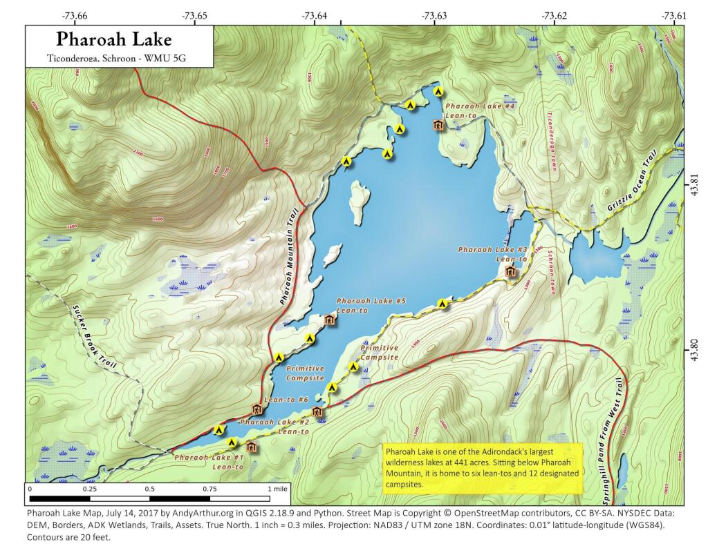
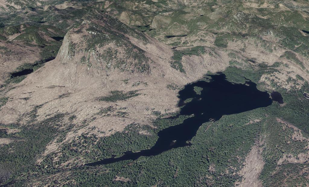
Pharoah Lake
Updated map of Pharoah Lake with campsites based on the latest data dump from the NYSDEC. As of this summer, the bridge over the outlet (southern tip) of Pharoah Lake is closed for repairs, so one must go around the lake to get to the northern shore of the lake from the Pharoah Lake Trail from Pharoah Road/Beaver Dam Road in Schroon.