Old WV 93
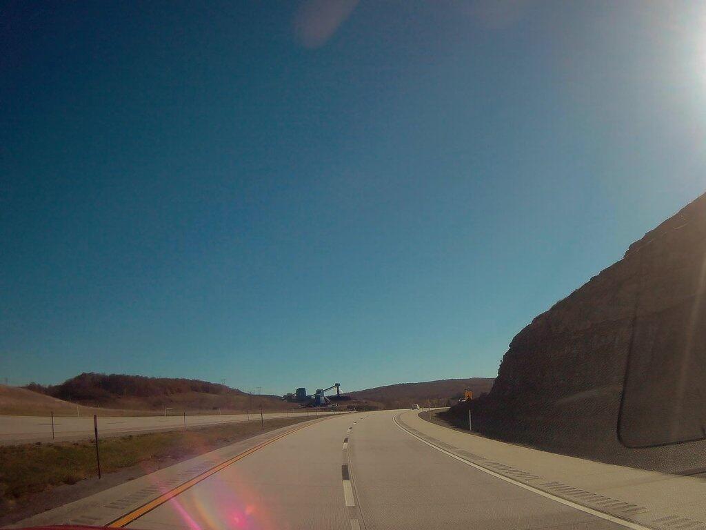
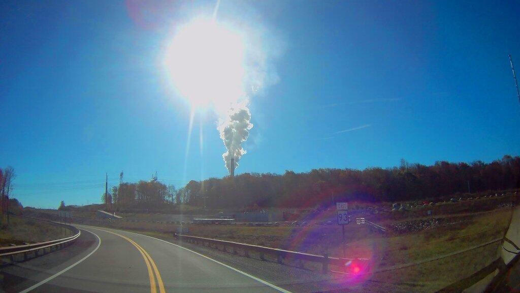
Driving to Mount Storm Lake and the Mount Storm Power Plant on WV 93.

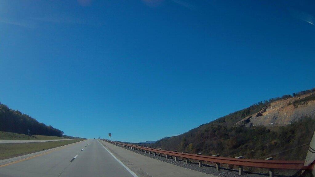
Driving along Corridor “H” the new limited access highway that runs in the Northern Tier of West Virginia from Davis to Morehead past the strip mined coal fields and the big Storm Mountain Coal-fired Power Plant, I was thinking what a truly nasty way to be making electricity, especially in the 21st century, when much cleaner fuels have long been on the market, and when renewables are a growing part of the electricity industry.
In the early days of the industrial revolution, coal was the only on-demand source of energy that could be used virtually everywhere. You haul coal somewhere, you get coal lit on fire, it burns hot, often with a thick black smoke, boils water into steam which turns a turbine. More advanced controls were invented which got more heat energy turned into steam, captured more of the soot and chemical byproducts of coal, and generally made coal a better fuel. But from a chemical standpoint, coal can not compete with oil or natural gas, which is much easier to burn and control the output of the furnace. As oil and gas have fewer contaminates it can be burned with much fewer pollution controls. Mount Storm is a large coal-fired generating station. It has what appears to be two active units from the two large currently operating smoke stacks, but there may be multiple units attached to one stack. It produces an enormous cloud of water vapor visible from miles around — including from the Dolly Sods Wilderness and most elevated locations within 30 miles. Water vapor is a nice way to put it — the smoke is mostly carbon dioxide and water but it’s mixed with a wide variety of heavy metals, mercury, sulfur dioxide, carbon monoxide, and nitrous oxides. Things that limit the amount of otherwise healthy fish they can safely consume out of streams even far away. It produces a steady output of “base-load” that lights wells over a million households, or a combination of households, factories, and commercial facilities. It’s one of the bigger power plants out there, but certainly not the biggest.
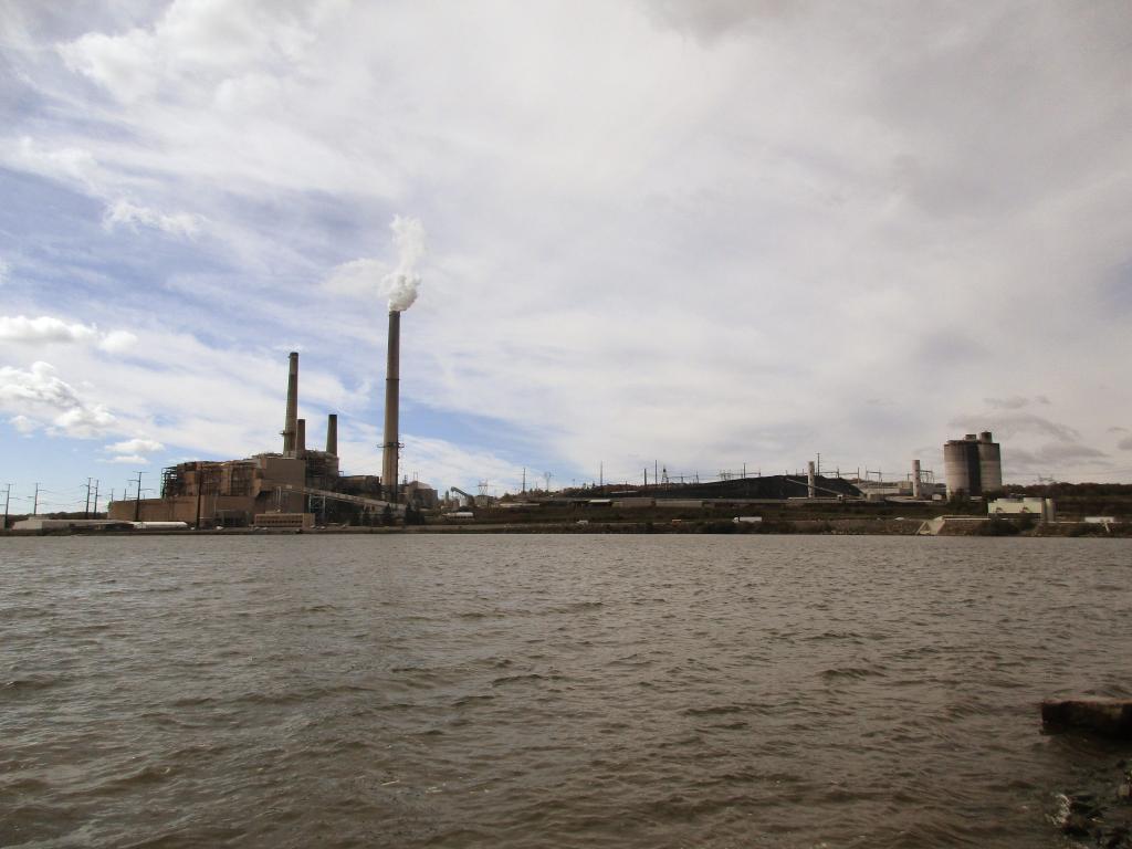
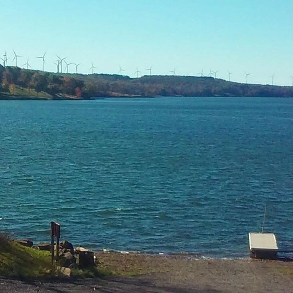
Mount Storm a big industrial facility with a large cooling reservoir whose warm waters are popular for boating and fishing. The warm cooling water from the plant keeps the lake ice free for much of the year and provides good stable water temperature for fishing. It’s nice that they allow public access to the reservoir, one with impressive views of the plant from the boat launch. That’s great. But what’s no so great is the large open pit mines that surrounded the plant, laid bare for all to see by the construction of the Corridor H Expressway. Mountain top removal, and strip mining turn mountains into mounds that look like garbage dumps. Even “restored” landscapes make mountain look engineered, the hopes of getting new businesses in the area to locate in this remote area are slim — although somewhat improved by Corridor H. For every four tons of coal hauled to the plant, one tons of coal, limestone scrubber residue, and fly ash are landfilled near the plant. The coal fired plant itself is a small part of the landscape compared to the wastes that are disposed of at on-site landfills. You can only see some of the outer walls of the landfills from the WV 94 (the old road) and Corridor H. From satellite pictures you can see much more. Burning coal cuts enormous sections out of mountains, and creates new mountains of ash landfills.
Coal haters, myself included, will note that nothing is really clean about coal. Toxic coal air emissions, while a small part of what goes up the smoke stack, are enormous, because so much coal is burned every day, 365 days a year at Mount Storm and thousands of other coal fired plants across the country. The electricity produced lights millions of homes. Not only is mining ugly and restored landscapes are often just a glimmer of the once wild lands, cutting into the earth, especially in places where coal is common, release many toxic compounds. Coal often is mixed with pyrite, commonly known as fools gold. You might get rich off the coal, but your still a fool. Pyrite when it’s exposed to water and rain releases it’s sulfuric compounds, the same ones that often go up the stack when coal is burned. The sulfuric compounds in pyrite mixed with water produce sulfuric acid mine discharge — sometimes as powerful as car battery acid and poison streams, especially hitting fish who are sensitive to even minor changes to pH levels in stream levels. To say nothing of the removed an rerouted streams, which bring sediment downstream, boost nutrient levels, and otherwise wreck formerly good trout streams. Of course if you read my blog, you probably are aware of all these things. That coal is a lot more evil then just the excess amounts of carbon dioxide it’s bleaching into air forever changing both our local and global climates, acidifying the oceans and lakes, changing the natural rhythms of moth earth. But seeing Mount Storm up close seemed to bring that all back home to me.
Now I also saw the nice rural houses in the neighborhoods, with the neatly maintained yards, beautiful 3/4 ton pickup trucks, a four wheeler or two, and maybe a horse, and a family cow or a hog. All most certainly paid by the good salaries for the engineers and technical people who use their advanced knowledge to keep Mount Storm humming along. Or they work with heavy equipment in the strip mines and below ground mines to feed the ever hungry coal furnaces at Mount Storm. They are doing what they need to do to feed their family and live the good life. I respect them, I might be even kind of jealous because I’d love to live in rural God’s country like this. West Virginia is a special place. Coal may be dirty and working with it may have life-long consequences, it’s a good source of jobs in these towns that don’t have much else to do — sure there are jobs in timber, road construction, local government, a few other industries, but the area is still incredibly rural, even if Corridor H is making it easier to get around. If Virginia finally agrees to extend Corridor H so it meets up with Interstate 81, this area will become even less remote. But even without the final extension, this superhighway — granted one that has grade intersections is making the whole area much better connected together and accessible. I can’t overstate how much Corridor H changes life in the Northern Tier of West Virginia, compared to the much inferior West Virigina 93.
![Untitled [Expires November 8 2025]](https://andyarthur.org//data/photo_021818_large.jpg)
I think it’s fully reasonable to predict that Corridor H will eventually become an interstate highway, connecting with Interstate 81 heading west from Davis to Interstate 79 outside of Morganstown. Mount Storm will probably eventually close. President Donald Trump may say coal will be great again, but it’s a dying, nasty technology, that is long in the tooth, especially as renewables grow on the grid. Probably many of younger generation will move away, rather then struggle with the hard life of Rural Appalachia. Some people will stay and carry on the values, working in other industries or being part of the growing renewable energy industry. As Mount Storm and the coal industry is in it’s twilight years, making as much of a mess as usual, more and more wind turbines are going up on the remote ridges of the pan handle of West Virginia. Areas mined for coal might still be high enough to site new turbines — to say nothing of solar. People will still hunt deer and bear, raise a hog or beef in their backyard, live the good rural life. Mount Storm and the coal industry may be on it’s last horrific breath, but it doesn’t mean Appalachia and it’s beautiful landscape must come to an end.
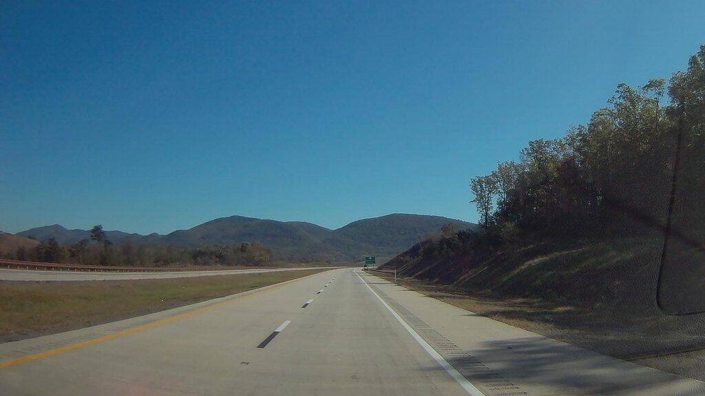
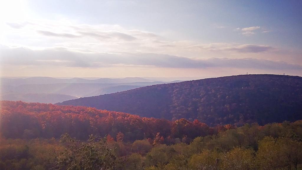
Despite all the blasting, the large bridges, and forever changed landscape, I think Corridor H is great. It shows the beauty and ugliness of West Virginia. It will move the whole area forward, make it less remote, and allow it to transition to the industry of tomorrow. The sheer distance from other population centers will limit high-end residential and commercial development, to say nothing of the steep mountains slopes, the rough rocky terrain, even if the distances aren’t as far thanks to the safe, modern road. I think everybody should drive Corridor H at least once.

Corridor H is a new divided highway that runs along the northern tier of West Virginia from Davis, WV to Moorefield, WV. Eventually it may be upgraded to the superhighway, but for now it's a two lane divided highway with some at-grade intersections. While much of the highway passes coal mining areas, it also has some very scenic sections.
