Seneca Lake stands as the largest among the glacial Finger Lakes within the state of New York. Renowned for its substantial size and depth, it remains entirely contained within the state’s borders. The lake has earned distinction as the preeminent locale for lake trout angling, exemplified by its role as the host of the esteemed National Lake Trout Derby. Positioned at the northern terminus of Seneca Lake, the city of Geneva, New York, commands attention, serving as the domicile for Hobart and William Smith Colleges, along with housing the New York State Agricultural Experiment Station, a constituent entity of Cornell University. Conversely, the village of Watkins Glen, situated at the southern extremity of the lake, boasts a notable reputation due to its association with motorsport, primarily due to the presence of Watkins Glen International racetrack, as well as its picturesque cascades.
Seneca Lake possesses an uncommon macroclimate that has bestowed it with the distinction of nurturing over 50 wineries, predominantly characterized as farm wineries. Its geographical attributes have led to the designation of the Seneca Lake American Viticultural Area (AVA), solidifying its reputation within oenophilic circles.
In terms of dimensions, Seneca Lake stretches across a length of approximately 38 miles, securing its position as the second longest Finger Lake. Remarkably voluminous, it is estimated to contain an impressive 3.81 cubic miles (15.9 km³) of water, accounting for nearly half of the cumulative water volume across all the Finger Lakes. The lake’s profundity is notable, averaging 291 feet, while plunging to a maximum depth of 618 feet. The expansive water body covers a surface area of approximately 66.9 square miles (173 km²).
Good morning! Happy Tuesday. Partly sunny and 73 degrees in Burdett at the Finger Lakes National Forest. There is a west-northwest breeze at 10 mph. The dew point is 61 degrees. A quite pleasant morning with a breeze helping to dry things out.
Today will be sunny, with a high of 82 degrees at 3pm. One degrees below normal. Northwest wind around 11 mph. Maximum dew point of 61 at 9am. The record high of 96 was set in 1963. The sun will set at 8:32 pm with dusk around 9:05 pm, which is 1 minutes and 1 seconds earlier than yesterday. Today will have 14 hours and 38 minutes of daylight, a decrease of 1 minute over yesterday.
Heading out to Robert Treman State this park. Hopefully both the gorge trail through Enfield Glen and the swimming area will be open today. Some of those Watkins Glen photos I posted yesterday came out quite nice. Hoping also to watch the sunset from the Teeter Pond area, as the sun sets over Seneca Lake tonight.
Tonight will be mostly clear, with a low of 61 degrees at 5am. One degree below normal. North wind around 6 mph becoming light and variable. Maximum dew point of 59 at 10pm. The record low of 47 occurred back in 1977.
Listened to the Democratic National Convention until 10:30, falling asleep right before Bernie Sanders spoke. I was hoping to hear his remarks, but it was not to be. I caught up on them this morning with morning edition.
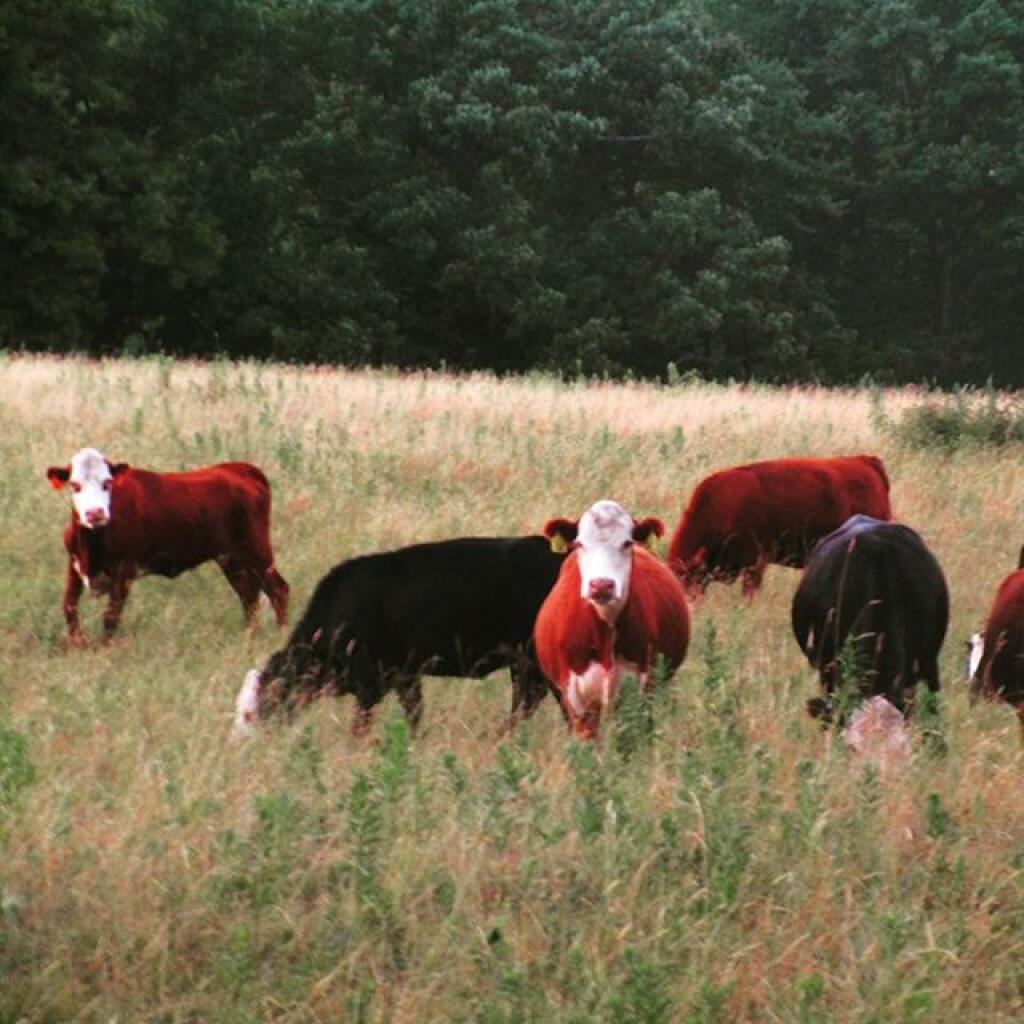
I saw for the first time the cows over in the pasture near my campsite. For the most part in the heat the cows have been hiding out in the more wooded areas and down by the pond. They were probably listening for Bernie Sanders Speech.
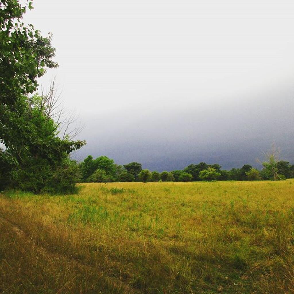
0.4 inch of rain expected between Thursday 8am and Saturday 7am. Within the next four days, a total of 0.4 inches of rain is expected. After the long drought, thunderstorms bring much needed rain – during my vacation. Despite thunderstorms bringing rain tomorrow, the rest of the week is expected to have low humidity.
On this day in 2007, Shambo, a black cow in Wales that had been adopted by the local Hindu community, is slaughtered due to a bovine tuberculosis infection, causing widespread controversy. Preventing the spread of bovine TB is probably much more important then some religious tradition.
And in 1948, U.S. President Harry S. Truman signs Executive Order 9981 desegregating the military of the United States. It would be one step in many in protecting the rights of minority races in our country.
There are 3 weeks until Altamont Fair Opens when the sun will be setting at 8:05 pm with dusk at 8:35 pm. As we head into August the days really grow shorter. The average high temperature for the opening day of the fair is 81 degrees, with a record high of 97 in 1936.
Good evening! Partly cloudy and 73 degrees in Burdett. There is a west breeze at 7 mph. The dew point is 67 degrees. A damp evening in the woods, listening to the Democratic National Convention. I find the speakers are fairly convincing but then again I’m a democrat.
It was a rather rainy day with blue skies in between the rain showers. I drove to Watkins Glen and the sky opened up and started to pour. I went to the Watkins Glen library and played on the Internet to wait out the storm. Once the rain stopped, I hiked Watkins Glen which was the beautiful with the fog, and not very crowded. Then went for a dip in the Watkins Glen pool, took a shower picked up some groceries and returned to camp. Cooked dinner and are now listening to the DNC.
Tonight will be partly cloudy, with a low of 64 degrees at 6am. Two degrees above normal. West wind 3 to 7 mph. Maximum dew point of 67 at 10pm. The record low of 46 occurred back in 1976. Waning Gibbous Moon tonight with 60% illuminated. The moon will rise around 12:00 am. The Last Quarter Moon is on Tuesday with clear skies expected. The Full “Strugeon” Moon is on Thursday, August 18th.
Tomorrow will be sunny, with a high of 83 degrees at 3pm. Typical for Tomorrow. West wind 7 to 11 mph. Maximum dew point of 62 at 8am. The record high of 96 was set in 1963. The sun will rise at 5:53 am with the first light at 5:21 am, which is 59 seconds later then yesterday.
0.1 inch of rain expected between Thursday 8am and Friday 7am. Within the next four days, a total of 0.1 inches of rain is expected.
We have some muggy weather coming up.Monday 10pm – Tuesday 12am. Maximum temperature will be 73 degrees and a maximum dew point of 67.
Looking ahead, First Day of August is in 1 weeks, National Relaxation Day is in 3 weeks, State Fair Opens is in 1 months, Labor Day is in 6 weeks, First Day with More Night then Day in Albany is in 2 months, Columbus Day is in 11 weeks, Halloween is in 14 weeks, Last Day with 10 Hours of Daylight in Albany is in 15 weeks, Beaver Moon is in 16 weeks, Buy Nothing Day / Black Friday is in 4 months and Christmas is in 5 months.
Tuesday Night. Clear and 61 degrees, 59 max dew point, 5:55 sunrise. Wednesday. Sunny and 86 degrees, 59 max dew point, 8:31 sunset. Wednesday Night. Partly Cloudy and 64 degrees, 60 max dew point, 5:56 sunrise. Thursday. Chance of T-storms and 82 degrees, 62 max dew point, 8:30 sunset. Thursday Night. Chance of T-storms and 65 degrees, 62 max dew point, 5:57 sunrise. Friday. Chance of T-storms and 79 degrees, 62 max dew point, 8:29 sunset. Friday Night. Chance of Showers and 63 degrees, 61 max dew point, 5:58 sunrise. Saturday. Chance of T-storms and 79 degrees, 61 max dew point, 8:28 sunset. Saturday Night. Chance of T-storms and 64 degrees, 62 max dew point, 5:59 sunrise. Sunday. Chance of T-storms and 79 degrees, 63 max dew point, 8:27 sunset.
I hope you had a good Monday and you didn’t get as wet as I got tonight in the Finger Lakes.
Good afternoon! Mostly sunny and 80 degrees in Burdett. There is a west-southwest breeze at 10 mph. The dew point is 69 degrees.
After the heavy but much needed rain this morning, things have cleared out quite a bit. It’s now mostly sunny and pretty nice. The thunderstorms brought around a quarter to half inch of rain. That should help keep down the dust for a while.
Heading back to Watkins Glen to get some supplies, hike the gorge, and stop and grab photos. Also plan to spend some time swimming and enjoying those Adirondack Chairs.
Beautiful day now but definitely sad to hear about the passing of Mike Kane. He was quite the guy the times I worked with him.
Hoping later if it remains clear to photograph the sunset from one of the open pastures, as the sun sets over Seneca Lake. We’ll see how the weather cooperates but right now its pretty nice.