Hudson Valley

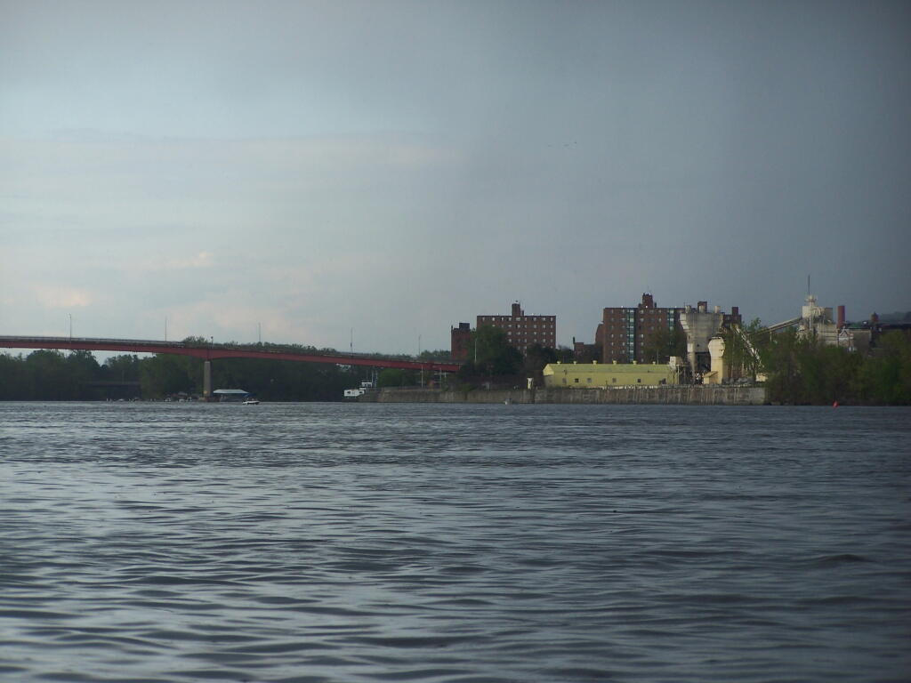
Troy from the Hudson River

After fighting some pretty strong winds, a severe thunderstorm threat, and some heavy rain, I finally made it to Troy. I was running a little late, so I decided not to paddle into Downtown Troy.

Taken on Saturday May 7, 2011 at Kayak the Hudson.
Peaks on State Land in Hudson Valley, Northern Catskills and Long Island

A list of peaks on state land shown in the Open Street Map along with coordinates for Department of Environmental Conservation Regions 1 through 4 excluding the Catskill Park. These peaks are in the Heldebergs, Taconics, Hudson Highlands, Shawgunks and hills outside of the Catskill Park.

Region 1 – Suffolk County (Long Island)

Peak Name Elevation in Feet State Land Class UMP Region County Location
Flanders Hill 230 David A. Sarnoff Preserve Β  North Atlantic 1 Suffolk 40.8745441, -72.6045377

Region 3 – Dutchess County County (Hudson Highlands)

Peak Name Elevation in Feet State Land Class UMP Region County Location
Depot Hill 1305 Depot Hill Multiple Use Area Β  Lower New England East 3 Dutchess 41.5753714, -73.6751291

Region 3 – Putnam County (Hudson Highlands)

Big Buck Mountain 1115 Big Buck Mountain Multiple Use Area Β  Lower New England East 3 Putnam 41.4948155, -73.7165195
California Hill 1178 California Hill State Forest Β  Lower New England East 3 Putnam 41.4373157, -73.7762439
Castle Rock 626 Castle Rock Unique Area Β  Lower New England East 3 Putnam 41.367316, -73.935416
Cranberry Mountain 1233 Cranberry Mountain WMA Β  Cranberry Mountain Hmp 3 Putnam 41.5037049, -73.5626259
Nimham Mount 1273 Nimham Mountain Multiple Use Area Β  Lower New England East 3 Putnam 41.461407, -73.7250815
Pigeon Hill Β  Bashakill WMA Β  Β  3 Sullivan 41.538532, -74.5191017
Unnamed Peak 1414 Wurtsboro Ridge State Forest Β  Shawangunk Ridge 3 Sullivan 41.5944736, -74.4385778

Region 3 – Orange County (Greater Newburgh)

Peak Name Elevation in Feet State Land Class UMP Region County Location
Buchanan Hill 649 Stewart State Forest Β  West Of Hudson 3 Orange 41.4912049, -74.1423678
Sloop Hill 128 Kowawese Unique Area Β  West Of Hudson 3 Orange 41.4584271, -74.0156961

Region 4 – Albany County (Heldebergs)

Peak Name Elevation in Feet State Land Class UMP Region County Location
Blodget Hill 1145 Louise E. Keir WMA Β  Louise E. Keir Hmp 4 Albany 42.5150798, -73.8954045
Henry Hill 2162 Partridge Run WMA Β  Partridge Run Hmp 4 Albany 42.5495213, -74.1979138

Region 4 – Delaware County (Western Catskills outside Catskill Park)

Peak Name Elevation in Feet State Land Class UMP Region County Location
Jensen Hill 1683 Hancock Fp Detached Parcel Wild Forest Β  4 Delaware 41.8670322, -75.1543365
Kenyon Mountain 2988 Plattekill State Forest Β  East Branch 4 Delaware 42.2938395, -74.6382349
McGregor Mountain 3191 Stamford Fp Detached Parcel Wild Forest Β  4 Delaware 42.3900808, -74.5790396
Murphy Hill 2306 Murphy Hill State Forest Β  East Branch 4 Delaware 42.1311981, -74.8676606
Pine Hill 2007 Pine Hill State Forest Β  Treaty Line 4 Delaware 42.2823038, -75.3435096
Plattekill Mountain 3267 Plattekill State Forest Β  East Branch 4 Delaware 42.2667522, -74.6482102
Round Top 3067 Plattekill State Forest Β  East Branch 4 Delaware 42.2714741, -74.6832109

Region 4 – Greene County (Northern Catskills outside Catskill Park)

Peak Name Elevation in Feet State Land Class UMP Region County Location
Bearpen Mountain 3601 Bearpen Mountain State Forest Β  Mt. Pisgah 4 Greene 42.2652179, -74.4737802
Huntersfield Mountain 3421 Huntersfield State Forest Β  Mt. Pisgah 4 Greene 42.355638, -74.3465339
Mount Hayden 2929 Mount Hayden State Forest Β  Mt. Pisgah 4 Greene 42.3586936, -74.2190298
Mount Pisgah 2909 Mount Pisgah State Forest Β  Mt. Pisgah 4 Greene 42.3773038, -74.2448639
North Bearpen Mountain 3529 Bearpen Mountain State Forest Β  Mt. Pisgah 4 Greene 42.2734189, -74.4840396
Richmond Mountain 3214 Mount Pisgah State Forest Β  Mt. Pisgah 4 Greene 42.367582, -74.270976
Richtmyer Peak 2985 Mount Pisgah State Forest Β  Mt. Pisgah 4 Greene 42.3756373, -74.2634757
Roundtop 3451 Bearpen Mountain State Forest Β  Mt. Pisgah 4 Greene 42.2939737, -74.4904283
Unnamed Peak 3398 Greene County Fp Detached Parcel Wild Forest 0 4 Greene 42.2368271, -74.4986128
Noahs Rump 1991 Plainfield State Forest Β  Leatherstocking 4 Otsego 42.8103497, -75.1862732
Stone Quarry Hill 2194 Decatur State Forest Β  Cherry Valley 4 Otsego 42.6322978, -74.6870919

Region 4 – Schoharie County (Northern Catskills outside Catskill Park)

Peak Name Elevation in Feet State Land Class UMP Region County Location
Blenheim Mountain 2004 Blenheim Hill State Forest Β  Eminence 4 Schoharie 42.4550782, -74.4923695
Burnt Hill 1906 Burnt-Rossman Hills State Forest Β  Eminence 4 Schoharie 42.4975764, -74.4962576
Cotton Hill 2109 Dutch Settlement State Forest Β  Β  4 Schoharie 42.6289647, -74.267079
High Knob 2663 High Knob State Forest Β  Catskill Creek 4 Schoharie 42.4284128, -74.3126429
Hubbard Hill 2624 Leonard Hill State Forest Β  Catskill Creek 4 Schoharie 42.4489676, -74.3437545
Leonard Hill 2604 Leonard Hill State Forest Β  Catskill Creek 4 Schoharie 42.4506342, -74.3526436
Petersburg Mountain 2322 Petersburg State Forest Β  Eminence 4 Schoharie 42.6331311, -74.4490288
Rossman Hill 2080 Burnt-Rossman Hills State Forest Β  Eminence 4 Schoharie 42.5506316, -74.4812552
South Mountain 2886 South Mountain State Forest Β  Mt. Pisgah 4 Schoharie 42.3620266, -74.2851432
Steenburg Mountain 2565 South Mountain State Forest Β  Mt. Pisgah 4 Schoharie 42.3945253, -74.2748646

Region 4 – Columbia County (Taconics)

Peak Name Elevation in Feet State Land Class UMP Region County Location
Beebe Hill 1758 Beebe Hill Multiple Use Area Β  Taconic Highlands 4 Columbia 42.3359195, -73.485113
Pinnacle Point 1952 Harvey Mountain State Forest Β  Taconic Highlands 4 Columbia 42.3103647, -73.4434453

Region 4 – Rensselear County (Taconics)

Peak Name Elevation in Feet State Land Class UMP Region County Location
Bald Mountain 2483 Taconic Ridge State Forest Β  Taconic Highlands 4 Rensselaer 42.7648012, -73.2837205
Berlin Mountain 2798 Taconic Ridge State Forest Β  Taconic Highlands 4 Rensselaer 42.6920245, -73.2862195
Berlin Mountain 2795 Taconic Ridge State Forest Β  Taconic Highlands 4 Rensselaer 42.6917468, -73.2856639
Misery Mountain 2601 Taconic Ridge State Forest Β  Taconic Highlands 4 Rensselaer 42.6184144, -73.3176081
Mount Raimer 2572 Taconic Ridge State Forest Β  Taconic Highlands 4 Rensselaer 42.7161908, -73.2837199
White Rock 2542 Taconic Ridge State Forest Β  Taconic Highlands 4 Rensselaer 42.753968, -73.2803869

Giant Refrigerator Building

This is the famous former refrigerated food rail building that burned last fall, that nobody seems to know what to do about. Also, notice the barge restaurant at the Corning Preserve.

Taken on Saturday May 7, 2011 at Kayak the Hudson.