A list of peaks on state land shown in the Open Street Map along with coordinates for Department of Environmental Conservation Regions 1 through 4 excluding the Catskill Park. These peaks are in the Heldebergs, Taconics, Hudson Highlands, Shawgunks and hills outside of the Catskill Park.
Region 1 – Suffolk County (Long Island)
Region 3 – Dutchess County County (Hudson Highlands)
Region 3 – Putnam County (Hudson Highlands)
Region 3 – Orange County (Greater Newburgh)
Region 4 – Albany County (Heldebergs)
Region 4 – Delaware County (Western Catskills outside Catskill Park)
Region 4 – Greene County (Northern Catskills outside Catskill Park)
| Peak Name |
Elevation in Feet |
State Land |
Class |
UMP |
Region |
County |
Location |
| Bearpen Mountain |
3601 |
Bearpen Mountain State Forest |
|
Mt. Pisgah |
4 |
Greene |
42.2652179, -74.4737802 |
| Huntersfield Mountain |
3421 |
Huntersfield State Forest |
|
Mt. Pisgah |
4 |
Greene |
42.355638, -74.3465339 |
| Mount Hayden |
2929 |
Mount Hayden State Forest |
|
Mt. Pisgah |
4 |
Greene |
42.3586936, -74.2190298 |
| Mount Pisgah |
2909 |
Mount Pisgah State Forest |
|
Mt. Pisgah |
4 |
Greene |
42.3773038, -74.2448639 |
| North Bearpen Mountain |
3529 |
Bearpen Mountain State Forest |
|
Mt. Pisgah |
4 |
Greene |
42.2734189, -74.4840396 |
| Richmond Mountain |
3214 |
Mount Pisgah State Forest |
|
Mt. Pisgah |
4 |
Greene |
42.367582, -74.270976 |
| Richtmyer Peak |
2985 |
Mount Pisgah State Forest |
|
Mt. Pisgah |
4 |
Greene |
42.3756373, -74.2634757 |
| Roundtop |
3451 |
Bearpen Mountain State Forest |
|
Mt. Pisgah |
4 |
Greene |
42.2939737, -74.4904283 |
| Unnamed Peak |
3398 |
Greene County Fp Detached Parcel |
Wild Forest |
0 |
4 |
Greene |
42.2368271, -74.4986128 |
| Noahs Rump |
1991 |
Plainfield State Forest |
|
Leatherstocking |
4 |
Otsego |
42.8103497, -75.1862732 |
| Stone Quarry Hill |
2194 |
Decatur State Forest |
|
Cherry Valley |
4 |
Otsego |
42.6322978, -74.6870919 |
Region 4 – Schoharie County (Northern Catskills outside Catskill Park)
| Peak Name |
Elevation in Feet |
State Land |
Class |
UMP |
Region |
County |
Location |
| Blenheim Mountain |
2004 |
Blenheim Hill State Forest |
|
Eminence |
4 |
Schoharie |
42.4550782, -74.4923695 |
| Burnt Hill |
1906 |
Burnt-Rossman Hills State Forest |
|
Eminence |
4 |
Schoharie |
42.4975764, -74.4962576 |
| Cotton Hill |
2109 |
Dutch Settlement State Forest |
|
|
4 |
Schoharie |
42.6289647, -74.267079 |
| High Knob |
2663 |
High Knob State Forest |
|
Catskill Creek |
4 |
Schoharie |
42.4284128, -74.3126429 |
| Hubbard Hill |
2624 |
Leonard Hill State Forest |
|
Catskill Creek |
4 |
Schoharie |
42.4489676, -74.3437545 |
| Leonard Hill |
2604 |
Leonard Hill State Forest |
|
Catskill Creek |
4 |
Schoharie |
42.4506342, -74.3526436 |
| Petersburg Mountain |
2322 |
Petersburg State Forest |
|
Eminence |
4 |
Schoharie |
42.6331311, -74.4490288 |
| Rossman Hill |
2080 |
Burnt-Rossman Hills State Forest |
|
Eminence |
4 |
Schoharie |
42.5506316, -74.4812552 |
| South Mountain |
2886 |
South Mountain State Forest |
|
Mt. Pisgah |
4 |
Schoharie |
42.3620266, -74.2851432 |
| Steenburg Mountain |
2565 |
South Mountain State Forest |
|
Mt. Pisgah |
4 |
Schoharie |
42.3945253, -74.2748646 |
Region 4 – Columbia County (Taconics)
Region 4 – Rensselear County (Taconics)
This is the famous former refrigerated food rail building that burned last fall, that nobody seems to know what to do about. Also, notice the barge restaurant at the Corning Preserve.
Taken on Saturday May 7, 2011 at Kayak the Hudson.
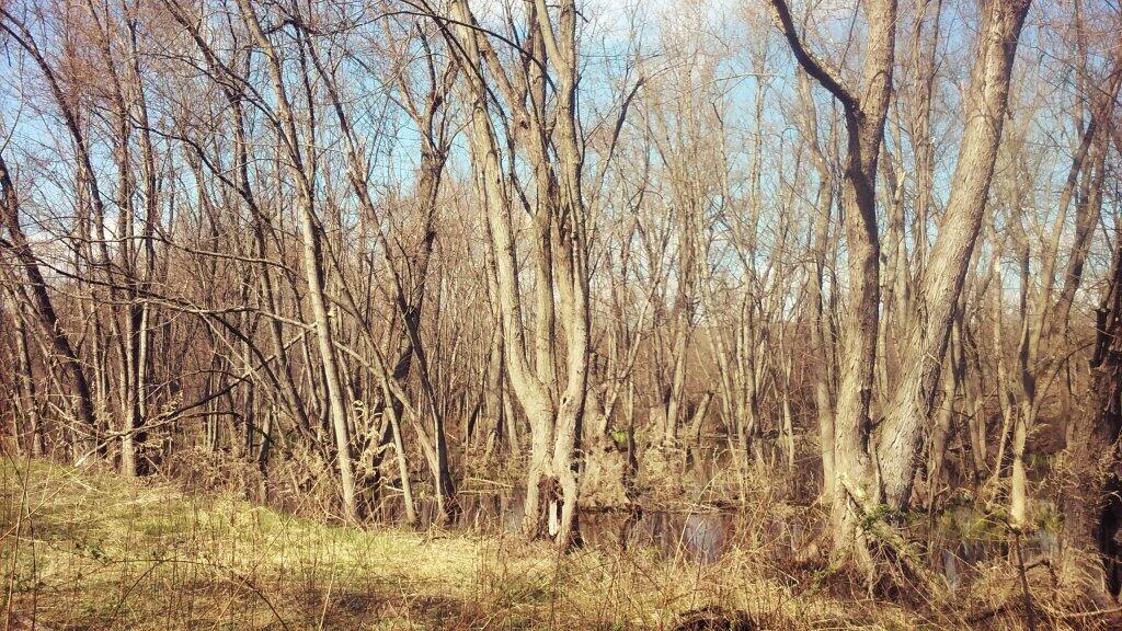
The preserve is covered by many different vernal pools and small wetlands in the backwaters of the Hudson which make it perfect for observing nature and wildlife.
Taken on Wednesday April 15, 2020 at Papscanee Island Nature Preserve.


