Kueka Outlet Trail
I was looking at the Open Street Map for the Kueka Outlet Trail and noticed how they have all the various parking areas designated on the map. That sure is handy.


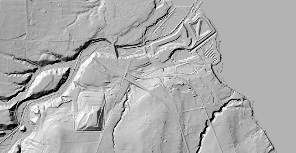
AES Greenridge LiDAR
Back when AES Greenridge first went online, they dumped the coal ash in settling ponds along Seneca Lake. In later years, they, well the State of New York, decided it was a better to build a large coal ash landfill farther away from the lake and not dump it directly in the lake.