Albany, NY
Albany Lumber District
The lumber district of Albany, New York was relatively small in the 1830s with around six wholesale lumber merchants, but by the 1870s Albany was the largest lumber district in the United States by value, though by that time it had recently been outstripped in feet sold by Chicago.
For about a quarter century in the middle of the 19th century the Albany lumber district was considered the largest white pine wholesale market. There were 3,963 sawmills operating in the lumber district in 1865 but by 1900 there were only around 150. A fire ripped through the district in 1908 signalling the decline of the lumber industry for Albany.
Back Of Agency Four
Thunderstorm on Sheridan Avenue
Age of Buildings Along Second Avenue
You can now mouse over the building to see the exact year it was built, besides looking at the colors. I am not sure why I didn't implement this feature until now -- it was all of four lines of code. Kind of interesting to see how old the buildings are in Albany's South End.
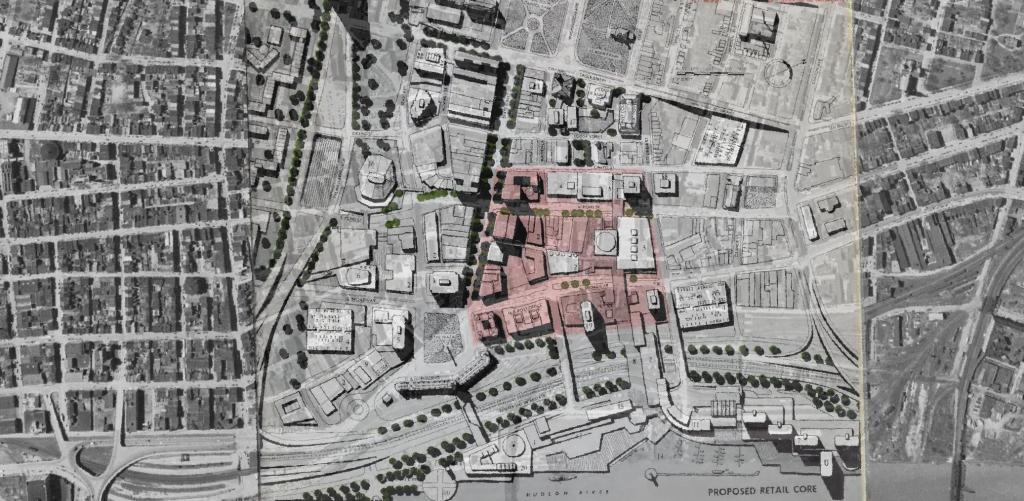
Proposed Downtown Retail District – Plan for the Capital City
I was experimenting with QGIS and old maps from the 1963 Plan for the Capital City and overlaid the proposed development plan over an aerial photo of the city from 1952. While overall this plan didn't come to fruition, many elements did and can be seen in the contemporary downtown.


