Rotten Stump

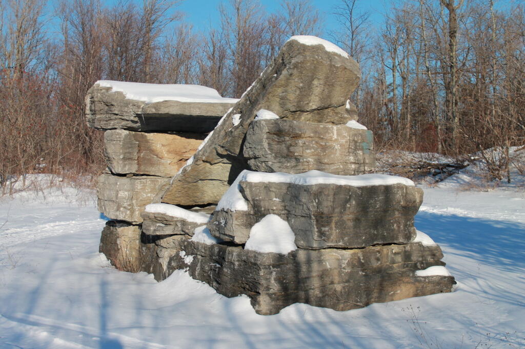
For those living in colder climes, winter presents its share of driving challenges. Once upon a time, General Motors took a novel approach to improving winter traction with the Liquid Tire Chain Traction Dispenser.
The onboard system promised, at the push of a button, improved traction through chemistry. As option V75, it launched in 1969 on everything from full-size Chevrolets and sporty Chevelles to the economical and compact Chevy II. Liquid Tire Chain joined a group of other late-’60s wintery options such headlight washers, a rear-window defroster, and an engine block heater.
Old tires used to be really bad in the snow as rubber hardened a lot in the cold. You wanted hard rubber to make the tires last but soft rubber for traction. This spray both made the tires softer and stickier. Modern rubbers are more temperature consistent, and are more plyable but durable.
| Day | Month | Day | Phase | Moon-Rise | Moon-Set |
|---|---|---|---|---|---|
| Wednesday | January | 19 | Wolf 🐺 Full 🌝 | east-northeast 64° |
west-northwest 297° |
| Saturday | January | 22 | Waining Gibbous 🌖 | Tuesday 1:51 pm east-northeast 67° |
Tuesday 1:25 am west-northwest 295° |
| Wednesday | January | 26 | Last Quarter 🌗 | Saturday 4:59 pm east 86° |
Saturday 4:35 am west 277° |
| Saturday | January | 29 | Waining Crescent 🌘 | Tuesday 7:26 pm east-southeast 105° |
Tuesday 6:58 am west-southwest 258° |
| DOW | Month | Day | Phase | Moon-Rise | Moon-Set |
|---|---|---|---|---|---|
| Tuesday | February | 1 | New 🌚 | – | – |
| Saturday | February | 5 | Waxing Crescent 🌒 | Tuesday 1:28 am east-southeast 111° |
Tuesday 1:54 pm west-southwest 251° |
| Tuesday | February | 8 | First Quarter 🌓 | Friday 3:59 am east 96° |
Friday 4:20 pm west 267° |
| Saturday | February | 12 | Waxing Gibbous 🌔 | Tuesday 6:53 am east-northeast 74° |
Tuesday 7:14 pm west-northwest 288° |
| Wednesday | February | 16 | Snow ❄ Full 🌝 | east-northeast 63° |
west-northwest 297° |
| Sunday | February | 20 | Waining Gibbous 🌖 | Wednesday 1:21 pm east-northeast 73° |
Wednesday 12:57 am west-northwest 289° |
| Thursday | February | 24 | Last Quarter 🌗 | Sunday 4:26 pm east 96° |
Sunday 4:01 am west 267° |
| Monday | February | 28 | Waining Crescent 🌘 | Thursday 8:11 pm east-southeast 115° |
Thursday 7:36 am west-southwest 246° |
| DOW | Month | Day | Phase | Moon-Rise | Moon-Set |
|---|---|---|---|---|---|
| Thursday | March | 3 | New 🌚 | – | – |
| Sunday | March | 6 | Waxing Crescent 🌒 | Wednesday 1:04 am east-southeast 104° |
Wednesday 1:28 pm west 259° |
| Thursday | March | 10 | First Quarter 🌓 | Sunday 4:05 am east 81° |
Sunday 4:25 pm west-northwest 282° |
| Monday | March | 14 | Waxing Gibbous 🌔 | Thursday 7:08 am east-northeast 65° |
Thursday 7:31 pm west-northwest 296° |
| Friday | March | 18 | Worm 🐛 Full 🌝 | east-northeast 67° |
west-northwest 291° |
| Tuesday | March | 22 | Waining Gibbous 🌖 | Friday 2:33 pm east 88° |
Friday 2:09 am west 275° |
| Saturday | March | 26 | Last Quarter 🌗 | Tuesday 5:55 pm east-southeast 111° |
Tuesday 5:25 am west-southwest 251° |
| Tuesday | March | 29 | Waining Crescent 🌘 | Friday 9:02 pm east-southeast 116° |
Friday 8:28 am west-southwest 243° |
| DOW | Month | Day | Phase | Moon-Rise | Moon-Set |
|---|---|---|---|---|---|
| Friday | April | 1 | New 🌚 | – | – |
| Tuesday | April | 5 | Waxing Crescent 🌒 | Friday 2:16 am east 88° |
Friday 2:37 pm west 274° |
| Saturday | April | 9 | First Quarter 🌓 | Tuesday 5:15 am east-northeast 69° |
Tuesday 5:37 pm west-northwest 293° |
| Wednesday | April | 13 | Waxing Gibbous 🌔 | Saturday 8:32 am east-northeast 64° |
Saturday 8:56 pm west-northwest 295° |
| Sunday | April | 17 | Pink 🌸 Full 🌝 | east 79° |
west 278° |
| Thursday | April | 21 | Waining Gibbous 🌖 | Sunday 2:49 pm east-southeast 104° |
Sunday 2:23 am west 259° |
| Sunday | April | 24 | Last Quarter 🌗 | Wednesday 5:43 pm east-southeast 116° |
Wednesday 5:11 am west-southwest 245° |
| Wednesday | April | 27 | Waining Crescent 🌘 | Saturday 8:51 pm east-southeast 112° |
Saturday 8:21 am west-southwest 246° |
| DOW | Month | Day | Phase | Moon-Rise | Moon-Set |
|---|---|---|---|---|---|
| Sunday | May | 1 | New 🌚 | – | – |
| Wednesday | May | 4 | Waxing Crescent 🌒 | Saturday 1:39 am east 79° |
Saturday 2:00 pm west-northwest 283° |
| Monday | May | 9 | First Quarter 🌓 | Thursday 5:36 am east-northeast 63° |
Thursday 6:00 pm west-northwest 297° |
| Friday | May | 13 | Waxing Gibbous 🌔 | Monday 8:51 am east-northeast 72° |
Monday 9:13 pm west-northwest 285° |
| Monday | May | 16 | Flower 🌷 Full 🌝 | east 89° |
west 268° |
| Friday | May | 20 | Waining Gibbous 🌖 | Monday 2:28 pm east-southeast 112° |
Monday 1:58 am west-southwest 250° |
| Monday | May | 23 | Last Quarter 🌗 | Thursday 5:37 pm east-southeast 116° |
Thursday 5:03 am west-southwest 243° |
| Friday | May | 27 | Waining Crescent 🌘 | Monday 9:19 pm east 99° |
Monday 8:53 am west-southwest 258° |


In four weeks on February 12 the sun will be setting in the west-southwest (252°) at 5:23 pm,🌄 which is 36 minutes later then today. In 2021 on that day, we had cold, partly cloudy and temperatures between 16 and 3 degrees. Typically, you have temperatures between 35 and 17 degrees. The record high of 55 degrees was set back in 1932.
Locally not so much snow, but maybe we will get some more on Monday, although the latest models are suggesting it will be more rain and ice in the greater Albany-area. Maybe a few inches of snow here and there, but it looking less and less like a major snow event, but they keep warning us that the storm track will change again one way or another. But on Tug and Western Adirondacks, they have some decent snow falls around.
There locations have the deepest snow in New York State, per National Weather Service.
1) Lewis County, West Turin town, Highmarket (HGHN6)
14 inches ☃☃☃☃☃☃☃☃☃☃☃☃☃☃☃ 6am
2) Oneida County, Lee town, Point Rock 0.6 SE (NY-OD-2)
10.5 inches ☃☃☃☃☃☃☃☃☃☃☃ 8am
3) Essex County, North Elba town, Lake Placid 2 S (LPLN6)
9 inches ☃☃☃☃☃☃☃☃☃☃ 8am
4) Essex County, Newcomb town, Newcomb (NCBN6)
7 inches ☃☃☃☃☃☃☃☃ 9am
5) Madison County, Nelson town, Cazenovia 2.9 SE (NY-MD-10)
5 inches ☃☃☃☃☃☃ 7am
6) Franklin County, Malone town, Malone (MALN6)
5 inches ☃☃☃☃☃☃ 7am
7) Hamilton County, Indian Lake town, Indian Lake (INDN6)
5 inches ☃☃☃☃☃☃ 8am
8) St. Lawrence County, Gouverneur town, Gouverneur 3 NW (GOVN6)
5 inches ☃☃☃☃☃☃ 7am
9) Lewis County, Watson town, Chase Lake (GFDN6)
5 inches ☃☃☃☃☃☃ 6am
10) Essex County, Schroon town, Olmstedville 4.6 NNE (NY-ES-6)
4.5 inches ❄️❄️❄️❄️❄️ 8am


This certainly would not have been the weekend to head out of town. 🏕 Even Sunday looks cold. And who knows about Martin Luther King Day. Looks to be a mixed bag, as much as anything. Probably more ice, so I can slip and fall and actually do damage to my body 😣 this time. I got to be careful with those dress shoes and the ice.
But maybe like last time, they will have sidewalks well salted in a day or two, and with the sun on Tuesday things will start to melt away, even if it’s cold. Kind of weird how some days will be quite cold, while other days will be warm enough to count as late February. Who knows what next month will look like?
| This Afternoon. Cold ! |
|
Mostly sunny and cold. Wind chill values as low as -6. North wind 9 to 14 mph.
|
10 degrees | -6 max wind chill | 4:48 sunset |
| Tonight. Cold ! |
|
Mostly clear, with a low around -8. North wind 3 to 8 mph.
|
-8 degrees | -14 max wind chill | 7:21 sunrise |
| Sunday. Cold ! |
|
Sunny. Wind chill values as low as -14. Light and variable wind becoming southeast 5 to 7 mph in the afternoon.
|
23 degrees | -14 max wind chill | 4:48 sunset |
| Sunday Night. Feels like … February 18th. |
|
Snow before 4am, then snow and sleet, possibly mixed with freezing rain. Low around 18. Southeast wind 5 to 11 mph becoming east after midnight. Chance of precipitation is 100%. New snow and sleet accumulation of 2 to 4 inches possible.
|
18 degrees | 8 max wind chill | 7:21 sunrise |
| M.L.King Day. Feels like … February 20th. |
|
Rain, snow and sleet, possibly mixed with freezing rain before 1pm, then a chance of rain between 1pm and 4pm, then a chance of rain and snow after 4pm. High near 37. East wind 11 to 15 mph becoming southwest in the afternoon. Chance of precipitation is 80%. New precipitation amounts between a half and three quarters of an inch possible.
|
37 degrees | 4:49 sunset |
|
| Monday Night. Feels like … February 14th. |
|
A chance of snow before 7pm, then scattered snow showers, mainly between 7pm and 1am. Mostly cloudy. Chance of precipitation is 30%.
|
17 degrees | 2 max wind chill | 7:20 sunrise |
| Tuesday. Cold ! |
|
Partly sunny.
|
23 degrees | 2 max wind chill | 4:50 sunset |
| Tuesday Night. Cold ! |
|
Partly cloudy.
|
7 degrees | 1 max wind chill | 7:20 sunrise |
| Wednesday. Feels like … February 17th. |
|
A chance of snow showers after 1pm. Mostly cloudy. Chance of precipitation is 30%.
|
36 degrees | 1 max wind chill | 4:52 sunset |
| Wednesday Night. Feels like … February 18th. |
|
A chance of snow showers before 1am. Mostly cloudy. Chance of precipitation is 40%.
|
18 degrees | 13 max wind chill | 7:19 sunrise |
| Thursday. Cold ! |
|
Partly sunny.
|
26 degrees | 8 max wind chill | 4:53 sunset |
| Thursday Night. Cold ! |
|
Mostly cloudy.
|
2 degrees | -7 max wind chill | 7:18 sunrise |
| Friday. Cold ! |
|
Partly sunny.
|
17 degrees | -7 max wind chill | 4:54 sunset |