Microsoft Windows
The past two laptops I’ve owned, I’ve kept Microsoft Windows installed in it, but I almost never use it. The only time I ever use Windows is to load a product upgrade or run a driver that isn’t working properly in Linux. Like for example, right now I am booted into Windows to read and reformat a memory card that Linux is refusing to see at all because it is corrupted. It seems to work okay.
Every time I’ve loaded Microsoft Windows, I’ve always noticed how truly slow the operating system is compared to the striped down version of Linux I run with the XFCE Window Manager. It also is trying to sell me some kind of new product, that is always free and easily installed in Linux like office software, software updates, and virus protection. Why pay for something that is already free and easier to install?
I agree that some hardware and software requires a bit more fiddling to get working perfectly. But on the other hand, not all Windows programs are easy to install, especially if you have to buy them, download them and run them through an installer — compared with the ease of apt-get. Linux’s powerful command line makes scripting, and basic repetitive tasks much easer to do then doing a lot of clicking. But for more complicated tasks, there are almost always easy to use GUI programs like OpenOffice and QGIS.
Technology Connections – Space Heater Nonsense
Yes, even the cheapest space heater works as well as the most expensive one. And most have exactly the same heat output -- 1.5kWh or 5,200 BTU -- as that's what the electric code says. And because fossil electric plants aren't exactly efficient are converting fossils into electricity, they are much more expensive then burning fossils right in your home.
How to Add LIDAR Hillshade to Your LeafletJS Map
How to Add LIDAR Hillshade to Your LeafletJS Maps
Using the 3DEP Hillshade and some CSS3, it’s quite easy to add beautiful, LIDAR-generated hillshade to LeafletJS Maps.
A few things to note …
- This is not mobile friendly, as it uses a lot of CPU for the mix-blend-mode, so you may want to disable for mobile browsers
- Areas without hillshade (e.g. the ocean) are shown as black, so you won’t want to use this for large scale maps
Here is a simple example of how to do this with NY Aerial Orthophotography:
<html>
  <head>
    <title>Example</title>
    <meta name="viewport" content="initial-scale=1.0, user-scalable=no">
    <meta charset="utf-8">
    <style>
      html, body, #map-canvas {
        height: 100%;
        margin: 0px;
        padding: 0px;
      }

     .lidarBase {
		 filter: brightness(140%) contrast(100%) !important;
		 // this filter raises brightness and contrast for better appearance
	 }

    .baseLayer  {
		mix-blend-mode: multiply !important;
		// usually a nice way to blend the hillshade with the overlay
	}

	.nyAerial {
		filter: saturate(150%) contrast(110%) brightness(130%);
		// enhance colors a bit
	}
    </style>

    <link rel="stylesheet" href="https://unpkg.com/leaflet@1.6.0/dist/leaflet.css">
    <script src="https://unpkg.com/leaflet@1.6.0/dist/leaflet.js"></script>

  </head>
  <body>
    <div id="map-canvas"></div>
          <script>

var nyAerial =	L.tileLayer.wms(
	'https://orthos.its.ny.gov/ArcGIS/services/wms/Latest/MapServer/WMSServer?',
	{ layers: '0,1,2,3,4,5',
	attribution: 'NYS High-Resolution Color Aerial (Winter 2015-2020) - <a href="https://gis.ny.gov/">NYS Geographic Information Services</a>',
	className: 'nyAerial',
	maxZoom: 21 });

var lidarBase =	L.tileLayer.wms(
	'https://elevation.nationalmap.gov/arcgis/services/3DEPElevation/ImageServer/WMSServer?',
	{
		layers: '3DEPElevation:Hillshade Gray',
		className: 'lidarBase',
	}
);

var map = L.map('map-canvas', {
			center: [42.37348470, -76.88088670],
			zoom: 17,
			layers: [lidarBase,nyAerial]
		});

</script>
</body>
</html>
Here is the produced map with this code:
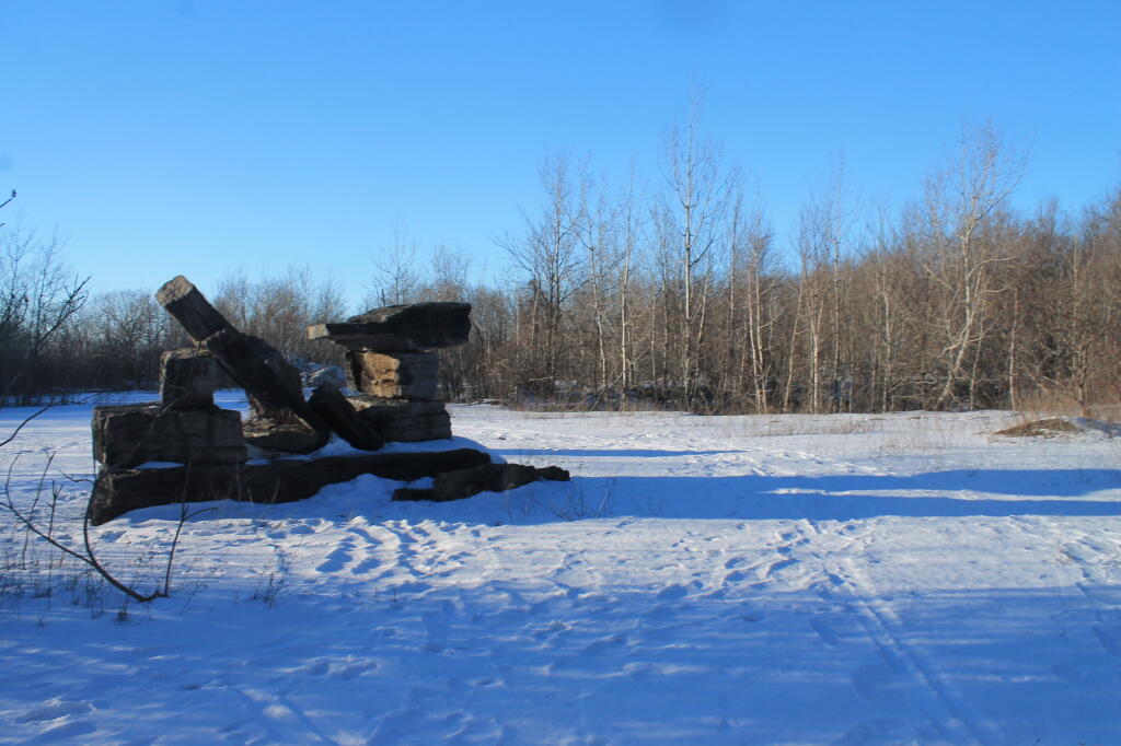
Old Stone Quary
February 10, 2021 Morning
Good morning! Happy Clean Your Computer Day 🧹 ! GIS users 👥 the worse kind of hoarders when I comes to data. But if you don’t save it, the internet disappears or moves it. Next Wednesday is 5:30 PM Sunset 🌇 . Partly sunny and 23 7/8 degrees in Delmar, NY. 🌄 There is a west-northwest breeze at 5 mph. 🍃. There are 7 inches of snow on the ground. ☃ ️The skies will clear around 9 am.
I think it’s a pretty nice morning. 🌅 Sun feels pretty nice on the skin as I’m out for my morning walk. 🚶🏻 Still a few icy patches around so I have to be careful about blogging while walking so I don’t twist 🔀 my ankle too many times while walking. 💪🏻 Hoping with the sun ☀ that the sidewalks will be bare by evening but I’m sure black ice will be a problem.
Today will be partly sunny 🌞, with a high of 27 degrees at 1pm. Six degrees below normal. Northwest wind 5 to 8 mph. A year ago, we had light rain in the morning, which became cloudy by afternoon. The high last year was 41 degrees. The record high of 53 was set in 1955. 4 inches of snow fell back in 1892.❄
One set of models shows more clouds 🌥 and the other for sun ☀ today. In many ways I’m thinking today would be a better day to work from home and then tomorrow ar lunch time go shopping 🛒 and wash the truck 🚚.
Solar noon 🌞 is at 12:11 pm with sun having an altitude of 33.2° from the due south horizon (-37.7° vs. 6/21). A six foot person will cast a 9.2 foot shadow today compared to 2.2 feet on the first day of summer. The golden hour 🏅 starts at 4:41 pm with the sun in the west-southwest (245°). 📸 The sunset is in the west-southwest (251°) with the sun dropping below the horizon at 5:21 pm after setting for 3 minutes and 4 seconds with dusk around 5:50 pm, which is one minute and 18 seconds later than yesterday. 🌇 The best time to look at the stars is after 6:24 pm. At sunset, look for partly cloudy skies 🌃 and temperatures around 26 degrees. There will be a west-northwest breeze at 6 mph. Today will have 10 hours and 22 minutes of daytime, an increase of 2 minutes and 35 seconds over yesterday.
Tonight will be mostly cloudy 🌥, with a low of 17 degrees at 5am. Typical for tonight. Maximum wind chill around 16 at 9pm; Northwest wind around 5 mph becoming calm in the evening. In 2020, we had mostly clear skies in the evening, which became light drizzle by the early hours of the morning. It got down to 34 degrees. The record low of -18 occurred back in 1962.
Not much sun this weekend. 🌥 Saturday, mostly cloudy, with a high near 20. Sunday, a chance of snow. Mostly cloudy, with a high near 27. Chance of precipitation is 50%. Typical average high for the weekend is 34 degrees.
I don’t think there is much hope to getting out of town for the long Presidential Weekend. ⛺ It’s a dream I have every year but February is tough and tends to be quite cold and snowy, plus at this point spring isn’t that far away. 🌷
🌹🌻🌼Only 38 days remain until the first day of calendar spring!🌹🌻🌼
As previously noted, next Wednesday is 5:30 PM Sunset 🌇 when the sun will be setting at 5:30 pm with dusk at 5:58 pm. On that day in 2020, we had partly sunny and temperatures between 38 and 25 degrees. Typically, the high temperature is 35 degrees. We hit a record high of 60 back in 1981.


