Counties: Albany to Delaware / Dutchess to Livingston / Madison to Otsego / Putnam to Suffolk / Sullivan to Yates
Browse Topographic Maps: Full State / Historical USGS Topographic Maps
Counties: Albany to Delaware / Dutchess to Livingston / Madison to Otsego / Putnam to Suffolk / Sullivan to Yates
Browse Topographic Maps: Full State / Historical USGS Topographic Maps
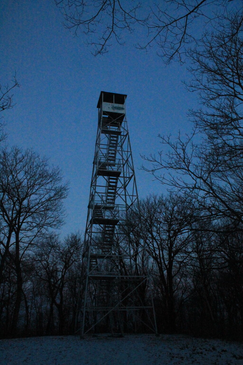
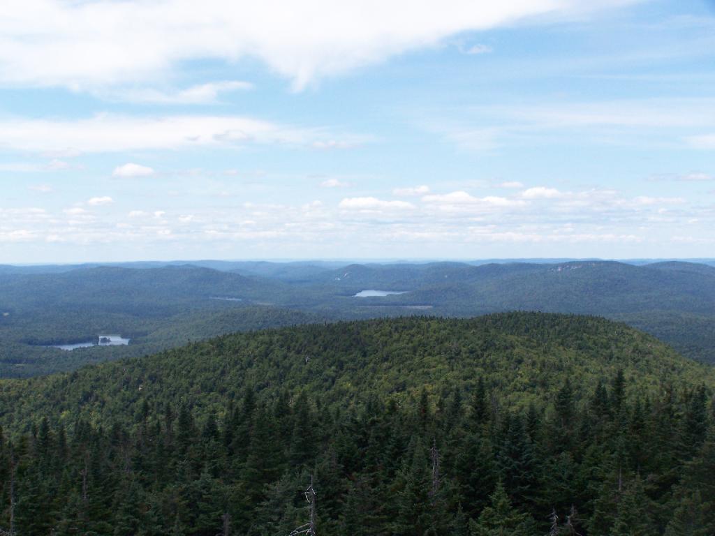
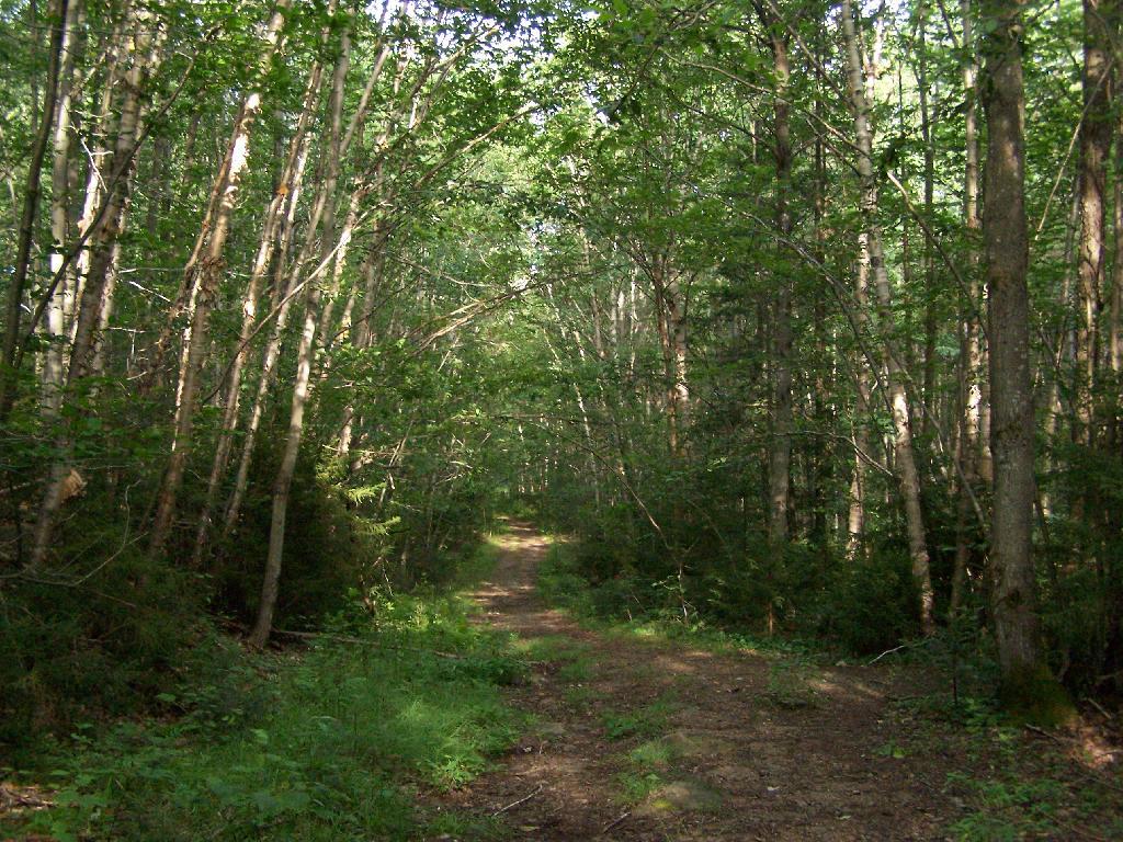
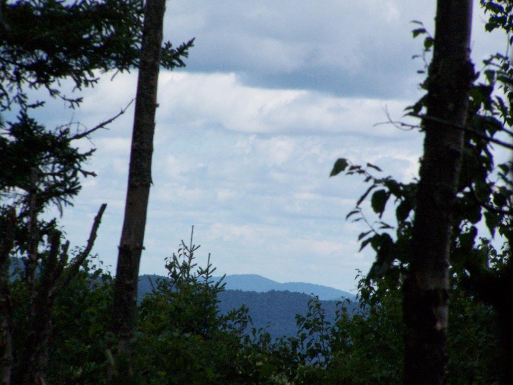
Discover a wealth of information on this page about fire towers situated on state lands, accessible through invigorating hikes that lead to panoramic vistas. Interactive maps guide your exploration, offering insights into the locations and trails leading to these towering viewpoints. Additionally, find convenient links to other pages that delve deeper into fire towers across the entirety of New York State. Embark on a journey that combines outdoor adventure with breathtaking scenery, as you navigate the trails and pathways leading to these historic landmarks that have stood as guardians of the landscape. This resource opens doors to captivating experiences that allow you to savor the beauty of nature from elevated perspectives while providing avenues for further exploration of New York’s fire tower heritage.
Here is a list of Fire Towers on NYS DEC lands. You can get this also on Google Sheets. Does not include the Dickinson Hill Fire Tower in Grafton, which is part of the Grafton Lakes State Park. You might also be interested in nearby camping opportunities.
| Tower | State Land | Notes | Coordinates |
| Azure Mtn. Fire Tower | Debar Mountain Wild Forest | Relatively short hike. | 44.5412601955876, -74.5007131438668 |
| Balsam Lake Mountain | Balsam Lake Mountain Wild Forest | Longer hike along old road. | 42.0453530369935, -74.5943882522534 |
| Belfry Mountain Fire Tower | Hammond Pond Wild Forest | Very short hike up dirt road. | 44.0977783227959, -73.5480575565177 |
| Berry Hill Firetower | Mcdonough State Forest | Only up to second level is open, no upper level access. | 42.5498033738312, -75.6903147862666 |
| Black Mountain Fire Tower | Lake George Wild Forest | Longer hike up a snowmobile trail. | 43.6068253423597, -73.5315598873687 |
| Blue Mountain Fire Tower | Blue Mountain Wild Forest | Very popular, worn-down trail. | 43.8722986188442, -74.4007350580445 |
| Lowville Demostration Area Fire Tower | Lowville Demonstration Area | No access to tower, part of demonstration forest. | 43.8093267984132, -75.4730800808841 |
| Goodnow Mountain Fire Tower | Suny Esf Lands | Open to public, SUNY ESF Lands | 43.9598725064095, -74.2096091339017 |
| Hadley Mountain Fire Tower | Wilcox Lake Wild Forest | Popular hike in Southern Adirondacks. | 43.3769100935034, -73.9709647959219 |
| Hunter Mountain Fire Tower | Hunter-West Kill Wilderness | Multiple approaches to this fire tower offer different hikes with different amounts of work. | 42.1779299997605, -74.2297619994181 |
| Hurricane Mountain Firetower | Hurricane Mountain Primitive Area | The only fire tower remaining in the Adirondack High Peaks. | 44.2352949729449, -73.7101070215222 |
| Kane Mountain | Shaker Mountain Wild Forest | Short hike near Caroga Lake. | 43.1810788942093, -74.5151618559196 |
| Beebe Hill Fire Tower | Beebe Hill State Forest | Shorter hike near Austerlitz and Massachussetts border. | 42.3361525194561, -73.4862760091067 |
| Leonard Hill Fire Tower | Leonard Hill State Forest | You can drive to this tower. Bottom floors removed, no access to tower. | 42.4510039574136, -74.3529141572996 |
| Lyon Mountain Fire Tower | Chazy Highlands Wild Forest | Longer hike, new trail avoids severely erroded old trail | 44.7048354583899, -73.8627762019644 |
| Mount Adam Fire Tower | High Peaks Wilderness | Just south of main high peaks area. | 44.0874829962416, -74.0228637207712 |
| Mount Nimham Fire Tower | Nimham Mountain Mua | Near Beacon | 41.4611546516545, -73.72510657899 |
| Mount Tremper | Phoenicia – Mt. Tobias Wild Forest | Follow an old woods road to summit. | 42.0739476727477, -74.2781528438603 |
| Mt Arab Fire Tower | Horseshoe Lake Wild Forest | Relatively short hike outside of Tupper Lake. | 44.2046152316571, -74.5879293129745 |
| Overlook Mountain | Overlook Mountain Wild Forest | Popular hike outside of Woodstock, follows a gated road. | 42.085023587202, -74.0933592964641 |
| Owls Head Firetower | Sargent Ponds Wild Forest | Moderate hike outside of Long Lake. | 43.9542904615568, -74.4984616500416 |
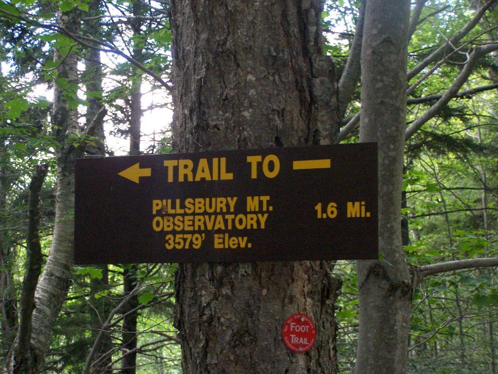
| Pillsbury Mountain Fire Tower | Jessup River Wild Forest | Mile long hike to a firetower with views over Perkins Clearing and areas around Spectulator | 43.5807556043109, -74.5118079500206 |
| Poke-O-Moonshine Fire Tower | Taylor Pond Wild Forest | New trail is less steep and follows old woods road. | 44.4019104158425, -73.5130620065356 |
| Red Hill Fire Tower | Sundown Wild Forest | 1 mile hike to a fairly remote firetower. | 41.9238122519417, -74.5170620256067 |
| Rondaxe Fire Tower | Fulton Chain Wild Forest | Quick hike outside of Old Forge that is very popular. | 43.7385880495938, -74.9129188420394 |
| Roosa Gap Firetower | Roosa Gap State Forest | Firetower on the Long Path in the Shawgunks. | 41.6176280752519, -74.4267422878805 |
| Snowy Mt | Jessup River Wild Forest | Popular hike, one of the more difficult towers to access. | 43.7003213769888, -74.3866001142199 |
| Spruce Mountain Fire Tower | Wilcox Lake Wild Forest | Trail crosses private land, closed during hunting season. | 43.2163188109202, -73.9061192265182 |
| St. Regis Mtn. Fire Tower | Saint Regis Canoe Area | Currently closed to public use. | 44.4085838385311, -74.3296128971506 |
| Stillwater Mountain Fire Tower | Independence River Wild Forest | Near the Stillwater Reservior. | 43.8618343053993, -75.033327606033 |
| Sugar Hill Fire Tower | Sugar Hill State Forest | Observation tower in Finger Lakes, during summer months you can drive to it, part of Six Nations Horse Cap. | 42.3871467022238, -77.0025364212371 |
| Vanderwhacker Mountain Fire Tower | Vanderwhacker Mountain Wild Forest | Rough seasonal road then 2 ½ mile hike. | 43.8982271055416, -74.0959123515681 |
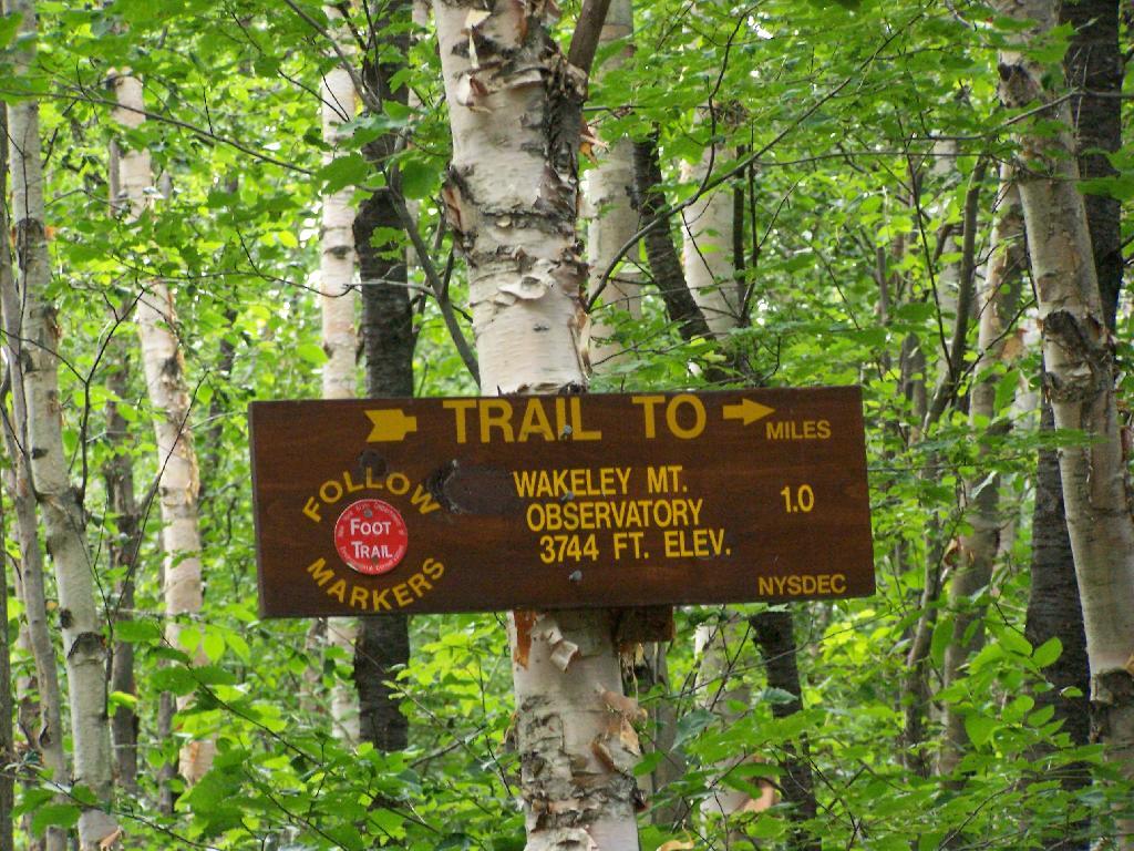
| Wakely Mountain Fire Tower | Wakely Mountain Primitive Area | Near Cedar River Flow at Moose River Plains. Seasonal use road to access. | 43.7358887903725, -74.515229327937 |
| Woodhull Mountain Fire Tower | Black River Wild Forest | One of the longer hikes, part of the trail is an old railroad grade until you climb the peak. | 43.6230161401271, -74.9615452951445 |
Here is an updated list of state land websites for March 2023. The topographic map links will bring you to the latest USGS Topographic Maps for the area, or you can use the listing to bulk download the maps or get the quads you need from USGS Store or your local map seller.
Many of the state lands in New York have DEC websites. Here is an index of all of the webpages about various state lands. Some lands do not have state websites, and therefore do not have links to pages. Updated with UMP, acerage and formatting improvements from DEC data produced March 2016.
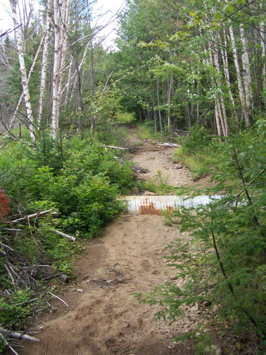
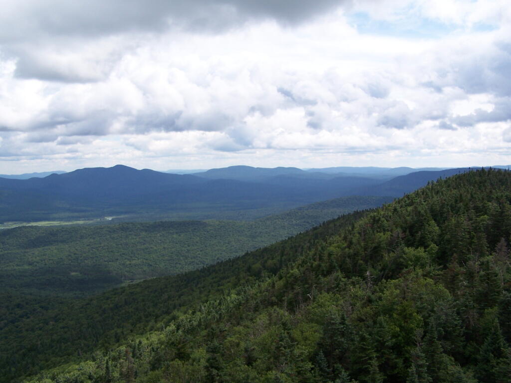
Pillsbury Mountain Firetower is located at the edge of the Jessup River Wild Forest and the West Canada Wilderness. To reach there, you have to drive North of Spectulator, and take about 6 miles of fairly smooth logging roads through International Paper’s Perkins Clearing Easement.
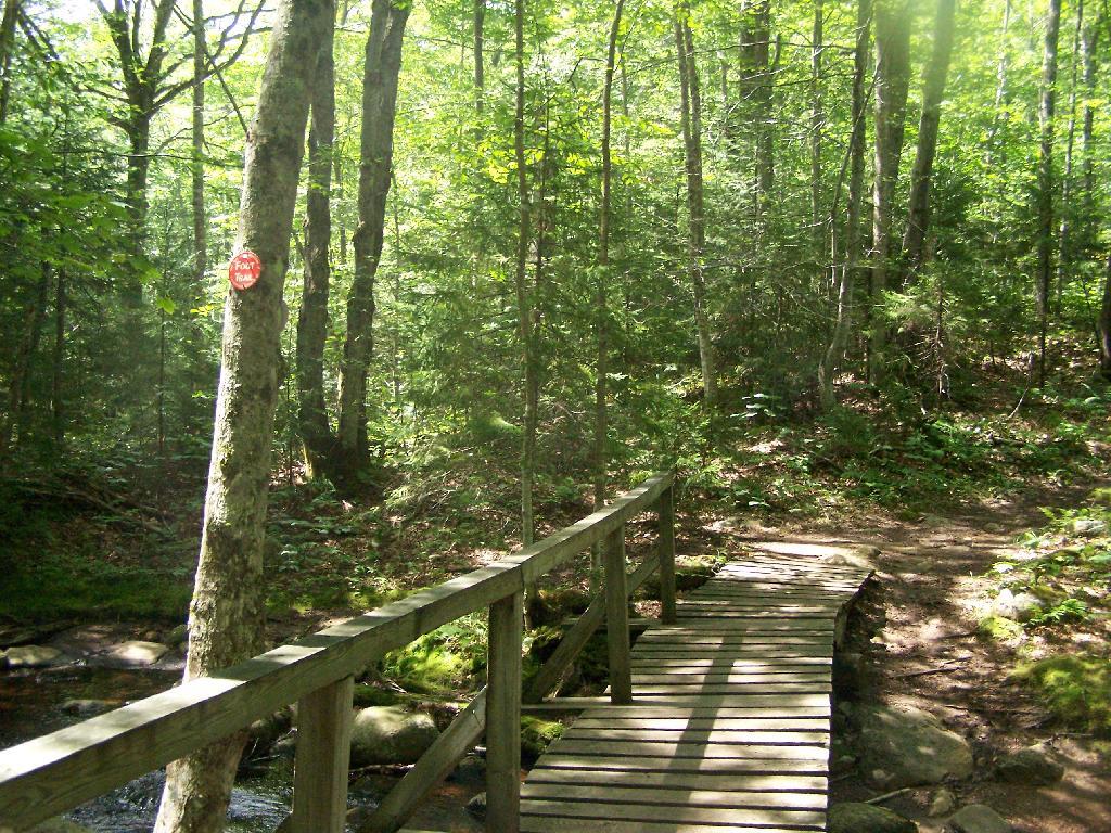
Hiking Bridge Across Miami River. Not that th Miami River really deserves to be called a river, but on the trail up the Pillsbury Mountain, its particularly small.
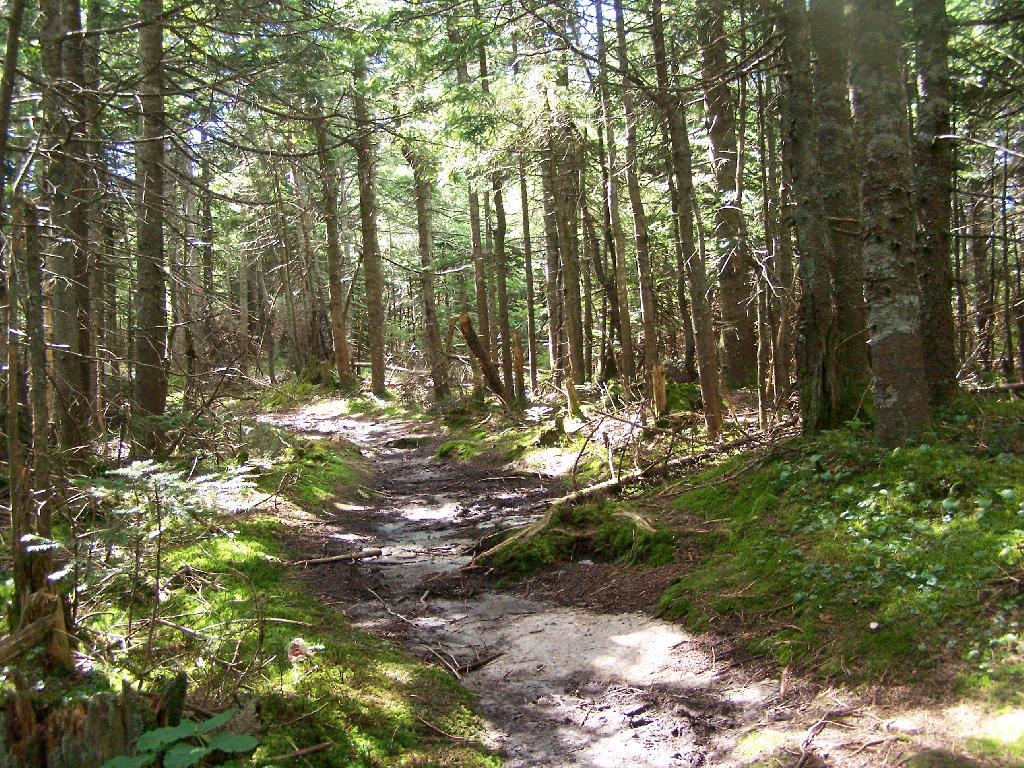
Taking the trail Up Pillsbury Mountain. It’s about two miles long, and not a difficult hike, although you do gain about 1200 in elevation.
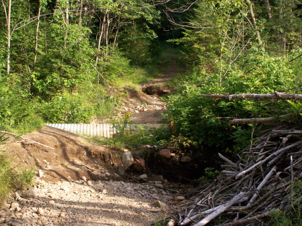
About a 1/4 mile before reaching the tower, reach marshy and thick boreal forest that the trail passes through, with some re-routes to avoid the muck kicked up over the years.
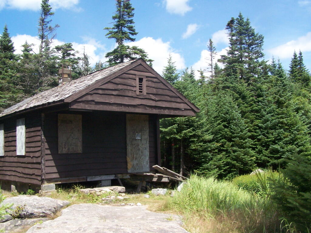
Approaching Fire Tower.
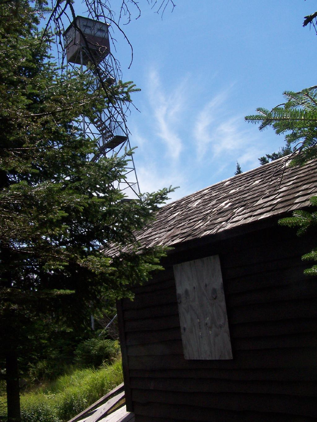
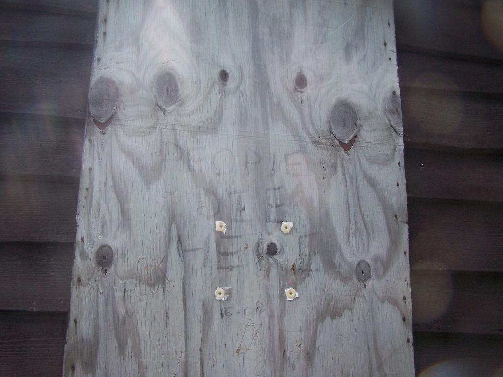
People Die Here. I kid you not, that’s what the cabin says when you first get here. Combined with the creepy fire tower top, it’s kind of neat.
Tower Cabin. That sure looks scary, doesn’t it? Now I understand why people die up here, probably with a secret DEC Forest Ranger, who hides up there, shooting at people he or she doesn’t like. Or maybe not.
The tower is pretty conventional with normal looking landings, a rangers cabin, and a clearing for a helicopter to land in an emergency.
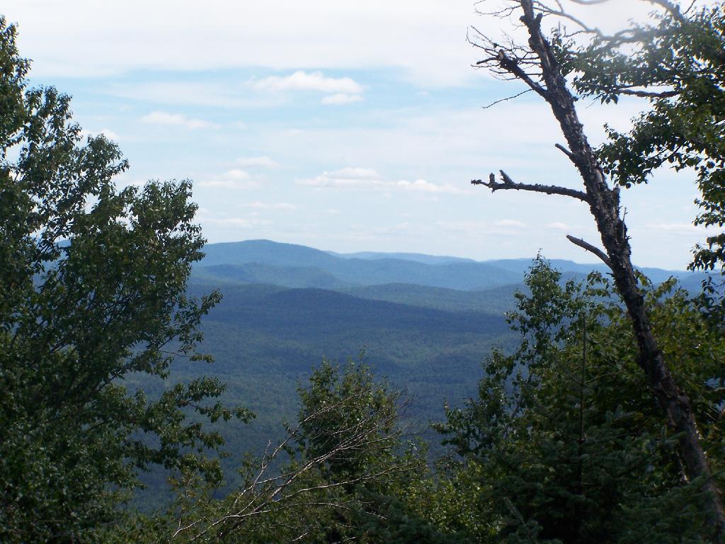
The views from the tower are quite great. Looking east thru the Jessup River Wild Forest.
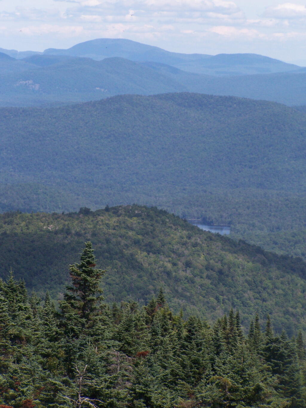
Snowy Mountain to the North. If you look carefully, you can see the tower up top of it.
South towards Lake Pleasant and Spectulator.
Moose River Plans and West Canada Creek Wilderness from Pillsbury Mountain Fire Tower.
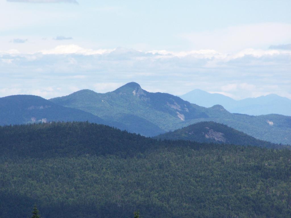
North towards Cedar River Flow and Wakely Mountain. If you look carefully, you should be able to see the Wakely Mountain Firetower from here.
Map of the hike.
View Pillsbury Mountain in a larger map
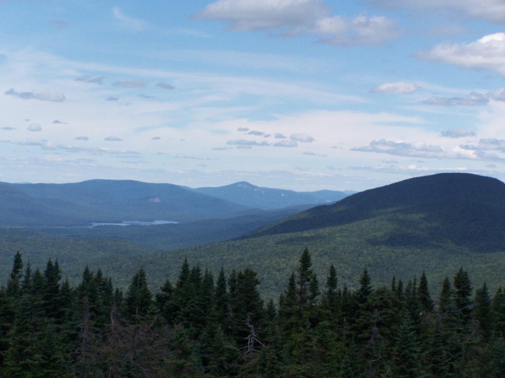
On the afternoon of Thursday July 22nd I hiked up to the Wakley Mountain Firetower. The weather wasn’t perfect, but it was still quite popular, passing several hikers and families visting this tower. The views are pretty good, but probably not as good as Pillsbury Mountain or Snowy Mountain to the south. The nice thing is it’s a 5 minute drive from Cedar River Flow and pretty close from Moose River Plans too, and provides a great overview of the Plains.
You can print the above map, by clicking it, to be taken to a high resolution (500 DPI) that will print nicely on a laser or inkjet printer.
When you first start up the mountain, you pass a “Warning! Road Washed Out” sign. This sign is at the parking area for Wakely Mountain, to warn drivers that they won’t get very far on Wakely Mountain Road, since the DEC has basically abandoned it.
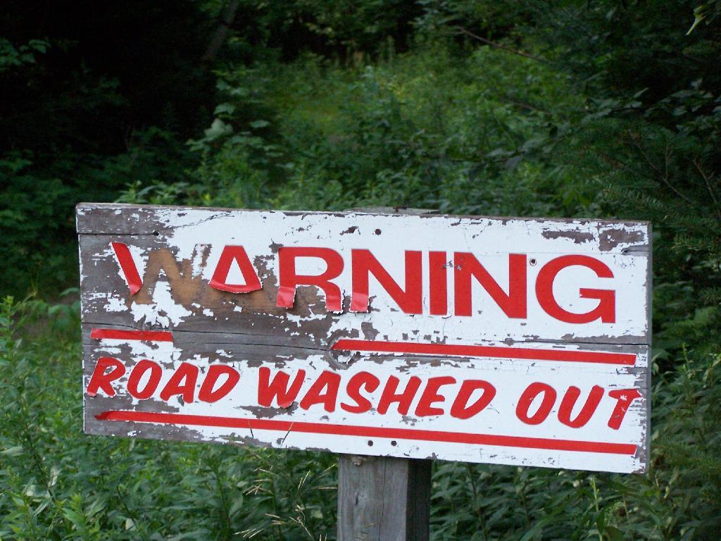
Washed Out Road to Wakely Mountain. I honestly don’t expect the DEC to fix this road, but instead will make people walk the entire 3 miles up the mountain, because that keeps the eco-facists happy.
The End of Wakely Road. That said, you’d be hard press to get a vehicle this far, due to the wash out at the earlier marsh.
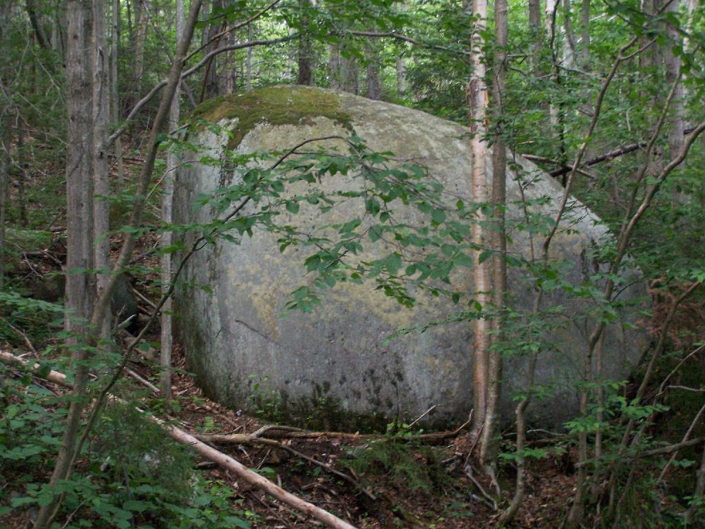
As you climb, you pass this big boulder On side of Wakely.
The first two miles of the trail are pretty flat, a small incline that increases above 400 feet in elevation over two miles.
Marsh Along Wakely Mountain Trail. That’s Payne Mountain, not Wakely Mountain in the background.
The Final Mile. You might think the previous two miles of the Wakely Mountain trail where easy, rising maybe 300 feet, until you hit the last mile, as indicated by this sign. It’s another 1200 feet on up for that last mile.
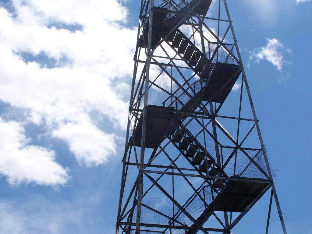
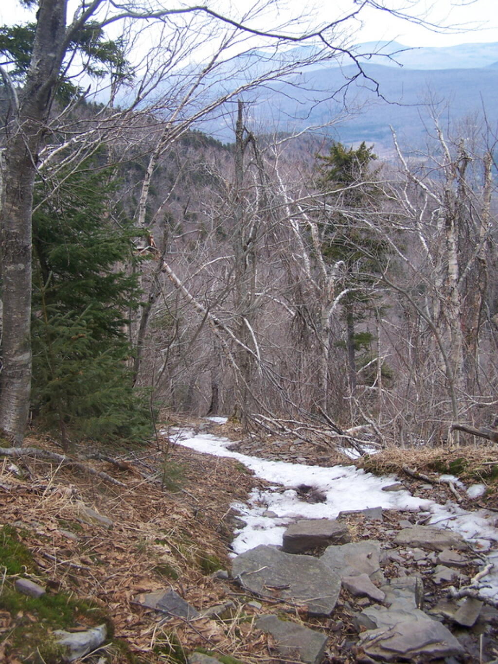
The trail up Wakely Mountain is badly eroded due to heavy use and neglect by the DEC.
The last mile up Wakely Mountain is a long one, especially if you start late in the afternoon as I did. You are treated with some limited views while climbing Wakely Mountain, but all and all, there isn’t a lot to see except steep trail (but no open rock face!).
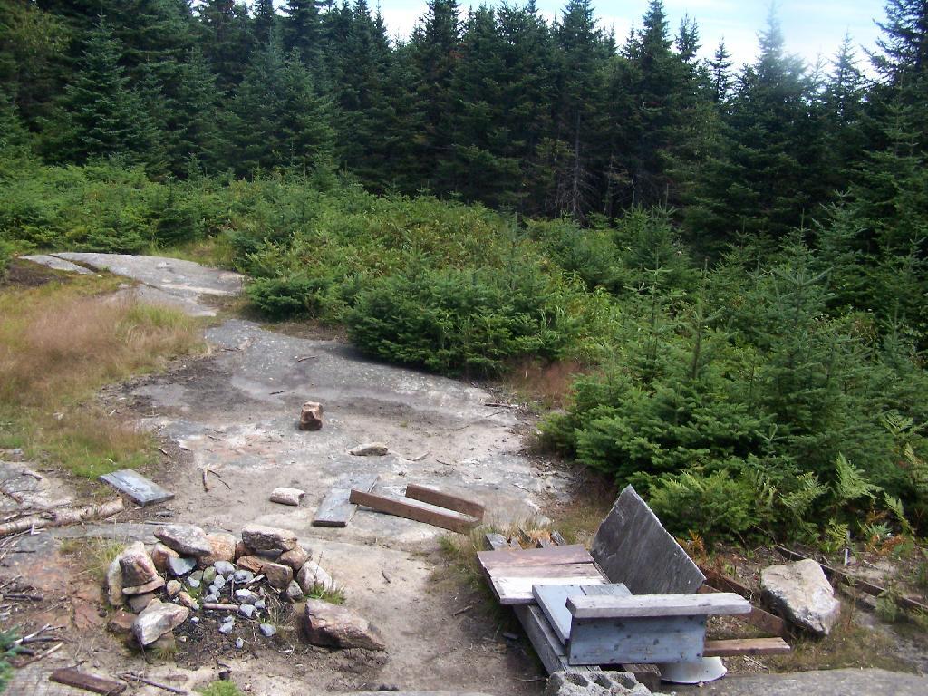
Once you almost reach the top of the mountain, you come to the Wakely Mountain Helipad. This is used by emergency responders, providing quick access to the top of mountain, to either access the tower for observation, or to help those injured on top of the mountain.
Next to helipad is a trash pile. I was wondering how this trash ended up top of the mountain, but after thinking about it a bit, it probably was trash from the ranger’s cabin, that was dumped here some time in the past, and was dug up in the re-construction of the helipad.
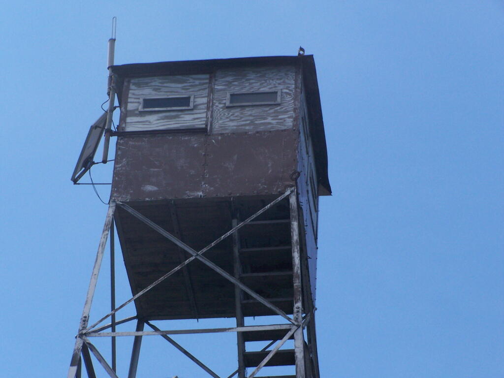
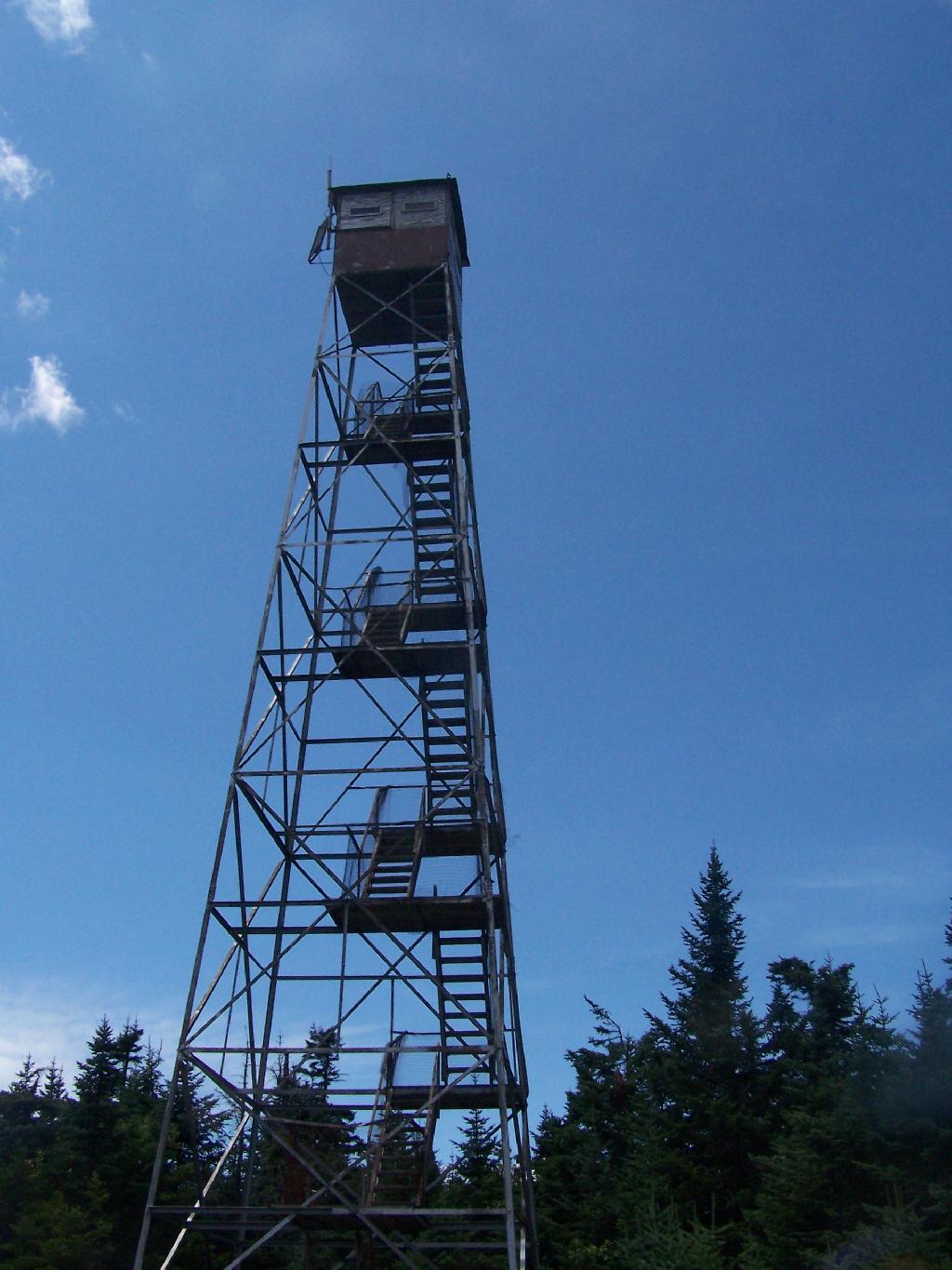
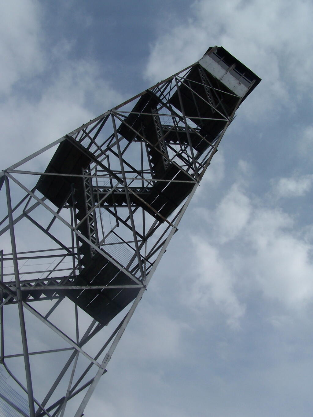
Eventually you reach the fire tower, about a 500 feet from the Helipad. The Wakely Fire Tower is an interesting Aeromotor LS 25 tower, that originally lacked a staircase, but was added in the form of an internal ladder, for the convience of hikers and the fire warden alike. Prior to the 1919 addition of the “stairs tower within the fire tower”, you had to climb a ladder on the side of the tower, to get all 60 feet to the top of the tower.
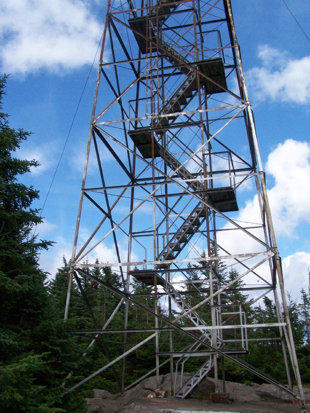
Here is the original ladder you had to climb. They removed the lower flights to discourage people from trying to use the ladder, although the stairs themselves also lack any safety fencing, so it’s a bit scary if your not used to climbing towers.
A close up over the tower within the tower.
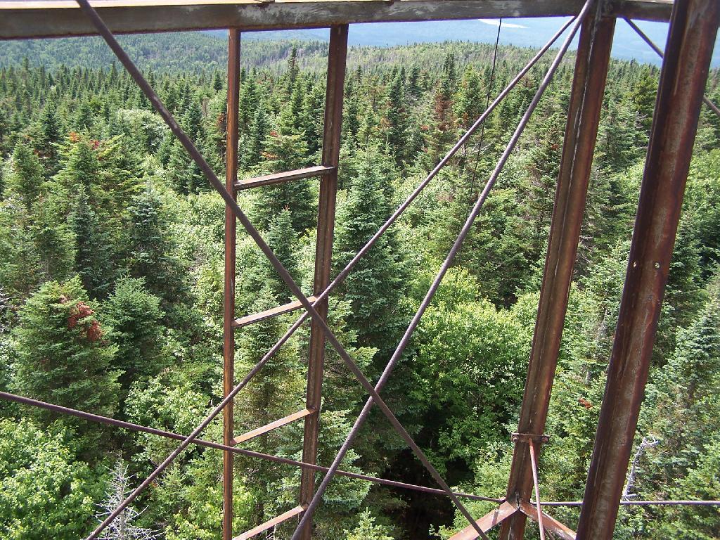
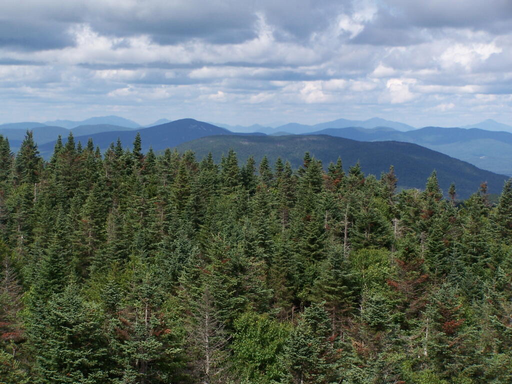
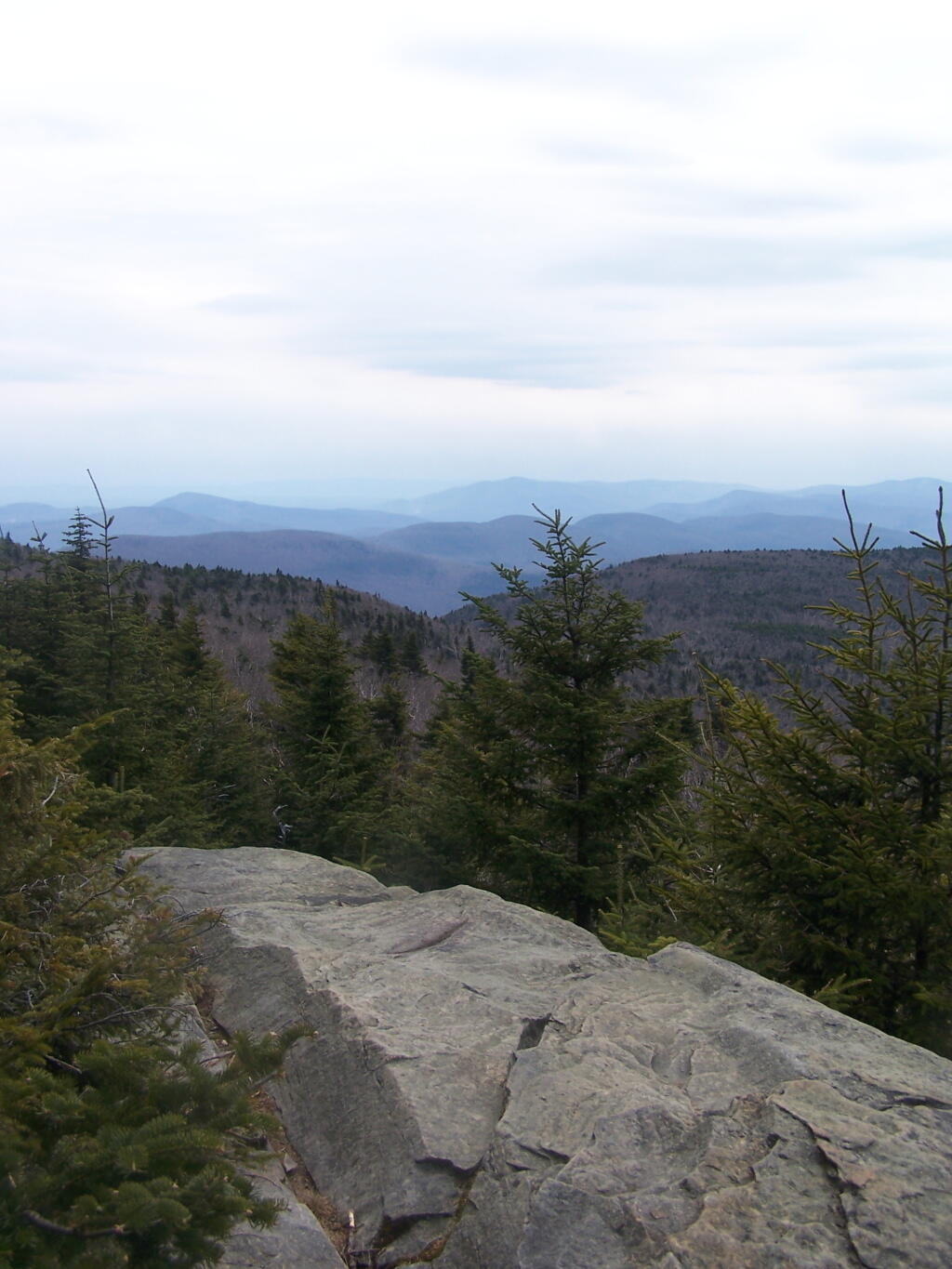
The firetower presents one with spectular views of the upper Moose River Plains, from the marshy end of Cedar River Flow to the Lost Ponds area, to around Wakely Dam and Wakely Pond.
To the east is the Blue Ridge Wilderness and Blue Mountain.
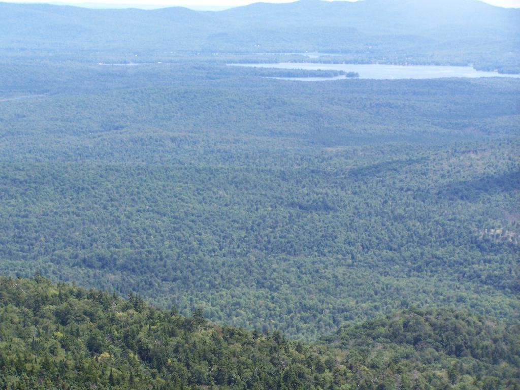
Looking down towards Indian Lake from the Fire Tower. There are many beautiful peaks to the south east.
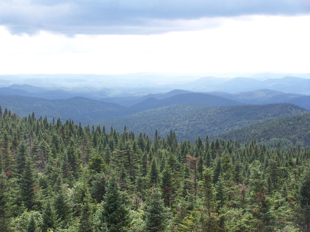
You can also see the High Peaks from Wakley Mountain.
And the Fulton Chain of Lakes.
Cellar Mountain somewhat blocks the views to the west, as you look down to the plains, towards the ridges that follow along the NY 28 Corridor.
The tower’s foundation sadly is in bad shape and needs work. The cabin of the tower is also only accessible via ladder, if your crazy enough to do that. It lacks safety fences on the various landings. Hopefully the state will find the funds and resources to restore this beautiful and popular tower, even though it’s likely to be expensive due to the need to use to Helicopter in supplies and possibly ironworkers to restore it.
A Google Map of the hike…
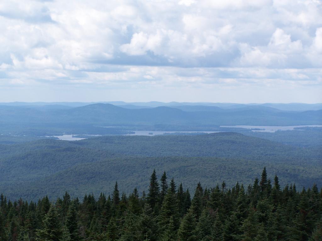
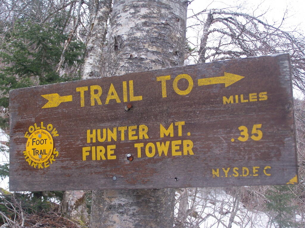
On Friday I hiked up Hunter Mountain, the second tallest peak in the Catskills at 4040′ elevation above sea level. From the trail head you clime 2020′ feet in elevation, about doubling your height, but it’s not that bad when you consider the climb is over 2.5 miles via the Becker Hollow Trail.
It was a beautiful sunny day, although I was well aware that rain was expected by afternoon. I had gotten a late start, not reaching the trail head until about 9:30 AM. It was quite hot going up, in part because there was little shade to hide out under.
The first part of the trail was relatively modest, but it quickly got steeper. It didn’t seem that bad, but I could feel the elevation, and with the sun it was quite warm. I took frequent breaks, stopping for lunch, pictures, water, and just to cool down, especially where I could find shade under the pine trees.
Around 3500 elevation marker, the trail headed south and got snowy and icy. It was a steeper hike, but not any worst then any other of the Catskill peaks. Then the yellow trail split off the blue trail, and it was a 1/4 mile up to the fire tower.
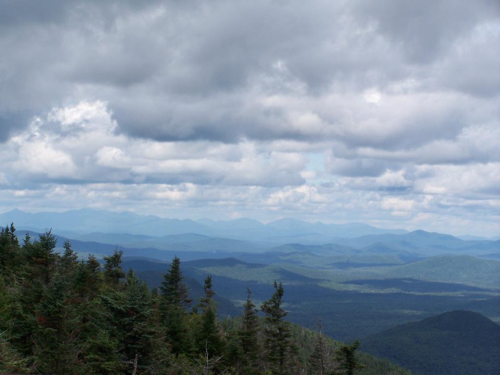
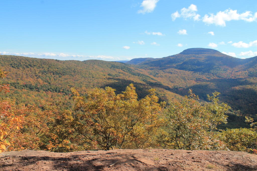
The fire tower is in the middle of the Catskills, so the surrounding mountains block the view of the valley except for a few views, such as down the Palenville Clove. Westerly views are the best, as are some of the southerly views.
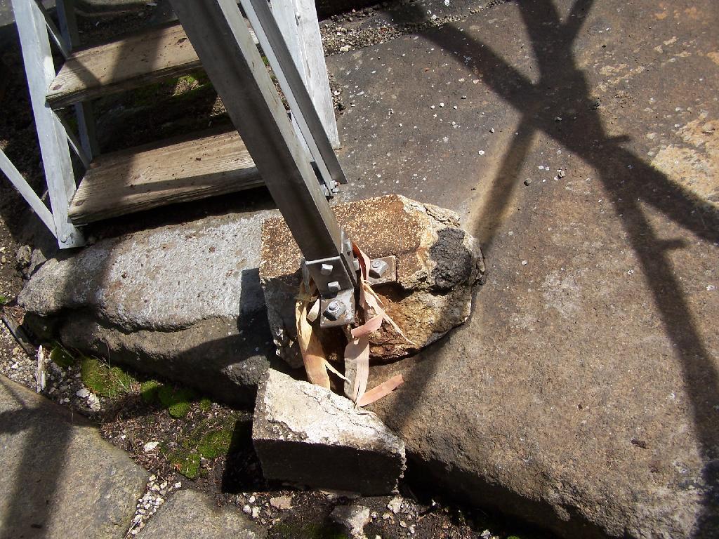
The top deck of the fire tower of is missing the safety screen. Not that it matters much as the railing makes it pretty unlikely to fall, but I still have enough of a fear of heights to be extra careful. Stupid, sure.
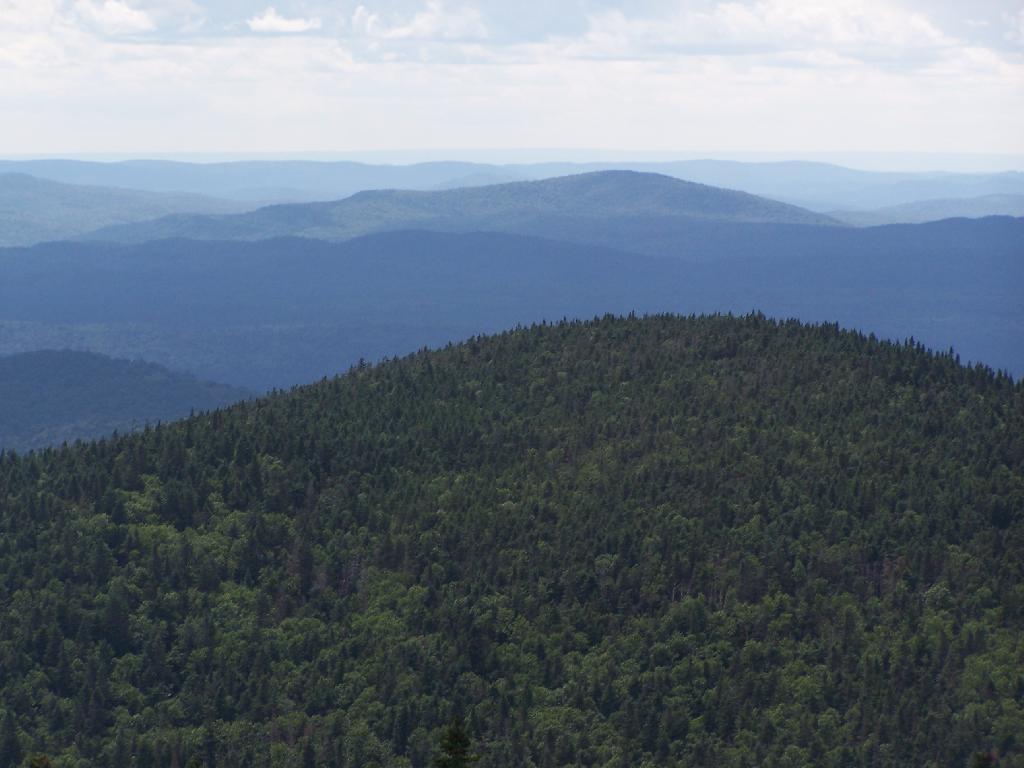
A little ways to the south on the blue trail, about 1/2 mile, there is another view that overlooks the south-west, including West Kill Mountains, Slide Mountain, and Belleayre, all clearly identifiable.
This hike is definitely worthwhile when things are green out, if you enjoy looking at mountains. But it was awful gray out, especially by the time I reached the top, and it had clouded over. The lack of views of the Hudson Valley and the river was somewhat disappointing, but not surprising.
I slipped on some ice on the way down, slide about 10 feet and certainly felt it the next day. Other then that, it was a nice descent, much easier then going up. It started to pour, just about the time I reached my truck.
Be sure to see the Central Catskills Photos, where many are from Hunter Mountain.
Hikers – Trail Head
Purple Line – Becker Hollow Trail
Flag – Hunter Mountain Firetower
Balloon – Hunter Mountain South-West Overlook
There are 229 summits in New York State greater then 3,000 feet elevation.
| Tallest Peak | Summit Name | Elevation | County | USGS Topo Map Name | State Land | Trail | Location |
|---|---|---|---|---|---|---|---|
| 1 | Mount Marcy | 5,344 | Essex | Mount Marcy | High Peaks Wilderness | NA | 44.112733, -73.9237833 |
| 2 | Algonquin Peak | 5,105 | Essex | North Elba | High Peaks Wilderness | Algonquin Trail | 44.1436636, -73.9865357 |
| 3 | Mount Haystack | 4,924 | Essex | Mount Marcy | High Peaks Wilderness | Haystack Trail Via Barklet Ridge | 44.1056093, -73.9004196 |
| 4 | Mount Skylight | 4,908 | Essex | Mount Marcy | High Peaks Wilderness | Skylight Trail | 44.0994987, -73.9306986 |
| 5 | Basin Mountain | 4,852 | Essex | Mount Marcy | High Peaks Wilderness | State Range Trail | 44.1211639, -73.8862527 |
| 6 | Iroquois Peak | 4,829 | Essex | North Elba | High Peaks Wilderness | Iroquois Herd Path Via Boundary Peak | 44.1369973, -73.9982027 |
| 7 | Boundary Peak | 4,826 | Essex | North Elba | High Peaks Wilderness | Iroquois Herd Path Via Boundary Peak | 44.1397749, -73.9937582 |
| 8 | Whiteface Mountain | 4,816 | Essex | Lake Placid | Whiteface Mountain Ski Center | Whiteface Landing To Whiteface Mtn. Trail | 44.3658804, -73.9026456 |
| 9 | Dix Mountain | 4,813 | Essex | Dix Mountain | High Peaks Wilderness | Elk Lake To Dix Mountain Trail | 44.0822756, -73.7862471 |
| 10 | Gray Peak | 4,800 | Essex | Mount Marcy | High Peaks Wilderness | Mount Marcy Trail Via Opalescent River | 44.1114427, -73.9348658 |
| 11 | Schofield Cobble | 4,744 | Essex | Mount Marcy | High Peaks Wilderness | NA | 44.1089427, -73.9270876 |
| 12 | Little Marcy | 4,728 | Essex | Mount Marcy | High Peaks Wilderness | Van Hoevenberg Trail To Marcy | 44.1197753, -73.910976 |
| 13 | Gothics | 4,724 | Essex | Keene Valley | High Peaks Wilderness | Beaver Meadow Falls Trail | 44.1281079, -73.8570849 |
| 14 | Mount Colden | 4,708 | Essex | North Elba | High Peaks Wilderness | Mount Colden Via Lake Arnold | 44.1269976, -73.9598674 |
| 15 | Beck-horn | 4,695 | Essex | Dix Mountain | High Peaks Wilderness | Elk Lake To Dix Mountain Trail | 44.0800534, -73.7845802 |
| 16 | Little Haystack | 4,678 | Essex | Mount Marcy | High Peaks Wilderness | Haystack Trail Via Slant Rock | 44.1103313, -73.9004197 |
| 17 | Giant Mountain | 4,623 | Essex | Rocky Peak Ridge | Giant Mountain Wilderness | North Trail To Giant Mtn. | 44.161165, -73.720279 |
| 18 | Mount Redfield | 4,603 | Essex | Mount Marcy | High Peaks Wilderness | Mt Redfield Trail | 44.094777, -73.949866 |
| 19 | Santanoni Peak | 4,596 | Essex | Santanoni Peak | High Peaks Wilderness | Bradley Pond Trail | 44.0822811, -74.1309855 |
| 20 | Wright Peak | 4,564 | Essex | North Elba | High Peaks Wilderness | Wright Peak Spur Trail | 44.1517187, -73.9801468 |
| 21 | Nippletop | 4,554 | Essex | Dix Mountain | High Peaks Wilderness | Nipple Top Trail | 44.0892202, -73.8159708 |
| 22 | Saddleback Mountain | 4,534 | Essex | North Elba | High Peaks Wilderness | State Range Trail | 44.1264414, -73.8748634 |
| 23 | Panther Peak | 4,455 | Essex | Santanoni Peak | High Peaks Wilderness | Bradley Pond Trail | 44.0983915, -74.132097 |
| 24 | Rocky Peak | 4,403 | Essex | Rocky Peak Ridge | Giant Mountain Wilderness | East Trail To Giant Mtn. Via Rocky Peak Ridge | 44.1542177, -73.7051718 |
| 25 | Macomb Mountain | 4,396 | Essex | Dix Mountain | High Peaks Wilderness | Macomb-E. Dix Trail | 44.0517211, -73.7801349 |
| 26 | Hough Peak | 4,393 | Essex | Dix Mountain | High Peaks Wilderness | S. Dix-Hough Trail | 44.0694981, -73.7776352 |
| 27 | Mount Marshall | 4,380 | Essex | Street Mountain | High Peaks Wilderness | Mt Marshall Trail | 44.1275538, -74.0118142 |
| 28 | Armstrong Mountain | 4,360 | Essex | Keene Valley | High Peaks Wilderness | Adk Range Trail | 44.1347741, -73.8490291 |
| 29 | Seward Mountain | 4,327 | Franklin | Ampersand Lake | High Peaks Wilderness | Seymour Mountain Herd Path | 44.1597799, -74.1993239 |
| 30 | Allen Mountain | 4,321 | Essex | Mount Marcy | High Peaks Wilderness | Mt Redfield Trail | 44.0708892, -73.9395871 |
| 31 | Table Top Mountain | 4,295 | Essex | North Elba | High Peaks Wilderness | Table Top Mountain Trail | 44.143663, -73.9070876 |
| 32 | Big Slide Mountain | 4,232 | Essex | Keene Valley | High Peaks Wilderness | Big Slide Trail | 44.1822721, -73.8704202 |
| 33 | Esther Mountain | 4,232 | Essex | Franklin Falls | Wilmington Wild Forest | Esther Mt Trail | 44.3869916, -73.8898673 |
| 34 | MacIntyre Mountains | 4,193 | Essex | Street Mountain | High Peaks Wilderness | Mt Marshall Trail | 44.1308868, -74.008203 |
| 35 | Lower Wolfjaw Mountain | 4,190 | Essex | Keene Valley | High Peaks Wilderness | W.a. White Trail | 44.1483845, -73.8326399 |
| 36 | Upper Wolfjaw Mountain | 4,190 | Essex | Keene Valley | High Peaks Wilderness | Adk Range Trail | 44.1406072, -73.8451402 |
| 37 | Slide Mountain | 4,167 | Ulster | Peekamoose Mountain | Slide Mountain Wilderness | Burroughs Range Trail-Wittenberg-Cornell | 41.9987034, -74.3862617 |
| 38 | Phelps Mountain | 4,137 | Essex | North Elba | High Peaks Wilderness | Phelps Mtn. Trail | 44.1569957, -73.9209775 |
| 39 | Cascade Mountain | 4,094 | Essex | Keene Valley | High Peaks Wilderness | Casade Mountain Trail | 44.2186594, -73.860143 |
| 40 | South Dix | 4,088 | Essex | Dix Mountain | High Peaks Wilderness | Macomb-E. Dix Trail | 44.060054, -73.7743014 |
| 41 | Lookout Mountain | 4,078 | Essex | Franklin Falls | Whiteface Mountain Ski Center | Esther Mt Trail | 44.3778249, -73.887645 |
| 42 | Donaldson Mountain | 4,062 | Franklin | Ampersand Lake | High Peaks Wilderness | Seymour Mountain Herd Path | 44.1539471, -74.210991 |
| 43 | Seymour Mountain | 4,055 | Franklin | Ampersand Lake | High Peaks Wilderness | Seymour Mountain Herd Path | 44.1578347, -74.1721003 |
| 44 | Colvin Range | 4,049 | Essex | Dix Mountain | High Peaks Wilderness | Colvin Trail | 44.0939424, -73.8345829 |
| 45 | Mount Colvin | 4,049 | Essex | Dix Mountain | High Peaks Wilderness | Colvin Trail | 44.0939424, -73.8345829 |
| 46 | Hunter Mountain | 4,045 | Greene | Hunter | Hunter-West Kill Wilderness | Spruceton Trail | 42.1778662, -74.2304216 |
| 47 | Mount Emmons | 4,022 | Franklin | Ampersand Lake | High Peaks Wilderness | Northville-Placid Trail | 44.1436698, -74.2140464 |
| 48 | Street Mountain | 4,022 | Essex | Street Mountain | High Peaks Wilderness | Street Mountain Trail | 44.1797741, -74.0437616 |
| 49 | Grace Peak | 4,006 | Essex | Dix Mountain | High Peaks Wilderness | Macomb-E. Dix Trail | 44.0653314, -73.7573564 |
| 50 | Yard Mountain | 3,999 | Essex | North Elba | High Peaks Wilderness | Big Slide Trail Via Yard Mtn. | 44.1747725, -73.8845874 |
| 51 | MacNaughton Mountain | 3,983 | Essex | Street Mountain | High Peaks Wilderness | Wall Face Ponds Trail | 44.1397768, -74.064317 |
| 52 | Dial Mountain | 3,980 | Essex | Dix Mountain | High Peaks Wilderness | Leach Trail | 44.1058859, -73.7959703 |
| 53 | Blake Peak | 3,976 | Essex | Dix Mountain | High Peaks Wilderness | Pinnacle Trail | 44.081443, -73.844583 |
| 54 | Green Mountain | 3,976 | Essex | Rocky Peak Ridge | Giant Mountain Wilderness | North Trail To Giant Mtn. | 44.182272, -73.714858 |
| 55 | Black Dome | 3,973 | Greene | Freehold | Windham-Blackhead Range Wilderness | Blackhead Range Trail | 42.2700864, -74.1226382 |
| 56 | Thomas Cole Mountain | 3,944 | Greene | Hensonville | Windham-Blackhead Range Wilderness | Blackhead Range Trail | 42.2709196, -74.1365275 |
| 57 | Cliff Mountain | 3,940 | Essex | Mount Marcy | High Peaks Wilderness | Mount Marcy Trail Via Opalescent River | 44.1031102, -73.9751452 |
| 58 | McDonnel Mountain | 3,940 | Essex | Mount Marcy | High Peaks Wilderness | Mt Redfield Trail | 44.0803332, -73.9340315 |
| 59 | Blackhead | 3,930 | Greene | Freehold | Windham-Blackhead Range Wilderness | Blackhead Mountain Spur Trail | 42.2678644, -74.1045818 |
| 60 | West Kill Mountain | 3,891 | Greene | Lexington | Hunter-West Kill Wilderness | Devil’s Path | 42.1678663, -74.2895904 |
| 61 | Doubletop Mountain | 3,875 | Ulster | Seager | NA | Seager Big Indian Trail | 42.0275913, -74.5282095 |
| 62 | Nye Mountain | 3,871 | Essex | Street Mountain | High Peaks Wilderness | Nye Mountain Trail | 44.1931062, -74.0240387 |
| 63 | Kilburn Mountain | 3,868 | Essex | Lake Placid | Sentinel Range Wilderness | Copperas Owen Pond Trl | 44.3028247, -73.8818114 |
| 64 | Moose Mountain | 3,868 | Essex | McKenzie Mountain | Mckenzie Mountain Wilderness | Mckenzie Mtn. Trail | 44.3506029, -74.0032049 |
| 65 | Howard Mountain | 3,852 | Essex | North Elba | High Peaks Wilderness | Klondike Notch Trail | 44.1583844, -73.8912539 |
| 66 | Cornell Mountain | 3,848 | Ulster | Phoenicia | Slide Mountain Wilderness | Burroughs Range Trail-Wittenberg-Cornell | 42.0014812, -74.3568163 |
| 67 | Graham Mountain | 3,848 | Ulster | Seager | NA | Seager Big Indian Trail | 42.0392576, -74.5495986 |
| 68 | Plateau Mountain | 3,845 | Greene | Hunter | Indian Head Wilderness | Devil’s Path | 42.1378671, -74.1743088 |
| 69 | McKenzie Mountain | 3,842 | Essex | McKenzie Mountain | Mckenzie Mountain Wilderness | Mckenzie Mtn. Trail | 44.3361593, -74.0320951 |
| 70 | Rist Mountain | 3,839 | Essex | Mount Marcy | High Peaks Wilderness | Boreas Road | 44.027559, -73.987366 |
| 71 | Sentinel Mountain | 3,835 | Essex | Keene | Sentinel Range Wilderness | Winch Pond | 44.3061581, -73.8523658 |
| 72 | Lyon Mountain | 3,829 | Clinton | Moffitsville | Chazy Highlands Wild Forest | New Lyon Mountain Trail | 44.7036537, -73.8645877 |
| 73 | T R Mountain | 3,829 | Essex | North Elba | High Peaks Wilderness | Lake Arnold Crossover | 44.143941, -73.9354222 |
| 74 | Snowy Mountain | 3,825 | Hamilton | Snowy Mountain | NA | Snowy Mt | 43.7003432, -74.3859856 |
| 75 | Table Mountain | 3,819 | Ulster | Peekamoose Mountain | Slide Mountain Wilderness | Peekamoose-Table Trail | 41.9587036, -74.4048739 |
| 76 | Peekamoose Mountain | 3,812 | Ulster | Peekamoose Mountain | Slide Mountain Wilderness | Peekamoose-Table Trail | 41.9531481, -74.398207 |
| 77 | Avalanche Mountain | 3,809 | Essex | North Elba | High Peaks Wilderness | Avalanche Pass Trail | 44.1361639, -73.9695903 |
| 78 | Averill Peak | 3,806 | Clinton | Lyon Mountain | Chazy Highlands Wild Forest | New Lyon Mountain Trail | 44.6928208, -73.8809768 |
| 79 | Sugarloaf Mountain | 3,806 | Greene | Hunter | Indian Head Wilderness | Devil’s Path | 42.1312006, -74.1501414 |
| 80 | Couchsachraga Peak | 3,793 | Essex | Santanoni Peak | High Peaks Wilderness | Cold River Horse Trail | 44.0956146, -74.1601539 |
| 81 | Boreas Mountain | 3,779 | Essex | Mount Marcy | NA | Gulf Brook Road | 44.0031138, -73.8806937 |
| 82 | Wittenberg Mountain | 3,766 | Ulster | Phoenicia | Slide Mountain Wilderness | Burroughs Range Trail-Wittenberg-Cornell | 42.0081478, -74.3473716 |
| 83 | Panther Mountain | 3,763 | Hamilton | Snowy Mountain | NA | Snowy Mt | 43.7367317, -74.3907093 |
| 84 | Burroughs Range | 3,760 | Ulster | Phoenicia | Slide Mountain Wilderness | Burroughs Range Trail-Wittenberg-Cornell | 42.0084255, -74.3476494 |
| 85 | Blue Mountain | 3,750 | Hamilton | Blue Mountain Lake | Blue Mountain Wild Forest | Blue Mountain Trail | 43.8725634, -74.4009917 |
| 86 | Porter Mountain | 3,750 | Essex | Keene Valley | High Peaks Wilderness | Porter Mountain Trail Via Marcy Field | 44.2153262, -73.8434754 |
| 87 | Wakely Mountain | 3,750 | Hamilton | Wakely Mountain | Wakely Mountain Primitive Area | Wakely Mountain Trail | 43.7358986, -74.5151595 |
| 88 | Little Nippletop | 3,720 | Essex | Mount Marcy | High Peaks Wilderness | Elk Lake To Marcy Trail | 44.0853327, -73.9201422 |
| 89 | Wallface Mountain | 3,720 | Essex | Street Mountain | High Peaks Wilderness | Indian Pass Trail | 44.1378317, -74.0365378 |
| 90 | Panther Mountain | 3,714 | Ulster | Shandaken | Slide Mountain Wilderness | Giant Ledge-Panther Mountian-Fox Hollow Trail | 42.0564799, -74.3945946 |
| 91 | Balsam Lake Mountain | 3,707 | Ulster | Seager | Balsam Lake Mountain Wild Forest | Balsam Lake Mountain Trail | 42.0459236, -74.5940438 |
| 92 | Henderson Mountain | 3,707 | Essex | Mount Adams | High Peaks Wilderness | Bradley Pond Trail | 44.0978353, -74.0976509 |
| 93 | Hoffman Mountain | 3,701 | Essex | Blue Ridge | Hoffman Notch Wilderness | Hoffman Notch Trail | 43.9114489, -73.8168 |
| 94 | Lone Mountain | 3,697 | Ulster | Peekamoose Mountain | Slide Mountain Wilderness | Peekamoose-Table Trail | 41.9692592, -74.3893177 |
| 95 | Big Indian Mountain | 3,694 | Ulster | Shandaken | Big Indian Wilderness | Pine Hill West Branch Trail | 42.0350915, -74.4965421 |
| 96 | Hurricane Mountain | 3,688 | Essex | Rocky Peak Ridge | Hurricane Mountain Wilderness | East Hurricane Mtn Trial | 44.235326, -73.7106926 |
| 97 | Friday Mountain | 3,681 | Ulster | West Shokan | Slide Mountain Wilderness | Burroughs Range Trail-Wittenberg-Cornell | 41.9875924, -74.3620944 |
| 98 | Rusk Mountain | 3,678 | Greene | Lexington | Rusk Mountain Wild Forest | Spruceton Trail | 42.2006434, -74.2770897 |
| 99 | Cheney Cobble | 3,674 | Essex | Mount Marcy | High Peaks Wilderness | East River Trail | 44.0445021, -73.9648654 |
| 100 | Lewey Mountain | 3,665 | Hamilton | Snowy Mountain | West Canada Lake Wilderness | Sucker Brook Trail | 43.6642328, -74.4412649 |
| 101 | Seward Mountains | 3,665 | Franklin | Ampersand Lake | High Peaks Wilderness | Calkins Creek Truck Trail | 44.1561694, -74.2148801 |
| 102 | Santanoni Mountains | 3,661 | Essex | Santanoni Peak | High Peaks Wilderness | Bradley Pond Trail | 44.0881144, -74.138486 |
| 103 | Buell Mountain | 3,652 | Hamilton | Snowy Mountain | NA | Snowy Mt | 43.7161764, -74.4065426 |
| 104 | High Peak | 3,645 | Greene | Kaaterskill Clove | Kaaterskill Wild Forest | Kaaterskill High Peak Trail | 42.1620334, -74.0801381 |
| 105 | Little Whiteface Mountain | 3,638 | Essex | Lake Placid | Whiteface Mountain Ski Center | Whiteface Landing To Whiteface Mtn. Trail | 44.3558804, -73.891534 |
| 106 | Burtons Peak | 3,632 | Essex | Keene Valley | NA | The Brothers Trail | 44.1925, -73.8586111 |
| 107 | Fir Mountain | 3,629 | Ulster | Shandaken | Big Indian Wilderness | Pine Hill West Branch Trail | 42.0275916, -74.4690414 |
| 108 | Twin Mountain | 3,629 | Greene | Hunter | Indian Head Wilderness | Devil’s Path | 42.1256453, -74.1290294 |
| 109 | Little Moose Mountain | 3,609 | Hamilton | Wakely Mountain | Little Moose Wilderness | Otter Brook Trail | 43.6700663, -74.5707151 |
| 110 | Balsam Mountain | 3,606 | Ulster | Shandaken | Big Indian Wilderness | Pine Hill West Branch Trail | 42.0909235, -74.4882082 |
| 111 | Calamity Mountain | 3,606 | Essex | Mount Adams | High Peaks Wilderness | Calamity Brook Trail | 44.1028328, -74.0043132 |
| 112 | Sunrise Mountain | 3,606 | Essex | Dix Mountain | High Peaks Wilderness | Elk Lake To Dix Mountain Trail | 44.0247778, -73.7904124 |
| 113 | Balsam Cap | 3,602 | Ulster | West Shokan | Slide Mountain Wilderness | Burroughs Range Trail-Wittenberg-Cornell | 41.9770369, -74.3573722 |
| 114 | Stewart Mountain | 3,602 | Essex | Keene | Sentinel Range Wilderness | Winch Pond | 44.3261581, -73.8562549 |
| 115 | North Dome | 3,596 | Greene | Lexington | Hunter-West Kill Wilderness | Devil’s Path | 42.1734217, -74.3490366 |
| 116 | Pillsbury Mountain | 3,589 | Hamilton | Spruce Lake | West Canada Lake Wilderness | Pillsbury Mountain Trail | 43.580901, -74.5120992 |
| 117 | Slide Mountain | 3,586 | Essex | Lake Placid | Sentinel Range Wilderness | Barkeater Cliffs Campsite Trail | 44.2767136, -73.8862561 |
| 118 | Eagle Mountain | 3,573 | Ulster | Seager | Big Indian Wilderness | Pine Hill West Branch Trail | 42.0620352, -74.50932 |
| 119 | Dun Brook Mountain | 3,563 | Hamilton | Dun Brook Mountain | NA | Deer Pond Road | 43.890897, -74.3187666 |
| 120 | Saddleback Mountain | 3,560 | Essex | Jay Mountain | Jay Mountain Wilderness | Jay Mountain Trail | 44.2953258, -73.6676367 |
| 121 | Indian Head Mountain | 3,553 | Greene | Woodstock | Indian Head Wilderness | Devil’s Path | 42.116201, -74.1145846 |
| 122 | Fishing Brook Mountain | 3,550 | Essex | Dun Brook Mountain | Blue Mountain Wild Forest | Deer Pond Road | 43.9342303, -74.2946002 |
| 123 | Mount Sherrill | 3,550 | Greene | Lexington | Hunter-West Kill Wilderness | Devil’s Path | 42.1756439, -74.3729262 |
| 124 | Gooseberry Mountain | 3,540 | Essex | Keene Valley | High Peaks Wilderness | Orebed Brook Trail | 44.1367187, -73.8731969 |
| 125 | Bearpen Mountain | 3,530 | Delaware | Prattsville | Bearpen Mountain State Forest | Access Trail | 42.2734189, -74.4840396 |
| 126 | Vly Mountain | 3,530 | Greene | West Kill | Bearpen Mountain State Forest | Snowmobile Trail | 42.2453645, -74.4459834 |
| 127 | Windham High Peak | 3,527 | Greene | Hensonville | Windham-Blackhead Range Wilderness | Escarpment Trail | 42.3148069, -74.1434718 |
| 128 | Halcott Mountain | 3,524 | Greene | West Kill | Halcott Mountain Wild Forest | Condon Hollow Rd. | 42.1800882, -74.4379281 |
| 129 | Mount Adams | 3,520 | Essex | Mount Adams | High Peaks Wilderness | Mt Adams Trail | 44.0867231, -74.0257027 |
| 130 | Pitchoff Mountain | 3,501 | Essex | North Elba | Sentinel Range Wilderness | Pitchoff Mountain Trail | 44.2375474, -73.8776443 |
| 131 | Noonmark Mountain | 3,491 | Essex | Keene Valley | High Peaks Wilderness | Stimson Trail | 44.1289404, -73.7720809 |
| 132 | Rocky Mountain | 3,478 | Ulster | West Shokan | Slide Mountain Wilderness | Peekamoose-Table Trail | 41.9728703, -74.3726505 |
| 133 | Little Santanoni Mountain | 3,471 | Essex | Santanoni Peak | High Peaks Wilderness | Moose Pond Horse Trail | 44.0731156, -74.1670981 |
| 134 | Spotted Mountain | 3,461 | Essex | Underwood | High Peaks Wilderness | Macomb-E. Dix Trail | 44.0769975, -73.7440228 |
| 135 | Manbury Mountain | 3,455 | Hamilton | Wakely Mountain | Little Moose Wilderness | Otter Brook Trail | 43.6653442, -74.5532143 |
| 136 | Blue Ridge Mountain | 3,451 | Essex | Blue Ridge | Hoffman Notch Wilderness | Hoffman Notch Trail | 43.9247817, -73.8148558 |
| 137 | Roundtop | 3,451 | Delaware | Prattsville | Bearpen Mountain State Forest | Ski Run Road | 42.2939737, -74.4904283 |
| 138 | Roundtop Mountain | 3,451 | Greene | Kaaterskill Clove | Kaaterskill Wild Forest | Kaaterskill High Peak Trail | 42.1684222, -74.094583 |
| 139 | Olderbark Mountain | 3,438 | Greene | Bearsville | Indian Head Wilderness | Mink Hollow Trail | 42.1142565, -74.1909765 |
| 140 | Puffer Mountain | 3,438 | Hamilton | Bullhead Mountain | Siamese Ponds Wilderness | Puffer Pond Brook Trail | 43.6617318, -74.1993082 |
| 141 | Morgan Mountain | 3,432 | Essex | Wilmington | Wilmington Wild Forest | Cooper Kill Trail | 44.4186582, -73.8593108 |
| 142 | Wolf Pond Mountain | 3,425 | Essex | Cheney Pond | NA | Gulf Brook Road | 43.9892253, -73.8781933 |
| 143 | Stoppel Point | 3,422 | Greene | Kaaterskill Clove | Windham-Blackhead Range Wilderness | Escarpment Trail | 42.2250879, -74.0651364 |
| 144 | Huntersfield Mountain | 3,419 | Greene | Ashland | Huntersfield State Forest | Huntersfield Access Trail #8/Long Path Access | 42.355638, -74.3465339 |
| 145 | Cellar Mountain | 3,405 | Hamilton | Wakely Mountain | Moose River Plains Wild Forest | Cellar Pond Trail | 43.7122879, -74.5429375 |
| 146 | Haynes Mountain | 3,405 | Ulster | Seager | Big Indian Wilderness | Pine Hill West Branch Trail | 42.0792571, -74.5079309 |
| 147 | Sawtooth Mountains | 3,402 | Franklin | Street Mountain | High Peaks Wilderness | Northville-Placid Trail | 44.1928314, -74.1134874 |
| 148 | Bear Den Mountain | 3,389 | Essex | Dix Mountain | High Peaks Wilderness | Leach Trail | 44.1194964, -73.792915 |
| 149 | Pinnacle | 3,389 | Essex | Dix Mountain | High Peaks Wilderness | Pinnacle Trail Spur To Summit | 44.0583887, -73.8640277 |
| 150 | Vanderwhacker Mountain | 3,389 | Essex | Vanderwhacker Mountain | Vanderwhacker Mountain Wild Forest | Vanderwhacker Firetower Trail | 43.8983963, -74.0959781 |
| 151 | Jay Mountain | 3,379 | Essex | Jay Mountain | Jay Mountain Wilderness | Jay Mountain Trail | 44.3125477, -73.685693 |
| 152 | Spruce Top | 3,379 | Greene | Hunter | NA | Devil’s Path | 42.1506447, -74.1679195 |
| 153 | Spruce Mountain | 3,376 | Ulster | Shandaken | Big Indian Wilderness | Phoenicia East Branch Trail | 42.0175919, -74.4498744 |
| 154 | Belle Ayr Mountain | 3,373 | Ulster | Shandaken | Belleayre Mountain Ski Center | NA | 42.1159229, -74.4979304 |
| 155 | Evergreen Mountain | 3,369 | Greene | Lexington | Rusk Mountain Wild Forest | Devil’s Path | 42.2117542, -74.3079238 |
| 156 | Hedgehog Mountain | 3,366 | Essex | Keene Valley | High Peaks Wilderness | Rooster Comb And Hedgehog Trail | 44.159495, -73.8109724 |
| 157 | Balsam Mountain | 3,353 | Greene | West Kill | Hunter-West Kill Wilderness | Condon Hollow Rd. | 42.1836992, -74.387371 |
| 158 | Kempshall Mountain | 3,350 | Hamilton | Kempshall Mountain | High Peaks Wilderness | Northville-Placid Trail | 44.0236734, -74.3271041 |
| 159 | Buck Mountain | 3,346 | Hamilton | Snowy Mountain | West Canada Lake Wilderness | Snowy Mt | 43.6947879, -74.4368212 |
| 160 | Mount Pisgah | 3,340 | Delaware | Margaretville | NA | Mountain Brook Road | 42.2211973, -74.7357125 |
| 161 | MacDonough Mountain | 3,320 | Essex | Jay Mountain | Jay Mountain Wilderness | Jay Mountain Trail | 44.3050482, -73.644025 |
| 162 | Debar Mountain | 3,317 | Franklin | Debar Mountain | Debar Mountain Wild Forest | Debar Mountain Trail | 44.6033852, -74.2204351 |
| 163 | Bullhead Mountain | 3,314 | Warren | Bullhead Mountain | Siamese Ponds Wilderness | John Pond Crossover Trail | 43.7017316, -74.1804199 |
| 164 | Laramore Mountain | 3,314 | Essex | Keene Valley | High Peaks Wilderness | Casade Mountain Trail | 44.2258813, -73.8501427 |
| 165 | Tripod Mountain | 3,307 | Essex | Rocky Peak Ridge | Giant Mountain Wilderness | Hopkin Via Direct Trail | 44.1983824, -73.736248 |
| 166 | Metcalf Mountain | 3,304 | Hamilton | Blue Mountain Lake | Blue Ridge Wilderness | Gould Road | 43.7522873, -74.4957146 |
| 167 | Wyman Mountain | 3,304 | Essex | Underwood | High Peaks Wilderness | Macomb-E. Dix Trail | 44.0581093, -73.7445779 |
| 168 | Jay Mountains | 3,297 | Essex | Jay Mountain | Jay Mountain Wilderness | Jay Mountain Trail | 44.308659, -73.6704147 |
| 169 | Eleventh Mountain | 3,294 | Warren | Bakers Mills | Siamese Ponds Wilderness | Bog Meadow Trail | 43.6142322, -74.0720783 |
| 170 | Schultice Mountain | 3,284 | Delaware | Roxbury | NA | Ski Run Road | 42.3186948, -74.5157062 |
| 171 | Cellar Mountain | 3,281 | Hamilton | Snowy Mountain | West Canada Lake Wilderness | Sucker Brook Trail | 43.6411776, -74.4443199 |
| 172 | Plattekill Mountain | 3,268 | Delaware | Hobart | Plattekill State Forest | Mountain Brook/ Harold Roberts Access Trail | 42.2667522, -74.6482102 |
| 173 | South Pond Mountain | 3,258 | Hamilton | South Pond Mountain | Siamese Ponds Wilderness | County Line Brook Trail | 43.5900656, -74.2204175 |
| 174 | Hemlock Mountain | 3,248 | Ulster | Shandaken | Big Indian Wilderness | Phoenicia East Branch Trail | 42.0128698, -74.4390407 |
| 175 | Peaked Mountain | 3,235 | Essex | Jay Mountain | Hurricane Mountain Wilderness | Soda Range Trail | 44.2656034, -73.6993039 |
| 176 | Onteora Mountain | 3,232 | Greene | Hunter | NA | Blackhead Range Trail | 42.2223098, -74.1679184 |
| 177 | Kitty Cobble | 3,225 | Hamilton | Wakely Mountain | West Canada Lake Wilderness | Otter Brook Trail | 43.6295111, -74.6229377 |
| 178 | Baldwin Hill | 3,218 | Essex | Franklin Falls | Mckenzie Mountain Wilderness | Esther Mt Trail | 44.3847694, -73.9195905 |
| 179 | Richmond Mountain | 3,218 | Greene | Ashland | Mount Pisgah State Forest | Long Path Hiking Trail | 42.367582, -74.270976 |
| 180 | Squaw Mountain | 3,218 | Hamilton | Indian Lake | NA | Snowy Mt | 43.7270094, -74.3420956 |
| 181 | Dug Mountain | 3,215 | Hamilton | Kunjamuk River | NA | Long Pond Trail | 43.583122, -74.345146 |
| 182 | Hamilton Mountain | 3,215 | Hamilton | Wells | Silver Lake Wilderness | West River Road | 43.412013, -74.3673645 |
| 183 | Mount Alton | 3,212 | Essex | Lake Placid | Mckenzie Mountain Wilderness | Whiteface Mountain Trail | 44.3717139, -73.9662589 |
| 184 | Utsayantha Mountain | 3,209 | Delaware | Stamford | NA | Ward Allen Road | 42.3992472, -74.5895953 |
| 185 | Van Wyck Mountain | 3,202 | Ulster | Peekamoose Mountain | Slide Mountain Wilderness | Phoenicia East Branch Trail | 41.9523147, -74.4354304 |
| 186 | Colonels Chair | 3,199 | Greene | Hunter | NA | Colonel’s Chair Trail | 42.2006434, -74.2306991 |
| 187 | Gore Mountain | 3,199 | Warren | Gore Mountain | Gore Mountain Ski Center | Schaefer Trail | 43.6764539, -74.035134 |
| 188 | Chase Mountain | 3,192 | Essex | Rocky Peak Ridge | Hurricane Mountain Wilderness | North Hurricane Trail | 44.2417145, -73.7248599 |
| 189 | Knob Lock Mountain | 3,192 | Essex | Rocky Peak Ridge | Giant Mountain Wilderness | Hurricane Trail From 9n | 44.2003271, -73.7073583 |
| 190 | McGregor Mountain | 3,192 | Delaware | Stamford | Stamford Fp Detached Parcel | Relay Public Forest Access Road | 42.3900808, -74.5790396 |
| 191 | Weston Mountain | 3,192 | Essex | Jay Mountain | Hurricane Mountain Wilderness | Soda Range Trail | 44.2642144, -73.7079152 |
| 192 | Burnt Knob | 3,189 | Greene | Freehold | Windham-Blackhead Range Wilderness | Escarpment Trail | 42.3020297, -74.1190264 |
| 193 | Burgess Mountain | 3,189 | Hamilton | Rock Lake | NA | Bear Trap Brook Trail | 43.7520092, -74.3565416 |
| 194 | North Mountain | 3,186 | Greene | Kaaterskill Clove | Windham-Blackhead Range Wilderness | Escarpment Trail | 42.2175881, -74.0487469 |
| 195 | Payne Mountain | 3,182 | Hamilton | Snowy Mountain | Moose River Plains Wild Forest | Northville-Placid Trail | 43.7231211, -74.4951582 |
| 196 | Hopkins Mountain | 3,169 | Essex | Rocky Peak Ridge | Giant Mountain Wilderness | Hopkins Mtn. Via Spread Eagle Mtn. | 44.1833828, -73.7490257 |
| 197 | Spruce Lake Mountain | 3,163 | Hamilton | Spruce Lake Mountain | West Canada Lake Wilderness | Northville-Placid Trail | 43.5120126, -74.6532121 |
| 198 | Tongue Mountain | 3,159 | Hamilton | Dun Brook Mountain | NA | Northville-Placid Trail | 43.9114522, -74.3454349 |
| 199 | Catamount Mountain | 3,153 | Clinton | Wilmington | Taylor Pond Wild Forest | Catamount Trail | 44.459214, -73.8723668 |
| 200 | Wildcat Mountain | 3,153 | Ulster | Peekamoose Mountain | Slide Mountain Wilderness | Pine Hill West Branch Trail | 41.9775924, -74.4759867 |
| 201 | White Man Mountain | 3,146 | Delaware | Roxbury | NA | Access Trail | 42.2845295, -74.5340406 |
| 202 | Bradley Mountain | 3,140 | Hamilton | Wakely Mountain | Blue Ridge Wilderness | Cellar Pond Trail | 43.7378431, -74.5546055 |
| 203 | Overlook Mountain | 3,136 | Ulster | Woodstock | Overlook Mountain Wild Forest | Firetower Spur | 42.0850905, -74.0931954 |
| 204 | Mount Tamarac | 3,127 | Essex | McKenzie Mountain | Mckenzie Mountain Wilderness | Jackrabbit Trail | 44.3267144, -74.0204281 |
| 205 | Mount Morris | 3,117 | Franklin | Tupper Lake | NA | Goodman Mountain Trail | 44.1595046, -74.475168 |
| 206 | Acra Point | 3,110 | Greene | Freehold | Windham-Blackhead Range Wilderness | Escarpment Trail | 42.2964745, -74.0998591 |
| 207 | Round Mountain | 3,107 | Essex | Keene Valley | High Peaks Wilderness | Weston Trail Spur To Round Mt | 44.1317179, -73.7515245 |
| 208 | Cave Mountain | 3,104 | Greene | Hensonville | Elm Ridge Wild Forest | North Face Trail | 42.2859185, -74.2462543 |
| 209 | Pete Gay Mountain | 3,097 | Warren | Gore Mountain | NA | Schaefer Trail | 43.6903427, -74.0443015 |
| 210 | Plattekill Mountain | 3,091 | Greene | Woodstock | Indian Head Wilderness | Overlook Trail | 42.1073123, -74.0865281 |
| 211 | Mount Andrew | 3,081 | Essex | Mount Adams | High Peaks Wilderness | Bradley Pond Trail | 44.0564482, -74.093483 |
| 212 | County Line Mountain | 3,081 | Hamilton | South Pond Mountain | Siamese Ponds Wilderness | Siamese Ponds Trail | 43.6114543, -74.2006952 |
| 213 | High Point | 3,074 | Ulster | West Shokan | Sundown Wild Forest | Ashokan High Point | 41.9248149, -74.2879263 |
| 214 | Rose Mountain | 3,074 | Ulster | West Kill | NA | Rochester Hollow | 42.1506445, -74.4379284 |
| 215 | Cowan Mountain | 3,068 | Delaware | Hobart | NA | Relay Public Forest Access Road | 42.3450825, -74.6498756 |
| 216 | Round Top | 3,068 | Delaware | Hobart | Plattekill State Forest | Mountain Brook/ Harold Roberts Access Trail | 42.2714741, -74.6832109 |
| 217 | Churchill Mountain | 3,064 | Delaware | Stamford | NA | Relay Public Forest Access Road | 42.388692, -74.6098738 |
| 218 | Irish Mountain | 3,064 | Delaware | Roxbury | NA | Ski Run Road | 42.3356386, -74.5262617 |
| 219 | Swart Mountain | 3,061 | Hamilton | Lake Pleasant | Silver Lake Wilderness | West River Road | 43.3967355, -74.3815314 |
| 220 | Scarface Mountain | 3,058 | Essex | McKenzie Mountain | Saranac Lakes Wild Forest | Scarface Mountain Trail | 44.2647717, -74.0737646 |
| 221 | T Lake Mountain | 3,058 | Hamilton | Piseco Lake | West Canada Lake Wilderness | T Lake Trail | 43.4470133, -74.5770967 |
| 222 | Bailey Hill | 3,054 | Essex | Cheney Pond | Hoffman Notch Wilderness | Hoffman Notch Trail | 43.9108943, -73.9026366 |
| 223 | Bald Peak | 3,054 | Essex | Rocky Peak Ridge | Giant Mountain Wilderness | East Trail To Giant Mtn. Via Rocky Peak Ridge | 44.1597731, -73.6654114 |
| 224 | Little Rocky Mountain | 3,051 | Greene | Bearsville | Indian Head Wilderness | Warner Creek Trail | 42.1150898, -74.2040325 |
| 225 | Denman Mountain | 3,048 | Sullivan | Claryville | NA | Denman Mountain Snowmobile Trail | 41.90287, -74.5396005 |
| 226 | Woodhull Mountain | 3,045 | Ulster | Peekamoose Mountain | NA | Phoenicia East Branch Trail | 41.9459259, -74.4637647 |
| 227 | Barkaboom Mountain | 3,005 | Delaware | Arena | Dry Brook Ridge Wild Forest | Touch-Me-Not-Trail | 42.0717554, -74.7201571 |
| 228 | Stony Creek Mountain | 3,002 | Franklin | Stony Creek Mountain | High Peaks Wilderness | Ampersand Mountain Trail | 44.222002, -74.2659949 |
| 229 | Van Dorrien Mountain | 3,002 | Franklin | Ampersand Lake | High Peaks Wilderness | Ampersand Mountain Trail | 44.2222766, -74.1704351 |
An interactive map and listing of the 280 peaks over 3,000 feet elevation listed in the Open Street Map database for New York State.


