Search Results for: map pharoah mountain

Glidden Marsh To Pharaoh Lake Trail

 Glidden Marsh To Pharaoh Lake Trail

There are two ways to get between Crane Pond and Pharaoh Lake. One brings you over Pharoah Mountain, which has great views but it's a much bigger climb, especially on the southern side.

Pharaoh Mountain Trail (2,556 feet) extends 3.8 miles between the Pharaoh Lake Trail and Crane Pond Trail. The trails ascends 1,355 feet in 1.2 miles to the summit and then descends 1,405 feet in 2.6 miles to Crane Pond.

Glidden Marsh Trail extends 2.6 miles between Pharaoh Lake Loop Trail and the Pharaoh Mountain Trail. The trail ascends 300 feet from Pharaoh Lake for the first 0.4 mile and then descends 270 feet for the remaining 2.2 miles.

Hiking Back to Pharaoh Mountain from Crane Lake Road

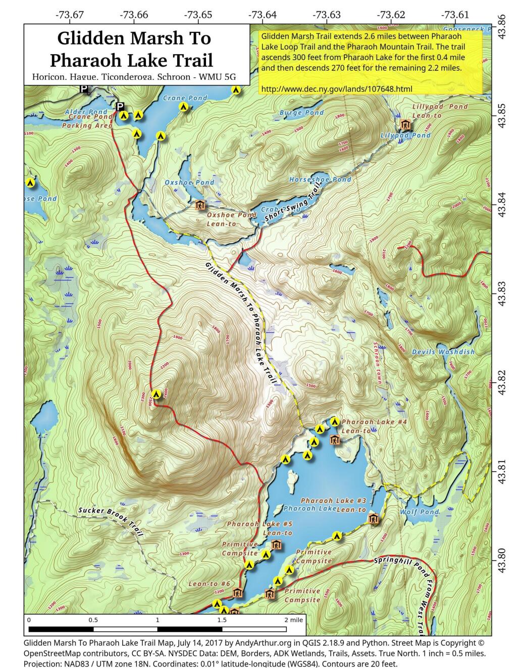
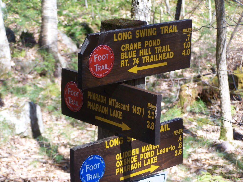
Pharaoh Mountain is located about 10 miles east of Schroon Lake, and can be accessed from the Long Swing / Pharaoh Mountain Trail from the North along with a much steeper and longer trail from Pharaoh Lake from south.

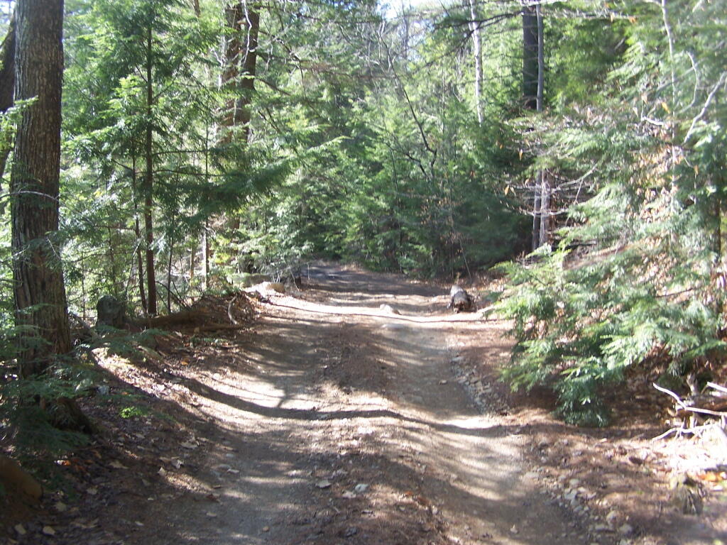
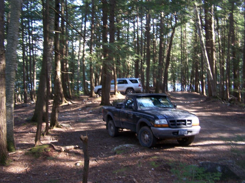
If you choose to take the infamous and rough Crane Pond Truck Trail to it’s end, and then park at Crane Pond, it’s only about a 3 1/2 mile hike up the mountain. If you stop at Alder Pond, and don’t drive through the shallow end of Alder Pond to get to the last mile of Crane Pond Road, then it’s a 4 1/2 mile hike each way.

 Where Crane Pond Road Crosses Alder Pond

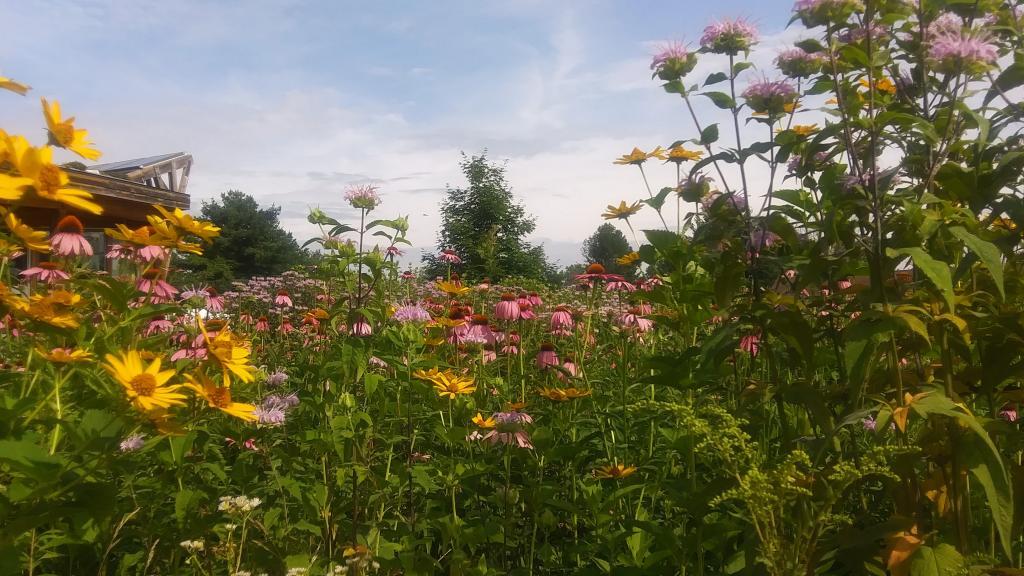
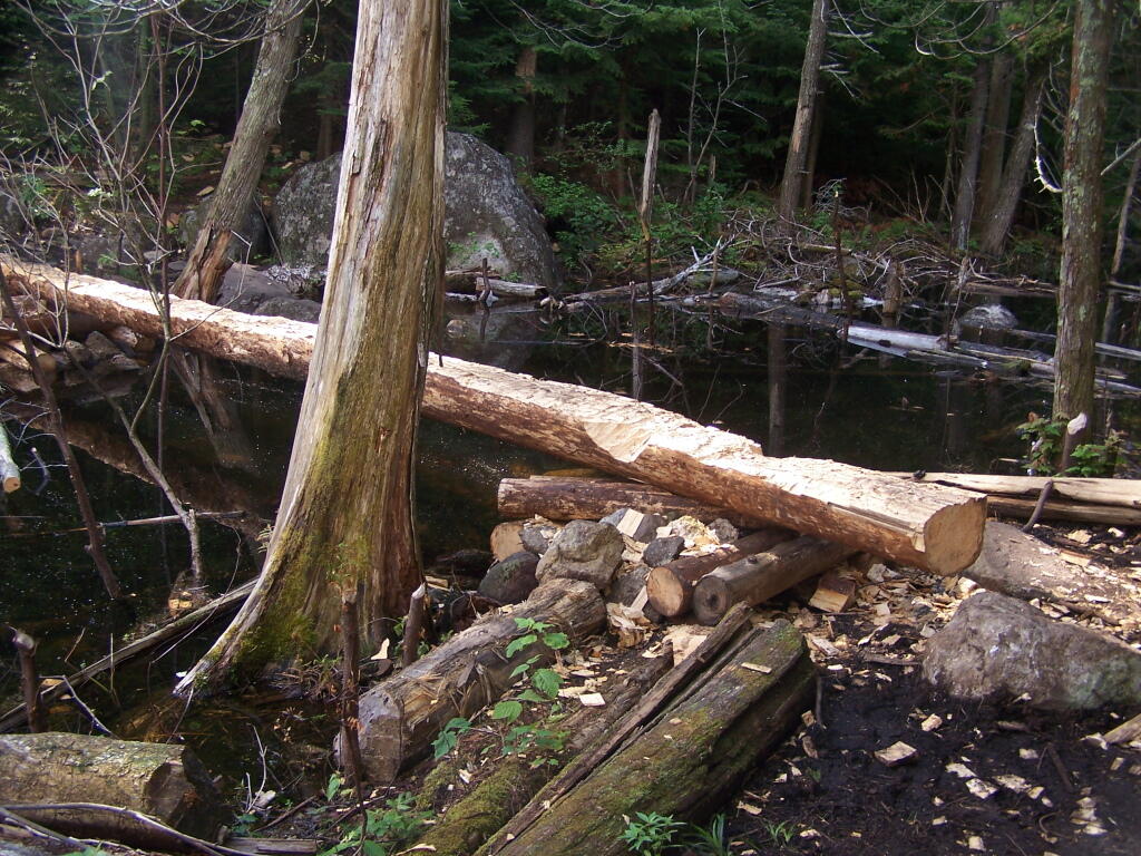
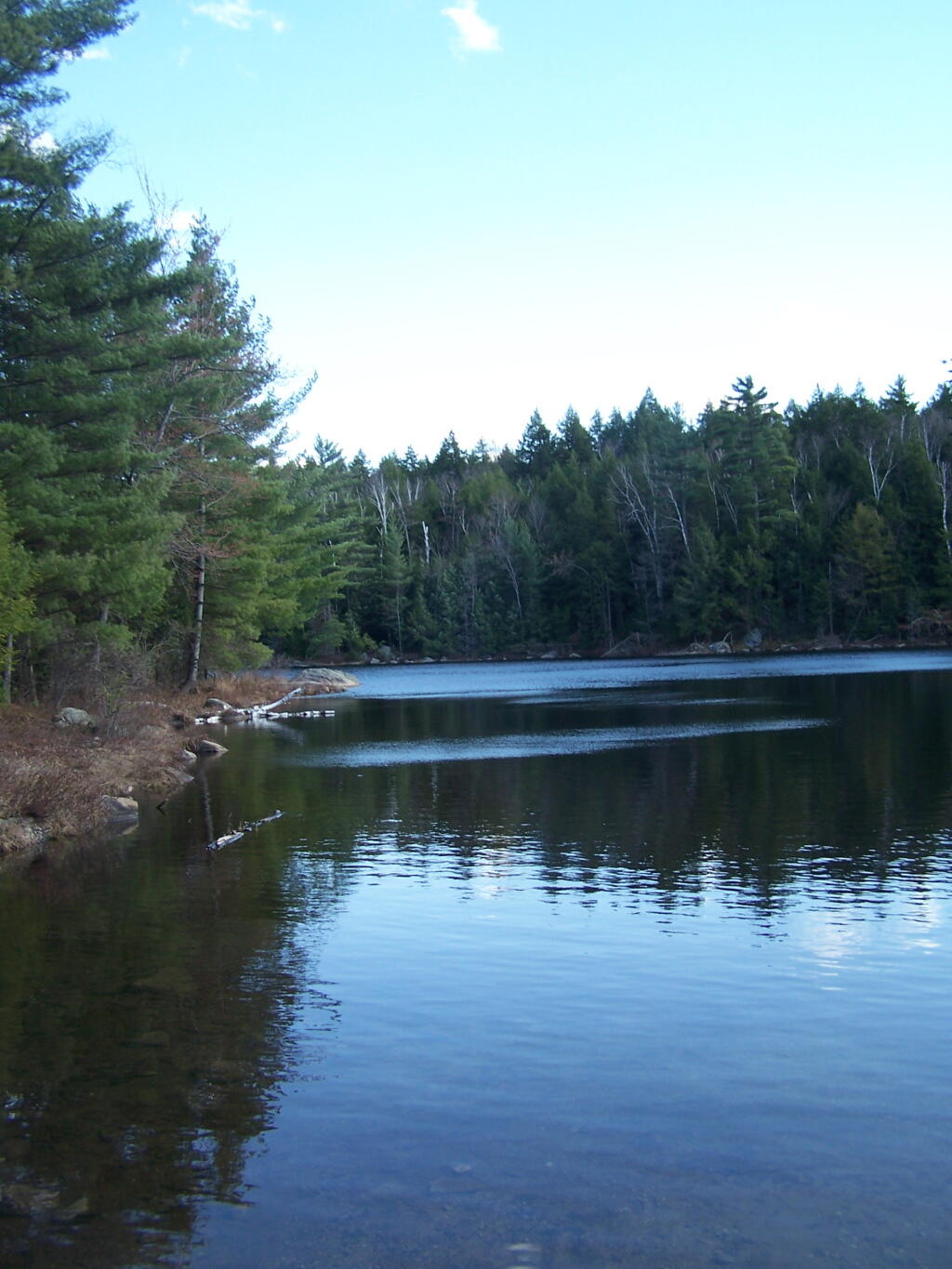
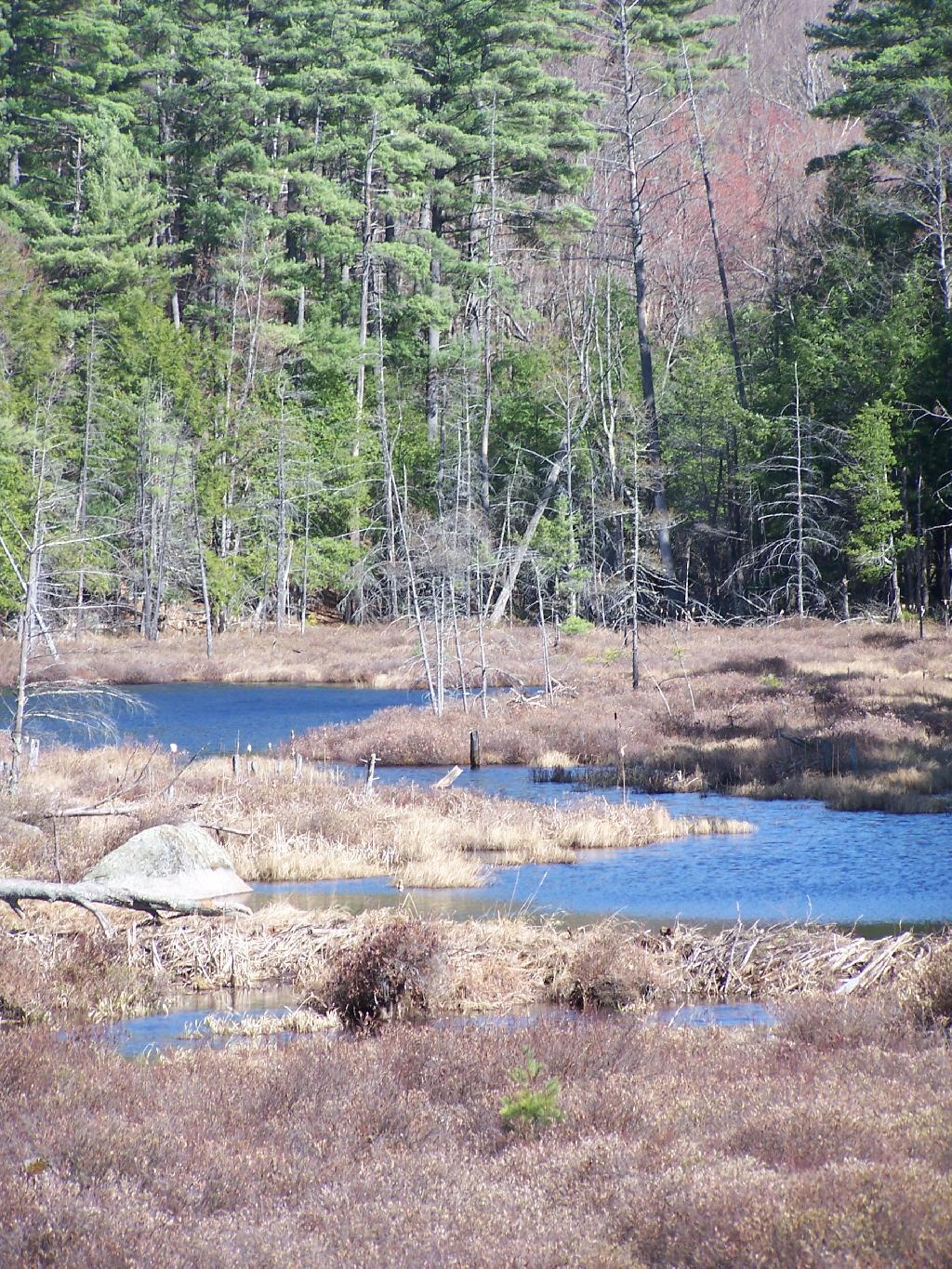
Below is Alder Pond. It was an amazing morning, as the rain let up and started to clear off. The truck trail cuts through the end of the pond, and with the recent rains, it was deeper then I wanted to take my old pickup through.

 Across Alder Pond

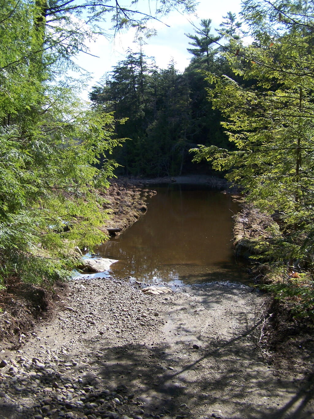
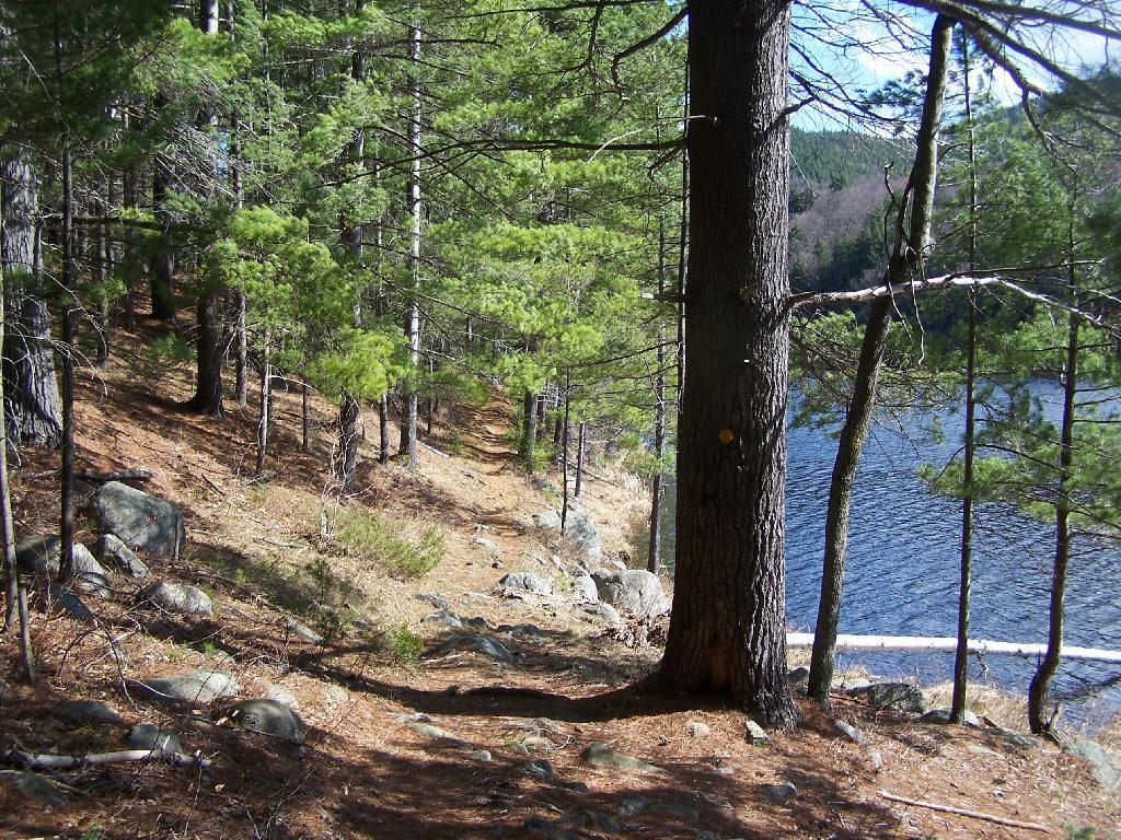
At end of Crane Pond Road is Crane Pond (not surpisingly!) There is a parking area here, and Crane Pond is known for it’s good fishing and beauty.

Crane Pond

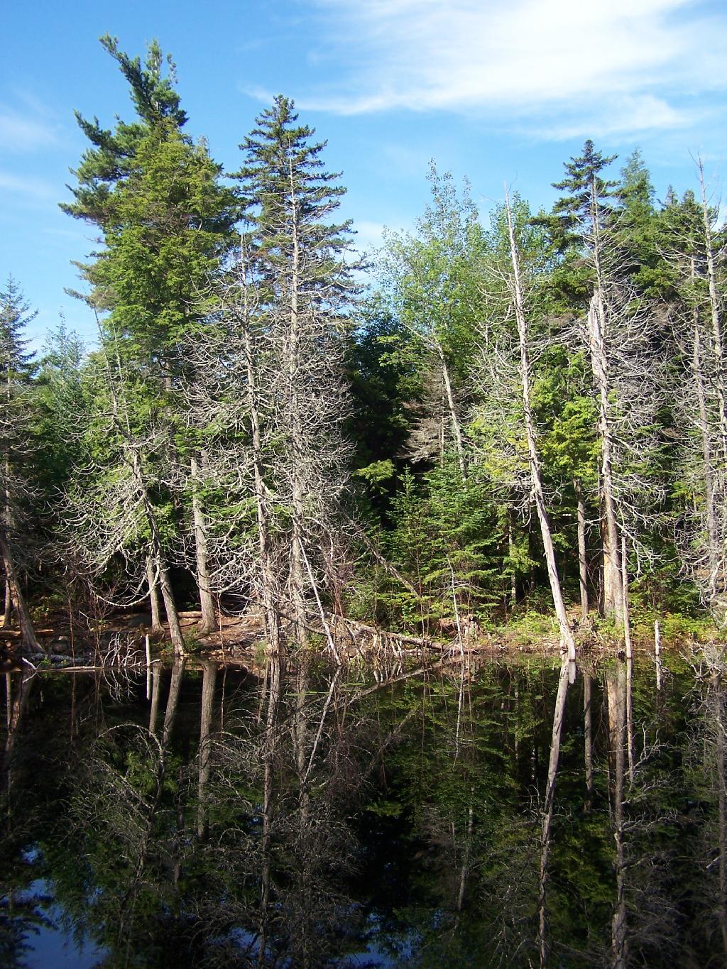
Reaching Glidden Marsh on the Pharaoh Mountain Trail. Pharoah Mountain is in the distance, with the peak sticking up. Most of the trail is relatively flat, until you reach the mountain, and then you start climbing.

 Glidden Marsh Through Trees

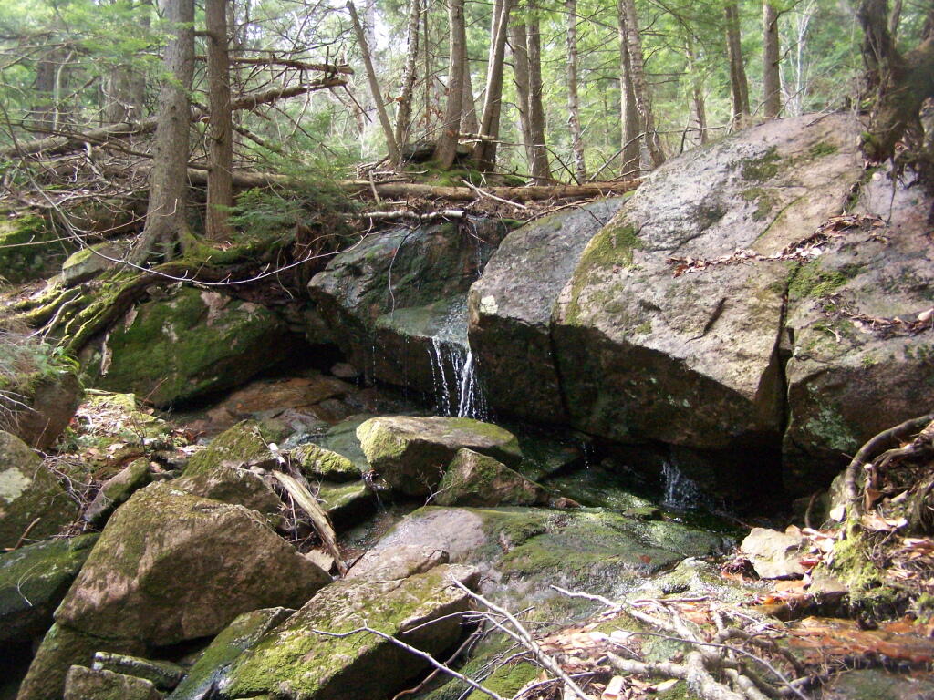
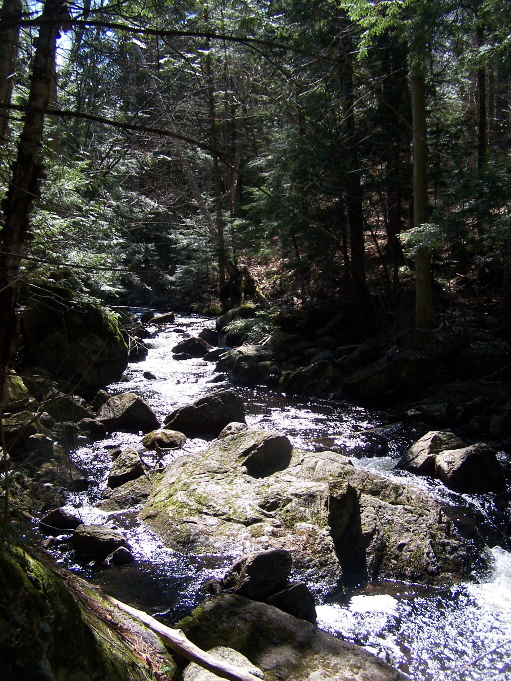
About halfway up there, there is the most charming little water fall.

Small Waterfall

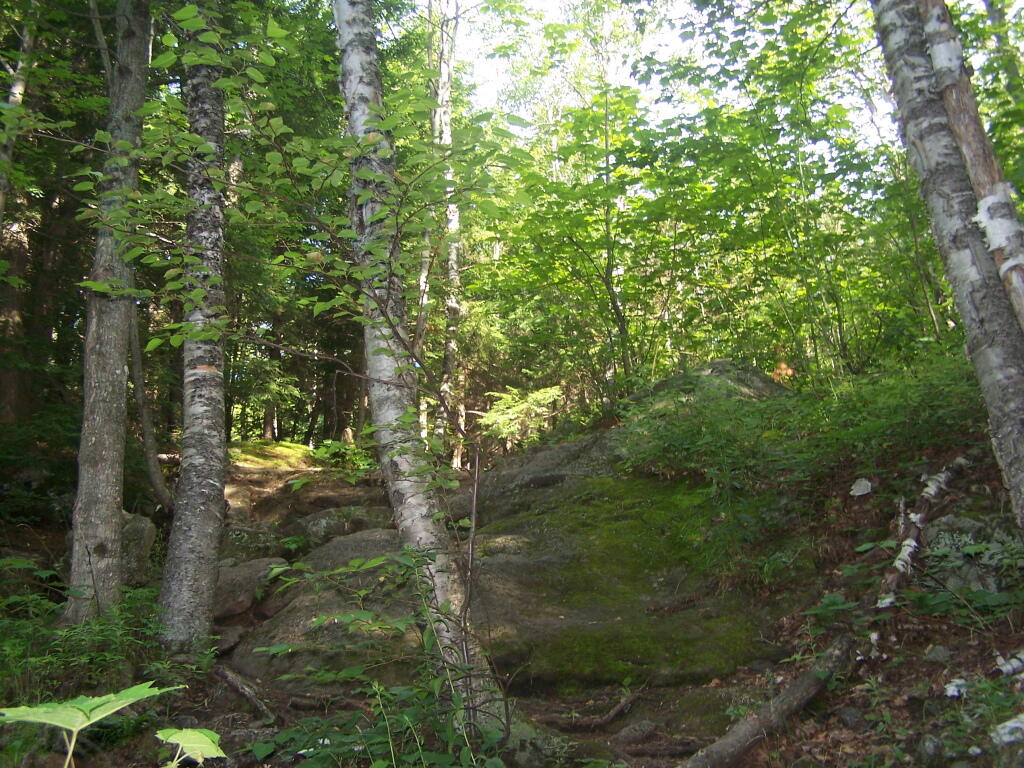
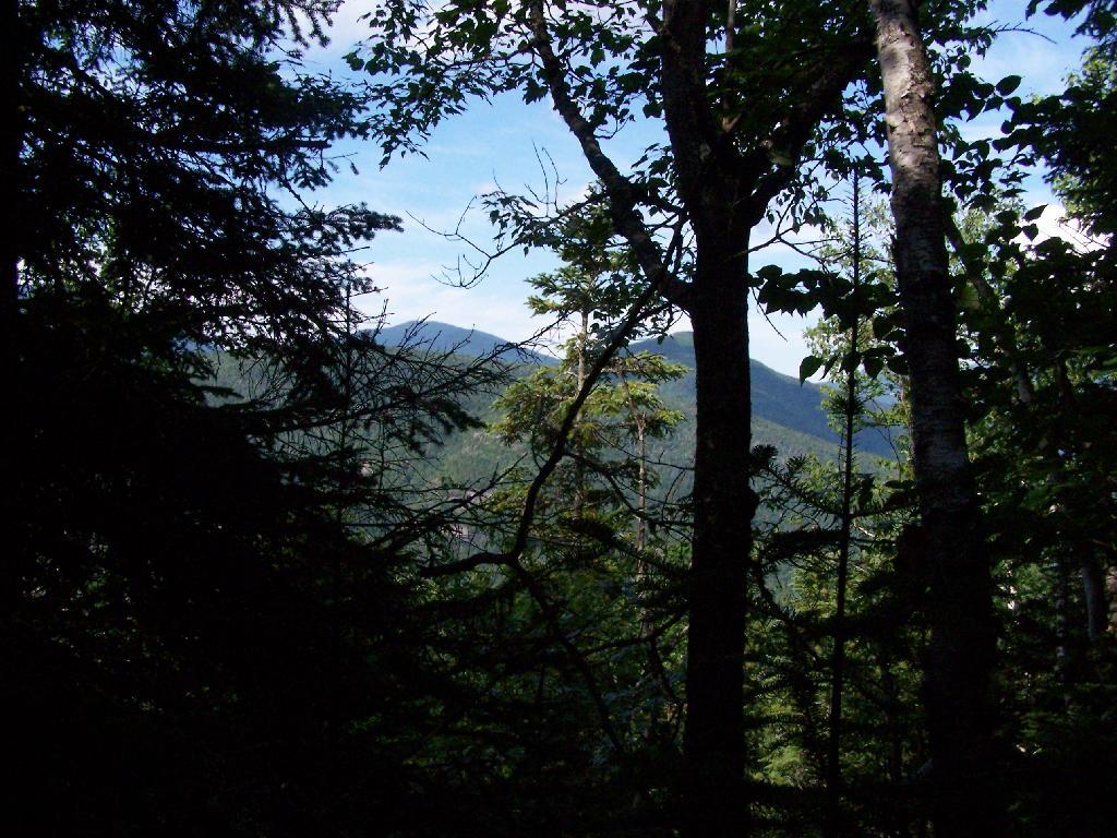
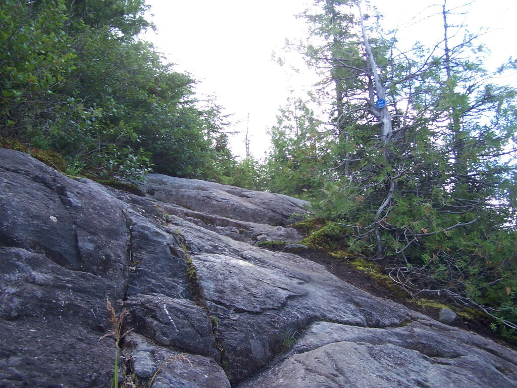
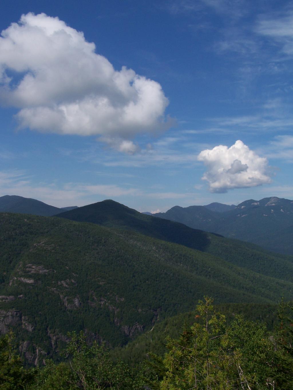
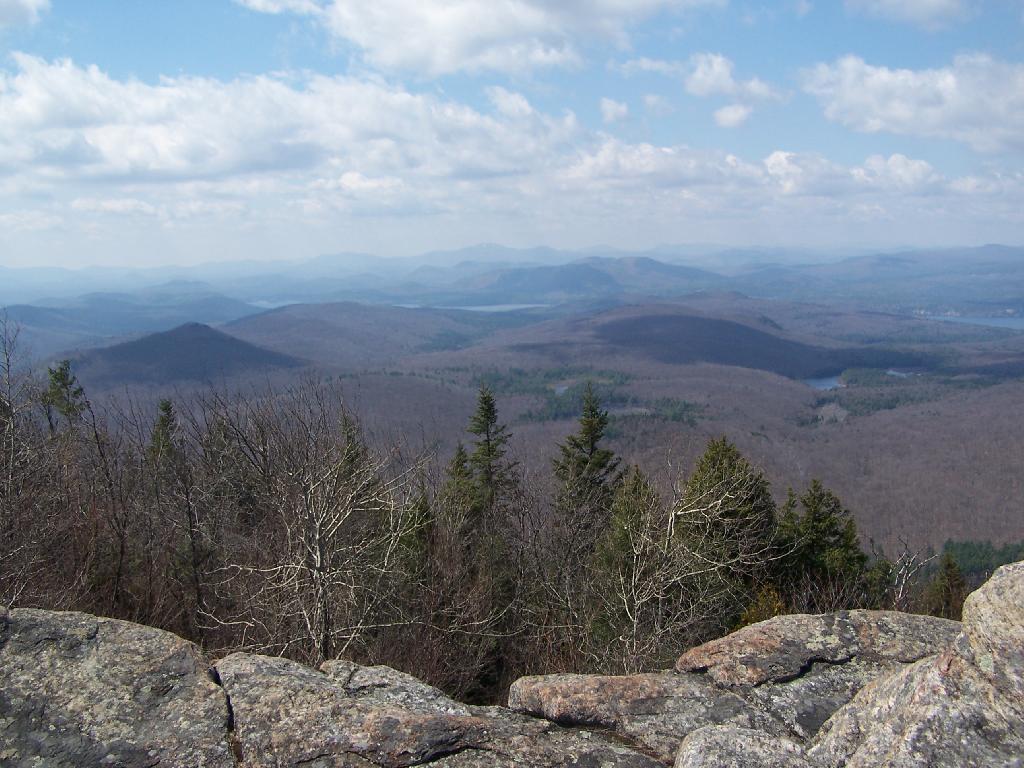
As you climb, views become progressively better.

Clearing Out to Be Quite Nice

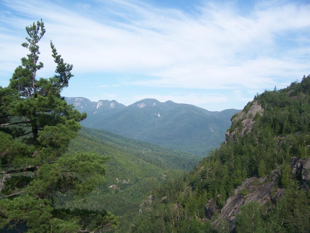
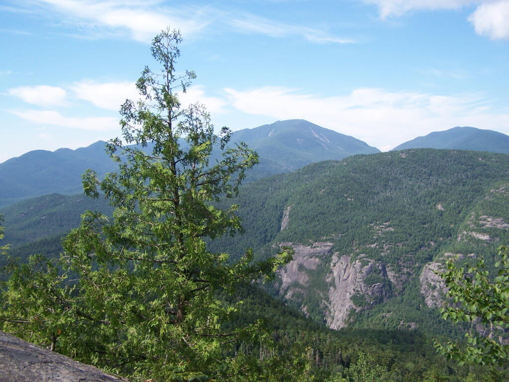
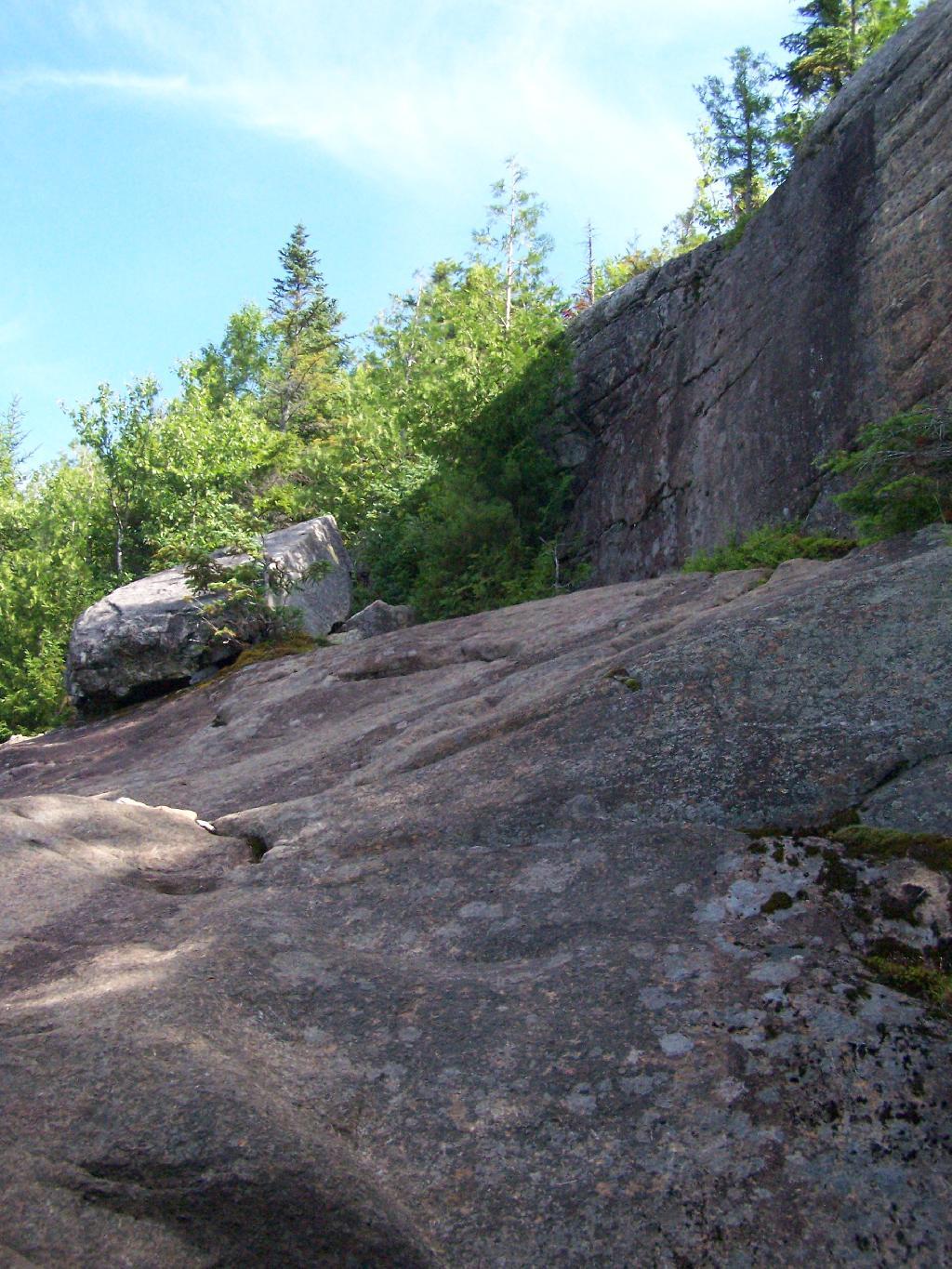
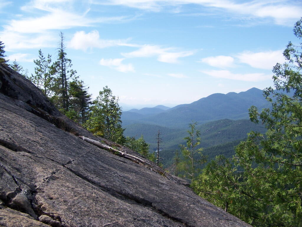
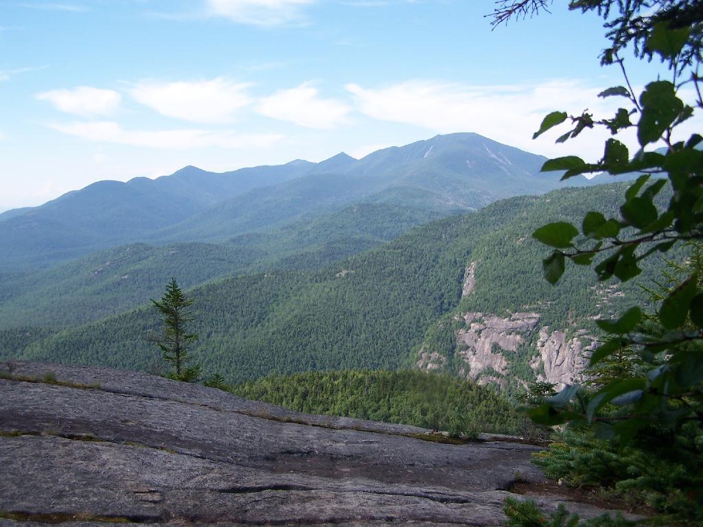
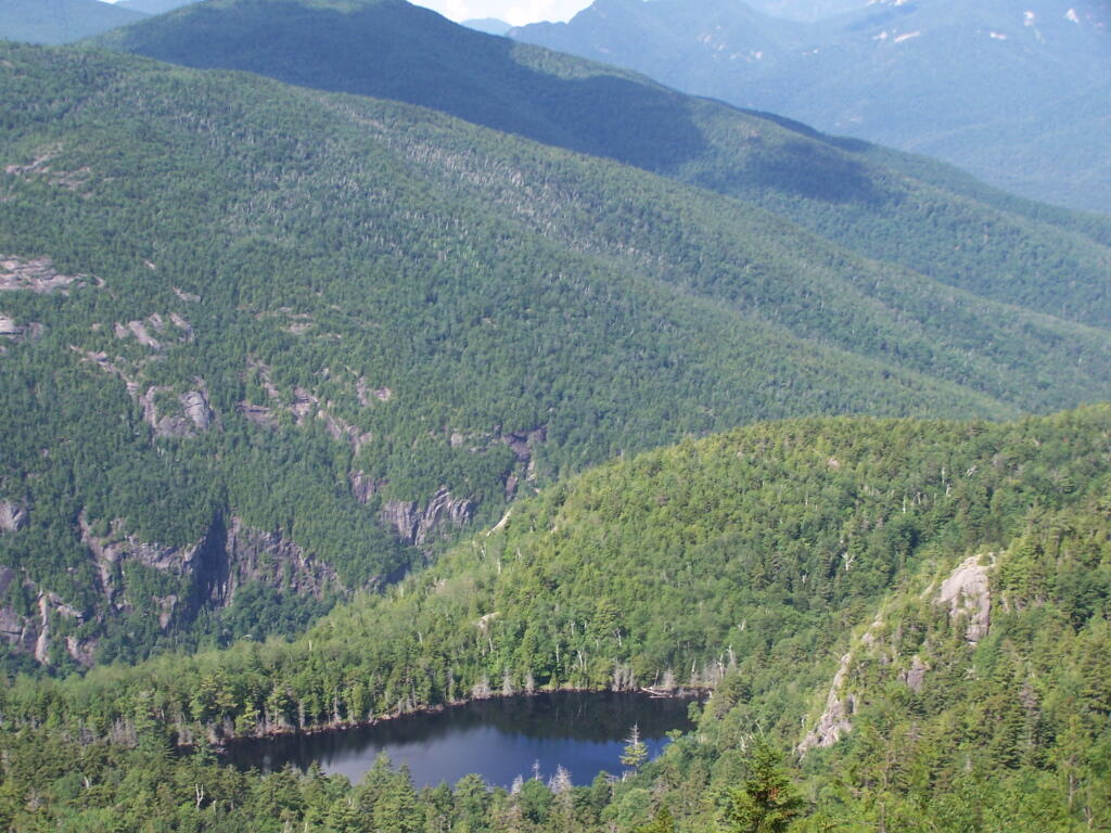
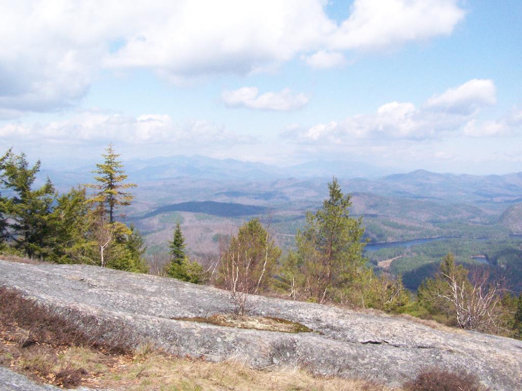
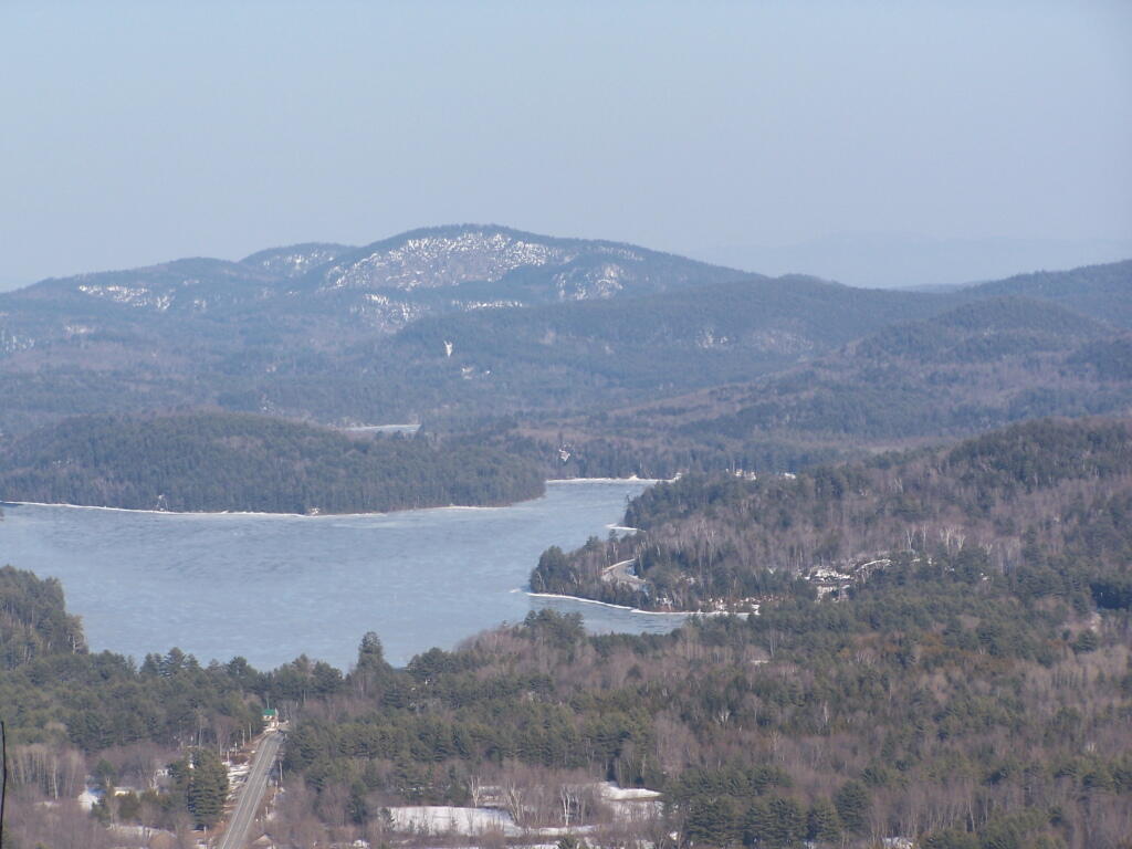
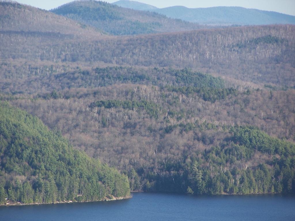
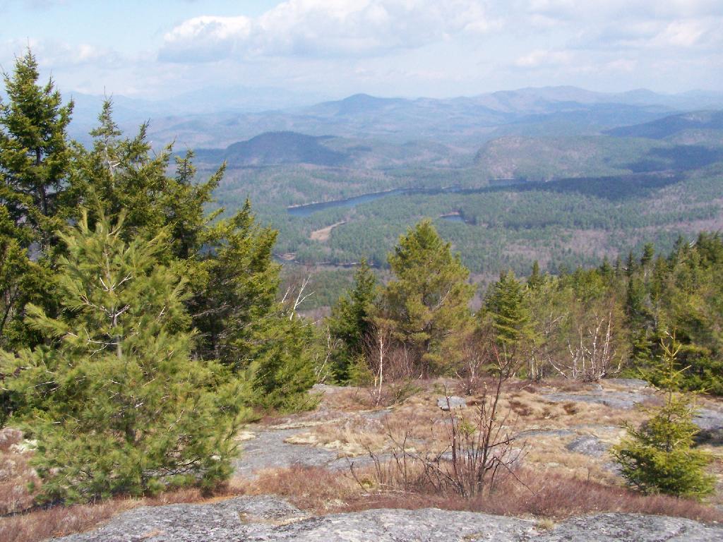
Reaching the summit, there are views in almost all directions, although you have to wonder around the top of the mountain to get all views. Here is looking North-East toward Ticonderoga. You can see Lake Champlain in the distance — barely, along with Crane Pond, Alder Pond, Oxbow Lake, and other features up close.

North East

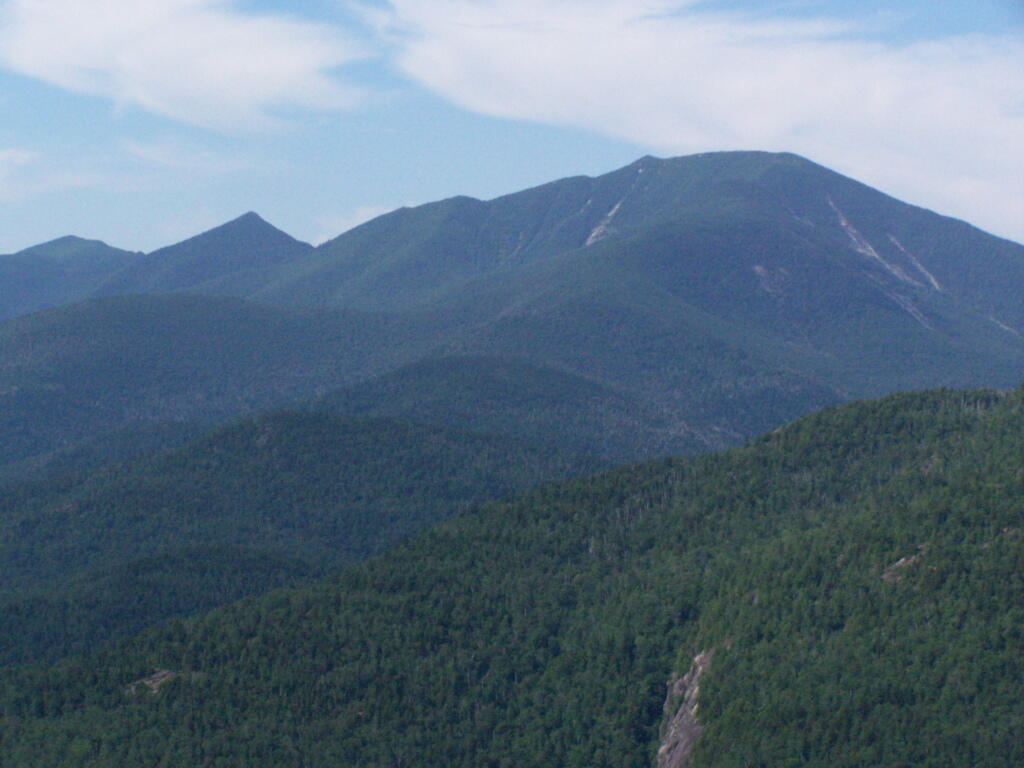
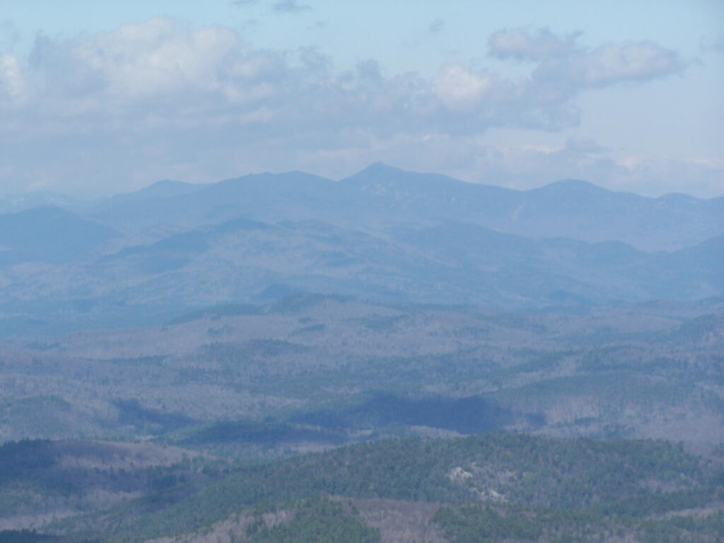
On the northernly view, you have nice views of the High Peaks Region of the Adirondacks, with Mount Marcy and Alonquin Mountains peaking out top.

 Mount Marcy

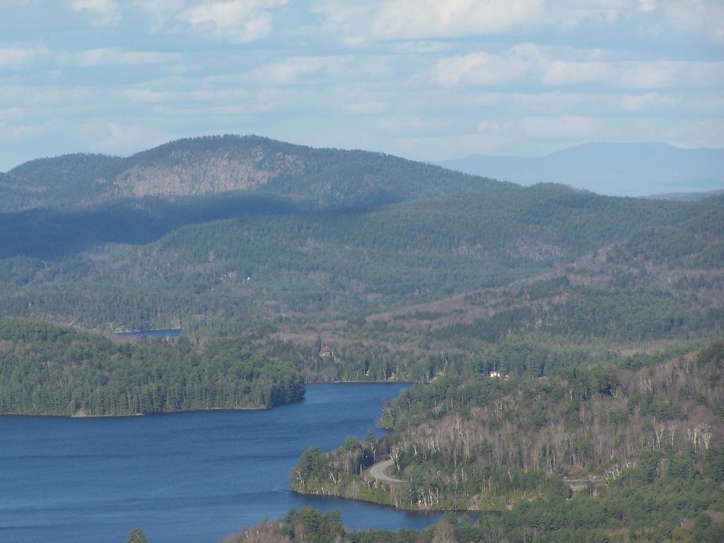
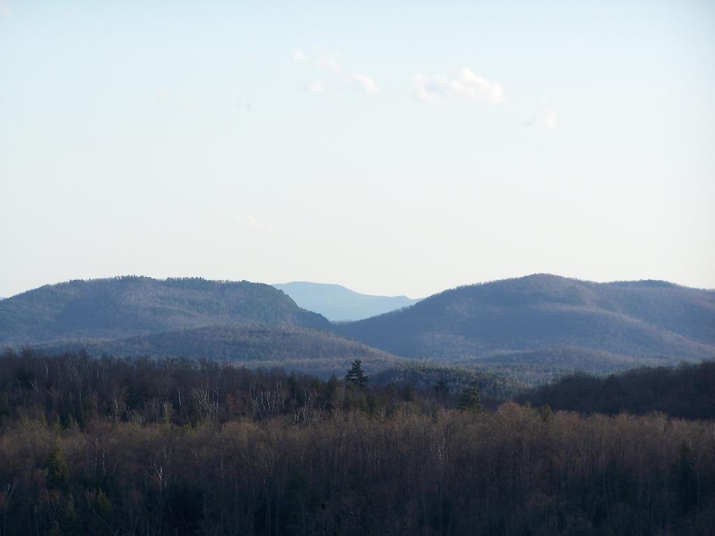
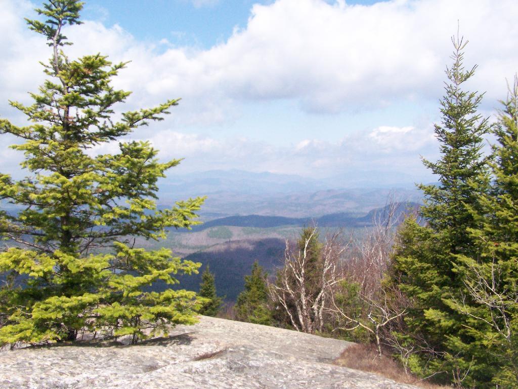
To the south-west, there are view of Gore Mountain (ski trails still with snow on it as of April 11).

South-West Towards Schroon Lake

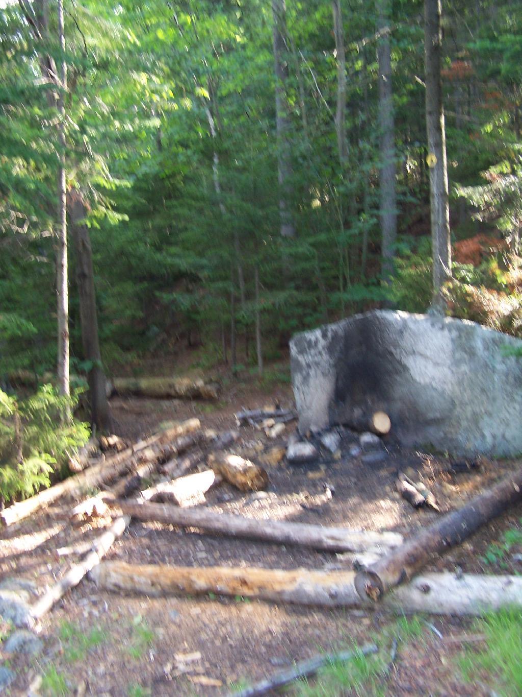
There also is a primative campsite on top of Pharaoh Mountain.

 Primative Campsite on Pharaoah Mountain

To the South-East there is Pharaoh Lake, which I did not visit, but the maps show about 5 lean-tos surround it.

Pharaoh Lake

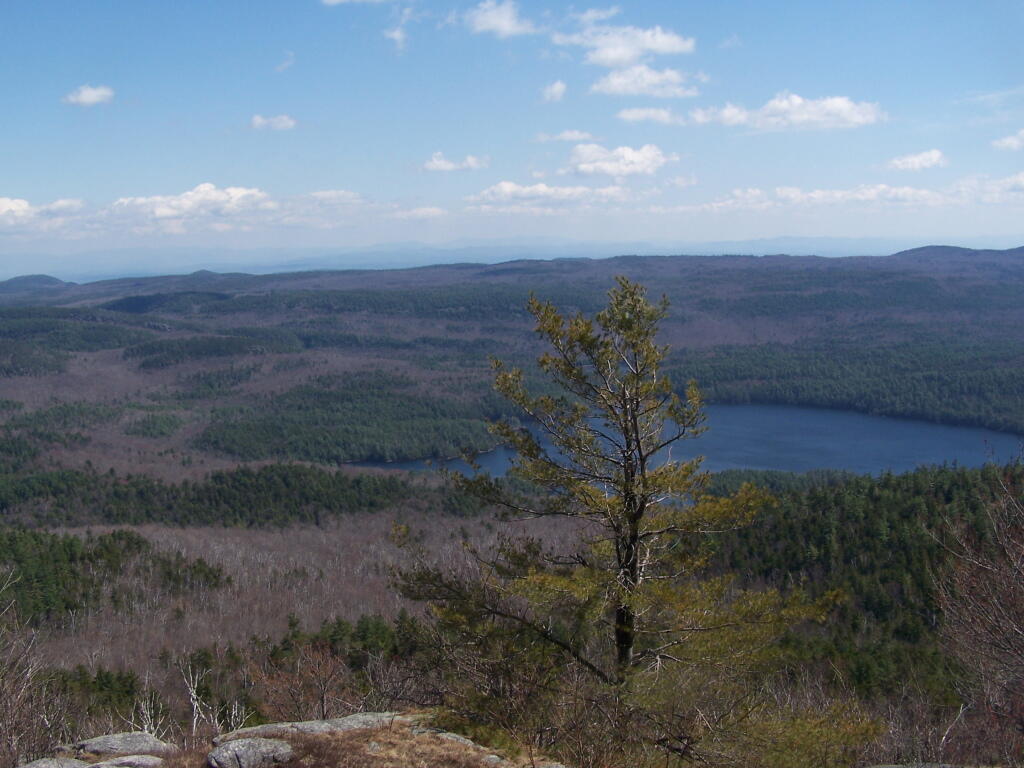
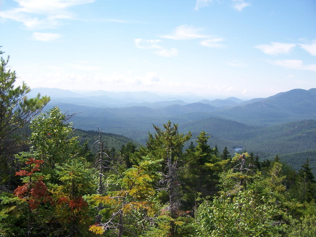
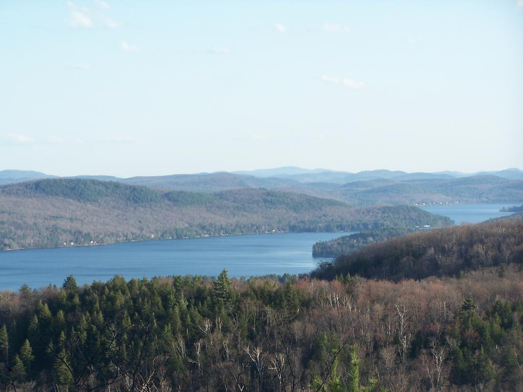
Desolate Swamp is quite purty from the mountain.

Desolate Swamp

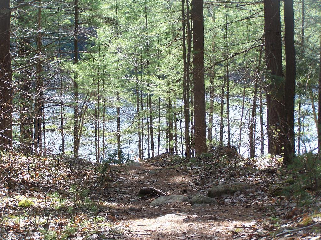
After hiking up the mountain, I took a side trip to the beautiful Oxbow Pond, and the other side of Glidden Marsh. Here is the Long-Swing Trail along the edge of Glidden Marsh, near the turn off to Oxbow Lake.

Along Long Swing Trail at Glidden Marsh

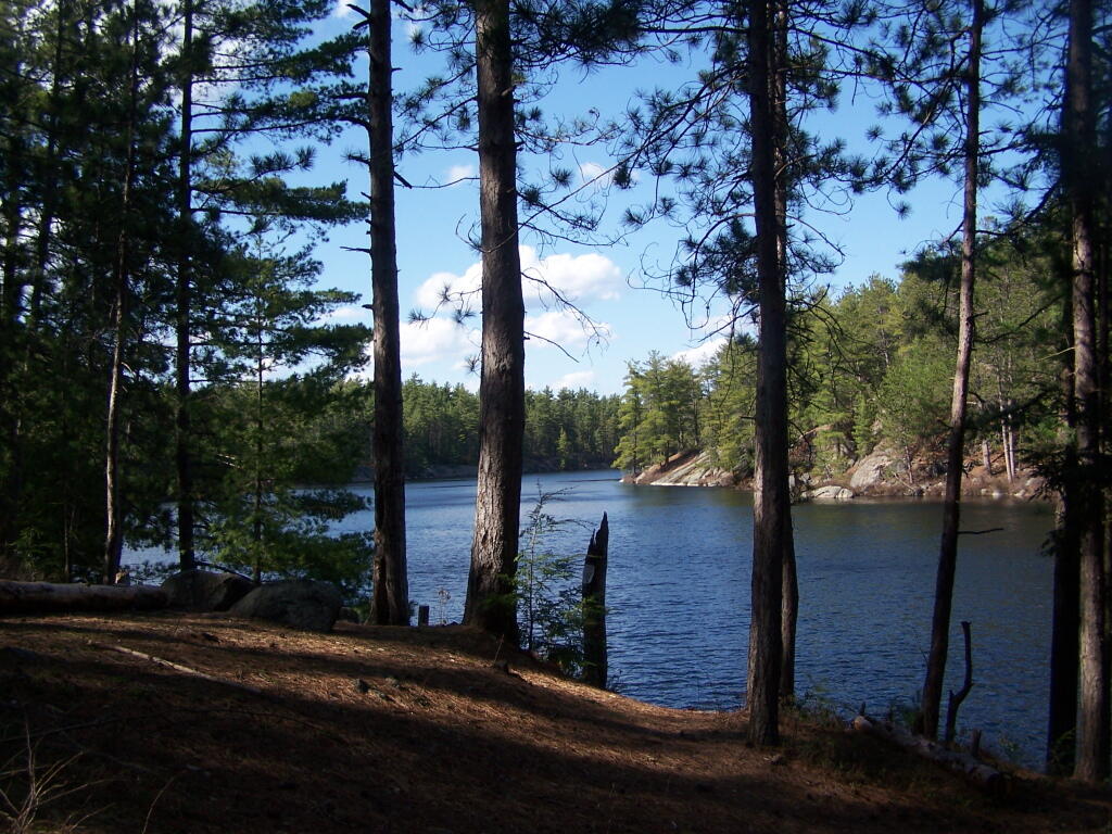
Oxbow Lake is so beautiful, and probably real deep.

Oxbow Through Trees

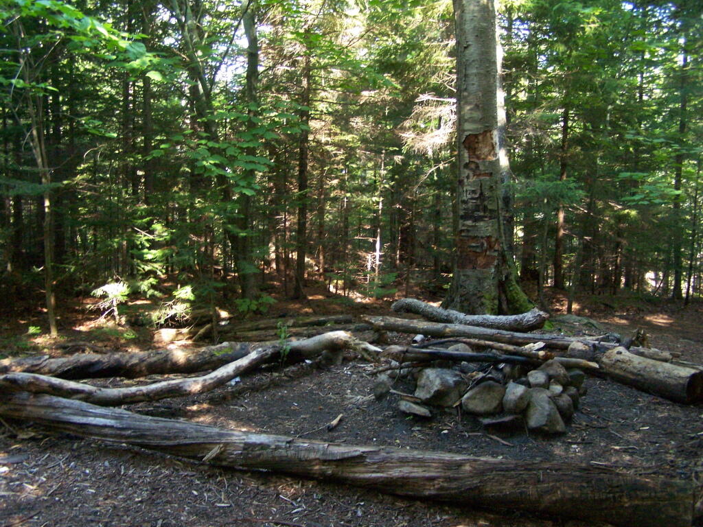
The Oxbow Lean-To. It looks well used, but is in good shape, and has a decent outhouse a little ways from it, a fire pit, along with lots of water for cooking in the nearby pond.

Oxbow Pond LeanTo

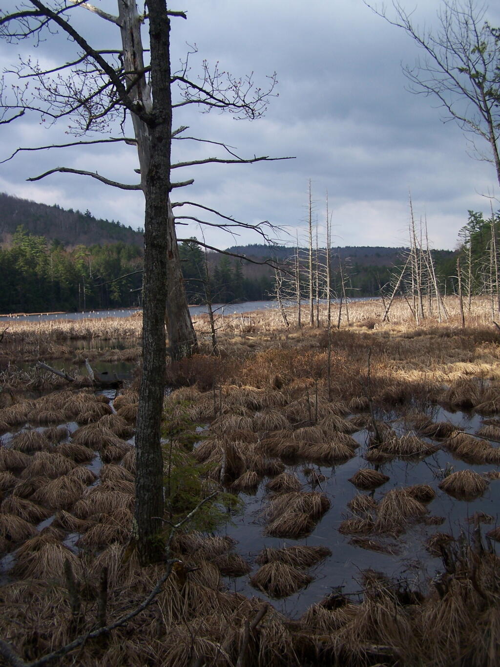
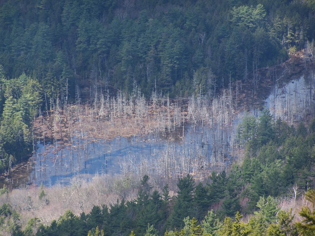
The one end of Oxbow Lake is swampy, as it runs between outfall of Crab Pond down to Oxbow.

Swampy End of Oxshoe Pond

Heading back to the truck, the sun flickers on the outlet of Glidden Marsh.

 Outlet of Glidden Marsh

An amazing hike. Definitely want to come back, and possibly spend a night at Oxbow Pond.

Giant Mountain

About three weeks ago I decided I wanted to go hiking in the Adirondack High Peaks. It was my first time hiking there, and it probably will be the last time I go up there for a while, mainly because of the absurdly bad fear of heights. A 120 mile drive from Albany, it took me about 2 1/2 hours to reach the trail head on NY 73.

Waiting for the bus to Thacher Park

The first part of the trail is steep (as is most of the trail), but with limited views.

Along Trail

After 3/4 mile of a hike, it opens up to a ledge with views of the Keene Valley.

Keene Valley

Shortly there after you reach the Giant Washbowl, a mountain pond with interesting views, surrounded by mountains.

7/10 Mi to NY 73

You also get a neat view of Nubble.

Untitled

There are two primative campsites along Giants’ Washbowl with no facilities except some logs to sit on.

Campsite

Second Campsite at Washbowl

You cross Giants’ Washbowl on a log.

Foot Bridge

With the confirous trees surrounding Giants’ Washbowl you would have no idea what season it was from this picture.

Colors

Past Giants’ Washbowl, the trail gets steeper and goes through a series of switch backs as you continue to climb.

View Through Trees

At about 2 miles the trail opens up to a series of open rock scrambles, where you walk along a ledge of sloped rocks. It did nothing for me.

Rock Scrabble

Literally, the trail runs right along this sloped ledge. These open ledges just made me sick. I started to puke, with my fear of heights kicking in as as scrambled along this.

Open Rock Face

That and seeing the maggots swarming over this piece of dung right on the trail did nothing for me.

Got Maggots

That said, the views from this ledge where spectular.

Looking Across the Valley

I continued to climb another 300 feet or so on the trail, when I decided to go back, but I did get a chance to get some pretty awesome pictures from up above.

Further

On a rock ledge, looking down at Giants’ Washbowl.

Giants Washbowl from Above

And Noomatic Mountain.

Noomantic Mountain

Looking South-West towards Pharoah Mountain Wilderness.

South-West

Dix Mountain and surrounding range.

Dix Mountain

At any rate, this kind of hiking did nothing for me. I decided to descend Giant Mountain, and not spend much more time in the High Peaks Range for the foreseeable future. As much as I enjoy spending time outdoors, the High Peaks with their significant ascent and the open faces just is no fun. Just writing about this mountain and looking at the pictures makes me want to barf again!

Untitled

Map of the hike:


View Giant Mountain in a larger map

Crane Pond Road in My Pickup

Crane Pond Road is a 2 mile historical truck trail in the Pharaoh Lake bureaucratically-defined “Wilderness”. This truck trail provides access Alder Pond and Crane Pond, along with access to hiking trails to Goose Pond, Glidden Marsh, Oxshoe Pond, Crab Pond, and Pharaoh Mountain.

In the Wilderness?

This truck trail is popular and is frequently used hunters, fishermen, backpackers, and hikers visiting the vast lands of Pharoah Lake “Wilderness”. The wilderness distinction, is rather dubious as these lands are not historical wilderness but only designated as such on paper by the Department of Environmental Conservation and the Adirondack Porn Agency. There is few old growth forests or undeveloped land remaining in our state, and the wilderness designation is frequently abused by environmental extremists.

The entire Pharaoh Lake “Wilderness” is traversed by old logging roads, has old foundations, and other ruins of a once privately owned, farmed or logged land. Many of the hiking trails follow old logging roads. The state has developed foot bridges, hiking trails, and many lean-tos throughout the property, so man made structures are not uncommon to find in this so-called “Wilderness”.

Oxbow Pond LeanTo

A Rough Truck Trail.

The entire Crane Pond Road is a rough truck trail. It’s has gotten minimal maintenance by the state of New York, ever since those with an certain extremist ideological agenda attempted to get this truck trail closed off.

 Relatively Smooth Section of Crane Pond Road

Some portions of the truck trail are deeply rutted, and at least this time of year, very muddy. A few places are washed out, and you have to travel past washed outs, or carefully climb over them. I bottomed out my Ford Ranger a couple of times and could feel the front-drive train pulling the back wheels along as they started to slip.

 Where Crane Pond Road Crosses Alder Pond

Towards the end of the truck trail, the truck trail actually crosses an inlet to Alder Pond. I didn’t try driving through this section during the high water of spring, but apparently at least one person with an old Chevy K1500 4×4 made it to the end without problems.

Lazy spring days

I drove to the pull-off right before the spot where the truck trail crosses Alder Pond. In low water, I wouldn’t mind driving through the inlet to the parking area at the end of Crane Mountain Road, but I wasn’t going to get my pickup stuck or flooded.

 My Truck Parked at Alder Pond

A Good Thing to Still Be Open.

All and all, I am happy that citizens fought to keep this existing truck trail open, against an extremist ideological agenda of some environmentalists. It shortens the hike up Pharaoh Mountain by 4 miles, and provides easy access to many important areas.

 Granite Rock Face

This would have been different issue if was proposed by the NYS DEC to build a new road through the Pharoah Lake “Wilderness”. If the DEC had shown up with bulldozers, and chainsaws, to cut a new road one could have made an argument against building a new road.

 Intersection

Yet, Paraoh Lake “Wilderness” is not that — it’s a land that has long been minimally developed with forest access roads, trails, lean-tos, with Crane Pond Road long being minimally maintained to provide access to this important public land. It’s not a Strip Mall or Housing division, and most of the area is very wild, even if it’s somewhat developed to provide for the public access and enjoyment.

New York State Should Maintain &
Keep Crane Pond Road
OPEN to Public Motor Vehicles !

Severence Hill in April

One month after my first hike up Severence Hill, I decided to do another “cool” down hike up this mountain. In only a month, the look off the mountain had changed quite dramatically.

Here is Paradox Lake on March 7, 2010.

Paradox Lake Area

Here it is on April 11, 2010.

 Paradox Lake

With the Adirondack Snow having melted in the past month, things looked a lot different for sure. Things where already starting to show some signs of spring, and life, even if the Adirondack Winter still had another month to go before casting off it’s winter.

 Schroon Lake

I must have spent an hour staring down at Schroon Lake, just pondering the Adirondacks and possibly moving out west. It was such delightful weather out there, and while I was tired from a day hiking, there was so much beauty with the setting sun. I had no reason at all to rush back to Albany, having no commitments when I got back home, except to get ready for the next day at work.

Steep Bay

This hike, while short has so much beauty. Looking down at Steep Bay (part of Pharoah Mountain Wilderness) on Schroon Lake.

Hatchhack and Allered Hills

Then one last look at Hatchhack and Allered Hills to the south, silhouetted by the setting sun, as I descended the mountain, and headed back to Albany.


View Severance Hill Hike in a larger map