
Download NYS Ground Level LIDAR Data using R
This code will download ground-level LIDAR digital elevation model, the best available, for any part of state when you supply it with a shapefle. It queries the rest server with the dem indexes, and then downloads the relevant files, and joins them into one image.
library(tidyverse)
library(sf)
library(raster)
library(arcpullr)

shape_to_download <- read_sf('/path/to/shapefile_of_area_to_download.shp')

lidar.url <- tibble()

for (i in seq(2,14)) {
  if (nrow(lidar.url) == 0)
    lidar.url <- get_layer_by_poly(str_c('https://elevation.its.ny.gov/arcgis/rest/services/Dem_Indexes/MapServer/',i),
                                            shape_to_download, sp_rel='intersects'
    )
}

# download and merge all lidar titles that intersect
map(lidar.url$DIRECT_DL, \(x) {
  lidar.file <- tempfile(fileext = '.tif')
  download.file(x, destfile = lidar.file)
  lidar <- rast(lidar.file)
}) %>% sprc %>% merge %>% writeRaster('output.tif')
Interstate 80 and 81 Interchange
Pink Tulips

Lodge Window

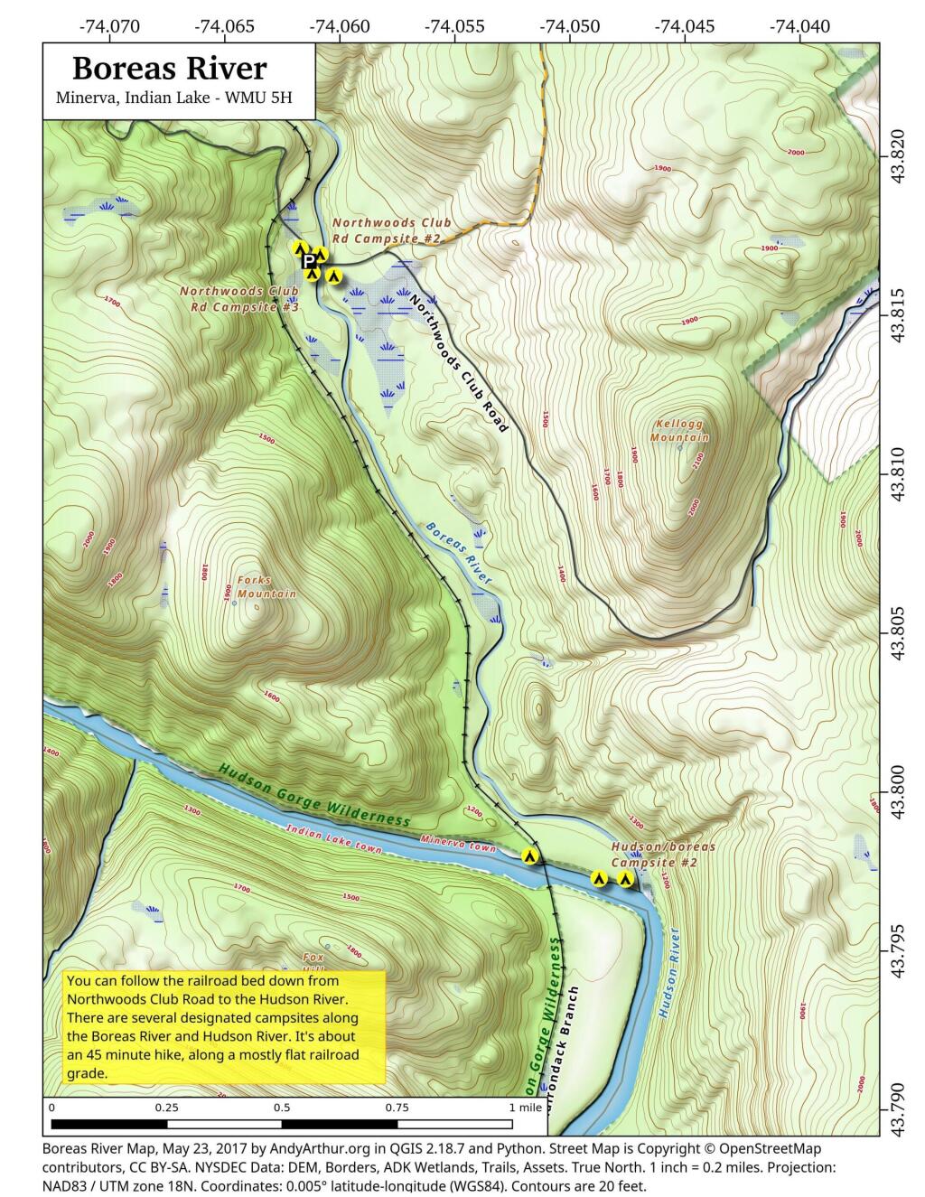
Boreas River
New York City Catskill Reservior Watersheds
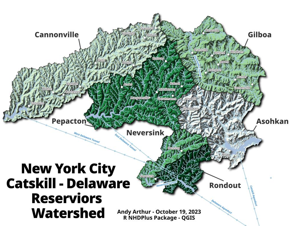
This map shows the individual areas that feed into the six-Catskill New York City Reservoirs by each individual reservoir.