AI-generated spam is starting to fill social media. Here’s why : NPR

Spring is coming
NPR
Office of Cannabis Management quietly changes rules amid legal controversy
Morning
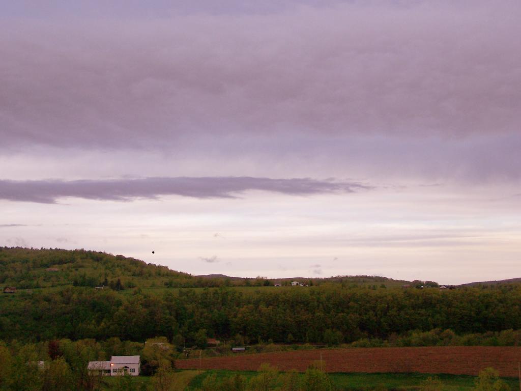
A picture taken off Route 10 in Richmondville in Schoharie County.
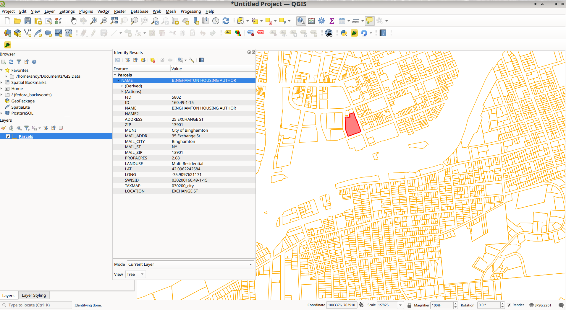
Taken on Saturday May 16, 2009 at Schoharie County.How to Find MapServer Data and Load Into QGIS
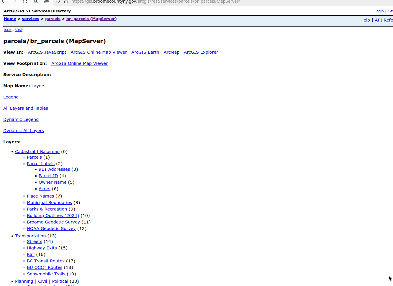
Most Interactive Maps you will find on the Internet are powered by ArcGIS MapServer that can be easily loaded into QGIS once you know the URL for the MapServer. To find the URL, you will need to do a bit of snooping, but the best way to do that is to go to Web Developer Tools in your browser, then to the Network Tab, and keep that open while loading the page. Search for MapServer in the files being loaded. Right click on the MapServer URL and click Copy Value.
With some luck you will find the MapServer URL which looks like this that you can paste into your browser.
https://gis.broomecountyny.gov/arcgis/rest/services/parcels/br_parcels/MapServer
For example, the Broome County Parcel Viewer: https://gis.broomecountyny.gov/website/apps/parcel_mapper/viewer.html

If you enter that URL into your browser in most cases you will be brought to the web interface of the MapServer. It is often helpful to remove anything beyond rest/services to get the full listing of public REST/Services. For Broome County: https://gis.broomecountyny.gov/arcgis/rest/services/
You can enter that URL in the ArcGIS Rest Server tab in the QGIS Data Service Manager.

So I could see all the layers, I only entered the part up through rest/services: https://gis.broomecountyny.gov/arcgis/rest/services/
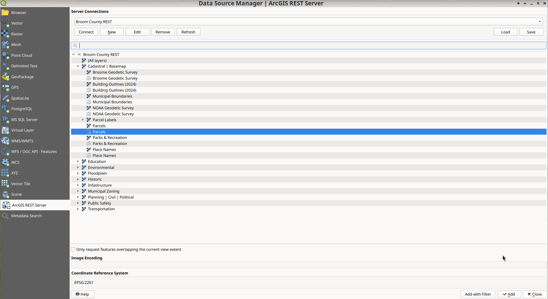
Then you can load into QGIS and style as you like.
You can also save the layer to your hard drive locally as a Geopackage or Shapefile. This might take some time depending on the size of the MapServer. Parcels are often hundreds of megabytes to download, and REST/Services tend to be slow for large data requests that require many page requests of the server.
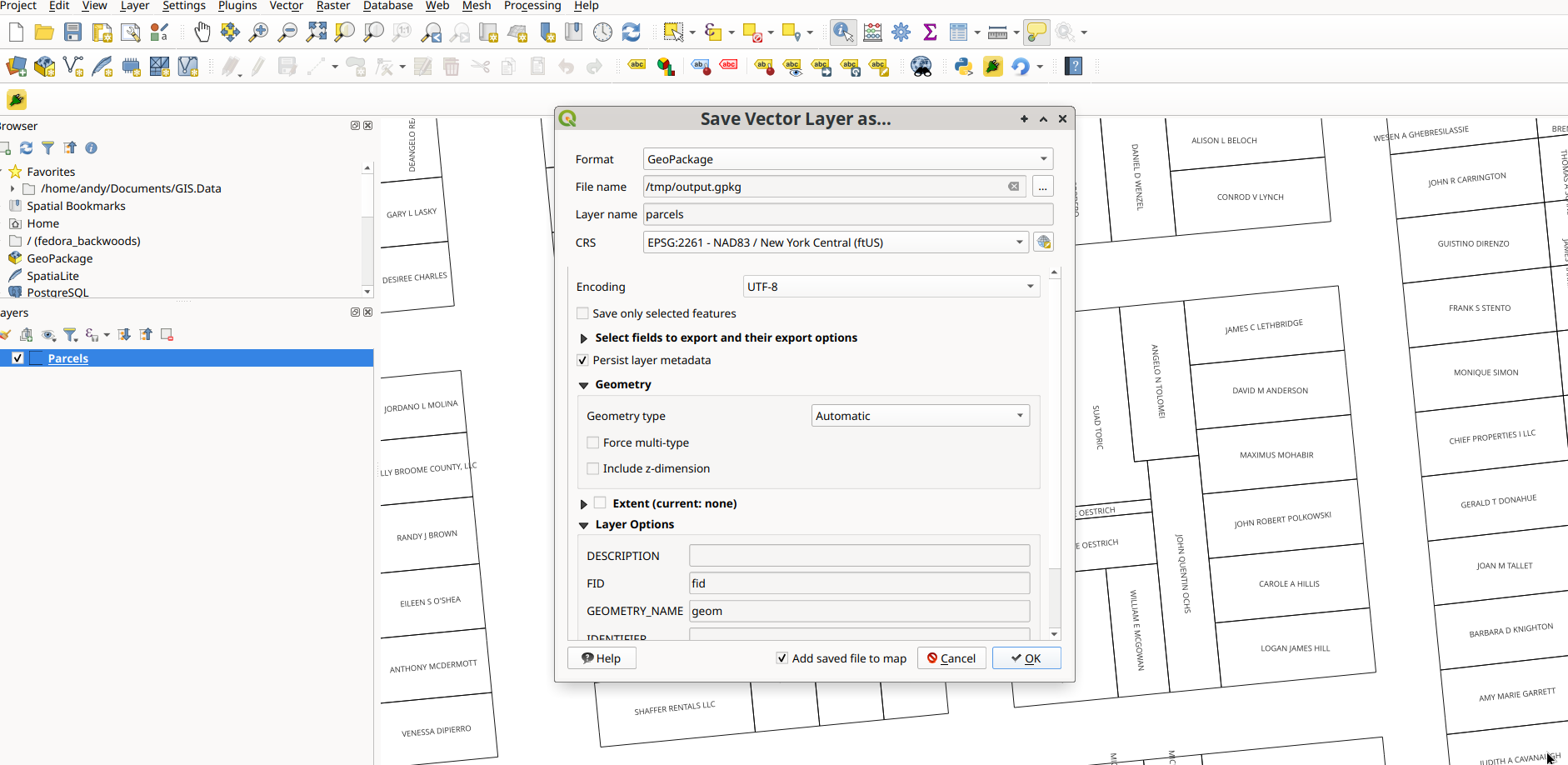
You don’t necessarily have to save the file locally, you can query and style the data like any shapefile or geopackage.

This will work for any ArcGIS REST/SERVICE you find on the Internet which is the majority of interactive maps. This list is often helpful to finding a REST/Service quickly: https://mappingsupport.com/p/surf_gis/list-federal-state-county-city-GIS-servers.pdf
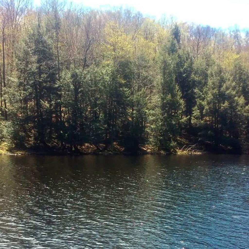
Henderson Lake from the Dam
There is a 450 acre man-lake up at the Tahawus Tract, known as Henderson Lake, with campsites around it. It is where the Hudson River has been damed up.
Taken on Saturday May 21, 2011 at Tahawus.