Search Results for: photo path 11

October 10, 2019 Morning

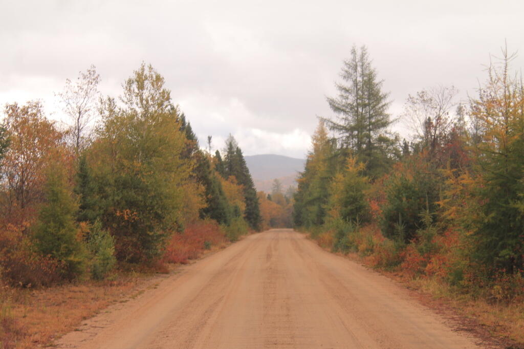
Good morning! Happy Thursday. Vacation is going by much too quickly but I’m excited as today I’m going to West Virginia through Sunday. Three weeks to Halloween 🛥️. Sunny and 42 degrees at the Buzzard Swamp Coop Mangement Area. 🌞 Calm wind.

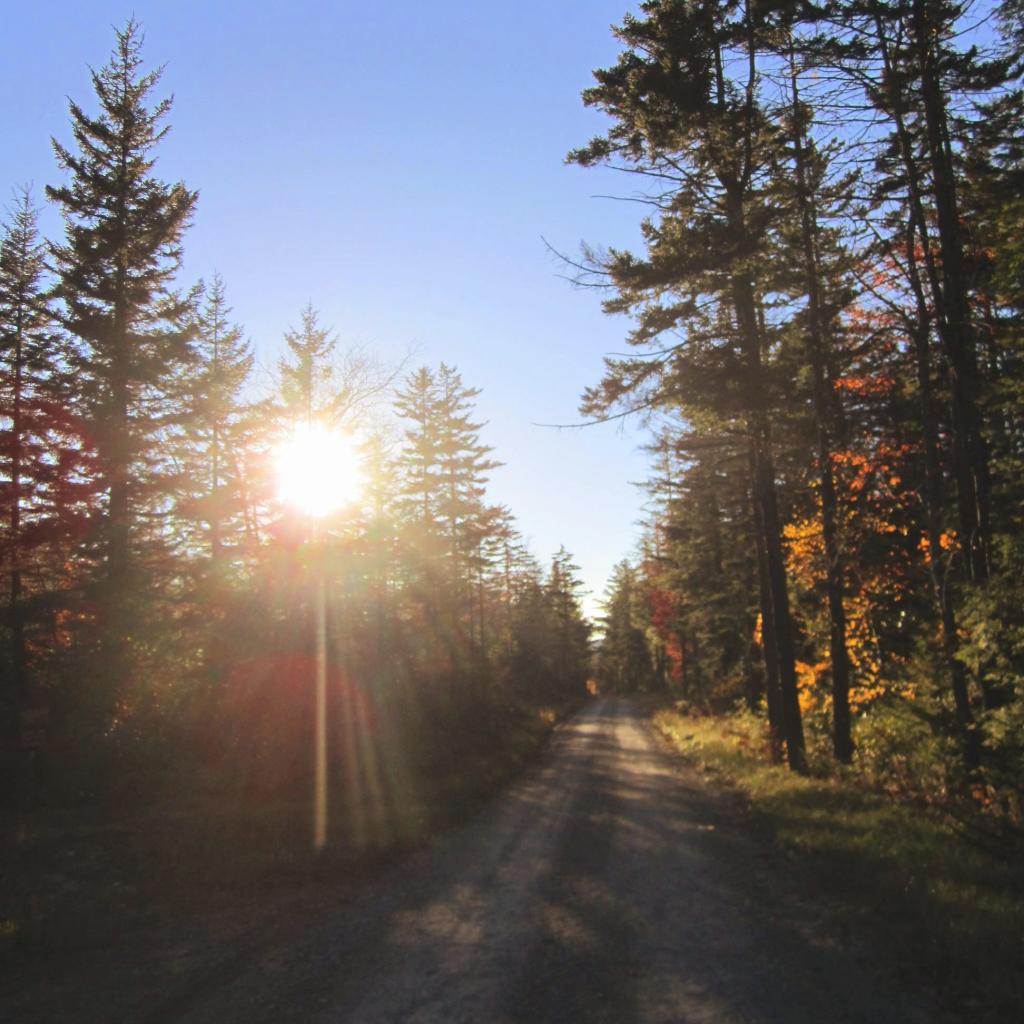
This morning I started out the day with walk back to Buzzard Swamp 🐦. Beautiful morning with fog 🌁 over part of the Buzzard Swamp. I really do tight invest in a good pair of binoculars. 🔭Maybe I’ll look at that for Christmas 🎄 sales time. Later it’s to Punxsutawney on PA 36 then Mount Davis Pennsylvania High Point and then Cannan Heights WV.

Today will be sunny 🌞, with a high of 66 degrees at 3pm. Four degrees above normal, which is similar to a typical day around October 1st. East wind 3 to 5 mph. A year ago, we had mostly sunny skies. It was humid. The high last year was 83 degrees. The record high of 89 was set in 1939. 0.8 inches of snow fell back in 1925.❄

The sun will set at 6:43 pm with dusk around 7:11 pm, which is one minute and 38 seconds earlier than yesterday. 🌇 At sunset, look for clear skies 🌄 and temperatures around 63 degrees. There will be a calm wind. Today will have 11 hours and 21 minutes of daytime, an increase of 2 minutes and 43 seconds over yesterday.

Tonight will be clear 🌃, with a low of 41 degrees at 6am. Typical for tonight. East wind 3 to 6 mph. In 2018, we had mostly clear skies in the evening, which became light rain by the early hours of the morning. It became very sticky as the night progressed. It got down to 61 degrees. The record low of 22 occurred back in 1943.

I set my alarm for six AM ⏰ which was pitch black this morning except for the stars. 🎑 I did hit the reset a few times more then I’m proud to admit but less than yesterday. The moon had set and it was cold but unlike yesterday, I was determined to break camp by eight to drive down to West Virginia. I saw the starting battery 🔋 was at 12.50 so I started up the truck with a bit to be safe.

Not so cold this morning and I made only a small pot of coffee ☕ so hopefully I won’t have to stop a million times on the way to West Virginia. I tried to leave early the previous day but it was so dark and cold and I had to the down the tarp and tent. Today I had a lot less gear plus I camped fifty miles to the south. Saved some dash cam video 📹 on my laptop.

Yesterday I decided to go to Warren Tops to buy groceries. I really needed ice and was running low on milk and cheese. I also decided to buy beer. 🍻 It’s now sold at selected grocery stores in Pennsylvania but it’s a completely separate unit – you have to pay for it separately from the rest of the groceries and they sell non standard sizes – I bought a 15 pack of Budwiser for $12.98 no tax or deposit which is cheap compared to New York. It maybe not, I often buy 30 racks at Walmart for $19.95 plus $1.60 in sales tax and $1.60. But unfortunately without a deposit, I’ll have to crush the cans and bring them back to the transfer station for recycling ♻. Forgot how much Warren stinks like oil country – its a mix of crude oil, hydrogen sulfide with a certain amount of sweetness to the air. Actually camp smells a bit like that.

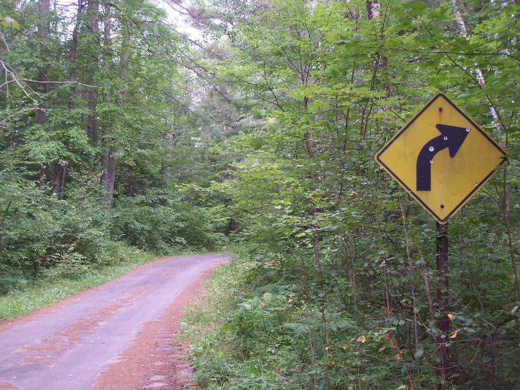
Then I headed south along US 62 stopping at the Tidoute Overlook 📷 and then going to Nebraska Submergable Bridge. 🌉 It’s kind of fun to see it again after seeing many Facebook posts of people exploring it while it’s submerged. Honestly I was surprised how much traffic goes over the bridge but it’s a pretty big shortcut to a lot of hunting camps. Hit a lot of construction 🚧 on US 62 AND on PA 36. They were paving PA 36, big delays there.

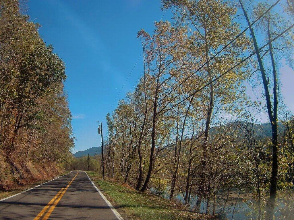
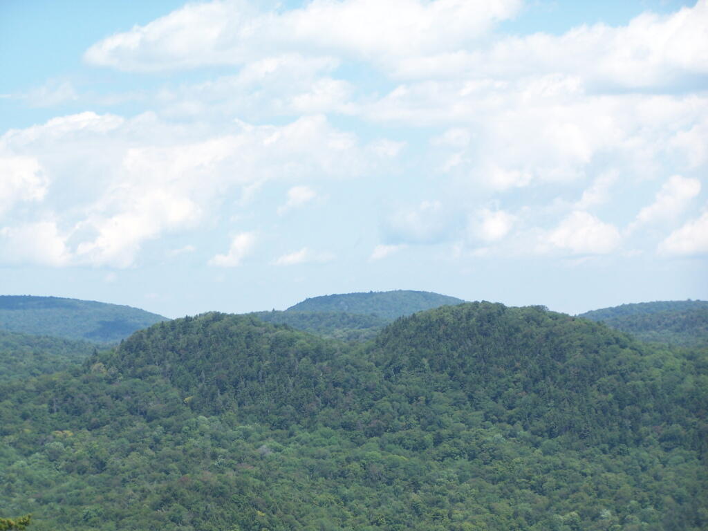
Not a lot of interesting country 🐮 – some of the sections along the Alleghany River between Tidoute and Tionesta were quite pretty. I can get why that section is popular with kayakers. 🚤Flat once you climb out of Tionesta Valley, some farmland and some businesses supporting the pop business. Rather flat until I got down to the area around Cooks Forest and then timberland as I headed to Marienville. I did see a household burning trash, which is still somewhat common in rural PA but nothing like a decade ago. Some of that plastic stuff stinks, especially if it’s smoldering. 👃

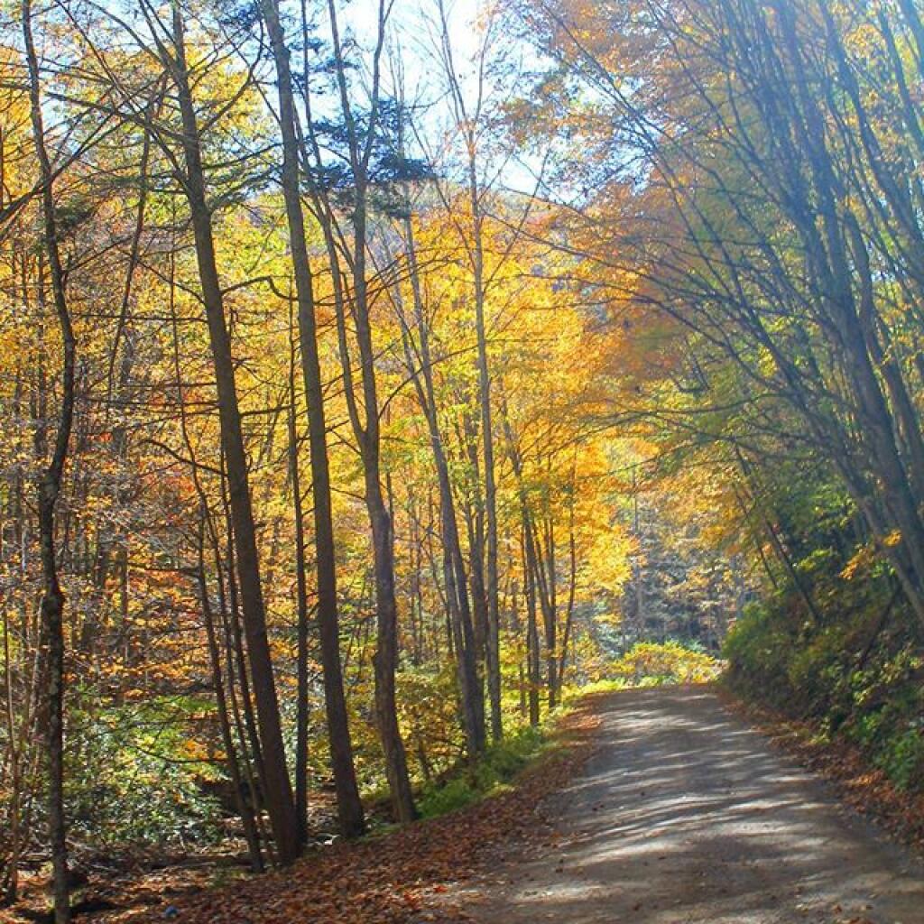
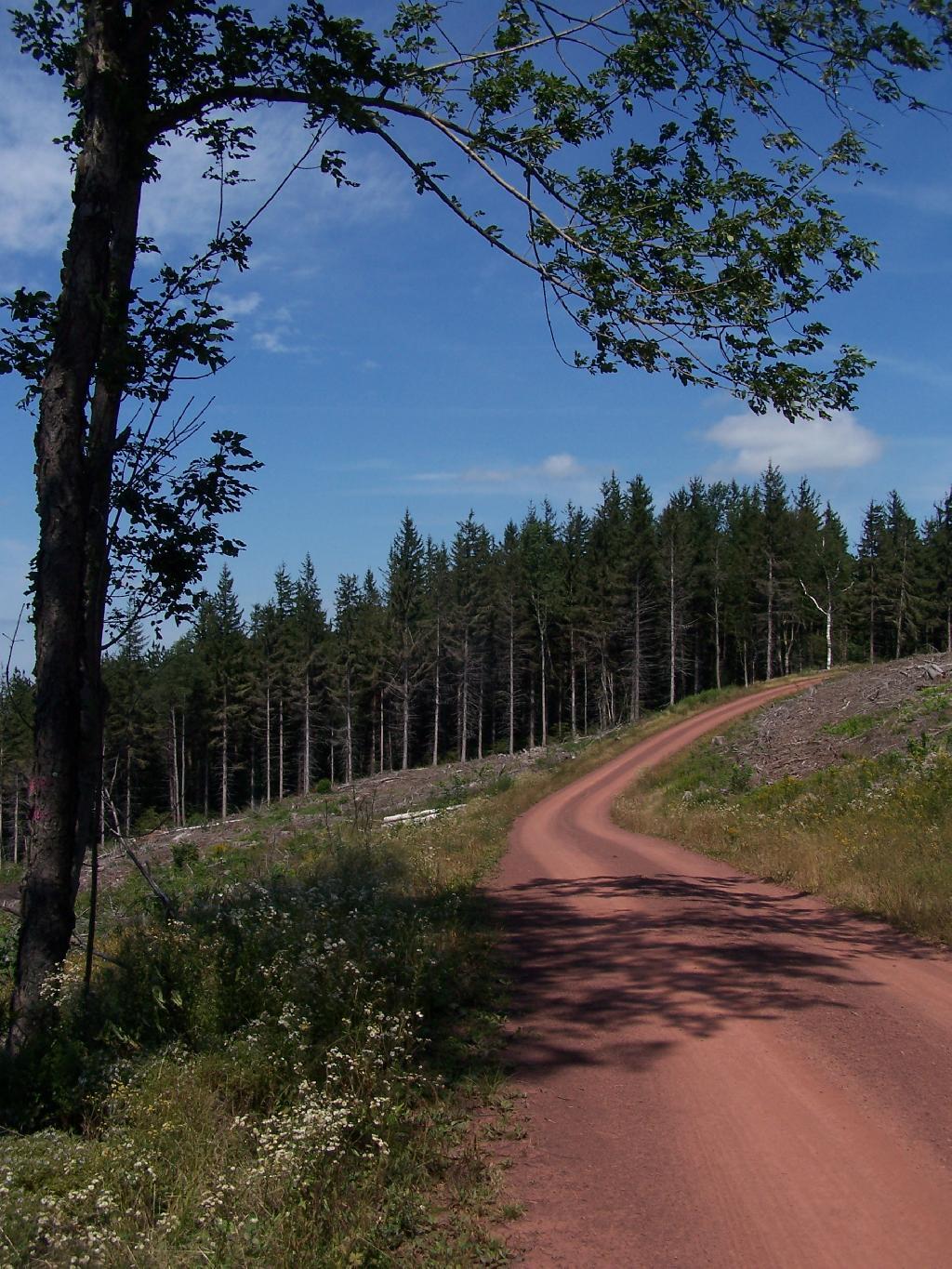
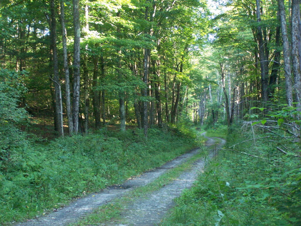
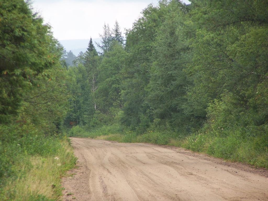
After that I visited the Cook Forest State Park ⛲ which had a fire tower and a path down to the gorge where the Clarion River runs and a nice picnic area around a historic tree planation. 🌲🌲🌲 I took River Road along Clarion River. That road is narrow but beautiful. Almost hit a doe, ran up from the river bank and into the shadow. My tires squealed but I fortunately missed it. Reviewing the dashcam it would have been hard for me to spot it. Really in the shadow.

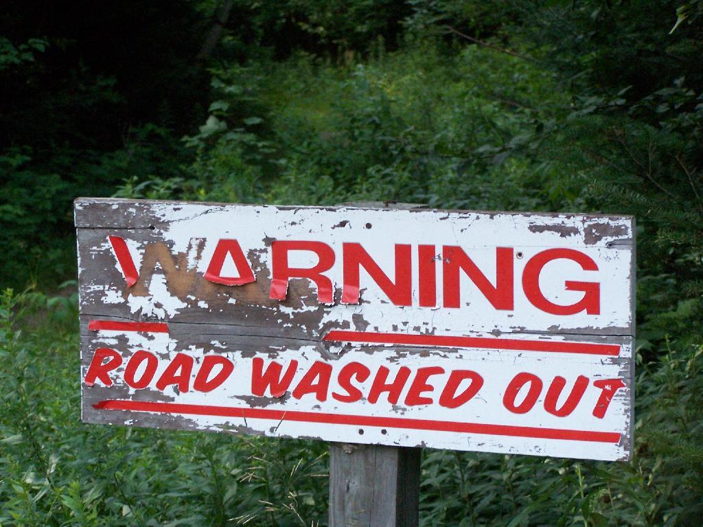
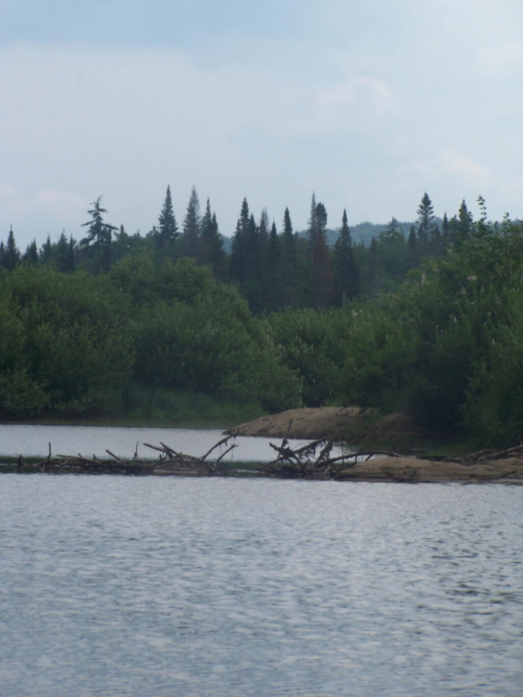
I was hoping to camp ⛺ at Loleta Grade campsite 16 which I like because it has good cell service 📱 which makes the night by go by quickly and makes the remote country seem less remote. It also has a good view of the stars ✨ and would be good for solar. But alas somebody already grabbed it with their camper, probably a bow hunter 🙇. They appeared to have solar too and probably cell service internet in their camp. That’s a much nicer campsite. This site on the Gurgling Run smells a bit like Hydrogen Sulfide from an oil well, I assume that’s what makes the Gurgling Run Gurgle. 💩 And it not only smells, it gurgles. Plus I don’t want to spend three nights without cell service. 📱

It thought about staying here for three nights then going to see the Elk and drive the Elk Drive and do Hyer View on Sunday. 🚙But then I would miss West Virginia and I don’t really like the campsite I ended up in. It doesn’t look good for me getting down to West Virginia in 2020 as it’s a busy election year at my other job and they’re could be recounts or snow in November.

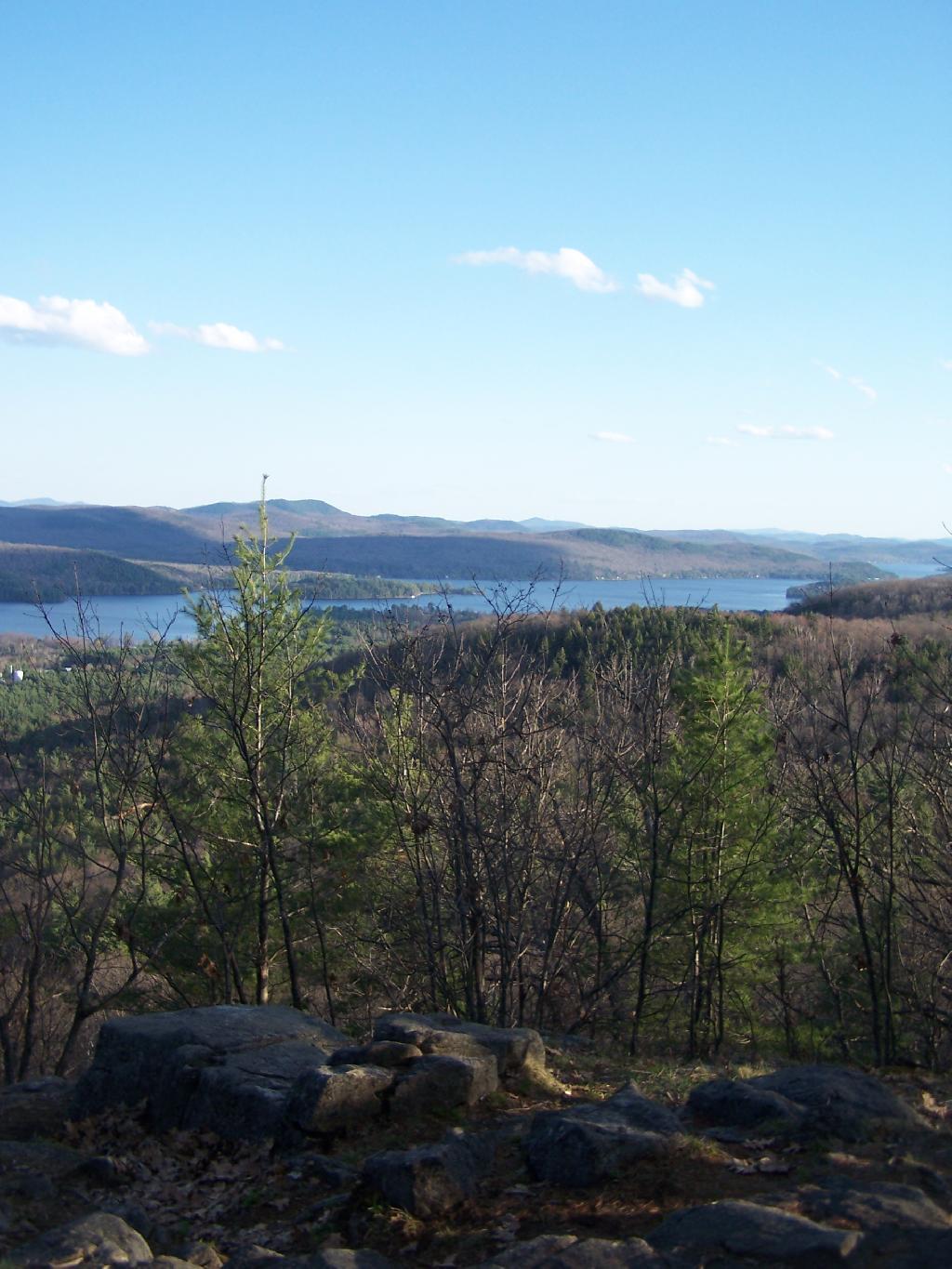
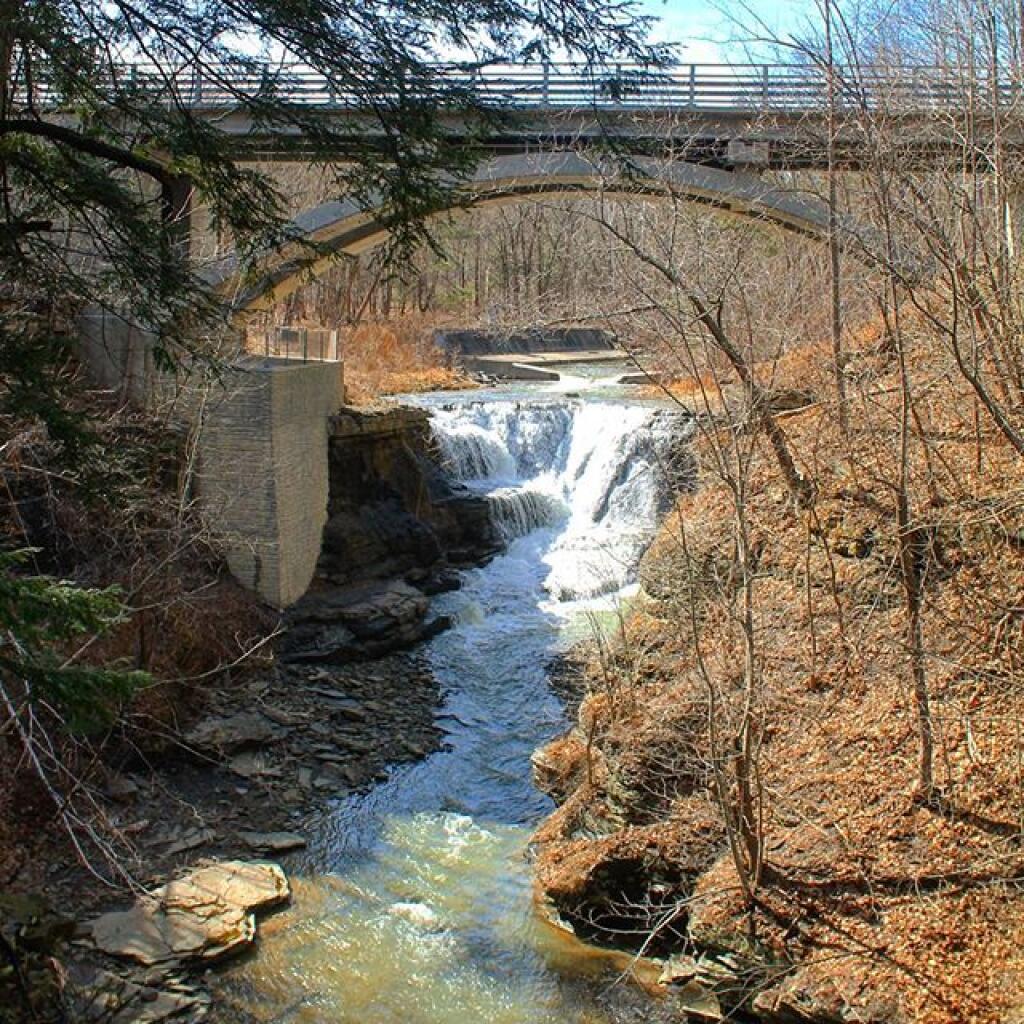
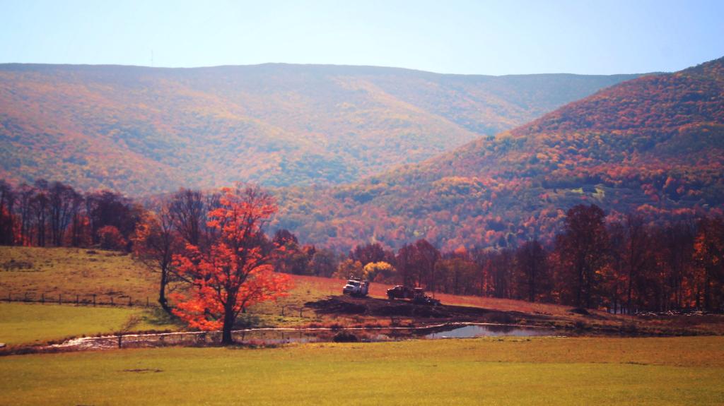
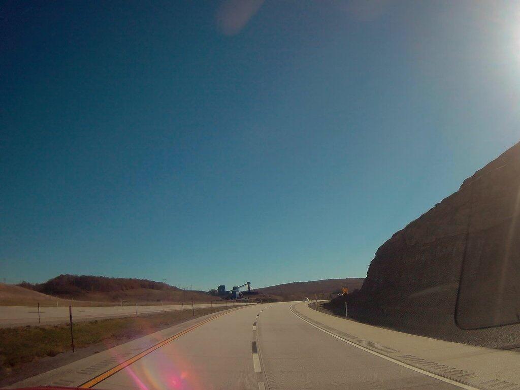
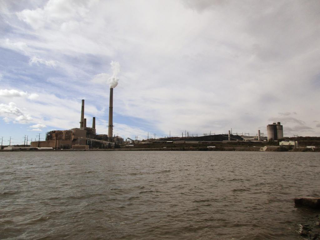
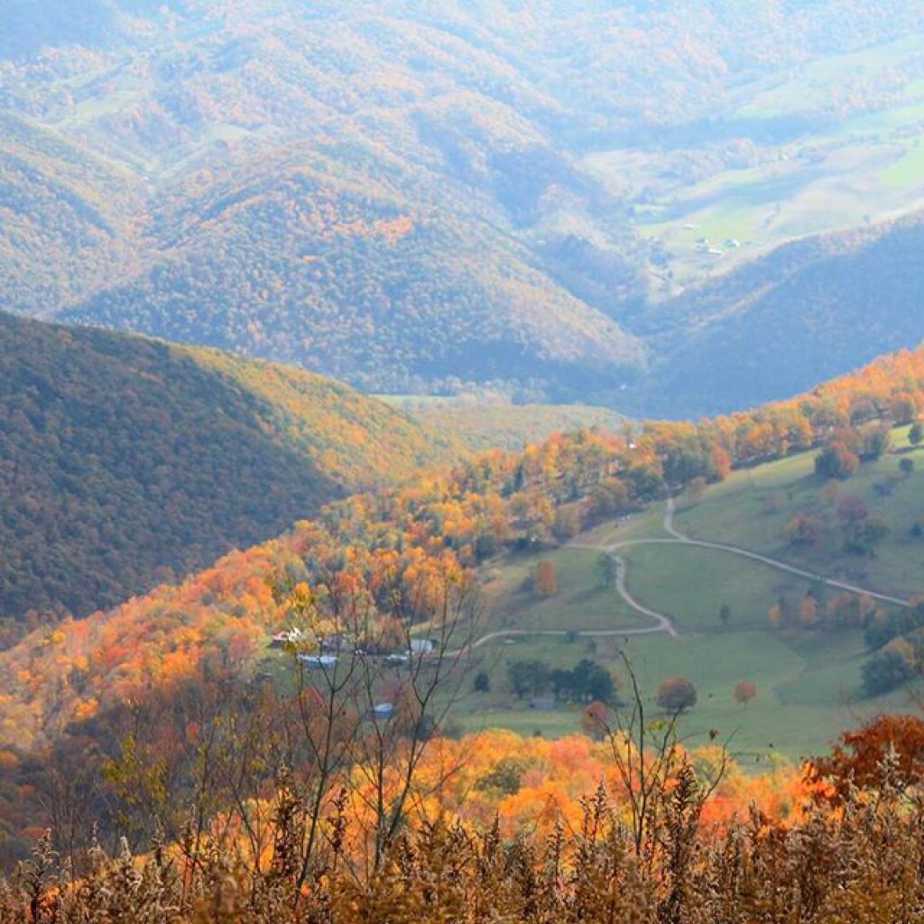
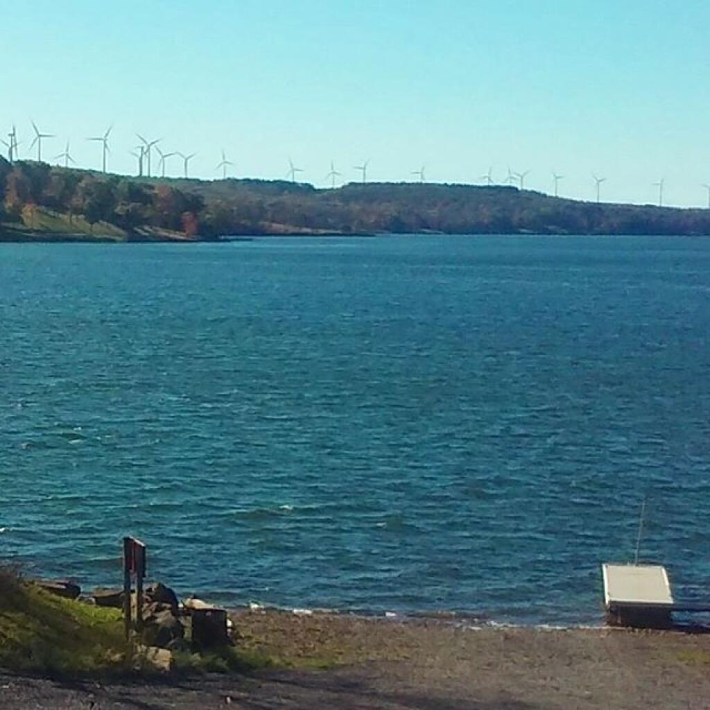
So I decided instead to drive down to Thomas, WV for the long weekend, heading back to County Bridge Campground. 🗻 Heading down now to Mount Davis, Pennsylvania High Point via Penna 36 and US 219. More of that highway is built through Somerset and some of those new expressway bridges look like they’ll have amazing views. It’s a lot of driving but less than I really had in my original plan as I’m not going down to the New River Gorge – just Dolly Sods one day and the other – the cloudy and potentially rainy Saturday I’ll do Maryland High Point and Blackwater Falls. But it’s fine. Sunday I’ll take Cooridor H, visit the Mount Storm Lake 🏭 and the massive power plant and then take to the road Keyser and then to Cumberland Maryland, then take US 220 and Interstate 99 to Mount Pisagh State Park for a drive with hopefully good colors then overnight at County Bridge outside of Troy.

I will pitch the tent down in West Virginia with the heater. No fires down there due to continuing fire ban 🔥 but I’ll save the paper plates and other burnables and have a fire the last night when overnight in Pennsylvania. I also have a little bit of kiln dried wood to burn at County Bridge. It’s fine – most nights I’ve been laying back in the hammock fairly early and letting the fire go out. It’s going to quite mild and the tent heater will be toasty. Not having to gather wood means that I’ll have more time for relaxing and reading 📖. Fires are really a lot of work and kind of a waste of fire wood.

As previously noted, there are 3 weeks until Halloween 🛥️ when the sun will be setting at 6:13 pm with dusk at 6:41 pm. On that day in 2018, we had mostly cloudy, patches of fog and temperatures between 61 and 28 degrees. Typically, the high temperature is 54 degrees. We hit a record high of 73 back in 1946.

Towards Big Moose Mountain

April 25, 2019 Afternoon

Good afternoon! Three weeks until the average high is 70 in Albany. 🐮 But still a pretty nice day here in the Sieamese Pond Wilderness. Blue skies and sunny and 53 degrees at the end of the East Branch Sacandaga River Gorge Trail. There is a southwest breeze at 5 mph. 🍃. Temperatures will drop below freezing at Sunday around 2 am. ☃️

This afternoon will be mostly sunny 🌞, with a high of 62 degrees at 4pm. One degree below normal for Albany, which is similiar to a typical day around April 24th. Not terrible for being in the Adirondack Wilderness in the spring. Southwest wind around 5 mph. Really not a cloud in the sky. A year ago, we had light rain in the morning, which tapered off to light drizzle by afternoon. The high last year was 57 degrees. The record high of 89 was set in 2009. 0.3 inches of snow fell back in 1928.❄That’s the year they laid the cornerstone of the office building I work at far away from the wilderness I’m currently at.

Yesterday I kind of got stuck in the office 🏢 until 5:30 so I didn’t get on the road until 5:45 but I drove straight out to Amsterdam so I was up to camp around 7:45. I kind of had some trouble getting the lantern 🏮 started after replacing then again breaking a mantle but then I got it working after fiddling for a few minutes. It kind of was getting dark and I forgot to bring a bright 🔆 light bulb 💡 but with the flash light I finally got it going. Then I got the fire started 🔥 which really took off with some of the brush and other stuff that they had cut out for the new privy they built up at the campsite. 💩 I was the first one to use it. The lights were up and the fire going good by 9ish and I stayed up listening 👂 to podcasts until around 11:30. An obnoxious barred owl occasionally woke me up during the night with his who? Who? But so be it. 😴

Today I hiked back to the East Branch Gorge Trail aftee hiking around Fox Lair for a while which I took pictures with from my other camera. 📷 This time the trail wasn’t so icy unlike the time I tried it in 2014. 🚶 Still its a pain to find the trail head, the best way to find it is to bushwhack following the East Branch until you reach the somewhat challenging to cross Kibby Pond outlook then follow it until you spot and old woods road and then ford the creek on the rocks and look for a herd path across from the old woods road. You never leave the view of the East Branch although at one point you do get quite a way above the gorge on the herd path up a good sized mountain. I was pretty underwhelmed by the end of the trail which had a pretty unimpressive designated tent 🎪 spot and then a relatively small water falls, maybe at most 20 feet tall. Further down the trail where the gorge is narrower is more impressive.

The sun will set at 7:52 pm with dusk around 8:22 pm, which is one minute and 11 seconds later than yesterday. 🌇 At sunset, look for mostly clear skies 🌄 and temperatures around 57 degrees. Should be a delightful evening once I get that campfire 🔥 a roaring and some good eats cooking. There will be a south breeze at 5 mph. Today will have 13 hours and 55 minutes of daytime, an increase of 2 minutes and 42 seconds over yesterday. Almost to the point of the the fourteenth hour day.

Tonight will rain likely, mainly after 5am. Increasing clouds 🌧, with a low of 41 degrees at 5am. Typical for tonight. Southeast wind 3 to 5 mph. Chance of precipitation is 60%. New precipitation amounts of less than a tenth of an inch possible. In 2018, we had light rain in the evening, which became cloudy by the early hours of the morning. It got down to 39 degrees. The record low of 24 occurred back in 1972.

Tomorrow will have periods of rain. The rain could be heavy at times. 🌧 High of 49 degrees at 2pm. 14 degrees below normal, which is similiar to a typical day around March 27th. Southeast wind 8 to 11 mph. Chance of precipitation is 100%. New precipitation amounts between a half and three quarters of an inch possible. A year ago, we had light rain in the morning, which became light drizzle by afternoon. The high last year was 56 degrees. The record high of 90 was set in 1990. 0.3 inches of snow fell back in 1993.❄

Today is definitely a beautiful day 😎 but maybe not so much tomorrow.😰 ☔ I’m going to enjoy today and tonight I guess tomorrow I’ll head home. If it’s going to pour than be followed by cold rainy weekend no reason to stay up north. I would have liked a four day weekend but I had a nice big ass fire last night and the hike back to the East Branch of the Sacandaga River Gorge is pretty nice although I have to admit I’m a little bit under impressed the falls. The trail really ends after the narrows of the gorge and the most scenic part is relatively unaccessible. But the best is yet to come of the summer …

As previously noted, there are 3 weeks until Average High is 70 🐮 when the sun will be setting at 8:16 pm with dusk at 8:49 pm. On that day in 2018, we had partly sunny, patches of fog and temperatures between 72 and 51 degrees. Typically, the high temperature is 70 degrees. We hit a record high of 89 back in 1991.

Not a particularly nice weekend on tap. 😞 Saturday, showers, mainly before 11am. High near 44. West wind 15 to 18 mph, with gusts as high as 31 mph. Chance of precipitation is 80%. New precipitation amounts of less than a tenth of an inch possible. Sunday, showers likely, mainly after 2pm. Partly sunny, with a high near 46. Chance of precipitation is 60%. Typical average high for the weekend is 63 degrees.

In four weeks on May 23 the sun will be setting at 8:23 pm,🌄 which is 31 minutes and 8 seconds later then today. In 2018 on that day, we had mostly sunny and temperatures between 81 and 56 degrees. Typically, you have temperatures between 72 and 49 degrees. The record high of 93 degrees was set back in 1964.

Looking ahead, Average High is 70 🐮 is in 3 weeks, Summer ️⛱️ is in 8 weeks, Independence Day 🇺🇸 is in 10 weeks, August 🌻 is in 14 weeks, More Night then Day 🌌 is in 5 months and Last Sunset After 7 PM 🌆 is in 23 weeks.

 Looking at the Lake

March 31, 2019 Morning

Good morning! March is almost done. Next Sunday is 7:30 PM Sunset 🌇. Partly cloudy, blustery and 55 degrees in Delmar, NY. ☁ 17 mph breeze from the south 🌬 with gusts up to 34 mph 💨💨💨. You hear the wind pick up from time to time. 🍃 The dew point is 44 degrees. Temperatures will drop below freezing at tomorrow around noontime. ☃️

It was nice having some sun this morning as I got up for work. Rain showers are expected to push in shortly though. ☔ I’m off to the shower 🚿 and then to a long day at work on this final day of March 2019 that’s more like a wet wool smelling lamb then anything else. Woke up early around 5 AM then fell back asleep. 💤 I’ve been waking up a lot around 4:30 AM many mornings, not sure why, maybe it’s because I’ve been going to bed early.

I turned the heat back on 🔥 before leaving for work, as tomorrow will be pretty cold. It’s set to 50 degrees. Too warm inside to kick on until later, but I don’t know how late I’ll return tonight. Only need it through Tuesday morning, 😊at which point I hope the heat can be off until October. It’s not that expensive but I need to save some money with camping season just around the corner.

Today will have showers, mainly after 8am. Temperature falling to around 43 by 3pm. Breezy, with a south wind 14 to 20 mph becoming west in the afternoon. Winds could gust as high as 34 mph. Chance of precipitation is 100%. New precipitation amounts between a tenth and quarter of an inch possible. A year ago, we had sunny in the morning, which became mostly sunny by afternoon. The high last year was 56 degrees. The record high of 89 was set in 1998. 14.6 inches of snow fell back in 1997.❄

The sun will set at 7:20 pm with dusk around 7:48 pm, which is one minute and 9 seconds later than yesterday. 🌇 At sunset, look for rain 🌧 and temperatures around 39 degrees. Breezy, 18 mph breeze ⛅ from the west-northwest with gusts up to 31mph. Today will have 12 hours and 42 minutes of daytime, an increase of 2 minutes and 53 seconds over yesterday.

Tonight will have a chance of rain and snow showers before midnight, then a slight chance of snow showers between midnight and 3am. Mostly cloudy 🌧, with a low of 28 degrees at 6am. Four degrees below normal, which is similiar to a typical night around March 23rd. Northwest wind 14 to 17 mph, with gusts as high as 29 mph. Chance of precipitation is 30%. Little or no snow accumulation expected. In 2018, we had cloudy in the evening, which became partly cloudy by the early hours of the morning. It got down to 27 degrees. The record low of 9 occurred back in 1923.

As previously noted, Monday will be sunny but cold 🌞, with a high of 44 degrees at 4pm. Eight degrees below normal, which is similiar to a typical day around March 16th. Breezy, with a northwest wind 18 to 22 mph, with gusts as high as 37 mph. A year ago, we had sunny in the morning, which became mostly sunny by afternoon. The high last year was 47 degrees. The record high of 77 was set in 1986. 5.0 inches of snow fell back in 1924.❄

The one day weekend came and went pretty quickly for me. Back to work on this Sunday morning.😮 Not that I had big ambitions for today, it’s kind of a rather wet and rainy day.💦 Yesterday, despite the clouds was a pretty mild and nice day – the Pine Bush Hike was nice as was Bennett a Hill. 🚶I’ll post my Bennett Hill photos later on today.📷

Nice hiking up Bennett Hill yesterday. Those cows next to the mountain though sure were muddy. 🐄It looked like their path back to the barn was a bit flooded too. Cows are fairly hardy animals but wet feet just like humans can cause all kinds of problems too. Not a bad hike but a lot of people on the mountain.

Driving out to my parents house, past my neighbors house with their hobby farm with pigs, cows, goats, chickens,🐷🐮🐤 and God knows what else reminded me how jealous I am of them and their redneck life with all their knowledge and toys I’ll never have. Even if I work hard and invest everything I can, I’ll never be able to achieve the life that they did. 🔨They’re is something so wonderful and charming about the redneck life.

I went out and saw the folks yesterday for dinner, hanging my hammock up and relaxing out front there. 😁I wouldn’t mind using the hammock where I live but the landlord chopped down all the trees in the yard. Well I’ll get plenty of use this summer. 🐸I’m thinking about doing some hammock camping in the back country this summer. Once black fly season is done for sure.

I went out for my evening walk and sat out back for a while, still a pretty mild evening although in some ways I prefer laying in my bed compared to the lawn chair. 🚶 Had a nice glass of cider vinegar water and retired to bed around 9:30, listening to a podcast for a while.🎶 I tried to get as much sleep as possible as I know today is going to be a long day.

I bought about $30 on groceries yesterday but today driving into work I’m going to buy some pan spray, 🍳 which I forgot plus some candy 🍬 to hand out in the office plus some energy shots. Even if I don’t take them tonight to keep my alert for the drive home, they’re good to keep in my truck should I get tired driving up to camp one night. ☕ Energy shots are good for keeping awake without having to stop and pee along the road every five minutes. I also need to gas up the truck this morning, ⛽ first time in a month. Gas prices have gone up a lot.

Stopped at Falvo’s on the way back from the Save the Pine Bush Hike and bought some more of their meat balls. 🍝I have a full pack in the freezer but my parents swear by them and I figured I should buy them before they are gone for good. Those old fashioned butcher shops are all a dying breed and the owners there are a million years old.👵 I missed out on ever going to Toll Gate Ice Cream 🍦and I don’t want to not have a few good meals from there.

I noticed the cruise control isn’t working on my truck even in the warm weather due to that sensor that is malfunctioning.🔎 Not critical, more annoying, I thought it only was a cold weather problem. I might have the General fix🔧 it the next time I have an oil change done💸. Annoying enough I think I’m willing to pay for the fix, especially if I’m heading out a lot more to spend time in the Adirondacks camping this summer.🚗

The long range looks cloudy but mild for next weekend. Next Saturday, mostly cloudy, with a high near 58. ☁ Typical average high for the weekend is 54 degrees.

In four weeks on April 28 the sun will be setting at 7:52 pm,🌄 which is 31 minutes and 51 seconds later then today. In 2018 on that day, we had partly cloudy, rain showers and temperatures between 68 and 45 degrees. Typically, you have temperatures between 64 and 42 degrees. The record high of 92 degrees was set back in 1990.

Looking ahead, 7:30 PM Sunset 🌇 is in 1 weeks, Palm Sunday 🌴 is in 2 weeks, Easter 🐰 is in 3 weeks, Cinco de Mayo 🤠 is in 5 weeks, Mothers Day 👩‍ is in 6 weeks, Fathers Day 👨 is in 11 weeks, National Nude Day 👱 is in 15 weeks, Sunset Before 7:30 PM 🌆 is in 22 weeks, Autumn 🍂 is in 25 weeks and Average High is 60 🍂 is in 28 weeks.

Upper Falls

Coal Stories

I finished up the five episodes of NPR’s Embedded podcasts on Coal Stories. 🔊I cried a little bit when the final podcast came to an end as I knew how it would end.

Listen to Embedded Podcast Here: https://www.npr.org/podcasts/510311/embedded

Except for the brave wayward tourist or maybe the backcountry hunter few non local people ever spend much in Appalachia off the beaten path🚧 of the expressway and the tourist trap. It’s hard to fall in love with a land at seventy miles per hour or by staying only in designated locations. Many people believe that the world ends once you pass the last stop light,🚥 descending into a dark place highlighted by Deliverance. Despite what television says, there aren’t people hiding in the woods hoping to make you squeal like a pig 🐷.

Almost Heaven

Evening

Appalachia with its mighty mountains, 🗻twisty narrow roads with steep decents and quaint villages in the river valleys is a special, wild place in many ways. It’s a place filled with amazing people, spectacular scenery and fascinating accents, traditions and customs. It’s a place of remarkable natural resources like fish and wildlife,🐡 poor farms carved into hillsides and fertile valleys🐮, timber🌲, rock, oil and gas and most importantly coal.

 Along The Potomac River

 Coal Strip Mine Along Corridor H

While the best of Appalachia’s coal has long been burned, there are still substantial reserves of this dirty but cheap fuel, especially the low value soft bituminous coal.🏭 Loaded with sulfur and heavy with carbon atoms, mining has provided good paying, if not tough jobs in area where there is few other jobs – as Appalachia is already poor and provides the big bustling metropolitan areas🏢 with cheap, but very dirty electricity.

Mount Storm

Farm in Riverton, WV

Sure there are other jobs in Appalachia, but for the most part they pay less. Most people, especially those in Appalachia know that coal jobs are disappearing 🌁due cleaner and easier to burn natural gas, greater efficiency, and more renewables. Even in deep Appalachia wind turbines dot the ridges and solar panels cling to hillsides, but nothing pays quite like coal when it comes to natural resource production – despite being an industry that is only becoming more troubled. Coal is not unlike the dairy industry in New York – dairy ain’t the best sector of agriculture in the state but it has steady milk checks year round.

Coal allows people to stay in Appalachia, at least the lucky few that can score the remaining jobs. It’s tough nasty work, an industry that every local knows is poisoning the land but is also putting dinner on the table, paying for a nice house and pickup truck, a deer rifle for hunting season and a four wheeler.🗻 Coal allows people to remain in the land they love, the blessed hills and hollows, the twisty steep roads off the mountains where people hunt and fish, at least where acid mine discharge hasn’t poisoned the steams.

Route 7 in Gandy, WV

Make no mistake, coal is not an easy industry to break into. Only a few percentage of people in Appalachia are lucky enough to have scored a job in the coal industry. 👷But for the lucky few, it’s a good job in a wonderful community. And that was the whole story of Embedded’s Coal Stories.

Mount Storm Lake

I highly recommend listening to the Embedded Coal Stories. 🎧Don’t be afraid to exit the four lane, explore the quaint villages that time and tourists has forgotten between the mountains,🏰 take many narrow and steep roads through the mountains. Speak jealously about the few people lucky enough to carve a life out of what so little remains of the hills and hollows of Appalachia.

 Moorefield WV

Laws and Case Law

Highway Law Section 115-A:
Abandonment of County Highways.

Whenever a county road or part thereof constructed as part of the county road system deviates from the line of an existing town highway, or from the line of a former town highway within the limits of an incorporated village, as shown on the map of the county road system, the board of supervisors by resolution duly adopted upon the recommendation of the county superintendent of highways, and pursuant to a written agreement with the town board or village board of trustees, or in the event such an agreement cannot be reached with the approval of the commissioner of transportation, may abandon to the town or the incorporated village as the case may be for future maintenance, that part of the town highway or former town highway within the limits of an incorporated village not improved and modify the map of the county road system accordingly. The portion of any town highway or former town highway within the limits of an incorporated village excluded from the county road system shall be maintained by the town or village in which it is located.

Warning! Road Washed Out

Highway Law Section 205:
Highways Abandoned By Local Governments.

1. Every highway that shall not have been opened and worked within six years from the time it shall have been dedicated to the use of the public, or laid out, shall cease to be a highway; but the period during which any action or proceeding shall have been, or shall be pending in regard to any such highway, shall form no part of such six years; and every highway that shall not have been traveled or used as a highway for six years, shall cease to be a highway, and every public right of way that shall not have been used for said period shall be deemed abandoned as a right-of-way. The town superintendent with the written consent of a majority of the town board shall file, and cause to be recorded in the town clerk’s office of the town a written description, signed by him, and by said town board of each highway and public right-of-way so abandoned, and the same shall thereupon be discontinued.

2. There may also be a qualified abandonment of a highway under the following conditions and for the following purposes, to wit: Where it appears to the town superintendent and said town board, at any time, that a highway has not become wholly disused as aforesaid, but that it has not for two years next previous thereto, been usually traveled along the greater part thereof, by more than two vehicles daily, in addition to pedestrians and persons on horseback, and it shall also appear to the superintendent of highways of the county in which such town is situate that a qualified abandonment of such highway is proper and will not cause injustice or hardship to the owner or occupant of any lands adjoining such highway after such superintendent shall have held a public hearing thereon upon giving at least twenty days’ written notice to such owners and occupants of such lands of the time and place of such hearing, they shall file and cause to be recorded in the town clerk’s office a certificate containing a description of that portion of the highway partly disused as aforesaid and declaring a qualified abandonment thereof. The effect of such qualified abandonment, with respect to the portion of said highway described in the certificate, shall be as follows: It shall no longer be worked at the public expense; it shall not cease to be a highway for purposes of the public easement, by reason of such suspension of work thereon; no persons shall impair its use as a highway nor obstruct it, except as hereinafter provided, but no persons shall be required to keep any part of it in repair; wherever an owner or lessee of adjoining lands has the right to possession of other lands wholly or partly on the directly opposite side of the highway therefrom, he may construct and maintain across said highway a fence at each end of the area of highway which adjoins both of said opposite pieces of land, provided that each said cross fence must have a gate in the middle thereof at least ten feet in length, which gate must at all times be kept unlocked and supplied with a sufficient hasp or latch for keeping the same closed; all persons owning or using opposite lands, connected by such gates and fences, may use the portion of highway thus enclosed for pasturage; any traveler or other person who intentionally, or by wilful neglect, leaves such gate unlatched, shall be guilty of a misdemeanor, and the fact of leaving it unlatched shall be prima facie evidence of such intent or wilful neglect. Excepting as herein abrogated, all other general laws relating to highways shall apply to such partially abandoned highway. This section shall not apply to highways less than two rods in width unless it shall appear to the town superintendent at any time that such a highway has not, during the months of June to September inclusive of the two years next previous thereto, been usually traveled along the greater part thereof by more than ten pedestrians daily.

Any action or proceeding involving the abandonment or qualified abandonment of a highway made pursuant to this section must, in the case of abandonment, be commenced within one year from the date of filing by the town superintendent as provided in subdivision one of this section.

Old NY 30 Signs

Matter of Smigel v. Town of Rennselaer.

As seen on Google Scholar.

MATTER OF SMIGEL v. TOWN OF RENSSELAERVILLE

283 A.D.2d 863 (2001)

725 N.Y.S.2d 138

In the Matter of HENRIETTA SMIGEL, Respondent, v.
TOWN OF RENSSELAERVILLE et al., Appellants.

Appellate Division of the Supreme Court of the State of New York, Third Department.

Decided May 24, 2001.

Mercure, J. P., Peters, Spain and Carpinello, JJ., concur. Lahtinen, J.

Petitioner is the owner of land bordering the Camp Winsocki Road (hereinafter the road) located in respondent Town of Rensselaerville in Albany County, having acquired title to the property in 1986. In December 1995, petitioner requested that respondents abandon a portion of the road which she had barricaded at both ends in 1986, and which respondent Town Supervisor admitted had not been maintained by respondents for at least 20 years. Her request was continued for further study by the Town Board of the Town of Rensselaerville. In October 1999, petitioner and another petitioned respondents “to abandon a portion of its present easement to [the road].” In January 2000, after a public hearing, respondents refused to abandon the road and passed a resolution finding that the road had not been abandoned through disuse, ordering petitioner to remove all of her barricades, and making the road a seasonal road to be maintained from April 1 to December 1.

In January 2000, petitioner commenced this combined CPLR article 78 proceeding and action for declaratory judgment seeking a judgment clearing her title “as to the portion of her property previously subjected to an easement for the highway,” injunctive relief prohibiting respondents from removing her barriers on the road and trespassing on her property and an order directing respondents to file a certification of abandonment. Respondents answered, asserting that the petition/ complaint failed to state a cause of action.

The parties submitted numerous affidavits and documentary evidence in support of their respective positions and, in April 2000, Supreme Court determined that because no photographs had been submitted by either party, the matter could not be summarily decided, and it therefore set a hearing date to determine whether recreational travel “follows the `lines of the ancient street.'” When the parties appeared on the scheduled hearing date, they were informed that the hearing had been canceled and were directed to leave any photographs that they had with the court for review. Both parties submitted photographs depicting the present condition of the road.* On May 26, 2000, Supreme Court granted the petition/complaint and declared the road to be abandoned. Respondents appeal and we reverse.

Highway Law § 205 (1) provides, in relevant part, that “every highway that shall not have been traveled or used as a highway for six years, shall cease to be a highway.” Once a highway exists, it is presumed to continue until the contrary is demonstrated and the presumption is in favor of continuance (see, City of Cohoes v Delaware & Hudson Canal Co., 134 N.Y. 397, 407; Matter of Van Aken v Town of Roxbury,211 A.D.2d 863, 865, lv denied 85 N.Y.2d 812). The burden of establishing abandonment is on the party claiming that the highway has been abandoned (see, Matter of Faigle v Macumber,169 A.D.2d 914, 915). In that regard, a municipality’s intention regarding a road is irrelevant (see, Daetsch v Taber,149 A.D.2d 864, 865) and its failure to maintain a road does not mean that the road ceases to be a highway (see, O’Leary v Town of Trenton,172 Misc.2d 447, 450). A determination of abandonment of a road by nonuse is a factual determination (see, e.g., Coleman v Village of Head of Harbor,163 A.D.2d 456, 458, lv denied76 N.Y.2d 768; Holland v Superintendent of Highways of Town of Smithtown,73 Misc.2d 851, 852).

It is undisputed that respondents never filed a certificate of abandonment to officially abandon the road. Likewise, it is clear that respondents did not maintain the road nor had the road been used by motor vehicles for more than the statutory six-year period. The narrow question left to be decided after submission of the photographs was framed by Supreme Court as follows: “[i]f the road entrance has been obstructed, and it is unpaved and overgrown with weeds, trees, bushes and shrubs, as claimed by petitioner, making travel along the `lines of the ancient street’ improbable, then even the most active recreational and seasonal use propounded by [respondents], that of snowmobilers, hikers, and bicyclists, would fall short of being highway use” (citing O’Leary v Town of Trenton, supra, at 451; Holland v Superintendent of Highways of Town of Smithtown, supra, at 853).

We find that Supreme Court correctly set forth the applicable law regarding abandonment of a highway through nonuse. After reviewing the photographs submitted by the parties, Supreme Court made the factual determination that the “photographs reveal many years of non-use as a highway” and “it is apparent that the road entrance has often been obstructed, preventing travel along the `lines of the ancient street,'” and summarily granted the relief sought by petitioner. We agree that the photographs show a number of barricades located at various points along the unpaved road, but they also show an ancient road, not overgrown with weeds, trees, bushes or shrubs, but clearly discernible, and not “virtually indistinguishable from the surrounding wooded area” (Matter of Faigle v Macumber, supra, at 916). Indeed, the pictures appear to depict a clearly defined, unpaved roadway through an area overgrown with brush and thick woods on both sides, precluding travel other than on the road, except with extreme difficulty. Our review of the photographs suggests to us that travel over this road by such disparate groups as snowmobilers, bicyclists, cross-country skiers and pedestrians would follow “along the lines of an existing street” (Town of Leray v New York Cent. R. R. Co., 226 N.Y. 109, 113). Moreover, respondents’ submissions reflect that although petitioner had barricaded the road on a number of occasions, those obstructions were either removed or knocked down so as to access its year-round recreational use. Therefore, the recreational uses found by Supreme Court may be sufficient to preclude a finding of abandonment of the road by nonuse. In our opinion, summary judgment should not have been granted in this matter in the absence of clarifying testimony as to the condition and use of the roadway.

Ordered that the judgment is reversed, on the law, without costs, and matter remitted to the Supreme Court for further proceedings not inconsistent with this Court’s decision.

Red Dirt Road

MATTER OF VAN AKEN v. Town of Roxbury, 211 AD 2d 863.

As found on Google Scholar.

211 A.D.2d 863 (1995) 621 N.Y.S.2d 204 In the Matter of Millard Van Aken et al., Appellants, v. Town of Roxbury et al., Respondents

Appellate Division of the Supreme Court of the State of New York, Third Department.

January 5, 1995 Mikoll, Crew III, Yesawich Jr. and Peters, JJ., concur.

Cardona, P. J.

Petitioners are property owners with residences located in the Town of Roxbury, Delaware County, which extends beyond the roadway presently maintained by respondents as a Town road. On October 20, 1992, petitioners wrote to respondent Town of Roxbury requesting maintenance of the road segment at issue. On November 10, 1992, the Town Attorney responded by requesting evidence that the segment was a Town road. The attorney for petitioners wrote back indicating the reasons the particular segment was a Town highway. When no response was received, petitioner Millard Van Aken asked the Town Supervisor about the status of the request and was told that the Town Attorney was supposed to respond but had been delayed by other matters.

On March 4, 1993, the Town Attorney informed petitioners that if the segment was a Town road it had been abandoned. On July 1, 1993, petitioners commenced this CPLR article 78 proceeding seeking to compel the Town and respondent Town Superintendent of Highways to maintain the road segment pursuant to Highway Law § 140. In their answer, respondents asserted that the proceeding was barred by the four-month Statute of Limitations (see, CPLR 217 [1]). Supreme Court held that the Town was required to make a final binding determination on petitioners’ request before CPLR article 78 review was possible and the Town Attorney’s letter of March 4, 1993 did not constitute a binding determination. Unable to determine 864*864 if or when the Town had taken official action on petitioners’ request, Supreme Court dismissed the petition as either untimely or premature. By letter to the Town Board dated September 30, 1993, petitioners sought a formal vote on their request for maintenance. On October 11, 1993, the Town Board denied their request. Thereafter, petitioners moved for reconsideration, which Supreme Court denied.

Initially, we note that Supreme Court relied upon our decision in Treadway v Town Bd. (163 AD2d 637) in determining the Statute of Limitations issue. We treated the declaratory judgment action in Treadway as a mandamus to review for limitation purposes. However, the present proceeding is in the nature of mandamus to compel rather than mandamus to review. In mandamus to review, the court examines an administrative action involving the exercise of discretion for which no quasi-judicial hearing is required. On the other hand, in mandamus to compel an agency or officer’s performance of a ministerial act, the court examines whether the petitioner possesses a clear legal right to the relief sought and whether the agency or officer has a corresponding nondiscretionary duty to grant the relief requested (see, CPLR 7803 [1]; Matter of Scherbyn v Wayne-Finger Lakes Bd. of Coop. Educ. Servs., 77 N.Y.2d 753, 757; see also, Matter of Armstrong v Centerville Fire Co., 83 N.Y.2d 937, 939; Matter of Legal Aid Socy. v Scheinman, 53 N.Y.2d 12, 16).

In Treadway (supra), review was sought of an administrative action in the form of a declaration by the Town Board that the disputed road was not a public road. We held that the four-month Statute of Limitations began to run from that final binding determination. In this case, there is no question but that petitioners made a demand for maintenance to the Town on October 20, 1992. The March 4, 1993 letter from the Town Attorney[*] conveyed the Town’s refusal to perform its ministerial duty to maintain the road (see, Highway Law § 140). Accordingly, the four-month Statute of Limitations began to run at that time (see, CPLR 217 [1]; Matter of Waterside Assocs. v New York State Dept. of Envtl. Conservation, 72 N.Y.2d 1009, 1010; Matter of De Milio v Borghard, 55 N.Y.2d 216, 220; Matter of Pfingst v Levitt, 44 AD2d 157, 159, lv denied 34 N.Y.2d 518; see also, Siegel, NY Prac § 566, at 887 [2d ed]). Therefore, the petition filed on July 1, 1993 was 865*865 within the applicable period of limitations and the proceeding was timely commenced.

Having established that petitioners’ proceeding was timely commenced, we turn now to the merits of their petition. While it is clear that the Town has a legal duty to maintain Town roads (see, Highway Law § 140) and can be compelled to perform such a duty (see, People ex rel. Schau v McWilliams, 185 N.Y. 92, 100), the parties disagree on the fundamental question of whether the road segment at issue was abandoned by the Town and therefore no longer a Town highway. It is undisputed that no certificate of abandonment was ever filed by the Town, as provided for in Highway Law § 205. “Once a road becomes a highway, it remains such until the contrary is shown” (Matter of Shawangunk Holdings v Superintendent of Highways of Town of Shawangunk, 101 AD2d 905, 907; see, Matter of Flacke v Strack, 98 AD2d 881). A highway will be deemed abandoned if it is not traveled or used as a highway for six years (see, Highway Law § 205). The burden of proving such abandonment rests, in this case, with the Town (see, Matter of Shawangunk Holdings v Superintendent of Highways of Town of Shawangunk, supra, at 907).

Respondents have failed to meet their burden of proving that the road segment at issue was not traveled or used as a highway for six years. Although respondents argue that abandonment is shown because of a period of nonmaintenance in excess of 30 years, the law is clear that a highway does not cease to be a highway merely because the Town has failed to service it (see, Hewitt v Town of Scipio, 32 AD2d 734, affd 26 N.Y.2d 934). Nor is it relevant whether the Town intended an abandonment, as it is the substantive facts themselves which establish abandonment (see, Daetsch v Taber, 149 AD2d 864, 865). Petitioners have introduced uncontroverted cartographic and testimonial evidence to support their contention that the road has been and continues to be regularly used and traveled as a highway. We, therefore, find that no genuine issue of abandonment exists and that the contested road segment continues to be a Town road.

Ordered that the judgment and order are reversed, on the law, with costs, and petition granted.

Betty Brook Road

Holland v. SUPT. OF HIGHWAYS, 73 Misc. 2d 851

This case also from Google Scholar.

73 Misc.2d 851 (1973)

Eugene W. Holland, Plaintiff,
v.
Superintendent of Highways of the Town of Smithtown et al., Defendants.

Supreme Court, Special Term, Nassau County.

April 3, 1973 Donner, Fagelson & Hariton for plaintiff. H. Paul King for defendants.

BERTRAM HARNETT, J.

Eugene W. Holland owns property in Smithtown, New York, bordering to the east on a plot of land about 50 feet wide sometimes known as the “Old Smithtown to St. Johnsland Road”. In this declaratory judgment action brought against the Town of Smithtown and its Superintendent of Highways, Mr. Holland now seeks, by summary judgment motion, a declaration that he owns the westerly one half of the land by virtue of State and town abandonment of 852*852 it. Defendants move to dismiss pursuant to CPLR 3211 (subd. [a], par. 10).

Despite some minor disputation, the parties essentially agree that the subject land is not used as a public road for motor vehicular traffic. It is unpaved, blocked off on both ends, and substantially overgrown with trees and shrubbery. Pedestrians and bicyclers occasionally use it as a sort of pathway or shortcut. No material issue of fact appears to prevent a summary disposition. (Sachs v. Real Estate Capital Corp., 31 A D 2d 916; Law Research Serv. v. Honeywell, 31 A D 2d 900.)

Subdivision 1 of section 205 of the Highway Law provides in pertinent part: “Every highway that shall not have been traveled or used as a highway for six years, shall cease to be a highway * * * The town superintendent with the written consent of a majority of the town board shall file, and cause to be recorded in the town clerk’s office of the town a written description, signed by him, and by said town board of each highway and public right-of-way so abandoned, and the same shall thereupon be discontinued”.

The statute does not specify any procedures to be followed in town ascertainment of an abandoned highway, in contrast to the notice and hearing required for a “qualified abandonment” finding. (See Highway Law, § 205, subd. 2.) Any route once declared and used as a highway is presumed to continue as such until shown, by the party seeking a contrary declaration, to have been abandoned. (Hallenbeck v. State of New York, 59 Misc 2d 475, 480; Stupnicki v. Southern New York Fish & Game Assn., 41 Misc 2d 266, affd. 19 A D 2d 921.) The focal determination is essentially a factual one. And, nonuse of only a portion of a highway, while the rest continues to be utilized as a highway, does not result in abandonment, even of the unused portion. (Bovee v. State of New York, 28 A D 2d 1165.)

While at one time the Smithtown to St. Johnsland Road may have been heavily traveled, after its completion in 1917, the portion abutting Mr. Holland’s land has been in substantial disuse since a realignment of the Jericho Turnpike intersection in 1930. The evidence is overwhelming for much more than the past six years the land was not used as a highway. Petitioner and 16 residents in the surrounding neighborhood so attest in sworn statements and the photographs submitted clearly indicate lack of highway activity for many years. Indeed, the town itself uses the easterly half of the old road land as part of a park.

853*853While use as a highway upon appropriate circumstances may encompass less than contemporary expressway traffic of trailer trucks and high-speed automobiles, even the most active use posited by the town, that of pedestrian and bicycle passage, falls far short of being highway use. (Town of Leray v. New York Cent. R. R. Co., 226 N.Y. 109, 113.) Were this activity to create a public easement, the ownership rights of the adjoining fee owner would still remain unaffected. “It is the rule that where an easement only exists in the public that upon abandonment the fee is presumptively in the owners of the adjoining land.” (Stupnicki v. Southern New York Fish & Game Assn., 41 Misc 2d 266, 271, affd. 19 A D 2d 921, supra).

As Judge CARDOZO observed in Barnes v. Midland R. R. Term. Co. (218 N.Y. 91, 98): “If for six years the highway remains closed with the acquiescence of the public, there is an extinguishment of the public right”.

One peculiar wrinkle remains. After the State apparently realized that this portion of the “Old Smithtown to St. Johnsland Road” would be unused because of the mentioned realignment, the Commissioner of the Department of Works, Division of Highways, issued an official order dated July 19, 1932, substituting as part of the official State highway the realigned section for the abandoned section, stating that the unused portion was to be “TURNED OVER to the COUNTY OF SUFFOLK for future maintenance and repair”. The town asserts, in seeking dismissal, that this directive adversely affects Mr. Holland’s fee interest, and further requires the County of Suffolk to be joined as a necessary party.

Mr. Holland’s fee interest, clearly established by his surveyor’s title search of deeds going back over one hundred years, is not disturbed by the State’s order which relates solely to maintenance and care of the discontinued stretch of highway, not to the underlying ownership. Under the State highway system, created in 1908, the State does not own its roads unless prescribed condemnation procedures are first completed. (L. 1908, ch. 330; Highway Law, § 30.) Here, there is no indication of any prior State condemnation. When the Department of Works’ order was issued in 1932, the State’s interest was merely that of a public right of way, limited to its entitlement and obligation to maintain the roads. Accordingly, even if the Commissioner had conveyance power, all that could have been “turned over” to Suffolk County in 1932 was the State’s maintenance right. In this proceeding to determine ownership rights in the land, the county is not, therefore, a necessary or 854*854 indispensable party, particularly where, upon abandonment declaration, and resulting ownership and use vesting in the adjoining owner, he would then assume use, control and maintenance of the land.

Moreover, the purported deed from the county to the town dated July 28, 1930, transferring the 15 feet on each side of the subject parcel to the town only for use as a park or plaza, does not appear to affect the easterly side of the road, not owned at any time by the town. In any event, it could not convey a fee interest that the county did not have.

Finally, the lack of any formal application for a town certificate is not at this stage fatal. The abandonment exists, independent of the town certification, a purely ministerial act. (See People ex rel. De Groat v. Marlette, 94 App. Div. 592, 594.) There are no procedures set forth in the statute indicating who may obtain, and how, the “consent” to abandonment by the Town Board. (Highway Law, § 205, subd. 1.) No reason is suggested why a court, with the town and its Highway Department fully and fairly before it, may not declare the respective rights of the parties so as to resolve the controversy. Exhaustion of administrative remedies is not a prerequisite in an action for declaratory judgment. (Northern Operating Corp. v. Town of Ramapo, 31 A D 2d 822.) Moreover, the town, by fully appearing here and expressing its opposition on the merits in the many forms indicated, has demonstrated that a remand of Mr. Holland’s application to the town would be a futile and superfluous avenue, and has therefore rendered the dispute ripe for judicial determination.

Accordingly, defendants’ motion to dismiss is denied, the plaintiff’s motion for summary judgment is granted, and a declaratory judgment shall be issued declaring the road land abutting plaintiff’s property to be abandoned.

Settle judgment on notice.

A look at the various laws and a few cases relating to the abandonment of highways in NY State.

DEIS on 2013 Amendments to the Adirondack Park State Land Master Plan

July 15, 2013

James E. Connolly, Deputy Director, Planning
Adirondack Park Agency
Post Office Box 99
1133 State Route 86
Ray Brook, NY 12977

Dear Mr. Connolly:

 RE:  DEIS on 2013 Amendments to the Adirondack Park State Land Master Plan

 The Draft Supplemental Environmental Impact Statement fails to provide all ‘reasonable alternatives’ in its review of possibilities, by failing to include the option of classifying the lands of Essex Chain Tract, Indian River Tract, OK Slip Tract, and Open Space Conservancy (OSC) Tracts as ‘Wild Forest’ in their entirety.  A reasonable person could conclude that providing such a ‘Wild Forest’ classification, as part of the review, is required under the analysis mandated by ECL 8-0109 (“reasonable alternatives under SERQA”) and the Executive Law 816 (“state land plan for Adirondacks”).

While Alternative 4A (“New Land as Wild Forest with a Wilderness Corridor Along the Hudson River”) comes close to a pure ‘Wild Forest’ option, I would strongly recommend that the agency consider creating an Alternative 4C, with a ‘Wild Forest’ option, and ultimately adopt the Alternative 4C, pure ‘Wild Forest’ option, to preserve access to existing roadways, as felt necessary and proper by the Department of Environmental Conservation.

A pure ‘Wild Forest’ option would continue to allow use many of the existing roadways to provide access to the interior of these lands that exists today, under private ownership to existing camps and facilities. Nobody is proposing the construction of new roads or expanded motor vehicle access to this area, indeed such a provision would be violative of Article XIV of the state’s constitution, which states, “…nor shall the timber thereon be sold, removed or destroyed.”

East

The unique provisions of the state’s constitution will prevent excessive development and use of these lands. In Association for Protection of Adirondacks v MacDonald (253 N.Y. 234, affg 228 App Div 73, 1930), it was decided that most cutting of trees in the forest preserve by the DEC was prohibited. A state-owned bob sleigh run was prohibited from being built in state forest preserve.

 “The Adirondack Park was to be preserved, not destroyed. Therefore, all things necessary were permitted, such as measures to prevent forest fires, the repairs to roads and proper inspection, or the erection and maintenance of proper facilities for the use by the public which did not call for the removal of the timber to any material degree. The Forest Preserve is preserved for the public; its benefits are for the people of the State as a whole.” (emphasis added)

No new facilities on these lands may be constructed that require the cutting of timber, beyond a “material degree” as defined in MacDonald and subsequent decision in Balsam Anglers Club v. DEC (153 Misc. 2d 606, 1991), which continued to hold that DEC could not cut any material amount of timber, although a small amount of brush removed to conduct a hiking a trail would be permissive.

Further restrictions on public motor vehicle use in ‘Wild Forest’ lands under 1935 opinion of Attorney General John J. Bennett, Jr., who stated it would be unlawful to create new public roads within forest preserve, without amending the state constitution. Mr. Bennett’s opinion permitted the DEC to create new “truck trails” for administrative use and forest-fire prevention, however if such truck trails were to be built, the public would be banned from use of them.

Therefore, Adirondack Park Agency (APA) should not be concerned or fearful about an expansion of motorized transportation in this areas, but should continue to allow existing access roads where deemed necessary and proper by the Department of Environmental Conservation (DEC).

Sandy Plains

Moreover, the APA is not constrained, on their classification of these parcels. The controlling law is Executive Law 816, which simply requires the APA to create a plan, and for the DEC to follow it. The statue allows for the APA to amend their plan, at will, when acquiring new parcels or meet contemporary uses of land, as long as it is consistent with the state constitution’s prohibition on the removal of timber.

A ‘Wild Forest’ classification, with the protections provided under state constitution is what is needed for these lands. This would keep most of the existing interior roads open for low-speed, controlled motor vehicle travel, for access to the Hudson River, campsites, and the many ponds and trail heads up mountains. Let the DEC then decide which existing interior roads to convert to hiking trails, based on terrain and sensitive environmental areas.

Additionally, a ‘Wild Forest’ classification would keep existing interior roads open to snowmobiles in winter and ATV access in the summer and fall including hunting seasons. Again, exact routing of such corridors should be left to the DEC in their creation of the Unit Master Plan (UMP). Likewise, hiking trails should be designated in the UMP, and may be created either following existing routes, or new routes, under the authority granted by the court in Balsam Anglers Club.

To be clear, current precedence and practice allows roadside camping, with a small trailer or pickup truck with a camper top, is allowed in Wild Forest-area in designated areas. As such, I would call for an amendment to the APSLMP, as part of the plan to strike the road “tent” from the description of campsite, as designated under Wild Forest. All other provisions, including the ¼ mile separation should remain for campsites in Adirondack Park.

Units with existing, department-designed roadside campsites, and no prohibitions on small vehicular campers include the following Wild Forests: Aldrich Pond, Black River, Debar Mountain, Ferris Lake, Horsehoe Lake, Jessup River, Independence River, Moose River, Saranac Lake, Sargent Ponds, Taylor Pond, Vanderwhacker, and Wilcox Lake – all of largest wild forests. Roadside camping is popular activity on many back roads, and is not only allowed in many designated sites in New York State, but is common in National Forests in neighboring states, such as Pennsylvania and Vermont. The impact on existing ecosystems is minimal, as the land is already impacted by existing motor vehicle traffic traveling on these roads.

Finally, the Adirondack Park Agency should carefully review the resolution, “Resolution in Support of the Upper Hudson Recreational Hub Request for Maximum Access to Unclassified State Lands,” by the Adirondack Association of Village and Towns in making their classification decision for these lands. Setting out a dramatic vision for these lands, they would protect the existing wild forest character of these lands, while maximizing the public use of these lands, which were ultimately paid for with our taxpayer dollars.

Thank you for reviewing these comments. I look forward to reviewing the revised DEIS.

Sincerely,

Andy Arthur

Beaver Dam


 Resolution in Support of the Upper Hudson Recreational Hub

Request for Maximum Access to Unclassified State Lands


Resolution Date: 3 June 2013 at the Membership Meeting of the Adirondack Association of Towns and Villages

Moved By: Supervisor Farber, seconded by Supervisor Monroe  CARRIED

WHEREAS, Governor Cuomo has announced the State’s acquisition of 69,000 acres of the former Finch Pruyn and other Nature Conservancy Lands; and

WHEREAS, Governor Cuomo has stated that this agreement will make the Adirondack Park one of the most sought after destinations for paddlers, hikers, hunters, sportspeople, and snowmobilers, and that opening these lands to public use and enjoyment for the first time in 150 years will provide extraordinary new outdoor recreational opportunities, increase the number of visitors to the North Country and generate additional tourism revenue; and

WHEREAS, the five Towns in the Adirondack Park most affected by this acquisition wish to realize the maximum benefit of increased tourism revenue; and

WHEREAS, the five Towns consisting of Indian Lake, Long Lake, Minerva, Newcomb, and North Hudson wish to work together to achieve the maximum economic benefit to the region from the increased tourism and have now formed the Upper Hudson Recreation Hub; and

WHEREAS, these tracts of land have an extensive network of maintained roads formerly used as logging and access roads; and

WHEREAS, the Upper Hudson Recreation Hub is in agreement that the only path to realize the maximum economic benefit of this land acquisition is to provide the utmost access to the public to the ponds, lakes, rivers, streams, and trails and that access should be provided to all citizens including the elderly, handicapped, disabled and physically challenged; and

WHEREAS, the Upper Hudson Recreation Hub is also in agreement that all forms of recreational activities to include, but not be limited to, hiking, canoeing, camping, skiing, snowmobiling, mountain biking, horseback riding, dog sledding, and the use of ATV’s be permitted; and

WHEREAS, the Upper Hudson Recreation Hub is of the opinion that the “Gooley Historical Society” be permitted to preserve and maintain the Outer Gooley Farmhouse, a building of historical significance that would be a learning tool for current and future generations and the loss of this valuable asset would be truly disrespectful to our Adirondack Ancestors; and ..

WHEREAS, the Upper Hudson Recreation Hub agrees that the proposal to surplus the Boreas Pond Lodge and support buildings would be a complete waste of a valuable asset that could be used for many purposes such as training and education, as an information center, an outpost, or as lodging; and

NOW, THEREFORE BE IT RESOLVED, that the Adirondack Association of Towns and Villages wholeheartedly supports the position of the Upper Hudson Recreation Hub, in its honorable efforts to achieve the greatest economic benefit from this purchase by requesting that the State classify these lands in away that promotes the maximum access to the ponds, lakes, rivers, streams, and trails by all citizens, including the elderly, handicapped, disabled and physically challenged; and

BE IT FURTHER RESOLVED, the Adirondack Association of Towns and Villages strongly oppose any land use and classification that does not allow for all forms of recreational activities to include, but not be limited to, hiking, canoeing, camping, snowmobiling, skiing, mountain biking, horseback riding, dog sledding, and the use of ATV’s; and

BE IT FURTHER RESOLVED, that the Adirondack Association of Towns and Villages fully supports the continued maintenance and preservation of the Outer Gooley Farm House, a place of historical significance where early settlers tried to farm and run a sporting camp; where there was a discovery of hand dugout canoes; where Heavyweight boxer Gene Tunney trained; and where Senator Bobby Kennedy launched his raft into the Hudson River, and, if not preserved, would be the loss of an invaluable asset that could be used as a learning center for present and future generations; and

BE IT FURTHER RESOLVED, that the Adirondack Association of Towns and Villages fully supports the continued use of Boreas Pond Lodge and support buildings that could be used for many purposes such as training and education, as an information center, an outpost, or as lodging; and

BE IT FURTHER RESOLVED, that copies of this resolution be sent to Governor Andrew Cuomo, Commissioner Joe Martens, Senator Elizabeth O’C Little, Senator Hugh T. Farley, Assemblyman Daniel G. Stec, Assemblyman Marc W. Butler, Adirondack Park Agency Chairwoman Leilani Ulrich, DEC Region 5 Regional Director Robert Steggeman and DEC Region 5 Regional Natural Resource Supervisor Thomas Martin.

Previously Used Lands Can Revert to Wilderness

One of the claims sometimes made is that previously industrialized or man made landscapes can not ever be reversed into wilderness. It is claimed that once man touches a landscape, mines, farms, or timbers it surface, it can not ever revert back to a natural status.

Grown Up Farm Field

The reality is that is far from that.

Man made works, while remarkable, quickly start to fall down and revert back to a more natural status, quickly after abadonmnet. Certainly man is powerful, can move large mounds of earth, and bring materials from far away. Yet, as soon as man walks away, plants start to grow into cracks, water erodes roadways and causes buildings ot fall apart, and animals start to return to recolonize a land once dominated by man.

Fragmentation and private inholdings can make it more challenging for abandoned lands to revert back to wilderness. Any attempt by man to upkeep man’s works, will prolong their existence. Man can fight the natural forces through his active stewartship of his products, and through design, but he can not stop nature’s processes once underway, by simply standing on the sidelines.

Sun Filters Through Mountain House

Buildings make take decades to fall in and rot away in soil. The lost of old growth timber might take hundreds of years to be replaced. Eroded soils, rock cuts might take thousands if not million years to be disolved back into a truly natural state. Yet, still man’s battle against wilderness is only temporary at best, for once man takes his hand of wilderness, it only starts the long path into wildness once again.