A lot of people think cows when they think of the Green Mountain State. Vermont often celebrates it's rural heritage and agricultural is a big part of land use along Lake Champlain but the same can't be said about the Northeast Kingdom of Vermont. While there are certainly farms up that way, there is a lot less crop growing then some of the real agricultural areas of New York.
I wonder how much of disturbance you see in the western part of the county is actually just regular timber cuts rather then permanent development of the land.
I was noticing on the National Land Cover Dataset how relatively narrow the fertile agricultural land around Lake Champlain is on the map. You don't get very far from the lake before the hills and mountains turn the fantastic soil for growing into infertile rock and sand.
While a lot of people think of Pennsylvania for it's dairying and other forms of farming, the Allegheny Plateau region, sometimes called the Pennsylvania Wilds from Wellsboro to Warren, south to Dubois and Williamsport really is mostly timber country -- a land of camps and trees, along with oil and natural gas wells. The highly forested area is much larger then just National Forest.
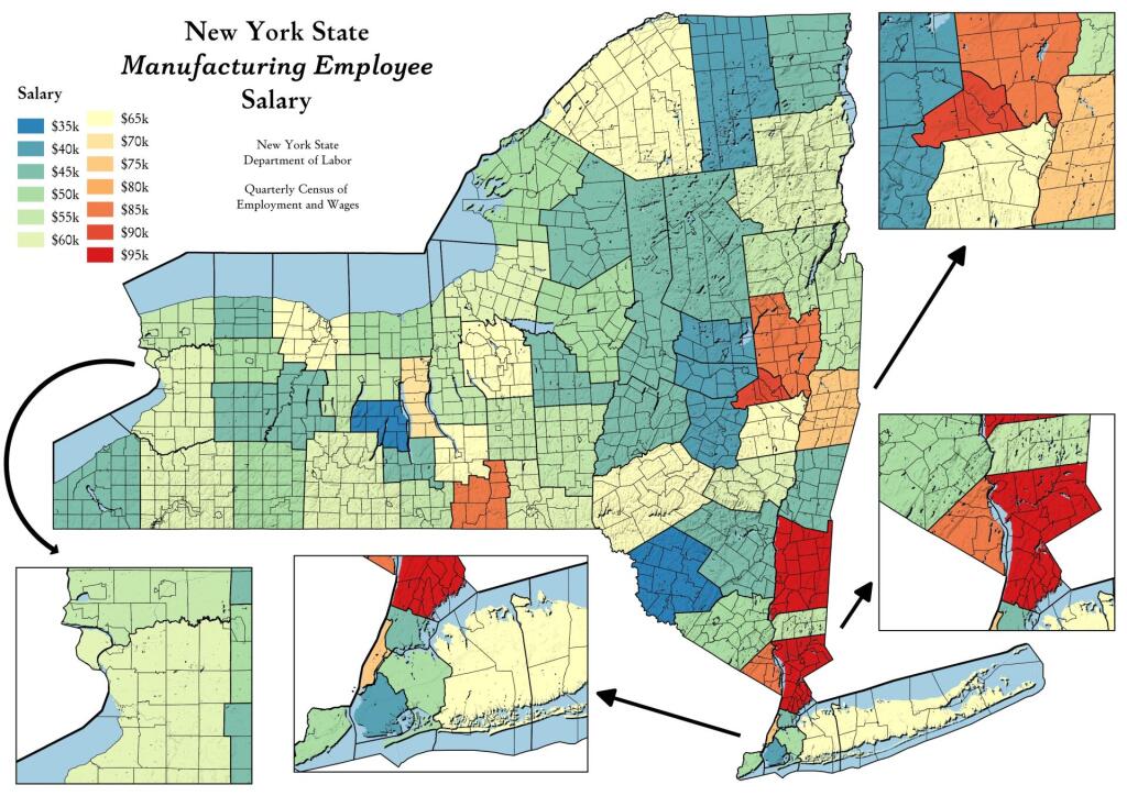
While manufacturing jobs generally pay better then the median income in most regions of state, some locations, especially those with high-tech manufacturing, have jobs that pay much better then other counties.
Data Source: NYS Department of Labor. Quarterly Census of Employment and Wages Annual Data: Beginning 2000. https://data.ny.gov/Economic-Development/Quarterly-Census-of-Employment-and-Wages-Annual-Da/shc7-xcbw
While in the Adirondacks you often think most about state wild forest and wilderness, Essex County has about 1,000 acres of county lands for reforestation purposes. Shown on this map in yellow.
Orange County is one of the farthest north counties in the Metropolitan Region, serviced by the MTA Trains. They pay a special tax for that privilege. Orange County has many large forested areas, along with sprawling cities and towns, pasture land and the rich farm black dirt farm county.
