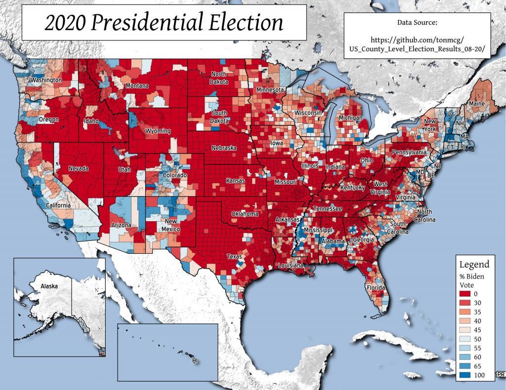
"How can that be? No one I know voted for Nixon."- Pauline Kael, 1972.
Biden got more then 70 percent of the vote in 85 counties, representing 18.8 million votes, while Trump got more then 70 percent of the vote in 1,418 counties representing 12.6 million votes.
This map would better expressed as a cartogram but it might take a lot of CPU power to make it happen.
Data Source: https://github.com/tonmcg/US_County_Level_Election_Results_08-20/
The National Land Cover Dataset shows that much of eastern Knox near the escarpment is a mixture of deciduous trees with some confers, while the western part of county is more cow country (MOO!), where grazing and hay production prevails. Some field cultivation along the Gallupville - Knox border at county line, but much of the soils in Knox aren't great for crop production.
Chautauqua County is much more wooded then you might think, with most of the fields under active tillage right along Lake Erie. Grape growing is a big industry along the lake. In other parts of the county, there is a lot of forested areas and land used for production of forages and grazing.
One thing I've always remarked upon about heading out in Southern New Hampshiere is how little farming goes on there these days and how wooded the area really is.
Watersheds, rivers, wetlands, flood zones of Albany County. Zoom in for more details.
Orleans County west of Rochester along Lake Ontario has a lot of acres of field crops grown, except right on the Niagara Escarpment which is more infertile and rocky.
Tonight, we take a look at Land Use in the State of New Jersey. Notable is how Northwest Jersey on the Delaware River Gap has a fair amount of hay and pasture, while South Jersey has quite a few acres under cultivation for field crops. So, while you might know it Scroll in to see county and township lines, or switch layers.
