Search Results for: photo line of green

Good morning! Happy Thursday. 🌅

It’s literally freezing out this Thursday morning, though no wind and it’s more like a heavy dew rather than a frost this morning. Still it’s the second half of May and not October.

Mostly sunny and a freezing 32 degrees for the morning walk in Delmar, NY. ☀ Calm wind. It looks like there is a pretty good temperature inversion around. Probably warmer in higher elevations. Happens in the Albany area sometimes trapping in all the pollution. There was this one house that looked like an oil burner was malfunctioning, and it almost looked like a house fire from all the black smoke. But I think it was just a bad injector, putting in too much fuel into the furnace. But they might want to get that fixed before they have an actual house fire.

I am out walking this morning, 🚶‍♀️ and when I get home, I have rice soaking which I will cook with red lentils. Makes a bit more of pasty, softer rice mixture but I like to change things up then the green lentils. I did forget to get beans last night but I probably wouldn’t have had enough time to soak before morning. 👨‍🍳 I also have chicken 🐔 thawing in the refrigerator which I will cook up for dinner, along with the rice, spinach and those mini potatoes I got for camping a few weeks back. 🥞 I was thinking banana-oatmeal pancakes this morning, but they will have to wait for oatmeal and blackberries this morning, as I think my stove will be busy cooking the rice. But it’s fine, I haven’t had oatmeal since Monday, and true be told, it’s a pretty similar meal.

Today will be sunny 🌞, with a high of 65 degrees at 4pm. Seven degrees below normal, which is similar to a typical day around April 28th. Calm wind becoming south around 6 mph in the afternoon. Not quite as cold as yesterday. I just want endless summer. A year ago, we had partly cloudy skies in the morning, remaining cloudy in the afternoon. The high last year was 69 degrees. The record high of 94 was set in 2017. 2.2 inches of snow fell back in 2002.❄

Yesterday I checked off a lot of things on my list. ☑ Walked 8.6 miles, got my dry cleaning and a few groceries 🥦 like more spinach, banana peppers and olives. Finally got skim milk 🥛 at Stewart’s, I’ve been putting it off as I don’t like drinking calories but I need for some recipes and it’s good for hot coffee. ☕ Soaking some brown rice 🍚 currently, going to cook that up this morning.

Solar noon 🌞 is at 12:53 pm with sun having an altitude of 66.9° from the due south horizon (-3.9° vs. 6/21). A six foot person will cast a 2.6 foot shadow today compared to 2.2 feet on the first day of summer. The golden hour 🏅 starts at 7:33 pm with the sun in the west-northwest (291°). 📸 The sunset is in the west-northwest (298°) with the sun dropping below the horizon at 8:14 pm after setting for 3 minutes and 16 seconds with dusk around 8:46 pm, which is one minute and one second later than yesterday. 🌇 The best time to look at the stars is after 9:28 pm. At sunset, look for mostly clear skies 🌄 and temperatures around 58 degrees. There will be a south-southeast breeze at 7 mph. Today will have 14 hours and 46 minutes of daytime, an increase of one minute and 58 seconds over yesterday.

I fixed some bugs in the style sheet for the blog 🖥 and uploaded that R script I developed for extracting up to date property tax data from the rolls. I’m working on some new ideas for content for the blog, I often monitor what people are searching for on the blog and use it for ideas for content. 💡

I was doing my monthly financial check up 🔎 💵 and discovered I’m taking in a lot of interest payments from my savings account which is at 4% now that the fed pushed up the rates. Combined with dividends, I’m making nearly a fifth of my monthly income from those quarterly taxable sources. That’s kind of bad as I’m going to owe a lot come July 15. Not sure what I’m going to do. I could move more into stocks and bonds but I want to keep cash on hand as I’m going to need a new truck at some point and if the market declines further I want to be able to buy stocks or bonds.

Not the greatest weather ever for the Lupine Festival but not ungodly hot. 🦋 Saturday, a chance of showers, then showers likely and possibly a thunderstorm after 2pm. Mostly cloudy, with a high near 66. Chance of precipitation is 70%. New rainfall amounts between a tenth and quarter of an inch, except higher amounts possible in thunderstorms. Maximum dew point of 57 at 8pm. Sunday, a chance of showers before 8am. Mostly sunny, with a high near 74. Chance of precipitation is 30%. Maximum dew point of 51 at 6am. Typical average high for the weekend is 73 degrees.

Looking ahead l, there are 2 weeks until 9 PM Dusk 🌆 when the sun will be setting at 8:27 pm with dusk at 9:00 pm. On that day in 2022, we had rain and temperatures between 69 and 60 degrees. Typically, the high temperature is 76 degrees. We hit a record high of 94 back in 1918.

 Along the Skanateles Turnpike

Peaks Over 3,000 Feet Elevation in New York State

There are 229 summits in New York State greater then 3,000 feet elevation.

Tallest Peak Summit Name Elevation County USGS Topo Map Name State Land Trail Location
1 Mount Marcy 5,344 Essex Mount Marcy High Peaks Wilderness NA 44.112733,
-73.9237833
2 Algonquin Peak 5,105 Essex North Elba High Peaks Wilderness Algonquin Trail 44.1436636,
-73.9865357
3 Mount Haystack 4,924 Essex Mount Marcy High Peaks Wilderness Haystack Trail Via Barklet Ridge 44.1056093,
-73.9004196
4 Mount Skylight 4,908 Essex Mount Marcy High Peaks Wilderness Skylight Trail 44.0994987,
-73.9306986
5 Basin Mountain 4,852 Essex Mount Marcy High Peaks Wilderness State Range Trail 44.1211639,
-73.8862527
6 Iroquois Peak 4,829 Essex North Elba High Peaks Wilderness Iroquois Herd Path Via Boundary Peak 44.1369973,
-73.9982027
7 Boundary Peak 4,826 Essex North Elba High Peaks Wilderness Iroquois Herd Path Via Boundary Peak 44.1397749,
-73.9937582
8 Whiteface Mountain 4,816 Essex Lake Placid Whiteface Mountain Ski Center Whiteface Landing To Whiteface Mtn. Trail 44.3658804,
-73.9026456
9 Dix Mountain 4,813 Essex Dix Mountain High Peaks Wilderness Elk Lake To Dix Mountain Trail 44.0822756,
-73.7862471
10 Gray Peak 4,800 Essex Mount Marcy High Peaks Wilderness Mount Marcy Trail Via Opalescent River 44.1114427,
-73.9348658
11 Schofield Cobble 4,744 Essex Mount Marcy High Peaks Wilderness NA 44.1089427,
-73.9270876
12 Little Marcy 4,728 Essex Mount Marcy High Peaks Wilderness Van Hoevenberg Trail To Marcy 44.1197753,
-73.910976
13 Gothics 4,724 Essex Keene Valley High Peaks Wilderness Beaver Meadow Falls Trail 44.1281079,
-73.8570849
14 Mount Colden 4,708 Essex North Elba High Peaks Wilderness Mount Colden Via Lake Arnold 44.1269976,
-73.9598674
15 Beck-horn 4,695 Essex Dix Mountain High Peaks Wilderness Elk Lake To Dix Mountain Trail 44.0800534,
-73.7845802
16 Little Haystack 4,678 Essex Mount Marcy High Peaks Wilderness Haystack Trail Via Slant Rock 44.1103313,
-73.9004197
17 Giant Mountain 4,623 Essex Rocky Peak Ridge Giant Mountain Wilderness North Trail To Giant Mtn. 44.161165,
-73.720279
18 Mount Redfield 4,603 Essex Mount Marcy High Peaks Wilderness Mt Redfield Trail 44.094777,
-73.949866
19 Santanoni Peak 4,596 Essex Santanoni Peak High Peaks Wilderness Bradley Pond Trail 44.0822811,
-74.1309855
20 Wright Peak 4,564 Essex North Elba High Peaks Wilderness Wright Peak Spur Trail 44.1517187,
-73.9801468
21 Nippletop 4,554 Essex Dix Mountain High Peaks Wilderness Nipple Top Trail 44.0892202,
-73.8159708
22 Saddleback Mountain 4,534 Essex North Elba High Peaks Wilderness State Range Trail 44.1264414,
-73.8748634
23 Panther Peak 4,455 Essex Santanoni Peak High Peaks Wilderness Bradley Pond Trail 44.0983915,
-74.132097
24 Rocky Peak 4,403 Essex Rocky Peak Ridge Giant Mountain Wilderness East Trail To Giant Mtn. Via Rocky Peak Ridge 44.1542177,
-73.7051718
25 Macomb Mountain 4,396 Essex Dix Mountain High Peaks Wilderness Macomb-E. Dix Trail 44.0517211,
-73.7801349
26 Hough Peak 4,393 Essex Dix Mountain High Peaks Wilderness S. Dix-Hough Trail 44.0694981,
-73.7776352
27 Mount Marshall 4,380 Essex Street Mountain High Peaks Wilderness Mt Marshall Trail 44.1275538,
-74.0118142
28 Armstrong Mountain 4,360 Essex Keene Valley High Peaks Wilderness Adk Range Trail 44.1347741,
-73.8490291
29 Seward Mountain 4,327 Franklin Ampersand Lake High Peaks Wilderness Seymour Mountain Herd Path 44.1597799,
-74.1993239
30 Allen Mountain 4,321 Essex Mount Marcy High Peaks Wilderness Mt Redfield Trail 44.0708892,
-73.9395871
31 Table Top Mountain 4,295 Essex North Elba High Peaks Wilderness Table Top Mountain Trail 44.143663,
-73.9070876
32 Big Slide Mountain 4,232 Essex Keene Valley High Peaks Wilderness Big Slide Trail 44.1822721,
-73.8704202
33 Esther Mountain 4,232 Essex Franklin Falls Wilmington Wild Forest Esther Mt Trail 44.3869916,
-73.8898673
34 MacIntyre Mountains 4,193 Essex Street Mountain High Peaks Wilderness Mt Marshall Trail 44.1308868,
-74.008203
35 Lower Wolfjaw Mountain 4,190 Essex Keene Valley High Peaks Wilderness W.a. White Trail 44.1483845,
-73.8326399
36 Upper Wolfjaw Mountain 4,190 Essex Keene Valley High Peaks Wilderness Adk Range Trail 44.1406072,
-73.8451402
37 Slide Mountain 4,167 Ulster Peekamoose Mountain Slide Mountain Wilderness Burroughs Range Trail-Wittenberg-Cornell 41.9987034,
-74.3862617
38 Phelps Mountain 4,137 Essex North Elba High Peaks Wilderness Phelps Mtn. Trail 44.1569957,
-73.9209775
39 Cascade Mountain 4,094 Essex Keene Valley High Peaks Wilderness Casade Mountain Trail 44.2186594,
-73.860143
40 South Dix 4,088 Essex Dix Mountain High Peaks Wilderness Macomb-E. Dix Trail 44.060054,
-73.7743014
41 Lookout Mountain 4,078 Essex Franklin Falls Whiteface Mountain Ski Center Esther Mt Trail 44.3778249,
-73.887645
42 Donaldson Mountain 4,062 Franklin Ampersand Lake High Peaks Wilderness Seymour Mountain Herd Path 44.1539471,
-74.210991
43 Seymour Mountain 4,055 Franklin Ampersand Lake High Peaks Wilderness Seymour Mountain Herd Path 44.1578347,
-74.1721003
44 Colvin Range 4,049 Essex Dix Mountain High Peaks Wilderness Colvin Trail 44.0939424,
-73.8345829
45 Mount Colvin 4,049 Essex Dix Mountain High Peaks Wilderness Colvin Trail 44.0939424,
-73.8345829
46 Hunter Mountain 4,045 Greene Hunter Hunter-West Kill Wilderness Spruceton Trail 42.1778662,
-74.2304216
47 Mount Emmons 4,022 Franklin Ampersand Lake High Peaks Wilderness Northville-Placid Trail 44.1436698,
-74.2140464
48 Street Mountain 4,022 Essex Street Mountain High Peaks Wilderness Street Mountain Trail 44.1797741,
-74.0437616
49 Grace Peak 4,006 Essex Dix Mountain High Peaks Wilderness Macomb-E. Dix Trail 44.0653314,
-73.7573564
50 Yard Mountain 3,999 Essex North Elba High Peaks Wilderness Big Slide Trail Via Yard Mtn. 44.1747725,
-73.8845874
51 MacNaughton Mountain 3,983 Essex Street Mountain High Peaks Wilderness Wall Face Ponds Trail 44.1397768,
-74.064317
52 Dial Mountain 3,980 Essex Dix Mountain High Peaks Wilderness Leach Trail 44.1058859,
-73.7959703
53 Blake Peak 3,976 Essex Dix Mountain High Peaks Wilderness Pinnacle Trail 44.081443,
-73.844583
54 Green Mountain 3,976 Essex Rocky Peak Ridge Giant Mountain Wilderness North Trail To Giant Mtn. 44.182272,
-73.714858
55 Black Dome 3,973 Greene Freehold Windham-Blackhead Range Wilderness Blackhead Range Trail 42.2700864,
-74.1226382
56 Thomas Cole Mountain 3,944 Greene Hensonville Windham-Blackhead Range Wilderness Blackhead Range Trail 42.2709196,
-74.1365275
57 Cliff Mountain 3,940 Essex Mount Marcy High Peaks Wilderness Mount Marcy Trail Via Opalescent River 44.1031102,
-73.9751452
58 McDonnel Mountain 3,940 Essex Mount Marcy High Peaks Wilderness Mt Redfield Trail 44.0803332,
-73.9340315
59 Blackhead 3,930 Greene Freehold Windham-Blackhead Range Wilderness Blackhead Mountain Spur Trail 42.2678644,
-74.1045818
60 West Kill Mountain 3,891 Greene Lexington Hunter-West Kill Wilderness Devil’s Path 42.1678663,
-74.2895904
61 Doubletop Mountain 3,875 Ulster Seager NA Seager Big Indian Trail 42.0275913,
-74.5282095
62 Nye Mountain 3,871 Essex Street Mountain High Peaks Wilderness Nye Mountain Trail 44.1931062,
-74.0240387
63 Kilburn Mountain 3,868 Essex Lake Placid Sentinel Range Wilderness Copperas Owen Pond Trl 44.3028247,
-73.8818114
64 Moose Mountain 3,868 Essex McKenzie Mountain Mckenzie Mountain Wilderness Mckenzie Mtn. Trail 44.3506029,
-74.0032049
65 Howard Mountain 3,852 Essex North Elba High Peaks Wilderness Klondike Notch Trail 44.1583844,
-73.8912539
66 Cornell Mountain 3,848 Ulster Phoenicia Slide Mountain Wilderness Burroughs Range Trail-Wittenberg-Cornell 42.0014812,
-74.3568163
67 Graham Mountain 3,848 Ulster Seager NA Seager Big Indian Trail 42.0392576,
-74.5495986
68 Plateau Mountain 3,845 Greene Hunter Indian Head Wilderness Devil’s Path 42.1378671,
-74.1743088
69 McKenzie Mountain 3,842 Essex McKenzie Mountain Mckenzie Mountain Wilderness Mckenzie Mtn. Trail 44.3361593,
-74.0320951
70 Rist Mountain 3,839 Essex Mount Marcy High Peaks Wilderness Boreas Road 44.027559,
-73.987366
71 Sentinel Mountain 3,835 Essex Keene Sentinel Range Wilderness Winch Pond 44.3061581,
-73.8523658
72 Lyon Mountain 3,829 Clinton Moffitsville Chazy Highlands Wild Forest New Lyon Mountain Trail 44.7036537,
-73.8645877
73 T R Mountain 3,829 Essex North Elba High Peaks Wilderness Lake Arnold Crossover 44.143941,
-73.9354222
74 Snowy Mountain 3,825 Hamilton Snowy Mountain NA Snowy Mt 43.7003432,
-74.3859856
75 Table Mountain 3,819 Ulster Peekamoose Mountain Slide Mountain Wilderness Peekamoose-Table Trail 41.9587036,
-74.4048739
76 Peekamoose Mountain 3,812 Ulster Peekamoose Mountain Slide Mountain Wilderness Peekamoose-Table Trail 41.9531481,
-74.398207
77 Avalanche Mountain 3,809 Essex North Elba High Peaks Wilderness Avalanche Pass Trail 44.1361639,
-73.9695903
78 Averill Peak 3,806 Clinton Lyon Mountain Chazy Highlands Wild Forest New Lyon Mountain Trail 44.6928208,
-73.8809768
79 Sugarloaf Mountain 3,806 Greene Hunter Indian Head Wilderness Devil’s Path 42.1312006,
-74.1501414
80 Couchsachraga Peak 3,793 Essex Santanoni Peak High Peaks Wilderness Cold River Horse Trail 44.0956146,
-74.1601539
81 Boreas Mountain 3,779 Essex Mount Marcy NA Gulf Brook Road 44.0031138,
-73.8806937
82 Wittenberg Mountain 3,766 Ulster Phoenicia Slide Mountain Wilderness Burroughs Range Trail-Wittenberg-Cornell 42.0081478,
-74.3473716
83 Panther Mountain 3,763 Hamilton Snowy Mountain NA Snowy Mt 43.7367317,
-74.3907093
84 Burroughs Range 3,760 Ulster Phoenicia Slide Mountain Wilderness Burroughs Range Trail-Wittenberg-Cornell 42.0084255,
-74.3476494
85 Blue Mountain 3,750 Hamilton Blue Mountain Lake Blue Mountain Wild Forest Blue Mountain Trail 43.8725634,
-74.4009917
86 Porter Mountain 3,750 Essex Keene Valley High Peaks Wilderness Porter Mountain Trail Via Marcy Field 44.2153262,
-73.8434754
87 Wakely Mountain 3,750 Hamilton Wakely Mountain Wakely Mountain Primitive Area Wakely Mountain Trail 43.7358986,
-74.5151595
88 Little Nippletop 3,720 Essex Mount Marcy High Peaks Wilderness Elk Lake To Marcy Trail 44.0853327,
-73.9201422
89 Wallface Mountain 3,720 Essex Street Mountain High Peaks Wilderness Indian Pass Trail 44.1378317,
-74.0365378
90 Panther Mountain 3,714 Ulster Shandaken Slide Mountain Wilderness Giant Ledge-Panther Mountian-Fox Hollow Trail 42.0564799,
-74.3945946
91 Balsam Lake Mountain 3,707 Ulster Seager Balsam Lake Mountain Wild Forest Balsam Lake Mountain Trail 42.0459236,
-74.5940438
92 Henderson Mountain 3,707 Essex Mount Adams High Peaks Wilderness Bradley Pond Trail 44.0978353,
-74.0976509
93 Hoffman Mountain 3,701 Essex Blue Ridge Hoffman Notch Wilderness Hoffman Notch Trail 43.9114489,
-73.8168
94 Lone Mountain 3,697 Ulster Peekamoose Mountain Slide Mountain Wilderness Peekamoose-Table Trail 41.9692592,
-74.3893177
95 Big Indian Mountain 3,694 Ulster Shandaken Big Indian Wilderness Pine Hill West Branch Trail 42.0350915,
-74.4965421
96 Hurricane Mountain 3,688 Essex Rocky Peak Ridge Hurricane Mountain Wilderness East Hurricane Mtn Trial 44.235326,
-73.7106926
97 Friday Mountain 3,681 Ulster West Shokan Slide Mountain Wilderness Burroughs Range Trail-Wittenberg-Cornell 41.9875924,
-74.3620944
98 Rusk Mountain 3,678 Greene Lexington Rusk Mountain Wild Forest Spruceton Trail 42.2006434,
-74.2770897
99 Cheney Cobble 3,674 Essex Mount Marcy High Peaks Wilderness East River Trail 44.0445021,
-73.9648654
100 Lewey Mountain 3,665 Hamilton Snowy Mountain West Canada Lake Wilderness Sucker Brook Trail 43.6642328,
-74.4412649
101 Seward Mountains 3,665 Franklin Ampersand Lake High Peaks Wilderness Calkins Creek Truck Trail 44.1561694,
-74.2148801
102 Santanoni Mountains 3,661 Essex Santanoni Peak High Peaks Wilderness Bradley Pond Trail 44.0881144,
-74.138486
103 Buell Mountain 3,652 Hamilton Snowy Mountain NA Snowy Mt 43.7161764,
-74.4065426
104 High Peak 3,645 Greene Kaaterskill Clove Kaaterskill Wild Forest Kaaterskill High Peak Trail 42.1620334,
-74.0801381
105 Little Whiteface Mountain 3,638 Essex Lake Placid Whiteface Mountain Ski Center Whiteface Landing To Whiteface Mtn. Trail 44.3558804,
-73.891534
106 Burtons Peak 3,632 Essex Keene Valley NA The Brothers Trail 44.1925,
-73.8586111
107 Fir Mountain 3,629 Ulster Shandaken Big Indian Wilderness Pine Hill West Branch Trail 42.0275916,
-74.4690414
108 Twin Mountain 3,629 Greene Hunter Indian Head Wilderness Devil’s Path 42.1256453,
-74.1290294
109 Little Moose Mountain 3,609 Hamilton Wakely Mountain Little Moose Wilderness Otter Brook Trail 43.6700663,
-74.5707151
110 Balsam Mountain 3,606 Ulster Shandaken Big Indian Wilderness Pine Hill West Branch Trail 42.0909235,
-74.4882082
111 Calamity Mountain 3,606 Essex Mount Adams High Peaks Wilderness Calamity Brook Trail 44.1028328,
-74.0043132
112 Sunrise Mountain 3,606 Essex Dix Mountain High Peaks Wilderness Elk Lake To Dix Mountain Trail 44.0247778,
-73.7904124
113 Balsam Cap 3,602 Ulster West Shokan Slide Mountain Wilderness Burroughs Range Trail-Wittenberg-Cornell 41.9770369,
-74.3573722
114 Stewart Mountain 3,602 Essex Keene Sentinel Range Wilderness Winch Pond 44.3261581,
-73.8562549
115 North Dome 3,596 Greene Lexington Hunter-West Kill Wilderness Devil’s Path 42.1734217,
-74.3490366
116 Pillsbury Mountain 3,589 Hamilton Spruce Lake West Canada Lake Wilderness Pillsbury Mountain Trail 43.580901,
-74.5120992
117 Slide Mountain 3,586 Essex Lake Placid Sentinel Range Wilderness Barkeater Cliffs Campsite Trail 44.2767136,
-73.8862561
118 Eagle Mountain 3,573 Ulster Seager Big Indian Wilderness Pine Hill West Branch Trail 42.0620352,
-74.50932
119 Dun Brook Mountain 3,563 Hamilton Dun Brook Mountain NA Deer Pond Road 43.890897,
-74.3187666
120 Saddleback Mountain 3,560 Essex Jay Mountain Jay Mountain Wilderness Jay Mountain Trail 44.2953258,
-73.6676367
121 Indian Head Mountain 3,553 Greene Woodstock Indian Head Wilderness Devil’s Path 42.116201,
-74.1145846
122 Fishing Brook Mountain 3,550 Essex Dun Brook Mountain Blue Mountain Wild Forest Deer Pond Road 43.9342303,
-74.2946002
123 Mount Sherrill 3,550 Greene Lexington Hunter-West Kill Wilderness Devil’s Path 42.1756439,
-74.3729262
124 Gooseberry Mountain 3,540 Essex Keene Valley High Peaks Wilderness Orebed Brook Trail 44.1367187,
-73.8731969
125 Bearpen Mountain 3,530 Delaware Prattsville Bearpen Mountain State Forest Access Trail 42.2734189,
-74.4840396
126 Vly Mountain 3,530 Greene West Kill Bearpen Mountain State Forest Snowmobile Trail 42.2453645,
-74.4459834
127 Windham High Peak 3,527 Greene Hensonville Windham-Blackhead Range Wilderness Escarpment Trail 42.3148069,
-74.1434718
128 Halcott Mountain 3,524 Greene West Kill Halcott Mountain Wild Forest Condon Hollow Rd. 42.1800882,
-74.4379281
129 Mount Adams 3,520 Essex Mount Adams High Peaks Wilderness Mt Adams Trail 44.0867231,
-74.0257027
130 Pitchoff Mountain 3,501 Essex North Elba Sentinel Range Wilderness Pitchoff Mountain Trail 44.2375474,
-73.8776443
131 Noonmark Mountain 3,491 Essex Keene Valley High Peaks Wilderness Stimson Trail 44.1289404,
-73.7720809
132 Rocky Mountain 3,478 Ulster West Shokan Slide Mountain Wilderness Peekamoose-Table Trail 41.9728703,
-74.3726505
133 Little Santanoni Mountain 3,471 Essex Santanoni Peak High Peaks Wilderness Moose Pond Horse Trail 44.0731156,
-74.1670981
134 Spotted Mountain 3,461 Essex Underwood High Peaks Wilderness Macomb-E. Dix Trail 44.0769975,
-73.7440228
135 Manbury Mountain 3,455 Hamilton Wakely Mountain Little Moose Wilderness Otter Brook Trail 43.6653442,
-74.5532143
136 Blue Ridge Mountain 3,451 Essex Blue Ridge Hoffman Notch Wilderness Hoffman Notch Trail 43.9247817,
-73.8148558
137 Roundtop 3,451 Delaware Prattsville Bearpen Mountain State Forest Ski Run Road 42.2939737,
-74.4904283
138 Roundtop Mountain 3,451 Greene Kaaterskill Clove Kaaterskill Wild Forest Kaaterskill High Peak Trail 42.1684222,
-74.094583
139 Olderbark Mountain 3,438 Greene Bearsville Indian Head Wilderness Mink Hollow Trail 42.1142565,
-74.1909765
140 Puffer Mountain 3,438 Hamilton Bullhead Mountain Siamese Ponds Wilderness Puffer Pond Brook Trail 43.6617318,
-74.1993082
141 Morgan Mountain 3,432 Essex Wilmington Wilmington Wild Forest Cooper Kill Trail 44.4186582,
-73.8593108
142 Wolf Pond Mountain 3,425 Essex Cheney Pond NA Gulf Brook Road 43.9892253,
-73.8781933
143 Stoppel Point 3,422 Greene Kaaterskill Clove Windham-Blackhead Range Wilderness Escarpment Trail 42.2250879,
-74.0651364
144 Huntersfield Mountain 3,419 Greene Ashland Huntersfield State Forest Huntersfield Access Trail #8/Long Path Access 42.355638,
-74.3465339
145 Cellar Mountain 3,405 Hamilton Wakely Mountain Moose River Plains Wild Forest Cellar Pond Trail 43.7122879,
-74.5429375
146 Haynes Mountain 3,405 Ulster Seager Big Indian Wilderness Pine Hill West Branch Trail 42.0792571,
-74.5079309
147 Sawtooth Mountains 3,402 Franklin Street Mountain High Peaks Wilderness Northville-Placid Trail 44.1928314,
-74.1134874
148 Bear Den Mountain 3,389 Essex Dix Mountain High Peaks Wilderness Leach Trail 44.1194964,
-73.792915
149 Pinnacle 3,389 Essex Dix Mountain High Peaks Wilderness Pinnacle Trail Spur To Summit 44.0583887,
-73.8640277
150 Vanderwhacker Mountain 3,389 Essex Vanderwhacker Mountain Vanderwhacker Mountain Wild Forest Vanderwhacker Firetower Trail 43.8983963,
-74.0959781
151 Jay Mountain 3,379 Essex Jay Mountain Jay Mountain Wilderness Jay Mountain Trail 44.3125477,
-73.685693
152 Spruce Top 3,379 Greene Hunter NA Devil’s Path 42.1506447,
-74.1679195
153 Spruce Mountain 3,376 Ulster Shandaken Big Indian Wilderness Phoenicia East Branch Trail 42.0175919,
-74.4498744
154 Belle Ayr Mountain 3,373 Ulster Shandaken Belleayre Mountain Ski Center NA 42.1159229,
-74.4979304
155 Evergreen Mountain 3,369 Greene Lexington Rusk Mountain Wild Forest Devil’s Path 42.2117542,
-74.3079238
156 Hedgehog Mountain 3,366 Essex Keene Valley High Peaks Wilderness Rooster Comb And Hedgehog Trail 44.159495,
-73.8109724
157 Balsam Mountain 3,353 Greene West Kill Hunter-West Kill Wilderness Condon Hollow Rd. 42.1836992,
-74.387371
158 Kempshall Mountain 3,350 Hamilton Kempshall Mountain High Peaks Wilderness Northville-Placid Trail 44.0236734,
-74.3271041
159 Buck Mountain 3,346 Hamilton Snowy Mountain West Canada Lake Wilderness Snowy Mt 43.6947879,
-74.4368212
160 Mount Pisgah 3,340 Delaware Margaretville NA Mountain Brook Road 42.2211973,
-74.7357125
161 MacDonough Mountain 3,320 Essex Jay Mountain Jay Mountain Wilderness Jay Mountain Trail 44.3050482,
-73.644025
162 Debar Mountain 3,317 Franklin Debar Mountain Debar Mountain Wild Forest Debar Mountain Trail 44.6033852,
-74.2204351
163 Bullhead Mountain 3,314 Warren Bullhead Mountain Siamese Ponds Wilderness John Pond Crossover Trail 43.7017316,
-74.1804199
164 Laramore Mountain 3,314 Essex Keene Valley High Peaks Wilderness Casade Mountain Trail 44.2258813,
-73.8501427
165 Tripod Mountain 3,307 Essex Rocky Peak Ridge Giant Mountain Wilderness Hopkin Via Direct Trail 44.1983824,
-73.736248
166 Metcalf Mountain 3,304 Hamilton Blue Mountain Lake Blue Ridge Wilderness Gould Road 43.7522873,
-74.4957146
167 Wyman Mountain 3,304 Essex Underwood High Peaks Wilderness Macomb-E. Dix Trail 44.0581093,
-73.7445779
168 Jay Mountains 3,297 Essex Jay Mountain Jay Mountain Wilderness Jay Mountain Trail 44.308659,
-73.6704147
169 Eleventh Mountain 3,294 Warren Bakers Mills Siamese Ponds Wilderness Bog Meadow Trail 43.6142322,
-74.0720783
170 Schultice Mountain 3,284 Delaware Roxbury NA Ski Run Road 42.3186948,
-74.5157062
171 Cellar Mountain 3,281 Hamilton Snowy Mountain West Canada Lake Wilderness Sucker Brook Trail 43.6411776,
-74.4443199
172 Plattekill Mountain 3,268 Delaware Hobart Plattekill State Forest Mountain Brook/ Harold Roberts Access Trail 42.2667522,
-74.6482102
173 South Pond Mountain 3,258 Hamilton South Pond Mountain Siamese Ponds Wilderness County Line Brook Trail 43.5900656,
-74.2204175
174 Hemlock Mountain 3,248 Ulster Shandaken Big Indian Wilderness Phoenicia East Branch Trail 42.0128698,
-74.4390407
175 Peaked Mountain 3,235 Essex Jay Mountain Hurricane Mountain Wilderness Soda Range Trail 44.2656034,
-73.6993039
176 Onteora Mountain 3,232 Greene Hunter NA Blackhead Range Trail 42.2223098,
-74.1679184
177 Kitty Cobble 3,225 Hamilton Wakely Mountain West Canada Lake Wilderness Otter Brook Trail 43.6295111,
-74.6229377
178 Baldwin Hill 3,218 Essex Franklin Falls Mckenzie Mountain Wilderness Esther Mt Trail 44.3847694,
-73.9195905
179 Richmond Mountain 3,218 Greene Ashland Mount Pisgah State Forest Long Path Hiking Trail 42.367582,
-74.270976
180 Squaw Mountain 3,218 Hamilton Indian Lake NA Snowy Mt 43.7270094,
-74.3420956
181 Dug Mountain 3,215 Hamilton Kunjamuk River NA Long Pond Trail 43.583122,
-74.345146
182 Hamilton Mountain 3,215 Hamilton Wells Silver Lake Wilderness West River Road 43.412013,
-74.3673645
183 Mount Alton 3,212 Essex Lake Placid Mckenzie Mountain Wilderness Whiteface Mountain Trail 44.3717139,
-73.9662589
184 Utsayantha Mountain 3,209 Delaware Stamford NA Ward Allen Road 42.3992472,
-74.5895953
185 Van Wyck Mountain 3,202 Ulster Peekamoose Mountain Slide Mountain Wilderness Phoenicia East Branch Trail 41.9523147,
-74.4354304
186 Colonels Chair 3,199 Greene Hunter NA Colonel’s Chair Trail 42.2006434,
-74.2306991
187 Gore Mountain 3,199 Warren Gore Mountain Gore Mountain Ski Center Schaefer Trail 43.6764539,
-74.035134
188 Chase Mountain 3,192 Essex Rocky Peak Ridge Hurricane Mountain Wilderness North Hurricane Trail 44.2417145,
-73.7248599
189 Knob Lock Mountain 3,192 Essex Rocky Peak Ridge Giant Mountain Wilderness Hurricane Trail From 9n 44.2003271,
-73.7073583
190 McGregor Mountain 3,192 Delaware Stamford Stamford Fp Detached Parcel Relay Public Forest Access Road 42.3900808,
-74.5790396
191 Weston Mountain 3,192 Essex Jay Mountain Hurricane Mountain Wilderness Soda Range Trail 44.2642144,
-73.7079152
192 Burnt Knob 3,189 Greene Freehold Windham-Blackhead Range Wilderness Escarpment Trail 42.3020297,
-74.1190264
193 Burgess Mountain 3,189 Hamilton Rock Lake NA Bear Trap Brook Trail 43.7520092,
-74.3565416
194 North Mountain 3,186 Greene Kaaterskill Clove Windham-Blackhead Range Wilderness Escarpment Trail 42.2175881,
-74.0487469
195 Payne Mountain 3,182 Hamilton Snowy Mountain Moose River Plains Wild Forest Northville-Placid Trail 43.7231211,
-74.4951582
196 Hopkins Mountain 3,169 Essex Rocky Peak Ridge Giant Mountain Wilderness Hopkins Mtn. Via Spread Eagle Mtn. 44.1833828,
-73.7490257
197 Spruce Lake Mountain 3,163 Hamilton Spruce Lake Mountain West Canada Lake Wilderness Northville-Placid Trail 43.5120126,
-74.6532121
198 Tongue Mountain 3,159 Hamilton Dun Brook Mountain NA Northville-Placid Trail 43.9114522,
-74.3454349
199 Catamount Mountain 3,153 Clinton Wilmington Taylor Pond Wild Forest Catamount Trail 44.459214,
-73.8723668
200 Wildcat Mountain 3,153 Ulster Peekamoose Mountain Slide Mountain Wilderness Pine Hill West Branch Trail 41.9775924,
-74.4759867
201 White Man Mountain 3,146 Delaware Roxbury NA Access Trail 42.2845295,
-74.5340406
202 Bradley Mountain 3,140 Hamilton Wakely Mountain Blue Ridge Wilderness Cellar Pond Trail 43.7378431,
-74.5546055
203 Overlook Mountain 3,136 Ulster Woodstock Overlook Mountain Wild Forest Firetower Spur 42.0850905,
-74.0931954
204 Mount Tamarac 3,127 Essex McKenzie Mountain Mckenzie Mountain Wilderness Jackrabbit Trail 44.3267144,
-74.0204281
205 Mount Morris 3,117 Franklin Tupper Lake NA Goodman Mountain Trail 44.1595046,
-74.475168
206 Acra Point 3,110 Greene Freehold Windham-Blackhead Range Wilderness Escarpment Trail 42.2964745,
-74.0998591
207 Round Mountain 3,107 Essex Keene Valley High Peaks Wilderness Weston Trail Spur To Round Mt 44.1317179,
-73.7515245
208 Cave Mountain 3,104 Greene Hensonville Elm Ridge Wild Forest North Face Trail 42.2859185,
-74.2462543
209 Pete Gay Mountain 3,097 Warren Gore Mountain NA Schaefer Trail 43.6903427,
-74.0443015
210 Plattekill Mountain 3,091 Greene Woodstock Indian Head Wilderness Overlook Trail 42.1073123,
-74.0865281
211 Mount Andrew 3,081 Essex Mount Adams High Peaks Wilderness Bradley Pond Trail 44.0564482,
-74.093483
212 County Line Mountain 3,081 Hamilton South Pond Mountain Siamese Ponds Wilderness Siamese Ponds Trail 43.6114543,
-74.2006952
213 High Point 3,074 Ulster West Shokan Sundown Wild Forest Ashokan High Point 41.9248149,
-74.2879263
214 Rose Mountain 3,074 Ulster West Kill NA Rochester Hollow 42.1506445,
-74.4379284
215 Cowan Mountain 3,068 Delaware Hobart NA Relay Public Forest Access Road 42.3450825,
-74.6498756
216 Round Top 3,068 Delaware Hobart Plattekill State Forest Mountain Brook/ Harold Roberts Access Trail 42.2714741,
-74.6832109
217 Churchill Mountain 3,064 Delaware Stamford NA Relay Public Forest Access Road 42.388692,
-74.6098738
218 Irish Mountain 3,064 Delaware Roxbury NA Ski Run Road 42.3356386,
-74.5262617
219 Swart Mountain 3,061 Hamilton Lake Pleasant Silver Lake Wilderness West River Road 43.3967355,
-74.3815314
220 Scarface Mountain 3,058 Essex McKenzie Mountain Saranac Lakes Wild Forest Scarface Mountain Trail 44.2647717,
-74.0737646
221 T Lake Mountain 3,058 Hamilton Piseco Lake West Canada Lake Wilderness T Lake Trail 43.4470133,
-74.5770967
222 Bailey Hill 3,054 Essex Cheney Pond Hoffman Notch Wilderness Hoffman Notch Trail 43.9108943,
-73.9026366
223 Bald Peak 3,054 Essex Rocky Peak Ridge Giant Mountain Wilderness East Trail To Giant Mtn. Via Rocky Peak Ridge 44.1597731,
-73.6654114
224 Little Rocky Mountain 3,051 Greene Bearsville Indian Head Wilderness Warner Creek Trail 42.1150898,
-74.2040325
225 Denman Mountain 3,048 Sullivan Claryville NA Denman Mountain Snowmobile Trail 41.90287,
-74.5396005
226 Woodhull Mountain 3,045 Ulster Peekamoose Mountain NA Phoenicia East Branch Trail 41.9459259,
-74.4637647
227 Barkaboom Mountain 3,005 Delaware Arena Dry Brook Ridge Wild Forest Touch-Me-Not-Trail 42.0717554,
-74.7201571
228 Stony Creek Mountain 3,002 Franklin Stony Creek Mountain High Peaks Wilderness Ampersand Mountain Trail 44.222002,
-74.2659949
229 Van Dorrien Mountain 3,002 Franklin Ampersand Lake High Peaks Wilderness Ampersand Mountain Trail 44.2222766,
-74.1704351

Burnt Knob Overlook

An interactive map and listing of the 280 peaks over 3,000 feet elevation listed in the Open Street Map database for New York State.

April 23, 2023 Evening

Turned out to be a beautiful ending to the weekend 🏞

It really is a beautiful evening with everything greening up. It was such a rainy dark start to the day but it left everything such a beautiful green.

Good evening! Partly clear and 50 degrees at the Bennett Hill Preserve. 🌇 There is a northwest breeze at 9 mph. 🍃. The skies will clear tomorrow around 9 pm.

It was nice seeing the folks. 👪 We had a nice afternoon, Dad helped me get the gears ⚙ off my bike 🚲 wheel. I’m still trying to determine the spoke length, I’m thinking 292 mm but struggling to confirm with the online calculators.

We had an interesting conversations 👥 and I played out back for a while with the dog. 🐶 I did my wash 👚 and we had dinner. Sausage and peppers, with bread with dipping sauce. I nibbled on some bread and a little bit of sauce but it’s pretty high on calories, sugars and carbohydrates so I didn’t partake like I might have years ago. 🍝 Once you quit that old way of eating that kind of food tastes overly sweet and fatty and it’d hard to really enjoy much of it. Still it was nice to sit around the table with my parents.

Tonight will have a chance of showers, mainly before 11pm. Mostly cloudy 🌧, with a low of 39 degrees at 6am. One degrees below normal, which is similar to a typical night around April 21st. Northwest wind 9 to 15 mph. Chance of precipitation is 40%. New precipitation amounts of less than a tenth of an inch possible. In 2022, we had light rain in the evening, which became mostly clear by the early hours of the morning. It got down to 45 degrees. The record low of 25 occurred back in 1965.

Tonight will have a Waxing Crescent 🌒 Moon with 16% illuminated. At 7 PM, the moon was in the west (259°) at an altitude of 51° from the horizon, some 246,401 miles away from where you are looking up from the earth. 🚀 At the state speed limit of 55 mph, you’ll make it there by October 27th. Buckle up for safety! 💺

The Flower 🌷 Moon is on Friday, May 5. The darkest hour is at 12:55 am, followed by dawn at 5:33 am, and sun starting to rise at 6:03 am in the east-northeast (72°) and last for 3 minutes and 2 seconds. Sunrise is one minute and 31 seconds earlier than yesterday. 🌄 The golden hour ends at 6:42 am with sun in the east-northeast (79°). Tonight will have 10 hours and 11 minutes of darkness, a decrease of 2 minutes and 38 seconds over last night.

Tomorrow will be scattered showers, mainly after noon. Mostly cloudy 🌦, with a high of 53 degrees at 3pm. 10 degrees below normal, which is similar to a typical day around April 4th. Northwest wind 8 to 10 mph. Chance of precipitation is 40%. New precipitation amounts of less than a tenth of an inch possible. A year ago, we had partly cloudy skies in the morning, remaining cloudy in the afternoon. The high last year was 72 degrees. The record high of 81 was set in 2001. 1.2 inches of snow fell back in 1967.❄

In four weeks on May 21 the sun will be setting in the west-northwest (299°) at 8:18 pm,🌄 which is 30 minutes and 31 seconds later then today. In 2022 on that day, we had hot, humid, partly cloudy and temperatures between 91 and 65 degrees. Typically, you have temperatures between 73 and 50 degrees. The record high of 92 degrees was set back in 1941.

Looking ahead, tommorow is , 8 PM Sunset 🌇 is Next Sunday, Mothers Day 👩‍ is in 3 weeks, Fathers Day 👨 is in 7 weeks, Last Sunset After 8:30 PM 🌆 is in 12 weeks, 6:30 Sunrise 🌇 is in 20 weeks, Constitution Day 📜 is in 21 weeks, October 🎃 is in 23 weeks, Average High is 65 🍂 is in 24 weeks, Thanksgiving 🦃 is in 7 months, 7:15 AM Sunrise ⌛️ is in 33 weeks, Festivus 🍖 is in 8 months and Christmas Eve 🎅 is in 35 weeks.

 Off Blueberry Hill

February 20, 2023 Morning

Good morning! Cloudy and 36 degrees at the Moscow Hill Camping Area. 🌥 There is a south-southwest breeze at 9 mph. 🍃. Temperatures will drop below freezing at around 5 pm. ☃️

The past few days I’ve decided to take a break from social media and the blog 📜 so I can spend more time in the woods hiking and thinking, 👂 listening to podcasts and drinking 🍻 beer and being away from it all. Two nights is never enough, especially since I got used to remote work from camp. I could have taken tomorrow off but rain is coming.

I was on the fence about where to this long weekend ⛺ but settled on Brookfield as there was more trails I wanted to explore and the forecast while cloudy for Sunday and today looked less wet. I had been at Rennselearville State Forest three weekends ago and wanted to mix things up especially so I didn’t burn up too much firewood. Plus I like the rural landscape 🚜 heading out to Brookfield. Longer drive though but a pleasant one.

Saturday I walked around Glimmerglass State Park 🏞 and it was cold by the lake but in the woods with the wind 🍃 blocked by the mountains it wasn’t so bad. I didn’t stick around very long as such. Deep blue skies and a pretty sunset 🌇. Got to Moscow Hill Horse Camp 🐴 and set up camp then hiked over to Elmer’s Place and then bushwhacked over Grassy Hill trying to find a good view which didn’t exist but I did flush out a ton of grouse. 🕊

By the time I got back to camp it was 6:10 and nearly pitch black but I had previously gathered firewood, set up the lights and propane, 🏮 had everything ready to go so it was a pleasant night. Had a big fire 🔥 though it was smokey at times due to all the wet wood, wet stuff in the burnables as I’ve been eating healthier. Heard a local fire station whistle go of 🚒🧑‍🚒 and thought I might have some unplanned visitors but no it was some other call. This place isn’t as remote as some places I camp. ⛺ Forgot to buy lighter fluid but once I got the somewhat damp and frozen wood going it burned well but was sparky until the wind died out. Saturday was a star filled night ✨ and very mild which was nice.

Sunday was cloudy and breezy at times 🌬️ especially up on the hills. I hiked the bulk of the day, visiting most of the outer truck trails at Charles Baker State Forest 🌲🌳🌲 as I didn’t want to hike muddy horse trails. Checked out the Elmer Spring Campsite which is remote but accessible by vehicle and is really nice and private. ⛺ Hiked the Ledges Trail which was kind of interesting as was Truck Trail 7 which is cut into a ledge on the side of the mountain ⛰️. Icy in spots especially on the road but cold enough even the horse 🐴 trails weren’t too icy.

For today, Washington’s Birthday will have showers likely, mainly before 11am. Cloudy 🌦, with a high of 40 degrees at 11am. Three degrees above normal, which is similar to a typical day around February 28th. Not bad for the high country in in. Just wearing the vest. Southwest wind 9 to 13 mph becoming northwest in the afternoon. Chance of precipitation is 60%. New precipitation amounts of less than a tenth of an inch possible. A year ago, we had partly cloudy skies in the morning, remaining cloudy in the afternoon. The high last year was 28 degrees. The record high of 66 was set in 1930. 11.2 inches of snow fell back in 1977.❄

While it hasn’t been sunny ☁️ the mid weather has been nice. Not having to deal with frozen water 💦, frozen food like milk 🥛 or eggs 🥚 is good for a change. The batteries are healthy and happy 😊 in my truck 🔋, I haven’t had to start the truck all weekend long. Used the propane heater ♨ a lot less than I have in recent trips, no icy propane lines to deal with. But it’s been cold enough that things have remained generally frozen in the ground, keeping the trails from being too muddy.

Solar noon 🌞 is at 12:16 pm with sun having an altitude of 36.2° from the due south horizon (-34.4° vs. 6/21). A six foot person will cast a 8.2 foot shadow today compared to 2.2 feet on the first day of summer. The golden hour 🏅 starts at 5:01 pm with the sun in the west-southwest (249°). 📸 The sunset is in the west-southwest (256°) with the sun dropping below the horizon at 5:40 pm after setting for 3 minutes with dusk around 6:07 pm, which is one minute and 17 seconds later than yesterday. 🌇 At dusk you’ll see the Waxing Crescent 🌒 Moon in the west-southwest (253°) at an altitude of 2° from the horizon, 228,419 miles away. 🚀 The best time to look at the stars is after 6:41 pm. At sunset, look for mostly cloudy skies ☁ and temperatures around 34 degrees. There will be a west-northwest breeze at 10 mph. Today will have 10 hours and 50 minutes of daytime, an increase of 2 minutes and 47 seconds over yesterday.

Today I decided to hike back and explore a few more ponds 🐸 in the northern part of the state forest. Then midday head back home. I figure enjoy and explore as much of the land while I’m here. Then I’ll have to head home. I thought about taking Tuesday off but it looks like rain ☔ and maybe snow here.

Tonight will have a slight chance of snow showers after 4am. Mostly cloudy 🌧, with a low of 23 degrees at 2am. Four degrees above normal, which is similar to a typical night around March 5th. Maximum wind chill around 17 at 4am; Northwest wind 5 to 8 mph becoming calm. Chance of precipitation is 20%. In 2022, we had mostly clear skies in the evening, which became mostly clear by the early hours of the morning. It got down to 13 degrees. The record low of -10 occurred back in 2015.

Planning to go out and see the folks 👪 when I get home, that is after showering 🚿 and unpacking. Then I want to run to the car wash 🚙 and then Walmart for fruit and vegetables for the upcoming week. 🍏

Brookfield looks cold and snowy for next weekend. 🌨 But I got my fun in. Saturday, a chance of snow. Mostly cloudy, with a high near 25. Chance of precipitation is 40%. Sunday, a chance of snow. Mostly cloudy, with a high near 34. Breezy. Chance of precipitation is 30%. Typical average high for the weekend is 39 degrees.

I don’t necessarily plan on being back to Brookfield anytime soon though I might do my April trip to Cazenovia rather than the Adirondacks East Branch Sacandaga River for a change. 🗻 Easter is late this year and depending on how mild the spring is things could be greening up by then. Probably few black flies up north 🐜 but I’ve been itching to do the Gorge Rail Trail is Cazenovia – Canestota for some time again. March maybe a camping trip ⛺ to Rennselearville State Forest again or Burnt Rossman. Depends on how much snow. It will be after the time change at this point.

Looking ahead, there are 7 weeks until 8 PM Dusk 🌆 when the sun will be setting at 7:39 pm with dusk at 8:06 pm (Daylight Savings Time) in Brookfield. Earlier back in Albany. On that day in 2022, we had partly cloudy, warm and temperatures between 74 and 49 degrees. Typically, the high temperature is 57 degrees. Thinking spring thoughts 💭 on this cloudy but mild morning. We hit a record high of 86 back in 1922.

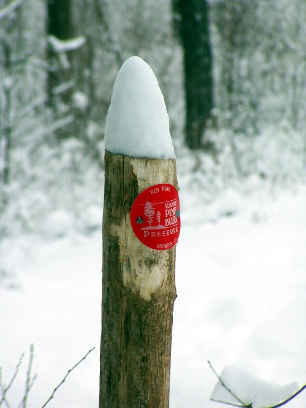
Red Trail Marker

State Truck Trails and Forest Preserve Roads Over A Half Mile

Looking for state land to wheel on? This list shows all of the conservation department-maintained DEC truck trails and public access roads that are more then a 1/2 mile long. This roads are varied, but most of them are dirt roads that take you through the back country. Town maintained roads through state forests are generally not shown on in this listing.

State Land Road Miles
Albert J. Woodford Memorial State Forest Truck Trail 0.7
Albert J. Woodford Memorial State Forest Janis Road 1.1
Aldrich Pond Wild Forest Powell Road 0.5
Aldrich Pond Wild Forest Mullins Flow Road 0.6
Aldrich Pond Wild Forest Little River Road 0.7
Aldrich Pond Wild Forest Silver Dawn Road 0.7
Aldrich Pond Wild Forest Jackworks Trail 1.1
Aldrich Pond Wild Forest South Creek Lake Road 1.6
Aldrich Pond Wild Forest Tyler Road 3.7
Aldrich Pond Wild Forest Streeter Lake Road 4.8
Allen Lake State Forest George Forest Road 1.5
Ambler State Forest Truck Trail 1.8
Ampersand Primitive Area Ampersand Park Road 3.2
Andersen Hill State Forest Big Pine Public Forest Acess Road 1.5
Arctic China State Forest China Public Forest Access Road 1.1
Arctic China State Forest Shears Public Forest Access Road 2
Arctic China State Forest Dunbar Public Forest Access Road 2.1
Armlin Hill State Forest Truck Trail 1.1
Arnold Lake State Forest Public Forest Access Road 0.9
Arnold Lake State Forest Hartwick Forest Access Road 1
Ashland Pinnacle State Forest Ashland Pinnacle Access Road #2 0.5
Ashland Pinnacle State Forest Haul Road #1/Long Path Hiking Trail 1.4
Avon Regional Office Goodlake Year Entrance Road 0.7
Baker School House State Forest Baker School House Public Forest Acess Road 1.8
Bald Mountain State Forest Howe Forest Road 2.4
Balsam Creek State Forest Briar Hill Road 1.5
Barbour Brook State Forest Barbour Brook Public Forest Access Road 2
Basswood State Forest Burlington Public Forest Access Road 0.5
Basswood State Forest Basswood Pond Public Forest Access Road 1
Basswood State Forest Dr. Crouch Truck Trail 1.3
Bates State Forest Pucker Street 1
Bates State Forest Bates Forest Road 2.6
Battle Hill State Forest Unnamed 1.3
Bear Pond Primitive Area Bear Pond Road 0.8
Bear Swamp State Forest Karsch Haul Road 0.5
Bear Swamp State Forest Joe Chamberlin Public Forest Access Road 1.6
Bear Swamp State Forest Roseboom Public Facility Truck Trail 1.8
Bear Swamp State Forest Snowmobile Trail 8.3
Bearpen Mountain State Forest Ski Run Road 2.1
Beartown State Forest Town Road 0.7
Beartown State Forest Cotton Road 0.8
Beartown State Forest Steam Mill Road 0.8
Beartown State Forest Aspen Hollow Road 2.4
Beaver Creek State Forest Public Forest Access Road 2, Madison 11 0.5
Beaver Creek State Forest Truck Trail -2-12 0.7
Beaver Creek State Forest Public Forest Access Road 1, Madison 11 1.3
Beaver Creek State Forest Truck Trail -1-12 3.6
Beaver Dam State Forest Sears Public Forest Acess Road 1.4
Beaver Meadow State Forest Weir Dam Truck Trail 0.5
Beebe Hill State Forest Barrett Pond Road 1.4
Beebe Hill State Forest Loop Road 2.3
Big Brook State Forest County Line Road Spur 0.6
Big Brook State Forest Walasek Mulcoy Road 0.8
Big Brook State Forest Hanifin Road 0.9
Big Brook State Forest County Line Road 1.4
Birdseye Hollow State Forest Sanford Lake Access Road 0.5
Black Creek State Forest Stanley Road 1.1
Black River Wild Forest Remsen Falls Trail 0.5
Black River Wild Forest Woods Lake Road 0.5
Black River Wild Forest Gull Lake Road 0.6
Black River Wild Forest Flansburg Road 0.7
Black River Wild Forest Party Road 0.7
Black River Wild Forest Black Creek Road 0.8
Black River Wild Forest Cohen Road 1.7
Black River Wild Forest Flansberg Road 2.6
Black River Wild Forest Black Creek Lake Road 3
Black River Wild Forest Haskell Road 3
Black River Wild Forest Mill Creek Road 3.4
Black River Wild Forest Nicks Lake Campground Roads 3.5
Black River Wild Forest Wolf Lake Landing Road 4.8
Black River Wild Forest West Creek Road 6.3
Blenheim Hill State Forest Ward Allen Road 1.1
Blenheim Hill State Forest Quarry Road 1.2
Blue Mountain Wild Forest Deer Pond Road 1.1
Blue Mountain Wild Forest Chain Lakes Road North 1.3
Blue Mountain Wild Forest Polaris Road 1.3
Bombay State Forest Cross Haul Road 0.7
Bombay State Forest Railroad Bed Public Forest Acess Road 1.2
Bombay State Forest Pike Brook Haul Road 3.1
Bonaparte’s Cave State Forest Corbine Road 0.8
Bonaparte’s Cave State Forest Mud Pond Road 0.8
Boutwell Hill State Forest Arab Hill Forest Road, Cha 1 Section 0.8
Boutwell Hill State Forest Arab Hill Forest Road, Cha 7 Section 2.1
Boyce Hill State Forest Jackson Forest Road 0.6
Brasher State Forest Route 53 Haul Road 0.5
Brasher State Forest Beaver Pond Trail 0.6
Brasher State Forest Kennehan Haul Road 0.8
Brasher State Forest Bush Road 1.1
Brasher State Forest Buckley Haul Road 1.2
Brasher State Forest Cc Dam Public Forest Access Road 1.2
Brasher State Forest Mccarthy Public Forest Access Road 1.6
Brasher State Forest Liberty Public Forest Access Road 1.7
Brasher State Forest Hastings Falls Haul Road 2.1
Brasher State Forest Wilson Public Forest Access Road 2.1
Brasher State Forest Camp / Larue Public Forest Access Road 2.2
Brasher State Forest Pascal Haul Road 2.4
Brasher State Forest Bush Public Forest Access Road 2.9
Brasher State Forest Railroad Bed Public Forest Access Road 3.6
Brokenstraw State Forest Brokenstraw Forest Road 1.7
Bryant Hill State Forest Hawk Forest Road 1.4
Buck Hill State Forest Hertz Road 0.7
Buck Hill State Forest Truck Trail 1.5
Buck Hill State Forest Buck Hill Road 3.1
Bucks Brook State Forest Access Trail 0.6
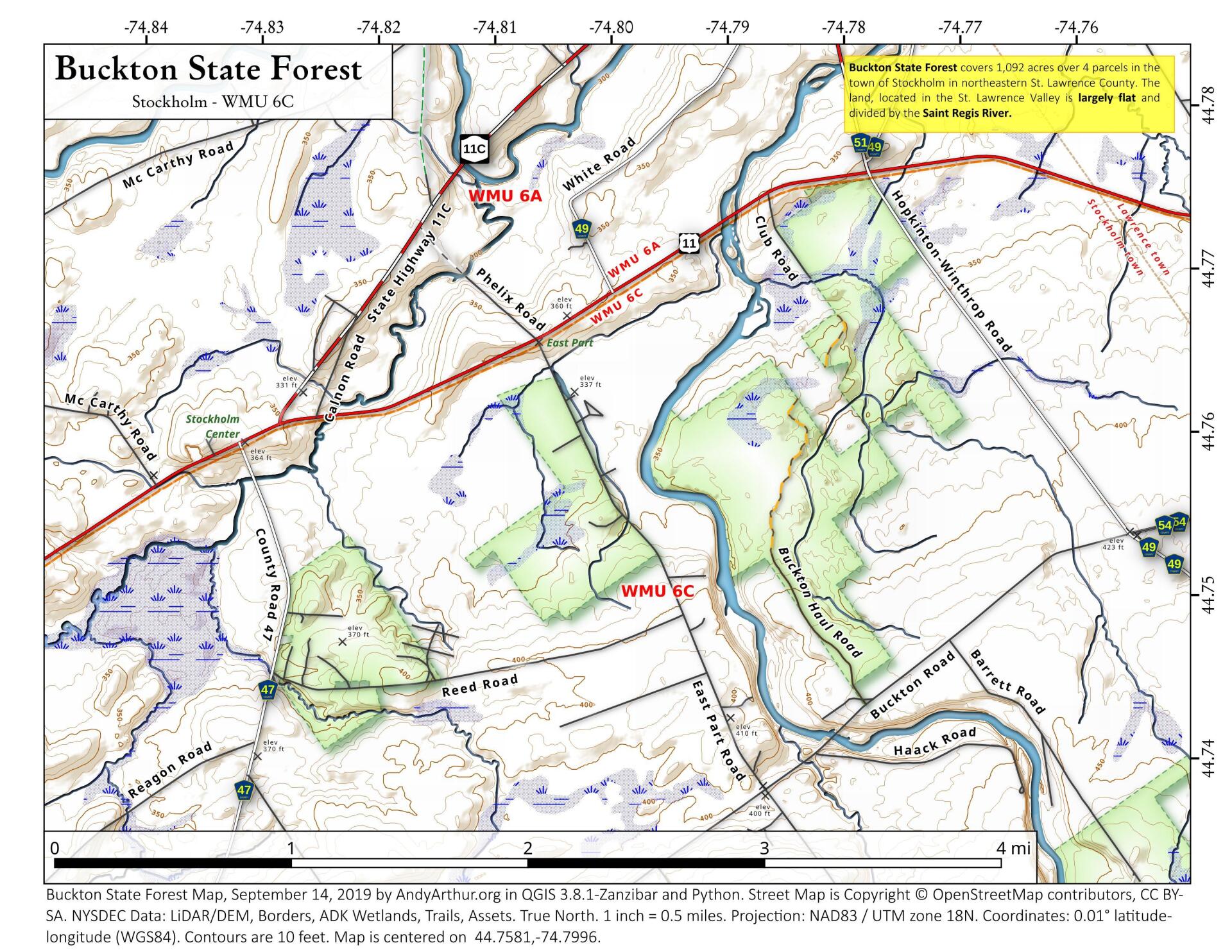
Buckton State Forest Buckton Haul Road 0.8
Bucktooth State Forest Baily Hollow Forest Road 0.6
Bucktooth State Forest Manley Hill Forest Road 1
Bully Hill State Forest Dixon Forest Road 1
Bully Hill State Forest Connection Forest Road 1.6
Bully Hill State Forest Stearns Forest Road 2.1
Burnt-Rossman Hills State Forest Koenig Road 0.5
Burnt-Rossman Hills State Forest Betty Brook Haul Road 0.6
Burnt-Rossman Hills State Forest Eminence Dead End Truck Trail 0.7
Burnt-Rossman Hills State Forest Duck Pond Road 1.2
Burnt-Rossman Hills State Forest Monkey Run Truck Trail East 1.3
Burnt-Rossman Hills State Forest Yankee Street Truck Trail 1.3
Burnt-Rossman Hills State Forest Betty Brook Road 1.4
Burnt-Rossman Hills State Forest Betty Brook Truck Trail 1.5
Burnt-Rossman Hills State Forest Duck Pond Truck Trail 1.5
Burnt-Rossman Hills State Forest Morey Road Truck Trail 1.7
Burnt-Rossman Hills State Forest Eminence Road Truck Trail 2.6
Burnt-Rossman Hills State Forest Burnt Hill Road 2.9
Bush Hill State Forest Fox Cross Forest Road 2
California Hill State Forest Wayawanda Road 0.7
Canacadea State Forest Macduff Road 2.3
Canadaway Creek Wma Dibble Hill Forest Road 2
Canaseraga State Forest Ringelberg Truck Trail 0.5
Canaseraga State Forest Right Fork Truck Trail 1
Canaseraga State Forest Stanley Road 1.1
Canaseraga State Forest Left Fork Truck Trail 1.4
Caroga Lake Campground Campground Road 2
Catherineville State Forest Santamont Access Trail 1.1
Catherineville State Forest Circle Public Forest Access Road 1.8
Charles E. Baker State Forest Truck Trail 5 0.6
Charles E. Baker State Forest Truck Trail 2 0.9
Charles E. Baker State Forest Truck Trail 6 0.9
Charles E. Baker State Forest Truck Trail 4 1.4
Charles E. Baker State Forest Truck Trail 12 1.5
Charles E. Baker State Forest Truck Trail 8 1.9
Charles E. Baker State Forest Truck Trail 7 2.1
Charles E. Baker State Forest Truck Trail 1 3
Charles E. Baker State Forest Truck Trail 13 3.2
Chazy Highlands State Forest Spring Road 0.6
Cherry Valley State Forest Kniskern Public Access Road 1.2
Cherry Valley State Forest Mosse Public Forest Access Road 1.9
Cinnamon Lake State Forest Hornby Road Haul Road 0.7
Clapper Hollow State Forest Clapper Hollow Truck Trail 1
Clark Hill State Forest Abandoned Town Road 0.8
Clark Hill State Forest Truck Trail 0.9
Clark Hill State Forest Access Road North Of Buck Hill Road 0.9
Clark Hill State Forest Class A Truck Trail 1.2
Clark Hill State Forest Haul Road 1.3
Cliffside State Forest Railroad Haul Road 1.3
Cobb Brook State Forest Unnamed Truck Trail 0.6
Cold Creek State Forest Headwaters Forest Road 1.4
Cold Spring Brook State Forest Cold Spring Brook Public Forest Access Road 1.9
Cole Hill State Forest Cr 2 Access Road 0.8
Coyle Hill State Forest Warner Spur Forest Road 0.5
Coyle Hill State Forest Slawson Forest Road 0.8
Coyle Hill State Forest Warner Forest Road 1.8
Cranberry Lake Campground Campground Road 2.5
Cranberry Lake Wild Forest Grass River Railroad 6.1
Cuyler Hill State Forest Jipson Hill Public Forest Acess Road 1.3
Cuyler Hill State Forest Cuyler Hill Public Forest Acess Road 5.1
David A. Sarnoff Preserve Field Access Road 0.8
Debar Mountain Wild Forest Debar Game Refuge Road 0.5
Debar Mountain Wild Forest Debar Meadow Road 0.6
Debar Mountain Wild Forest Vanderwalker Road 0.9
Debar Mountain Wild Forest 4 Mile Road Riffle Season Access Corridor 1.1
Debar Mountain Wild Forest Ny Centrail Railroad Bed 2.2
Deer River State Forest Ccc Road 0.6
Deer River State Forest Hogsback Road 0.6
Deer River State Forest Willow Road 0.6
Deer River State Forest Glaze Road 0.7
Deer River State Forest Avery Lot Road 0.9
Deer River State Forest Esseltine Hill Road 0.9
Deer River State Forest Ricky’s Number Trail 1
Deer River State Forest Horse Barn Road 1.2
Deer River State Forest Laramie Road 1.3
Deer River State Forest Beanville Road 1.4
Deer River State Forest Spruce Road 1.6
Deer River State Forest Loope Road 2
Deer River State Forest Firewood Road 2.6
Degrasse State Forest Burns Flats Road 0.5
Degrasse State Forest Loop Road 1.2
Deruyter State Forest Tromp Road 1.5
Dobbins Memorial State Forest Snowmobile Trail 3.5
Dog Hollow State Forest Brewer Public Forest Acess Road 0.9
Downerville State Forest River Public Forest Access Road 1
Dry Run State Forest Wildcat Hollow 0.8
Dunkin’s Reserve State Forest Access Road 3.5
Dutch Settlement State Forest Haul Road #1 0.6
Dutton Ridge State Forest Dutton Ridge Access Road 1.5
Earlville State Forest Mad 2 Forest Access Road 1.5
East Osceola State Forest Malloy Brook Road 1.1
East Otto State Forest Kriedeman Forest Road 1.7
Edgewood Oak Brush Plains Preserve Edgewood Oak Brush Plains Preserve 0.5
Edgewood Oak Brush Plains Preserve Unpaved Forest Road 0.5
Edgewood Oak Brush Plains Preserve Old Commack Road 1.6
English Hill State Forest Ricketts Forest Road 0.9
Exeter State Forest Exeter Public Forest Access Road 1.3
Fairfield State Forest Jenksville Hill Public Forest Acess Road 2
Fall Brook State Forest Gossner Road 0.6
Fall Brook State Forest Haul Road To B-45 Wetland 0.9
Fall Brook State Forest Access Road From Co. Rt 67A 1
Fall Brook State Forest Forest Access Roaad 1.2
Ferris Lake Wild Forest Meco Lake Trail 0.9
Ferris Lake Wild Forest Sheriff Lake Trail 0.9
Ferris Lake Wild Forest Mud Lake Road 5.5
Fish Creek State Forest Forward Road 0.5
Fish Creek State Forest Trestle Road 0.6
Fish Creek Wma State Highway 184 Access Road 0.9
Five Rivers Education Center Goose Lane 0.5
Flat Rock State Forest Pedobo Road 0.8
Flat Rock State Forest Karsch Haul Road 0.9
Flat Rock State Forest Ampersand Park Road 1.9
Florence Hill State Forest Florence Hill Road 1.9
Fort Jackson State Forest Sheldon Public Forest Access Road 0.5
Frank E. Jadwin Memorial State Forest Keesler Road 0.6
Frank E. Jadwin Memorial State Forest Old Croghan Road 0.7
Frank E. Jadwin Memorial State Forest Henry Road 0.8
Frank E. Jadwin Memorial State Forest Nelson Road 0.8
Frank E. Jadwin Memorial State Forest Wahalula Road 0.8
Frank E. Jadwin Memorial State Forest Q- Road 1.5
Frank E. Jadwin Memorial State Forest Patchin Road 1.7
Frank E. Jadwin Memorial State Forest Blanchard Creek Road 2.7
Frank E. Jadwin Memorial State Forest Wisner Road 2.7
Frank E. Jadwin Memorial State Forest Judy Cole Road 2.8
Frank E. Jadwin Memorial State Forest Loop Road 3.2
Fulton Chain Wild Forest Cary Lake Road 1.8
Furnace Creek State Forest Miller Road East 0.7
Furnace Creek State Forest Powerline Row 0.7
Furnace Creek State Forest Sheehan Road 1.2
Furnace Creek State Forest B-29 Road 1.4
Gates Hill State Forest Coons Den Truck Trail 0.6
Gates Hill State Forest Eviann Road 1.2
Genegantslet State Forest South Loomis Road 0.7
Gillies Hill State Forest Abbey Forest Road 0.9
Gillies Hill State Forest Pettit Forest Road 1.4
Golden Hill State Forest Firelane Forest Road 1.6
Goundry Hill State Forest Guiren Road 1
Goundry Hill State Forest Corbett Hollow Access Road 1.1
Grant Powell State Forest Huck Berry Road 2.1
Grass River Wild Forest Spruce Mountain Road 0.8
Grass River Wild Forest Hollywood Road 2.5
Grass River Wild Forest Railroad Grade Road 2.9
Greenwood Creek State Forest Grass Pond Public Forest Access Road 0.9
Grigg’s Gulf State Forest Grigg’s Gulf Public Forest Acess Road 1.5
Gulf Unique Area Gulf R.O.W. Road 0.5
Gulf Unique Area Old Skid Road 1.1
Hall Island State Forest Unnamed Public Forest Acess Road 0.7
Hammond Hill State Forest Redman Run Public Forest Acess Road 1.1
Hammond Hill State Forest Cannan Public Forest Acess Road 1.3
Hammond Pond Wild Forest Paynes Way 0.7
Harris Hill State Forest Sprague Forest Road 0.8
Harvey Mountain State Forest Harvey Mt Access Road 0.9
Harvey Mountain State Forest East Hill Access Road 2.4
Hatch Creek State Forest Hodge Forest Road 0.6
Hatch Creek State Forest North Forest Road 0.8
Hatch Creek State Forest South Forest Road 0.9
Hemlock-Canadice State Forest South Hemlock Access Road 0.7
Henderson Shores Unique Area Radar Road 0.8
Hewitt State Forest Hewitt Rd 1.1
Hickok Brook Multiple Use Area Spur Road 0.7
Hickok Brook Multiple Use Area Main Road 1.1
High Flats State Forest Chapel Hill Access Trail 0.5
High Flats State Forest Crowley Access Trail 0.5
High Flats State Forest Close Pond Access Trail 0.7
High Flats State Forest Donovan Public Forest Access Road 1.1
High Knob State Forest Shale Pit Road 1.9
High Peaks Wilderness Northville-Placid Trail-Northern Terminus 1.1
Hill Higher State Forest Hill Higher Forest Road 1.1
Hinckley State Forest Elm Flats Road 0.5
Hinckley State Forest Roberts Road 0.5
Hinckley State Forest Lanning Road 0.8
Hinckley State Forest Access Road 1.6
Hinckley State Forest Black Creek Road 2
Hogsback State Forest Forest Access Road 3
Honey Hill State Forest Edwards Public Forest Access Road 1.4
Hooker Mountain State Forest Norton Public Forest Access Road 0.8
Horseshoe Lake Wild Forest Cut Off Road 0.6
Horseshoe Lake Wild Forest Lower Dam Road 0.7
Horseshoe Lake Wild Forest Otter Brook Trail 0.9
Horseshoe Lake Wild Forest Grass River Railroad 1.7
Horseshoe Lake Wild Forest Otter Brook Road 2.2
Hoxie Gorge State Forest Russel Hill Public Forest Acess Road 2.5
Huntersfield State Forest Huntersfield Access Road #2 0.7
Huntersfield State Forest Huntersfield Access Road #1 1.9
Hunts Pond State Forest Truck Trail 1.7
Independence River State Forest Assembly Road 1
Independence River Wild Forest Blue Jog Road 0.5
Independence River Wild Forest Sunday Lake Road 0.5
Independence River Wild Forest Evies Pond Road 0.7
Independence River Wild Forest Burnt Creek Road 0.7
Independence River Wild Forest Elbow Rd 0.7
Independence River Wild Forest Shortcut Road 0.8
Independence River Wild Forest Fish Pond Road 1
Independence River Wild Forest Halfmoon Lake Rd 1
Independence River Wild Forest Little Otter Creek Road 1
Independence River Wild Forest Long Pond Spur 1
Independence River Wild Forest East Loop Road 1.1
Independence River Wild Forest Copper Lake Road 1.2
Independence River Wild Forest Necessary Dam Road 1.2
Independence River Wild Forest Pitcher Pond Road 1.3
Independence River Wild Forest Hinchings Pond Road 1.8
Independence River Wild Forest Basket Factory Road 2.1
Independence River Wild Forest Catspaw Lake Road 2.4
Independence River Wild Forest Confusion Flats Road 2.6
Independence River Wild Forest Big Otter Lake Road 3.1
Independence River Wild Forest Stony Lake Road 3.1
Independence River Wild Forest Florence Pond Road 3.1
Independence River Wild Forest Steam Mill Road 3.5
Independence River Wild Forest Smith Road 3.7
Indian Pipe State Forest Dunes Road 0.7
Indian River Wma Red Lake Road 2
Jackson Hill State Forest Forest Access Road 2.1
Jersey Hill State Forest Scholes Forest Road 1.6
Jessup River Wild Forest Lake Colby Camp Road 0.7
Karr Valley Creek State Forest Frungillo Forest Road 0.8
Karr Valley Creek State Forest Norton Forest Road 1.3
Karr Valley Creek State Forest Davison Forest Road 1.4
Keeney Swamp State Forest Fitch Hill Spur Forest Road 0.7
Keeney Swamp State Forest C3D 0.8
Keeney Swamp State Forest Fitch Hill Forest Road 1.2
Keeney Swamp State Forest Gordon Forest Road 1.4
Kennedy State Forest Courtney Hill Public Forest Acess Road 0.7
Kennedy State Forest Cotton-Hanlon Public Forest Acess Road 1
Kennedy State Forest Kennedy Public Forest Acess Road 2.5
Kenneth Wilson Campground Campground Road 9.7
Ketchumville State Forest Ketchumville Public Forest Acess Road 1
Keyserkill State Forest Guinea Road Truck Trail 1
Keyserkill State Forest Keyserkill Truck Trail #1 1.3
Klipnocky State Forest Emery Forest Road 1.2
Klipnocky State Forest Marble Forest Road 1.6
Klondike State Forest Klondike Public Forest Acess Road 1.7
Lafayetteville Multiple Use Area Wilbur Flats Road 0.9
Lake Durant Campground Scott Public Forest Acess Road 0.9
Lake George Wild Forest Jabe Pond Road 1
Lake George Wild Forest Dacy Clearing Road 1.6
Lake George Wild Forest Lily Pond Road 2.1
Lake George Wild Forest Gay Pond Road 4
Lake Harris Campground Campground Road 0.9
Lakeview Marsh Wma Skinner Road 0.7
Leonard Hill State Forest Leonard Hill Access Road #1 0.7
Leonard Hill State Forest Leonard Hill Access Road #3 1.2
Leonard Hill State Forest Leonard Hill Access Road #2 1.6
Lesser Wilderness State Forest Gomer Hill Road 0.5
Lesser Wilderness State Forest Toole Road 0.6
Lesser Wilderness State Forest Alguire Road 0.7
Lesser Wilderness State Forest Smith Road 0.8
Lesser Wilderness State Forest Nob Road 0.9
Lesser Wilderness State Forest Seelman Road 1.3
Lesser Wilderness State Forest Mcgoldrick Road 3
Lesser Wilderness State Forest #9 Road 4.7
Limekiln Lake Campground Lime Kiln Lake Campground Trails 3.9
Linda Gronlund Memorial At Barcelona Neck Trustee Road West 1
Linda Gronlund Memorial At Barcelona Neck Trustee Road East 1.7
Lonesome Bay State Forest Alamogin Public Forest Access Road 2.2
Long Pond State Forest Access Road 0.5
Long Pond State Forest Truck Trail 0.7
Long Pond State Forest Long Pond Snowmobile Trail 0.8
Lookout State Forest Ball Road 0.6
Lost Nation State Forest Brookdale Road / Jenkins Corners Rd / Red Barn Rd 2.5
Lost Valley State Forest Lost Valley Haul Road 1.2
Lowville Demonstration Area Dadville Road 0.6
Ludlow Creek State Forest Trail Road 1.3
Lutheranville State Forest Access Road #1 0.5
Lutheranville State Forest Access Road #2 1.2
Lyon Brook State Forest Lyon Brook Truck Trail 1.2
Mad River State Forest Thompson Corners Florence Road 0.5
Mad River State Forest Bartlett Road 0.6
Mad River State Forest Rehm Road 0.6
Mad River State Forest Phalen Road South 1.9
Mad River State Forest Mcspirit Road 2.1
Madawaska Flow – Quebec Brook Primitive Area Benz Pond Road 2.2
Mallet Pond State Forest Cemetery Road Truck Trail 2
Maxon Creek State Forest Pease Hill Public Forest Acess Road 1
Mccarthy Hill State Forest Main Access Road 0.5
Mccarty Hill State Forest Ccc Forest Road 1.5
Mccarty Hill State Forest Mccarty Hill East Forest Road 2
Mcdonough State Forest Ccc Trail 1
Mcdonough State Forest Truck Trail 4 1.1
Mcdonough State Forest Finger Lakes Trail 1.8
Mcdonough State Forest Truck Trail 3 2
Melondy Hill State Forest Public Forest Access Road 2.5
Montrose Point State Forest Through Trail 0.6
Moose River Plains Wild Forest Loop Road 1.2
Moose River Plains Wild Forest Indian Lake Road 3.4
Moose River Plains Wild Forest Otter Brook Road 3.4
Moose River Plains Wild Forest Rock Dam Road 4.2
Moose River Plains Wild Forest Lime Kiln Lake – Cedar River Road 16.9
Morgan Hill State Forest Herlihy Haul Road 0.6
Morgan Hill State Forest Keith Gutchess Haul Road 0.7
Morrow Mountain State Forest Mollie Road 2.8
Mount Hunger State Forest Whalen Road 0.6
Mount Pisgah State Forest Mt Pisgah Access Road #1 1.3
Mount Pleasant State Forest Beck Forest Road 0.6
Mount Pleasant State Forest Brumagin Forest Road 0.7
Mount Pleasant State Forest Spruce Forest Road 0.8
Mount Tom State Forest Notch Lane Access Road 1.4
Mount Tom State Forest Shaker Hollow Access Trail 1.4
Muller Hill State Forest Davenport Road 1.4
Muller Hill State Forest Bliss Road 1.5
New Forge State Forest New Forge Access Road #2 0.5
New Forge State Forest New Forge Access Road #3 0.6
New Forge State Forest New Forge Access Road 1.5
Newfield State Forest Irish Hill Haul Road 0.8
Nicks Lake Campground Nicks Lake Campground Roads 0.6
Nimham Mountain Multiple Use Area Coles Mills Road 0.7
Nimham Mountain Multiple Use Area Tower Road 0.7
Nine Mile Creek State Forest North Nine Mile Town Road 0.5
Nine Mile Creek State Forest Phearsdorf Forest Road 0.5
Nine Mile Creek State Forest North Nine Mile Forest Road 2.2
North Harmony State Forest Snake Forest Road 0.9
North South Lake Campground South Lake Road 1.3
North South Lake Campground North Lake Campground Road 1.8
Northhampton Beach Campground Campground Road 5.5
Oakley Corners State Forest Oakley Corners North Public Forest Acess Road 1.6
Ohissa State Forest Cramers Corner Road 0.8
Onjebonge State Forest Lime Quarry Road 1.3
Onjebonge State Forest Alice Coffey Road 2.5
Orebed Creek State Forest Ritz Road 1.3
Ossian State Forest Back Road To Rattlesnake 0.7
Ossian State Forest Scoville Access Road 1
Ossian State Forest Linzy Road Truck Trail 1.8
Otselic State Forest Truck Trail 3.1
Otsquago State Forest Wagner Hill Road 0.8
Otter Creek State Forest Eatonville Road 0.6
Otter Creek State Forest Mikes Road 1.2
Otter Creek State Forest Otter Creek Road 1.5
Palmer’s Pond State Forest Geitner Forest Road 0.7
Palmer’s Pond State Forest Palmer’s Pond Forest Road 1.5
Palmer’s Pond State Forest 6 2.4
Partridge Run Wma Boys Camp Road Ext 2
Patria State Forest Pleasant Valley Road 0.6
Patria State Forest Barkman Road Access 0.6
Patria State Forest Hardscrabble Road Access 0.8
Peck Hill State Forest Swamp Road 0.5
Peck Hill State Forest West Boundary Trail 0.6
Peck Hill State Forest Beaver Vly 0.7
Peck Hill State Forest Dam Road 0.7
Penn Mountain State Forest Star Hill Road 1
Penn Mountain State Forest West Gate Road 2.6
Penn Mountain State Forest South Gate Road 3.6
Penn Mountain State Forest East Gate Road 3.8
Perch River Wma Perch Lake Road 0.5
Perch River Wma Buckminster Road 0.9
Perch River Wma Cook Road 1.4
Perch River Wma Allen Road 2.1
Perch River Wma State Route 12 2.6
Perch River Wma Vaadi Road 3
Perch River Wma Dog Hill Road 4
Pharsalia Woods State Forest Nine Mile Truck Trail Snowmobile Trail 1.6
Piermont Marsh Tidal Wetland Piermont Pier Access Road 0.9
Pine Hill State Forest Bundy Hollow Public Forest Access Road 1
Pittstown State Forest State Fire Lane 2.2
Plainfield State Forest Hughes Public Forest Access Road 1.3
Plattekill State Forest Mountain Brook Road 1
Plumbottom State Forest Reddy Forest Road 3
Point Peninsula Wma Pine Woods Road 1.5
Point Peninsula Wma Beach Road 2.1
Point Peninsula Wma Shore Road 8
Point Rock State Forest Egger Brrok Raod 1.3
Popple Pond State Forest Smith Road 0.7
Popple Pond State Forest Haul Road Shared By Oneida 6 And County Forest 1.6
Popple Pond State Forest Truck Trail 3
Potato Hill State Forest Blackman Hill Rd 1.1
Potato Hill State Forest Level Green Rd 1.2
Pulpit Rock State Forest Watson Road 0.6
Punkeyville State Forest Irish Settlement Road 0.7
Punkeyville State Forest River Road 0.9
R Milton Hick Memorial State Forest Lafleuer Road 1.2
Relay State Forest Relay Public Forest Access Road 1.2
Rensselaerville State Forest Kenyon Road Access 2.4
Ridge Conservation Area And Maintenance Center Mid-Island Access Road 0.5
Rock City State Forest Salamanca Forest Road 0.8
Rock City State Forest Eckert Forest Road 0.9
Rock City State Forest Little Rock City Forest Road 2
Rock Creek State Forest Admin Access Road 1.3
Rockwood State Forest Spring Road 0.5
Rockwood State Forest B Road 0.6
Rocky Point Pine Barrens State Forest Accessible 0.5
Rocky Point Pine Barrens State Forest Firestone Road 1.7
Rural Grove State Forest Rural Grove Access Road (Shibley Road) 3.1
Rush Creek State Forest C2-C 1.2
Rush Creek State Forest Russell Forest Road 3
Sacandaga Campground Sacandaga Campground 1.4
Salmon River State Forest Harpers Ferry Public Forest Acess Road 0.9
Sand Flats State Forest Bucks Corners Road 0.9
Sand Flats State Forest Obrian Road 0.9
Sand Flats State Forest Water Hole Road 1
Sand Flats State Forest Y Road 1.5
Sand Flats State Forest Powell Road 1.7
Sand Flats State Forest Fall Brook Road 2.2
Saranac Lakes Wild Forest Horseshoe Pond Trail 0.5
Saranac Lakes Wild Forest Little Clear Pond Road 0.5
Saranac Lakes Wild Forest Connery Pond Road 0.6
Saranac Lakes Wild Forest Little Green Pond Road 0.6
Saranac Lakes Wild Forest Rollins Pond Access Road 0.8
Saranac Lakes Wild Forest Medow Pond Truck Trail 0.9
Saranac Lakes Wild Forest Bartlett Carry Road 1.2
Saranac Lakes Wild Forest Floodwood Mountain Road 1.2
Saranac Lakes Wild Forest Rat Pond Road 1.5
Saranac Lakes Wild Forest Sunday Pond Road 1.6
Scott Patent State Forest Scott Patent Access Road 1.4
Shawangunk Ridge State Forest Woods Road 1
Shindagin Hollow State Forest Ekroos Public Forest Acess Road 1.4
Skyline Drive State Forest Skyline Drive Public Forest Acess Road 2.2
Slader Creek State Forest Oberdorf Forest Road 2.1
Sonyea State Forest Shaker Access Road 1.9
South Bradford State Forest Ccc Road 1.6
South Hill State Forest South Hill Truck Trail 0.5
South Hill State Forest Public Forest Access Road Extension 0.9
South Hill State Forest South Hill Public Forest Access Road 0.9
South Hill State Forest Kotary Road Extension 1
South Hill State Forest Powerline Road 1
South Mountain State Forest Ashland Pinnacle Access Road #2 0.5
South Mountain State Forest South Mountain Access Road 0.9
South Mountain State Forest Bluebird Road 1.1
South Valley State Forest Phillips Brook Fr First Section 0.7
South Valley State Forest Phillips Brook Forest Road 1.2
St. Regis River State Forest Old Railroad Bed 1.6
Stammer Creek State Forest Sugar Bush Haul Road 1.1
Steam Mill State Forest Zion Public Forest Access Road #2 0.5
Steam Mill State Forest Glass House Hill Road 1
Steam Mill State Forest Assembly Road 1.1
Steam Mill State Forest Steammill Rd 1.4
Steam Mill State Forest Carroll Hill Public Forest Access Road #2 1.9
Steam Mill State Forest Zion Public Forest Access Road #1 2
Steam Mill State Forest Carroll Hill Public Forest Access Road #3 2.5
Stewart State Forest Great Swamp Road 0.5
Stewart State Forest Drakes Ln 0.6
Stewart State Forest Orlando Dr 0.6
Stewart State Forest Ridge Road South 0.6
Stewart State Forest Scofield Lane 0.7
Stewart State Forest Armstrong Lane Trail 0.9
Stewart State Forest Giles Road 0.9
Stewart State Forest Pittman Robertson Pond Road 0.9
Stewart State Forest Weed Road 1.2
Stewart State Forest Beaver Pond Road 1.3
Stewart State Forest Barron Road 1.8
Stewart State Forest Barron Road South 208 1.8
Stewart State Forest Ridge Road 2.8
Stewart State Forest Maple Ave 3.1
Stewart State Forest New Road 3.4
Stockton State Forest Blackman Forest Road 1.4
Stone Store State Forest Fawn Ridge Road 2.7
Sugar Hill State Forest Firetower Access Road 0.5
Sugar Hill State Forest Old Westerfield Road 0.5
Sugar Hill State Forest A Trail 1
Sugar Hill State Forest Pine Knob Road 1
Sugar Hill State Forest Maple Lane 2.1
Summer Hill State Forest Snowmobile Trail 5
Sundown Wild Forest South Mountain Extension 1
Swancott Hill State Forest Tower Road 2.3
Swancott Mill State Forest Swancott Mill Road 0.9
Taconic Hereford Multiple Use Area Pirate Crrek 0.5
Taconic Hereford Multiple Use Area Whatchamacallit 0.5
Taconic Hereford Multiple Use Area Camp 0.6
Taconic Hereford Multiple Use Area Mercury 0.6
Taconic Hereford Multiple Use Area Border Trail 0.8
Taconic Hereford Multiple Use Area Mustang 0.8
Taconic Hereford Multiple Use Area Outer Gut 0.8
Taconic Hereford Multiple Use Area Brockway Road 0.9
Taconic Hereford Multiple Use Area Green Acres 1.2
Taconic Hereford Multiple Use Area Tsp Road 1.2
Taconic Hereford Multiple Use Area Pond Gut Road 1.3
Taconic Hereford Multiple Use Area Timbuktu 1.3
Taconic Hereford Multiple Use Area Fong’s Way 1.4
Taconic Hereford Multiple Use Area Getaway 1.9
Taconic Hereford Multiple Use Area Upper Snowmobile Trail 1.9
Taconic Ridge State Forest Rounds Mountain Rd. 0.8
Taconic Ridge State Forest Robinson’s Hollow Road 0.9
Taconic Ridge State Forest Green Hollow Access Road 1.1
Taylor Creek State Forest T Road Public Forest Access Road 1
Taylor Valley State Forest Seacord Hill Spur Public Forest Acess Road 0.9
Taylor Valley State Forest Seacord Hill Public Forest Acess Road 2.1
Taylor Valley State Forest Mount Roderick Public Forest Acess Road 4.3
Terry Mountain State Forest Lynch Mt Road Trail 1
Terry Mountain State Forest Red Road 1.7
Terry Mountain State Forest Mud Pond Road Trail 2
Terry Mountain State Forest Tower Road 2
Texas Hill State Forest M8 Access Trail 0.6
Texas Hill State Forest Texas Hill Truck Trail 0.7
Texas School House State Forest New Lisbon Public Forest Access Road 1.2
Three Springs State Forest Three Springs Access Road 1.6
Tied Lake Primitive Area Tied Lake Road 1.2
Titusville Mountain State Forest Lee Road 2
Tomannex State Forest Tomannex Public Forest Access Road 1
Tomannex State Forest Haul Road #1 4.7
Toothaker Creek State Forest Garrison Access Trail 1.1
Tri-County State Forest Flanagan Road 0.5
Trout Lake State Forest Cedar Lake Public Forest Access Road 0.5
Tug Hill State Forest Home Run Road 0.6
Tug Hill State Forest Babbit Road 0.8
Tug Hill State Forest Gruntley Road 1.3
Tug Hill State Forest Mile Strip Road 2.5
Tug Hill State Forest Denning (West) Road 2.8
Tug Hill State Forest Willams Road 2.9
Tug Hill State Forest Horace Forward Road 3.3
Tug Hill Wma Alphabet Lane Road 0.8
Tug Hill Wma Runing George Road 1.3
Tug Hill Wma Beech Street Road 1.7
Tug Hill Wma Running George Road 3.8
Tuller Hill State Forest Snyder Hill Public Forest Acess Road 1.6
Tuller Hill State Forest Pipeline Public Forest Acess Road 1.6
Tuller Hill State Forest Vinnedge Public Forest Acess Road 1.7
Turkey Hill State Forest Turkey Hill Public Forest Acess Road 1.3
Turkey Ridge State Forest Turkey Road 0.7
Turnpike State Forest Turnpike Forest Road 2.2
Turnpike State Forest Stewart Forest Road 3.1
Upper And Lower Lakes Wma Canton Access Road 0.5
Upper And Lower Lakes Wma Logging Access Road 0.5
Upper And Lower Lakes Wma Corning Access Road 1
Upper And Lower Lakes Wma Middle Access Road 1.2
Vandermark State Forest Allen Forest Road 1.1
Vandermark State Forest Bird Forest Road 1.5
Vanderwhacker Mountain Wild Forest Cheney Pond Road 0.5
Vanderwhacker Mountain Wild Forest Thilo Road 1.7
Vanderwhacker Mountain Wild Forest Vanderwhacker Road 2.6
Watson’s East Triangle Wild Forest Wolf Creek Road West 0.5
Watson’s East Triangle Wild Forest Deep Cuts Road 0.6
Watson’s East Triangle Wild Forest Tunnel Road 0.7
Watson’s East Triangle Wild Forest Number 1 Road 2.1
Watson’s East Triangle Wild Forest Bear Pond Road 8.4
Webster Hill State Forest Webster Hill Forest Access Road 0.8
West Canada Lake Wilderness Northville-Placid Trail 2.2
West Parishville State Forest Scotch Pine Access Trail 0.5
West Parishville State Forest Red Pine Access Trail 0.7
West Parishville State Forest Kidney Killer Access Trail 0.9
Whalen Memorial State Forest Whalen Forest Road 1.6
Whaupaunaucau State Forest Haul Road #4 0.5
Whaupaunaucau State Forest Alguire Road 1
Whaupaunaucau State Forest C8 – B15 Road 1.3
Whippoorwill Corners State Forest Loop Access Road 1.3
Whiskey Flats State Forest Capell Access Road 0.5
Whiskey Flats State Forest Sochia Pond Public Forest Access Road 0.5
Whiskey Flats State Forest Sandy Public Forest Access Road 0.7
White Pond Multiple Use Area Farmers Mills Road 0.9
White Pond Multiple Use Area White Pond Road 1
Wilcox Lake Wild Forest Dorr Road 0.5
Wilcox Lake Wild Forest Lizard Pond Road 0.6
Wilcox Lake Wild Forest Mud Pond Road 0.7
Wilcox Lake Wild Forest Fish Ponds Road 0.8
Wilcox Lake Wild Forest Harrisburg Lake Road 1.5
Wilcox Lake Wild Forest Pumpkin Hollow Road 1.5
Wilcox Lake Wild Forest Oregon Road 1.7
Wilcox Lake Wild Forest West Stony Creek Road 5.4
Wiley Brook State Forest Finger Lakes Trail 0.7
William C. Whitney Wilderness Lake Lila Road 5.8
Wilson Hill Wma Sand Road 0.6
Wilson Hill Wma Northern Access Road 1.9
Winona State Forest Blood Road 0.7
Winona State Forest Hessel Road 0.9
Winona State Forest Remington 1.1
Winona State Forest Hawley Road 1.5
Winona State Forest Tucker Road 2.6
Winona State Forest Bargy (Main) Road 3.2
Wolf Lake State Forest Orbegezo Row 1.4
Woodland Valley Campground Woodland Valley Road 0.5
Woodland Valley Campground Camping Trail Road 0.8
Yatesville Falls State Forest Yatesville Falls Access Road 1.2

Along Pheasant Truck Trail

Looking for state land to wheel on? This list shows all of the conservation department-maintained DEC truck trails and public access roads that are more then a 1/2 mile long. This roads are varied, but most of them are dirt roads that take you through the back country. Town maintained roads through state forests are generally not shown on in this listing.

The Catskill Wilderness Areas

Trees and Mountains

The text of today’s fodder is based on the Catskill Park State Lands Master Plan, as revised in 2008. Maps were rendered by myself, using Quantum GIS and DEC Lands and Forests data.

Big Indian Wilderness

(Formerly Big Indian – Beaverkill Range Wilderness Area)

This wilderness is located in the Towns of Hardenburgh, Denning and Shandaken in Ulster County. It lies generally west of Oliverea and the Frost Valley Road, south of Belleayre Ski Center, east of Seager and Hardenburgh and north of Willowemoc and Claryville. The area ranges in width from 1 to 5 miles, is about 19 miles long and contains approximately 33,500 acres of land. Elevations range from 1,500 feet in McKenley Hollow to 3,840 feet where the state boundary crosses Doubletop Mountain. The mountains in the northeastern portion of the area are quite rugged, while those to the south and west are more characteristic of high hills. Water from the area flows into three New York City water supply reservoirs and the Delaware River Basin. Nine mountains or ridges with elevations of over 3000 feet make up the area.

Peaks

Doubletop* 3,860′
Haynes 3,420′
Big Indian 3,700′
Spruce 3,380′
Fir 3,620′
Eagle 3,600′
Hemlock 3,240′
Balsam* 3,600′
Beaver Kill Range 3,377′

* Maximum elevations given are not necessarily located within the Wilderness Area.

The forest cover is predominantly hardwood mixtures in various associations. Spruce and fir, while present at some of the higher elevations, are less noticeable here than in other Catskill wilderness areas.

Interior facilities consisting of foot trails and lean-tos are generally considered adequate.

Area statistics:

Approximate Area 33,500 Acres
Roads (non conforming) 1.4 Miles
Foot Trails 29.4 Miles
Lean-tos 6
Designated Campsites 5
Parking Lots 5
Public Use (visitors/year) 4,500
Exterior Boundary Line 67 Miles
Minimum Elevation 1,500′
Maximum Elevation 3,840′

Non-conforming uses:

Motor vehicle use of Black Bear Road from the wilderness boundary to Fall Brook Lean-to.

A UMP for this area was completed in June of 1993.

Hunter – West Kill Wilderness

(Formerly West Kill – North Dome Wilderness, Ox Clove Wild Forest, and a portion of the former Hunter Mountain Wild Forest)

The unit generally lies within the following boundaries: New York State Route 42 on the west, the Shandakan Wild Forest and NYS Route 28 to the south, and NYS Route 214 on the east. The northern extent of the unit is County Route 6, and continues along a line 100′ parallel to, and south or east of, the edge of Spruceton trailhead parking area and the centerline of the Spruceton Truck Trail, to the junction of the Colonel’s Chair Trail. A corridor, 100 feet either side of the center line of the Spruceton Truck Trail, from the Colonel’s Chair Trail to the summit of Hunter Mountain, culminating in a circle 175′ in radius from the center of the chimney on the observer’s cabin shall be within the Rusk Mountain Wild Forest.

The unit contains approximately 27,000 acres of land, and inside it’s boundaries are found the named mountain peaks of Balsam, Sherrill, North Dome, West Kill, Sheridan, Hunter and Southwest Hunter. Hunter Mountain is the second highest peak in the Catskills at 4,040 feet, and portions of it’s summit, along with a fairly extensive area on the summits of West Kill, North Dome and Sherrill Mountains are within the Catskill High Peaks Bird Conservation Area, and are of special significance in that they provide habitat for high elevation spruce-fir inhabitants such as Bicknell’s Thrush and the Blackpoll Warbler, among others.

There are currently two lean-to’s on the unit, the Diamond Notch lean-to located just off the Diamond Notch Trail, and the Devil’s Acre Lean-to off of the Devil’s Path Trail. Waters from this unit drain into Schoharie and Esopus Creeks and then into the Schoharie and Ashokan Reservoirs, which are in the New York City water supply system.

Area statistics:

Approximate Area 27,000 Acres
Foot Trails 18 Miles
Lean-to’s 2
Parking Lots 5
Minimum Elevation 920′ Maximum Elevation 4,040′

Indian Head Wilderness

(Formerly Plateau Mountain – Indian Head Mountain Wilderness Area)

This wilderness is located in the Town of Hunter, Greene County and the Towns of Saugerties and Woodstock, Ulster County. It lies generally west of the east boundary of the Catskill Park, south of Platte Clove, east of Devil’s Tombstone Campground and north of Lake Hill and Shady. The area ranges from 1 ½ miles to 3 ½ miles in width, is eight miles long and contains approximately 16,800 acres.

Elevations range from 900 to 3840 feet and the four major mountains in the area are visible against the skyline from all directions. Echo Lake, the only natural lake in a Catskill wilderness, is located in the east-central portion of the area. Water from this eastern section flows into the Kingston and Saugerties water supply reservoirs, while drainage from the central and western section flows into two New York City water supply reservoirs. Six named mountain peaks over 3,000 feet in elevation dominate the area.

Peaks

Plateau 3,840′
Indian Head 3,573′
Sugarloaf 3,800′
Olderbark 3,440′
Twin 3,640′
Plattekill 3,100′

The forest cover varies from extensive oak stands on the eastern most slopes to mature spruce-fir on top of Plateau Mountain. An excellent mature stand of northern hardwood and hemlock occupies the slopes south of the Saw Kill.

Echo Lake, unique to the Catskill wilderness, is very popular for undeveloped camping. A small number of scattered primitive tent sites with fire rings have been established and public camping is limited to their capacities.

Public access is provided by several foot trails entering the area, including the old road from Meads to Overlook Mountain.

Area statistics:

Approximate Area 16,800 Acres
Roads 6.6 Miles
Foot Trails 24.1 Miles
Cross-country Ski Trails 5.6
Lean-tos 3
Designated Campsites 10
Parking Lots 1
Public Use (visitors/year) 8,000
Length of Boundary 33 Miles
Minimum Elevation 900′
Maximum Elevation 3,840′

A UMP for this area was completed in October of 1992.

Slide Mountain Wilderness

(Formerly Slide Mountain – Panther Mountain Wilderness Area)

This wilderness is located in the towns of Shandaken, Denning and Olive in Ulster County. It lies generally south of NYS Route 28, west of West Shokan, north of the Peekamoose Road (County Route 42) and east of the Frost Valley Road (County Route 47). It surrounds the Woodland Valley Campground and abuts the Sundown Wild Forest to its south. This area ranges from 1 to 10 miles in width, is about 13 miles long, and contains approximately 47,500 acres of land. The wilderness boundary is 118 miles long.

The terrain is rugged and steep with elevations ranging from 1,100 to 4,180 feet. All water draining from the area eventually reaches three New York City water supply reservoirs by way of the East and West Branches of the Neversink River, Rondout Creek and Esopus Creek. Twelve named mountain peaks with elevations over 3000 feet exist in the area. Of these, six may still be considered trail-less to the extent that they have no marked and maintained trails.

Peaks with Trails

Slide 4,180′
Peekamoose 3,843′
Cornell 3,860′
Wittenberg 3,780′
Table 3,847′
Panther 3,720′

Trail-less Peaks

Lone 3,721′
Rocky 3,508′
Friday 3,694′
Van Wyck 3,206′
Wildcat 3,340′
Balsam Cap 3,623′

The forest cover consists of nearly every possible mixture and association of hardwood and softwood trees native to the mountain region. While hardwoods predominate higher elevations are often covered with red spruce and balsam fir.

This area receives more public use than any other Catskill wilderness. Superb vistas are found on Slide, Wittenberg, Cornell, Giant Ledge and Panther Mountains. Access via foot trails is available from the north, south, east and west.

Area statistics:

Approximate Area 47,500 Acres
Foot Trails 35.3 Miles
Lean-tos 3
Parking Lots 10
Designated Campsites 29
Public Use (visitors/year) 23,000
Length of Boundary 118 Miles
Minimum Elevation 1,100′
Maximum Elevation 4,180′

A UMP for this area was completed in March of 1987 and revised in October of 1998.

Windham – Blackhead Range Wilderness

(Formerly Blackhead Range, and North Mountain Wild Forests, and portions of Windham High Peak, and Black Dome Valley Wild Forests)

The combination of these Wild Forest areas creates the Windham – Blackhead Range Wilderness Area, which lies within the Greene County towns of Cairo, Hunter, Jewett, Windham and Durham. The classification of these former Wild Forest areas was changed to Wilderness because their combined area comprises approximately 17,100 acres and contains rugged, high elevation land that clearly exhibits wilderness character. This newly classified area has seven named mountain peaks over 3,000 feet in elevation.

They are:

Peaks Black Dome 3,980′
Windham High Pk 3,520′
Blackhead 3,940′
Stoppel Point 3,420′
Thomas Cole 3,940′
Burnt Knob 3,180′
Acra Point 3,100′

The unit also contains six unnamed peaks over 3,000 feet, which range from 3,040 feet to 3,540 feet in elevation. Of the five highest peaks in the Catskills, three – Black Dome, Thomas Cole and Blackhead – are in this unit. This concentration of 13 peaks over 3,000 feet, within an area of approximately 28 square miles, with limited access, structures and improvements (30 miles of maintained foot trails and two lean-to’s) make the Windham – Blackhead Range Unit an area with excellent wilderness character.

A fairly extensive area of old growth forest can be found on this unit at the higher elevations, along the ridge stretching from an area west of Thomas Cole Mountain to Blackhead Mountain, and on Windham High Peak. The presence of this old growth forest, with its distinctive flora and fauna, add to the wilderness character of the unit. The unit also includes the headwaters of the Batavia Kill and, to the south over the Blackhead Range, the headwaters of the East Kill. Both of these rivers flow into Schoharie Creek, and are an integral part of the New York City Watershed system.

The western boundary of this unit shall be the east side of the Elm Ridge Trail, Black Dome Trail leaving it within the Elm Ridge Wild Forest, continuing north along the drainage to the Catskill Park boundary. The southern boundary of the unit shall be the Escarpment Trail approximately one half mile south of Stoppel Point to a point on the Escarpment Trail where it comes closest to the eastern Forest Preserve boundary. Both North Point and Stoppel Point will be within the Wilderness area. Lands to the south of the south edge of the Escarpment Trail in this area, will be in the Kaaterskill Wild Forest.

Because the Windham – Blackhead Range Wilderness surrounds the smaller Colgate Lake Wild Forest Unit, and because they are linked together by public use, the Unit Management Plans for the two units shall be contained in one document.

Area statistics:

Approximate Area 18,0000 Acres
Foot Trails 30 Miles
Lean-tos 2
Parking Lots 1
Minimum Elevation 980′
Maximum Elevation 3,980′

I Can Help You Make a Map

Geographic Information Services (GIS)MapsCartography 🗺

I am an amateur cartographer who designs maps and does a wide variety geospatial analysis using free and open-source geographic information software (GIS) and public sources of data to design quality maps, graphs, charts and datasets. I am looking for new and interesting projects to improve my skills, make connections and expand my portfolio.

Are you looking for my personal blog with it’s hiking, camping and outdoor recreation maps, along with a variety of charts, photos, and stories? Please visit andyarthur.org.

Mapping Avaliable

  • Tax/Property Mapping
  • High Resolution Aerial Photography
  • Recreational Maps – Hunting, Camping, Hiking
  • Georeference addresses using State Address Mapping service, plot them on a map
  • Wetlands, Topographic Contours, Land Cover
  • Compare historical aerial photos or maps to current photography
  • Web mapping using leaflet (HTML/Javascript file to embed on a website or use at home)

Example maps can found below.

Services Available

  • A list of property owners within 1,000 feet of a proposed development
  • How many cars per day pass a business?
  • How many people who live within 5 miles of a business or park?
  • How many African Americans and Hispanics live within 10 miles of Albany Pine Bush?
  • What are wealthiest election districts?
  • How many people ride public transit in a neighborhood?
  • How much of an area is wetland or farm field?
  • How big an interchange?
  • What is the average slope and elevation of an area or trail?

Example data can found below.

Pricing and Cost

For most projects, there is no fee. I am looking for experience, references, mentors and connections in the geospatial community.

If you have a large project, let’s talk about it. I might be willing to do it for free, if it’s something really interesting
or important like fighting suburban sprawl and pollution. I don’t a business or taxes set up, so I can’t really charge at this point.

How to get started?

Please send me an email describing the mapping or data project in as much detail as possible.

My email is andy@andyarthur.org

Data Avaliable

  • US Census – 2019 American Community Survey, 2020 US Census
  • NYS Tax and Assessment Rolls (2020)
  • NYSDOT Traffic Counts and Road Data
  • Historical Aerial Photography (primarily 1952, but earlier and later exist)
  • ArcGIS REST/Services and WMS Services from state and local agencies
  • LiDAR Elevation Profiles
  • USGS Topographic Maps, historic and modern – with overlays if requested
  • Data Repositories like CUGIR, DataNY.gov and NYSGIS
  • Recreation data from NYSDEC

Software Used

  • Quantum GIS (QGIS) including 3D Mapping
  • Geodata Abstraction Library (GDAL, ogr2ogr)
  • Python, including the data-science libraries PANDAS and GeoPANDAS
  • LeafletJS Web Mapping Services

Geographies Avaliable

  • Primary Capital Region and also much of New York State, also some for Pennsylvania, Vermont, West Virginia
  • State, county, municipal, school districts – Most data sets
  • Parks, highways, buffer (distance to) – Most data sets
  • Election districts – Roughly 75% of NYS counties
  • Census Tract or Blockgroup – 2019 American Community Survey
  • Tabulation Block – 2020 US Census

Are printed maps avaliable at this time?

Not currently. I can send you a file based on your specifications to print at your local print shop.

How long do mapping projects take?

Depends on complexity of the project. Many projects only take minutes, however if a project requires georeferencing, data cleaning, or custom shapes or layouts, it might take significantly longer. More revisions lead to better quality output.

Do you make maps professionally?

No! This is just a hobby. But I’m interested in expanding my skills. I do a lot of mapping for my blog and in support of community organizations like Save the Pine Bush.

Are my maps of good quality?

Thats for you to decide. I don’t have formal education in map making, and I don’t have professional tools. But do take a look at the work I’ve done below.

Examples of Maps


This shows a 3D rendering of the Buckville Canal north of Hamilton


This map shows the use of 2020 PL 94-171 data to calculate population density in City of Albany.


This 1985 aerial photo shows Crossgates Mall prior to it’s expansion.


This GIF image shows the change in unemployment during Coronavirus panademic.

This image shows hiking trails near Brooktrout, Falls Pond and Deep Lake.


Peebles Island, a Comparison 1952


3D Interactive of campsites at Moose River Plains.


Sample tax map in Albany.


Election results – 2020 Presidential Election, Onondoga County.


Map showing where sparklers are legally sold in New York.


Downtown Plattsburgh 1866 Beers (1866 Beers vs. 2020 OSM)


3D Rendering of Canandaigua Lake


Map showing Buffalo Mayoral Primary results and campaign donors.


Overlay of Proposed Retail Core in 1963 Plan for the Capital City.


Map showing Local Area Unemployment Statistics – April 2020.


Interactive tax map in Delmar


State Land in Stockholm, NY – Buckton State Forest.


Empire State Plaza take area, 1952


3D Rendering of the 1898 Watkins Glen Topographic Map

Examples of Data and Code

Properties in Albany Pine Bush Study Area,Excel Files: Various Tax Rolls,Find coordinates and political districts,Look Up State Tax Records and aScript for Processing RPTL 1520 PDFs.

Querying state property database, political enrollments, PL 94-171 Census files, calculating population statistics, what address is a district in, converting old districts to new districts.

Miles from Albany millions population
50 1.002
100 1.750
150 3.511
200 17.102
250 17.725
300 18.699
350 19.411
400 20.187
450 20.201
import pandas as pd
import geopandas as gpd
 
# path to overlay shapefile
overlayshp = r'/tmp/dis_to_albany.gpkg'
 
# summary level -- 750 is tabulation block, 150 is blockgroup
# large areas over about 50 miles much faster to use bg
summaryLevel = 150
#summaryLevel = 750
 
# path to block or blockgroup file
if summaryLevel == 150:
    blockshp = r'/home/andy/Documents/GIS.Data/census.tiger/36_New_York/tl_2020_36_bg20.shp.gpkg'
else:
    blockshp = r'/home/andy/Documents/GIS.Data/census.tiger/36_New_York/tl_2020_36_tabblock20.shp.gpkg'
 
# path to PL 94-171 redistricting geoheader file
pl94171File = '/home/andy/Desktop/nygeo2020.pl'
 
# field to categorize on (such as Ward -- required!)
catField = 'Name'
 
# geo header contains 2020 census population in column 90 
# per PL 94-171 documentation, low memory chunking disabled 
# as it causes issues with the geoid column being mixed types
df=pd.read_csv(pl94171File,delimiter='|',header=None, low_memory=False )
 
# column 2 is summary level 
population=df[(df.iloc[:,2] == summaryLevel)][[9,90]]
 
# load overlay
overlay = gpd.read_file(overlayshp).to_crs(epsg='3857')
 
# shapefile of nys 2020 blocks, IMPORTANT (!) mask by output file for speed
blocks = gpd.read_file(blockshp,mask=overlay).to_crs(epsg='3857')
 
# geoid for linking to shapefile is column 9
joinedBlocks=blocks.set_index('GEOID20').join(population.set_index(9))
 
# store the size of unbroken blocks
# in case overlay lines break blocks into two
joinedBlocks['area']=joinedBlocks.area
 
# run union
unionBlocks=gpd.overlay(overlay, joinedBlocks, how='union')
 
# drop blocks outside of overlay
unionBlocks=unionBlocks.dropna(subset=[catField])
 
# create population projection when a block crosses
# an overlay line -- avoid double counting -- this isn't perfect
# as we loose a 0.15 percent due to floating point errors
unionBlocks['sublock']=unionBlocks[90]*(unionBlocks.area/unionBlocks['area'])
 
# sum blocks in category
unionBlocks=pd.DataFrame(unionBlocks.groupby(catField).sum()['sublock'])
 
# rename columns
unionBlocks=unionBlocks.rename({'sublock': '2020 Census Population'},axis=1)
 
# calculate cumulative sum as you go out each ring
unionBlocks['millions']=unionBlocks.cumsum(axis=0)['2020 Census Population']/1000000
 
# each ring is 50 miles
unionBlocks['miles']=unionBlocks.index*50
 
# output
unionBlocks

Land use in town of Berne (from 2016 National Land Cover Dataset)

Most highly assessed properties in Albany County …

from arcgis.features import FeatureLayer
lyr_url = 'https://gisservices.its.ny.gov/arcgis/rest/services/NYS_Tax_Parcel_Centroid_Points/MapServer/0'
layer = FeatureLayer(lyr_url)
query_result1 = layer.query(where="COUNTY_NAME='Albany' AND FULL_MARKET_VAL > 100000000", 
                                    out_fields='PARCEL_ADDR,CITYTOWN_NAME,FULL_MARKET_VAL,OWNER_TYPE', out_sr='4326')

df=query_result1.sdf.sort_values(by='FULL_MARKET_VAL', ascending=False)
df['Full Market Value'] = df['FULL_MARKET_VAL'].map('${:,.0f}'.format)

df
 OBJECTIDPARCEL_ADDRCITYTOWN_NAMEFULL_MARKET_VALOWNER_TYPESHAPEFull Market Value
112665264 Eagle StAlbany12042549252{“x”: -73.75980312511581, “y”: 42.650469918250…$1,204,254,925
391501200 Washington AveAlbany8862987152{“x”: -73.81092293494828, “y”: 42.679257168282…$886,298,715
4102081400 Washington AveAlbany6423982872{“x”: -73.82369286130952, “y”: 42.685845700657…$642,398,287
0885251 Fuller RdAlbany4400428272{“x”: -73.83559002316825, “y”: 42.690208093507…$440,042,827
518164632 New Scotland AveAlbany3775682018{“x”: -73.80381341626146, “y”: 42.655758957669…$377,568,201
1906141 Fuller RdAlbany3211991432{“x”: -73.83323986150171, “y”: 42.693189748928…$321,199,143
19108087See Card 1067Watervliet2808988761{“x”: -73.70670724174552, “y”: 42.719628647232…$280,898,876
1565380737 Alb Shaker RdColonie2639161003{“x”: -73.80365248218001, “y”: 42.747956678125…$263,916,100
921923304 Madison AveAlbany2342654182{“x”: -73.76227373289564, “y”: 42.648000674457…$234,265,418
2907201 Fuller RdAlbany2034261242{“x”: -73.83362605353057, “y”: 42.692609131686…$203,426,124
1669999515 Loudon RdColonie1660656008{“x”: -73.74958475282632, “y”: 42.719321807666…$166,065,600
72059247 New Scotland AveAlbany1622763388{“x”: -73.77597163421673, “y”: 42.653565689693…$162,276,338
620574132 S Lake AveAlbany1462963602{“x”: -73.77970918544908, “y”: 42.654390366929…$146,296,360
820597113 Holland AveAlbany1434985012{“x”: -73.77306688593143, “y”: 42.650762742870…$143,498,501
1778203MannsvilleColonie1425704001{“x”: -73.71245452369443, “y”: 42.718124477080…$142,570,400
18955091 Crossgates Mall RdGuilderland1305547008{“x”: -73.84702700595471, “y”: 42.687699053797…$130,554,700
102452186 S Swan StAlbany1284364032{“x”: -73.75980563770365, “y”: 42.653931892804…$128,436,403
13468831916 US 9WCoeymans1100000008{“x”: -73.83388475575597, “y”: 42.488730743021…$110,000,000
1235152380 River RdBethlehem1052631588{“x”: -73.76445503554325, “y”: 42.595925419330…$105,263,158
146509715 Wolf RdColonie1019672138{“x”: -73.81423716588279, “y”: 42.709939498581…$101,967,213
Categories: