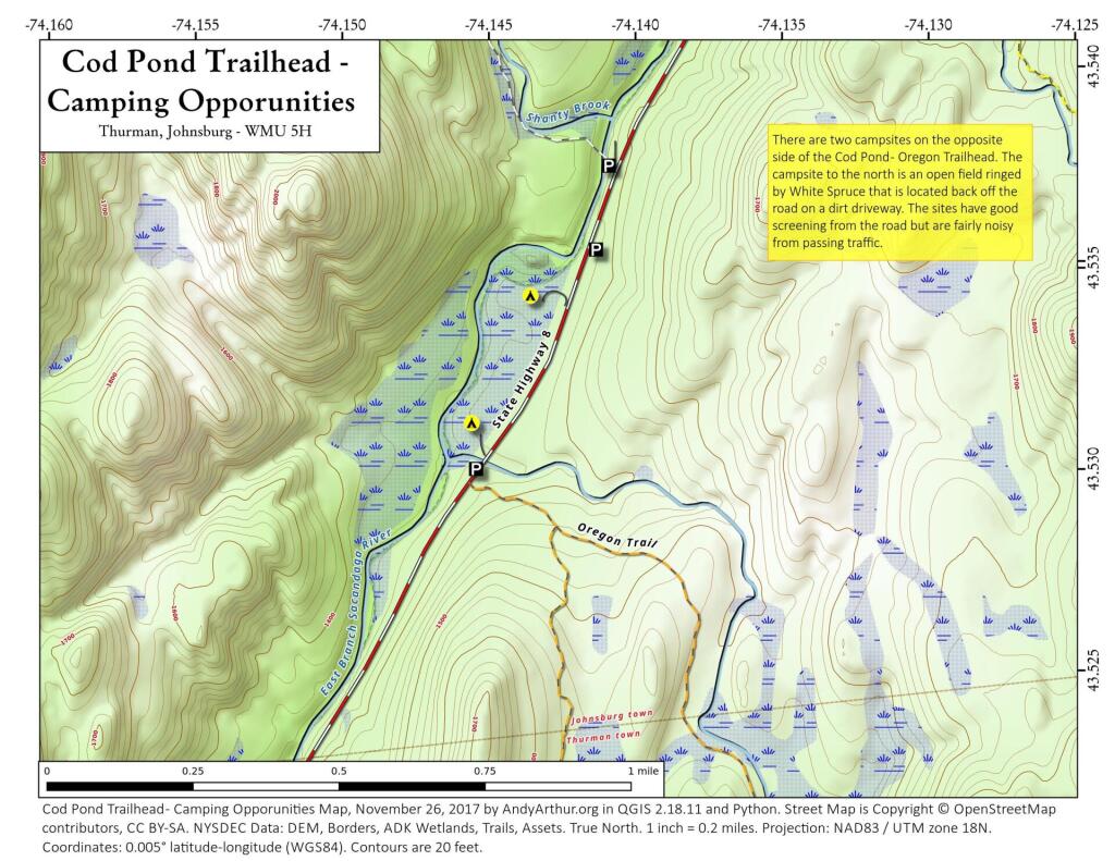
This past weekend I camped at the upper of these two campsites. It was a nice open field surrounded by white spruce. I hadn't ever been back to this campsite, but being sheltered from the wind with great views oft he stars, it is clearly now one of my favorite sites along NY 8. I have not explored the lower site but I confirmed it existed -- or at least the driveway exists to it -- when I was up that way this past weekend.
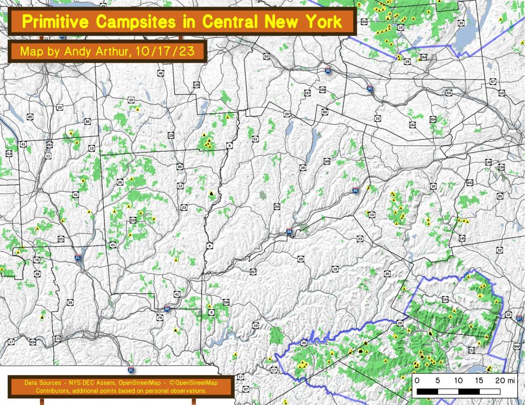
An overview of free primitive and roadside campsites located throughout the Central New York region of New York State including Broome County, Cortland County, Chenango County, Madison County, Otsego County and Schoharie County. Major areas include Burnt Rossman State Forest, Charles Baker State Forest, Stony Pond State Forest, Hunts Pond State Forest and Long Pond State Forest. You can see more detailed locations by exploring this Interactive Google Map (KML) of the campsites across the state.
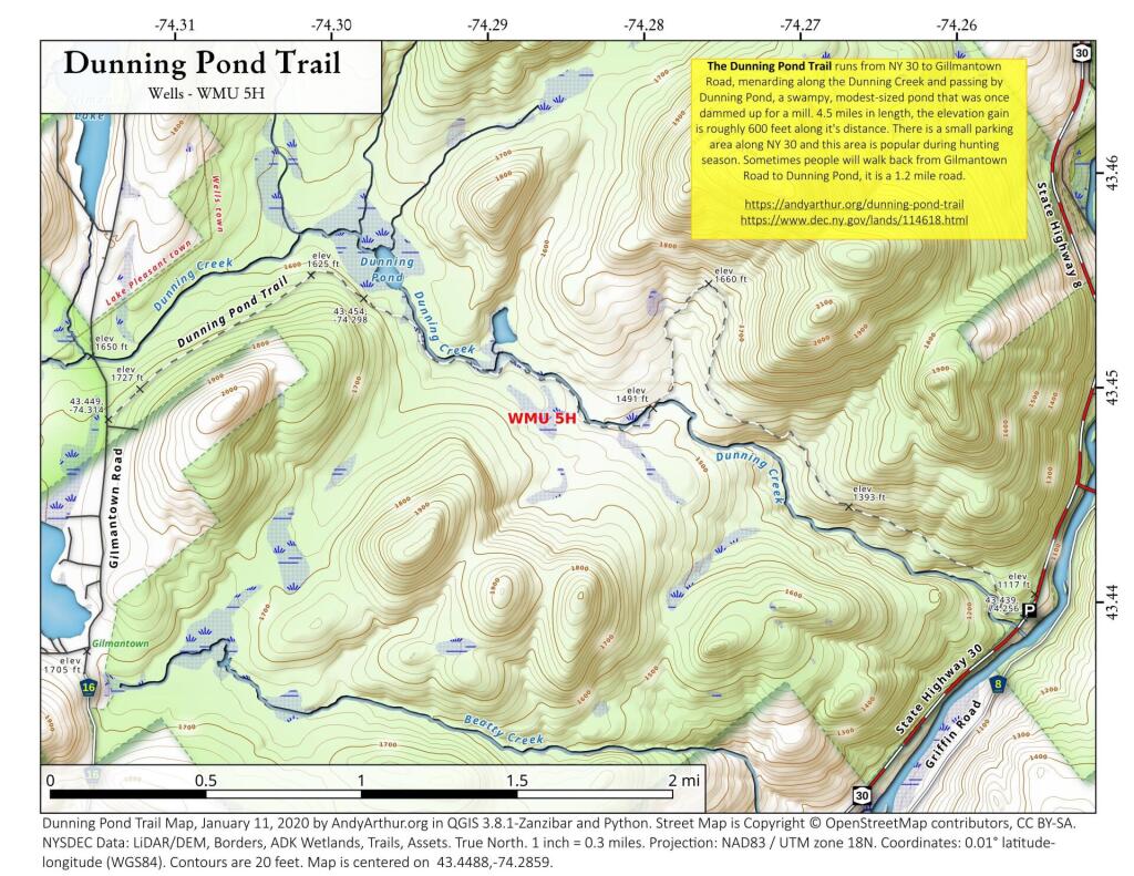
The Dunning Pond Trail runs from NY 30 to Gillmantown Road, mendaring along the Dunning Creek and passing by Dunning Pond, a swampy, modest-sized pond that was once dammed up for a mill. 4.5 miles in length, the elevation gain is roughly 600 feet along it's distance. There is a small parking area along NY 30 and this area is popular during hunting season. Sometimes people will walk back from Gilmantown Road to Dunning Pond, it is a 1.2 mile road.
https://andyarthur.org/dunning-pond-trail
https://www.dec.ny.gov/lands/114618.html
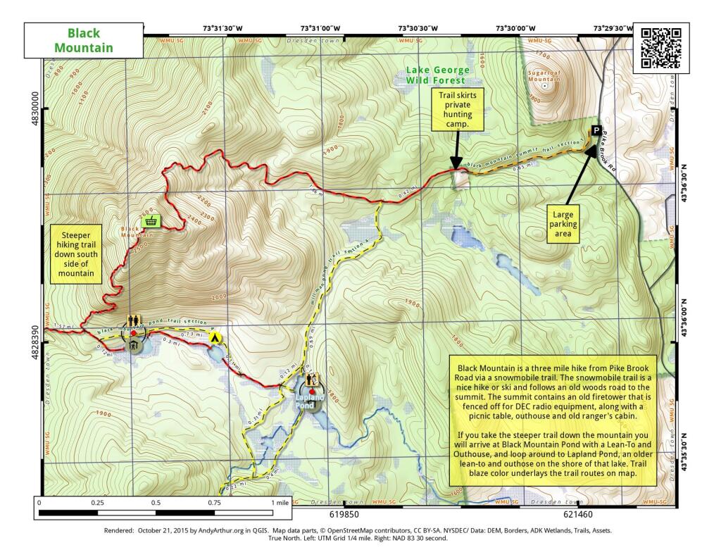
Black Mountain is a three mile hike from Pike Brook Road via a snowmobile trail. The snowmobile trail is a nice hike or ski and follows an old woods road to the summit. The summit contains an old firetower this is fenced off for DEC radio equipment, along with a picnic table, outhouse, and old ranger's cabin.
If you take the steeper trail down the mountain you will arrive at Black Mountain Pond with a Lean-To and Outhouse, and loop around to Lapland Pond, an older lean-to and outhouse on the shore of the lake. Trail blaze color underlays the trail routes on the map.
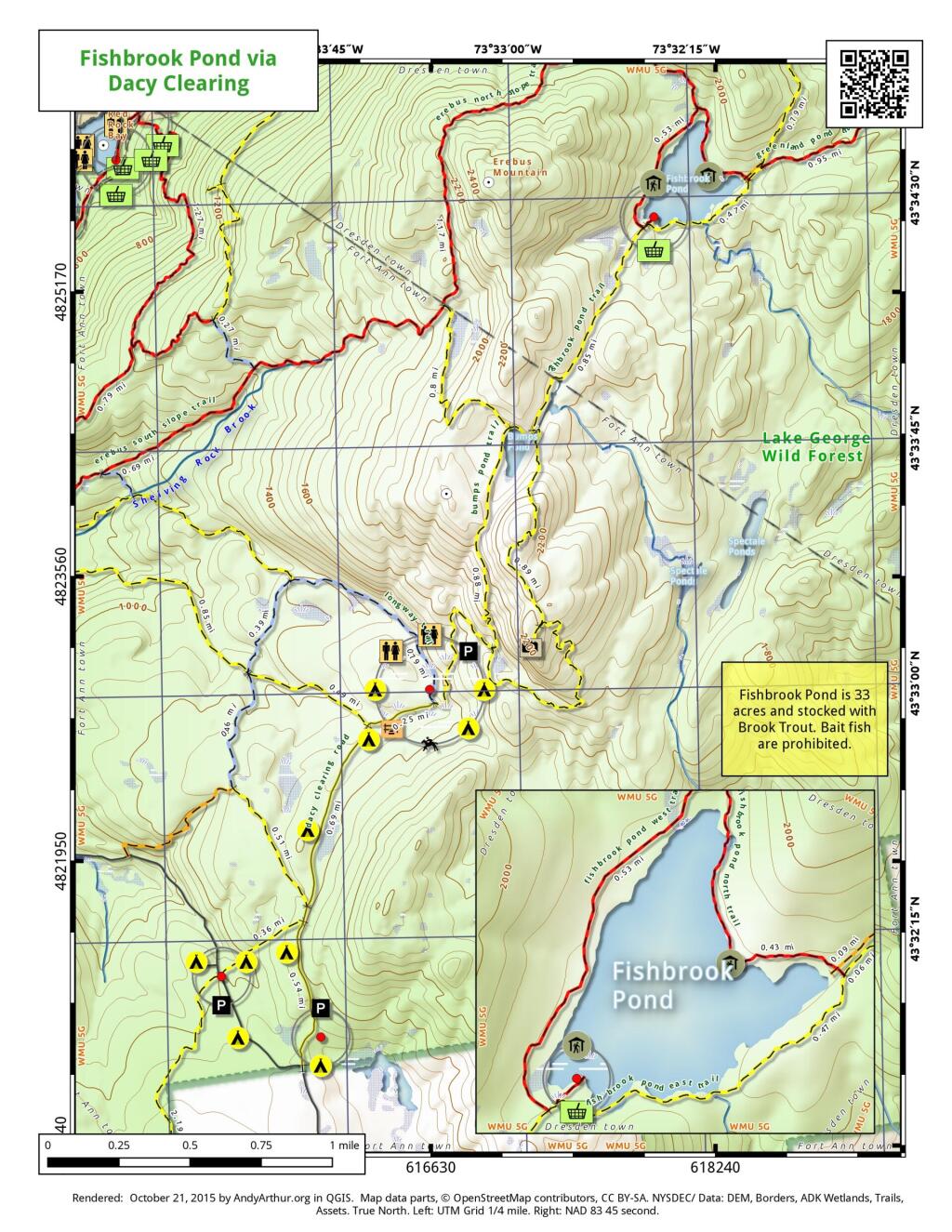
Here is a map of Fishbrook Pond, as accessed via trails around Dacy Clearing Road. Fishbrook Pond is 33 acres with a lean-to and picnic area. On the way there is Sleeping Beauty Mountain along with several campsites and other facilities.
Scenic trail along an old woods road from Huntley Pond to the Hudson River.
The Bourn Pond Trail skirts the western edge of Branch Pond and then enters the Lye Brook Wilderness. The trail travels along an old railroad grade and reaches south end of Borun Pond. Sections of this trail can be very muddy and may not be suitable for hiking during wet weather.