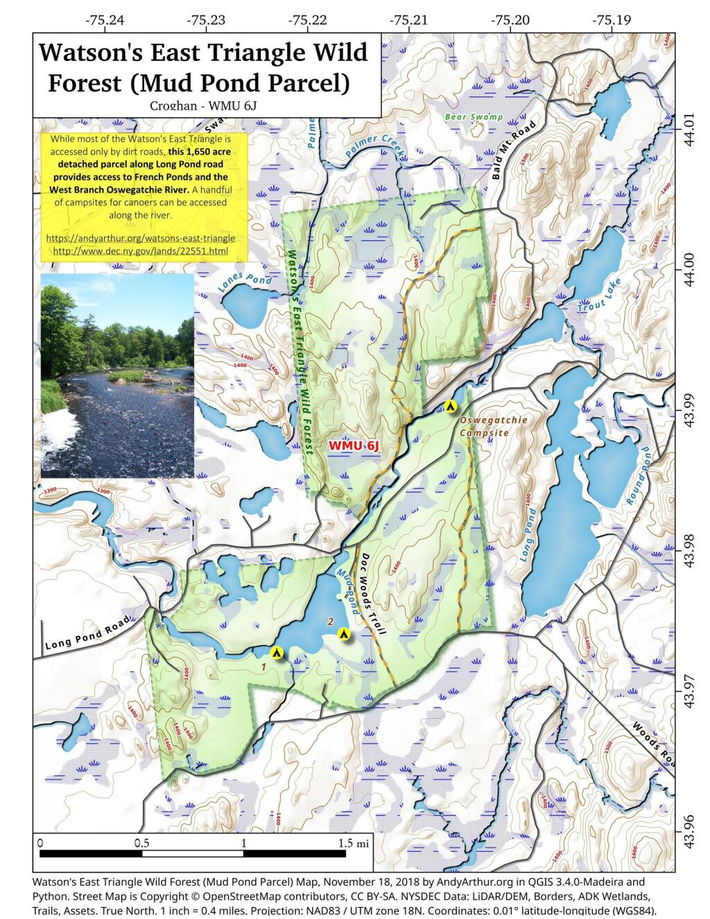
While most of Watson's East Triangle is accessed only by seasonal dirt roads, this 1,650 acre detached parcel along Long Pond road provides access to Franch Ponds and the West Branch Oswegathie River. A handful of campsites can be accessed along the river.
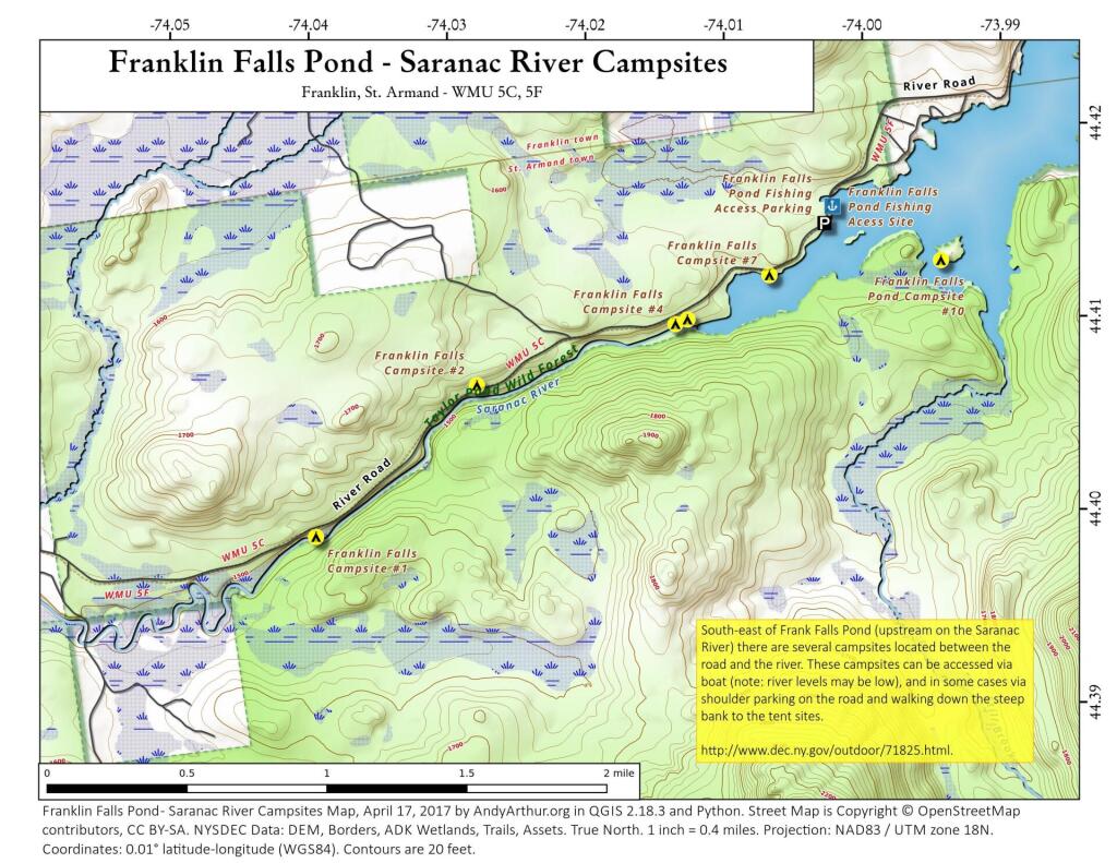
This shows the campsites south-west of the Franklin Falls Pond/Reservoir. The Saranac River at this point is mostly navigable at higher level flows but it is shallow with lots of big boulders and some rapids. You will be hoping in out of your canoe. Most of the campsites can also be accessed by parking on the shoulder of the road and climbing down a steep bank to campsites along the shoreline.
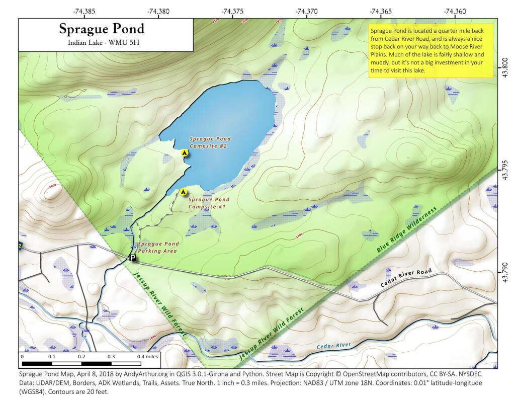
Located a quarter mile north of Cedar River Road, about half way to Cedar River Flow at Moose River Plains, is the trail head for Sprague Pond. It's a short hike a quarter mile north of the road, along it's outlet creek to a modestly sized, swampy pond. Campsites along the pond are very informal, and lightly used.
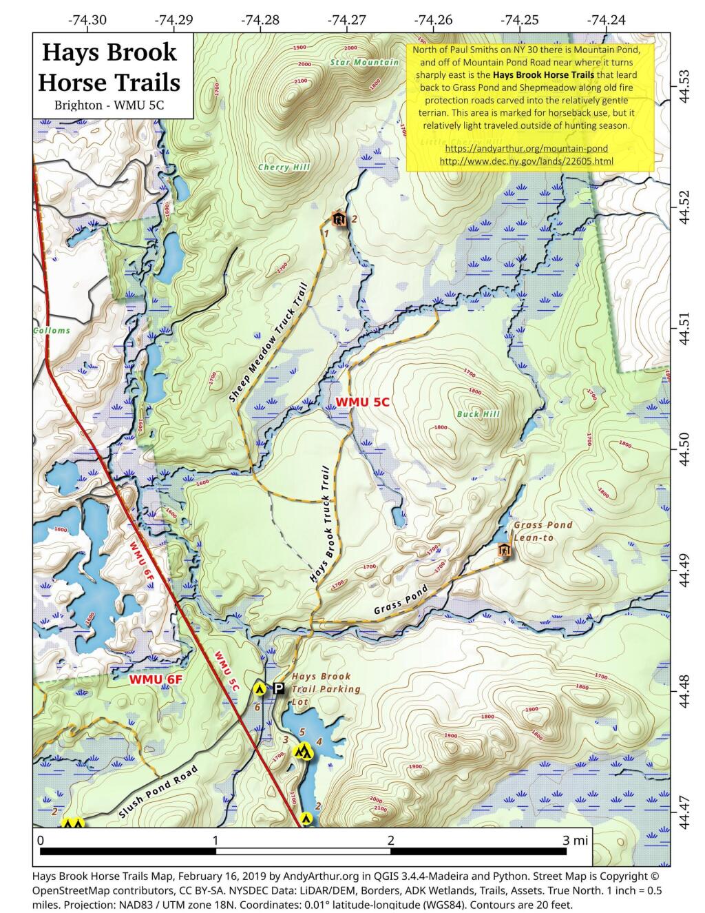
North of Mountain Pond in Paul Smiths is an old routing of NY 30 and several old fire protection roads that are used today for hiking, horseback riding, and accessing backcountry hunting locations. Known as the Hays Brook Horse Trails, there is a small parking area along Mountain Pond Road (Old Route 30), along with a falling apart wooden sign indicating the trail head.
Interactive map showing the campsites and lean-tos along Cheney Pond and Lester Flow (Vanderwhacker Creek) in the Cental Adirondacks.
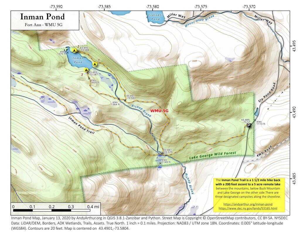
43.490132211131176,-73.5804143288084
The Inman Pond Trail is a 1 1/2 mile hike back with a 200 foot ascent to a 5 acre remote lake between the mountains, below Buck Mountain and Lake George on the other side.There are three designated campsites along the shoreline.
https://andyarthur.org/inman-pond
https://www.dec.ny.gov/lands/53165.html
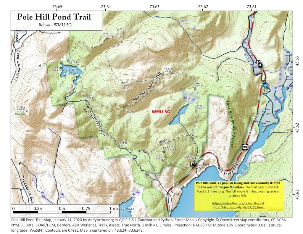
Pole Hill Pond is a popular hiking and cross-country ski trail to the west of Tongue Mountain. The trail back to Poll Hill Pond is 2 miles long. The full loop is 6 miles, crossing several unamed hills.
https://andyarthur.org/pole-hill-pond
https://dec.ny.gov/lands/53165.html