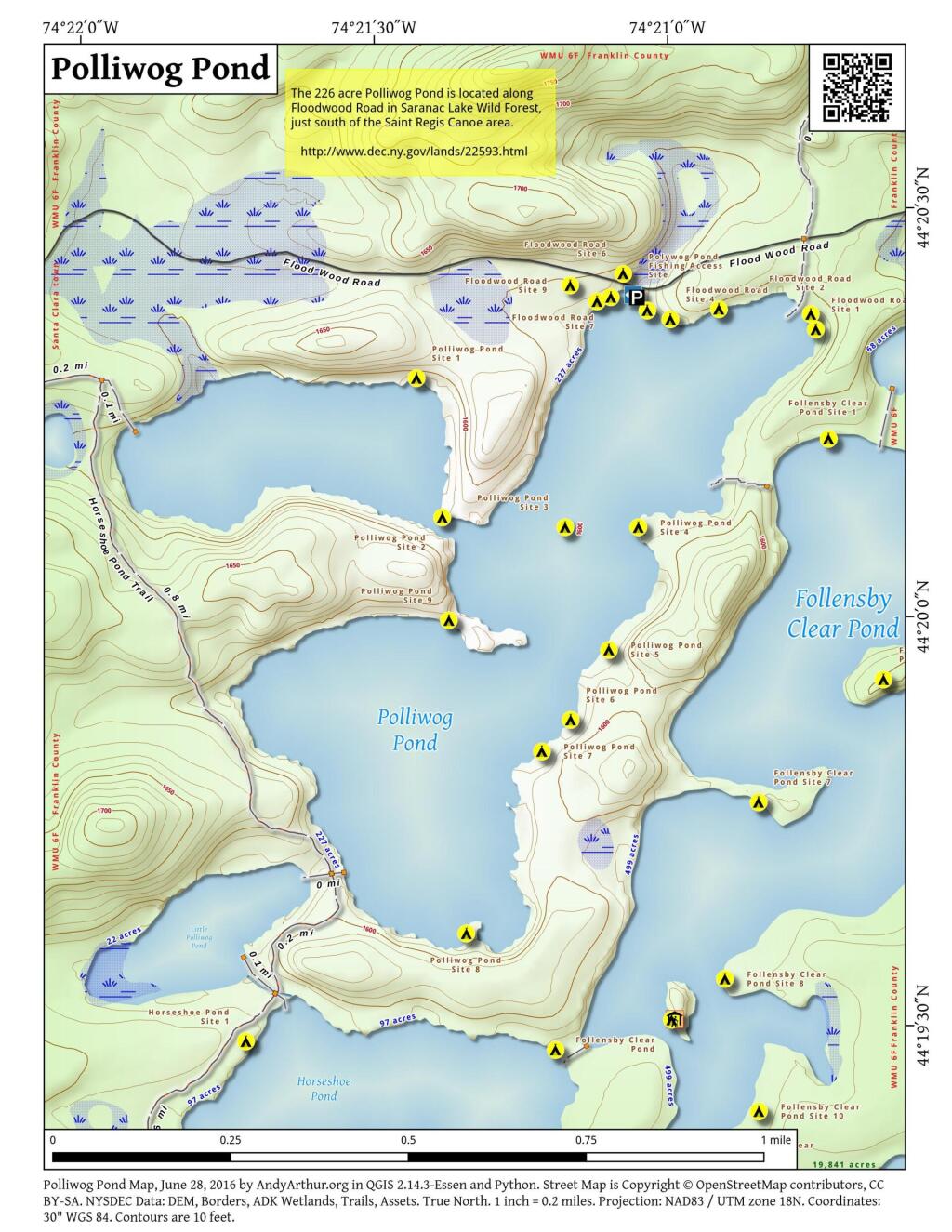
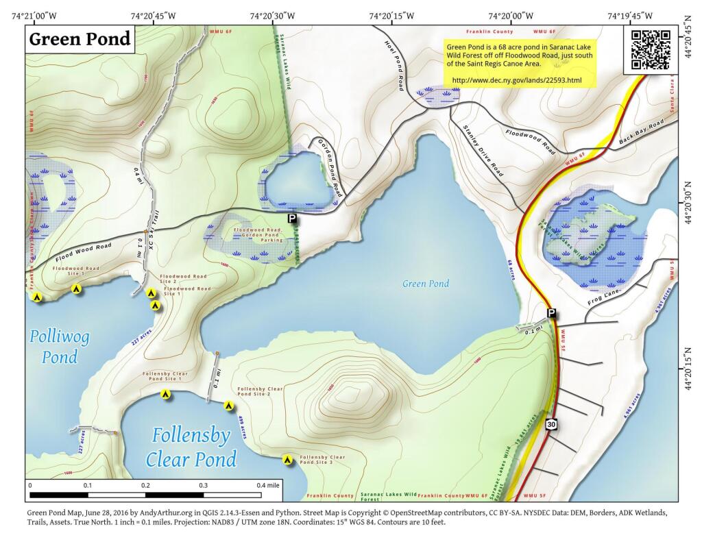
Follensby Clear Pond
Large 431 acre pond off Floodwood Road near the St. Regis Canoe Area with several free primative campsites along it's edge.
Polliwog Pond
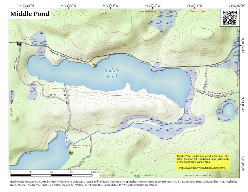
Middle Pond
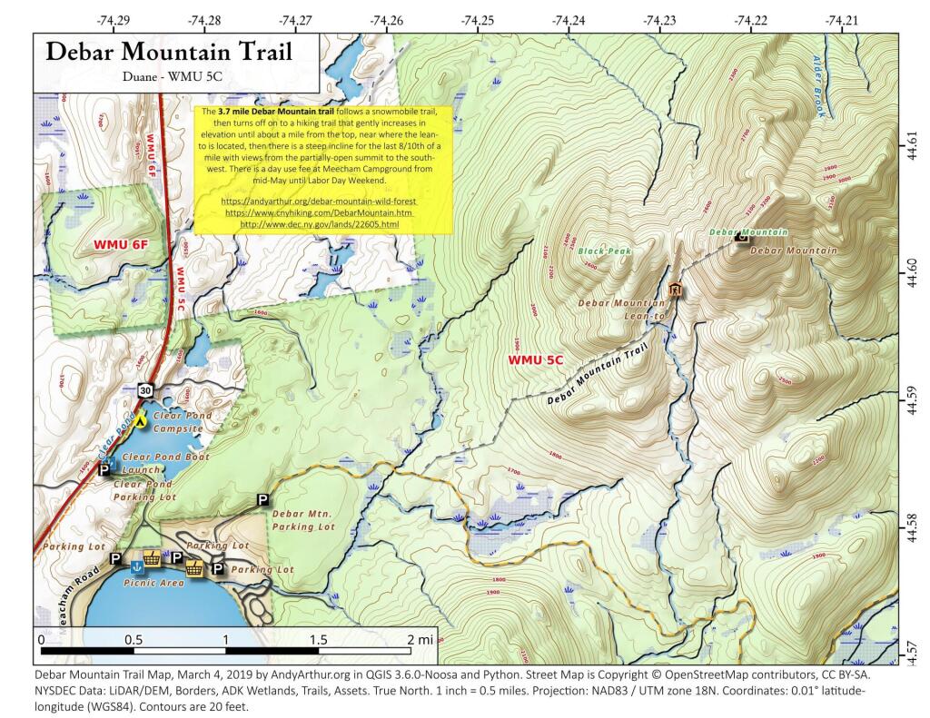
Debar Mountain Trail
Debar Mountain Trail (3,305 feet) extends 3.7 miles and ascends 1,725 feet from the trailhead within Meacham Lake Campground to the summit of the mountain. The trail ascends only 170 feet in the first 1.9 miles and ascends 755 feet in the next 1.3 miles. The last portion of the trail is steep, climbing 800 feet in the 0.5 mile to the summit. A lean-to is located along the trail just before the last steep section to the summit. Views at the top are limited by the trees growing on the summit but include the High Peaks to the south. When the campground is open, hikers are required to pay a day-use fee.
![Untitled [Expires July 12 2024]](https://andyarthur.org//data/photo_014913_large.jpg)
