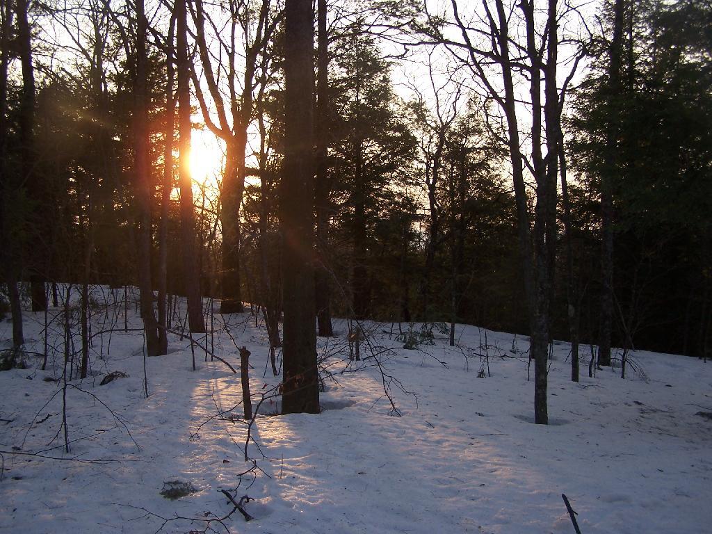
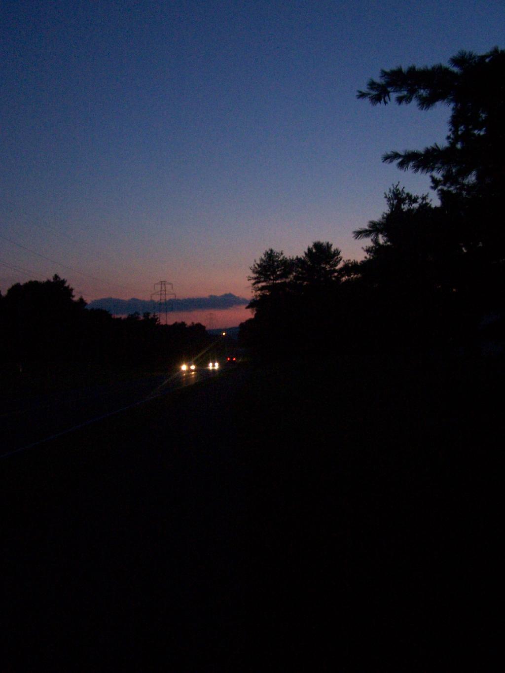
Sunset from Lean-To
Looking at the beautiful sunset from the lean-to, as the sky fills with color, as I sit back listening to Prairie Home Companion.
Taken on Saturday March 20, 2010 at Dutch Settlement State Forest.
Looking at the beautiful sunset from the lean-to, as the sky fills with color, as I sit back listening to Prairie Home Companion.
Taken on Saturday March 20, 2010 at Dutch Settlement State Forest.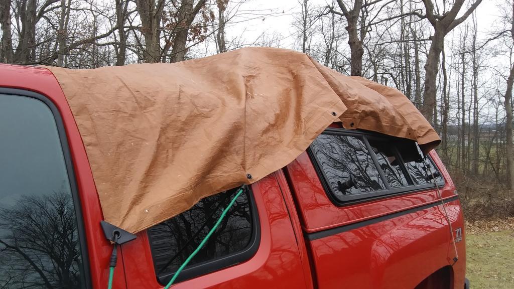
I figured this snow isn't going to be real icy so make it easy for cleaning off the snow from the cap come tomorrow so I can have solar panel cranking out a trickle charge when the sun comes back out.
Taken on Wednesday December 16, 2020 at Big Red.
Back in the 1930s, Robert Moses proposed and started constructing a parkway that would run along the lake shore of Lake Ontario, connecting Niagara Falls, Rochester, Oswego, and ultimately Watertown, Massena, and Malone, roughly parallel to the local routes now known as NY 104 and NY 3. Only about 35 miles of the parkway were ultimately built west of Rochester, leaving a 30 mile gap between the Robert Moses Parkway in Fort Niagara to Lakeside Beach Park in Carlton, Orleans County.
Taken on Sunday May 5, 2019 at Niagara, Genesee, Orleans Counties.Finally cleaned out around the electric baseboard heat in my bedroom. What a pain in the ass, but very much needed. The paper hornets nest wasn’t as big of a deal around the heater as I thought it was going to be, I don’t think it posed that much of a fire risk, being at the back of the unit and there wasn’t much evidence of any hornets coming out when I turned on the heat, but it’s totally gone now and cleaned up.
Found a shotgun shell on one of the radiators and some wires, so it’s good I didn’t turn the heat on and have a melty mess or one that could go bang. So much dust and random junk, although a lot could go to paper recycling or be cleaned up and put in it’s proper location. Shit falls behind the dresser and desk when they’ve not been moved for over 11 years at this point.
I don’t think it posed that much of a fire risk, as I only use the electric heat occasionally when I’m home, and the outside of the heaters don’t get that warm (although one melted a transformer sitting on it), but it’s safer being clean. I made sure no wires run close to the heater.
Hopefully with the dust vacuumed off the radiators things will work well and not stink too bad the first few times I turn them on. This often is an issue the first few times of the year – just kind of musty and mildewy like the rest of my apartment. I have the gas heat downstairs which works fine in ordinary winter weather – down to the teens or so – but when it gets really cold it has trouble keeping up for the upstairs.
The electric heat, unlike the gas heat, is very quick, so if I turn the heat down to 50 degrees during the day time when I’m at work or during the night, I can take the chill quickly off my bedroom when I get home from work or wake up.
I’ve never been a fan of heat. I like it cold in my bedroom, rarely turning the main heat above 55 degrees except in exceptionally cold weather or when I’m home for an extended period. I guess in very cold weather I’ll turn the downstairs heat up to 60 degrees, but it overrides by quite a bit upstairs in moderate weather, and I don’t like it much about the low 60s, or I get hot and uncomfortable. Keeping it cold saves money, and makes the outdoors less cold in the winter when I go for walks, or head out to work and play. Plus saves money, which is good because I’m trying to save and invest every spare penny so eventually I can own land.
| Location | Region | Facility | Name | Notes |
|---|---|---|---|---|
| 40.8977396062, -72.6606151038 |
1 | David A. Sarnoff Pine Barrens Preserve | Interior Lean- To | |
| 42.039846675, -74.593646931 |
3 | Balsam Lake Mountain Wild Forest | Balsam Lake Mountain Lean-To | |
| 42.0821851976, -74.5866114487 |
3 | Balsam Lake Mountain Wild Forest | Dry Brook Ridge Lean-To | |
| 42.0669125899, -74.6546347244 |
3 | Balsam Lake Mountain Wild Forest | Kelly Hollow Lean-To | |
| 42.0673682324, -74.5869876883 |
3 | Balsam Lake Mountain Wild Forest | Mill Brook Lean-To | |
| 42.0490509759, -74.644686588 |
3 | Balsam Lake Mountain Wild Forest | Mill Brook Ridge Lean-To | |
| 42.1150311581, -74.4907498238 |
3 | Belleayre Mtn Ski Center | East Ski Lean-To | |
| 42.1177186512, -74.5031992126 |
3 | Belleayre Mtn Ski Center | West Ski Lean-To | |
| 42.009105151, -74.4838519037 |
3 | Big Indian Wildernes Area | Biscuit Brook Lean-To | |
| 41.9980754336, -74.5603918334 |
3 | Big Indian Wildernes Area | Fall Brook Lean-To | |
| 42.0753394054, -74.4858565042 |
3 | Big Indian Wildernes Area | Mckinly Hollow Lean-To | |
| 42.0920121203, -74.50571316 |
3 | Big Indian Wildernes Area | Rider Hollow Lean-To | |
| 42.0502743293, -74.5106001667 |
3 | Big Indian Wildernes Area | Shandaken Brook Lean-To | |
| 42.0697505965, -74.2874492999 |
3 | Phoenicia – Mt. Tobias Wild Forest | Tremper Mountain Lean-To 1 | |
| 42.0719347774, -74.280350018 |
3 | Phoenicia – Mt. Tobias Wild Forest | Tremper Mountain Lean-To 2 | |
| 42.1388242073, -74.4544191301 |
3 | Shandaken Wild Forest | Rochester Hollow Lean-To | |
| 42.1027865494, -74.3948255307 |
3 | Slide Mountain Wilderness | Fox Hollow Lean-To | |
| 41.9591817103, -74.4068771821 |
3 | Slide Mountain Wilderness | Table Mountain Lean-To | |
| 42.0273156785, -74.3356447251 |
3 | Slide Mountain Wilderness | Terrace Mountain Lean-To | |
| 41.9400595492, -74.6320548238 |
3 | Willowemoc Wild Forest | Long Pond Lean-To | |
| 42.1584913515, -75.3620266032 |
4 | Arctic China State Forest | A-40 Lean-To | |
| 42.1528069973, -75.3102096425 |
4 | Barbour Brook State Forest | A-41 Lean To | |
| 42.2276166115, -75.3902198332 |
4 | Beals Pond State Forest | ||
| 42.3354251044, -73.4841812463 |
4 | Beebe Hill State Forest | Beebe Hill Lean-To | |
| 42.543303724, -74.4885945942 |
4 | Burnt-Rossman Hills State Forest | Eminence Lean-To | |
| 42.5282012278, -74.6420043552 |
4 | Clapper Hollow State Forest | Clapper Hollow Lean-To | |
| 42.0491041533, -74.9281738602 |
4 | Delaware Wild Forest | Cat Hollow Lean-To | |
| 42.0118726464, -74.9483763817 |
4 | Delaware Wild Forest | Mud Pond Trail Lean-To | |
| 42.0058597072, -74.8682131934 |
4 | Delaware Wild Forest | Pelnor Hollow Lean-To | |
| 42.0124988931, -74.9472696156 |
4 | Delaware Wild Forest | Trout Pond Trail Lean-To | Built For ADA |
| 42.6294376039, -74.2675434311 |
4 | Dutch Settlement State Forest | Lean-To | |
| 42.2197534864, -74.4391024687 |
4 | Halcott Mountain Wild Forest | Halcott Lean-To | |
| 42.313988005, -73.4414954693 |
4 | Harvey Mountain State Forest | Harvey Mountain Lean-To | |
| 42.1660752671, -74.2304343401 |
4 | Hunter-West Kill Wilderness | Devil’s Acre Lean-To | Good Condition |
| 42.1692897833, -74.2576582937 |
4 | Hunter-West Kill Wilderness | Diamond Notch Lean-To | |
| 42.3550413796, -74.3460668476 |
4 | Huntersfield State Forest | Lean-To | |
| 42.1196391066, -74.0873843029 |
4 | Indian Head Wilderness | Devils Kitchen Lean-To | |
| 42.0985881282, -74.0915994051 |
4 | Indian Head Wilderness | Echo Lake Lean-To | |
| 42.1357750354, -74.1634997793 |
4 | Indian Head Wilderness | Mink Hollow Lean-To | |
| 42.1894936316, -74.239507302 |
4 | Rusk Mountain Wild Forest | John Robb Lean-To | |
| 42.2789596573, -74.1033902943 |
4 | Windham Blackhead Range Wilderness | Batavia Kill Lean-To | |
| 42.3062546068, -74.1744107284 |
4 | Windham Blackhead Range Wilderness | Elm Ridge Lean-To | |
| 43.8755968409, -74.366426237 |
5 | Blue Mountain Wild Forest | O’neill Flow Lean-To | |
| 43.8873444776, -74.3788006261 |
5 | Blue Mountain Wild Forest | Tirrel Pond North Lean-To | |
| 43.829937473, -74.4366163022 |
5 | Blue Ridge Wilderness | Cascade Pond Lean-To | Fair |
| 43.8186736685, -74.4205248717 |
5 | Blue Ridge Wilderness | Stephens Pond Lean-To | Good |
| 43.8201917816, -74.4686803224 |
5 | Blue Ridge Wilderness | Wilson Pond Lean-To | Fair |
| 44.5989256982, -74.2285921246 |
5 | Debar Mtn. Wild Forest | Debar Mountian Lean-To | Debar Mtn Leanto |
| 44.4918501724, -74.2523227309 |
5 | Debar Mtn. Wild Forest | Grass Pond Lean-To | |
| 44.5192586399, -74.2710522386 |
5 | Debar Mtn. Wild Forest | Sheep Meadow Lean-To #1 | |
| 44.5193465505, -74.2711670085 |
5 | Debar Mtn. Wild Forest | Sheep Meadow Lean-To #2 | |
| 44.108205472, -73.7738312581 |
5 | Dix Mountain Wilderness | Bouquet Lean-To | |
| 44.0601596209, -73.8078167801 |
5 | Dix Mountain Wilderness | Lilian Brook Lean-To | |
| 44.044126198, -73.8058583966 |
5 | Dix Mountain Wilderness | Slide Brook Lean-To | |
| 44.1759172265, -73.7215350426 |
5 | Giant Mountain Wilderness | Giant Mtn. Lean-To | |
| 43.8863219437, -73.5641701351 |
5 | Hammond Pond Wild Forest | Eagle Lake Lean-To | |
| 43.9655912049, -73.6440374623 |
5 | Hammond Pond Wild Forest | Moose Mt Pond Lean-To | |
| 44.1447454969, -73.9547665307 |
5 | High Peaks Wilderness | Avalanche | |
| 44.1809734501, -73.8284043214 |
5 | High Peaks Wilderness | Bear Brook Lean-To | |
| 44.121015479, -73.9821264349 |
5 | High Peaks Wilderness | Beaver Point #1 | |
| 44.1207874446, -73.9817139904 |
5 | High Peaks Wilderness | Beaver Point #2 | |
| 44.1825279757, -74.1805220238 |
5 | High Peaks Wilderness | Blueberry Lean-To | |
| 44.1449655863, -73.8833895452 |
5 | High Peaks Wilderness | Bushnell Falls #1 Lean-To | |
| 44.1444007481, -73.8834828976 |
5 | High Peaks Wilderness | Bushnell Falls #2 Lean-To | |
| 44.1129718174, -73.9928913122 |
5 | High Peaks Wilderness | Calamity #1 Lean-To | |
| 44.1448580137, -74.2751710479 |
5 | High Peaks Wilderness | Calkin’s Brook Lean-To | |
| 44.1058294131, -74.3120366857 |
5 | High Peaks Wilderness | Calkin’s Creek Lean-To | |
| 43.9980126927, -74.3927845611 |
5 | High Peaks Wilderness | Catlin Bay #1 Lean-To | |
| 43.9972143811, -74.3959393656 |
5 | High Peaks Wilderness | Catlin Bay #2 Lean-To | |
| 44.1425166432, -74.1303582429 |
5 | High Peaks Wilderness | Cold River #2 Lean-To | |
| 44.091459278, -74.2576417508 |
5 | High Peaks Wilderness | Cold River #3 Lean-To | |
| 44.0913902533, -74.2557348025 |
5 | High Peaks Wilderness | Cold River #4 Lean-To | |
| 44.1427273763, -74.1298402107 |
5 | High Peaks Wilderness | Cold River Lean-To #1 Lean-To | |
| 44.1778467491, -73.833854921 |
5 | High Peaks Wilderness | Deer Brook Lean-To | |
| 44.141626874, -74.1069373468 |
5 | High Peaks Wilderness | Duck Hole #1 Lean-To | |
| 44.1416768647, -74.1065435467 |
5 | High Peaks Wilderness | Duck Hole #2 Lean-To | |
| 44.1142099053, -73.9556152329 |
5 | High Peaks Wilderness | Feldspar Lean-To | |
| 44.1186643668, -73.9840090128 |
5 | High Peaks Wilderness | Flowed Lands #2 Lean-To | |
| 44.1077341951, -73.9912056361 |
5 | High Peaks Wilderness | Griffin Lean-To | |
| 44.1773165403, -74.3218077012 |
5 | High Peaks Wilderness | Hemlock Hill Lean-To | |
| 44.1041784421, -74.0669132937 |
5 | High Peaks Wilderness | Henderson Lake Lean-To | |
| 44.1117549601, -74.0592189223 |
5 | High Peaks Wilderness | Henderson Lean-To | |
| 44.1178828905, -73.9873641274 |
5 | High Peaks Wilderness | Herbert Brook Lean-To | |
| 44.0026552882, -74.3864802633 |
5 | High Peaks Wilderness | Hidden Cove Lean-To | |
| 44.0760291647, -74.3235341651 |
5 | High Peaks Wilderness | Island House Lean-To | |
| 44.1494011459, -73.9557902347 |
5 | High Peaks Wilderness | Kagel Lean-To | |
| 44.0288002362, -74.367307986 |
5 | High Peaks Wilderness | Kelly Point #1 Lean-To | |
| 44.0287025672, -74.3671303487 |
5 | High Peaks Wilderness | Kelly Point #2 Lean-To | |
| 44.1706807759, -73.9050776091 |
5 | High Peaks Wilderness | Klondike Lean-To | |
| 44.1130126221, -73.9888393806 |
5 | High Peaks Wilderness | Livingston Point Lean-To | |
| 44.1469386475, -73.9552287453 |
5 | High Peaks Wilderness | Marcy Brook Lean-To | |
| 44.1579156535, -73.953395811 |
5 | High Peaks Wilderness | Marcy Dam #1 Lean-To | |
| 44.1573119259, -73.9533863686 |
5 | High Peaks Wilderness | Marcy Dam #2 Lean-To | |
| 44.1573817221, -73.9512823564 |
5 | High Peaks Wilderness | Marcy Dam #3 Lean-To | |
| 44.158399029, -73.9510719571 |
5 | High Peaks Wilderness | Marcy Dam #4 Lean-To | |
| 44.1586913289, -73.9524288871 |
5 | High Peaks Wilderness | Marcy Dam #5 Lean-To | |
| 44.1828433824, -74.0736410238 |
5 | High Peaks Wilderness | Moose Pond Lean-To | |
| 44.079589789, -74.2389368367 |
5 | High Peaks Wilderness | Moose Pond Stream Lean-To | |
| 44.0795538786, -74.2391509433 |
5 | High Peaks Wilderness | Moose Pond Stream Lean-To #2 | |
| 44.1992083493, -73.9059885406 |
5 | High Peaks Wilderness | Mr. Van Lean-To | |
| 44.0158171441, -74.1523218843 |
5 | High Peaks Wilderness | Newcomb Lake Lean-To #1 | |
| 44.0205306743, -74.1522782707 |
5 | High Peaks Wilderness | Newcomb Lake Lean-To #2 | |
| 44.1733720177, -74.1571389816 |
5 | High Peaks Wilderness | Number Four #1 Lean-To | |
| 44.1733860424, -74.1561240274 |
5 | High Peaks Wilderness | Number Four #2 Lean-To | |
| 44.1110695692, -73.9924324205 |
5 | High Peaks Wilderness | Opalescent Lean-To | |
| 44.1466502842, -73.8622440861 |
5 | High Peaks Wilderness | Ore Bed Brook Lean-To | |
| 44.1202212816, -74.1874471739 |
5 | High Peaks Wilderness | Ouluska Pass Brook Lean-To | |
| 44.0996351514, -73.9133647612 |
5 | High Peaks Wilderness | Panther Gorge Lean-To | |
| 44.0654422644, -74.3285192442 |
5 | High Peaks Wilderness | Plumley Point #1 Lean-To | |
| 44.0655989161, -74.3276122455 |
5 | High Peaks Wilderness | Plumley Point #2 Lean-To | |
| 44.1472355081, -74.318105399 |
5 | High Peaks Wilderness | Raquette Falls #1 Lean-To | |
| 44.1568302695, -74.3133083456 |
5 | High Peaks Wilderness | Raquette Falls #2 Lean-To | |
| 44.1710800022, -73.9974911766 |
5 | High Peaks Wilderness | Rocky Falls Lean-To | |
| 44.0414093849, -74.3501490964 |
5 | High Peaks Wilderness | Rodney Point #1 Lean-To | |
| 44.0429767454, -74.3493346475 |
5 | High Peaks Wilderness | Rodney Point #2 Lean-To | |
| 44.099413657, -74.1052871721 |
5 | High Peaks Wilderness | Santanoni Lean-To | |
| 44.159177638, -74.013876769 |
5 | High Peaks Wilderness | Scott Clearing Lean-To | |
| 44.1062441377, -74.2091536428 |
5 | High Peaks Wilderness | Seward Lean-To | |
| 44.1247329647, -73.9010796778 |
5 | High Peaks Wilderness | Slant Rock Lean-To | |
| 44.1988046777, -74.3183103111 |
5 | High Peaks Wilderness | Stony Creek Lean-To | |
| 44.1093110139, -73.961729679 |
5 | High Peaks Wilderness | Uphill Lean-To | |
| 44.1191510722, -73.9841831313 |
5 | High Peaks Wilderness | Walker Brook Lean-To | |
| 44.1221483174, -74.0532242803 |
5 | High Peaks Wilderness | Wallface Lean-To | |
| 44.1784419747, -74.1736369919 |
5 | High Peaks Wilderness | Ward Brook Lean-To | |
| 44.161824666, -73.8555947195 |
5 | High Peaks Wilderness | Wm. G. Howard Lean-To | |
| 44.1538919753, -73.8510077515 |
5 | High Peaks Wilderness | Wolf Jaw Lean-To | |
| 44.2530195934, -73.7180348153 |
5 | Hurricane Mountain Primitive Area | Gulf Brook Lean-To | Fair |
| 44.2607301476, -73.7100106669 |
5 | Hurricane Mountain Primitive Area | Lost Pond/Biesemeyer Lean-To | Fair |
| 43.5996600139, -73.5330643346 |
5 | Lake George Wild Forest | Black Mountain Ponds Lean-To | Lean-To With Privy And Fire Ring Black Mtn Pond Trail |
| 43.6193129088, -73.5841121844 |
5 | Lake George Wild Forest | Fifth Peak Lean-To | Lean-To W/ Privy And Fire Ring Tongue Mtn Range Trail |
| 43.5760391953, -73.5361031163 |
5 | Lake George Wild Forest | Fishbrook Pond North Lean-To | Leanto With Privy, Picnic Table And Fire Ring Fishbrook Pd-Lk Grg Shore Trl |
| 43.5738720148, -73.5384766731 |
5 | Lake George Wild Forest | Fishbrook Pond South Lean-To | Leanto With Privy, Picnic Table And Fire Ring Fishbrook Pd E Shore Trl |
| 43.6473357817, -73.5745337831 |
5 | Lake George Wild Forest | Five Mile Mountain Lean-To | Lean-To W/ Privy And Fire Ring Tongue Mtn Range Trail |
| 43.5778037953, -73.5168397538 |
5 | Lake George Wild Forest | Greenland Pond Lean-To | Leanto With Privy, Picnic Table And Fire Ring Greenland Pd Shelter Spur |
| 43.5958213341, -73.5179510245 |
5 | Lake George Wild Forest | Lapland Pond Lean-To | Campsite With Lean-To 13-27 Lapland Pond Lean-To Conector |
| 43.5871682823, -73.5277594231 |
5 | Lake George Wild Forest | Millman Pond Lean-To | Campsite With Lean-To 5-10 Old Farm To Millman Pond Trl |
| 44.3214560457, -74.0307860439 |
5 | Mckenzie Mtn. Wilderness | Placid Lean-To | |
| 44.3442169075, -73.9286469378 |
5 | Mckenzie Mtn. Wilderness | White Face Brook Lean-To | |
| 43.7790246336, -74.7044289121 |
5 | Moose River Plains Wild Forest | 8th Lake Island Lean-To | |
| 43.7801152974, -74.7044390115 |
5 | Moose River Plains Wild Forest | 8th Lake North Shore | |
| 43.7897826664, -74.6985922707 |
5 | Moose River Plains Wild Forest | 8thlake East Shore Lean-To | |
| 43.8316711731, -74.6617561796 |
5 | Moose River Plains Wild Forest | Beaver Bay Lean-To 1 | |
| 43.8316049364, -74.6615109228 |
5 | Moose River Plains Wild Forest | Beaver Bay Lean-To 2 | |
| 43.8314336654, -74.6609019165 |
5 | Moose River Plains Wild Forest | Beaver Bay Lean-To 3 | |
| 43.7478050188, -74.7441985068 |
5 | Moose River Plains Wild Forest | Seventh Lake Lean-To 1 | |
| 43.7507665118, -74.7346427944 |
5 | Moose River Plains Wild Forest | Seventh Lake Lean-To 2 | |
| 43.7563901134, -74.7178174969 |
5 | Moose River Plains Wild Forest | Seventh Lake Lean-To 3 | |
| 43.8145480145, -73.5808194792 |
5 | Pharaoh Lake Wilderness | Berrymill Pond Lean-To | Digitized From National Geographic Map |
| 43.8384100119, -73.5916749102 |
5 | Pharaoh Lake Wilderness | Clear Pond Lean-To | Digitized From National Geographic Map |
| 43.8412911595, -73.6316882519 |
5 | Pharaoh Lake Wilderness | Crab Pond Lean-To | Digitized From National Geographic Map |
| 43.8223693677, -73.5906397879 |
5 | Pharaoh Lake Wilderness | Grizzle Ocean Lean-To | Digitized From National Geographic Map |
| 43.8492027141, -73.6180024108 |
5 | Pharaoh Lake Wilderness | Lillypad Pond Lean-To | Digitized From National Geographic Map |
| 43.8500028762, -73.5895397847 |
5 | Pharaoh Lake Wilderness | Little Rock Pond Lean-To | Digitized From National Geographic Map |
| 43.8405296779, -73.6501782303 |
5 | Pharaoh Lake Wilderness | Oxshoe Pond Lean-To | Digitized From National Geographic Map |
| 43.7945783128, -73.6458567831 |
5 | Pharaoh Lake Wilderness | Pharaoh Lake #1 Lean-To | Digitized From National Geographic Map |
| 43.7966550547, -73.6403349616 |
5 | Pharaoh Lake Wilderness | Pharaoh Lake #2 Lean-To | Digitized From National Geographic Map |
| 43.8049450672, -73.6240085371 |
5 | Pharaoh Lake Wilderness | Pharaoh Lake #3 Lean-To | Digitized From National Geographic Map |
| 43.8049450672, -73.6240085371 |
5 | Pharaoh Lake Wilderness | Pharaoh Lake #3 Lean-To | Digitized From National Geographic Map |
| 43.8121074537, -73.6282851829 |
5 | Pharaoh Lake Wilderness | Pharaoh Lake #4 Lean-To | Digitized From National Geographic Map |
| 43.8021964679, -73.6391689125 |
5 | Pharaoh Lake Wilderness | Pharaoh Lake #5 Lean-To | Digitized From National Geographic Map |
| 43.8505590671, -73.5922949091 |
5 | Pharaoh Lake Wilderness | Rock Pond Lean-To | Digitized From National Geographic Map |
| 43.8581713271, -73.626483712 |
5 | Pharaoh Lake Wilderness | Tubmill Marsh Lean-To | Digitized From National Geographic Map |
| 44.3961331068, -74.3704212658 |
5 | Saint Regis Canoe Area | Fish Pond Site 2 Lean-To | Saint Regis Mountain |
| 44.3913013571, -74.3658071555 |
5 | Saint Regis Canoe Area | Fish Pond Site 5 Lean-To | New Lean-To Built Sept. 2010,Relocated Further From Water |
| 44.3808655111, -74.3200340382 |
5 | Saint Regis Canoe Area | St. Regis Pond Site 3 Lean-To | Lean-To Too Close To Water, Need To Move Back When Major Work Is Needed |
| 44.3250945507, -74.3498966646 |
5 | Saranac Lakes Wild Forest | Follensby Clear Lean-To | |
| 44.2866574735, -74.1626018103 |
5 | Saranac Lakes Wild Forest | Kiwasa Lake Site 3 Lean-To | |
| 44.3322955804, -73.9566258523 |
5 | Saranac Lakes Wild Forest | Lake Placid Site 2 Lean-To | Lake Placid |
| 44.3325954268, -73.9566801194 |
5 | Saranac Lakes Wild Forest | Lake Placid Site 3 Lean-To | Lake Placid |
| 44.2253525405, -74.3803783852 |
5 | Saranac Lakes Wild Forest | Raquette Lean-To | Built In 2013 Relocated From Trombley Landing Site |
| 44.3092299998, -74.1801499997 |
5 | Saranac Lakes Wild Forest | Saranac Islands Site 2 Lean-To | |
| 44.2890999998, -74.2172199999 |
5 | Saranac Lakes Wild Forest | Saranac Islands Site 45 Lean-To | |
| 44.2666999994, -74.2447999995 |
5 | Saranac Lakes Wild Forest | Saranac Islands Site 63 Lean-To | |
| 44.2729500004, -74.27398 |
5 | Saranac Lakes Wild Forest | Saranac Islands Site 81 Lean-To | |
| 44.2878799998, -74.2885399997 |
5 | Saranac Lakes Wild Forest | Saranac Islands Site 87 Lean-To | |
| 44.2287716477, -74.3755334312 |
5 | Saranac Lakes Wild Forest | Trombley Landing Lean-To | |
| 44.3028866826, -74.3026336593 |
5 | Saranac Lakes Wild Forest | Upper Saranac Lake Lean-To | |
| 43.8161997506, -74.6446678086 |
5 | Sargent Ponds Wild Forest | Big Island Lean-To 1 | |
| 43.8170896757, -74.6432509546 |
5 | Sargent Ponds Wild Forest | Big Island Lean-To 2 | |
| 43.8171339137, -74.6437800321 |
5 | Sargent Ponds Wild Forest | Big Island Lean-To 3 | |
| 43.8707715776, -74.6285067054 |
5 | Sargent Ponds Wild Forest | Boucher Point Lean-To #1 | |
| 43.8710064606, -74.6281079204 |
5 | Sargent Ponds Wild Forest | Boucher Point Lean-To #2 | |
| 43.8707202965, -74.629171869 |
5 | Sargent Ponds Wild Forest | Boucher Point Lean-To #3 | |
| 44.1027442039, -74.321862706 |
5 | Sargent Ponds Wild Forest | Deep Hole Lean-To | |
| 43.9262175397, -74.4753958672 |
5 | Sargent Ponds Wild Forest | Deerland Carry # 2 Lean-To | Fair Condition |
| 43.9257807189, -74.4758457554 |
5 | Sargent Ponds Wild Forest | Deerland Carry #1 Lean-To | Fair Condition |
| 43.9028470717, -74.5480629364 |
5 | Sargent Ponds Wild Forest | Forked Lake Lean-To | |
| 44.0814068183, -74.3358291461 |
5 | Sargent Ponds Wild Forest | Long Lake Nw Lean-To #1 | |
| 44.0825043385, -74.3339145725 |
5 | Sargent Ponds Wild Forest | Long Lake Nw Lean-To #2 | |
| 43.8593314968, -74.5626945075 |
5 | Sargent Ponds Wild Forest | Lower Sargents Pond Lean-To | Fair Condition |
| 43.8794136061, -74.6060523536 |
5 | Sargent Ponds Wild Forest | Outlet Bay Lean-To | Hit By Tree, 2011 |
| 43.9066458928, -74.5025901551 |
5 | Sargent Ponds Wild Forest | Pinebrook Lean-To | Fair Condition |
| 43.8368984989, -74.5352656022 |
5 | Sargent Ponds Wild Forest | Utowana Lake Lean-To | |
| 44.3317122951, -73.8997103538 |
5 | Sentinel Range Wilderness | Copperas Pond Lean-To | |
| 43.2171873383, -74.3641178087 |
5 | Shaker Mountain Wild Forest | Chase Lake Lean-To | |
| 43.1885867657, -74.4310218123 |
5 | Shaker Mountain Wild Forest | Holmes Lake Lean-To | |
| 43.6161332228, -74.1506253912 |
5 | Siamese Ponds Wilderness | E. Sacandaga River Lean-To | |
| 43.7007731961, -74.1581732825 |
5 | Siamese Ponds Wilderness | Hour Pond Lean-To | |
| 43.7278247362, -74.2012685562 |
5 | Siamese Ponds Wilderness | John Pond Lean-To | |
| 43.6775543215, -74.1916025718 |
5 | Siamese Ponds Wilderness | Puffer Pond #1 Lean-To | |
| 43.6765395437, -74.1997399401 |
5 | Siamese Ponds Wilderness | Puffer Pond #2 Lean-To | |
| 43.3974135952, -74.45529759 |
5 | Silver Lake Wilderness | Hamilton Lake Stream #1 Lean-To | |
| 43.3426710732, -74.4562907856 |
5 | Silver Lake Wilderness | Mud Lake Lean-To | |
| 43.2919354568, -74.4237351677 |
5 | Silver Lake Wilderness | Silver Lake Lean-To | |
| 44.4897002134, -73.8614267379 |
5 | Taylor Pond Wild Forest | North Shore Taylor Pond Lean-To | Managed By Operations |
| 44.4776887718, -73.881283087 |
5 | Taylor Pond Wild Forest | Northwest Shore Taylor Pond Lean-To | Managed By Operations |
| 44.3997973549, -73.5145569962 |
5 | Taylor Pond Wild Forest | Poke-O-Moonshine Summit Lean-To | |
| 44.4828880086, -73.8537772441 |
5 | Taylor Pond Wild Forest | South East Taylor Pond Lean-To | Managed By Operations |
| 43.9326741166, -73.9690844017 |
5 | Vanderwhacker Mountain Wild Forest | Cheney Pond Lean-To | |
| 43.8387348153, -73.9856219154 |
5 | Vanderwhacker Mountain Wild Forest | Stony Pond Lean-To | |
| 43.6259693968, -74.5492715037 |
5 | West Canada Lake Wilderness | Beaver Pond (AKA Cedar Lakes Lean-To #2) | |
| 43.6787448835, -74.4954982188 |
5 | West Canada Lake Wilderness | Carry Lean-To | |
| 43.628125665, -74.5404732399 |
5 | West Canada Lake Wilderness | Cedar Lakes #1 Lean-To | |
| 43.6084635843, -74.559724172 |
5 | West Canada Lake Wilderness | Cedar Lakes #3 Lean-To | |
| 43.6524139144, -74.4903803529 |
5 | West Canada Lake Wilderness | Colvin Brook Lean-To | |
| 43.5968984709, -74.5316653645 |
5 | West Canada Lake Wilderness | Pillsbury Lake Lean-To | |
| 43.5807608964, -74.576533363 |
5 | West Canada Lake Wilderness | Sampson Lake Lean-To | |
| 43.5872448097, -74.6215788384 |
5 | West Canada Lake Wilderness | South Lake Lean-To | |
| 43.5272841126, -74.6099246975 |
5 | West Canada Lake Wilderness | Spruce Lake #1 Lean-To | |
| 43.5346306298, -74.6080858031 |
5 | West Canada Lake Wilderness | Spruce Lake #2 Lean-To | |
| 43.5371297279, -74.608209628 |
5 | West Canada Lake Wilderness | Spruce Lake #3 Lean-To | |
| 43.4527175892, -74.5822815394 |
5 | West Canada Lake Wilderness | T Lake Lean-To | |
| 43.586987614, -74.613997971 |
5 | West Canada Lake Wilderness | West Canada Creek Lean-To | |
| 43.5931622288, -74.6268866843 |
5 | West Canada Lake Wilderness | West Lake #1 Lean-To | |
| 43.5970642572, -74.6231056496 |
5 | West Canada Lake Wilderness | West Lake #2 Lean-To | |
| 43.5102617091, -74.0492883971 |
5 | Wilcox Lake Wild Forest | Lizard Pond Lean-To | Digitized From National Geographic Map |
| 43.3363734227, -74.2173211966 |
5 | Wilcox Lake Wild Forest | Murphy Lake Lean-To | Digitized From National Geographic Map |
| 43.396075559, -74.1532214824 |
5 | Wilcox Lake Wild Forest | Wilcox Lake #1 Lean-To | Digitized From National Geographic Map |
| 43.39859675, -74.1554639493 |
5 | Wilcox Lake Wild Forest | Wilcox Lake #2 Lean-To | Digitized From National Geographic Map |
| 44.0021452737, -74.7756817712 |
5 | William C. Whitney Wilderness | Lake Lila # 7 Lean-To | |
| 44.4244015852, -73.8486868866 |
5 | Wilmington Wild Forest | Cooper Kill Lean-To | Too Close To Water, Need To Replocate, Do Not Repair |
| 44.1070894301, -75.0674448544 |
6 | Aldrich Pond Wild Forest | Streeter Lake Lean-To | Wood |
| 43.7434886212, -74.8776068003 |
6 | Alger Island Campground | Campsite # 01 | |
| 43.7443528827, -74.8771318496 |
6 | Alger Island Campground | Campsite # 02 | |
| 43.7456011181, -74.8768832894 |
6 | Alger Island Campground | Campsite # 03 | |
| 43.7466942129, -74.8745145576 |
6 | Alger Island Campground | Campsite # 04 | |
| 43.746535972, -74.8735980503 |
6 | Alger Island Campground | Campsite # 05 | |
| 43.7467703384, -74.8722666576 |
6 | Alger Island Campground | Campsite # 06 | |
| 43.7465482669, -74.8718037808 |
6 | Alger Island Campground | Campsite # 07 | |
| 43.7458848539, -74.8729191925 |
6 | Alger Island Campground | Campsite # 08 | |
| 43.7454701717, -74.8727721949 |
6 | Alger Island Campground | Campsite # 09 | |
| 43.7450840439, -74.8725955649 |
6 | Alger Island Campground | Campsite # 10 | |
| 43.744783668, -74.8724088972 |
6 | Alger Island Campground | Campsite # 11 | |
| 43.7441622435, -74.8727256743 |
6 | Alger Island Campground | Campsite # 12 | |
| 43.7440135576, -74.8739878218 |
6 | Alger Island Campground | Campsite # 13 | |
| 43.7431429387, -74.875172598 |
6 | Alger Island Campground | Campsite # 14 | |
| 43.7428736074, -74.8760835968 |
6 | Alger Island Campground | Campsite # 15 | |
| 43.6000735406, -75.0530032053 |
6 | Black River Wild Forest | Bear Lake Lean-To | |
| 43.5245079024, -75.0409215605 |
6 | Black River Wild Forest | Chub Pond #1 Lean-To | Rehabbed In 2008 |
| 43.5298225654, -75.0424937056 |
6 | Black River Wild Forest | Chub Pond #2 Lean-To | Built By Lean-To Permit 1963, Taken Care Of By Plumley Family |
| 43.5537469236, -75.059377614 |
6 | Black River Wild Forest | Gull Lake Lean-To | |
| 43.5341150034, -74.9280935302 |
6 | Black River Wild Forest | Lean-To | |
| 43.6299248982, -75.0362877527 |
6 | Black River Wild Forest | Remsen Falls Lean-To | Rehabbed In 2008 |
| 43.5589136946, -75.0030576033 |
6 | Black River Wild Forest | Sand Lake Falls Lean-To | Rehabbed In 2008 |
| 43.5998849075, -75.0203817469 |
6 | Black River Wild Forest | Woodhull Lake Lean-To | Rehabbed In 2008, Double Sized Lean-To |
| 43.6520754244, -75.0592470923 |
6 | Black River Wildforest | Nelson Lake Trail Lean-To | |
| 43.3445446485, -75.6722203255 |
6 | Cobb Brook State Forest | Leanto | |
| 44.1990987752, -74.8148790735 |
6 | Cranberry Lake Wild Forest | Bear Mountain Lean-To | |
| 44.2105729246, -74.7181527787 |
6 | Cranberry Lake Wild Forest | Burntbridge Pond Lean-To | |
| 44.1533999108, -74.8840290725 |
6 | Cranberry Lake Wild Forest | Ranger School Lean-To | Campsite 41 Aka Inlet Flow Lean-To |
| 44.0529214425, -74.9471939334 |
6 | Five Ponds Wilderness | Big Shallow Lean-To | Cs 30 |
| 44.0528916324, -75.0090580588 |
6 | Five Ponds Wilderness | Cage Lake Lean-To | |
| 44.0931113064, -74.8498397365 |
6 | Five Ponds Wilderness | Cowhorn Pond Lean-To | |
| 44.1123581654, -74.8914922468 |
6 | Five Ponds Wilderness | Janacks Landing Lean-To | With Full Sized Privy |
| 44.0474525004, -74.9526919257 |
6 | Five Ponds Wilderness | Little Shallow Lean-To | Cs 30 |
| 44.1198328093, -74.8454890242 |
6 | Five Ponds Wilderness | Olmstead Pond Lean-To | With Full Sized Privy |
| 44.0689970407, -74.9112845696 |
6 | Five Ponds Wilderness | Oswegatchie River Site 13 Lean-To | Cs 13 Lt |
| 44.0688665373, -74.9093532798 |
6 | Five Ponds Wilderness | Oswegatchie River Site 15 Lean-To | Cs 15 Lt |
| 44.0746275016, -74.9613775006 |
6 | Five Ponds Wilderness | Oswegatchie River Site 34 Lean-To | Cs 34 Lt |
| 44.0843538607, -74.9687312803 |
6 | Five Ponds Wilderness | Oswegatchie River Site 38 Lean-To | Cs 38 Lt |
| 44.0154640897, -75.0054753701 |
6 | Five Ponds Wilderness | Sand Lake Lean-To | Cs 30 |
| 43.9284894776, -74.9448704212 |
6 | Five Ponds Wilderness | Trout Pond Lean-To | |
| 43.9284894776, -74.9448704212 |
6 | Five Ponds Wilderness | Trout Pond Lean-To | |
| 44.0299676783, -74.9801386129 |
6 | Five Ponds Wilderness | Wolf Lake Lean-To | Cs 30 |
| 43.7029255425, -75.0960024266 |
6 | Haderondah | Middle Branch Lake Lean-To | |
| 43.6859486954, -75.0986138399 |
6 | Haderondah | Middle Settlement Lake Lean-To | |
| 44.1511613292, -74.5657606156 |
6 | Horseshoe Lake Wild Forest | Black Bay Lean-To | Checked 11/2015 |
| 44.196860294, -74.5121752893 |
6 | Horseshoe Lake Wild Forest | Eagle Landing Lean-To | Tupper Lake Site #5 |
| 43.8235350455, -75.1693122081 |
6 | Independence River Wild Forest | Panther Pond Lean-To | |
| 43.7083935125, -75.14645298 |
6 | Independence River Wild Forest | Pine Lake Lean-To | |
| 43.8089062032, -75.474955964 |
6 | Lowville Demonstration Area | Lowville Forestry Demonstration Area | |
| 43.8558345419, -74.804220953 |
6 | Pigeon Lake Wilderness | Andes Creek Lean-To | |
| 43.8575116443, -74.8252446695 |
6 | Pigeon Lake Wilderness | Gull Lake Lean-To | |
| 43.8764050748, -74.7655286668 |
6 | Pigeon Lake Wilderness | Lower Sister Lake Lean-To | |
| 43.8421644493, -74.8055993839 |
6 | Pigeon Lake Wilderness | Russian Lake Lean-To | |
| 43.8139160683, -74.7983685471 |
6 | Pigeon Lake Wilderness Area | Queer Lake Lean-To | Campsite With Lean-To |
| 43.8348742486, -75.8607286637 |
6 | Tug Hill State Forest | Electric Loop Lean-Too | Wooden Lean-Too Built In 1982, By Steve Wood Troop 7 |
| 44.3578220602, -75.3160008277 |
6 | Wolf Lake State Forest | Beaver Flow Lean-To | Beaver Flow Leanto |
| 44.3242717044, -75.3337383742 |
6 | Wolf Lake State Forest | Huckleberry Lake Lean-To | Huckleberry Lake Leanto |
| 44.3322757137, -75.3211717792 |
6 | Wolf Lake State Forest | Moon Pond Lean-To | Moon Lake Leanto |
| 44.3322757137, -75.3211717792 |
6 | Wolf Lake State Forest | Moon Pond Lean-To | Moon Lake Leanto |
| 44.3322757137, -75.3211717792 |
6 | Wolf Lake State Forest | Moon Pond Lean-To | Moon Lake Leanto |
| 44.3322757137, -75.3211717792 |
6 | Wolf Lake State Forest | Moon Pond Lean-To | Moon Lake Leanto |
| 44.3363136709, -75.313863327 |
6 | Wolf Lake State Forest | Wolf Lake Lean-To | Wolf Lake Leanto |
| 42.746653083, -75.3797255193 |
7 | Charles E. Baker State Forest | Trail 17 Lean-To | Primitive Campsite With Fire Pit |
| 42.7627233838, -75.379619514 |
7 | Charles E. Baker State Forest | Woodland Pond Lean-To | Primitive Campsite With Hore Tie Rail And Fire Pit |
| 42.3270424066, -76.4900608723 |
7 | Danby State Forest | Chestnut Lean-To | |
| 42.3176423354, -76.4225442513 |
7 | Danby State Forest | Tamarack Lean-To | |
| 42.8201846305, -75.8591052772 |
7 | Deruyter State Forest | Deruyter Lean-To | |
| 42.4228873052, -75.7674346807 |
7 | Genegantslet State Forest | Top Ten Lean-To | 20′ X 20′ Log Cabin |
| 42.4728525684, -76.1787322193 |
7 | Kennedy State Forest | Foxfire Lean-To | |
| 42.4458019158, -75.7015069607 |
7 | Ludlow Creek State Forest | Ludlow Creek Lean-To | 8′ X 10′ Constructed 2002 |
| 42.723126977, -75.8709545002 |
7 | Mariposa State Forest | Mariposa Finger Lakes Lean-To | |
| 42.7672022335, -76.0112561891 |
7 | Morgan Hill State Forest | Morgan Hill Lean-To | |
| 42.6423073773, -75.7437663179 |
7 | Perkins Pond State Forest | Flt Lean-To Lean-To | |
| 42.3905962266, -76.2718006242 |
7 | Robinson Hollow State Forest | Kimme Lean-To | |
| 42.3276442724, -76.3290355678 |
7 | Shindagin Hollow State Forest | Shindagin Lean-T0 | Scheduled For Replacement In 2004 |
| 42.5122011517, -76.1208238604 |
7 | Tuller Hill State Forest | Woodchuck Hollow Lean-To | Rebuilt In 2002 From Local State Forest Red Pine, Built By Volunteers From Suny Cortland |
| 42.6060629372, -75.4671141039 |
7 | Whaupaunaucau State | Leanto | |
| 42.3132130609, -77.5663734584 |
8 | Burt Hill State Forest | On Finger Lake Trail Lean-To | |
| 42.625051213, -77.3586638233 |
8 | High Tor Wma | High Tor North Lean-To | Campsite With Stone Firepit And Privy Updated By Emily Bonk Forest Tech |
| 42.6146971076, -77.3661109424 |
8 | High Tor Wma | High Tor South Lean-To | Campsite With Firepit And Privy Updated By Emily Bonk Forest Tech |
| 42.0965007548, -77.1964378403 |
8 | Mccarthy Hill State Forest | Mccarthy Hill Leanto | Built By Fltc 2012 |
| 42.2891155929, -77.1188809327 |
8 | South Bradford State Forest | Moss Hill Lean-To | |
| 42.3730816642, -76.9554800047 |
8 | Sugar Hill State Forest | Buck Settlement Lean-To | Built 2006 By Fltc |
| 42.369515888, -77.0127591279 |
8 | Sugar Hill State Forest | Parks Hollow Lean-To | |
| 42.3690917205, -77.0130036276 |
8 | Sugar Hill State Forest | Parks Hollow Lean-To | Log Built 2011 |
| 42.3822533326, -77.0026799995 |
8 | Sugar Hill State Forest | The Twin Lean-To’s | 2 Lean-To At This Location |
| 42.3898077706, -76.9725898373 |
8 | Sugar Hill State Forest | Vanzandt Lean-To | |
| 42.3340314562, -78.532889311 |
9 | Boyce Hill State Forest | Flt Lean To | Log Lean To Built In 2012 By Flt Club |
| 42.53472215, -73.9623319605 |
Cabins | |||
| 42.3492343019, -77.8075299409 |
Flt |

This lists out the 331 lean-tos with coordinates in the DEC's April 2017 release of Points of Interest Shapefile, that can be obtained from here: http://gis.ny.gov/gisdata/inventories/member.cfm?OrganizationID=529
Lately I have not been going on the evening walk as much as I used to. It’s been hot, and I’ve been lazy. But more to the point, my radio was broken, and I don’t like going for a walk without my radio to keep me company in the evening.
I had thought my radio had beat the dust. I dozen or so times, I had thought about chucking it in a campfire in the woods, and gotten rid of it. But like many times before, I took it back apart, and was able to clean up the contacts enough to get it working again.
I probably should have either fixed my radio sooner or bought a new one. I had previously tried fixing the radio to no luck, but maybe letting it sit for a while, and really scrubbing the contacts did the trick.
Getting back to the evening walk is a good thing. I’ve been doing it occasionally, but not enough, and I can tell I’ve put on some weight over the summer. My jeans are tighter, and I just feel heavier. The stress of the car crash certainly didn’t help.
But now that I have my radio working again, I am more committed to doing the evening walk, every night that it’s not oppressively hot or I’m not out on the town.
Not having a functioning radio seems like a weak excuse for not participating in this healthy activity, however it’s the truth.
This table is based on the data in the Catskill State Land Master Plan. I believe most of these sites are tent or lean-to sites, some fairly far back in.
| Catskill F.P. Unit | Designated Campsites | Lean-Tos | Major Desinations | Unit Yearly Usage |
|---|---|---|---|---|
| Big Indian Wilderness | 5 | 6 | n/a | 4,500 |
| Hunter – West Kill Wilderness | n/a | 2 | Hunter Mountain, West Kill Mountain | n/a |
| Indian Head Wilderness | 10 | 3 | Echo Lake | 8,000 |
| Slide Mountain Wilderness | 29 | 10 | Slide Mountain | 23,000 |
| Windham-Blackhead Wilderness | n/a | 2 | Blackhead Mountains | n/a |
| Balsam Lake Mountain Wild Forest | 15 | 5 | Alder Lake | 5,000 |
| Bluestone Wild Forest | n/a | n/a | n/a | n/a |
| Colgate Lake Wild Forest | n/a | n/a | Colgate Lake | n/a |
| Delaware Wild Forest | n/a | n/a | n/a | n/a |
| Dry Brook Ridge Wild Forest | n/a | n/a | Dry Brook Mountains | n/a |
| Halcott Mountain Wild Forest | n/a | 1 | n/a | n/a |
| Elm Ridge Wild Forest | n/a | 1 | Windham High Peak | n/a |
| Overlook Mountain Wild Forest | n/a | n/a | Overlook Mountain | n/a |
| Phoenicia – Mt. Tobias Wild Forest | 0 | 2 | n/a | n/a |
| Rusk Mountain Wild Forest | n/a | n/a | n/a | n/a |
| Shandaken Wild Forest | 10 | n/a | n/a | n/a |
| Sundown Wild Forest | 60 | 0 | Kaaterskill High Point | n/a |
| Willowemoc Wild Forest | 2 | 12 | n/a | n/a |
| Crystal Lake Wild Forest | n/a | n/a | n/a | n/a |
| Catskill Total | 131 | 44 | – | – |