Search Results for: map osi parcel 2

Laws and Case Law

Highway Law Section 115-A:
Abandonment of County Highways.

Whenever a county road or part thereof constructed as part of the county road system deviates from the line of an existing town highway, or from the line of a former town highway within the limits of an incorporated village, as shown on the map of the county road system, the board of supervisors by resolution duly adopted upon the recommendation of the county superintendent of highways, and pursuant to a written agreement with the town board or village board of trustees, or in the event such an agreement cannot be reached with the approval of the commissioner of transportation, may abandon to the town or the incorporated village as the case may be for future maintenance, that part of the town highway or former town highway within the limits of an incorporated village not improved and modify the map of the county road system accordingly. The portion of any town highway or former town highway within the limits of an incorporated village excluded from the county road system shall be maintained by the town or village in which it is located.

Warning! Road Washed Out

Highway Law Section 205:
Highways Abandoned By Local Governments.

1. Every highway that shall not have been opened and worked within six years from the time it shall have been dedicated to the use of the public, or laid out, shall cease to be a highway; but the period during which any action or proceeding shall have been, or shall be pending in regard to any such highway, shall form no part of such six years; and every highway that shall not have been traveled or used as a highway for six years, shall cease to be a highway, and every public right of way that shall not have been used for said period shall be deemed abandoned as a right-of-way. The town superintendent with the written consent of a majority of the town board shall file, and cause to be recorded in the town clerk’s office of the town a written description, signed by him, and by said town board of each highway and public right-of-way so abandoned, and the same shall thereupon be discontinued.

2. There may also be a qualified abandonment of a highway under the following conditions and for the following purposes, to wit: Where it appears to the town superintendent and said town board, at any time, that a highway has not become wholly disused as aforesaid, but that it has not for two years next previous thereto, been usually traveled along the greater part thereof, by more than two vehicles daily, in addition to pedestrians and persons on horseback, and it shall also appear to the superintendent of highways of the county in which such town is situate that a qualified abandonment of such highway is proper and will not cause injustice or hardship to the owner or occupant of any lands adjoining such highway after such superintendent shall have held a public hearing thereon upon giving at least twenty days’ written notice to such owners and occupants of such lands of the time and place of such hearing, they shall file and cause to be recorded in the town clerk’s office a certificate containing a description of that portion of the highway partly disused as aforesaid and declaring a qualified abandonment thereof. The effect of such qualified abandonment, with respect to the portion of said highway described in the certificate, shall be as follows: It shall no longer be worked at the public expense; it shall not cease to be a highway for purposes of the public easement, by reason of such suspension of work thereon; no persons shall impair its use as a highway nor obstruct it, except as hereinafter provided, but no persons shall be required to keep any part of it in repair; wherever an owner or lessee of adjoining lands has the right to possession of other lands wholly or partly on the directly opposite side of the highway therefrom, he may construct and maintain across said highway a fence at each end of the area of highway which adjoins both of said opposite pieces of land, provided that each said cross fence must have a gate in the middle thereof at least ten feet in length, which gate must at all times be kept unlocked and supplied with a sufficient hasp or latch for keeping the same closed; all persons owning or using opposite lands, connected by such gates and fences, may use the portion of highway thus enclosed for pasturage; any traveler or other person who intentionally, or by wilful neglect, leaves such gate unlatched, shall be guilty of a misdemeanor, and the fact of leaving it unlatched shall be prima facie evidence of such intent or wilful neglect. Excepting as herein abrogated, all other general laws relating to highways shall apply to such partially abandoned highway. This section shall not apply to highways less than two rods in width unless it shall appear to the town superintendent at any time that such a highway has not, during the months of June to September inclusive of the two years next previous thereto, been usually traveled along the greater part thereof by more than ten pedestrians daily.

Any action or proceeding involving the abandonment or qualified abandonment of a highway made pursuant to this section must, in the case of abandonment, be commenced within one year from the date of filing by the town superintendent as provided in subdivision one of this section.

Old NY 30 Signs

Matter of Smigel v. Town of Rennselaer.

As seen on Google Scholar.

MATTER OF SMIGEL v. TOWN OF RENSSELAERVILLE

283 A.D.2d 863 (2001)

725 N.Y.S.2d 138

In the Matter of HENRIETTA SMIGEL, Respondent, v.
TOWN OF RENSSELAERVILLE et al., Appellants.

Appellate Division of the Supreme Court of the State of New York, Third Department.

Decided May 24, 2001.

Mercure, J. P., Peters, Spain and Carpinello, JJ., concur. Lahtinen, J.

Petitioner is the owner of land bordering the Camp Winsocki Road (hereinafter the road) located in respondent Town of Rensselaerville in Albany County, having acquired title to the property in 1986. In December 1995, petitioner requested that respondents abandon a portion of the road which she had barricaded at both ends in 1986, and which respondent Town Supervisor admitted had not been maintained by respondents for at least 20 years. Her request was continued for further study by the Town Board of the Town of Rensselaerville. In October 1999, petitioner and another petitioned respondents “to abandon a portion of its present easement to [the road].” In January 2000, after a public hearing, respondents refused to abandon the road and passed a resolution finding that the road had not been abandoned through disuse, ordering petitioner to remove all of her barricades, and making the road a seasonal road to be maintained from April 1 to December 1.

In January 2000, petitioner commenced this combined CPLR article 78 proceeding and action for declaratory judgment seeking a judgment clearing her title “as to the portion of her property previously subjected to an easement for the highway,” injunctive relief prohibiting respondents from removing her barriers on the road and trespassing on her property and an order directing respondents to file a certification of abandonment. Respondents answered, asserting that the petition/ complaint failed to state a cause of action.

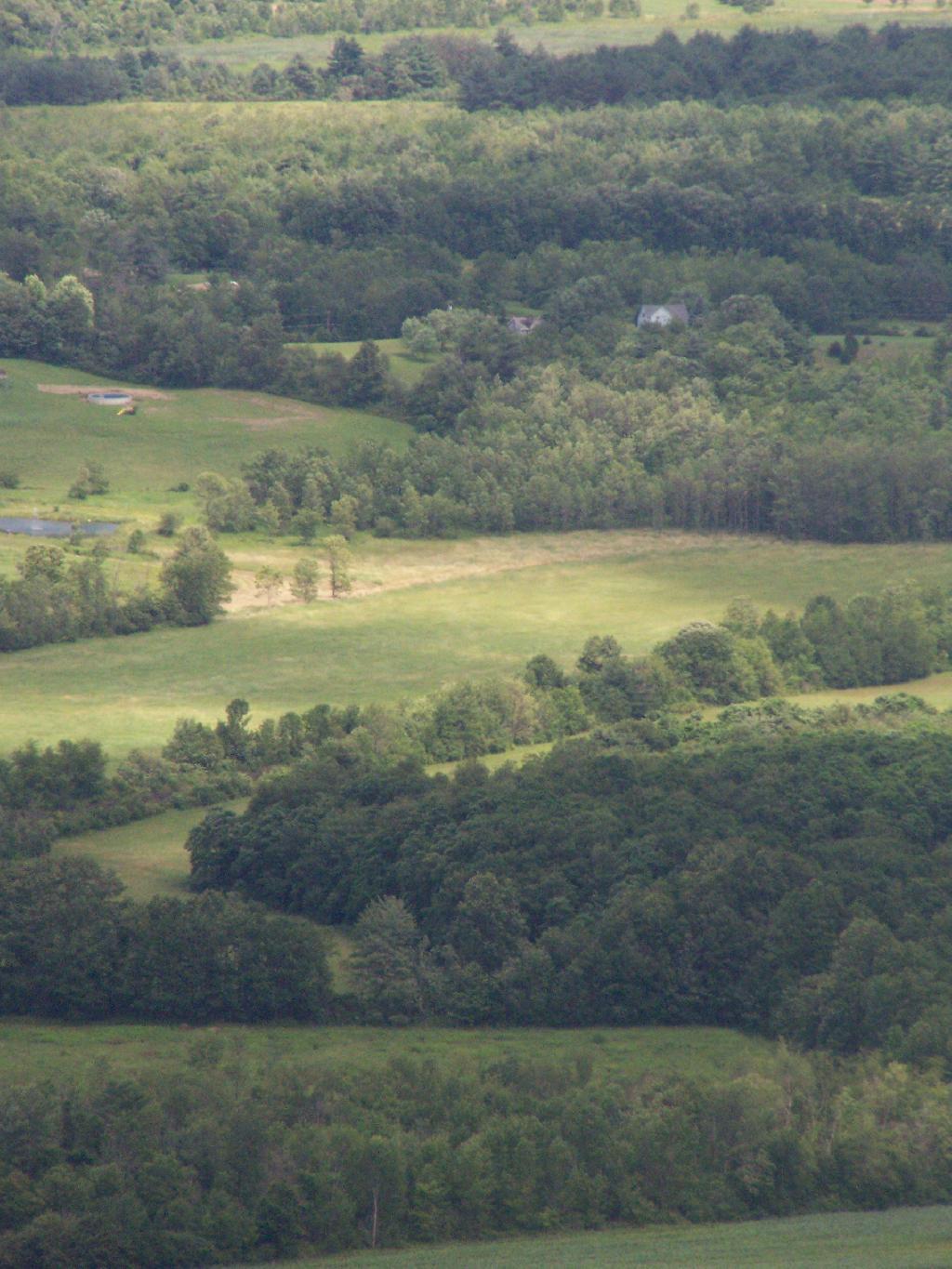
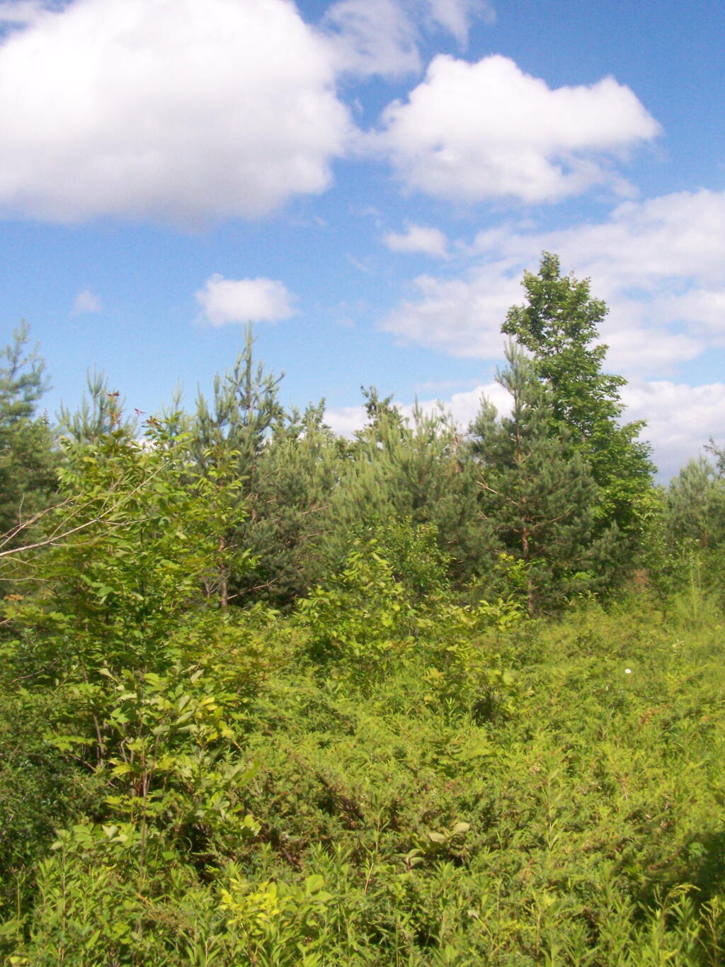
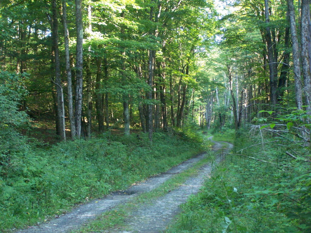
The parties submitted numerous affidavits and documentary evidence in support of their respective positions and, in April 2000, Supreme Court determined that because no photographs had been submitted by either party, the matter could not be summarily decided, and it therefore set a hearing date to determine whether recreational travel “follows the `lines of the ancient street.'” When the parties appeared on the scheduled hearing date, they were informed that the hearing had been canceled and were directed to leave any photographs that they had with the court for review. Both parties submitted photographs depicting the present condition of the road.* On May 26, 2000, Supreme Court granted the petition/complaint and declared the road to be abandoned. Respondents appeal and we reverse.

Highway Law § 205 (1) provides, in relevant part, that “every highway that shall not have been traveled or used as a highway for six years, shall cease to be a highway.” Once a highway exists, it is presumed to continue until the contrary is demonstrated and the presumption is in favor of continuance (see, City of Cohoes v Delaware & Hudson Canal Co., 134 N.Y. 397, 407; Matter of Van Aken v Town of Roxbury,211 A.D.2d 863, 865, lv denied 85 N.Y.2d 812). The burden of establishing abandonment is on the party claiming that the highway has been abandoned (see, Matter of Faigle v Macumber,169 A.D.2d 914, 915). In that regard, a municipality’s intention regarding a road is irrelevant (see, Daetsch v Taber,149 A.D.2d 864, 865) and its failure to maintain a road does not mean that the road ceases to be a highway (see, O’Leary v Town of Trenton,172 Misc.2d 447, 450). A determination of abandonment of a road by nonuse is a factual determination (see, e.g., Coleman v Village of Head of Harbor,163 A.D.2d 456, 458, lv denied76 N.Y.2d 768; Holland v Superintendent of Highways of Town of Smithtown,73 Misc.2d 851, 852).

It is undisputed that respondents never filed a certificate of abandonment to officially abandon the road. Likewise, it is clear that respondents did not maintain the road nor had the road been used by motor vehicles for more than the statutory six-year period. The narrow question left to be decided after submission of the photographs was framed by Supreme Court as follows: “[i]f the road entrance has been obstructed, and it is unpaved and overgrown with weeds, trees, bushes and shrubs, as claimed by petitioner, making travel along the `lines of the ancient street’ improbable, then even the most active recreational and seasonal use propounded by [respondents], that of snowmobilers, hikers, and bicyclists, would fall short of being highway use” (citing O’Leary v Town of Trenton, supra, at 451; Holland v Superintendent of Highways of Town of Smithtown, supra, at 853).

We find that Supreme Court correctly set forth the applicable law regarding abandonment of a highway through nonuse. After reviewing the photographs submitted by the parties, Supreme Court made the factual determination that the “photographs reveal many years of non-use as a highway” and “it is apparent that the road entrance has often been obstructed, preventing travel along the `lines of the ancient street,'” and summarily granted the relief sought by petitioner. We agree that the photographs show a number of barricades located at various points along the unpaved road, but they also show an ancient road, not overgrown with weeds, trees, bushes or shrubs, but clearly discernible, and not “virtually indistinguishable from the surrounding wooded area” (Matter of Faigle v Macumber, supra, at 916). Indeed, the pictures appear to depict a clearly defined, unpaved roadway through an area overgrown with brush and thick woods on both sides, precluding travel other than on the road, except with extreme difficulty. Our review of the photographs suggests to us that travel over this road by such disparate groups as snowmobilers, bicyclists, cross-country skiers and pedestrians would follow “along the lines of an existing street” (Town of Leray v New York Cent. R. R. Co., 226 N.Y. 109, 113). Moreover, respondents’ submissions reflect that although petitioner had barricaded the road on a number of occasions, those obstructions were either removed or knocked down so as to access its year-round recreational use. Therefore, the recreational uses found by Supreme Court may be sufficient to preclude a finding of abandonment of the road by nonuse. In our opinion, summary judgment should not have been granted in this matter in the absence of clarifying testimony as to the condition and use of the roadway.

Ordered that the judgment is reversed, on the law, without costs, and matter remitted to the Supreme Court for further proceedings not inconsistent with this Court’s decision.

Red Dirt Road

MATTER OF VAN AKEN v. Town of Roxbury, 211 AD 2d 863.

As found on Google Scholar.

211 A.D.2d 863 (1995) 621 N.Y.S.2d 204 In the Matter of Millard Van Aken et al., Appellants, v. Town of Roxbury et al., Respondents

Appellate Division of the Supreme Court of the State of New York, Third Department.

January 5, 1995 Mikoll, Crew III, Yesawich Jr. and Peters, JJ., concur.

Cardona, P. J.

Petitioners are property owners with residences located in the Town of Roxbury, Delaware County, which extends beyond the roadway presently maintained by respondents as a Town road. On October 20, 1992, petitioners wrote to respondent Town of Roxbury requesting maintenance of the road segment at issue. On November 10, 1992, the Town Attorney responded by requesting evidence that the segment was a Town road. The attorney for petitioners wrote back indicating the reasons the particular segment was a Town highway. When no response was received, petitioner Millard Van Aken asked the Town Supervisor about the status of the request and was told that the Town Attorney was supposed to respond but had been delayed by other matters.

On March 4, 1993, the Town Attorney informed petitioners that if the segment was a Town road it had been abandoned. On July 1, 1993, petitioners commenced this CPLR article 78 proceeding seeking to compel the Town and respondent Town Superintendent of Highways to maintain the road segment pursuant to Highway Law § 140. In their answer, respondents asserted that the proceeding was barred by the four-month Statute of Limitations (see, CPLR 217 [1]). Supreme Court held that the Town was required to make a final binding determination on petitioners’ request before CPLR article 78 review was possible and the Town Attorney’s letter of March 4, 1993 did not constitute a binding determination. Unable to determine 864*864 if or when the Town had taken official action on petitioners’ request, Supreme Court dismissed the petition as either untimely or premature. By letter to the Town Board dated September 30, 1993, petitioners sought a formal vote on their request for maintenance. On October 11, 1993, the Town Board denied their request. Thereafter, petitioners moved for reconsideration, which Supreme Court denied.

Initially, we note that Supreme Court relied upon our decision in Treadway v Town Bd. (163 AD2d 637) in determining the Statute of Limitations issue. We treated the declaratory judgment action in Treadway as a mandamus to review for limitation purposes. However, the present proceeding is in the nature of mandamus to compel rather than mandamus to review. In mandamus to review, the court examines an administrative action involving the exercise of discretion for which no quasi-judicial hearing is required. On the other hand, in mandamus to compel an agency or officer’s performance of a ministerial act, the court examines whether the petitioner possesses a clear legal right to the relief sought and whether the agency or officer has a corresponding nondiscretionary duty to grant the relief requested (see, CPLR 7803 [1]; Matter of Scherbyn v Wayne-Finger Lakes Bd. of Coop. Educ. Servs., 77 N.Y.2d 753, 757; see also, Matter of Armstrong v Centerville Fire Co., 83 N.Y.2d 937, 939; Matter of Legal Aid Socy. v Scheinman, 53 N.Y.2d 12, 16).

In Treadway (supra), review was sought of an administrative action in the form of a declaration by the Town Board that the disputed road was not a public road. We held that the four-month Statute of Limitations began to run from that final binding determination. In this case, there is no question but that petitioners made a demand for maintenance to the Town on October 20, 1992. The March 4, 1993 letter from the Town Attorney[*] conveyed the Town’s refusal to perform its ministerial duty to maintain the road (see, Highway Law § 140). Accordingly, the four-month Statute of Limitations began to run at that time (see, CPLR 217 [1]; Matter of Waterside Assocs. v New York State Dept. of Envtl. Conservation, 72 N.Y.2d 1009, 1010; Matter of De Milio v Borghard, 55 N.Y.2d 216, 220; Matter of Pfingst v Levitt, 44 AD2d 157, 159, lv denied 34 N.Y.2d 518; see also, Siegel, NY Prac § 566, at 887 [2d ed]). Therefore, the petition filed on July 1, 1993 was 865*865 within the applicable period of limitations and the proceeding was timely commenced.

Having established that petitioners’ proceeding was timely commenced, we turn now to the merits of their petition. While it is clear that the Town has a legal duty to maintain Town roads (see, Highway Law § 140) and can be compelled to perform such a duty (see, People ex rel. Schau v McWilliams, 185 N.Y. 92, 100), the parties disagree on the fundamental question of whether the road segment at issue was abandoned by the Town and therefore no longer a Town highway. It is undisputed that no certificate of abandonment was ever filed by the Town, as provided for in Highway Law § 205. “Once a road becomes a highway, it remains such until the contrary is shown” (Matter of Shawangunk Holdings v Superintendent of Highways of Town of Shawangunk, 101 AD2d 905, 907; see, Matter of Flacke v Strack, 98 AD2d 881). A highway will be deemed abandoned if it is not traveled or used as a highway for six years (see, Highway Law § 205). The burden of proving such abandonment rests, in this case, with the Town (see, Matter of Shawangunk Holdings v Superintendent of Highways of Town of Shawangunk, supra, at 907).

Respondents have failed to meet their burden of proving that the road segment at issue was not traveled or used as a highway for six years. Although respondents argue that abandonment is shown because of a period of nonmaintenance in excess of 30 years, the law is clear that a highway does not cease to be a highway merely because the Town has failed to service it (see, Hewitt v Town of Scipio, 32 AD2d 734, affd 26 N.Y.2d 934). Nor is it relevant whether the Town intended an abandonment, as it is the substantive facts themselves which establish abandonment (see, Daetsch v Taber, 149 AD2d 864, 865). Petitioners have introduced uncontroverted cartographic and testimonial evidence to support their contention that the road has been and continues to be regularly used and traveled as a highway. We, therefore, find that no genuine issue of abandonment exists and that the contested road segment continues to be a Town road.

Ordered that the judgment and order are reversed, on the law, with costs, and petition granted.

Betty Brook Road

Holland v. SUPT. OF HIGHWAYS, 73 Misc. 2d 851

This case also from Google Scholar.

73 Misc.2d 851 (1973)

Eugene W. Holland, Plaintiff,
v.
Superintendent of Highways of the Town of Smithtown et al., Defendants.

Supreme Court, Special Term, Nassau County.

April 3, 1973 Donner, Fagelson & Hariton for plaintiff. H. Paul King for defendants.

BERTRAM HARNETT, J.

Eugene W. Holland owns property in Smithtown, New York, bordering to the east on a plot of land about 50 feet wide sometimes known as the “Old Smithtown to St. Johnsland Road”. In this declaratory judgment action brought against the Town of Smithtown and its Superintendent of Highways, Mr. Holland now seeks, by summary judgment motion, a declaration that he owns the westerly one half of the land by virtue of State and town abandonment of 852*852 it. Defendants move to dismiss pursuant to CPLR 3211 (subd. [a], par. 10).

Despite some minor disputation, the parties essentially agree that the subject land is not used as a public road for motor vehicular traffic. It is unpaved, blocked off on both ends, and substantially overgrown with trees and shrubbery. Pedestrians and bicyclers occasionally use it as a sort of pathway or shortcut. No material issue of fact appears to prevent a summary disposition. (Sachs v. Real Estate Capital Corp., 31 A D 2d 916; Law Research Serv. v. Honeywell, 31 A D 2d 900.)

Subdivision 1 of section 205 of the Highway Law provides in pertinent part: “Every highway that shall not have been traveled or used as a highway for six years, shall cease to be a highway * * * The town superintendent with the written consent of a majority of the town board shall file, and cause to be recorded in the town clerk’s office of the town a written description, signed by him, and by said town board of each highway and public right-of-way so abandoned, and the same shall thereupon be discontinued”.

The statute does not specify any procedures to be followed in town ascertainment of an abandoned highway, in contrast to the notice and hearing required for a “qualified abandonment” finding. (See Highway Law, § 205, subd. 2.) Any route once declared and used as a highway is presumed to continue as such until shown, by the party seeking a contrary declaration, to have been abandoned. (Hallenbeck v. State of New York, 59 Misc 2d 475, 480; Stupnicki v. Southern New York Fish & Game Assn., 41 Misc 2d 266, affd. 19 A D 2d 921.) The focal determination is essentially a factual one. And, nonuse of only a portion of a highway, while the rest continues to be utilized as a highway, does not result in abandonment, even of the unused portion. (Bovee v. State of New York, 28 A D 2d 1165.)

While at one time the Smithtown to St. Johnsland Road may have been heavily traveled, after its completion in 1917, the portion abutting Mr. Holland’s land has been in substantial disuse since a realignment of the Jericho Turnpike intersection in 1930. The evidence is overwhelming for much more than the past six years the land was not used as a highway. Petitioner and 16 residents in the surrounding neighborhood so attest in sworn statements and the photographs submitted clearly indicate lack of highway activity for many years. Indeed, the town itself uses the easterly half of the old road land as part of a park.

853*853While use as a highway upon appropriate circumstances may encompass less than contemporary expressway traffic of trailer trucks and high-speed automobiles, even the most active use posited by the town, that of pedestrian and bicycle passage, falls far short of being highway use. (Town of Leray v. New York Cent. R. R. Co., 226 N.Y. 109, 113.) Were this activity to create a public easement, the ownership rights of the adjoining fee owner would still remain unaffected. “It is the rule that where an easement only exists in the public that upon abandonment the fee is presumptively in the owners of the adjoining land.” (Stupnicki v. Southern New York Fish & Game Assn., 41 Misc 2d 266, 271, affd. 19 A D 2d 921, supra).

As Judge CARDOZO observed in Barnes v. Midland R. R. Term. Co. (218 N.Y. 91, 98): “If for six years the highway remains closed with the acquiescence of the public, there is an extinguishment of the public right”.

One peculiar wrinkle remains. After the State apparently realized that this portion of the “Old Smithtown to St. Johnsland Road” would be unused because of the mentioned realignment, the Commissioner of the Department of Works, Division of Highways, issued an official order dated July 19, 1932, substituting as part of the official State highway the realigned section for the abandoned section, stating that the unused portion was to be “TURNED OVER to the COUNTY OF SUFFOLK for future maintenance and repair”. The town asserts, in seeking dismissal, that this directive adversely affects Mr. Holland’s fee interest, and further requires the County of Suffolk to be joined as a necessary party.

Mr. Holland’s fee interest, clearly established by his surveyor’s title search of deeds going back over one hundred years, is not disturbed by the State’s order which relates solely to maintenance and care of the discontinued stretch of highway, not to the underlying ownership. Under the State highway system, created in 1908, the State does not own its roads unless prescribed condemnation procedures are first completed. (L. 1908, ch. 330; Highway Law, § 30.) Here, there is no indication of any prior State condemnation. When the Department of Works’ order was issued in 1932, the State’s interest was merely that of a public right of way, limited to its entitlement and obligation to maintain the roads. Accordingly, even if the Commissioner had conveyance power, all that could have been “turned over” to Suffolk County in 1932 was the State’s maintenance right. In this proceeding to determine ownership rights in the land, the county is not, therefore, a necessary or 854*854 indispensable party, particularly where, upon abandonment declaration, and resulting ownership and use vesting in the adjoining owner, he would then assume use, control and maintenance of the land.

Moreover, the purported deed from the county to the town dated July 28, 1930, transferring the 15 feet on each side of the subject parcel to the town only for use as a park or plaza, does not appear to affect the easterly side of the road, not owned at any time by the town. In any event, it could not convey a fee interest that the county did not have.

Finally, the lack of any formal application for a town certificate is not at this stage fatal. The abandonment exists, independent of the town certification, a purely ministerial act. (See People ex rel. De Groat v. Marlette, 94 App. Div. 592, 594.) There are no procedures set forth in the statute indicating who may obtain, and how, the “consent” to abandonment by the Town Board. (Highway Law, § 205, subd. 1.) No reason is suggested why a court, with the town and its Highway Department fully and fairly before it, may not declare the respective rights of the parties so as to resolve the controversy. Exhaustion of administrative remedies is not a prerequisite in an action for declaratory judgment. (Northern Operating Corp. v. Town of Ramapo, 31 A D 2d 822.) Moreover, the town, by fully appearing here and expressing its opposition on the merits in the many forms indicated, has demonstrated that a remand of Mr. Holland’s application to the town would be a futile and superfluous avenue, and has therefore rendered the dispute ripe for judicial determination.

Accordingly, defendants’ motion to dismiss is denied, the plaintiff’s motion for summary judgment is granted, and a declaratory judgment shall be issued declaring the road land abutting plaintiff’s property to be abandoned.

Settle judgment on notice.

A look at the various laws and a few cases relating to the abandonment of highways in NY State.

The New Albany Pine Bush Trail System

Recently, the Albany Pine Bush underwent several controversial changes to trail system that included closing off most interior trails, with a preference to route trails on the outskirts of the property along other right-of-aways.

While this decreases the user experience, the argument presented by commission was to reduce hiker use and increase the virtue of wildlife habitat. Sportsmen with licenses are free to continue to traverse the land freely, however the general public is restricted to these trails.

 Mount Hayden State Forest

One of the biggest changes was the over milage of trails at the preserve has increased greatly, with better connections to many of the nearby communities, at least to the extent that public right aways allowed such connections. While trails in the western portion of the Albany Pine Bush are not yet built, connections from Schenectady all the way to Rennselear Lake are planned.

Betty Brook

For the sake of the current map, I only included parcels that the Pine Bush Commission owns or are public Right-of-Ways or public Roadways. Some private parcels, such as the Albany Rapp Road Landfill Trail, are a long way off into the future, so the connection to Rennselear Lake from more westerly portions of the Pine Bush are further off.

Now let’s take a look at specific areas…

East Barriens / Commission Headquarters.

The trail along Vista Dune remains (Blue Trail), as do parts of the perimeter trail, but along the easterly portion of this area, the new trail runs much closer to the closed Greater Albany Landfill, and will eventually include a connection over the landfill to Rensselear Lake.

Old Trails …

Stairs

New Trails …

Tinker Falls

The White “Shortcut” Trails are removed, replaced by a major loop consisting of the Red and Yellow Trails, with a portion moved closer to landfill to avoid Karner Blue Habitat.

Blueberry Hill.

Removed are several of the loops in favor of bigger loops and more mileage in other parts of the preserve.

Old Trails …

Stairs

New Trails …

Syracuse

West Barriens and Kiakout Kill.

Some of smaller trails were closed, but for the most part a large expansion to trails in this area.

Old Trails …

The start of the day

New Trails …

 Mount Hayden State Forest

What Happened to Ferris Lake and Wilcox Lake Unit Management Plans?

What Happened to Ferris Lake and Wilcox Lake Unit Management Plans? The DEC released drafts and took public comment, yet never attempted to APA or Comissioner approval. The typical process for Unit Management Plans is:

  1. Conduct resource inventory of the unit area.
  2. Solicit written and verbal input from the public through press releases and meetings.
  3. Development of a draft plan and address State Environmental Quality Review (SEQRA) issues.
  4. Prepare a draft plan (for the APA to review in the Adirondack Park).
  5. Release draft UMP and conduct public hearings.
  6. Resolve issues, revise the plan (with APA review for compliance with the APSLMP).
  7. DEC Commissioner gives final approval and the UMP is adopted.

According to the DEC’s Unit Management Plans website, the following parcels of land in Adirondack Park had Draft Unit Management Plans and took public comment. The DEC got through Step 4 (Draft Plan and Public Comment), yet no final document was approved:

  • Ferris Lake Wild Forest – Public comment closed on December 2006
  • Wilcox Lake Wild Forest – Public comment closed on March 2007

 Cascade Falls

These two parcels represent the two largest wild forests in the Southen Adirondacks, with the largest “developed” recreation facilities such as primative campsites, hiking and snowmobile trails. They are located within 30 miles of major interstate highways, namely the Thruway and Adirondack Northway.

Ferris Lake Wild Forest.

 Bridge Over Wilcox Outlet

Wilcox Lake Wild Forest.

 Susquehanna State Forest

The Adirondack State Land Master Plan describes Wild Forests as:

A wild forest area is an area where the resources permit a somewhat higher degree of human use than in wilderness, primitive or canoe areas, while retaining an essentially wild character. A wild forest area is further defined as an area that frequently lacks the sense of remoteness of wilderness, primitive or canoe areas and that permits a wide variety of outdoor recreation.

Those areas classified as wild forest are generally less fragile, ecologically, than the wilderness and primitive areas. Because the resources of these areas can withstand more human impact, these areas should accommodate much of the future use of the Adirondack forest preserve. The scenic attributes and the variety of uses to which these areas lend themselves provide a challenge to the recreation planner. Within constitutional constraints, those types of outdoor recreation that afford enjoyment without destroying the wild forest character or natural resource quality should be encouraged.

Many of these areas are under-utilized. For example the crescent of wild forest areas from Lewis County south and east through Old Forge, southern Hamilton and northern Fulton Counties and north and east to the Lake George vicinity can and should afford extensive outdoor recreation readily accessible from the primary east-west transportation and population axis of New York State.

Frame 27

It’s not totally clear why the Spitzer and Paterson administrations did not proceed to revise the plans and seek final approval by the DEC Commissioner. Some issues one can think of:

  • The issue of controversal proposed road closures under Section 212, especially in the Wilcox Lake UMP. Many residents expressed concerns over certain roads are hearings and comments.
  • The issue of road-side camping? Developed facilities shown in maps appear to be incompatible with the seperation guidelines of the APSLMP, especially along Route 8 in Wilcox Lake and Piesco-Powley Road in Ferris Lake?
  • The role of ATVs and off-road vehicles in the UMP — should they be allowed? How do they fit in the APSLMP? This was not proposed in the draft UMP, however many in the public have expressed support for such facilities.

Plains of East Canada Creek

It’s too bad that these issues can not be resolved in a way that all sides can agree on. Closing off the campsites and the roads would be a disappointing option, yet at some point the state really should approve a UMP as:

Without a UMP, the management of these Forest Preserve lands can easily become a series of uncoordinated reactions to immediate problems.  No new facility construction, designation, or major rehabilitation can be undertaken until a UMP is completed and approved, with current management limited to routine maintenance and emergency actions. A written plan stabilizes management despite changes in personnel and integrates related legislation, legal codes, rules and regulations, policies, and area specific information into a single reference document. Other benefits of the planning process that are valuable to the public include the development of area maps, fishing information handouts, and a greater awareness of recreational opportunities and needs within specific areas of the Adirondack Park. In view of tight budgets and competition for monetary resources, plans that clearly identify area needs have greater potential for securing necessary funding, legislative support, and public acceptance.

Let’s hope there can be some kind of compromise reached, so future facilities and investments can forward on these important pieces of land in the Southern Adirondacks.

Past and Present Management Of Moose River Plains

Today’s fodder was is an excerpt from “Moose River Plains Wild Forest Revised Draft Unit Management Plan/Draft Generic Environmental Impact Statement ‐ July 2010”, Appendix III, a NYS Department of Conservation Document that is in the public domain. As the DEC will probably eventually remove this from the internet, and because it is only in PDF I have decided to share it in the entirity in this blog post.

I have added some pictures I’ve taken over the years at Moose River Plains. I hope you find this interesting and helpful. – Andy

Past and Present Management Of Moose River Plains.
As Written By NYSDEC, Revised Draft Unit Management Plan

The State acquired an original tract of 9,000 acres in the heart of what is now the MRPWF before 1900. In 1948 the Conservation Department issued a permit allowing Gould Paper Company to use an existing wagon road known as the Kenwell Road to haul timber across State lands and to maintain a gate at the end of the road near Limekiln Lake to prevent public access. The Department acquired 15,710 acres surrounding Limekiln Lake from Gould in 1960, then another Gould parcel encompassing Lost Ponds and containing approximately 1,803 acres in 1962. An individual owner sold the State a parcel of 356 acres including Beaver Lake in 1963. The majority of what is now the MRPWF and the northern part of the West Canada Lake Wilderness was added to the Forest Preserve in 1963 when Gould Paper Company sold the State a tract of 50,970 acres stretching from Horn Lake on the west to Manbury Mountain on the east. Major subsequent additions included 602 acres surrounding Wakely Dam and the north end of Cedar River Flow from Finch, Pruyn and Company in 1964 and two large parcels acquired from International Paper Company: the 1,120‐acre Cellar Mountain parcel in 1986 and a tract of 9,925 acres south of Wakely Mountain in 1988. The larger parcel was acquired subject to a 1987 easement conveyed by IP to Hamilton County for the maintenance of the four miles of Cedar River Road which crossed the parcel. Appendix 25 contains an acquisition map.

A small parcel was acquired in 1981 along Route 28. This acquisition included access to the shore of Fourth Lake. However, there is no potential to develop any water access at this location. Appendix 15 contains a deed and sketch map for this parcel.

Moose River Plains Overview

After this major acquisition, the Department took an active approach to the management of the area then referred to as the Moose River Recreation Area, a name which reflected the intent behind the purchase. From the beginning, the Department pursued the development of an extensive road system to provide public access to the remote interior for hunting, trapping, fishing and camping. An early Department report indicated that there were about 178 miles of primary gravel roads and an equal extent of secondary and winter roads throughout the former Gould lands. However none of the roads was suitable for public motor vehicle use without significant improvement. Minutes to a meeting of Department staff on December 9, 1963 included an estimated cost of $25,000 for the annual maintenance of 50 miles of roads and bridges. Starting in 1964, Division of Fish and Wildlife staff used heavy equipment to improve roads initially identified for public use. When the area first was opened to the public on October 23, 1964, the road connecting the Limekiln and Cedar River entrances had just been cleared by bulldozer, but remained difficult to traverse. In addition to the LLCR Road, the Rock Dam Road, Otter Brook Road and Sly Pond Loop were open to public use by permit for a total of about 30 miles. Fifty‐six parking areas were established along the road system. At the entrance gates, cars were assigned parking areas and travel was allowed only to and from those areas. The public were four‐wheel drive vehicles or tire chains. Pickups with slip‐on campers were permitted from the start, but because the roads were not yet suitable, trailers were not permitted.

Speed Limit 15 MPH

In a road plan adopted in 1965, roads to be designated were divided into three categories. Twenty‐two miles would be first priority roads, open to all traffic; 30.5 miles would be second priority roads open only to fourwheel drive vehicles; and 7.5 miles would be administrative roads restricted to use by Department staff for crossing private property. In the first years after the area was opened to the public, access remained difficult because of the effects of weather on road conditions. In the summer of 1965, work needed to make the roads passable delayed opening until July 1. In order to minimize fire danger and facilitate the disposal of trash, the public was allowed to camp only in areas adjacent to the roads and for a maximum of 3 days. Trash receptacles eventually were provided at most campsites and Department staff collected trash twice a week through the 1970s. The trash was deposited at a dump site south of the LLCR Road east of Helldiver Pond.

Helldiver Pond in Evening

The road crew worked steadily year by year to improve the roads with the intention of ultimately allowing them to be traveled safely by cars. After the extensive logging by Gould, especially after the 1950 Blowdown, much of the area was occupied by thick low vegetation, the tops of harvested and wind‐thrown trees. Foot travel was difficult. To allow hunters to more easily travel through more remote areas in search of game, Fish and Wildlife staff used a bulldozer to clear and extend logging roads and skid trails to serve as foot trails, starting in the late 1960s. Trails cleared in this way include routes to Mitchell Ponds, Bear Pond, Lost Ponds, Cellar Pond, Beaver Lake, Sly Pond and Squaw Lake, as well as those along Benedict Creek and Butter Brook. A number of routes cleared at that time are now within the West Canada Lake Wilderness, including the trails to Horn Lake and Falls Pond. Many of the cleared routes extended beyond the trails currently marked and maintained. A map prepared by Jack Harnish, a member of the crew that did the trail clearing work, is on file with the Department.

Direction Sign at The Big T Junction

The minutes of the December 9, 1963 Department staff meeting mentioned above included in the list of recommendations for the operation of the area that the Department should establish several small camping areas to include table, fireplace and latrine throughout the area adjacent to the roads where parties can park and camp. By 1965 the Department began constructing campsites and installing fireplaces, picnic tables and privies, which were built in a field just west of the Cedar River entrance. At each suitable location along the road system, a bulldozer was used to make a short access driveway and level an area where a car or pickup truck could park and camp. A number of campsites were created at former log landings. Many of the areas originally intended as roadside parking areas later were converted to campsites. Campsite construction was completed by the late 1960s.

Campsite 55

Because of the importance of the Plains as a deer wintering area, the Departments game management staff began studying the area in 1931. Hunting and fishing advocates such as the Adirondack Conservation Council supported the acquisition of the Plains and the development of its roads, trails and campsites for hunting and fishing access. In 1965 and 1966 with federal Pittman‐Robertson Act funding, 30 log landings were graded for hunter parking access and 30,000 trees were planted in the Plains area as an experiment intended to provide winter deer shelter.

Tall Pines in the Plains

In 1965 housing was constructed for the Limekiln and Cedar River gatekeepers. The possibility of a use fee was discussed, but no fee was charged during the early years. During the 1976 season the Department charged a fee of $1.50 or $2.00 per car. A subsequent assessment determined that most of the revenue generated by the fee was offset by the costs of staffing and administration. The fee was discontinued the following year.

Entrance to Moose River Plains

Work to clear hunter access trails by bulldozer continued for a few years. However, after repeated incidents of public motor vehicle travel on these trails, 16 barriers were installed in 1970, and motor vehicles no longer were used to maintain the trails. Also in 1970, the original road plan was changed to close 22.5 miles of the original III. Management and Policy Moose River Plains Wild Forest Revised Draft Unit Management Plan/Draft Generic Environmental Impact Statement ‐ July 2010 67 30.5 miles of secondary roads to the public and retain them as administrative roads. The other 8 miles, consisting of the beginning of the Otter Brook truck trail and the road to the Indian River, were upgraded to primary roads and the gate at the Otter Brook bridge was removed.

Otter Brook Bridge is Closed

As work progressed over the years and the condition of the road system improved, the Department relaxed restrictions on the types of vehicles the public could drive. In the late 1960s the Department decided to allow motorhomes up to 22 feet long to travel the roads through big game hunting season, as long as they had tire chains. It was thought that they were less likely to get stuck than vehicles towing camping trailers, which the Department continued to prohibit. However, pressure to allow trailers began early and continued to grow. After Department staff conducted an assessment of the roads and determined that they had been sufficiently improved, they decided to allow trailers beginning around 1980.

For several years after the Department first erected wood signs in the MRPWF, they were repeatedly damaged by black bears. To prevent further destruction, metal signs were installed in 1975.

6.5 Miles to Lost Pond

A detailed Department map prepared in 1977 shows 222 campsite and parking area locations along the road system. The map provides an inventory of the structures at each site, showing the prevalence of fireplaces, picnic tables and privies at the time. Twenty sites were closed in 1980 after the reclassification of the southwestern portion of the area to wilderness, when the road to the Indian River was gated at Indian Lake. The campsites were not given numbers on the ground until the 1980s. A number of original sites that had fallen into disuse were bypassed when the numbers were assigned, so that in 2008 there are 170 numbered sites. In 2006 sites 7, 34, 66, 73, 90, 119a, 130 , and site 1 at Cedar River Flow were modified and designated as accessible sites.

In recent years, maintenance activities have focused on keeping the road system in passable condition, replacing inadequate culverts and trail maintenance. In 2001, four gravel pits were reclaimed and replanted.

Warning! Road Washed Out

In 1996 an engineering evaluation was completed for the public motor vehicle roads in the unit. The report focused on 8 major and 12 minor culvert problem areas and made recommendations for replacing existing culverts with new structures of sufficient capacity to handle a design storm of 100‐year occurrence probability with a snowmelt allowance. Between 2000 and 2005, 11 of the 12 minor sites, with the exception of site 10B, were addressed and site 5A of the major sites is the only one complete. The report and an updated status can be found in Appendix 22.

Straight Thru the Plains

In 1974, jurisdiction over approximately one acre of State land was transferred from the Hudson River‐Black River Regulating District to the Department for use as a canoe access site on Sixth Lake. In 1986, the Department transferred jurisdiction of 6.41 acres of State land along Sagamore Road to DOT. This parcel encompasses an old sand pit and was transferred so that DOT could relocate their maintenance facility from an area immediately adjacent to State Route 28 to a more screened location. DEC reserved the right to use gravel from this site, as long as it did not interfere with the DOT facility. Currently DOT does not use the site, but may use it at some time in the future.

Moose River Plains Overview

When the Moose River Recreation Area was first opened to the public, use levels were relatively high. During big game hunting season in 1964, 2,021 vehicles with 5,764 passengers signed in. Though the area originally was purchased and developed for use by hunters, trappers and anglers, the first 10‐day report filed after the 1965 opening on July 1 indicated that 75 percent of visitors were campers and sight‐seers. In 1966, 7,809 people signed in as anglers and 23,408 camper‐days were recorded during big game hunting season, about 6,000 of which were recorded for campsites beyond the Otter Brook bridge. Big game hunters were very successful in the early years, harvesting 373 deer and 15 bear in 1966 and a high of 404 deer in 1968. Deer harvest levels declined sharply after 1969, with 77 harvested in 1970 and 11 in 1971. Since the 1970s the number of deer taken by hunters has increased and in recent years harvest numbers have nearly returned to the levels recorded in the 1960s. The MRPWF remains popular with hunters, trappers and anglers.

Thunderstorm Coming to the Plains

Early management included the adoption of a number of regulations in 1972. These regulations, which still apply to public use of the area, require visitors to register at the Cedar River and Limekiln entrances, require the use of tire chains after October 1 except on 4‐wheel drive vehicles, prohibit snowmobile operation during the big game hunting season and prohibit the use of motorcycles and motorized bicycles. Current conditions may warrant the elimination of the registration requirement and the prohibition against motorcycle use.

A Hot and Humid Sunday at Thacher Park

On June 20, prior to going out to the folks house, I decided to go for a little walk at the OSI Parcel of Thacher Park, from Carrick Road down to High Point, then to Hang Gliders’ Point. While very hazy, it still was a beautiful day.

Parked at the old Blue Stone Mining Pit, with the “Stone Sculptures”.

At the 3 Mile Ski Trail Loop Intersection.

Hiking down an old-woods road that I accidentially followed too far and went right past High Point.

Unmarked Woods Road

I ended up in this big hay field bordering the OSI Parcel that has a trail running through it via a landowner easement.

Hay Field

And I finally found my way to the High Point Overlook, in the haze.

Looking Off High Point

Looking down over the Altamont Fair Grounds.

Truck Trail 3

You could see the corn just starting to pop up along Brandle Road in Altamont from the overlook.

Freshly Planted Corn

And where a farmer had just cut some fresh hay below.

Drying Hay Field

A pretty cloud.

 Thunderhead Over Guilderland

Looking off High Point onto land below.

Looking Down

Hiked over to Hang Gliders’ Cliff.

Hang Gliders Cliff

View from the unmarked trail to Hang Glider’s Cliff.

Broken Views Climbing Wakely

A Hang Gliders’ Cliff.

Careful Running, The Cliff Drops Off

Low clouds hung out and over Settles Hill.

Settles Hill

Somebody had hung a flag at Hang Gliders Cliff.

Flag on Hang Gliders Cliff

Hiking back to the pickup truck saw this cute little flower.

Daisy

It was hot! Yet, it was nice to at least get out and do a lot of hiking during this very hot and humid weekend.

Here is a map of the hike.


View Thacher Park 6-20-10 in a larger map

Revisting High Point

On July 4th, I decided to go for a walk up to Thatcher Park/OSI parcel to check out the cliffs once again now that we are fully in the summer season with all of the grass out a bright green color.

The Trail

High Point and Beyond.

Beyond the Escarpment

Corn growing along Gardner Road.

Places I Camped in 2021

Light and dark landscapes off High Point.

Light and Dark

The trail passes several meadows and open areas.

Meadow

The old query with some interesting rocks stacked up.

English Hill State Forest

The trail when it follows hedgerows in farm fields.

Clouds


View Hikes of 2009 in a larger map

Finger Lakes National Forest

For the second day of the Finger Lakes Trip I spent a night at the Finger Lakes National Forest, a series of rather large leased public pastures interspersed with forested areas and ponds. National Forests are managed by the US Department of Agriculture, and this area in particular came under USDA jurisdiction in the 1930s when the Federal government bought out unproductive farms. This land was destroyed by the overuse of deep plowing for crops without proper management of soil erosion and fertility. It has since been well restored, thanks to controlled grazing and the creation of various wetlands.

I left around 10 AM from Balsam Pond, and headed out Route 23 to Cortland then down to Ithaca via Route 13. It was a beautiful day for sure, and there is some truly amazing country out around Pharsalia. I stopped briefly at the Cortland Walmart to buy a tarp and some windshield wipers — both badly needed as the rain would come later in the week. I also stopped down at Stewart Park in Ithaca briefly and snapped a few photos before heading west to the area of the Finger Lakes National Forest.

Here is the route I followed. The red line follows the route of my pickup on Sunday. The orange route is the auto tour I took on Monday. The blue point is Balsam Pond, the many red points are where I stopped to explore the National Forest.


View Finger Lakes Trip June 2009 in a larger map

Entering Forest

Hiking along the orange trail in the northern part of the National Forest. Other trails allow horses, just not this one through the forest.

Palmer Pond and Turnpike State Forests

The northern portion of the Orange Trail passes this beautiful pond. There are places for tent camping along it — the USDA Forest Service is less restrict then DEC about camping, you need only be 50 feet away from water to set up a tent. They do not allow you to set tents up in cattle pasture during grazing season, for obvious reasons.

Pond

A beautiful orange butterfly was seen nearby that pond. There was an amazing amount of wild and domestic animals around when I explored things. There also was many deer, birds, and other things, to say nothing of both beeves and dairy cattle.

Butterfly

Many times the trails crossed into cattle pastures. To keep the cows from getting out, they had big reminder signs. It’s amazing that people could be so stupid to let the cows roam lose by accident. They don’t use cattle guards in this National Forest like they do out west, instead cows are fenced into pasture and off roads.

Close the Gate

Howdy says the cow as you pass it on the trail. I think he liked my black stetson. They don’t see enough of them back east here.

Black Angus

Mind where you step on the trails.

Clouds Hang Low Over County Route 21

There are some pretty big pastures in this National Forest.

Junction Road

Later in the day, it started to rain.

Clouds

It really opened up and was raining so hard it was tricky to drive the dirt truck trails I was unfaimiliar with. That kind of sucked. Knowing that I wouldn’t be able to easily set up a tent in this heavy rain, that lasted most of the evening, and unable to find the road-side sites for camping (which I found in the morning).

I decided to stay at the Blueberry Patch primative campground in the National Forest, which costs $10 a night, via the honor system. They also have a group area, where groups can stay for $10 a night + 50 cents a person over 20 people. Quite neat. I paid, in part because the basic facilities (table/firepit/outhouses/nice tent platforms), where very well maintained.

Once I got settled in, I got the tarp hung up over the back of my truck.

Tarp

And made some coffee mixed with Jack Daniels, and poured it into a styrofoam cup. It was real good and strong. It was good, dulled the pain and missery of the rain, and kept me up half the night.

Making Coffee

In the morning I drove around the National Forest to just check out some more of the lands and the beautiful pastures. This was my route around the area. Red was the drive on Sunday, Monday is in Orange. Free Campsites are marked with a tent, the $10 a night Blueberry Patch campground has a picnic icon, and the part of the orange trail I hiked along is marked with a blue line.


View Finger Lakes Trip June 2009 in a larger map

Here is a map of the entire parcel from the Federal Government.