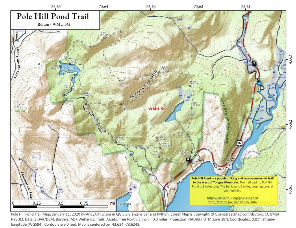
Pole Hill Pond is a popular hiking and cross-country ski trail to the west of Tongue Mountain. The trail back to Poll Hill Pond is 2 miles long. The full loop is 6 miles, crossing several unamed hills.
https://andyarthur.org/pole-hill-pond
https://dec.ny.gov/lands/53165.html
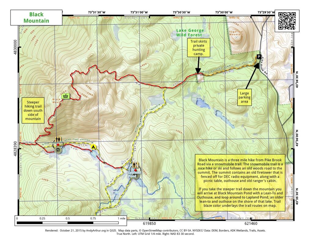
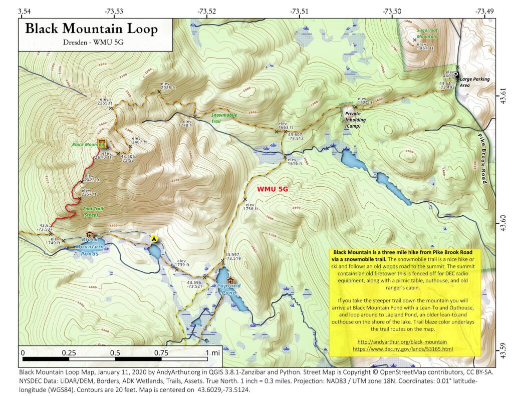
Black Mountain is a three mile hike from Pike Brook Road via a snowmobile trail. The snowmobile trail is a nice hike or ski and follows an old woods road to the summit. The summit contains an old firetower this is fenced off for DEC radio equipment, along with a picnic table, outhouse, and old ranger's cabin.
If you take the steeper trail down the mountain you will arrive at Black Mountain Pond with a Lean-To and Outhouse, and loop around to Lapland Pond, an older lean-to and outhouse on the shore of the lake. Trail blaze color underlays the trail routes on the map.
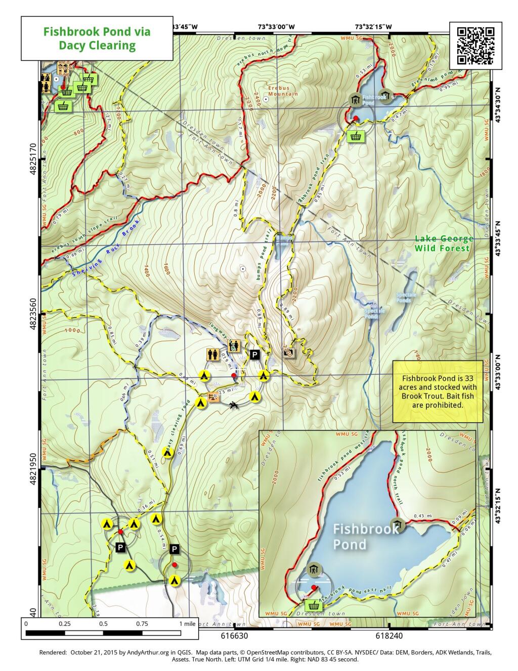
Here is a map of Fishbrook Pond, as accessed via trails around Dacy Clearing Road. Fishbrook Pond is 33 acres with a lean-to and picnic area. On the way there is Sleeping Beauty Mountain along with several campsites and other facilities.
The Wolf Pond extends 2.3 miles feet from the trailhead to the outlet of Wolf Pond on the southern shore. This new trail is gently rolling and easy to navigate trail. A new lean-to is located up a short spur trail on the
southwestern shore of the pond. Wolf Pond provides scenic views of the High Peaks and surrounding mountains, as well as excellent fishing opportunities. The 59-acre pond is home to native strain stocked brook trout.
DEC Map can be found here: https://www.dec.ny.gov/docs/lands_forests_pdf/wolfpondhikingmap.pdf
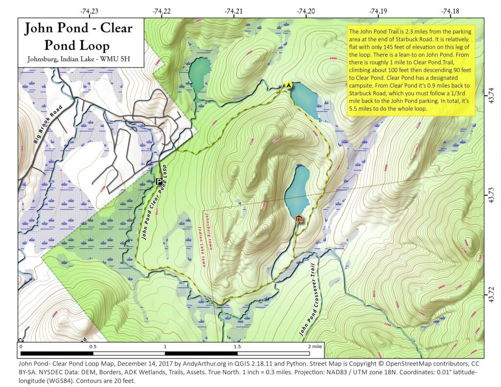
John Pond Trail extends 2.3 miles and ascends 145 feet from the John Pond trailhead to John Pond and a lean-to on the pond. The pond provides a scenic view of the small unnamed mountain that wraps around its shore. Clear Pond Trail extends 0.9 mile from the Clear Pond trailhead to the north end of Clear Pond. The trailhead can be accessed from the John Pond trailhead parking area by walking .35 mile on Starbuck Road. The trail climbs 330 feet for first 0.8 mile from the parking area before descending 90 feet to the pond. John Pond Crossover extends 3.4 miles from the John Pond Trail - 0.4 mile from John Pond - to the West Puffer Pond Trail - 1.5 miles from the King's Flow trailhead. Traveling from the John Pond Trail the trail ascends 365 feet and then descends 100 feet before reaching the West Puffer Pond Trail.
http://www.dec.ny.gov/lands/53172.html
Black Mountain is a three mile hike from Pike Brook Road via a snowmobile trail. The snowmobile trail is a nice hike or ski and follows an old woods road to the summit. The summit contains an old firetower this is fenced off for DEC radio equipment, along with a picnic table, outhouse, and old ranger's cabin.
If you take the steeper trail down the mountain you will arrive at Black Mountain Pond with a Lean-To and Outhouse, and loop around to Lapland Pond, an older lean-to and outhouse on the shore of the lake. Trail blaze color underlays the trail routes on the map.
https://andyarthur.org/black-mountain
https://www.dec.ny.gov/lands/53165.html
