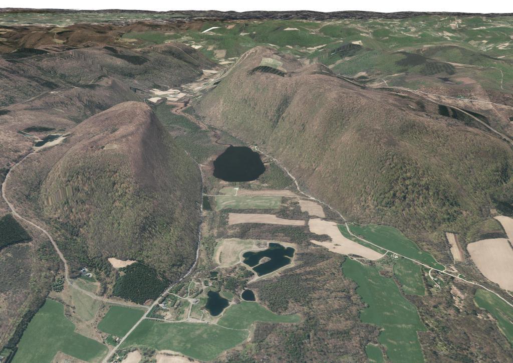
A digital rendering of the hills between Labrador Pond - Jones Hill and Labrador Mountain.
A map of the various dispersed campsites along Branch Pond Road in the Green Mountain National Forest.
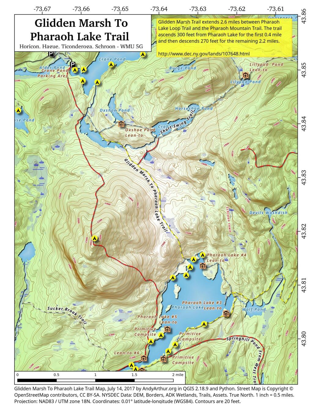
There are two ways to get between Crane Pond and Pharaoh Lake. One brings you over Pharoah Mountain, which has great views but it's a much bigger climb, especially on the southern side.
Pharaoh Mountain Trail (2,556 feet) extends 3.8 miles between the Pharaoh Lake Trail and Crane Pond Trail. The trails ascends 1,355 feet in 1.2 miles to the summit and then descends 1,405 feet in 2.6 miles to Crane Pond.
Glidden Marsh Trail extends 2.6 miles between Pharaoh Lake Loop Trail and the Pharaoh Mountain Trail. The trail ascends 300 feet from Pharaoh Lake for the first 0.4 mile and then descends 270 feet for the remaining 2.2 miles.
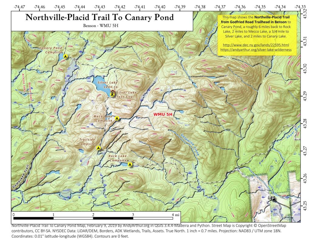
This map shows the Northville - Placid Trail from where it leaves the road in Benson up to the remote Canary Pond in the Shaker Mountain Wild Forest.
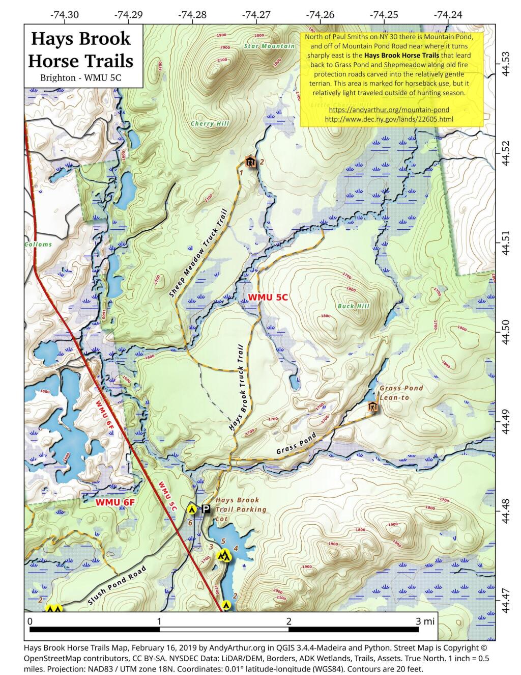
North of Mountain Pond in Paul Smiths is an old routing of NY 30 and several old fire protection roads that are used today for hiking, horseback riding, and accessing backcountry hunting locations. Known as the Hays Brook Horse Trails, there is a small parking area along Mountain Pond Road (Old Route 30), along with a falling apart wooden sign indicating the trail head.
43.490132211131176,-73.5804143288084
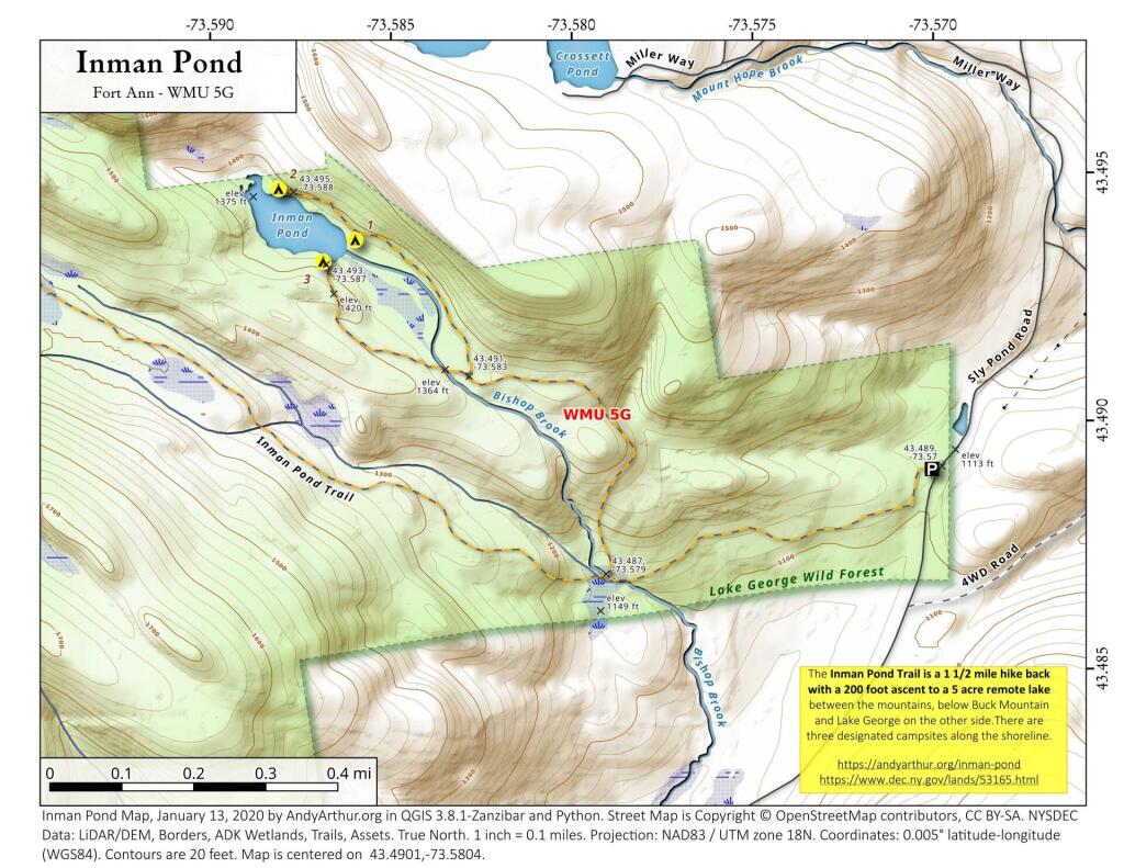
The Inman Pond Trail is a 1 1/2 mile hike back with a 200 foot ascent to a 5 acre remote lake between the mountains, below Buck Mountain and Lake George on the other side.There are three designated campsites along the shoreline.
https://andyarthur.org/inman-pond
https://www.dec.ny.gov/lands/53165.html
