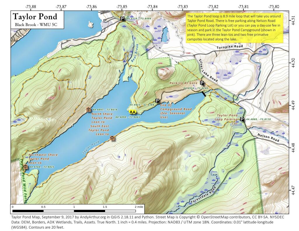
Taylor Pond
Even if you don't camp at the Taylor Pond Campground, there is a lot you can do at Taylor Pond from hiking to paddling to camping at the numerous free lean-tos and primitive campsites along the lake.
Even if you don't camp at the Taylor Pond Campground, there is a lot you can do at Taylor Pond from hiking to paddling to camping at the numerous free lean-tos and primitive campsites along the lake.
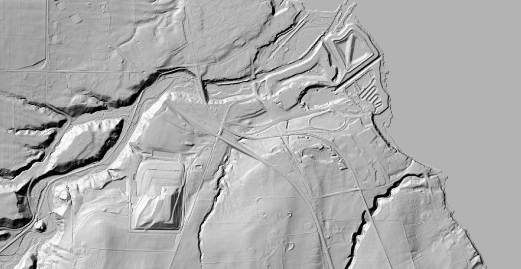
Back when AES Greenridge first went online, they dumped the coal ash in settling ponds along Seneca Lake. In later years, they, well the State of New York, decided it was a better to build a large coal ash landfill farther away from the lake and not dump it directly in the lake.
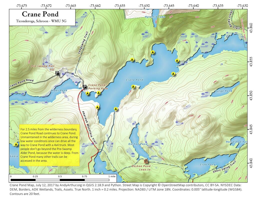
This updated map of Crane Pond in the Pharoah Lake Wilderness shows the location of the campsites along the lake.
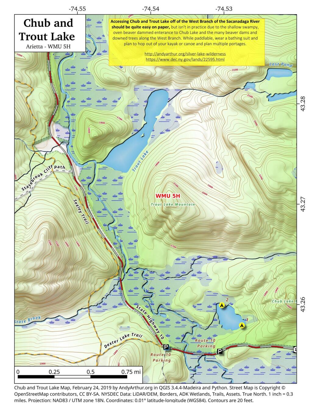
Chub Pond and Trout Lake in principle should be relatively easy to access, they as they are just a little ways from the put in used to access Good Luck Lake. Unfortunately, the West Branch of the Sacanadaga River has numerous strainers and down trees, and streams that flow out out of both Chub Pond and Trout Lake are narrow, shallow, and often impassable in times of low water. They also are very marshy along the shoreline, which can make it challenging to portage around the shallow water.
![Untitled [Expires July 12 2024]](https://andyarthur.org//data/photo_014913_large.jpg)
Large 431 acre pond off Floodwood Road near the St. Regis Canoe Area with several free primative campsites along it's edge.
68 acre partially developed pond along Floodwood Road and NY 30 in the St. Regis Canoe area portion of the Adirondacks.
A map of the various dispersed campsites along Branch Pond Road in the Green Mountain National Forest.