Search Results for: round lake wilderness adirondacks

Owls Head Mountain Firetower (Long Lake)

There are at least three different mountains in the Adirondacks known as Owls’ Head due to their small rounded peaks, with broad cols for shoulders. This one is the one near Long Lake, that has a 30 foot LS 45 Aermotor Firetower on top of it.

Sargent Ponds Wild Forest Kiosk. This is where you sign in, so they can have an idea on trail use, and make it easier to find you if your lost or injured.

Sargent Ponds Wild Forest Kiosk

1/2 Mile In. The trail crosses this downed tree.

1/2 Mile In

Boardwalks. Parts of the trail cross marshy areas on board walks, like these constructed on the first 3/4 mile of the trail.

Boardwalks

T Intersection. Make a left at one mile, to go up Owls Head. The other direction takes you to the Lake Eaton State Campground.

T Intersection

Grown Over Steel Trail Marker. It looks like in 1982, the state experimented with these imprinted steel trail markers along the trail, long since largely grown into the barks of the tree.

Grown Over Steel Trail Marker

Views as You Ascend. This is looking backwards, towards the Sargent Ponds Wilderness, Lake Eaton, and the timber lands between here and Tupper Lake.

Views as You Ascend

Observers Cabin Ruins. The cabin the fire warden lived in years ago, is not located on top of Owl’s Head, but below it on the shoulder. It’s a 1/4 mile hike to the top, and you accent about 200 more feet, up the pointly little head. The cabin was probably located here, so the warden could meet visitors, and escort them to the top.

Observers Cabin Ruins

Well Worn Trail. Part of the trail is well worn, and is on open rock face. The good news however is with the lush tree cover, you don’t have to worry about acrophobia up here.

Well Worn Trail

Reaching the Tower. You can’t see the fire tower until your almost on top of it, due to the heavy trees that surround the summit of the mountain, except for the bald portion where the tower is located, open to views to the south and east.

North Creek Falls

Survey Marker. It says it was placed in 1942 by USGS. It’s right below the fire tower proper.

Survey Marker

Fire Tower. The fire tower is a 30 foot LS 45 Aermotor tower, pretty typical for NY State. It’s one of the short little towers, like also seen on Rondaxe Mountain in Eagle Bay.

Fire Tower

Forked Lake. This is looking south from the summit towards Forked Lake Campground and possibly Racquette Lake. The mountain in the distance is Wakely Mountain, one of the other fire towers originally used to pin-point fires in the Adirondacks (it takes two towers to locate a fire through triangulation).

Forked Lake

Long Lake. This is another picture of Long Lake, a little bit farther north, with the shoulder/col of Owls Head visible in the foreground.

Long Lake

North. In the distance is Saranac Lake and Lake Placid, with Whiteface just beyond it. Not the clearest or nicest of days, but still visable. In the foreground is the col/shoulder of Owls Head.

North

Blue Mountain. Blue Mountain is another fire tower / mountain that is visible from Owls Head. Located about 10 miles away, in the foreground are Minnow Pond and Mud Pond.

Blue Mountain

Sargent Ponds Area & Timberland. This portion north of NY 28 Corridor and Fulton Chain of Lakes is relatively flat, wild, and many portions privately owned as timberland.

Sargent Ponds Area & Timberland

Float Plane. Owls Head is not the quietest mountain out there. Throughout the day, tourist float planes for hire, fly on and off Long Lake, just to north of mountain. They fly quiet low, as they are making the decent back to Long Lake.

Float Plane

Long Lake Village. While hazy today, you can see village of Long Lake quite well from the tower. It’s always crazy there, and I try to avoid towns whenever I’m in the Adirondacks.

Long Lake Village

Fire Tower Corner. I always like pictures of the angles and construction of the fire tower. While common after climbing so many, fire towers have a lot of character in their structural steel.

Fire Tower Corner

Tower Cabin Closed. It’s unfortunate but the tower’s cabin on this tower is closed, as it’s used for communications equipment.

Tower Cabin Closed

Sitting on Mountain. Just sitting back and looking south from the open rock face a top Owls Head.

Sitting on Mountain

Old Telephone Poll. Descending the trail off Owls Head, I saw several of the old telephone poles, heading up to the former Ranger’s cabin. Some have been cut down, and used to control run-off on the trail, but others still remain.

Dexter Lake

Here is a map of the hike.


View Owls Head in a larger map

Places I Camped in 2023

While this year was a rainy one, and it rained during many of my trips, I was able to get out for 53 nights in the wilderness — mostly fairly close to home but I also did a trip down to West Virginia in late October with several trips to the Adirondacks, Central New York and summer vacation in the Finger Lakes.

Places I Camped in 2023

Martin Luther Kings Day – January 14-16 (2 nights)

To start out my camping adventures in 2023, I drove out to Charles Baker State Forest and Brookfield Horse Camp. There wasn’t a lot of snow — just a dusting but it was a fun weekend, topped off by a beautiful sun-full glittery hike up Tassell Hill after a hoar frost. Explored Lost Pond and several of the trails in the middle of state forest.

Home for the weekend

40th Birthday – January 27-29 (2 nights)

For my fortieth birthday, I took off the Friday leading up to my 40th birthday to cross country ski and winter camp at Rensselaerville State Forest. It was a beautiful weekend with lots of blue skies, sufficient snow for skiing but not so much that was a ton of snowmobiles out on the trails.

Beautiful Day of Skiing

Presidents Day – February 17-19 (2 nights)

I decided for Presidents Day Weekend to do another trip out to Charles Baker State Forest and Brookfield Horse Camp. Slightly more snow then last time but again largely a snow-less winter, with some nice days for hikes through the various truck and horse trails. I hiked around much of state forest, especially the more southern part of the forest.

Evening on Truck Trail 13

Easter Weekend – April 7-9 (2 nights)

On Good Friday through Easter I camped at at Rensselaerville State Forest. The snow was gone and it was fairly mild though at times it was a bit cool. Spent a fair amount of time walking around and exploring the new OSI Parcel that has been recently added to state forest and is still largely open fields with sweeping views of the Catskill Mountains.

Hillcross Farm Pond

Duck Pond Trip – May 5-7 (2 nights)

The first Friday in May I took a half day from work and headed out to Schoharie County to camp at Duck Pond at Burnt-Rossman Hills State Forest. Originally the plan was to camp two nights at Duck Pond, hiking along the Long Path and exploring the state forest and then on Sunday hiking the Catskill Scenic Trail. That part of the trip changed when driving along Duck Pond Road the low tire pressure light came on I found a pallet nail in my truck tire. I was able to top off the truck tire and then change the tire when I got home and got the nail pulled and plugged. But it wasn’t the best way ever to end a trip early.

Spring

Overnight at Cole Hill – May 13-14 (1 night)

After visiting the folks on Mother’s Day Weekend, I decided to do a quick overnight hammock camp on Cole Hill State Forest in Berne. Nothing fancy or formal, it was as much a way to test out sleeping in my hammock with the bug screen. Kind of a chilly night, I took camp down fairly and headed home early in the morning.

Hammock Camping on Cole Hill

Memorial Day Weekend at Cole Hill – May 20-22 (2 nights)

This year I decided to eschew the Adirondacks and Greene Mountains for Memorial Day Weekend due to the black flies, my desire to look at bicycles, and work I had to do on the Saturday morning leading up to the holiday weekend. I decided to hammock camp again Cole Hill State Forest in Berne. This was a three-day two night trip, so it it gave me a chance to bring more gear up the mountain, set up a more formal camp. Cooked on the fire, hiked around the forest. It was a warm weekend, but I enjoy the solitude, along with having good cell service for listening to podcasts and watching videos.

Cooking down dinner

Juneteenth Weekend on Piseco-Powley – June 15-20 (4 nights)

To kick off summer, I did my usual Juneteenth weekend camping trip, tacking on some days on the Juneteenth Holiday Weekend. It was a bit of a cool and rainy weekend to kick off summer, one that would actually be followed by many cool and rainy weekends where I would stay home. Camped at House Pond for the first three nights, spending time down floating in the tube on East Branch while the final night I camped up at Powley Bridge site and kayaked along the East Branch. Really, like often is the case, the best weather was the day I took down camp.

Evening on East Canada Creek

Catskill Scenic Trail Trip – July 22-24 (3 nights)

After several months of researching and visiting various bike shops, I finally got a mountain bike. I decided it would be fun to do as much of the Catskill Scenic Trail as I could before my summer vacation got underway. Actually did quite a bit of riding and hiking that weekend — started out hiking Pratts Rock’s then riding from Grand George to Hobart. Sunday, I rode from Fultonham to Middleburgh on NY 30, doing a quick climb up Vromans Nose, then stopping at the farm market then going to Mine Kill State Park to swim. Monday I rode from Hobart down to Bloomville, getting caught in a major thunderstorm and downpour a few miles north of Bloomville with no shelter in sight. The trail became super boggy, then I went to Mine Kill State Park for one more swim, and then out to folks house for Sunday dinner a day later then usual.

After the rain showers

Finger Lakes National Forest – July 28 – August 6 (9 nights)

Every year for nearly a decade and a half I’ve been doing summer vacation out in the Finger Lakes — camping in the National Forest and exploring as much as possible during my days there. The past few years I’ve been driving there on a Friday, to get a better campsite before they’re taken by the weekend campers. This year was no exception. With Blackie, my mountain bike, I did nearly all of the bike trails in the near vicinity, from the Black Diamond Trail to the Cayuta Valley Trail to Dresden – Penn Yan Canal Trail. Kayaked on both Cayuga and Scenic Lakes, swam many days at Watkins Glen State Park and Taughannock State Park, explored the Cornell Campus and Botanical Gardens on my bike. Got some good ice cream at the Spotted Duck, explored the Geneva Waterfront along with the Cayuga-Seneca Canalway. Some rain but compared to the wet summer that was, this was a pretty good week.

Morning on Searsburg Road

Piseco-Powley – House Pond Campsite – August 18-20 (3 nights)

The next few weeks for rainy and by the time I got away for one more long weekend, it promised to be fairly nice weekend but turned out to be fairly cool and cloudy with some rain. Back at the House Pond Campsite, did some swimming in East Branch, but with the mercury in the 60s most of the weekend, I didn’t spend a lot of time in the water. Hardly what I had dreamed when the I planned the weekend. Rode Blackie up to Goldmine Stream Falls and relaxed down by the falls for a bit, also sat down by the swimming hole off of the Old Edick Road Snowmobile Trail, watching the rain fall, bemoaning the wet and cold weather. Still it was good to get away for a bit, and I did do a fair amount of reading in hammock, under the protection of the bug net, as the bugs were bad after such a wet summer.

Gentle Drop Into A Golden Pool

Labor Day at Perkins Clearing – September 1-4 (3 nights)

I took the Friday off before Labor Day to get a jump on the holiday season travel, and set up camp at the site I really enjoy up at Perkins Clearing overlooking the mountains. Did a fair amount of riding along the various dirt roads of Perkins Clearing, including over to Mason Lake and on Sunday rode most of the way to the Spruce Lake Trailhead, though didn’t make it there in time as I got a bit of a late start as I spent the balance of the day reading and swimming in the Jessup River Bridge swimming hole. Labor Day, I rode around the Spectulator Tree Farm, doing a large loop, through the tree farm, past the north end of Elm Lake, then down to Austin Falls and Old Route 8B. I had hoped to get ice cream, but by the time I got to the ice cream shop they were out of soft-ice cream, and there was a long line. Summer was dragging to a close.

Kunjamunk River from Long Level Bridge

September Trip to Rensselearville State Forest – September 15-17 (2 nights)

With time being fairly tight and the weather only so-so I decided to do a two night trip close to home out in Rennselearville to ride some of the gravel trails, explore the OSI Parcel further and just enjoy an early autumn weekend camping.

Evening

Columbus Day at Rensselearville State Forest – October 8-9 (1 night)

Columbus Day Weekend was cold and rainy for the first half of the weekend, but the Sunday heading into Columbus Day was nice, so I decided to head out to Rensselaerville for a quick overnight at the campsite on CCC Road. Leaves were late this year, so not a lot of color, but it still was nice to get away for a night and ride some of the trails around.

Leonard Hill

West Virginia Trip – October 21-29 (8 nights)

The banner trip of the year was my trip down to West Virigina. While it started and ended in rain, it was a very enjoyable trip with lots of new adventures this year. Camped the balance of the week — 6 nights in Canaan Heights — doing day trips from that area. Overnighted one night driving down at County Bridge Campground in Pennsylvania, and a on the way back camped overnight at Long Pond State Forest in New York. Adventures in West Virginia included hiking at Dolly Sods, mountain biking at night in the sods of Canaan Heights, riding up and hiking to Table Rock, exploring Blackwater Falls State Park on the mountain bike, MonPower Mountain Bike Park, Thomas Rail Grade and the Olson Firetower. Rode part of the Great Allegheny Trail through the Cumberland Passage, and the two sections of the Chesapeake and Ohio Canalway, including the Paw Paw Tunnel.

Sunrise

Stoney Pond – November 4-7 (3 nights)

A little over a week back from West Virginia, I headed out to Madison County to ride the Tassel Hill Mountain Bike Trails at Alfred Woodford, the Chenango Canal Trail in Hamilton and Erie Canalway from Chittenango to Green Lakes State Park and then to Canastota and Wampsville. The first night was cold at Stoney Pond but the subsequent nights were quite pleasant and mild.

Old Canal Warehouse in Chittenango  [Expires November 19 2023]

Prospect Mountain – East Branch Sacanadaga – Buttermilk Falls/Hudson Special Management Area – November 24-28 (3 nights)

Strangely enough, I had never been up Prospect Mountain. So I decided the day after Thanksgiving (Black Friday) to hike up Prospect Mountain, and then spend the next two nights camping on East Branch of the Sacandaga River. The Saturday and Sunday was fairly cold, so I ended up spending the bulk of day hanging around camp, doing a bit of hiking around Fox Lair. Sunday, evening around 8 PM it started to sleet, then snow, then rain, Monday morning, it turned into a white globby snow, and I ended up taking down camp fairly early after discovering I was out of propane and then spent much of the day exploring the Hudson River Special Management Area – Buttermilk Falls.

Icy River Road

Stoney Pond – Charles Baker – December 21-26 (5 nights)

On the days leading up to Christmas I decided to take a second trip to Madison County. I was originally planning to camp two nights at Stoney Pond then two nights at the Charles Baker Horse Camp but my family’s holiday plans were cancelled due to illness in my family, so I ended up staying an extra night at the horse camp, through the day after Christmas. On Friday, I rode the Erie Canalway from Canastota to East Verona, nearly to Rome. On Christmas Day I rode around many of truck trails at Charles Baker with my mountain bike, leaving my face splattered with mud. Many of the days were fairly cold and cloudy, but that’s too be expected in late December. Still it was a special way to spend Christmas.

Camp on this cold but still morning ?

USGS Topographic Maps – Dutchess to Livingston Counties

Counties: Albany to Delaware / Dutchess to Livingston / Madison to Otsego / Putnam to Suffolk / Sullivan to Yates

Browse Topographic Maps: Full State / Historical USGS Topographic Maps

Dutchess County

PDF (50-60 MB Download) Historical USGS Topo Maps State Lands (Links to DEC Website) Towns (Percent of Town’s Area)
Current Amenia GeoPDF Map
1958 Map No. 136605, 1958 Map No. 136606, 1958 Map No. 136607, 1958 Map No. 136608, 1958 Map No. 137065 Wassaic Multiple Use Area, Wassaic Creek Fishing Access Amenia (91%), Dover (2%), Stanford (3%), Washington (18%)
Current Ancram GeoPDF Map
1948 Map No. 136625, 1948 Map No. 710141, 1960 Map No. 136626, 1960 Map No. 136627, 1960 Map No. 137076, 1960 Map No. 710139 Roeliff Jansenkill Multiple Use Area, New Forge State Forest, Doodletown Wildlife Management Area Ancram (16%), Gallatin (80%), Milan (3%), Pine Plains (3%), Taghkanic (36%)
Current Clermont GeoPDF Map
1963 Map No. 137177, 1963 Map No. 137654, 1963 Map No. 137655, 1963 Map No. 137656 NA Clermont (63%), Gallatin (19%), Germantown (21%), Livingston (31%), Milan (21%), Red Hook (30%), Taghkanic (2%)
Current Copake GeoPDF Map
1953 Map No. 137709, 1953 Map No. 137710, 1953 Map No. 137711, 1953 Map No. 137712 Doodletown Wildlife Management Area Ancram (71%), Copake (46%), North East (14%), Taghkanic (3%)
Current Dover Plains GeoPDF Map
1944 Map No. 137886, 1958 Map No. 137890, 1958 Map No. 137891, 1958 Map No. 137892, 1958 Map No. 137893, 1998 Map No. 137336 Swamp River Fishing Access, Swamp River Waterway Access, West Mountain State Forest Amenia (0%), Dover (85%), Washington (1%)
Current Hopewell Junction GeoPDF Map
1957 Map No. 129768, 1957 Map No. 129769, 1957 Map No. 129770, 1981 Map No. 129767 NA Beekman (1%), East Fishkill (74%), Fishkill (14%), Kent (2%), Wappinger (27%)
Current Hyde Park GeoPDF Map
1963 Map No. 130048, 1963 Map No. 130049, 1980 Map No. 130050, 1980 Map No. 130051 Black Creek Waterway Access, Chodikee Lake Wetlands, Crum Elbow Creek Waterway Access, Black Creek State Forest, Crum Elbow Creek Fishing Access Clinton (2%), Esopus (44%), Hyde Park (79%), Lloyd (14%), Rhinebeck (0%)
Current Kingston East GeoPDF Map
1963 Map No. 130035, 1963 Map No. 130036, 1963 Map No. 130037, 1963 Map No. 137296, 1963 Map No. 137298 NA Clinton (0%), Esopus (16%), Hyde Park (1%), Kingston city (52%), Red Hook (15%), Rhinebeck (71%), Ulster (35%)
Current Millbrook GeoPDF Map
1947 Map No. 130580, 1960 Map No. 130583, 1960 Map No. 130584, 1960 Map No. 137450, 1960 Map No. 137451 Wappinger Creek Fishing Access Pleasant Valley (0%), Stanford (28%), Washington (70%)
Current Millerton GeoPDF Map
1955 Map No. 130590, 1955 Map No. 130591, 1955 Map No. 137452, 1955 Map No. 137453 NA Amenia (9%), Ancram (12%), North East (86%), Pine Plains (31%), Stanford (3%)
Current Pawling GeoPDF Map
1945 Map No. 135979, 1958 Map No. 135980, 1958 Map No. 135981, 1958 Map No. 135982, 1958 Map No. 136773, 1998 Map No. 136774 West Mountain State Forest, Great Swamp WMA, Cranberry Mountain WMA Dover (7%), Patterson (26%), Pawling (70%)
Current Pine Plains GeoPDF Map
1948 Map No. 129004, 1960 Map No. 129005, 1960 Map No. 129006, 1960 Map No. 136805, 1960 Map No. 136806 Shekomeko Creek Parking Fishing Access, Lafayetteville Multiple Use Area, Stissing Mountain Multiple Use Area Ancram (1%), Gallatin (1%), Milan (20%), North East (0%), Pine Plains (66%), Stanford (54%)
Current Pleasant Valley GeoPDF Map
1957 Map No. 129049, 1957 Map No. 129050, 1957 Map No. 129051 Taconic Hereford Multiple Use Area Beekman (2%), East Fishkill (1%), Hyde Park (3%), LaGrange (94%), Pleasant Valley (26%), Poughkeepsie (13%), Wappinger (11%)
Current Poughkeepsie GeoPDF Map
1957 Map No. 129158, 1957 Map No. 129159, 1957 Map No. 136830, 1995 Map No. 136831 NA Hyde Park (8%), LaGrange (0%), Lloyd (43%), Marlborough (39%), Poughkeepsie city (100%), Poughkeepsie (70%), Wappinger (2%)
Current Poughquag GeoPDF Map
1948 Map No. 129160, 1948 Map No. 129161, 1960 Map No. 129162, 1960 Map No. 129163, 1960 Map No. 129164, 1960 Map No. 136833 White Pond Multiple Use Area, Depot Hill Multiple Use Area, West Mountain State Forest, Big Buck Mountain Multiple Use Area, Sylvan Lake Waterway Access Beekman (72%), Dover (0%), East Fishkill (24%), Kent (10%), Patterson (5%), Pawling (30%)
Current Rock City GeoPDF Map
1963 Map No. 136098, 1963 Map No. 136099, 1963 Map No. 136866 NA Clinton (35%), Hyde Park (0%), Milan (55%), Red Hook (15%), Rhinebeck (29%), Stanford (8%)
Current Salt Point GeoPDF Map
1963 Map No. 129336, 1963 Map No. 129337, 1963 Map No. 136881 Taconic Hereford Multiple Use Area Clinton (63%), Hyde Park (10%), Pleasant Valley (73%), Stanford (4%), Washington (2%)
Current Saugerties GeoPDF Map
1963 Map No. 129404, 1963 Map No. 136889, 1963 Map No. 136890, 1963 Map No. 136891, 1963 Map No. 136892, 1997 Map No. 136893 Turkey Point State Forest, Tivoli Bays WMA Clermont (33%), Germantown (15%), Red Hook (39%), Saugerties (41%), Ulster (12%)
Current Verbank GeoPDF Map
1946 Map No. 139478, 1960 Map No. 136984, 1960 Map No. 139482, 1960 Map No. 139483 West Mountain State Forest, Taconic Hereford Multiple Use Area Beekman (25%), Dover (5%), LaGrange (6%), Pleasant Valley (1%), Union Vale (100%), Washington (9%)
Current Wappingers Falls GeoPDF Map
1956 Map No. 140039, 1956 Map No. 140040, 1956 Map No. 140041 Stonykill Environmental Education Center, Baxtertown Woods WMA Beacon city (64%), Fishkill (56%), Marlborough (24%), Newburgh city (3%), Newburgh (12%), Poughkeepsie (17%), Wappinger (60%)
Current West Point GeoPDF Map
1941 Map No. 140199, 1947 Map No. 140198, 1957 Map No. 137014, 1957 Map No. 140200, 1957 Map No. 140201, 1957 Map No. 140202 NA Beacon city (36%), Cornwall (8%), Fishkill (29%), Highlands (21%), New Windsor (0%), Newburgh city (4%), Philipstown (63%), Putnam Valley (7%)

Erie County

PDF (50-60 MB Download) Historical USGS Topo Maps State Lands (Links to DEC Website) Towns (Percent of Town’s Area)
Current Akron GeoPDF Map
1949 Map No. 136539, 1951 Map No. 136540, 1951 Map No. 710097 Onondaga Escarpment Unique Area, John White WMA, Tonawanda WMA Alabama (46%), Newstead (17%), Pembroke (24%), Royalton (6%), Tonawanda Reservation (100%), Tonawanda Reservation (100%), Tonawanda Reservation (100%)
Current Angola GeoPDF Map
1960 Map No. 136649, 1960 Map No. 136650 NA Evans (39%)
Current Arcade GeoPDF Map
1966 Map No. 136682, 1966 Map No. 136683 NA Arcade (57%), Freedom (12%), Holland (7%), Java (12%), Sardinia (19%), Yorkshire (14%)
Current Ashford Hollow GeoPDF Map
1964 Map No. 136700, 1964 Map No. 136701, 1964 Map No. 136702, 1964 Map No. 710169 NA Ashford (64%), Concord (9%), East Otto (36%), Ellicottville (2%)
Current Buffalo NE GeoPDF Map
1948 Map No. 123033, 1950 Map No. 123034, 1965 Map No. 123035 NA Amherst (23%), Buffalo city (52%), Cheektowaga (43%), Tonawanda (37%)
Current Buffalo NW GeoPDF Map
1950 Map No. 123036, 1950 Map No. 123038, 1965 Map No. 123039, 1965 Map No. 123040 Motor Island WMA Buffalo city (22%), Grand Island (25%), Tonawanda city (3%), Tonawanda (47%)
Current Buffalo SE GeoPDF Map
1948 Map No. 123041, 1950 Map No. 123042, 1965 Map No. 123043 NA Buffalo city (26%), Cheektowaga (2%), Hamburg (34%), Lackawanna city (100%), Orchard Park (22%), West Seneca (53%)
Current Clarence GeoPDF Map
1950 Map No. 137629, 1965 Map No. 137630 Tillman Road WMA Alden (63%), Clarence (14%), Lancaster (35%), Newstead (24%)
Current Clarence Center GeoPDF Map
1950 Map No. 137625, 1950 Map No. 137626, 1965 Map No. 137627 Great Baehre Swamp WMA Amherst (28%), Clarence (41%), Lockport (21%), Pendleton (29%)
Current Colden GeoPDF Map
1955 Map No. 137679, 1955 Map No. 137680, 1955 Map No. 137681, 1955 Map No. 137806 NA Aurora (38%), Boston (37%), Colden (49%), Orchard Park (26%)
Current Collins Center GeoPDF Map
1963 Map No. 137682, 1963 Map No. 137683, 1963 Map No. 137684 Cattaraugus Creek Waterway Access, Zoar Valley Multiple Use Area, Zoar Valley Unique Area, East Otto State Forest Collins (35%), Concord (5%), East Otto (37%), Otto (61%)
Current Corfu GeoPDF Map
1950 Map No. 137814, 1950 Map No. 137815 NA Alden (29%), Darien (53%), Newstead (11%), Pembroke (33%)
Current Cowlesville GeoPDF Map
1949 Map No. 137726, 1951 Map No. 137727 NA Alden (3%), Bennington (62%), Darien (5%), Marilla (14%), Sheldon (20%), Wales (11%)
Current East Aurora GeoPDF Map
1950 Map No. 137994, 1965 Map No. 137996, 1965 Map No. 137997 NA Alden (5%), Aurora (15%), Elma (40%), Lancaster (5%), Marilla (86%), Wales (24%)
Current Eden GeoPDF Map
1949 Map No. 138035, 1965 Map No. 138036 Eighteen Mile Creek Access Eden (43%), Evans (40%), Hamburg (31%)
Current Farnham GeoPDF Map
1960 Map No. 138142, 1960 Map No. 138143 NA Brant (61%), Cattaraugus Reservation (54%), Cattaraugus Reservation (49%), Cattaraugus Reservation (100%), Evans (13%), Hanover (20%), Perrysburg (17%)
Current Gowanda GeoPDF Map
1963 Map No. 129589, 1963 Map No. 129590 Zoar Valley Multiple Use Area, Zoar Valley Unique Area Cattaraugus Reservation (39%), Cattaraugus Reservation (8%), Collins (25%), Dayton (33%), Otto (11%), Perrysburg (30%), Persia (69%)
Current Hamburg GeoPDF Map
1948 Map No. 129666, 1965 Map No. 129667, 1965 Map No. 129668, 1965 Map No. 129669 Hampton Brook Woods WMA Boston (45%), Eden (38%), Hamburg (36%), Orchard Park (23%)
Current Holland GeoPDF Map
1955 Map No. 129880, 1955 Map No. 129881, 1979 Map No. 129879 NA Aurora (25%), Colden (30%), Holland (53%), Wales (44%)
Current Lancaster GeoPDF Map
1950 Map No. 130212, 1965 Map No. 130213 Reinstein Woods Nature Preserve And Environmental Education Center Amherst (17%), Cheektowaga (47%), Clarence (21%), Lancaster (54%)
Current Langford GeoPDF Map
1960 Map No. 130218, 1960 Map No. 130219 Clear Lake WMA Boston (10%), Collins (23%), Concord (18%), Eden (9%), North Collins (57%)
Current Niagara Falls GeoPDF Map
1949 Map No. 128711, 1965 Map No. 128712 NA Grand Island (9%), Niagara Falls city (67%), Niagara (10%)
Current North Collins GeoPDF Map
1960 Map No. 128742, 1960 Map No. 128743 NA Brant (39%), Cattaraugus Reservation (7%), Cattaraugus Reservation (41%), Collins (17%), Eden (10%), Evans (8%), North Collins (43%), Perrysburg (4%)
Current Orchard Park GeoPDF Map
1950 Map No. 128935, 1965 Map No. 128936, 1965 Map No. 128937, 1965 Map No. 137486, 1965 Map No. 137487 Cazenovia Creek Fwma Aurora (22%), Cheektowaga (7%), Elma (60%), Lancaster (7%), Orchard Park (29%), West Seneca (47%)
Current Sardinia GeoPDF Map
1957 Map No. 129402, 1957 Map No. 129403, 1957 Map No. 136888 Cattaraugus Creek Fishing Access Parking Ashford (2%), Colden (8%), Holland (15%), Sardinia (80%), Yorkshire (14%)
Current Silver Creek GeoPDF Map
1943 Map No. 136171, 1960 Map No. 136168, 1960 Map No. 136172 NA Brant (0%), Cattaraugus Reservation (3%), Hanover (22%), Sheridan (27%)
Current Springville GeoPDF Map
1954 Map No. 139842, 1954 Map No. 139843 NA Ashford (0%), Boston (8%), Colden (12%), Concord (68%), Sardinia (1%)
Current Strykersville GeoPDF Map
1957 Map No. 139925, 1957 Map No. 139926 NA Holland (25%), Java (45%), Sheldon (37%), Wales (20%)
Current Tonawanda East GeoPDF Map
1950 Map No. 139339, 1950 Map No. 139340, 1965 Map No. 139341, 1980 Map No. 139342 NA Amherst (31%), North Tonawanda city (64%), Pendleton (57%), Tonawanda city (41%), Tonawanda (13%), Wheatfield (39%)
Current Tonawanda West GeoPDF Map
1948 Map No. 139343, 1948 Map No. 139344, 1950 Map No. 139345, 1965 Map No. 139347 Spicer Creek WMA Grand Island (66%), Niagara Falls city (30%), Niagara (65%), North Tonawanda city (36%), Tonawanda city (57%), Tonawanda (3%), Wheatfield (51%)
Current Wolcottsville GeoPDF Map
1950 Map No. 140363, 1965 Map No. 140364 Tonawanda WMA, Tonawanda Creek Fishing Access Clarence (25%), Lockport (2%), Newstead (47%), Royalton (23%)

Essex County

PDF (50-60 MB Download) Historical USGS Topo Maps State Lands (Links to DEC Website) Towns (Percent of Town’s Area)
Current Ampersand Lake GeoPDF Map
NA Saranac Lakes Wild Forest, High Peaks Wilderness Harrietstown (24%), Newcomb (1%)
Current Au Sable Forks GeoPDF Map
NA Taylor Pond Wild Forest, Wilmington Wild Forest Au Sable (2%), Black Brook (17%), Chesterfield (1%), Jay (43%), Wilmington (0%)
Current Bad Luck Mountain GeoPDF Map
NA Unclassified, Hudson Gorge Wilderness, Blue Mountain Wild Forest, Jessup River Wild Forest, Vanderwhacker Mountain Wild Forest, Siamese Ponds Wilderness, Essex Chain Lakes Primitive Area, Pine Lake Primitive Area Indian Lake (12%), Minerva (10%), Newcomb (3%)
Current Bloomingdale GeoPDF Map
NA Mckenzie Mountain Wilderness, Taylor Pond Wild Forest, Debar Mountain Wild Forest, Saranac Lakes Wild Forest, Buck Pond Campground Franklin (21%), St. Armand (30%)
Current Blue Ridge GeoPDF Map
NA Hammond Pond Wild Forest, Vanderwhacker Mountain Wild Forest, Hoffman Notch Primitive Area, Hoffman Notch Wilderness, High Peaks Wilderness North Hudson (19%), Schroon (13%)
Current Charlotte GeoPDF Map
NA Split Rock Wild Forest Essex (35%), Westport (1%), Willsboro (11%)
Current Cheney Pond GeoPDF Map
NA Vanderwhacker Mountain Wild Forest, Hoffman Notch Wilderness, High Peaks Wilderness Minerva (11%), Newcomb (2%), North Hudson (15%), Schroon (3%)
Current Clintonville GeoPDF Map
NA Taylor Pond Wild Forest, Poke-O-Moonshine Day Use Area Au Sable (26%), Chesterfield (35%), Jay (4%), Lewis (3%)
Current Colchester Point GeoPDF Map
NA Schuyler Island Primitive Area Au Sable (4%), Chesterfield (8%), Peru (0%)
Current Crown Point GeoPDF Map
1950 Map No. 137752, 1950 Map No. 137753, 1950 Map No. 137754, 1950 Map No. 137755 Putnam Creek Access, Putnam Creek Fishing Access, Sheepshead Island, Signal Buoy Island, Hammond Pond Wild Forest, Putts Creek WMA Crown Point (32%), Ticonderoga (18%)
Current Dix Mountain GeoPDF Map
NA High Peaks Wilderness Keene (12%), North Hudson (19%)
Current Dun Brook Mountain GeoPDF Map
NA Blue Mountain Wild Forest, High Peaks Wilderness, Essex Chain Lakes Primitive Area Indian Lake (5%), Long Lake (5%), Minerva (11%), Newcomb (1%)
Current Dutton Mountain GeoPDF Map
NA Hudson Gorge Primitive Area, Hudson Gorge Wilderness, Ok Slip Pond Primitive Area, Vanderwhacker Mountain Wild Forest, Vanderwhacker Mountain Wild Forest, Siamese Ponds Wilderness Chester (0%), Indian Lake (5%), Minerva (25%)
Current Eagle Lake GeoPDF Map
1973 Map No. 137988 Pharaoh Lake Wilderness, Hammond Pond Wild Forest Crown Point (54%), Moriah (2%), North Hudson (0%), Ticonderoga (9%)
Current Elizabethtown GeoPDF Map
NA Giant Mountain Wilderness, Taylor Pond Wild Forest, Hammond Pond Wild Forest, Pauline Murdock WMA, Lincoln Pond Campground Elizabethtown (45%), Lewis (6%), Westport (16%)
Current Franklin Falls GeoPDF Map
NA Mckenzie Mountain Wilderness, Taylor Pond Wild Forest, Wilmington Wild Forest, Whiteface Mountain Ski Center Black Brook (7%), Franklin (12%), St. Armand (25%), Wilmington (12%)
Current Gabriels GeoPDF Map
NA Debar Mountain Wild Forest, Saranac Lakes Wild Forest Brighton (37%), Franklin (4%), Harrietstown (6%), St. Armand (3%)
Current Gore Mountain GeoPDF Map
NA Vanderwhacker Mountain Wild Forest, Chatiemac Lake Primitive Area, Siamese Ponds Wilderness, North Creek Parking Fishing Access, Gore Mountain Ski Center Chester (3%), Indian Lake (1%), Johnsburg (24%), Minerva (0%)
Current Graphite GeoPDF Map
1973 Map No. 129606, 1973 Map No. 129607 Bald Ledge Primitive Area, Gooseneck Pond Primitive Area, Pharaoh Lake Wilderness, Hammond Pond Wild Forest, Lake George Wild Forest, Putnam Pond Campground Hague (23%), Schroon (1%), Ticonderoga (39%)
Current Jay Mountain GeoPDF Map
NA Hurricane Mountain Primitive Area, Hurricane Mountain Wilderness, Taylor Pond Wild Forest, Wilmington Wild Forest, Jay Mountain Wilderness Chesterfield (3%), Elizabethtown (1%), Jay (39%), Keene (5%), Lewis (19%)
Current Juniper Island GeoPDF Map
NA Schuyler Island Primitive Area Chesterfield (8%), Willsboro (30%)
Current Keene GeoPDF Map
NA Hurricane Mountain Primitive Area, Hurricane Mountain Wilderness, Bartlett Primitive Area, Sentinel Range Wilderness, Mckenzie Mountain Wilderness, Hammond Pond Wild Forest, Wilmington Wild Forest, High Peaks Wilderness, Wilmington Notch Campground, Whiteface Mountain Ski Center Jay (12%), Keene (15%), Wilmington (33%)
Current Keene Valley GeoPDF Map
NA Giant Mountain Wilderness, Sentinel Range Wilderness, Hammond Pond Wild Forest, High Peaks Wilderness, Johns Brook Primitive Area Keene (34%), North Elba (0%)
Current Keeseville GeoPDF Map
1966 Map No. 130007, 1966 Map No. 130008 Unclassified, Valcour Island Primitive Area, Garden Island, Schuyler Island Primitive Area, Taylor Pond Wild Forest, Peru Dock Boat Launch, Ausable Marsh WMA, Wickham Marsh WMA, Ausable Point Campground Au Sable (24%), Chesterfield (12%), Peru (31%), Plattsburgh (0%)
Current Kempshall Mountain GeoPDF Map
NA Sargent Ponds Wild Forest, High Peaks Wilderness Harrietstown (1%), Long Lake (9%), Newcomb (4%)
Current Lake Placid GeoPDF Map
NA Sentinel Range Wilderness, Mckenzie Mountain Wilderness, Saranac Lakes Wild Forest, Wilmington Wild Forest, John Browns Farm Historic Site, Mirror Lake Boat Launch, Whiteface Mountain Ski Center Keene (1%), North Elba (22%), St. Armand (11%), Wilmington (16%)
Current Lewis GeoPDF Map
NA Taylor Pond Wild Forest, Jay Mountain Wilderness Chesterfield (2%), Lewis (60%)
Current Mckenzie Mountain GeoPDF Map
NA Unclassified, Mckenzie Mountain Wilderness, Saranac Lakes Wild Forest, High Peaks Wilderness, Meadowbrook Campground Harrietstown (1%), North Elba (22%), St. Armand (30%)
Current Minerva GeoPDF Map
NA Vanderwhacker Mountain Wild Forest, Hoffman Notch Wilderness Chester (3%), Minerva (25%), Schroon (7%)
Current Mount Adams GeoPDF Map
NA Vanderwhacker Mountain Wild Forest, High Peaks Wilderness, Macintyre Primitive Area, Tahawas Primitive Area Newcomb (23%)
Current Mount Marcy GeoPDF Map
NA Vanderwhacker Mountain Wild Forest, Boreas Ponds Primitive Area, High Peaks Wilderness Keene (11%), Newcomb (7%), North Hudson (11%)
Current Newcomb GeoPDF Map
NA Hudson Gorge Wilderness, Blue Mountain Wild Forest, Vanderwhacker Mountain Wild Forest, Camp Santanoni Historic Area, High Peaks Wilderness, Essex Chain Lakes Primitive Area, Lake Harris Campground Minerva (1%), Newcomb (22%)
Current North Elba GeoPDF Map
NA Mount Van Hoevenberg Winter Recreation Area, Sentinel Range Wilderness, Saranac Lakes Wild Forest, High Peaks Wilderness Keene (5%), Newcomb (1%), North Elba (29%)
Current Paradox Lake GeoPDF Map
1973 Map No. 135965, 1973 Map No. 136771 Pharaoh Lake Wilderness, Hammond Pond Wild Forest, Vanderwhacker Mountain Wild Forest, Hoffman Notch Wilderness, High Peaks Wilderness, Paradox Lake Campground Crown Point (7%), North Hudson (14%), Schroon (16%), Ticonderoga (0%)
Current Pharaoh Mountain GeoPDF Map
1973 Map No. 128968 Pharaoh Lake Wilderness, Hammond Pond Wild Forest, Lake George Wild Forest Hague (2%), Horicon (16%), Schroon (29%), Ticonderoga (1%)
Current Port Douglass GeoPDF Map
NA Unclassified, Schuyler Island Primitive Area, Taylor Pond Wild Forest, Port Douglass Boat Launch, Willsboro Bay Boat Launch Au Sable (1%), Chesterfield (32%), Lewis (0%), Willsboro (26%)
Current Port Henry GeoPDF Map
NA Crown Point Historic Area, Port Henry Boat Launch, Crown Point Campground Crown Point (7%), Moriah (34%), Westport (7%)
Current Rock Lake GeoPDF Map
NA Unclassified, Blue Ridge Wilderness, Blue Mountain Wild Forest, Jessup River Wild Forest, Essex Chain Lakes Primitive Area, Pine Lake Primitive Area Indian Lake (20%), Minerva (1%)
Current Rocky Peak Ridge GeoPDF Map
NA Giant Mountain Wilderness, Hurricane Mountain Fire Tower Historic Area, Hurricane Mountain Primitive Area, Hurricane Mountain Wilderness, Hammond Pond Wild Forest, High Peaks Wilderness Elizabethtown (38%), Keene (13%), Lewis (3%)
Current Santanoni Peak GeoPDF Map
NA Vanderwhacker Mountain Wild Forest, Camp Santanoni Historic Area, High Peaks Wilderness Harrietstown (0%), Newcomb (23%)
Current Saranac Lake GeoPDF Map
NA Saranac Lakes Wild Forest, Saranac Lakes Wild Forest, High Peaks Wilderness, Lake Flower Boat Launch, Lower Saranac Lake Boat Launch, Saranac Lake Islands Campground Harrietstown (25%), North Elba (0%), St. Armand (2%)
Current Schroon Lake GeoPDF Map
NA Pharaoh Lake Wilderness, Hammond Pond Wild Forest, Vanderwhacker Mountain Wild Forest, Scaroon Manor Campground, Lake George Wild Forest, Hoffman Notch Wilderness, Eagle Point Campground Chester (6%), Horicon (4%), Minerva (1%), Schroon (31%)
Current Street Mountain GeoPDF Map
NA Saranac Lakes Wild Forest, High Peaks Wilderness Harrietstown (4%), Newcomb (2%), North Elba (26%)
Current Ticonderoga GeoPDF Map
1950 Map No. 136965, 1950 Map No. 140023, 1950 Map No. 140024, 1950 Map No. 140025, 1950 Map No. 140026, 1950 Map No. 140027, 1950 Map No. 140028, 1950 Map No. 140029, 1950 Map No. 140030 Pharaoh Lake Wilderness, Lake George Wild Forest, Mossy Point State Boat Launch, Lake George Islands Campground, Rogers Rock Campground Hague (9%), Putnam (52%), Ticonderoga (33%)
Current Underwood GeoPDF Map
NA Boquet River Primtive Area, Giant Mountain Wilderness, Hammond Pond Wild Forest, High Peaks Wilderness, Sharp Bridge Campground Elizabethtown (8%), Keene (4%), Moriah (1%), North Hudson (21%)
Current Vanderwhacker Mountain GeoPDF Map
NA Vanderwhacker Mountain Wild Forest, High Peaks Wilderness, Lake Harris Campground Minerva (14%), Newcomb (13%), North Hudson (0%)
Current Vergennes West GeoPDF Map
NA Split Rock Wild Forest Westport (6%)
Current Westport GeoPDF Map
NA Cole Island, Hammond Pond Wild Forest, Split Rock Wild Forest, Westport Boat Launch Essex (3%), Lewis (1%), Westport (68%)
Current Willsboro GeoPDF Map
NA Wilsboro Dam Fish Dam, Boquet River Fishing Access, Taylor Pond Wild Forest, Split Rock Wild Forest Essex (62%), Lewis (7%), Westport (0%), Willsboro (33%)
Current Wilmington GeoPDF Map
NA Taylor Pond Wild Forest, Wilmington Wild Forest, Taylor Pond Campground, Whiteface Mountain Ski Center Black Brook (20%), Jay (2%), Wilmington (39%)
Current Witherbee GeoPDF Map
NA Hammond Pond Wild Forest Crown Point (0%), Elizabethtown (9%), Moriah (63%), North Hudson (0%), Westport (2%)

Franklin County

PDF (50-60 MB Download) Historical USGS Topo Maps State Lands (Links to DEC Website) Towns (Percent of Town’s Area)
Current Alder Brook GeoPDF Map
1968 Map No. 136574 Taylor Pond Wild Forest, Chazy Highlands Wild Forest Black Brook (12%), Franklin (16%), Saranac (8%)
Current Ampersand Lake GeoPDF Map
NA Saranac Lakes Wild Forest, High Peaks Wilderness Harrietstown (24%), Newcomb (1%)
Current Augerhole Falls GeoPDF Map
1970 Map No. 136744 Raquette-Jordan Boreal Primitive Area Hopkinton (13%), Tupper Lake (2%), Waverly (20%)
Current Bangor GeoPDF Map
1964 Map No. 123403, 1964 Map No. 123404 Deer River State Forest, Little Salmon River Access Bangor (82%), Brandon (33%), Dickinson (4%), Moira (5%)
Current Bay Pond GeoPDF Map
NA Debar Mountain Wild Forest, Madawaska Flow – Quebec Brook Primitive Area, Saint Regis Canoe Area Santa Clara (14%), Tupper Lake (3%), Waverly (17%)
Current Bloomingdale GeoPDF Map
NA Mckenzie Mountain Wilderness, Taylor Pond Wild Forest, Debar Mountain Wild Forest, Saranac Lakes Wild Forest, Buck Pond Campground Franklin (21%), St. Armand (30%)
Current Bombay GeoPDF Map
1964 Map No. 123356, 1964 Map No. 137121 Bombay State Forest Bombay (83%), Fort Covington (33%), Moira (5%), St. Regis Mohawk Reservation (39%)
Current Brainardsville GeoPDF Map
1964 Map No. 123115, 1964 Map No. 123116 Chazy Highlands Wild Forest Bellmont (29%), Burke (0%), Chateaugay (6%), Ellenburg (1%)
Current Brushton GeoPDF Map
1964 Map No. 123031, 1964 Map No. 123032 Deer River State Forest, Bombay State Forest Brasher (0%), Dickinson (26%), Lawrence (3%), Moira (89%)
Current Burke GeoPDF Map
1964 Map No. 123057, 1993 Map No. 137137 NA Burke (89%), Chateaugay (6%), Constable (15%), Malone (2%)
Current Chasm Falls GeoPDF Map
1964 Map No. 122921, 1964 Map No. 137168 Chazy Highlands Wild Forest Bellmont (19%), Burke (11%), Malone (16%)
Current Chateaugay GeoPDF Map
1964 Map No. 122927, 1964 Map No. 122928, 1964 Map No. 137169, 1993 Map No. 137170 Valley View State Forest, Chateaugay Fish Hatchery Burke (0%), Chateaugay (88%), Clinton (10%), Ellenburg (0%)
Current Constable GeoPDF Map
1964 Map No. 137702, 1964 Map No. 137703, 1993 Map No. 137187 Salmon River Waterway Access, Trout River State Forest Bangor (0%), Constable (85%), Malone (8%), Westville (38%)
Current Debar Mountain GeoPDF Map
1968 Map No. 137199, 1968 Map No. 137200, 1968 Map No. 137941 Debar Mountain Wild Forest, Chazy Highlands Wild Forest Brighton (20%), Duane (23%), Franklin (11%)
Current Derrick GeoPDF Map
NA Saranac Lakes Wild Forest, Saint Regis Canoe Area, Fish Creek Pond Campground, Rollins Pond Campground Harrietstown (0%), Santa Clara (10%), Tupper Lake (27%)
Current Ellenburg Center GeoPDF Map
1964 Map No. 138065 Chazy Highlands Wild Forest, Chazy Highlands State Forest, Upper Chateaugay Lake Boat Launch Bellmont (0%), Dannemora (8%), Ellenburg (44%)
Current Fort Covington GeoPDF Map
1993 Map No. 137210 NA Bangor (12%), Bombay (0%), Fort Covington (67%), Moira (0%), Westville (62%)
Current Franklin Falls GeoPDF Map
NA Mckenzie Mountain Wilderness, Taylor Pond Wild Forest, Wilmington Wild Forest, Whiteface Mountain Ski Center Black Brook (7%), Franklin (12%), St. Armand (25%), Wilmington (12%)
Current Gabriels GeoPDF Map
NA Debar Mountain Wild Forest, Saranac Lakes Wild Forest Brighton (37%), Franklin (4%), Harrietstown (6%), St. Armand (3%)
Current Grampus Lake GeoPDF Map
NA Sargent Ponds Wild Forest, High Peaks Wilderness Harrietstown (0%), Long Lake (10%), Tupper Lake (5%)
Current Hogansburg GeoPDF Map
1964 Map No. 129877, 1964 Map No. 129878, 1964 Map No. 137253 Bombay State Forest, Brasher State Forest Bombay (17%), Brasher (32%), Massena (7%), Moira (0%), St. Regis Mohawk Reservation (61%)
Current Kempshall Mountain GeoPDF Map
NA Sargent Ponds Wild Forest, High Peaks Wilderness Harrietstown (1%), Long Lake (9%), Newcomb (4%)
Current Lake Ozonia GeoPDF Map
1964 Map No. 130178, 1964 Map No. 130179 Debar Mountain Wild Forest, Lake Ozonia Fishing Access Site Hopkinton (9%), Waverly (29%)
Current Lake Titus GeoPDF Map
1964 Map No. 130203, 1964 Map No. 130204 Deer River State Forest, Franklin FP Detached Parcel, Lake Titus Boat Launch, Titusville Mountain State Forest, Debar Mountain Wild Forest, Deer River Primitive Area, Chazy Highlands Wild Forest Brandon (10%), Duane (30%), Malone (18%), Santa Clara (4%)
Current Little Tupper Lake GeoPDF Map
NA Sargent Ponds Wild Forest, Horseshoe Lake Wild Forest, Round Lake Wilderness, William C. Whitney Wilderness, Winding Falls Primitive Area Long Lake (9%), Piercefield (8%), Tupper Lake (2%)
Current Loon Lake GeoPDF Map
1968 Map No. 130357, 1968 Map No. 137380 Taylor Pond Wild Forest, Debar Mountain Wild Forest, Chazy Highlands Wild Forest, Buck Pond Campground Bellmont (0%), Franklin (30%)
Current Lyon Mountain GeoPDF Map
1968 Map No. 130400 Chazy Highlands Wild Forest, Chazy Highlands WMA Bellmont (7%), Dannemora (27%), Franklin (0%), Saranac (19%)
Current Malone GeoPDF Map
1964 Map No. 130433, 1964 Map No. 130434, 1964 Map No. 137426, 1964 Map No. 137427 Deer River State Forest Bangor (6%), Brandon (5%), Malone (47%)
Current Mckenzie Mountain GeoPDF Map
NA Unclassified, Mckenzie Mountain Wilderness, Saranac Lakes Wild Forest, High Peaks Wilderness, Meadowbrook Campground Harrietstown (1%), North Elba (22%), St. Armand (30%)
Current Meacham Lake GeoPDF Map
1964 Map No. 130509, 1964 Map No. 130510, 1964 Map No. 130511 Debar Mountain Wild Forest, Madawaska Flow – Quebec Brook Primitive Area, Meacham Lake Campground Brighton (16%), Duane (28%), Santa Clara (9%)
Current Meno GeoPDF Map
1964 Map No. 130535, 1964 Map No. 137442 Debar Mountain Wild Forest, Madawaska Flow – Quebec Brook Primitive Area Santa Clara (18%), Waverly (14%)
Current Mount Matumbla GeoPDF Map
1968 Map No. 130710, 1968 Map No. 130711 Raquette-Jordan Boreal Primitive Area Hopkinton (3%), Piercefield (25%), Tupper Lake (16%)
Current Owls Head GeoPDF Map
1968 Map No. 135953, 1968 Map No. 135954, 1968 Map No. 136758 Titusville Mountain State Forest, Debar Mountain Wild Forest, Chazy Highlands Wild Forest Bellmont (14%), Duane (20%), Franklin (3%), Malone (8%)
Current Piercefield GeoPDF Map
NA Dead Creek Primitive Area, Horseshoe Lake Wild Forest, Raquette-Jordan Boreal Primitive Area Piercefield (35%), Tupper Lake (11%)
Current Ragged Lake GeoPDF Map
1968 Map No. 136004, 1968 Map No. 136843 Chazy Highlands Wild Forest Bellmont (29%), Franklin (2%)
Current Saint Regis Falls GeoPDF Map
NA Deer River State Forest, St. Regis River State Forest, Debar Mountain Wild Forest Dickinson (59%), Hopkinton (3%), Lawrence (7%), Waverly (15%)
Current Saint Regis Mountain GeoPDF Map
NA Debar Mountain Wild Forest, Madawaska Flow – Quebec Brook Primitive Area, Saranac Lakes Wild Forest, Saint Regis Canoe Area, Saint Regis Mountain Fire Tower Historic Area Brighton (27%), Harrietstown (2%), Santa Clara (14%)
Current Santa Clara GeoPDF Map
1964 Map No. 129356, 1964 Map No. 136882 Deer River State Forest, Unclassified, Debar Mountain Wild Forest, Deer River Primitive Area Brandon (52%), Dickinson (12%), Santa Clara (10%), Waverly (5%)
Current Saranac Lake GeoPDF Map
NA Saranac Lakes Wild Forest, Saranac Lakes Wild Forest, High Peaks Wilderness, Lake Flower Boat Launch, Lower Saranac Lake Boat Launch, Saranac Lake Islands Campground Harrietstown (25%), North Elba (0%), St. Armand (2%)
Current Stony Creek Mountain GeoPDF Map
NA Saranac Lakes Wild Forest, Ampersand Primitive Area, High Peaks Wilderness, Middle Saranac Lake Boat Launch Harrietstown (25%)
Current Street Mountain GeoPDF Map
NA Saranac Lakes Wild Forest, High Peaks Wilderness Harrietstown (4%), Newcomb (2%), North Elba (26%)
Current Tupper Lake GeoPDF Map
NA Tupper Lake Boat Launch, Saranac Lakes Wild Forest, Horseshoe Lake Wild Forest, Raquette River Boat Launch Harrietstown (5%), Tupper Lake (34%)
Current Upper Saranac Lake GeoPDF Map
NA Saranac Lakes Wild Forest, Saranac Lakes Wild Forest, Saint Regis Canoe Area, Fish Creek Pond Campground, Saranac Lake Boat Launch Harrietstown (7%), Santa Clara (20%)

Fulton County

PDF (50-60 MB Download) Historical USGS Topo Maps State Lands (Links to DEC Website) Towns (Percent of Town’s Area)
Current Amsterdam GeoPDF Map
1954 Map No. 136622, 1954 Map No. 136623, 1954 Map No. 136624, 1954 Map No. 137071 NA Amsterdam city (100%), Amsterdam (56%), Duanesburg (0%), Florida (47%), Perth (28%), Princetown (0%)
Current Broadalbin GeoPDF Map
1945 Map No. 123095, 1946 Map No. 123096, 1970 Map No. 123099 Wilcox Lake Wild Forest, Broadalbin Boat Launch Broadalbin (76%), Mayfield (22%), Perth (38%)
Current Canada Lake GeoPDF Map
1945 Map No. 123087, 1945 Map No. 123088, 1945 Map No. 123089, 1945 Map No. 123090, 1946 Map No. 123091, 1946 Map No. 123092, 1997 Map No. 137147 Unclassified, Silver Lake Wilderness, Shaker Mountain Wild Forest, Ferris Lake Wild Forest Arietta (1%), Caroga (37%), Stratford (39%)
Current Canajoharie GeoPDF Map
1944 Map No. 123405, 1944 Map No. 123406 NA Canajoharie (28%), Ephratah (9%), Minden (1%), Palatine (84%), Root (3%), St. Johnsville (9%)
Current Caroga Lake GeoPDF Map
1945 Map No. 122816, 1945 Map No. 122817, 1970 Map No. 122818, 1997 Map No. 137156 Silver Lake Wilderness, Shaker Mountain Wild Forest, Ferris Lake Wild Forest, Caroga Lake Campground Arietta (1%), Benson (5%), Bleecker (49%), Caroga (34%)
Current Galway GeoPDF Map
1945 Map No. 138100, 1970 Map No. 138101 Saratoga FP Detached Parcel, Wilcox Lake Wild Forest Broadalbin (15%), Galway (59%), Perth (3%), Providence (48%)
Current Gloversville GeoPDF Map
1945 Map No. 129557, 1946 Map No. 129558, 1963 Map No. 129563, 1970 Map No. 129564 Johnstown FP Detached Parcel, Shaker Mountain Wild Forest Bleecker (5%), Gloversville city (100%), Johnstown city (47%), Johnstown (31%), Mayfield (27%), Perth (16%)
Current Jackson Summit GeoPDF Map
1945 Map No. 129959, 1946 Map No. 129960, 1970 Map No. 129961, 1970 Map No. 129962 Silver Lake Wilderness, Shaker Mountain Wild Forest Benson (12%), Bleecker (39%), Mayfield (33%)
Current Lassellsville GeoPDF Map
1945 Map No. 130223, 1945 Map No. 130224, 1945 Map No. 130225, 1946 Map No. 130228 Fulton FP Detached Parcel, Shaker Mountain Wild Forest, Rockwood State Forest, Lassellsville State Forest, Ferris Lake Wild Forest, Zimmerman Creek Fishing Access Caroga (13%), Ephratah (88%), Johnstown (0%), Oppenheim (11%), Palatine (0%), St. Johnsville (3%), Stratford (8%)
Current Little Falls GeoPDF Map
1943 Map No. 130279, 1943 Map No. 130280 NA Danube (27%), Fairfield (6%), Little Falls city (95%), Little Falls (14%), Manheim (97%), Oppenheim (8%), Salisbury (3%), St. Johnsville (1%)
Current Morehouse Lake GeoPDF Map
NA Ferris Lake Wild Forest Arietta (6%), Morehouse (11%), Salisbury (5%), Stratford (9%)
Current Northville GeoPDF Map
1945 Map No. 128798, 1946 Map No. 128799, 1970 Map No. 128800, 1970 Map No. 128801 Shaker Mountain Wild Forest, Wilcox Lake Wild Forest, Sacandaga River State Boat Launch, Northampton Beach Campground Benson (3%), Broadalbin (9%), Edinburg (3%), Hope (0%), Mayfield (18%), Northampton (99%)
Current Oppenheim GeoPDF Map
1945 Map No. 128927, 1945 Map No. 128928 Fulton FP Detached Parcel, Lassellsville State Forest, Ferris Lake Wild Forest Danube (0%), Manheim (3%), Oppenheim (75%), Salisbury (0%), St. Johnsville (62%), Stratford (1%)
Current Pattersonville GeoPDF Map
1954 Map No. 135974, 1954 Map No. 135975 NA Amsterdam (30%), Charlton (37%), Duanesburg (0%), Florida (5%), Galway (13%), Glenville (40%), Perth (6%), Princetown (7%), Rotterdam (5%)
Current Peck Lake GeoPDF Map
1946 Map No. 135991, 1962 Map No. 135992, 1970 Map No. 135993 Shaker Mountain Wild Forest, Peck Hill State Forest, Rockwood State Forest, Caroga Lake Campground Bleecker (7%), Caroga (16%), Ephratah (2%), Gloversville city (0%), Johnstown city (17%), Johnstown (56%)
Current Randall GeoPDF Map
1944 Map No. 136007, 1944 Map No. 136008, 1944 Map No. 136009 Yatesville Falls State Forest Ephratah (1%), Glen (28%), Johnstown city (27%), Johnstown (7%), Mohawk (62%), Palatine (14%), Root (18%)
Current Stratford GeoPDF Map
1945 Map No. 139921, 1945 Map No. 139922, 1945 Map No. 139923, 1945 Map No. 139924 Herkimer FP Detached Parcel, Ferris Lake Wild Forest, North Creek Fishing Access Oppenheim (6%), Salisbury (16%), Stratford (43%)
Current Tribes Hill GeoPDF Map
1944 Map No. 139361, 1944 Map No. 139363 NA Amsterdam (13%), Florida (17%), Glen (56%), Johnstown city (8%), Johnstown (6%), Mohawk (38%), Perth (8%)

Genesee County

PDF (50-60 MB Download) Historical USGS Topo Maps State Lands (Links to DEC Website) Towns (Percent of Town’s Area)
Current Akron GeoPDF Map
1949 Map No. 136539, 1951 Map No. 136540, 1951 Map No. 710097 Onondaga Escarpment Unique Area, John White WMA, Tonawanda WMA Alabama (46%), Newstead (17%), Pembroke (24%), Royalton (6%), Tonawanda Reservation (100%), Tonawanda Reservation (100%), Tonawanda Reservation (100%)
Current Albion GeoPDF Map
1950 Map No. 136565, 1950 Map No. 136566, 1950 Map No. 137062, 1952 Map No. 136570 NA Albion (64%), Barre (64%), Elba (7%), Oakfield (1%)
Current Alexander GeoPDF Map
1949 Map No. 136585, 1949 Map No. 136586, 1951 Map No. 136587 NA Alexander (47%), Batavia (18%), Darien (40%), Pembroke (24%)
Current Attica GeoPDF Map
1949 Map No. 136721, 1949 Map No. 136725, 1951 Map No. 136724 NA Alexander (3%), Attica (49%), Bennington (38%), Darien (3%), Orangeville (18%), Sheldon (15%)
Current Batavia North GeoPDF Map
1950 Map No. 123190, 1950 Map No. 123192, 1951 Map No. 123191 NA Batavia city (45%), Batavia (33%), Elba (84%), Oakfield (21%), Stafford (4%)
Current Batavia South GeoPDF Map
1950 Map No. 123193, 1950 Map No. 123194, 1950 Map No. 710214 Groveland Secondary Trailway Alexander (47%), Batavia city (55%), Batavia (30%), Bethany (54%), Stafford (4%)
Current Brockport GeoPDF Map
1934 Map No. 123100, 1952 Map No. 123101, 1952 Map No. 123102, 1952 Map No. 123103, 1971 Map No. 123104, 1971 Map No. 123106 NA Bergen (9%), Clarendon (2%), Clarkson (38%), Murray (1%), Ogden (11%), Riga (1%), Sweden (99%)
Current Byron GeoPDF Map
1950 Map No. 123063, 1950 Map No. 123065, 1950 Map No. 123134, 1952 Map No. 123064 NA Bergen (17%), Byron (93%), Elba (7%), Le Roy (11%), Stafford (40%)
Current Churchville GeoPDF Map
1935 Map No. 122736, 1950 Map No. 122738, 1950 Map No. 122739 NA Bergen (72%), Le Roy (32%), Riga (48%), Wheatland (13%)
Current Corfu GeoPDF Map
1950 Map No. 137814, 1950 Map No. 137815 NA Alden (29%), Darien (53%), Newstead (11%), Pembroke (33%)
Current Cowlesville GeoPDF Map
1949 Map No. 137726, 1951 Map No. 137727 NA Alden (3%), Bennington (62%), Darien (5%), Marilla (14%), Sheldon (20%), Wales (11%)
Current Dale GeoPDF Map
1949 Map No. 137942, 1949 Map No. 137944, 1949 Map No. 137945, 1951 Map No. 137943 Carlton Hill Mua Alexander (3%), Attica (51%), Bethany (3%), Middlebury (56%), Orangeville (19%), Warsaw (21%)
Current Holley GeoPDF Map
1950 Map No. 129882, 1950 Map No. 129883, 1950 Map No. 137254 NA Albion (5%), Barre (5%), Bergen (2%), Byron (7%), Clarendon (98%), Elba (1%), Murray (43%)
Current Knowlesville GeoPDF Map
1950 Map No. 130142, 1950 Map No. 130143, 1950 Map No. 255469 Oak Orchard WMA Alabama (3%), Albion (26%), Barre (31%), Oakfield (6%), Ridgeway (17%), Shelby (42%)
Current Le Roy GeoPDF Map
1950 Map No. 130235, 1950 Map No. 130236, 1950 Map No. 130237, 1950 Map No. 137314 Groveland Secondary Trailway Caledonia (24%), Le Roy (40%), Pavilion (39%), Wheatland (5%), York (23%)
Current Leicester GeoPDF Map
1951 Map No. 130247, 1951 Map No. 130248, 1951 Map No. 130249 Groveland Secondary Trailway Covington (37%), Leicester (50%), Pavilion (5%), Perry (22%), York (37%)
Current Medina GeoPDF Map
1949 Map No. 130524, 1951 Map No. 130527 Tonawanda WMA Alabama (4%), Hartland (9%), Ridgeway (20%), Royalton (16%), Shelby (58%)
Current Oakfield GeoPDF Map
1950 Map No. 128850, 1952 Map No. 128851 Oak Orchard WMA, Oak Orchard WMA Alabama (47%), Batavia (19%), Oakfield (72%), Pembroke (19%)
Current Stafford GeoPDF Map
1950 Map No. 139858, 1950 Map No. 139859, 1950 Map No. 139860 Groveland Secondary Trailway Bethany (41%), Le Roy (16%), Pavilion (48%), Stafford (52%)
Current Wyoming GeoPDF Map
1951 Map No. 137048, 1951 Map No. 137049, 1951 Map No. 140389, 1951 Map No. 140390 NA Bethany (2%), Covington (63%), Middlebury (44%), Pavilion (8%), Perry (37%), Warsaw (16%)

Greene County

PDF (50-60 MB Download) Historical USGS Topo Maps State Lands (Links to DEC Website) Towns (Percent of Town’s Area)
Current Alcove GeoPDF Map
1953 Map No. 136571, 1953 Map No. 136572, 1953 Map No. 136573 Coxsackie FP Detached Parcel, Greenville FP Detached Parcel Coeymans (33%), Coxsackie (6%), Greenville (30%), New Baltimore (39%), Westerlo (12%)
Current Ashland GeoPDF Map
1945 Map No. 136704, 1945 Map No. 136705, 1945 Map No. 136707, 1946 Map No. 136706 Huntersfield State Forest, Ashland Pinnacle State Forest, South Mountain State Forest, Mount Pisgah State Forest Ashland (91%), Conesville (13%), Jewett (21%), Lexington (6%), Prattsville (7%), Windham (24%)
Current Bearsville GeoPDF Map
1945 Map No. 123225, 1945 Map No. 123226, 1945 Map No. 137092, 1946 Map No. 123228, 1997 Map No. 137094 Overlook Mountain Wild Forest, Phoenicia – Mt. Tobias Wild Forest, Indian Head Wilderness, Mink Hollow Primitive Bicycle Corridor, Kenneth L. Wilson Campground Hunter (10%), Hurley (8%), Olive (2%), Woodstock (62%)
Current Cementon GeoPDF Map
1963 Map No. 122882, 1963 Map No. 122883, 1963 Map No. 122884, 1963 Map No. 137143 Seward’s Island, Catskill FP Detatched Parcel, Great Vly WMA Athens (0%), Cairo (0%), Catskill (68%), Germantown (29%), Saugerties (12%)
Current Durham GeoPDF Map
1945 Map No. 137938, 1946 Map No. 137933, 1946 Map No. 137934, 1967 Map No. 137937 Catskill Creek Fishing Access, Mount Hayden State Forest, Mount Pisgah State Forest, Scott Patent State Forest, Rensselaerville State Forest Broome (4%), Conesville (0%), Durham (36%), Rensselaerville (57%), Windham (0%)
Current Fleischmanns GeoPDF Map
1945 Map No. 138238, 1945 Map No. 138239, 1945 Map No. 138241, 1945 Map No. 138242, 1946 Map No. 138240 Belleayre Mountain Ski Center, Greene County FP Detached Parcel, Big Indian Wilderness, Dry Brook Ridge Wild Forest Halcott (19%), Hardenburgh (0%), Middletown (36%), Roxbury (15%), Shandaken (2%)
Current Freehold GeoPDF Map
1943 Map No. 138174, 1943 Map No. 138175, 1945 Map No. 138177 Cairo Lockwood State Forest, Colgate Lake Wild Forest, Windham-Blackhead Range Wilderness Cairo (57%), Durham (21%), Greenville (14%), Jewett (5%), Windham (6%)
Current Greenville GeoPDF Map
1945 Map No. 129624, 1945 Map No. 129625, 1946 Map No. 129626, 1980 Map No. 129627 NA Durham (16%), Greenville (42%), Rensselaerville (11%), Westerlo (41%)
Current Hensonville GeoPDF Map
1945 Map No. 129900, 1946 Map No. 129902, 1946 Map No. 129904, 1980 Map No. 129898, 1980 Map No. 129899 Mount Hayden State Forest, Mount Pisgah State Forest, Colgate Lake Wild Forest, Elm Ridge Wild Forest, Windham-Blackhead Range Wilderness Cairo (1%), Durham (27%), Jewett (20%), Windham (69%)
Current Hudson North GeoPDF Map
1953 Map No. 129935, 1953 Map No. 129936, 1953 Map No. 129937, 1980 Map No. 129938 Brandow Point Unique Area, Charles Flood WMA At The Empire Brickyard, Middle Ground Flats Unique Area, Stockport Flats Estuarine Sanctuary, Nutten Hook State Tidal Wetland, Stockport WMA, Vosburgh Swamp WMA, Athens State Boat Launch Athens (59%), Claverack (1%), Coxsackie (56%), Greenport (17%), Hudson city (58%), Stockport (56%), Stuyvesant (15%)
Current Hudson South GeoPDF Map
1963 Map No. 129939, 1963 Map No. 129940, 1963 Map No. 129942, 1980 Map No. 129941 Brandow Point Unique Area, Livingston State Forest, Rogers Island WMA Athens (5%), Catskill (8%), Claverack (3%), Clermont (4%), Germantown (34%), Greenport (82%), Hudson city (42%), Livingston (61%), Taghkanic (0%)
Current Hunter GeoPDF Map
1945 Map No. 129946, 1945 Map No. 129947, 1946 Map No. 129949, 1980 Map No. 129950, 1997 Map No. 137269 Colgate Lake Wild Forest, Kaaterskill Wild Forest, Rusk Mountain Wild Forest, Phoenicia – Mt. Tobias Wild Forest, Hunter-West Kill Wilderness, Indian Head Wilderness, Mink Hollow Primitive Bicycle Corridor, Windham-Blackhead Range Wilderness, Devil’s Tombstone Campground Hunter (49%), Jewett (21%), Lexington (1%)
Current Kaaterskill Clove GeoPDF Map
1946 Map No. 130114, 1997 Map No. 130115 Colgate Lake Wild Forest, Kaaterskill Wild Forest, Indian Head Wilderness, Overlook Turnpike Primitive Bicycle Corridor, Dutcher Notch Primitive Bicycle Corridor, Windham-Blackhead Range Wilderness, North/South Lake Campground Cairo (7%), Catskill (16%), Hunter (32%), Jewett (9%), Saugerties (11%)
Current Leeds GeoPDF Map
1953 Map No. 130243, 1953 Map No. 130244, 1953 Map No. 130245, 1953 Map No. 137315 Athens FP Detached Parcel Athens (36%), Cairo (35%), Catskill (8%), Coxsackie (34%), Greenville (14%)
Current Lexington GeoPDF Map
1946 Map No. 130258, 1960 Map No. 130260, 1960 Map No. 130261, 1960 Map No. 130262 Rusk Mountain Wild Forest, Shandaken Wild Forest, Phoenicia – Mt. Tobias Wild Forest, Diamond Notch Primitive Bicycle Corridor, Hunter-West Kill Wilderness Hunter (2%), Jewett (24%), Lexington (50%), Shandaken (1%)
Current Phoenicia GeoPDF Map
1946 Map No. 128986, 1960 Map No. 128990, 1960 Map No. 128991, 1960 Map No. 128992, 1960 Map No. 128993, 1960 Map No. 136793, 1997 Map No. 136794 Simpson Ski Slope, Unclassified, Esopus Creek Fishing Access, Woodland Valley Stream Parking, Shandaken Wild Forest, Phoenicia – Mt. Tobias Wild Forest, Hunter-West Kill Wilderness, Slide Mountain Wilderness, Woodland Valley Campground Hunter (2%), Lexington (2%), Olive (5%), Shandaken (36%), Woodstock (8%)
Current Prattsville GeoPDF Map
1945 Map No. 129181, 1945 Map No. 129182, 1945 Map No. 129183, 1946 Map No. 129184 Huntersfield State Forest, Bearpen Mountain State Forest Ashland (9%), Conesville (5%), Gilboa (4%), Halcott (12%), Lexington (13%), Prattsville (93%), Roxbury (18%)
Current Ravena GeoPDF Map
1953 Map No. 136024, 1953 Map No. 136025, 1953 Map No. 136026 Bronck Island, Hannacroix Unique Area, Van Schaak Unique Area, New Baltimore FP Detached Parcel, Nutten Hook State Tidal Wetland, Coeymans Creek WMA Coeymans (25%), Coxsackie (3%), New Baltimore (61%), Schodack (7%), Stuyvesant (38%)
Current West Kill GeoPDF Map
1945 Map No. 140167, 1960 Map No. 137008, 1960 Map No. 140169, 1960 Map No. 140170 Belleayre Mountain Ski Center, Belleayre Mountain Day Use Area, Greene County FP Detached Parcel, Halcott Mountain Wild Forest, Bearpen Mountain State Forest, Rusk Mountain Wild Forest, Shandaken Wild Forest, Hunter-West Kill Wilderness, Vinegar Hill WMA Halcott (69%), Lexington (28%), Middletown (4%), Shandaken (11%)
Current Woodstock GeoPDF Map
1945 Map No. 140378, 1945 Map No. 140379, 1945 Map No. 140380, 1945 Map No. 140381 High Woods Multiple Use Area, Kaaterskill Wild Forest, Overlook Mountain Wild Forest, Bluestone Wild Forest, Indian Head Wilderness, Overlook Turnpike Primitive Bicycle Corridor Hunter (6%), Hurley (7%), Kingston (11%), Saugerties (36%), Ulster (11%), Woodstock (28%)

Hamilton County

PDF (50-60 MB Download) Historical USGS Topo Maps State Lands (Links to DEC Website) Towns (Percent of Town’s Area)
Current Bad Luck Mountain GeoPDF Map
NA Unclassified, Hudson Gorge Wilderness, Blue Mountain Wild Forest, Jessup River Wild Forest, Vanderwhacker Mountain Wild Forest, Siamese Ponds Wilderness, Essex Chain Lakes Primitive Area, Pine Lake Primitive Area Indian Lake (12%), Minerva (10%), Newcomb (3%)
Current Blue Mountain Lake GeoPDF Map
NA Blue Ridge Wilderness, Blue Mountain Wild Forest, West Canada Lake Wilderness, Sargent Ponds Wild Forest, Jessup River Wild Forest, Lake Durant Campground Indian Lake (19%), Lake Pleasant (1%)
Current Brandreth Lake GeoPDF Map
NA Pigeon Lake Wilderness, Sargent Ponds Wild Forest, William C. Whitney Wilderness Long Lake (12%)
Current Bullhead Mountain GeoPDF Map
NA Jessup River Wild Forest, Siamese Ponds Wilderness Indian Lake (6%), Johnsburg (15%), Wells (4%)
Current Canada Lake GeoPDF Map
1945 Map No. 123087, 1945 Map No. 123088, 1945 Map No. 123089, 1945 Map No. 123090, 1946 Map No. 123091, 1946 Map No. 123092, 1997 Map No. 137147 Unclassified, Silver Lake Wilderness, Shaker Mountain Wild Forest, Ferris Lake Wild Forest Arietta (1%), Caroga (37%), Stratford (39%)
Current Caroga Lake GeoPDF Map
1945 Map No. 122816, 1945 Map No. 122817, 1970 Map No. 122818, 1997 Map No. 137156 Silver Lake Wilderness, Shaker Mountain Wild Forest, Ferris Lake Wild Forest, Caroga Lake Campground Arietta (1%), Benson (5%), Bleecker (49%), Caroga (34%)
Current Cathead Mountain GeoPDF Map
NA Cathead Mountain Primitive Area, Sacandaga Primitive Area, Silver Lake Wilderness, Shaker Mountain Wild Forest, Jessup River Wild Forest, Wilcox Lake Wild Forest, Sacandaga Campground Benson (42%), Hope (17%), Wells (7%)
Current Deerland GeoPDF Map
NA Blue Mountain Wild Forest, Sargent Ponds Wild Forest, High Peaks Wilderness, Lake Eaton Campground, Long Lake State Boat Launch Arietta (1%), Indian Lake (6%), Long Lake (8%)
Current Dun Brook Mountain GeoPDF Map
NA Blue Mountain Wild Forest, High Peaks Wilderness, Essex Chain Lakes Primitive Area Indian Lake (5%), Long Lake (5%), Minerva (11%), Newcomb (1%)
Current Dutton Mountain GeoPDF Map
NA Hudson Gorge Primitive Area, Hudson Gorge Wilderness, Ok Slip Pond Primitive Area, Vanderwhacker Mountain Wild Forest, Vanderwhacker Mountain Wild Forest, Siamese Ponds Wilderness Chester (0%), Indian Lake (5%), Minerva (25%)
Current Eagle Bay GeoPDF Map
NA Pigeon Lake Wilderness, Moose River Plains Wild Forest, Fulton Chain Wild Forest, Fourth Lake Boat Launch Inlet (13%), Long Lake (5%), Webb (5%)
Current Forked Lake GeoPDF Map
NA Sargent Ponds Wild Forest, William C. Whitney Wilderness, Forked Lake Campground Arietta (3%), Indian Lake (0%), Long Lake (10%)
Current Gore Mountain GeoPDF Map
NA Vanderwhacker Mountain Wild Forest, Chatiemac Lake Primitive Area, Siamese Ponds Wilderness, North Creek Parking Fishing Access, Gore Mountain Ski Center Chester (3%), Indian Lake (1%), Johnsburg (24%), Minerva (0%)
Current Grampus Lake GeoPDF Map
NA Sargent Ponds Wild Forest, High Peaks Wilderness Harrietstown (0%), Long Lake (10%), Tupper Lake (5%)
Current Griffin GeoPDF Map
NA Jessup River Wild Forest, Wilcox Lake Wild Forest, Forks Mountain Primitive Area, Siamese Ponds Wilderness Stony Creek (14%), Thurman (8%), Wells (19%)
Current Hoffmeister GeoPDF Map
NA West Canada Lake Wilderness, West Canada Mountain Primitive Area, Wilmurt Club Road Primitive Area, Ferris Lake Wild Forest Arietta (1%), Morehouse (25%)
Current Honnedaga Lake GeoPDF Map
NA West Canada Lake Wilderness, West Canada Mountain Primitive Area, Moose River Plains Wild Forest, Black River Wild Forest Morehouse (8%), Ohio (13%)
Current Hope Falls GeoPDF Map
NA Silver Lake Wilderness, Shaker Mountain Wild Forest, Wilcox Lake Wild Forest Benson (3%), Day (9%), Edinburg (7%), Hope (83%), Northampton (1%), Stony Creek (0%), Wells (3%)
Current Indian Lake GeoPDF Map
NA West Canada Lake Wilderness, Jessup River Wild Forest, Siamese Ponds Wilderness Indian Lake (17%), Lake Pleasant (2%), Wells (2%)
Current Jackson Summit GeoPDF Map
1945 Map No. 129959, 1946 Map No. 129960, 1970 Map No. 129961, 1970 Map No. 129962 Silver Lake Wilderness, Shaker Mountain Wild Forest Benson (12%), Bleecker (39%), Mayfield (33%)
Current Jerseyfield Lake GeoPDF Map
NA Ferris Lake Wild Forest Morehouse (11%), Ohio (2%), Salisbury (25%)
Current Kempshall Mountain GeoPDF Map
NA Sargent Ponds Wild Forest, High Peaks Wilderness Harrietstown (1%), Long Lake (9%), Newcomb (4%)
Current Kunjamuk River GeoPDF Map
NA Jessup River Wild Forest, Dug Mountain Primitive Area, Siamese Ponds Wilderness Indian Lake (0%), Lake Pleasant (12%), Wells (17%)
Current Lake Pleasant GeoPDF Map
NA Silver Lake Wilderness, Jessup River Wild Forest, Moffitt Beach Campground Arietta (2%), Lake Pleasant (22%), Wells (2%)
Current Limekiln Lake GeoPDF Map
NA West Canada Lake Wilderness, Moose River Plains Camping Area, Moose River Plains Wild Forest, Fulton Chain Wild Forest, Alger Island Campground, Limekiln Lake Campground Inlet (27%), Morehouse (2%), Ohio (8%), Webb (2%)
Current Little Tupper Lake GeoPDF Map
NA Sargent Ponds Wild Forest, Horseshoe Lake Wild Forest, Round Lake Wilderness, William C. Whitney Wilderness, Winding Falls Primitive Area Long Lake (9%), Piercefield (8%), Tupper Lake (2%)
Current Morehouse Lake GeoPDF Map
NA Ferris Lake Wild Forest Arietta (6%), Morehouse (11%), Salisbury (5%), Stratford (9%)
Current Morehouseville GeoPDF Map
NA West Canada Lake Wilderness, West Canada Mountain Primitive Area, Ferris Lake Wild Forest, Black River Wild Forest Morehouse (13%), Ohio (10%)
Current Mount Tom GeoPDF Map
NA West Canada Lake Wilderness, Little Moose Wilderness, Moose River Plains Camping Area, Moose River Plains Wild Forest, Fulton Chain Boat Launch Arietta (5%), Inlet (39%), Long Lake (0%), Morehouse (6%)
Current Nehasane Lake GeoPDF Map
NA Pigeon Lake Wilderness, Five Ponds Wilderness, Partlow Lake Primitive Area, Independence River Wild Forest, Nehasane Primitive Area, William C. Whitney Wilderness Long Lake (8%), Webb (3%)
Current Northville GeoPDF Map
1945 Map No. 128798, 1946 Map No. 128799, 1970 Map No. 128800, 1970 Map No. 128801 Shaker Mountain Wild Forest, Wilcox Lake Wild Forest, Sacandaga River State Boat Launch, Northampton Beach Campground Benson (3%), Broadalbin (9%), Edinburg (3%), Hope (0%), Mayfield (18%), Northampton (99%)
Current Page Mountain GeoPDF Map
NA West Canada Lake Wilderness, Jessup River Wild Forest, Siamese Ponds Wilderness Arietta (0%), Lake Pleasant (27%)
Current Piseco Lake GeoPDF Map
NA Silver Lake Wilderness, West Canada Lake Wilderness, Ferris Lake Wild Forest, Jessup River Wild Forest, Little Sand Point Campground, Point Comfort Campground, Poplar Point Day Use Area Arietta (16%)
Current Raquette Lake GeoPDF Map
NA Blue Ridge Wilderness, Pigeon Lake Wilderness, Sargent Ponds Wild Forest, Moose River Plains Wild Forest, Brown Tract Pond Campground, Eighth Lake Campground, Tioga Point Campground Arietta (0%), Inlet (21%), Long Lake (9%)
Current Rock Lake GeoPDF Map
NA Unclassified, Blue Ridge Wilderness, Blue Mountain Wild Forest, Jessup River Wild Forest, Essex Chain Lakes Primitive Area, Pine Lake Primitive Area Indian Lake (20%), Minerva (1%)
Current Sabattis GeoPDF Map
NA Eastern Five Ponds Access Primitive Area, Five Ponds Wilderness, Horseshoe Lake Wild Forest, Nehasane Primitive Area, Round Lake Wilderness, William C. Whitney Wilderness Colton (5%), Long Lake (8%), Piercefield (3%)
Current Sargent Ponds GeoPDF Map
NA Blue Ridge Wilderness, Sargent Ponds Wild Forest, Moose River Plains Wild Forest, Golden Beach Campground Arietta (10%), Indian Lake (3%), Lake Pleasant (3%), Long Lake (1%)
Current Snowy Mountain GeoPDF Map
NA Blue Ridge Wilderness, West Canada Lake Wilderness, Jessup River Wild Forest, Moose River Plains Camping Area, Moose River Plains Wild Forest, Indian Lake Islands Campground, Lewey Lake Campground Indian Lake (5%), Lake Pleasant (21%)
Current South Pond Mountain GeoPDF Map
NA Wilcox Lake Wild Forest, Siamese Ponds Wilderness Johnsburg (11%), Thurman (5%), Wells (15%)
Current Spruce Lake GeoPDF Map
NA West Canada Lake Wilderness, Jessup River Wild Forest Arietta (16%), Lake Pleasant (1%)
Current Spruce Lake Mountain GeoPDF Map
NA West Canada Lake Wilderness, West Canada Mountain Primitive Area, Moose River Plains Wild Forest Arietta (3%), Morehouse (23%)
Current Tomany Mountain GeoPDF Map
NA Silver Lake Wilderness, Ferris Lake Wild Forest Arietta (16%), Stratford (1%)
Current Wakely Mountain GeoPDF Map
NA Blue Ridge Wilderness, Wakely Mountain Primitive Area, West Canada Lake Wilderness, Little Moose Wilderness, Moose River Plains Camping Area, Moose River Plains Wild Forest Arietta (14%), Lake Pleasant (4%), Long Lake (0%)
Current Wells GeoPDF Map
NA Silver Lake Wilderness, Jessup River Wild Forest, Wilcox Lake Wild Forest, Forks Mountain Primitive Area, Siamese Ponds Wilderness Lake Pleasant (7%), Wells (23%)
Current Whitehouse GeoPDF Map
NA Sacandaga Primitive Area, Silver Lake Wilderness Arietta (4%), Benson (34%), Wells (7%)
Current Wolf Mountain GeoPDF Map
1968 Map No. 140367, 1968 Map No. 140368, 1999 Map No. 137042 Eastern Five Ponds Access Primitive Area, Five Ponds Wilderness, Partlow Lake Primitive Area, Nehasane Primitive Area, William C. Whitney Wilderness Clifton (12%), Colton (1%), Long Lake (6%), Webb (1%)

Herkimer County

PDF (50-60 MB Download) Historical USGS Topo Maps State Lands (Links to DEC Website) Towns (Percent of Town’s Area)
Current Beaver River GeoPDF Map
NA Pigeon Lake Wilderness, Five Ponds Wilderness, Independence River Wild Forest Webb (11%)
Current Big Moose GeoPDF Map
NA Pigeon Lake Wilderness, Twitchell Lake Primitive Area, Independence River Wild Forest, Fulton Chain Wild Forest, Ha-De-Ron-Dah Wilderness Webb (11%)
Current Bisby Lakes GeoPDF Map
NA West Canada Lake Wilderness, Black River Wild Forest Ohio (12%), Webb (3%)
Current Black Creek Lake GeoPDF Map
NA Ferris Lake Wild Forest, Black River Wild Forest Ohio (18%)
Current Eagle Bay GeoPDF Map
NA Pigeon Lake Wilderness, Moose River Plains Wild Forest, Fulton Chain Wild Forest, Fourth Lake Boat Launch Inlet (13%), Long Lake (5%), Webb (5%)
Current East Springfield GeoPDF Map
1943 Map No. 138023, 1943 Map No. 138024 NA Cherry Valley (34%), Middlefield (19%), Minden (1%), Otsego (0%), Roseboom (4%), Springfield (57%), Stark (3%)
Current Five Ponds GeoPDF Map
1969 Map No. 138155, 1969 Map No. 138156, 1999 Map No. 137329 Cranberry Lake Wild Forest, Buck Pond Primitive Area, Five Ponds Wilderness, Wanakena Primitive Area Clifton (2%), Fine (14%), Webb (6%)
Current Fort Plain GeoPDF Map
1944 Map No. 138157, 1944 Map No. 138280 NA Canajoharie (9%), Danube (4%), Manheim (0%), Minden (87%), Palatine (2%), St. Johnsville (25%)
Current Herkimer GeoPDF Map
1943 Map No. 129905, 1943 Map No. 129906 Plantation Island WMA, West Canada Creek Fishing Access Fairfield (43%), German Flatts (17%), Herkimer (55%), Little Falls city (5%), Little Falls (55%), Newport (1%)
Current Hinckley GeoPDF Map
1946 Map No. 129856, 1946 Map No. 129857, 1946 Map No. 137252 Hinckley State Forest, Ferris Lake Wild Forest, Black River Wild Forest, Hinckley Day Use Area Norway (2%), Ohio (2%), Remsen (23%), Russia (66%), Trenton (1%)
Current Honnedaga Lake GeoPDF Map
NA West Canada Lake Wilderness, West Canada Mountain Primitive Area, Moose River Plains Wild Forest, Black River Wild Forest Morehouse (8%), Ohio (13%)
Current Ilion GeoPDF Map
1943 Map No. 130052, 1982 Map No. 130056 Steuben Hill State Forest Frankfort (37%), German Flatts (12%), Herkimer (43%), Litchfield (0%), Newport (0%), Schuyler (58%)
Current Jerseyfield Lake GeoPDF Map
NA Ferris Lake Wild Forest Morehouse (11%), Ohio (2%), Salisbury (25%)
Current Jordanville GeoPDF Map
1943 Map No. 130104, 1943 Map No. 130105 Herkimer FP Detached Parcel Columbia (13%), German Flatts (48%), Little Falls (23%), Springfield (1%), Stark (7%), Warren (67%)
Current Limekiln Lake GeoPDF Map
NA West Canada Lake Wilderness, Moose River Plains Camping Area, Moose River Plains Wild Forest, Fulton Chain Wild Forest, Alger Island Campground, Limekiln Lake Campground Inlet (27%), Morehouse (2%), Ohio (8%), Webb (2%)
Current Little Falls GeoPDF Map
1943 Map No. 130279, 1943 Map No. 130280 NA Danube (27%), Fairfield (6%), Little Falls city (95%), Little Falls (14%), Manheim (97%), Oppenheim (8%), Salisbury (3%), St. Johnsville (1%)
Current Mckeever GeoPDF Map
NA Black River Wild Forest Forestport (11%), Lyonsdale (1%), Ohio (6%), Webb (5%)
Current Middleville GeoPDF Map
1943 Map No. 130565, 1943 Map No. 130566, 1943 Map No. 130567 Former Dairy Hill Firetower Site, Black Creek State Forest, Ferris Lake Wild Forest Fairfield (47%), Newport (14%), Norway (83%), Ohio (0%), Salisbury (0%)
Current Millers Mills GeoPDF Map
1943 Map No. 130585, 1943 Map No. 130586 Herkimer FP Detached Parcel Columbia (86%), Frankfort (3%), German Flatts (23%), Litchfield (24%), Richfield (19%), Winfield (9%)
Current Morehouse Lake GeoPDF Map
NA Ferris Lake Wild Forest Arietta (6%), Morehouse (11%), Salisbury (5%), Stratford (9%)
Current Morehouseville GeoPDF Map
NA West Canada Lake Wilderness, West Canada Mountain Primitive Area, Ferris Lake Wild Forest, Black River Wild Forest Morehouse (13%), Ohio (10%)
Current Nehasane Lake GeoPDF Map
NA Pigeon Lake Wilderness, Five Ponds Wilderness, Partlow Lake Primitive Area, Independence River Wild Forest, Nehasane Primitive Area, William C. Whitney Wilderness Long Lake (8%), Webb (3%)
Current Newport GeoPDF Map
1943 Map No. 130848, 1943 Map No. 130849, 1943 Map No. 130850, 1982 Map No. 130852 West Canada Creek Fishing Access Deerfield (24%), Herkimer (2%), Newport (85%), Norway (0%), Russia (14%), Schuyler (24%)
Current North Wilmurt GeoPDF Map
1946 Map No. 128775, 1946 Map No. 128777 Forestport FP Detached Parcel, Woodhull Detached Parcel, Black River Wild Forest, Black River Fishing Access Forestport (14%), Ohio (10%), Remsen (12%), Russia (11%)
Current Number Four GeoPDF Map
NA Pepperbox Wilderness, Independence River Wild Forest Greig (7%), Watson (37%), Webb (1%)
Current Ohio GeoPDF Map
NA Black Creek State Forest, Ferris Lake Wild Forest, Black River Wild Forest Norway (14%), Ohio (16%), Salisbury (0%)
Current Old Forge GeoPDF Map
NA Fourth Lake Day Use Area, Fulton Chain Wild Forest, Black River Wild Forest, Ha-De-Ron-Dah Wilderness, Alger Island Campground, Nicks Lake Campground Ohio (4%), Webb (9%)
Current Oppenheim GeoPDF Map
1945 Map No. 128927, 1945 Map No. 128928 Fulton FP Detached Parcel, Lassellsville State Forest, Ferris Lake Wild Forest Danube (0%), Manheim (3%), Oppenheim (75%), Salisbury (0%), St. Johnsville (62%), Stratford (1%)
Current Oswegatchie SE GeoPDF Map
1966 Map No. 135918, 1966 Map No. 135920 Buck Pond Primitive Area, Five Ponds Wilderness, Pepperbox Wilderness, Aldrich Pond Wild Forest, Watson’s East Triangle Wild Forest Fine (17%), Webb (5%)
Current Oswegatchie SW GeoPDF Map
1966 Map No. 135921 Five Ponds Wilderness, Aldrich Pond Wild Forest, Watson’s East Triangle Wild Forest Croghan (8%), Diana (13%), Fine (5%), Webb (2%)
Current Remsen GeoPDF Map
1955 Map No. 136052, 1955 Map No. 136053, 1955 Map No. 136054, 1955 Map No. 136855 Cincinnati Creek Waterway Access, Penn Mountain State Forest Floyd (1%), Remsen (41%), Russia (9%), Steuben (29%), Trenton (48%)
Current Richfield Springs GeoPDF Map
1943 Map No. 136062, 1943 Map No. 136063 Maumee Swamp Columbia (0%), Middlefield (2%), Otsego (34%), Richfield (15%), Springfield (35%), Warren (33%)
Current Salisbury GeoPDF Map
1945 Map No. 129330, 1945 Map No. 129331, 1945 Map No. 129332 Herkimer FP Detached Parcel, Ferris Lake Wild Forest Fairfield (4%), Norway (0%), Salisbury (49%)
Current Soft Maple Reservoir GeoPDF Map
NA Alder Creek Primitive Area, Pepperbox Wilderness, Independence River Wild Forest, Watson’s East Triangle Wild Forest Croghan (11%), New Bremen (1%), Watson (19%), Webb (2%)
Current South Trenton GeoPDF Map
1955 Map No. 136206, 1955 Map No. 136207, 1983 Map No. 136208 NA Deerfield (72%), Marcy (31%), Russia (0%), Schuyler (4%), Trenton (41%), Utica city (2%)
Current Stillwater GeoPDF Map
NA Alder Creek Primitive Area, Bear Pond Primitive Area, Five Ponds Wilderness, Pepperbox Wilderness, Raven Lake Road Primitive Area, Tied Lake Primitive Area, Independence River Wild Forest, Watson’s East Triangle Wild Forest, Stillwater Boat Launch Webb (11%)
Current Stillwater Mountain GeoPDF Map
NA Independence River Wild Forest, Ha-De-Ron-Dah Wilderness Webb (11%)
Current Stratford GeoPDF Map
1945 Map No. 139921, 1945 Map No. 139922, 1945 Map No. 139923, 1945 Map No. 139924 Herkimer FP Detached Parcel, Ferris Lake Wild Forest, North Creek Fishing Access Oppenheim (6%), Salisbury (16%), Stratford (43%)
Current Thendara GeoPDF Map
NA Independence River Wild Forest, Black River Wild Forest, Ha-De-Ron-Dah Wilderness Greig (1%), Lyonsdale (2%), Webb (11%)
Current Unadilla Forks GeoPDF Map
1943 Map No. 139435, 1943 Map No. 139436 Plainfield State Forest, Basswood Pond State Forest Bridgewater (0%), Brookfield (1%), Burlington (18%), Edmeston (16%), Exeter (15%), Plainfield (97%), Richfield (2%), Winfield (19%)
Current Utica East GeoPDF Map
1943 Map No. 139462, 1955 Map No. 139464, 1955 Map No. 139465, 1983 Map No. 139466 Herkimer FP Detached Parcel, Utica Marsh WMA Deerfield (3%), Frankfort (60%), Litchfield (12%), Marcy (2%), New Hartford (24%), Paris (8%), Schuyler (15%), Utica city (74%)
Current Van Hornesville GeoPDF Map
1943 Map No. 139474, 1943 Map No. 139475 Otsquago State Forest, Ohisa State Forest, Van Hornesville Fish Hatchery Danube (69%), Little Falls (7%), Minden (2%), Springfield (6%), Stark (90%), Warren (0%)
Current West Winfield GeoPDF Map
1943 Map No. 137017, 1943 Map No. 140225, 1943 Map No. 140226 NA Bridgewater (41%), Litchfield (63%), Paris (27%), Plainfield (1%), Richfield (0%), Winfield (72%)
Current Wolf Mountain GeoPDF Map
1968 Map No. 140367, 1968 Map No. 140368, 1999 Map No. 137042 Eastern Five Ponds Access Primitive Area, Five Ponds Wilderness, Partlow Lake Primitive Area, Nehasane Primitive Area, William C. Whitney Wilderness Clifton (12%), Colton (1%), Long Lake (6%), Webb (1%)

Jefferson County

PDF (50-60 MB Download) Historical USGS Topo Maps State Lands (Links to DEC Website) Towns (Percent of Town’s Area)
Current Adams GeoPDF Map
1959 Map No. 136529, 1959 Map No. 136530, 1959 Map No. 136531 NA Adams (60%), Ellisburg (22%), Henderson (12%), Lorraine (13%)
Current Alexandria Bay GeoPDF Map
1958 Map No. 136582, 1958 Map No. 136583 Collins Landing WMA, Cranberry Creek WMA Alexandria (45%), Orleans (11%)
Current Antwerp GeoPDF Map
1949 Map No. 136656, 1949 Map No. 136662, 1951 Map No. 136661 NA Antwerp (44%), Diana (1%), Fowler (0%), Philadelphia (1%), Rossie (0%), Wilna (5%)
Current Barnes Corners GeoPDF Map
1943 Map No. 123178, 1959 Map No. 123183, 1959 Map No. 123184, 1959 Map No. 137090 Tug Hill State Forest, Sears Pond State Forest, Pinckney State Forest, Lookout State Forest, Granger State Forest Montague (7%), Pinckney (69%), Rodman (20%), Worth (29%)
Current Black River GeoPDF Map
1948 Map No. 123314, 1958 Map No. 123315, 1958 Map No. 123316, 1958 Map No. 123317, 1958 Map No. 137112 NA Le Ray (64%), Pamelia (9%), Philadelphia (0%), Rutland (7%)
Current Boylston Center GeoPDF Map
1959 Map No. 123366, 1959 Map No. 123367, 1959 Map No. 123368 Winona State Forest, Littlejohn WMA Boylston (67%), Lorraine (40%), Redfield (7%), Worth (13%)
Current Brownville GeoPDF Map
1958 Map No. 123028, 1958 Map No. 123029, 1958 Map No. 123030 Perch River WMA Brownville (27%), Clayton (1%), Hounsfield (0%), Orleans (11%), Pamelia (79%), Watertown (0%)
Current Cape Vincent North GeoPDF Map
NA NA Cape Vincent (30%)
Current Cape Vincent South GeoPDF Map
NA Eastern Ontario Waterway Access, Lake Ontario Waterway Access, Point Peninsula WMA Cape Vincent (34%), Lyme (13%)
Current Carthage GeoPDF Map
1943 Map No. 122823, 1943 Map No. 122824, 1943 Map No. 137157 Beartown State Forest, Black River Fishing Access, Black River Waterway Access Champion (2%), Croghan (10%), Denmark (51%), New Bremen (0%), Wilna (10%)
Current Chaumont GeoPDF Map
1958 Map No. 122935, 1958 Map No. 122937 Lake Ontario Waterway Access, Ashland Flats WMA, Point Peninsula WMA Brownville (3%), Cape Vincent (5%), Lyme (52%)
Current Chippewa Bay GeoPDF Map
1948 Map No. 122977, 1948 Map No. 122978, 1958 Map No. 122980, 1958 Map No. 122981, 1958 Map No. 122982 NA Alexandria (6%), Hammond (38%)
Current Clayton GeoPDF Map
1942 Map No. 137649, 1958 Map No. 137651, 1958 Map No. 137653 French Creek WMA Clayton (50%), Lyme (1%), Orleans (2%)
Current Copenhagen GeoPDF Map
1942 Map No. 137713, 1942 Map No. 137714 Pinckney State Forest Champion (72%), Denmark (38%), Harrisburg (0%), Pinckney (1%), Rutland (3%), Wilna (0%)
Current Deferiet GeoPDF Map
1949 Map No. 137971, 1949 Map No. 137973, 1950 Map No. 137972 NA Champion (24%), Le Ray (20%), Philadelphia (21%), Rutland (3%), Wilna (23%)
Current Dexter GeoPDF Map
1958 Map No. 137883, 1958 Map No. 137884, 1958 Map No. 137885 Brownville WMA, Dexter Marsh WMA, Perch River WMA Brownville (51%), Clayton (11%), Hounsfield (1%), Lyme (18%)
Current Ellisburg GeoPDF Map
1958 Map No. 137320, 1958 Map No. 138208 North Pond Sandy Creek Waterway Access, Little Sandy Creek Fishing Access, Lakeview WMA Ellisburg (23%), Sandy Creek (29%)
Current Galloo Island GeoPDF Map
1958 Map No. 138094, 1958 Map No. 138095 Lake Ontario Islands WMA Hounsfield (7%)
Current Gananoque GeoPDF Map
1958 Map No. 138103 NA Clayton (5%)
Current Henderson GeoPDF Map
1959 Map No. 129890, 1959 Map No. 129891, 1959 Map No. 129892 Ontario Lake Boat Launch, Stony Creek Fishing Access, Crystal Lake Waterway Access, Black Pond WMA, Lakeview WMA Ellisburg (24%), Henderson (59%)
Current Henderson Bay GeoPDF Map
1959 Map No. 129895, 1980 Map No. 129894 Point Peninsula WMA, Lake Ontario Islands WMA Brownville (15%), Henderson (8%), Hounsfield (2%), Lyme (3%)
Current La Fargeville GeoPDF Map
1958 Map No. 130144, 1982 Map No. 130145 Coyote Flats State Forest, Perch River WMA Alexandria (3%), Clayton (0%), Le Ray (0%), Orleans (61%), Pamelia (4%), Theresa (2%)
Current Lake Bonaparte GeoPDF Map
1951 Map No. 130158, 1951 Map No. 130159, 1951 Map No. 130160, 1951 Map No. 137301, 1951 Map No. 137302 St. Lawrence FP Detached Parcel, Sand Bay State Forest, Bonaparte’s Cave State Forest, California Road State Forest Antwerp (7%), Diana (21%), Fowler (19%), Pitcairn (6%)
Current Muskellunge Lake GeoPDF Map
1961 Map No. 130739, 1961 Map No. 130740 Lake Of The Woods Waterway Access, Moon Lake Fishing Access, South Hammond State Forest, Pulpit Rock State Forest, Indian River WMA, Grass Lake Fishing Access Antwerp (14%), Hammond (4%), Macomb (0%), Rossie (47%), Theresa (23%)
Current Natural Bridge GeoPDF Map
1951 Map No. 130767, 1951 Map No. 130768, 1951 Map No. 130769, 1951 Map No. 130770 Onjebonge State Forest, Frank E. Jadwin Memorial State Forest, Hogsback State Forest, Beartown State Forest Croghan (9%), Diana (26%), Wilna (1%)
Current Natural Dam GeoPDF Map
1951 Map No. 130771, 1961 Map No. 130772, 1961 Map No. 130773, 1961 Map No. 130774 Pleasant Lake State Forest, Yellow Lake State Forest, Oswegatchie River At Oxbow Fishing Access, Yellow Lake Waterway Access Antwerp (8%), Fowler (3%), Gouverneur (30%), Macomb (8%), Rossie (42%)
Current North Wilna GeoPDF Map
1949 Map No. 128781, 1949 Map No. 128783, 1951 Map No. 128782 Onjebonge State Forest Antwerp (0%), Croghan (1%), Diana (3%), Wilna (60%)
Current Philadelphia GeoPDF Map
1949 Map No. 128975, 1949 Map No. 128976, 1949 Map No. 128978, 1951 Map No. 128977 NA Antwerp (25%), Philadelphia (65%), Theresa (2%), Wilna (1%)
Current Point Peninsula GeoPDF Map
1958 Map No. 129059, 1958 Map No. 129060 Point Peninsula WMA Henderson (1%), Hounsfield (5%), Lyme (5%)
Current Redwood GeoPDF Map
1958 Map No. 136044, 1958 Map No. 136045, 1958 Map No. 136046 Hyde Lake Fishing Access, Millsite Lake Fishing Access, Butterfield Lake Waterway Access, Sixberry Lake Fishing Access, Indian River WMA Alexandria (43%), Hammond (2%), Theresa (21%)
Current Rodman GeoPDF Map
1959 Map No. 136100, 1959 Map No. 136101, 1959 Map No. 136868 South Sandy Creek Fishing Access, Tug Hill State Forest, Gould’s Corners State Forest, Winona State Forest, Honeyville WMA Adams (15%), Lorraine (37%), Rodman (65%), Worth (13%)
Current Rutland Center GeoPDF Map
1959 Map No. 129268, 1959 Map No. 129269 Pinckney State Forest, Black River At Huntingtonville Waterway Access Champion (2%), Denmark (0%), Le Ray (2%), Pamelia (3%), Pinckney (5%), Rodman (3%), Rutland (87%), Watertown city (5%), Watertown (20%)
Current Sackets Harbor GeoPDF Map
1959 Map No. 129277, 1959 Map No. 129278 Dexter Marsh WMA Adams (20%), Brownville (5%), Henderson (6%), Hounsfield (71%)
Current Saint Lawrence GeoPDF Map
1958 Map No. 129291, 1958 Map No. 129292 Ashland Flats WMA, French Creek WMA Cape Vincent (31%), Clayton (15%), Lyme (9%)
Current Sandy Creek GeoPDF Map
1942 Map No. 129339, 1958 Map No. 129341, 1958 Map No. 129342, 1958 Map No. 129343, 1958 Map No. 129344 Lindsey Creek Fishing Access, Little Sandy Creek Fishing Access, Winona State Forest Boylston (16%), Ellisburg (31%), Lorraine (10%), Sandy Creek (37%)
Current Stony Point GeoPDF Map
1958 Map No. 139914, 1958 Map No. 139915 Henderson Shores Unique Area Henderson (15%), Hounsfield (0%)
Current Theresa GeoPDF Map
1948 Map No. 139992, 1958 Map No. 139990, 1958 Map No. 139991 Hyde Lake Fishing Access, Coyote Flats State Forest, Indian River Fishing Access Alexandria (2%), Antwerp (0%), Le Ray (13%), Pamelia (0%), Philadelphia (14%), Theresa (52%)
Current Thousand Island Park GeoPDF Map
NA NA Clayton (18%), Orleans (15%)
Current Watertown GeoPDF Map
1959 Map No. 140051, 1959 Map No. 140052, 1959 Map No. 140053 NA Adams (5%), Brownville (0%), Hounsfield (14%), Pamelia (5%), Rodman (12%), Watertown city (95%), Watertown (80%)
Current Worth Center GeoPDF Map
1960 Map No. 137044, 1960 Map No. 137045, 1960 Map No. 140382, 1960 Map No. 140383 Tug Hill State Forest, Sears Pond State Forest, Littlejohn WMA Montague (14%), Osceola (1%), Redfield (26%), Worth (44%)

Kings County

Lewis County

PDF (50-60 MB Download) Historical USGS Topo Maps State Lands (Links to DEC Website) Towns (Percent of Town’s Area)
Current Antwerp GeoPDF Map
1949 Map No. 136656, 1949 Map No. 136662, 1951 Map No. 136661 NA Antwerp (44%), Diana (1%), Fowler (0%), Philadelphia (1%), Rossie (0%), Wilna (5%)
Current Barnes Corners GeoPDF Map
1943 Map No. 123178, 1959 Map No. 123183, 1959 Map No. 123184, 1959 Map No. 137090 Tug Hill State Forest, Sears Pond State Forest, Pinckney State Forest, Lookout State Forest, Granger State Forest Montague (7%), Pinckney (69%), Rodman (20%), Worth (29%)
Current Belfort GeoPDF Map
1966 Map No. 123234, 1966 Map No. 123235 Frank E. Jadwin Memorial State Forest, Balsam Creek State Forest Croghan (24%), New Bremen (17%), Watson (0%)
Current Brantingham GeoPDF Map
1966 Map No. 122985, 1966 Map No. 137124, 1966 Map No. 137125 Greig FP Detached Parcel, Lyonsdale FP Detached Parcel, Independence River Wild Forest, Otter Creek State Forest, Independence River State Forest, High Towers State Forest, Burdicks Crossing Fishing Access Greig (45%), Lyonsdale (13%), Turin (4%), Watson (1%), West Turin (0%)
Current Carthage GeoPDF Map
1943 Map No. 122823, 1943 Map No. 122824, 1943 Map No. 137157 Beartown State Forest, Black River Fishing Access, Black River Waterway Access Champion (2%), Croghan (10%), Denmark (51%), New Bremen (0%), Wilna (10%)
Current Constableville GeoPDF Map
1966 Map No. 137700, 1966 Map No. 137701 Mohawk Springs State Forest, Lesser Wilderness State Forest Lewis (0%), Leyden (39%), Turin (2%), West Turin (39%)
Current Copenhagen GeoPDF Map
1942 Map No. 137713, 1942 Map No. 137714 Pinckney State Forest Champion (72%), Denmark (38%), Harrisburg (0%), Pinckney (1%), Rutland (3%), Wilna (0%)
Current Copper Lake GeoPDF Map
NA Independence River Wild Forest, Ha-De-Ron-Dah Wilderness Greig (44%), Lyonsdale (18%), Webb (0%)
Current Croghan GeoPDF Map
1966 Map No. 137196, 1966 Map No. 137743 Beartown State Forest Croghan (26%), Denmark (1%), New Bremen (11%)
Current Crystal Dale GeoPDF Map
1966 Map No. 137756, 1966 Map No. 137757, 1966 Map No. 137758 Independence River Wild Forest, Indian Pipe State Forest, Crystal Creek Fishing Access, Independence River State Forest, Crystal Creek Fishing Access Greig (0%), New Bremen (33%), Watson (31%)
Current Florence GeoPDF Map
1955 Map No. 138243, 1955 Map No. 138244, 1955 Map No. 138245 Lewis FP Detached Parcel, Lot 127 FP Detached Parcel, Lot 134 FP Detached Parcel, Salmon River Fishing Access, Big Brook State Forest, Swancott Hill State Forest, Tri-County State Forest, Fall Brook State Forest, Furnace Creek State Forest, Mad River State Forest, West Osceola State Forest, Swancott Mill State Forest, East Osceola State Forest, Salmon River East Branch Fishing Access Annsville (10%), Camden (0%), Florence (51%), Lewis (13%), Osceola (13%)
Current Glenfield GeoPDF Map
1966 Map No. 129534, 1966 Map No. 129535, 1966 Map No. 129536 Gomer Hill Radio Facility, Turin FP Detached Parcel, Lesser Wilderness State Forest, Black River At Glenfield Fishing Access, Black River Fishing Access Greig (3%), Martinsburg (25%), Turin (94%), Watson (1%), West Turin (2%)
Current Harrisville GeoPDF Map
1951 Map No. 129808, 1951 Map No. 129809, 1951 Map No. 129810, 1951 Map No. 137245 Diana FP Detached Parcel, Pitcairn FP Detached Parcel, St. Lawrence FP Detached Parcel, Cold Spring Brook State Forest, Toothaker Creek State Forest, Aldrich Pond Wild Forest, Frank E. Jadwin Memorial State Forest, Bonaparte’s Cave State Forest, California Road State Forest Diana (10%), Edwards (6%), Fine (0%), Fowler (4%), Pitcairn (56%)
Current High Market GeoPDF Map
1943 Map No. 129921, 1943 Map No. 129922, 1943 Map No. 137249 Lewis FP Detached Parcel, East Br Fish/Big Alder Creek Fishing Access, East Branch Fish Creek Fishing Access, Lesser Wilderness State Forest, East Branch Fish Creek State Forest Lewis (22%), Osceola (6%), West Turin (34%)
Current Lake Bonaparte GeoPDF Map
1951 Map No. 130158, 1951 Map No. 130159, 1951 Map No. 130160, 1951 Map No. 137301, 1951 Map No. 137302 St. Lawrence FP Detached Parcel, Sand Bay State Forest, Bonaparte’s Cave State Forest, California Road State Forest Antwerp (7%), Diana (21%), Fowler (19%), Pitcairn (6%)
Current Lowville GeoPDF Map
1966 Map No. 130369, 1966 Map No. 137381 Lowville Office, Indian Pipe State Forest, Lowville Demonstration Area, Black River At Beeches Bridge Fishing Access, Black River At Lowville Fishing Access Denmark (1%), Lowville (30%), Martinsburg (10%), New Bremen (38%), Watson (11%)
Current Mckeever GeoPDF Map
NA Black River Wild Forest Forestport (11%), Lyonsdale (1%), Ohio (6%), Webb (5%)
Current Natural Bridge GeoPDF Map
1951 Map No. 130767, 1951 Map No. 130768, 1951 Map No. 130769, 1951 Map No. 130770 Onjebonge State Forest, Frank E. Jadwin Memorial State Forest, Hogsback State Forest, Beartown State Forest Croghan (9%), Diana (26%), Wilna (1%)
Current New Boston GeoPDF Map
1943 Map No. 130798, 1943 Map No. 130799, 1943 Map No. 137406 Sears Pond State Forest, Pinckney State Forest, Lookout State Forest, Grant Powell State Forest, Cobb Creek State Forest Denmark (1%), Harrisburg (70%), Martinsburg (3%), Montague (20%), Pinckney (26%)
Current North Osceola GeoPDF Map
1943 Map No. 128758, 1943 Map No. 128759, 1943 Map No. 128760 Lewis FP Detached Parcel, Lot 38 FP Detached Parcel, Lot 50 FP Detached Parcel, Lot 69 FP Detached Parcel, Lot 74 FP Detached Parcel, Lot 98 FP Detached Parcel, West Osceola State Forest, Line Brook State Forest, East Osceola State Forest Lewis (2%), Osceola (61%), West Turin (0%)
Current North Wilna GeoPDF Map
1949 Map No. 128781, 1949 Map No. 128783, 1951 Map No. 128782 Onjebonge State Forest Antwerp (0%), Croghan (1%), Diana (3%), Wilna (60%)
Current Number Four GeoPDF Map
NA Pepperbox Wilderness, Independence River Wild Forest Greig (7%), Watson (37%), Webb (1%)
Current Oswegatchie SW GeoPDF Map
1966 Map No. 135921 Five Ponds Wilderness, Aldrich Pond Wild Forest, Watson’s East Triangle Wild Forest Croghan (8%), Diana (13%), Fine (5%), Webb (2%)
Current Page GeoPDF Map
1943 Map No. 135958, 1943 Map No. 136768 West Martinsburg Radio Facility, Lesser Wilderness State Forest, Grant Powell State Forest, East Branch Fish Creek State Forest Martinsburg (43%), Turin (1%), West Turin (21%)
Current Point Rock GeoPDF Map
1955 Map No. 129062, 1955 Map No. 129063, 1955 Map No. 136814, 1955 Map No. 136815 Lewis FP Detached Parcel, East Branch Fish Creek Fishing Access, Fish Creek Fishing Access, Fall Brook State Forest, Point Rock State Forest, Raywood Unique Area, Swancott Mill State Forest, East Branch Fish Creek State Forest, Cottrell State Forest, Kotary Road Fishing Access Annsville (23%), Ava (21%), Lee (4%), Lewis (47%)
Current Port Leyden GeoPDF Map
1966 Map No. 129118, 1966 Map No. 129119 Boonville FP Detached Parcel, Lyonsdale FP Detached Parcel, Popple Pond State Forest, Independence River Wild Forest, Black River Wild Forest, Sand Flats State Forest, Black River Fishing Access Boonville (14%), Leyden (48%), Lyonsdale (38%), West Turin (1%)
Current Redfield GeoPDF Map
1942 Map No. 136039, 1960 Map No. 136040, 1960 Map No. 136041, 1960 Map No. 136042, 1960 Map No. 136854 Stave Mill State Forest, Salmon River North Branch Fishing Access, Salmon River Fishing Access, Battle Hill State Forest, Hall Island State Forest, O’hara State Forest, Salmon River State Forest, West Osceola State Forest, Line Brook State Forest, Mill Stream Fishing Access, Mill Stream Fishing Access Osceola (6%), Redfield (52%)
Current Remington Corners GeoPDF Map
1951 Map No. 136047, 1951 Map No. 136048, 1951 Map No. 136049, 1951 Map No. 136051 Aldrich Pond Wild Forest, Frank E. Jadwin Memorial State Forest Croghan (10%), Diana (25%)
Current Rutland Center GeoPDF Map
1959 Map No. 129268, 1959 Map No. 129269 Pinckney State Forest, Black River At Huntingtonville Waterway Access Champion (2%), Denmark (0%), Le Ray (2%), Pamelia (3%), Pinckney (5%), Rodman (3%), Rutland (87%), Watertown city (5%), Watertown (20%)
Current Sears Pond GeoPDF Map
1943 Map No. 136127, 1943 Map No. 136128, 1943 Map No. 136129, 1943 Map No. 136906 Sears Pond State Forest, Grant Powell State Forest, Tug Hill WMA Martinsburg (4%), Montague (60%), Osceola (12%), West Turin (1%)
Current Soft Maple Reservoir GeoPDF Map
NA Alder Creek Primitive Area, Pepperbox Wilderness, Independence River Wild Forest, Watson’s East Triangle Wild Forest Croghan (11%), New Bremen (1%), Watson (19%), Webb (2%)
Current Thendara GeoPDF Map
NA Independence River Wild Forest, Black River Wild Forest, Ha-De-Ron-Dah Wilderness Greig (1%), Lyonsdale (2%), Webb (11%)
Current West Leyden GeoPDF Map
1955 Map No. 137009, 1955 Map No. 140171 Buck Hill State Forest, Webster Hill State Forest, Point Rock State Forest, Jackson Hill State Forest, Mohawk Springs State Forest Ava (77%), Boonville (4%), Lee (3%), Lewis (16%), Leyden (13%), West Turin (0%), Western (10%)
Current West Lowville GeoPDF Map
1943 Map No. 137010, 1943 Map No. 140178 Grant Powell State Forest Denmark (7%), Harrisburg (30%), Lowville (70%), Martinsburg (15%)
Current Westdale GeoPDF Map
1946 Map No. 140228, 1959 Map No. 137018, 1959 Map No. 140230, 1959 Map No. 140231 West Branch Fish Creek Fishing Access, Florence Hill State Forest, Tri-County State Forest, Mad River State Forest, O’hara State Forest, Orton Hollow State Forest, West Osceola State Forest Amboy (5%), Camden (12%), Florence (46%), Osceola (1%), Redfield (7%), Williamstown (33%)
Current Woodgate GeoPDF Map
NA Boonville FP Detached Parcel, Hogsback State Forest, Popple Pond State Forest, Black River Wild Forest, Sand Flats State Forest Boonville (8%), Forestport (36%), Lyonsdale (28%)
Current Worth Center GeoPDF Map
1960 Map No. 137044, 1960 Map No. 137045, 1960 Map No. 140382, 1960 Map No. 140383 Tug Hill State Forest, Sears Pond State Forest, Littlejohn WMA Montague (14%), Osceola (1%), Redfield (26%), Worth (44%)

Livingston County

PDF (50-60 MB Download) Historical USGS Topo Maps State Lands (Links to DEC Website) Towns (Percent of Town’s Area)
Current Arkport GeoPDF Map
1965 Map No. 136691, 1965 Map No. 136692, 1965 Map No. 136693 NA Almond (4%), Burns (22%), Dansville (62%), Fremont (24%), Hornell city (10%), Hornellsville (14%), Ossian (7%)
Current Bristol Springs GeoPDF Map
1943 Map No. 123020, 1943 Map No. 123021, 1943 Map No. 123022, 1943 Map No. 123023 Honeoye Inlet WMA, High Tor WMA, Stid Hill Mua Canadice (2%), Naples (44%), Richmond (13%), South Bristol (69%), Springwater (3%)
Current Caledonia GeoPDF Map
1950 Map No. 123137, 1950 Map No. 123138, 1950 Map No. 123139, 1950 Map No. 123142 Caledonia Fish Hatchery Avon (22%), Caledonia (68%), Rush (0%), Wheatland (17%), York (21%)
Current Canaseraga GeoPDF Map
1964 Map No. 122771 Ossian State Forest, Canaseraga State Forest, Hiltonville State Forest, Klipnocky State Forest, Gas Springs State Forest, Slader Creek State Forest, Rattlesnake Hill WMA, Keeney Swamp WMA Almond (21%), Birdsall (21%), Burns (78%), Grove (24%), Ossian (22%)
Current Conesus GeoPDF Map
1957 Map No. 137692, 1964 Map No. 137693 Hemlock-Canadice State Forest, Conesus Inlet WMA Conesus (70%), Groveland (26%), Sparta (52%), Springwater (9%), West Sparta (0%)
Current Dansville GeoPDF Map
1942 Map No. 137198, 1942 Map No. 137957, 1942 Map No. 137958, 1942 Map No. 137961 NA Dansville (20%), North Dansville (100%), Ossian (17%), Sparta (44%), Springwater (8%), Wayland (20%), West Sparta (13%)
Current Geneseo GeoPDF Map
1950 Map No. 129485, 1950 Map No. 129486, 1950 Map No. 129487, 1950 Map No. 129488 NA Avon (14%), Geneseo (73%), Groveland (2%), Leicester (19%), Mount Morris (0%), York (19%)
Current Honeoye GeoPDF Map
1951 Map No. 129741, 1951 Map No. 129742, 1951 Map No. 129743 Hemlock-Canadice State Forest, Honeoye Creek WMA Canadice (14%), Conesus (2%), Lima (17%), Livonia (29%), Richmond (65%), West Bloomfield (15%)
Current Honeoye Falls GeoPDF Map
1934 Map No. 129754, 1951 Map No. 129752, 1951 Map No. 129753, 1971 Map No. 129750, 1971 Map No. 129751, 1971 Map No. 137256 NA Lima (49%), Mendon (58%), Rush (4%), West Bloomfield (57%)
Current Le Roy GeoPDF Map
1950 Map No. 130235, 1950 Map No. 130236, 1950 Map No. 130237, 1950 Map No. 137314 Groveland Secondary Trailway Caledonia (24%), Le Roy (40%), Pavilion (39%), Wheatland (5%), York (23%)
Current Leicester GeoPDF Map
1951 Map No. 130247, 1951 Map No. 130248, 1951 Map No. 130249 Groveland Secondary Trailway Covington (37%), Leicester (50%), Pavilion (5%), Perry (22%), York (37%)
Current Livonia GeoPDF Map
1951 Map No. 130303, 1951 Map No. 130304, 1951 Map No. 130305, 1951 Map No. 137366 Hemlock-Canadice State Forest, Conesus Lake Waterway Access Avon (11%), Conesus (12%), Geneseo (27%), Groveland (1%), Lima (12%), Livonia (71%)
Current Mount Morris GeoPDF Map
1943 Map No. 130712, 1943 Map No. 130713, 1972 Map No. 130716, 1972 Map No. 130717 NA Castile (28%), Leicester (29%), Mount Morris (57%), Perry (16%)
Current Naples GeoPDF Map
1942 Map No. 130756, 1942 Map No. 130761, 1942 Map No. 137395 High Tor WMA Cohocton (47%), Naples (49%), Prattsburgh (15%), Springwater (3%)
Current Nunda GeoPDF Map
1943 Map No. 128828, 1972 Map No. 128834, 1972 Map No. 137474 Rattlesnake Hill WMA Castile (1%), Granger (9%), Grove (15%), Mount Morris (12%), Nunda (70%), Portage (54%)
Current Ossian GeoPDF Map
1943 Map No. 135910, 1972 Map No. 135911 Ossian State Forest, Canaseraga State Forest, Rattlesnake Hill WMA Grove (6%), Mount Morris (3%), Nunda (30%), Ossian (54%), West Sparta (55%)
Current Portageville GeoPDF Map
1943 Map No. 129125, 1972 Map No. 129128, 1972 Map No. 129129, 1972 Map No. 129131 East Koy Creek Fishing Access, Wiscoy Creek Fishing Access, Genesee Valley WMA Castile (11%), Gainesville (8%), Genesee Falls (100%), Granger (10%), Hume (15%), Mount Morris (0%), Pike (36%), Portage (46%)
Current Rush GeoPDF Map
1931 Map No. 148375, 1934 Map No. 129251, 1934 Map No. 129252, 1951 Map No. 129253, 1951 Map No. 129254, 1971 Map No. 129255, 1971 Map No. 129256, 1971 Map No. 136877 Avon Regional Office, Genesee River Waterway Access, Twin Cedars Environmental Area, Rush Oak Openings Unique Area Avon (52%), Caledonia (8%), Lima (22%), Mendon (1%), Rush (70%), Wheatland (3%)
Current Sonyea GeoPDF Map
1943 Map No. 136191, 1972 Map No. 136192, 1972 Map No. 136925 Sonyea State Forest Groveland (72%), Leicester (3%), Mount Morris (27%), Sparta (4%), West Sparta (32%)
Current Springwater GeoPDF Map
1942 Map No. 136931, 1942 Map No. 139848, 1942 Map No. 139849, 1942 Map No. 139850 Hemlock-Canadice State Forest, Honeoye Inlet WMA Canadice (84%), Conesus (16%), Richmond (3%), Springwater (38%)
Current Wayland GeoPDF Map
1943 Map No. 140081, 1953 Map No. 140079 Mill Creek Fishing Access Cohocton (20%), Dansville (1%), Springwater (38%), Wayland (59%)

How Much Recreational Development is Allowed in the Forest Preserve?

Most people probably agree it’s not the intent of the original drafters of the state consitution to allow totally unbridled development in the forest preserve. Article XIV Section 1 of the State Constitution states:

The lands of the state, now owned or hereafter acquired, constituting the forest preserve as now fixed by law, shall be forever kept as wild forest lands. They shall not be leased, sold or exchanged, or be taken by any corporation, public or private, nor shall the timber thereon be sold, removed or destroyed. [… exceptions removed]

It’s pretty clear that on Forest Preserve lands that the following is totally inappropriate:

  • Commerical facilities, such as shopping or amusements.
  • Government facilities that are not primarily rustic in character (i.e. wooden administrative cabins and barns that lack plumbing and electricity)
  • Highly developed recreation facilities, such as large metal or concrete luge tracks, ski slopes
  • Asphalt roads, and those roads designed for movement of vehicles not exclusively for the forest preserve use, or for speeds greater then 25 MPH.

Goodnight Mr Sun

Controlling Principles Of Recreation in the Forest Preserve.

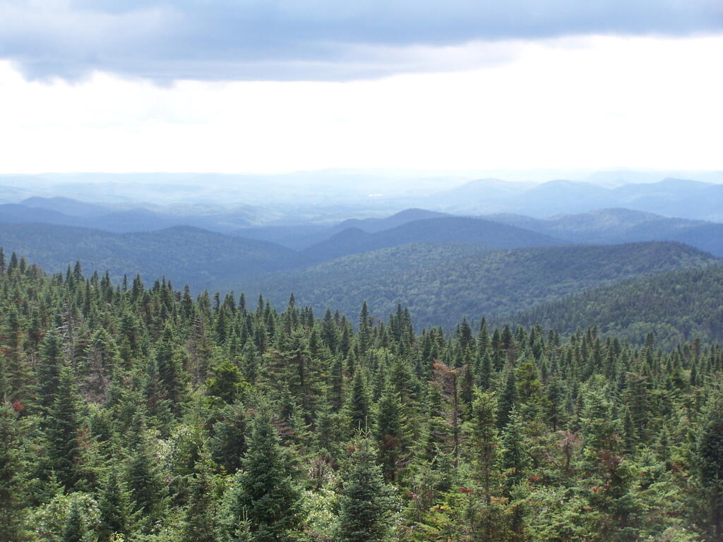
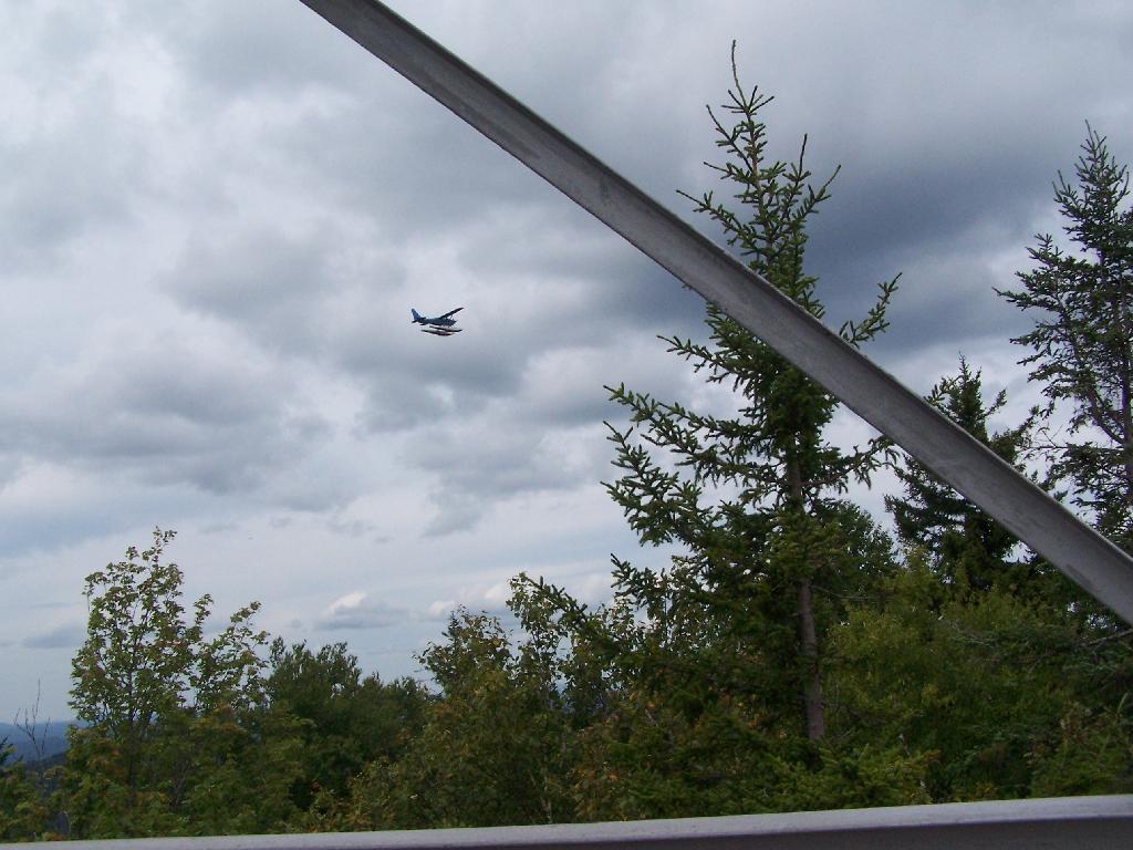
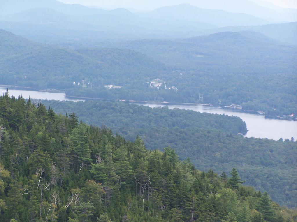
I think most people can agree forest Preserve must have an essentially wild character. Indeed, that is what the Court of Appeals upheld in Association for Protection of Adirondacks v MacDonald (253 N.Y. 234, affg 228 App Div 73, 1930), as I shared earlier this week. If you missed this earlier in the week, this case’s essence is cited in Balsam Anglers Club v. DEC (153 Misc. 2d 606, 1991).

Respondents adopted the UMP in furtherance of the Catskill Park State Land Master Plan, which was adopted in order to provide classifications and guidelines for the uniform protection and management of State-owned lands within the Catskill Forest Preserve. Under the UMP, respondents intend to construct a number of small parking areas providing access to trails and primitive campsites, to relocate certain trails to avoid private lands and to construct new trails within the Balsam Lake Mountain Wild Forest area. Since respondents must necessarily cut a certain number of seedlings, saplings and trees to complete such projects, petitioner contends that the UMP is in violation of article XIV, § 1 of the New York State Constitution. p>The Constitution provides, “[t]he lands of the state, now owned or hereafter acquired, constituting the forest preserve as now fixed by law, shall be forever kept as wild forest lands. They shall not be leased, sold or exchanged, or be taken by any corporation, public or private, nor shall the timber thereon be sold, removed, or destroyed.” Petitioner contends that the cutting of as many as 2,000 “trees”, most of which are less than three inches diameter at breast height, constitutes the removal or destruction of timber.

This specific constitutional issue has rarely been litigated. The Court of Appeals and the Appellate Division in Association for Protection of Adirondacks v MacDonald (253 N.Y. 234, affg 228 App Div 73) addressed legislation authorizing the construction of a bobsled run within the Adirondack Forest Preserve for the 1932 Winter Olympics.

The Appellate Division addressed the legislative history of the New York State Constitution and found an intent to prevent any actions “which might convert this preserve into anything but a wilderness” (228 App Div, at 79). However, the Appellate Division found that the framers of the New York State Constitution obviously distinguished between “timber” and any form of tree or wood. They quoted the framers as stating, “[a]ny campers that cannot pick up something on the shores, that will not be timber, to warm themselves with, would better either carry in their fuel or stay out” (supra, at 78). (emphasis added)

The Appellate Division also discussed the 1915 Constitutional Convention which sought to change the wording of the New York State Constitution to “trees and timber” (supra, at 79). Thereafter, the Appellate Division found that the project involved “the cutting of 2,600 trees which must unquestionably be regarded as of `timber’ size” (supra, at 82).

Based upon an 609*609 agreed statement of facts, all 2,600 trees were in excess of 3 inches diameter at breast height, 480 trees were in excess of 8 inches and 33 trees were in excess of 20 inches. The project involved total clearing of between 4 and 5 acres, some of which constituted first growth hardwoods and involved the removal of some 60,000 board feet of timber. The Appellate Division held the legislation unconstitutional based both upon the substantial destruction of timber and the nature of the proposed project.

Moose River Plains Road

The citation of Helms v. Reid, 90 Misc. 2d 583 gives further incite into the Assocation for the Protection of Adirondacks vs McDonald case:

The major case interpreting the “forever wild” clause is Association for Protection of Adirondacks v MacDonald (228 App Div 73, supra). The question before that court was whether a statute passed by the Legislature providing for the construction of a bobsled run on forest preserve land and the necessary cutting of some 2,600 trees was violative of section 7 of article VII of the Constitution (presently art XIV, § 1). The Appellate Division had carefully traced the adoption of the forest preserve language and then made a careful inspection of the record from the 1894 Constitutional Convention where the “forever wild” clause language was adopted as a proposed amendment to the Constitution. The Appellate Divison concluded that the constitutional mandate was clear and in declaring the statute unconstitutional stated at page 81: “Giving to the phrase `forever kept as wild forest lands’ the significance which the term `wild forest’ bears, we must conclude that the idea intended was a health resort and playground with the attributes of a wild forest park as distinguished from other parks so common to our civilization. We must preserve it in its wild nature, its trees, its rocks, its streams. It was to be a great resort for the free use of all the people, but it was made a wild resort in which nature is given free rein. Its uses for health and pleasure must not be inconsistent 595*595 with its preservation as forest lands in a wild state. It must always retain the character of a wilderness. Hunting, fishing, tramping, mountain climbing, snowshoeing, skiing or skating find ideal setting in nature’s wilderness. It is essentially a quiet and healthful retreat from the turmoils and artificialities of a busy urban life. Breathing its pure air is invigorating to the sick. No artificial setting is required for any of these purposes. Sports which require a setting that is man-made are unmistakeably inconsistent with the preservation of these forest lands in the wild and natural state in which Providence has developed them.”

Many Downed Trees

What About Developing More Modest Recreation Facilities in Forest Preserve?

Certainly building a bob sled run would have been a massive project with visible impacts on the mountain vistas where the timber was removed, the steel infrastructure of the bob sled run, and the general changes the wild forest character. But what about more minor projects, e.g.

  • Scenic Vista Cut Along Trails
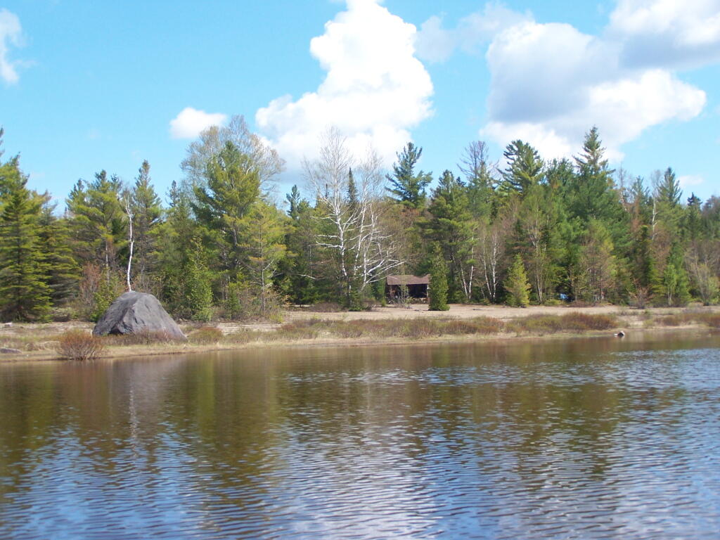
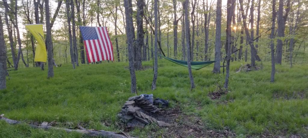
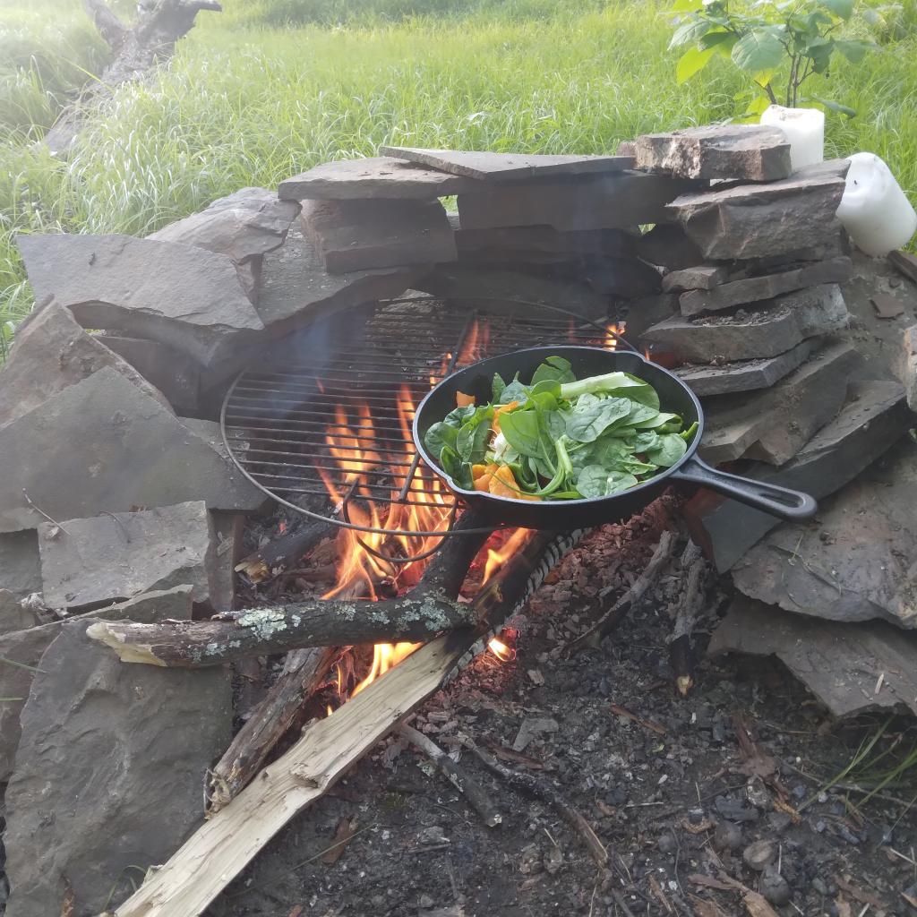
  • Primative tent campsites, along lakes, streams, or in the woods.
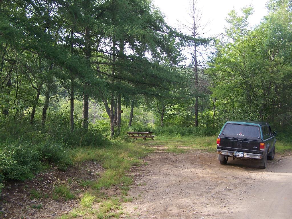
  • Roadside campsites with vehicular access.
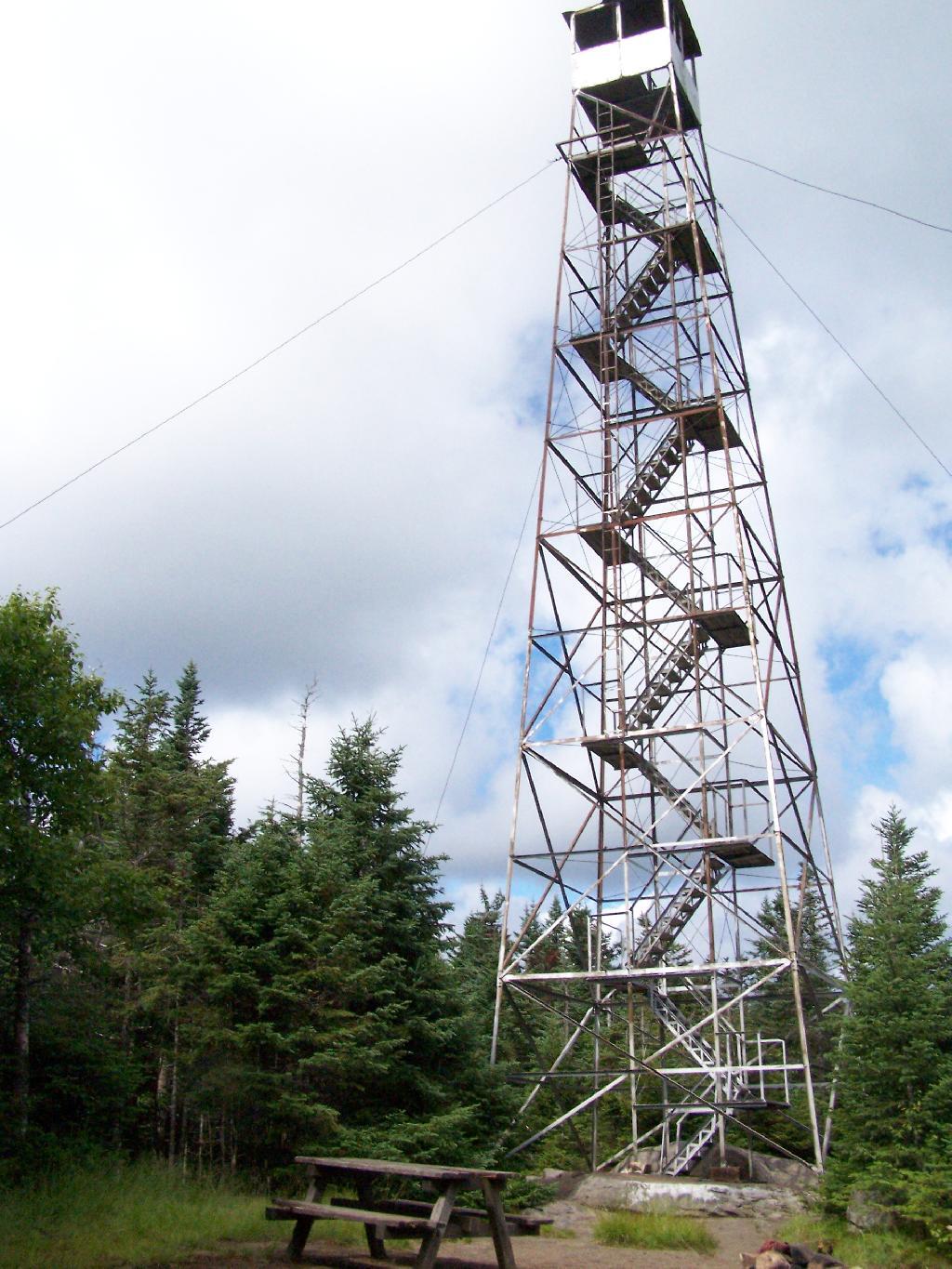
  • State Campgrounds with Flush Toilets and Showers.
  • Horse stalls and horse barns.
  • Construction of hiking trails that require the cutting of brush or a de minis amount of timber.
  • Construction of snowmobile trails that potentially could involve cutting a larger amount of timber.
  • Horse trails that require the cutting of brush or a de minis amount of timber.

Moose Pond Way

The Case Law on Recreational Facilities in the Forest Preserve.

We learn in Helms v. Reid, 90 Misc. 2d 583 some of debates surrounding adoption of Article XIV Section 1 of the State Consitution, and how the Consitutional Convention of 1894 intended not to prohibit “all things necessary” to provide public access and not damage the forst preserve.

The Court of Appeals decision in MacDonald is of great importance and must necessarily be the guiding light in the analysis of the “forever wild” clause which this court must follow in rendering its opinion. At page 238 Judge CRANE states: “The words of the Constitution, like those of any other law, must receive a reasonable interpretation, considering the purpose and the object in view. (State of Ohio ex rel Popovici v. Agler, 280 U. S. 379.) Words are but symbols indicating ideas and are subject to contraction and expansion to meet the idea sought to be expressed; they register frequently according to association, or like the thermometer, by the atmosphere surrounding them. The purpose of the constitutional provision, as indicated by the debates in the Convention of 1894, was to prevent the cutting or destruction of the timber or the sale thereof, as had theretofore been permitted by legislation, to the injury and ruin of the Forest Preserve. To accomplish the end in view, it was thought necessary to close all gaps and openings in the law, and to prohibit any cutting or any removal of the trees and timber to a substantial extent.”

This language sets forth that the purpose of the “forever wild” clause was to prevent the commercial exploitation of the forest preserve which had previously been sanctioned by the Legislature, and it appears to be the court’s feeling that some cutting is permissible as long as it is not a substantial amount. Continuing on page 238: “The Adirondack Park was to be preserved, not destroyed. Therefore, all things necessary were permitted, such as measures to prevent forest fires, the repairs to roads and proper inspection, or the erection and maintenance of proper facilities for the use by the public which did not call for the removal of the timber to any material degree.”

This language indicates the court’s recognition of the fact that even though the Constitution was intended to protect and preserve our natural forest lands, such protection does not prohibit use and enjoyment of the areas by the people of the State. Such a principle is based upon the theory that the forest preserve was for the use and benefit of the people and was not to be an isolated area in which no man would wander. (People v Adirondack Ry. Co., 160 N.Y. 225, affd 176 US 335). (emphasis added)

While the Court never ruled on these matters in Helms, plantiff Herbert R. Helms cited that the State Conservation Department, made major changes and “man-made improvements” to the Adirondack Forest Preserve, over the past 50 years, many of them of questionable consitutional virtue under McDonald, abit never challenged in court.

The first cause of action in the complaint sets forth the “forever wild” clause and then lists various uses undertaken within the forest preserve in the past and present by the New York State Department of Environmental Conservation (ENCON), which the plaintiffs contend destroy the wild forest nature of the preserve because they all entail cutting significant amounts of timber and over use of the forest preserve area. The purported misuses are as follows: construction of 42 or more public campsites; dirt access roads to these campsites, along with various outbuildings, facilities, boat launchings, sewage disposal systems and the maintenance thereof; construction of hundreds of lean-tos, trails, jeep trails, fire roads 587*587 and paved roads other than those specifically authorized by the Constitution; construction and maintenance of ranger stations, fire watch towers, telephone and electrical transmission lines, as well as other utility lines; construction of boat launchings, parking lots and tent platforms; overuse and misuse of backwoods causing unreasonable widening of trails, littering and defoliation of areas, and finally allowing private individuals to adversely possess forest preserve lands to the preclusion of other citizens.

Helms cites McDonald in saying limited development and recreation is allowed in the park, as long as it’s primarily primative in nature:

“What may be done in these forest lands to preserve them or to open them up for the use of the public, or what reasonable cutting or removal of timber may be necessitated in order to properly preserve the State Park, we are not at this time called upon to determine. What regulations may reasonably be made by the Commission for the use of the park by campers and those who seek recreation and health in the quiet and solitude of the north woods is not before us in this case. The Forest Preserve and the Adirondack Park within it are for the reasonable use and benefit of the public, as heretofore stated. A very considerable use may be made by campers and others without in any way interfering with this purpose of preserving them as wild forest lands. (See `The Problem of the Wilderness’ by Robert Marshall in `The Scientific Monthly’, Feb. 1930, p. 141.)”

Cheney Pond Lean-To

Helms goes further to state:

If we assume that a constitutional amendment is not necessary for every use in the preserve which requires a cutting of timber, then we must apply our reasonableness standard to proposed uses. The question then becomes, who is to apply this standard?

It would appear that although the Constitution has deprived the Legislature of any power to authorize a cutting of timber in the forest preserve for commercial purposes, it has not deprived that body of its power with respect to public purposes. The MacDonald decision has allowed the Legislature the power to make reasonable regulations as to this public use and preservation, and such use and preservation must necessarily include some cutting of timber.

Since the Legislature still retains at least this limited authority, it may properly delegate this authority to the administrative agency best adapted to applying the principles heretofore enumerated. This is precisely what our Legislature has done by the creation of the Adirondack Park Agency. (emphasis added)

While ultimately Helms went on to decline an attempt to overturn float plane restrictions in newly designated “Wilderness” areas, first implemented by Governor Rockefeller’s Environmental Conservation Commissioner, Henry Diamond, it did include this important note:

In the discussion of the “forever wild” clause it was pointed out that the preserve was not to be closed to the public, but was to be held open for all of the public to enjoy in its natural wild state. Therefore, plaintiffs’ main theory is correct, and any regulation which arbitrarily restricts public access to or a reasonable public use of the lands in the preserve is violative of section 1 of article XIV.

Wakley Fire Tower

The principle of limited development of the Adirondack and Catskill Forest Preserve, to enhance public access was upheld most recently in Balsam Lake Anglers Club v Department of Environmental Conservation (upheld on Appeal to 2nd Appelate Division). It states:

Respondents adopted the UMP in furtherance of the Catskill Park State Land Master Plan, which was adopted in order to provide classifications and guidelines for the uniform protection and management of State-owned lands within the Catskill Forest Preserve. Under the UMP, respondents intend to construct a number of small parking areas providing access to trails and primitive campsites, to relocate certain trails to avoid private lands and to construct new trails within the Balsam Lake Mountain Wild Forest area. Since respondents must necessarily cut a certain number of seedlings, saplings and trees to complete such projects, petitioner contends that the UMP is in violation of article XIV, § 1 of the New York State Constitution.

The Constitution provides, “[t]he lands of the state, now owned or hereafter acquired, constituting the forest preserve as now fixed by law, shall be forever kept as wild forest lands. They shall not be leased, sold or exchanged, or be taken by any corporation, public or private, nor shall the timber thereon be sold, removed, or destroyed.” Petitioner contends that the cutting of as many as 2,000 “trees”, most of which are less than three inches diameter at breast height, constitutes the removal or destruction of timber.

This specific constitutional issue has rarely been litigated. The Court of Appeals and the Appellate Division in Association for Protection of Adirondacks v MacDonald (253 N.Y. 234, affg 228 App Div 73) addressed legislation authorizing the construction of a bobsled run within the Adirondack Forest Preserve for the 1932 Winter Olympics. The Appellate Division addressed the legislative history of the New York State Constitution and found an intent to prevent any actions “which might convert this preserve into anything but a wilderness” (228 App Div, at 79). However, the Appellate Division found that the framers of the New York State Constitution obviously distinguished between “timber” and any form of tree or wood. They quoted the framers as stating, “[a]ny campers that cannot pick up something on the shores, that will not be timber, to warm themselves with, would better either carry in their fuel or stay out” (supra, at 78). The Appellate Division also discussed the 1915 Constitutional Convention which sought to change the wording of the New York State Constitution to “trees and timber” (supra, at 79). Thereafter, the Appellate Division found that the project involved “the cutting of 2,600 trees which must unquestionably be regarded as of `timber’ size” (supra, at 82). Based upon an 609*609 agreed statement of facts, all 2,600 trees were in excess of 3 inches diameter at breast height, 480 trees were in excess of 8 inches and 33 trees were in excess of 20 inches. The project involved total clearing of between 4 and 5 acres, some of which constituted first growth hardwoods and involved the removal of some 60,000 board feet of timber. The Appellate Division held the legislation unconstitutional based both upon the substantial destruction of timber and the nature of the proposed project.

The Court of Appeals in affirming the Appellate Division determination rejected the absolutist argument that not even a single tree or even fallen timber or deadwood could be removed and stated that the constitutional provision must be interpreted reasonably. “[A]ll things necessary were permitted, such as measures to prevent forest fires, the repairs to roads and proper inspection, or the erection and maintenance of proper facilities for the use by the public which did not call for the removal of the timber to any material degree. The Forest Preserve is preserved for the public; its benefits are for the people of the State as a whole. Whatever the advantages may be of having wild forest lands preserved in their natural state, the advantages are for every one within the State and for the use of the people of the State. Unless prohibited by the constitutional provision, this use and preservation are subject to the reasonable regulations of the Legislature” (supra, 253 NY, at 238-239). It is thus clear that the Court of Appeals determined that insubstantial and immaterial cutting of timber-sized trees was constitutionally authorized in order to facilitate public use of the forest preserve so long as such use is consistent with wild forest lands.

With respect to the relocation of the Hardenberg Neversink Trail challenged herein, petitioner contends that the amount of cutting is of constitutional dimension. The relocated trail is in excess of two miles long and is approximately six feet wide. With the trail approximately 80% completed, 73 trees of timber size, that is three inches or more, have been cut, including one nine-inch tree and one six-inch tree which was dead. The remaining trees are three, four or five inches in diameter. It is estimated by the court that the entire cutting, including trees not of timber size, that is, less than three inches, amounts to little more than one cord of firewood. The great majority of such cutting will be completely decomposed within a few years leaving no trace of their existence but 610*610 providing increased growth opportunity for the remaining trees in the forest.

It is therefore determined the amount of vegetation, seedlings, saplings and timber-sized trees destroyed so far in the construction of the relocated Hardenberg Neversink Trail is not constitutionally prohibited, nor is the number of trees planned to be removed to complete such relocation. While the actual route for the Millbrook Ridge Trail has not been chosen and it is not known how many trees, saplings, seedlings and other vegetation must be destroyed, it may be presumed that the Department of Environmental Conservation, pursuant to its regulations concerning the construction of trails and the destruction of trees and timber, will comply with the provisions of the New York State Constitution. In the event that the Department of Environmental Conservation does not comply, petitioner could certainly challenge the specific trail route or construction techniques at an appropriate time.

Petitioner also contends that the construction of new trails in the Balsam Lake Mountain Wild Forest area violates that portion of the New York State Constitution which requires that forest preserve lands “be forever kept as wild forest lands”, arguing that new trails will increase human activity, thereby necessarily making such areas less wild. Based upon the decisions of the Appellate Division and Court of Appeals in Association for Protection of Adirondacks v MacDonald (supra), it appears that the framers of the New York State Constitution intended not to prevent or hinder public use of the forest, but to allow forested areas to revert to their natural or wild state without human interference with the natural succession of different types of trees, selective cutting or thinning to “improve” the timber, or the harvesting of any mature timber. There is no indication of any intent to maintain the forest in an “absolutely” wild state with no organized human alteration or intervention at all.

The Court of Appeals specifically held that facilities consistent with the nature of the forest preserve could be constructed for the use by the public, including camping and hiking. Such use facilitated by the construction of new trails or increasing parking and camping areas will almost certainly degrade the pristine quality of certain areas of the forest preserve. While it may be desirable to initiate a policy to refrain from actions which will have the effect of increasing human activity, such issues are not of constitutional dimension unless significant cutting of timber is involved. Accordingly, it is declared that the Unit Management Plan adopted for the Balsam Lake Mountain Wild Forest area does not violate the provisions of article XIV of the New York State Constitution.

Towards Indian Lake

What is the Standard Held This Cases?

Over the years, the courts have created a certain principles on recreation facilities in Adirondacks. Distilled down, one can probably agree that courts in NY State hold:

  • Any project to be constructed in forest preserve must cut as few trees as possible, particularly of timber-grade trees, those larger then 3″ in diameter. Any project requiring significant timber cuts are unconstitutional.
  • There is a clear preference towards development of facilities in natural meadows and brushy areas, locating paths, trails, and roads on existing old woods road rather then cutting new roadways or trails through the woods.
  • Limited timber cutting is allowed for essentially wild forest purposes, such as campsites and trail location. It must be as limited as practical.
  • Any developed facilities must be rustic in nature (wood, painted brown), and must exist solely to complement forest preserve uses such as primative camping, hiking, hunting and fishing.
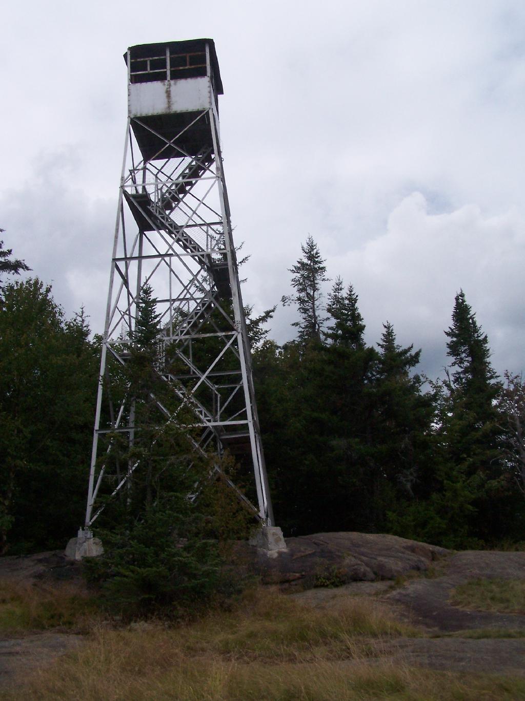
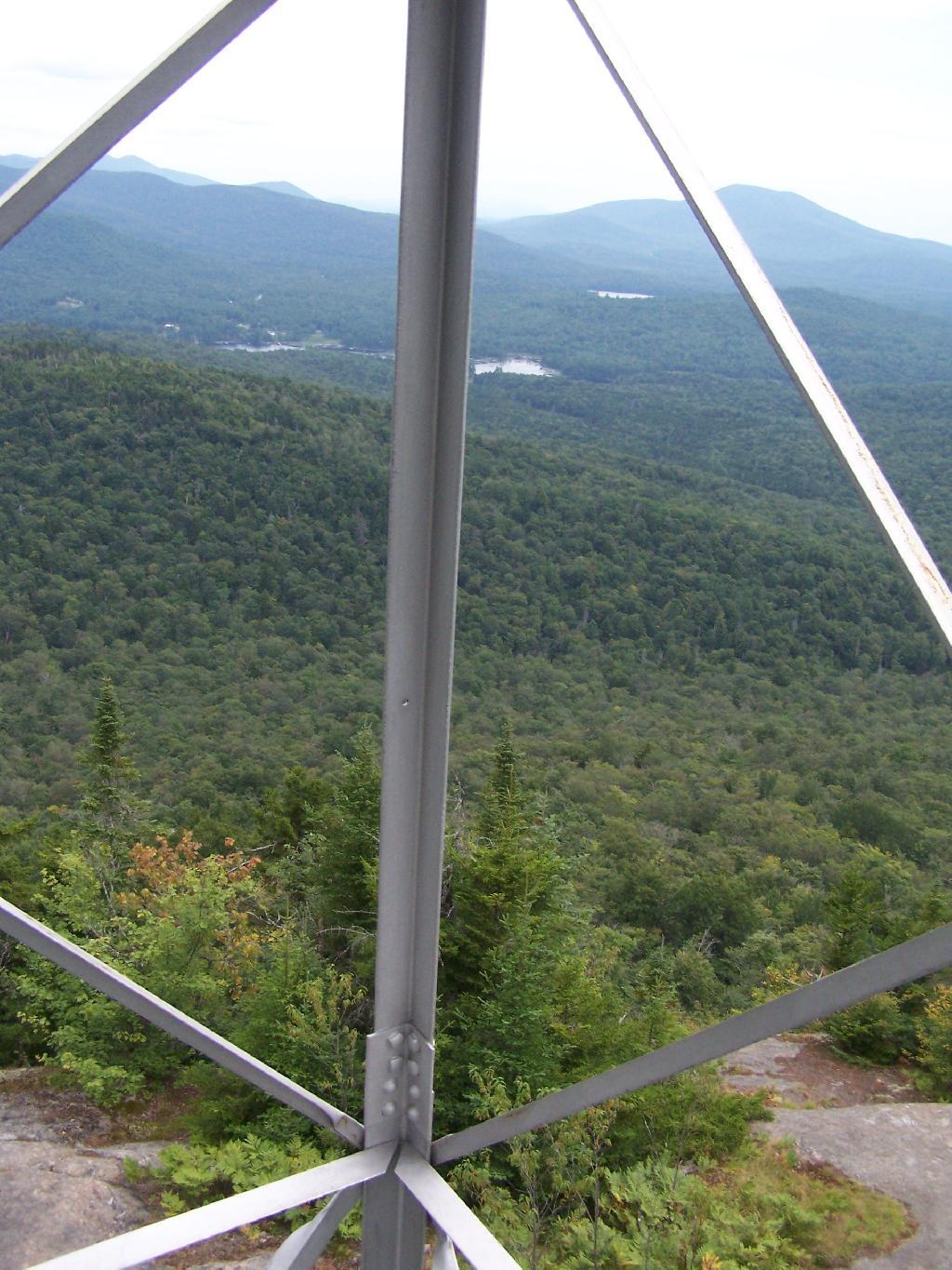
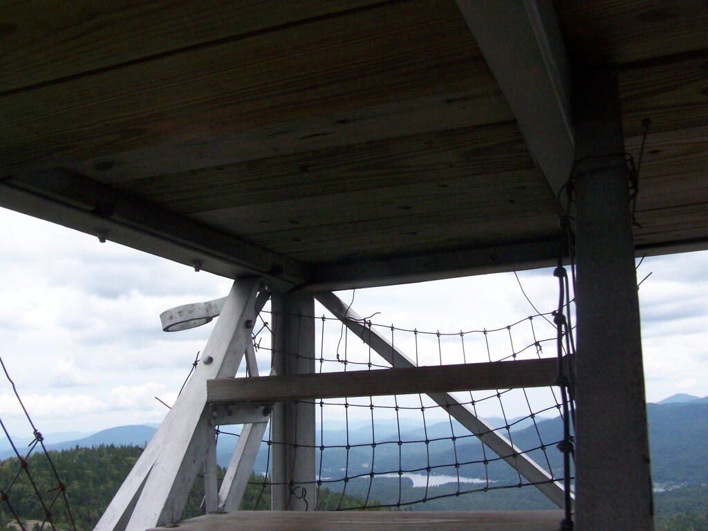
  • Intensive use areas are allowed, such as developed state campgrounds or firetowers, but they can not change the forest character or require the excessive removal of timber.

Tiny Roadside Campsite

… the courts have sought a balance between recreational demands and keeping the primarily wild nature of forests wild.

Daily Update – June 21, 2022

Good evening! Back home, Happy Summer. 🏖

Actually, I guess summer started at 5:17 AM this morning, though I was fast asleep in the back of my pickup, after staying up late last night looking at the stars at Powley Place. Been unusually cold weekend, but it was nice to get away for five days, and not have any social media or emails to look at in the mean time.

Rain and 67 degrees in Delmar. ☁ There is a southeast breeze at 6 mph. 🍃. The dew point is 54 degrees. 0.22 inches of rain is expected before it ends around 9 pm.

I decided not to leave for the Adirondacks until Friday morning. 🌅 I left before 7:30 and took the Thruway to Schenectady, got gas there and supplies and groceries at the Walmart in Gloversville.

Explored Willie Marsh around 9:30 am, only some geese 🦆 and swallow tail butterflies 🦋 there. First time there, I wasn’t that impressed didn’t stay long. Nice bridges and handicap access but it’s a pretty generic marsh.

Got to camp around 11. ⛺ Got the campsite I like at the trailhead to House Pond across from the swimming hole and a relatively short hike to the Potholers.

Swam and did a floating on the tube ⭕ and drinking 🍻 beer and eating Giraldi sausage patties with mozzarella. 🍔 They’re so good even with inflation raising their prices.

Had a real big fire, 🔥 with six or seven foot flames for a while. Looked like a bonfire although maybe it was more like a bonfire with eight weeks of burnables going up in smoke and a strong breeze to feed the fire and blow what was probably somewhat black smoke after dark into the wilderness.

Saturday was incredibly cold 🌧️ with drizzle and rain a good portion of the day. I hiked down to another waterfall and swimming 🏊 hole I had heard rumored about but never explored before. l also hiked back to the Potholers. Didn’t swim, for a while I was so chilled through I found myself sitting by the propane heater ♨ to stay warm.

Sunday also was cold with a gusty breeze most of the day and temperatures in 50s and low 60s. 🌬️ Enough sun ☀ I did some floating on the the tube but it was cold enough that out of the water 💦 and put my hoodie back on and sat by the heater. ♨ Hiked again to the Potholers.

Read 📖 four books. Making up for lost time on my summer reading program. The first one was a book on Statistics for Dummies. Second one was Nate Silver’s Signal and the Noise. Third was Algorithms in a nutshell, fourth was Triggers : creating behavior that lasts–becoming the person you want to be and then finally I got a good way through Steven Rinella’s Meat eater : adventures from the life of an American hunter.

Monday I took down my campsite at House Pond Trailhead and spent the balance of the morning at the Potholers 🏊‍♂️ spending a lot of the morning in the sun ☀ reading 📖 and floating in the tube. ⭕ I went in the Potholers a bit but it was cold. Set up camp ⛺ at Powley Place 10, had another sausage paddy and hiked back to Goldmine Stream Falls.

Got back to camp around six, had some dinner and beer 🍻 🍔 then went tubing on the East Canada Creek until around 8:15. Paddled between the navigable section beaver dam 🐻 to the first beaver dam downstream of the bridge. Probably a mile or two. While the tube isn’t as fast as the kayak 🛶 it certainly can be used for leisurely navigation and is much lighter and easier to pack then the kayak.

I wasn’t going to have a fire 🔥 until I decided to have a small one, and stayed up to around eleven to look at the stars ✨. Some haze and clouds in the evening but still very starry and pretty walking along that sandy road in the remote country surrounded by the tall old growth Spruce trees.

This morning I managed to break some eggs 🥚 in the cooler accidentally and then with the remaining eggs made breakfast. 🍳 I’m trying to use up whatever is left as after five days in the wilderness the ice is all but done. I have a few hot dogs left 🌭 and breakfast sausage but I’m hoping for enough cool for them to survive. More drizzle and cool this morning, incentivized me to take camp ⛺ down early lest things get wet.

Hiked back to Big Alderbed this morning. 🐠 I’m watching the fish jump in the lake to grab flies. The East Canada Creek was low enough flowing from Big Alderbed I could cross without having to do the alternative Bushwhack along the south shore. Upper part of the trail past the stream cross is unmarked – that’s despite the big sign at the trail head and many markers on the obvious part of the trail. It’s like the DEC ran out of markers and just gave up. 🔵 Drizzle continued this morning.

I was disappointed to see a bunch of litter 🚮 at the Powley Bridge campsite. I picked up some of it although I didn’t have a bag or gloves 🧤 with me so I didn’t get it all. I don’t leave a mess or a even trace if I can avoid it. Maybe some stirred up dirt 💩 but that’s part of walking on the land and the grass will regrow.

Truth be told, I was in no rush to head home 🏡, I’ve enjoyed being disconnected from the world 🗺 and email 📧. No social media and I mostly didn’t listen to the radio 📻 news. There’s just been so much going on lately and I wanted to be away from it all. It may be a while until I get to go another weekend like this.

Site Map

🌲🌲 Our Public Lands 🌳🌲

Interactive maps with backcountry and roadside camping: New York, Pennsylvania, West Virginia & Vermont.
List of NYS DEC Lean-Tos with map coordinates. List of NYS DEC Firetowers with map coordinates and more information.
Google Spreadsheet with Roadside, Primitive and Pay Campsites

Explore the Finger Lakes Trail, Long Path, Northville-Placid Trail and Long Trail/Appalachian in Vermont.
Catskill Park Mountain Peaks, Hudson Valley & Long Island Peaks, Peaks Over 3000 ft Elevation, Highest Peaks in Adirondacks, Interactive Map of All Named Summits in NYS, Blaze Colors in Catskill Park, Trailhead Parking Coordinates and Addresses in the Catskills.

Browse USGS Topo Quads as PDF 🆕 by State Lands or County. You can Bulk Download New & Old USGS Topograpic Maps.

Links to various NY State Land Websites 🆕. Get latest GIS Data from state Web Services.

⛺🌲 Camp 🌲🏕

Moose River PlainsCampsite Listing, Maps and photos of state’s largest free camping area.
Piseco-Powley RoadCampsite Listing, Maps and photos of 15 mile dirt road with camping.
Catskill Park Primitive CampsitesAn overview of free camping locations in Catskill Park.
Burnt-Rossman Forest, Cattaraugus County, East Branch Sacandaga River, Finger Lakes National Forest, Madison County, Pennsylvania, Vermont and West Virigina.

Campsite Coordinates for Bog River Flow / Lows Lake, Hudson River SMA (Buttermilk Falls), Lake Lila, Oswegathie River, Nine-Corner Lake, Pharaoh Lake Wilderness, Saranac River Campsites, Stillwater Lake, Schoharie County, and Sugar Hill State Forest.

Overview of Camping Areas in the Catskills, Green Mountains, Southern Adirondacks, Central Adirondacks, Northern Adirondacks, Allegheny National Forest and Penna. DCNR Motorized Campsites and the Monongahela National Forest West Virginia.

Free Campsite Overview Maps: Adirondack – North Country, Catskills, Central NY, Finger Lakes, Western NY. Interactive Map.

Places I camped in 2023, 2022, 2021 and 2020.

🏞 🛹 Bicycle Trails and “Blackie” My Mountain Bike 🚲 🚶

Finally bought a mountain bike, after chewing over a mountain vs commuter bike. Really enjoying riding my bike to work and when it rains there is always a bike rack to safely take it back home. One way to get to adventures at Thacher Park is the Nature Bus.

Empire Trail – KMZ and Interactive Map. Parking along it.

More Trailways with KMZ files including the Albany County Rail Trail, Black Diamond Trail, Catharine Valley Trail, Catskill Scenic Trail, Fonda, Johnstown & Gloversville Rail Trail, Genesee Valley Trail, Link Trail.

🦌🌲 Hunt 🦃🐿

Wildlife Management Units (Deer)KMZ Map shows the WMU boundaries.

Summer 2019 Aerial Photographs of WMUs

KMZ Maps of Deer Harvest Density by Town: 2019, 2018, 2017, 2016. By WMU 2017, 2016, 2015.

KMZ Maps of Buck Harvest Density by Town: 2019, 2018, 2017, 2016. By WMU 2017, 2016

2016 -2019 Deer and Buck Harvest by TownKMZ Spreadsheet with FIPS codes for making your own calculations.

🎣🐡 Fish 🐟🐠

Parking and Access to Trout StreamsAn interactive, downloadable KMZ Map.
Lakes with DEC Contour MapsA KMZ Map links to Contour Maps for Fishing.

🌨🏔 Sled & Wheel 🚙❄

State Truck Trails Over A Half MileDirt roads to explore in the backcountry.
NYS Statewide Snowmobile Trail SystemState trails on public and private lands.

📉📊 Learn 💵📈

Interactive Maps of NY CensusExplore and download KML files.
Charts and Interactive DiagramsFrom population to pollution control.
Andy Arthur GitHubGit my R and Python scripts used to make maps and diagrams.
Use ArcPullR to Get Geospatial DataSuper easy way to connect to get GIS data in R from government servers.
GDAL Opens E00 FilesMost open source programs nowadays can open common geospatial formats.
NY Building FootprintsWhere to find on the internet for making maps.
WMS and ArcMap ServicesDownloadable CSV file listing services used on the blog.
2022 US Census Population EstimatesRed states, south continue to gain population.
2020 Cartogram of State Population

💳 🏛 Property Taxes 🏠💸

Properties in Albany Pine Bush Study Area, Excel Files: Various Tax Rolls, Find coordinates and political districts, Look Up State Tax Records and a Script for Processing RPTL 1520 PDFs. Match NY SWIS Codes to FIPS Codes and GEOID

🚗🚗 Big Red 🚗🚗

Big RedPhotos and Videos of my lifted truck with its camper shell. Big Red’s Dual Battery Setup for Camp Power, Video Tour and Diagram. Big Red is getting old. What is next? I’ve thought about going carless for a while to save money and reduce pollution. Or maybe going bigger? Or smaller? Five dollar gas sucks.

🔥🌲 Off-Grid Living 🏠🤠

I am seriously thinking about building an off-grid house. I have a first draft. I need to learn CAD! I have a road map towards buying land and building. I concede might have to live with long commute and give up traveling and camping. I need to be strong.

Why off grid? Well, I’m not into contemporary society. I want to own land, but not be called a landowner, and a cabin, not hooked to electrical grid, farm, raise pigs for food and burn my own trash. I’m saving for a better tomorrow, hoping to make the leap to another freer state. Having acreage is important. Cornfields aren’t bad neighbors. Maybe though my vision has grown smaller and more local. More on off-grid living.

I am 16 years into my career and have made some significant progress in my life. I love my job. But I do wonder on all the things I’m missing out but saving sure makes me high. Maybe it will be different when I own my own land — the end of goal of all this saving.

2020 into 2021 during the pandemic was a year of remote work. It was a struggle not having internet at home, worked a lot out of my truck. But I worked remotely from Horseshoe Lake which was super cool.

Generally I like the idea of owning land in a red state, particularly Idaho, Iowa, Pennsylvania, West Virginia, Wisconsin — and Midwest more generally. But I may settle for New York – it’s all about the f-ing money!

💻👨‍💻 Open Source 🗺️📍

I use open source software and public sources of data for the blog. Quantum GIS (QGIS), GDAL/ogr2ogr, PyQGIS, GeoPANDAS, R Studio and Leaflet for map making, Arduino and ESP32 microprocessors, Ubuntu Linux and XFCE Window Manager. I’ve recently gotten interested in machine learning.

I avoid using commercial software like Microsoft Windows and do not have home internet or television. If you don’t use commercial software and use your brain, fears of computer viruses are overblown. I deleted most of my social media accounts.

Creating Digital Surface Models using LiDAR Point Clouds.

📊🗺 R Statistical Programming 📜👨‍🏫

The R programming language and RStudio are powerful tools for statistical analysis, making maps and charts. Many of the blog posts and analysis I do are in R, ggplot not only makes great charts but also maps using tidycensus. Generally, R is better then Python for geospatial work.

Use IDW Interpolation to fill in missing Census data, Zonal Histograms for land cover, load WMS Aerial Photography in R, find mountain peaks, save Census shapefiles using tigris quickly, pull NY Election Night Results using Selenium. Fast reverse Geocoding in PostGIS. Working with PDFs in R. Fix a common error starting rselenium/wdman. Make data-filled calendars. R is wonderful and weird, learn it!

🐼🔢 Python and Pandas 💻🐍

Querying state property database, political enrollments, PL 94-171 Census files, calculating population statistics, what address is a district in, converting old districts to new districts, Shapefiles missing Projection information in QGIS.

Learn to code for free modern HTML, Javascript, Python and SQL at freeCodeCamp and web development at the Odin Project.

🐴 🐘 Politics 🦁 🐍

Crunched Election Results with Turnout for Albany County: November 2023, 2022, 2021, 2020, 2019 and Primaries June 2019, Pres/June 2020, June 2021, June 2022, Aug 2022, June 2023.

Albany County Races converted to the new 2023 EDs using Super EDs and Code: 2022, 2021, 2020, 2019 and Primaries June 2019, Pres/June 2020, June 2021, June 2022, Aug 2022.

Above Election Results as zipped Excel files.

Albany County Legislature Districts 2024 Maps

Maps Comparing 2017 and 2023 Albany County Election Districts and a Crosswalk Table Showing the Proposition of Voting Age Population in New and Old EDs

Maps of 2022 NYC Assembly Races, NYS Assembly Races, NY Senate Races, Governor’s Race in Erie County and Statewide. Partisan shift in governor race between 2010 and 2018.

A comparison of Democratic Performance 2022 Assembly Districts to those proposed in 2023 by the IRC. Here is latest 4/20/23 IRC Maps, showing ADP and how they change from existing Assembly districts. Most towns upstate, outside of cities, are quite red. Using LATFOR data with R to calculate Average Democratic Performance.

You can scrape employee salary data from SeeThroughNY using R. Other useful investigative resources.

I often think politics is for losers. I’m into the politics of statistical analysis and reading history books.

I believe strongly in the first amendment, second amendment, oppose gun restrictions and I support de-funding the police in favor of lower-cost technology and civilian employees. Maybe use red flag laws for voting to stop dangerous voters? And the media should stop promoting mass-shootings, even if it’s super profitable for all involved. They should tax the media when it promotes violence. I think some people are much too paranoid in politics. How elections are rigged under law to benefit incumbents. But vote, it’s the best option and inexpensive.

Yeah for the third parties! I voted for Larry Sharpe for Governor and Jo Jergenson for President but my views are complicated and often vote for Democrats, after voting Jill Stein Green Party in 2016.

Generally, I think Biden has been a good change over DJT and glad the Trump era is over and are glad prosecutors and grand jurors are holding him responsible by indicting him for many serious felonies. I don’t think Trump can win in 2024, as nothing has changed politically from 2020.

I think rural people should be left alone and not worship government workers or have parades for them. I am no fan of Donald Trump, his speeches are bad, I don’t like Trump’s embrace of radical environmentalists, but do admire the homemade roadside monuments to DJT.

I don’t toke. But whatever. There are too many transit authorities.

🌲🌳The Earth 🌎 🐸

Why I oppose wilderness areas and parks. It’s trendy to be green these days, but is eco-marketing good for the planet? I visited the Mount Storm Coal Plant and Corridor H.

I worry about a lot about overly-aggressive Climate Change Action, and Undermining Environment Laws for Climate Action. I think we should all admit we are Addicted to Fossil Fuels. These days, urban recycling has become a joke, when it’s still an option at all. It’s better to just buy less shit and avoid the alure of Costcos. I really don’t like how aging radicals have become industrial solar salespeople.

Big bucks are coming to state-designated disadvantaged communities under the CLCP. Which counties and political districts are in line for the the most pork? Interactive map.

I’m a big of farmers who are essentially Living Off the Earth and think Rednecks are Noble Savages. Dairy Farming are key to our rural landscape. I’d trust a farmer or a hunter in a pile of guts he’s butchered over any ivory-tower scientist.

🌎🔆 Industrial Solar 🌞 🏭

Hundreds of multi-acre industrial solar farms are being built in our state. How bad is solar for the environment? We should ask tough questions. Interactive of recently built solar farms, proposed facilities. List of proposed industrial solar facilities. See how the Greenville Solar Farm changed the landscape.

💳 💸Saving Money 💰 💷

I am not a fan of ESG Investing as it’s not well diversified. I prefer index-funds and other tax-advantaged ways of saving. Why I am concerned about saving enough for retirement, even though I’m in my late 30s. We as a nation should save more, consume less. I like the idea of carbon tax to replace capital gains taxes to discourage consumption.

🥦 🍎Mission Fifty & Being Healthier 🏠🧠

I am now officially in my 40s! I am building to a better life in my 50s, which means getting up early, walking a lot, saying no to cake and yes to more fruit. In many ways, the forties are an awesome time to be alive.

And eating healthy for less without losing sleep over arsenic. And I don’t think we should subsidize unhealthy habits. How I got started in eating healther. Meals are too focused on meat and carbs due to how we describe them, maybe I eat too many bananas in the office, what to eat while camping, worry more about salt then GMOs, eat more beans. Do spend extra for farmers market peaches, especially doughnut peaches and plums. Consider ethnic supermarkets. Thinking about how to make a healthier macaroni and cheese, spinach-mackeral-pasta salad, quick-cook biscuits and whole-wheat bread. That said, too many recipes are junk food crap. Okay in moderation is not okay. The fact that I’m thinner is not a sign I’m dying.

A few years back I decided to explore my mental illness with therapy, thinking about why I have so much anxiety and how many of my values are rational or just thinking too much rednecks’ burn barrels and how much of a throwaway society we live in. Do I want to change?

I’ve learned to care less about the world, and focus more on myself. Maybe I am happier as I am now, saving and investing a lot towards owning my own land, where I don’t have to deal with all the bullshit of modern life.

Mission Fifty: Getting to the point where I own my own land. 🚜
Healthy Eating 🍎 / Growing My Wealth 💰
Healthy Thoughts 💭 / Enjoying Life 😃

Questions, comments? Feel free to email me at andy@andyarthur.org.

You do your thing, I’ll do mine.

I use GNU open source software.
Plus I like buck goats,
because they’re real macho men
spraying their beards with goat urine.

March is upon us. Get out, enjoy it, be safe with fire and burning shit, and remember soon enough black flies are waiting.” – Andy Arthur

Return to the Top

Laugh a bit and learn how your data is used on this blog: Privacy Policy

This blog is © Copyright 1997-2023 Andy Arthur.org, please share using the Creative Commons Attribution 3.0 License.

Categories:

July 2, 2021 Morning

Good morning! Yeah, it’s Friday! Working from home today, which is good because I’ve been staying up too late, although I did find time ⌚ for my morning walk 🚶🏻 before work Two weeks to Last Sunset After 8:30 PM 🌆. Days already are getting shorter, although fortunately in a few weeks when I go to the Finger Lakes that they’ll be longer due to being farther west. Cloudy, damp and 64 degrees in Delmar. ☁️ Calm wind. The dew point is 62 degrees. The skies will clear Sunday around 6 am.

Today will have showers likely, with thunderstorms also possible after 11am. Cloudy 🌦, with a high of 69 degrees at 2pm. 14 degrees below normal, which is similar to a typical day around May 9th. Maximum dew point of 63 at 9am. Light and variable wind becoming northeast around 5 mph in the afternoon. Chance of precipitation is 60%. New rainfall amounts between a tenth and quarter of an inch, except higher amounts possible in thunderstorms. A year ago, we had mostly sunny skies in the morning, which became light thunderstorm by afternoon. It was sticky. The high last year was 93 degrees. The record high of 98 was set in 1966.

Assuming it’s not pouring rain ☔ by afternoon, I will probably work down at the library 📚 for most of the afternoon. I like the faster internet connection and not having to watch the meter. I also want to browse the library and get some summer reading 📖 for the first time in a while. It’s been so long since I’ve spent much time in the library, although I guess I was there for a couple of hours last week.

Solar noon 🌞 is at 1:00 pm with sun having an altitude of 70.4° from the due south horizon (-0.4° vs. 6/21). A six foot person will cast a 2.1 foot shadow today compared to 2.2 feet on the first day of summer. The golden hour 🏅 starts at 7:55 pm with the sun in the west-northwest (296°). 📸 The sunset is in the west-northwest (303°) with the sun dropping below the horizon at 8:38 pm after setting for 3 minutes and 27 seconds with dusk around 9:11 pm, which is 11 seconds earlier than yesterday. 🌇 The best time to look at the stars is after 9:57 pm. At sunset, look for rain 🌧 and thunderstorms 🌩 and temperatures around 61 degrees. The dew point will be 58 degrees. There will be a east breeze at 6 mph. Today will have 15 hours and 14 minutes of daytime, a decrease of 44 seconds over yesterday.

Tonight will have a chance of showers and thunderstorms. Cloudy 🌧, with a low of 56 degrees at 5am. Six degrees below normal, which is similar to a typical night around June 11th. Maximum dew point of 60 at 6pm. East wind around 6 mph becoming calm in the evening. Chance of precipitation is 40%. New precipitation amounts between a tenth and quarter of an inch, except higher amounts possible in thunderstorms. In 2020, we had mostly clear skies. It was very sticky. It got down to 68 degrees. The record low of 44 occurred back in 1978.

On this day in 1962, The first Wal-Mart store opens for business in Rogers, Arkansas. 🛒 I know people talk shit about Wally World but it’s my go to place as it’s convenient, one stop shopping tit has everything I need. Two years later, President Johnson would sign the Civil Rights Act of 1964 into law on the same day. I’ve been doing a lot of though about racism, kind of like millions of other Americans these days.

Tomorrow will have a chance of showers, with thunderstorms also possible after 2pm. Mostly cloudy 🌦, with a high of 64 degrees at 2pm. 19 degrees below normal, which is similar to a typical day around April 26th. Maximum dew point of 57 at 3pm. Light north wind. Chance of precipitation is 50%. New rainfall amounts of less than a tenth of an inch, except higher amounts possible in thunderstorms. A year ago, we had mostly sunny skies in the morning, which became light thunderstorm by afternoon. It was sticky. The high last year was 83 degrees. The record high of 102 was set in 1911.

Looking ahead to Sunday, Independence Day 🎇 there is a slight chance of rain showers before 2pm, then a slight chance of showers and thunderstorms. Partly sunny, with a high near 69. North wind around 6 mph. Chance of precipitation is 20%. New rainfall amounts less than a tenth of an inch possible. Very cold Independence Day Weekend, maybe one of the coldest om record. Typical average high for the weekend is 83 degrees. Wasn’t Memorial Day Weekend kind of the same thing?

I am staying in town this weekend. 🌥 Going to take the Nature Bus 🚍 to Thacher Park assuming that it’s not pouring rain. If we get showers, I’ll hide out under a pavilion or sit up on the deck at the Visitor’s Center where they have the Adirondack Chairs. Not sure what the plans are for independence Day, I could wilderness tent camp locally ⛺ or maybe do a hike somewhere. It’s just going to be so cold but probably clear.

I canceled my therapy session for next week but I have the eye doctor 👀 in the morning and I’m thinking of heading to the Adirondacks after that. Not sure how long I’ll stay up north although I probably won’t take Monday off unless it’s nice. I would like a nice weekend if in the Adirondacks. I do think a future counseling session would be good 👨🏻‍⚕️but I need to know what I want to talk about and maybe with a different counselor that takes my concerns more seriously. But I’m also trying to learn some new coping and mental health skills from YouTube.

As previously noted, there are 2 weeks until Last Sunset After 8:30 PM 🌆 when the sun will be setting at 8:30 pm with dusk at 9:04 pm. On that day in 2020, we had rain and temperatures between 80 and 65 degrees. Typically, the high temperature is 84 degrees. We hit a record high of 97 back in 1900.

Branch Pond Road