Search Results for: map old route 30

Forest Routes in Green Mountain National Forest 🌲🌲🌲🌲🌲

Forest Routes in Green Mountain National Forest 🌲🌲🌲🌲🌲

Below is a list of various Forest Routes designated in Green Mountain National Forest.

(Zoom in to see individual roads on the above map)

Name Route Number   Name Route Number
Danby 10   Bacon Hollow 254
Griffith Brook 12   Freezing Hole 255
Powder House 13   Eddy Brook 256
Anderson Place 14   Peru 257
Fowler 15   Morris Brook 258
Trout Club 16   East Dorset 259
Jenny Coolidge 17   Catamount Cobble 260
Greendale 18   Cole Brook 261
Priory 19   Grout Pond 262
Wallingford Pond 20   Bailey Hill 263
Mad Tom 21   Roaring Brook 264
North Road 22   Cardinal Brook 265
Moosalamoo 24   Lamb Brook Road 266
Austin Brook 25   Haystack 267
Little Michigan Parking 26   Heather Brook 268
Silver Lake 27   Medbury 269
Sucker Brook 28   Medburyville 270
Moses Pond 29   Route 9 At/Lt Parking 271
Old Job 30   Pine Valley 272
Ten Kiln 31   Prospect Mountain 273
Goshen-Ripton 32   Turner Meadows 274
Stoddard 33   Little Pond 275
Crystal Brook 34   Dewey Access 277
Michigan 35   Middle Ridge 278
Brandon Gap Parking 36   Tabor Brook 279
Chittenden Brook West 38   Castilano Road 280
Texas Gap 39   Burnt Meadow 281
Leicester Hollow 40   Mud Pond West 282
Rochester West Hill 41   Mad Tom Brook North 283
Bingo 42   Mad Tom Brook 284
Stetson Hollow 43   Little Mad Tom 285
Bear Wallow 44   Bromley Parking 286
Chittenden Brook 45   Bickford 287
Hapgood Pond 46   Bolles Brook 288
Ccc’s Camp Parking 47   Pine Valley Parking 290
Danby Depot 48   Downingville 291
Boyden Brook 49   Mayo Hill 292
Patterson Brook 50   St. Therese 294
Stone Place Road 51   Center Turnpike 296
White Rocks 52   Flood Brook 297
Baker Brook 53   Notch 298
Natural Turnpike 54   Weston 299
Granville 55   Pete Parent Peak 301
Deer Hollow 56   County Line 303
Furnace Brook 57   Colburn 304
Staples Brook 58   Landgrove School 305
Steam Mill 59   French Hollow 306
Black Branch 60   Fayville 307
Smith Brook 61   City Stream 308
Thresher Hill 62   Clark Lodge 309
Maple Hill Rochester 63   Utley West 310
Chamberlain Hill 64   Fayville North 311
South Branch 65   Town Line 312
Lincoln Brook 66   Fayville South 313
Goshen Brook 67   Mill Brook North 314
Cobb Hill 68   French Hollow South 315
Pearl Lee 69   Lye Brook Access 317
Branch Pond 70   Rootville 319
Somerset 71   Winhall 320
Red Mill 72   North Old Job 322
West Branch 73   Glastenbury River 324
Aiken Road 74   Castle Brook 325
Dunville Hollow 75   Rake Branch 326
Meadow Brook 76   Lyman Brook 327
Old County 78   Short Stretch 328
Hapgood Pumphouse 79   Pit Road 330
Chandler Ridge South 80   Blue Road 331
Gilmore 81   Billings Pond 332
Flood Dam 83   Macintyre West 335
Somerset South 84   South Alder 336
Mac Intyre 85   Winhall North 338
Smith Woods 86   Railroad Grade 339
Water Tower 89   Shep Meadow 340
Beaver Meadows 90   Stratton Mountain 341
Fassett Hill 91   Little Pond South 342
Hale Brook 92   Webster Shelter 344
Tucker Brook 93   Shepardson 345
Hewitt Brook 94   Stratton Pond West 346
Dragon Brook 95   Shepardson North 347
Gonya Brook 96   Cutts Peak 348
Caryl Brook 97   Elk 349
Tozier Hill 98   Ball Diamond 350
New Boston 99   Osborne 351
Taylor Brook 100   Hog Back 352
Gulf Brook 101   Burgess 363
Middlebury District Office 102   Bailey 368
Horseshoe 103   Pike Hollow 369
Dutton Brook 104   Hell Hollow 370
Bryant Mountain 105   Deer Cabin Brook 371
Dunmore North 106   Deer Lick Brook 372
Smucker 108   Blind Brook 373
Baslow 111   Nichols Camp 374
Quaglino 112   Kid Gore 375
West Hill Range 113   Castle Meadow 376
West Hill School 114   Stratton Mountain Camp 383
Little Pico 115   South Black Brook 384
Satan’s Kingdom 119   Kelley Stand East Parking 386
Silver Lake North Parking 126   Lower Michigan 391
Silver Lake South Parking 127   Wilcox Peak 392
Yellow Birch 130   Knight’s Hill 393
Short Ridge 131   Townsend Brook 394
Poet Road 132   Frost House 396
Wright House 133   Frost Wayside 397
Joe Smith 142   Robert Frost Interpretive Site 398
Route 155 Parking 145   Rochester Administrative Site 400
Middlebury Gap Parking 148   Moseley 401
Pine Gap 154   Bert Green 402
Perkins 155   Middle 403
Leland Jones 160   York Parking 404
Mills Brook Parking 161   Hooker 406
Mad River Wayside Parking 162   At State Highway 12 Parking 407
Pine Plantation Parking 163   Ripton Barracks 408
Comes 176   Martin Farm Parking 410
Tunnel Brook 177   Eaton Mill Parking 411
Pitney 195   Lefferts Pond 412
Olive School 198   Chittenden Reservoir East 413
Lincoln Gap East Parking 199   Adams Parking 427
Potato Hill 200   Snow Valley 428
Big Basin 201   Bromley South 429
French Settlement 202   Gulf Stream 450
Cobb Hill East 205      
Waterbury 206      
Rob Ford 207      
Bagley 208      
Kelley Stand West Parking 209      
Kelley St At/Lt Parking 210      
Stratton Pond Parking 211      
Hancock Branch 212      
Mt. Horrid Overlook Parking 213      
Brandon Brook East 214      
Ash Hill 216      
Souphouse Flat 217      
Hawk Mountain 218      
Mt. Horrid 219      
Chittenden Brook East 220      
Brandon Brook 222      
Emerson 223      
Romance Mountain 224      
Corporation Brook 226      
Wilcox 227      
Guernsey Brook 228      
Liberty Hill 229      
Blue Ridge West 232      
Sparks 233      
Partridge 234      
Huntley Brook 235      
Oxbow 236      
Dow Brook 237      
Fay 243      
Mount Holly 244      
Mill River 245      
Homerstone Mountain 247      
Homerstone Brook 248      
Emporium 249      

Debar Mountain Wild Forest – Map

Debar Mountain Wild Forest – Map

Check out the DEC's website to find out an excellent overview map of Debar Mountain Wild Forest, updated April 2017.

"Trails on the unit offer opportunities for hiking, cross country skiing, snowshoeing, horse back riding, mountain biking and snowmobiling. Popular destinations within the unit include Debar Mountain, Azure Mountain and Debar Meadows. Other popular pastimes are hunting, fishing, canoeing and boating. Access to the unit's water resources is available at Meacham Lake Campground and Buck Pond Campground, as well as on the St. Regis River, Osgood Pond, Jones Pond, Deer River Flow, Mountain Pond, and Lake Kushaqua. Vehicle access to the unit is provided primarily via NYS Routes 3, 30 and 458. Important local roads for access include county route 26 (Old Route 99), Red Tavern Road, Kushaqua-Mud Pond Road, Gabriels-Onchiota Road, Blue Mountain Road, and Oregon Plains Road."

List of Addresses of Where the Long Path Crosses Roads

One of the challenges is to find places where the Long Path leaves the public roads. Using OpenStreetMap data I created a line intersection of the Long Path against public roads, then with some hand editing made sure only to include off-road trail sections when they meet public roads. Then I ran it against the state’s reverse geocoding service to add street addresses so you can use it with your phone or car GPS.

Street City ZIP lat lng
2824 Touareuna Rd Amsterdam 12010 42.9305966 -74.0868265
3699 W Glenville Rd Amsterdam 12010 42.9197609 -74.0783142
933 Hoffmans Hill Rd Schenectady 12302 42.9171703 -74.069787
699 Wolf Hollow Rd Schenectady 12302 42.9041371 -74.0744891
400 Mabie Ln Schenectady 12306 42.8584106 -74.0317499
119 Old Crawford Rd Schenectady 12306 42.8536279 -74.0250397
3001 Lower Gregg Rd Schenectady 12306 42.8465301 -74.029289
4632 Mariaville Rd Schenectady 12306 42.8231332 -74.0648912
294 Judith Ln Delanson 12053 42.8115677 -74.1163012
1442 Lake Rd Delanson 12053 42.8094393 -74.1284678
2535 Lake Rd Delanson 12053 42.8038552 -74.1438824
845 Bozenkill Rd Altamont 12009 42.7228851 -74.0888376
774 Bozenkill Rd Altamont 12009 42.7210610000358 -74.0833765001164
215 Old Stage Rd East Berne 12059 42.6814314 -74.0545106
5 Hailes Cave Rd Voorheesville 12186 42.6557304 -74.019139
649 Thacher Park Rd Voorheesville 12186 42.6489495 -74.0063475
150 Bush Dr East Berne 12059 42.6386064 -74.0150703
263 Treadlemire Rd Berne 12023 42.6291408 -74.2703397
292 Durfee Rd Middleburgh 12122 42.6273097 -74.2884482
197 Treadlemire Rd Berne 12023 42.6236946 -74.2741212
1050 Cotton Hill Rd Berne 12023 42.6212871 -74.2488514
96 Saw Mill Rd East Berne 12059 42.612683 -74.041551
121 Stage Rd East Berne 12059 42.604945 -74.0423173
182 Stage Rd East Berne 12059 42.603515 -74.046072
524 Helderberg Trl East Berne 12059 42.6032471 -74.0485744
619 Joslyn School Rd East Berne 12059 42.59829 -74.051772
1250 Canady Hill Rd Middleburgh 12122 42.5976577 -74.2377904
171 M T Path Middleburgh 12122 42.5976285 -74.3243928
792 Pleasant Valley Rd Warnerville 12187 42.5969852 -74.4358042
164 Irish Hill Rd East Berne 12059 42.5967723 -74.1111937
268 Lawton Hollow Rd Berne 12023 42.5954718 -74.2318034
617 Cole Hill Rd East Berne 12059 42.59463 -74.0951211
21 Irish Hill Rd East Berne 12059 42.5936846 -74.1061466
106 Mullberry Ln Middleburgh 12122 42.5904363 -74.3507145
3984 State Route 30 Middleburgh 12122 42.5889397 -74.3616479
313 Willsie Rd East Berne 12059 42.5878654 -74.1074344
620 Woodstock Rd Westerlo 12193 42.5864761 -74.0667513
3671 State Route 30 Middleburgh 12122 42.5848137 -74.3898311
304 Mallon Rd Warnerville 12187 42.5836864 -74.4368558
765 Bradt Hollow Rd Berne 12023 42.5826143 -74.20655
705 Patria Rd Warnerville 12187 42.5792491 -74.4468548
824 Gifford Hollow Rd Berne 12023 42.5769462 -74.1226055
467 High Point Rd Middleburgh 12122 42.5767564 -74.2104551
797 Gifford Hollow Rd Berne 12023 42.5741187 -74.1400203
761 Gifford Hollow Rd Berne 12023 42.5716012 -74.1344628
74 Beaver Rd Berne 12023 42.5678925 -74.1759941
467 High Point Rd Middleburgh 12122 42.5669749 -74.2029449
131 Patria Rd Warnerville 12187 42.5651591 -74.4613942
74 Beaver Rd Berne 12023 42.5648224 -74.1827641
854 Sickle Hill Rd Berne 12023 42.5619996991664 -74.1654766243059
484 Ravine Rd Berne 12023 42.5617094 -74.1512759
1233 Sawyer Hollow Rd Richmondville 12149 42.5589555 -74.4869896
766 Rossman Hill Rd West Fulton 12194 42.5510553 -74.4913793
1458 Burnt Hill Rd West Fulton 12194 42.5374204 -74.4819581
162 Huckleberry Kingdom Rd West Fulton 12194 42.5303225 -74.4777372
739 Cole Hollow Rd West Fulton 12194 42.518244 -74.4800406
116 Duck Pond Rd West Fulton 12194 42.5071693 -74.4829103
1632 Westkill Rd North Blenheim 12131 42.4851592 -74.4845538
1819 Westkill Rd Summit 12175 42.4779248 -74.4619016
1942 Westkill Rd North Blenheim 12131 42.4722731 -74.4551777
137 Creamery Rd North Blenheim 12131 42.4710068 -74.4605158
1670 State Route 30 North Blenheim 12131 42.4665802 -74.461879
1022 State Route 30 Gilboa 12076 42.4292935 -74.4724883
382 Stryker Rd Gilboa 12076 42.4136072 -74.4633121
214 Champlin Rd Gilboa 12076 42.3801688 -74.3755645
1022 Cunningham Rd Durham 12422 42.375758 -74.232817
6 Cunningham Rd Windham 12496 42.3751153999999 -74.2326722
698 S Mountain Rd Gilboa 12076 42.3737269 -74.3152619
937 Cunningham Rd Durham 12422 42.37314 -74.223946
277 Bluebird Rd Gilboa 12076 42.3702253 -74.2873087
283 Pangman Rd Gilboa 12076 42.369517 -74.4174038
295 Bluebird Rd Gilboa 12076 42.3685677 -74.2893322
124 Jennie Notch Rd Hensonville 12439 42.3289038 -74.1881716
530 Old Rd Hensonville 12439 42.320343 -74.187498
3 Cross Rd Windham 12496 42.3128558 -74.1898532
3622 Route 23A Palenville 12463 42.1768042 -74.036803
3664 Route 23A Palenville 12463 42.1766161 -74.0374648
3667 Route 23A Palenville 12463 42.1764158 -74.0369105
3525 Route 23A Palenville 12463 42.1761367 -74.0305116
414 Malden Ave Palenville 12463 42.1751342 -74.0314163
327 Malden Ave Palenville 12463 42.1740101 -74.0280332
2504 Platte Clove Rd Elka Park 12427 42.1331569 -74.0854672
2425 Platte Clove Rd Elka Park 12427 42.1331288 -74.0826962
25 Lane St Phoenicia 12464 42.0789625 -74.3192493
5636 Route 28 Phoenicia 12464 42.070796 -74.302315
359 Peekamoose Rd Grahamsville 12740 41.91677185 -74.4378855
415 Peekamoose Rd Grahamsville 12740 41.9149657 -74.4291244
197 Trails End Rd Kerhonkson 12446 41.884025 -74.36059
559 Upper Cherrytown Rd Kerhonkson 12446 41.864115 -74.346321
1054 Berme Rd Kerhonkson 12446 41.753416 -74.339492
5113 State Route 52 Ellenville 12428 41.6928347 -74.3935542
327 S Gully Rd Ellenville 12428 41.6781297 -74.3708664
440 S Gully Rd Ellenville 12428 41.6777944 -74.371414
11 VFW Rd Wurtsboro 12790 41.5752303 -74.4670939
762 South Rd Wurtsboro 12790 41.5341248 -74.5139809
99 County Road 61 Otisville 10963 41.4982235 -74.5530519
113 County Road 61 Otisville 10963 41.4967773 -74.5531814
507 State Route 211 Cuddebackville 12729 41.4802135 -74.555461
303 County Road 61 Otisville 10963 41.4760327 -74.5536354
2005 Guymard Tpke Otisville 10963 41.4265857 -74.5963229
1 Blue Flag Ln Cuddebackville 12729 41.426566 -74.5965342
545 County Road 50 New Hampton 10958 41.4121656 -74.3941192
38 Echo Lake Rd New Hampton 10958 41.4121500424313 -74.3787396591536
114 Hartley Rd Goshen 10924 41.409093 -74.371953
46 Six And One Half Station Rd Goshen 10924 41.4012238 -74.3590345
316 W Main St Goshen 10924 41.3998401 -74.3340928
84 Green St Goshen 10924 41.3993471 -74.322592
76 South St Goshen 10924 41.3939593 -74.3226989
1032 Mountain Rd Port Jervis 12771 41.3926953 -74.5986846
225 Knoell Rd Goshen 10924 41.3798692 -74.2964613
102 Chester Heights Dr Chester 10918 41.3640215500303 -74.2718868300712
860 State Route 32 Highland Mills 10930 41.3633416 -74.1052241
3 Greycourt Ave Chester 10918 41.3625334936556 -74.2691966874193
65 Greycourt Ave Chester 10918 41.3618575 -74.2549727
1 Laguardia Rd Chester 10918 41.3590216381678 -74.2397433875007
379 Seven Springs Rd Monroe 10950 41.3560042 -74.1735084
168 Seven Springs Mountain Rd Monroe 10950 41.355365 -74.177706
1214 Craigville Rd Chester 10918 41.3508776 -74.2157511
136 Seven Springs Rd Monroe 10950 41.3504509 -74.1819116
520 State Route 208 Monroe 10950 41.350432 -74.1922682
36 Museum Village Rd Monroe 10950 41.35042 -74.196911
130 Museum Village Rd Monroe 10950 41.346777 -74.198612
64 Park Ave Highland Mills 10930 41.344474 -74.120789
903 Barnes Lake Rd Highland Falls 10928 41.3285733 -74.0783374
277 Estrada Rd Central Valley 10917 41.3238472 -74.1048499
8 Reynolds Rd Highland Falls 10928 41.3205133 -74.0952524
81 Bailey Town Rd Highland Falls 10928 41.3162793 -74.0535806
2216 Seven Lakes Dr Southfields 10975 41.2776354 -74.0961941
1771 Seven Lakes Dr Southfields 10975 41.2356802 -74.102332
105 Johnsontown Rd Stony Point 10980 41.2226273 -74.09728
403 Call Hollow Rd Stony Point 10980 41.218184 -74.0489332
9 Cheesecote Ln Pomona 10970 41.2102991 -74.0442959
7 Lakeview Ct Pomona 10970 41.2091934 -74.0429687
199 Central Hwy Garnerville 10923 41.1921162 -74.004641
1675 Route 202 Pomona 10970 41.1859757 -74.0389189
33 Old Route 202A Pomona 10970 41.1843645 -74.0365253
330 Old Route 304 New City 10956 41.176861 -73.9629335
65 Landmark Dr Congers 10920 41.1745467 -73.9446311
86 Landing Rd Valley Cottage 10989 41.1437105 -73.9124038
582 N Route 9W Nyack 10960 41.1145506 -73.9268341
404 Christian Herald Rd Valley Cottage 10989 41.1089732 -73.9348648
61 Mountainview Ave Nyack 10960 41.0978228 -73.935651
57 Mountainview Ave Nyack 10960 41.0975246 -73.9362947
20 Towt St Nyack 10960 41.0906748 -73.9360351
986 Bradley Pkwy Nyack 10960 41.0861861 -73.9337348
233 South Blvd Nyack 10960 41.0813344 -73.9298696
8 N Tweed Blvd Nyack 10960 41.0764606826772 -73.9297238414169
5 First Class Marsico Ct Blauvelt 10913 41.0662594566299 -73.9421404629506
68 Clausland Mountain Rd Blauvelt 10913 41.0622485 -73.939429
244 Tweed Blvd Nyack 10960 41.0464497 -73.9247046
49 Castle Rd Sparkill 10976 41.0420154 -73.9251767
50 Ash St Piermont 10968 41.0413878 -73.9181724
34 Tate Ave Piermont 10968 41.0404488 -73.917408
30 Castle Rd Sparkill 10976 41.0397679 -73.9235619
13 Paradise Ave Piermont 10968 41.0374884 -73.9158113
70 Woods Rd Palisades 10964 41.01677 -73.908588
4 Prior Ct Palisades 10964 41.0085899 -73.913632
34 Route 9W Palisades 10964 41.0006901 -73.9113535
100 Lawrence Ln Palisades 10964 40.9914837 -73.9064843

Below is a list of lean-tos, campsites, parking areas, and other assets along the Northville – Placid Trail πŸ•οΈ

Link to anΒ  Interactive Map of the Northville Placid Trail.

Type Name Description Coordinates
Hand Launch Ceder River Flow Boat Ramp Hand Carry Launch, Ramp 43.725826369700904, -74.47289916126694
Lean-To Beaver Pond (Aka Cedar Lakes Lean-To #2) Β  43.625969396804386, -74.54927150370021
Lean-To Carry Lean-To Β  43.67874488347091, -74.49549821879448
Lean-To Catlin Bay #1 Lean-To Β  43.99801269269887, -74.39278456108421
Lean-To Cedar Lakes #1 Lean-To Β  43.628125665037935, -74.54047323992656
Lean-To Cold River #2 Lean-To Β  44.14251664317184, -74.13035824291548
Lean-To Cold River #3 Lean-To Β  44.091459278051204, -74.25764175084498
Lean-To Cold River #4 Lean-To Β  44.09139025333258, -74.25573480252505
Lean-To Cold River Lean-To #1 Lean-To Β  44.14272737628489, -74.12984021065587
Lean-To Duck Hole #1 Lean-To Β  44.14162687400988, -74.10693734676616
Lean-To Duck Hole #2 Lean-To Β  44.14167686466829, -74.10654354672256
Lean-To Hamilton Lake Stream #1 Lean-To Β  43.39741359517532, -74.45529759002217
Lean-To Hidden Cove Lean-To Β  44.00265528819394, -74.38648026325164
Lean-To Kelly Point #1 Lean-To Β  44.02880023617087, -74.36730798599064
Lean-To Kelly Point #2 Lean-To Β  44.02870256717196, -74.36713034867948
Lean-To Moose Pond Lean-To Β  44.182843382402666, -74.07364102375995
Lean-To Mud Lake Lean-To Β  43.342671073157994, -74.45629078563864
Lean-To O’neill Flow Lean-To Β  43.875596840936154, -74.36642623697053
Lean-To Ouluska Pass Brook Lean-To Β  44.120221281603584, -74.18744717390932
Lean-To Plumley Point #2 Lean-To Β  44.06559891610762, -74.32761224546002
Lean-To Rodney Point #1 Lean-To Β  44.04140938489936, -74.35014909639557
Lean-To Rodney Point #2 Lean-To Β  44.042976745412616, -74.34933464753136
Lean-To Seward Lean-To Β  44.106244137686204, -74.2091536427719
Lean-To Silver Lake Lean-To Β  43.29193545679836, -74.4237351676776
Lean-To South Lake Lean-To Β  43.58724480971, -74.62157883837274
Lean-To Spruce Lake #1 Lean-To Β  43.52728411257782, -74.6099246975027
Lean-To Spruce Lake #2 Lean-To Β  43.53463062983387, -74.60808580306896
Lean-To Spruce Lake #3 Lean-To Β  43.53712972792447, -74.60820962802477
Lean-To Stephens Pond Lean-To Β  43.818673668554965, -74.42052487172707
Lean-To Tirrel Pond North Lean-To Β  43.887344477557306, -74.37880062606054
Lean-To West Canada Creek Lean-To Β  43.58698761405157, -74.61399797100106
Lean-To West Lake #1 Lean-To Β  43.59316222884976, -74.62688668431306
Lean-To West Stony Creek Lean-To Β  43.22474428954461, -74.26933345717664
Paved Parking Lot Lake Durant Northville Placid Trail Parking Lot Paved, 12 Vehicle Capacity 43.84219550506574, -74.3862742856788
Paved Parking Lot Northville Lake Placid Trail Parking Lot Paved, Good Condition 43.84213270187873, -74.38656792328511
Primitive Tent Site Canary Pond Campsite Β  43.30513256312245, -74.4472062440692
Primitive Tent Site Cedar Lake Dam 1 Β  43.62894580965635, -74.53639939387939
Primitive Tent Site Cedar Lake Dam Tentsite Β  43.62937624507422, -74.53679785644344
Primitive Tent Site Cedar River Flow Tentsite Β  43.70292480315104, -74.48713041165333
Primitive Tent Site Fall Stream Tentsites Β  43.49661052800474, -74.53713112743992
Primitive Tent Site Jessup River Tentsites Β  43.51246207852797, -74.57229710138834
Primitive Tent Site Kelly Point Tentsites Β  44.02910364406153, -74.36670207204214
Primitive Tent Site Moose Pond Tentsites Β  44.18274441156179, -74.07408240028583
Primitive Tent Site Moose River Plains Campsite 01 Live 43.72667672123972, -74.47410026642402
Primitive Tent Site Moose River Plains Campsite 02 Live 43.72665150100841, -74.47331107300782
Primitive Tent Site Moose River Plains Campsite 03 Live 43.725959512295866, -74.47389996564202
Primitive Tent Site Moose River Plains Campsite 04 Live 43.726067692208126, -74.47423264719026
Primitive Tent Site Moose River Plains Campsite 05 Live 43.725563790898704, -74.47417512282912
Primitive Tent Site Moose River Plains Campsite 06 Live 43.72522313374867, -74.47458303719159
Primitive Tent Site Mud Lake Tentsites Β  43.59647433847274, -74.61354076182431
Primitive Tent Site O’neill Flow Tentsite Β  43.87567135918534, -74.3666467203306
Primitive Tent Site Rock Lake Campsite Β  43.265591839994535, -74.41543516012669
Primitive Tent Site Salmon River Tentsites Β  43.907925071619914, -74.38530801916977
Primitive Tent Site Shattuck Clearing Tentsites Β  44.08679657756681, -74.26368397541134
Primitive Tent Site Silver Lake Tent Site Β  43.29112770008321, -74.4240469986026
Primitive Tent Site Spruce Lake Tentsite Β  43.53695545329776, -74.60818912022354
Primitive Tent Site Tirrell Pond North Tentsites Β  43.88594343639596, -74.37834897628142
Primitive Tent Site Trailside Campsite Β  43.2716741112023, -74.43107546264162
Primitive Tent Site Wanika Falls Tentsites Β  44.19944690357389, -74.05663862305364
Primitive Tent Site West Lake Former Caretaker Clearing Tentsites Β  43.59389874347195, -74.62560220247346
Primitive Tent Site Whitehouse Campsite Β  43.373430193527696, -74.43578942968477
Primitive Tent Site Whitehouse Campsite Β  43.37406302094423, -74.43516794694158
Primitive Tent Site Woods Lake Campsite #2 Fire Pit, Water Front Campsite 43.25071034607129, -74.31177480398298
Primitive Tent Site Woods Lake Campsite #3 Fire Ring, Water Front Tentsite, Scenic View 43.250888826581715, -74.31104030228295
Primitive Tent Site Woods Lake Campsite #4 Fire Place, Water Front Campsite, Nice View 43.251811433787196, -74.3092782205918
Unpaved Parking Lot Benson Road Parking Area 8 Vehicle Capacity 43.24745928673895, -74.31187044250609
Unpaved Parking Lot Chubb River Bridge Β  44.2628824981147, -74.01364844250504
Unpaved Parking Lot Moose River Recrieation Area Northville-Placid And Cedar River Trails 43.726457025366315, -74.47386984656715
Unpaved Parking Lot Norhtville Placid Parking-Haskells Rd Β  43.45841038153893, -74.52201705350714
Unpaved Parking Lot Northville Placid Trail Parking Area 6 Car Interior Parking Area 43.21330828950083, -74.2083824784703
Unpaved Parking Lot Northville Placid Trail Route 28n Parking Lot Β  43.97584466308438, -74.39296138679799
Unpaved Parking Lot Tarbell Road Shoulder Parking Lot Β  43.984346733793245, -74.39813014848872
Unpaved Parking Lot Wakely Dam Β  43.72640808237045, -74.47425964611213
Unpaved Parking Lot Wakely Mountain Trailhead Parking Lot 1250 Sq Feet 43.732197733217824, -74.47253968128065
Unpaved Parking Lot Wakely Pond Accessible Fishing Dock Β  43.737643556916666, -74.46542853470272
Unpaved Parking Lot Wakely Pond Accessible Launch Β  43.738042554833534, -74.46399313053813

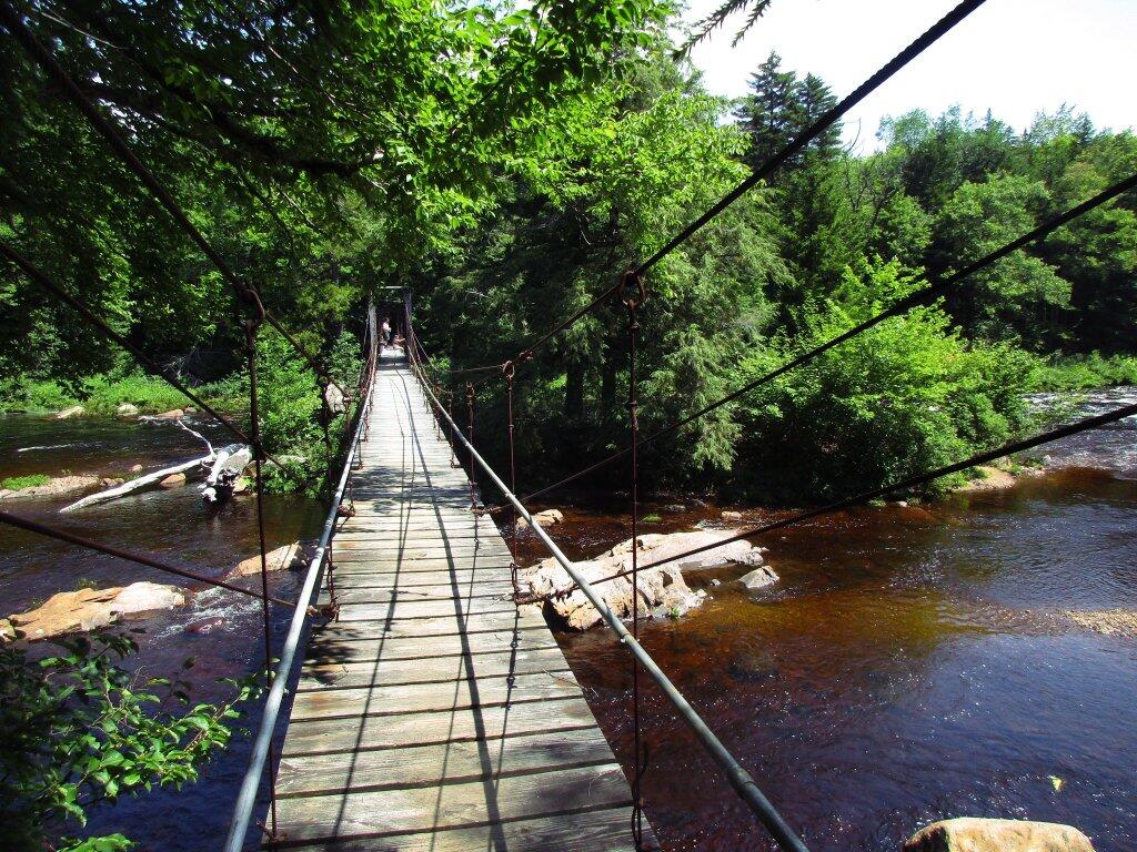
 Whitehouse Suspension Bridge

Places I Camped in 2023

While this year was a rainy one, and it rained during many of my trips, I was able to get out for 53 nights in the wilderness — mostly fairly close to home but I also did a trip down to West Virginia in late October with several trips to the Adirondacks, Central New York and summer vacation in the Finger Lakes.
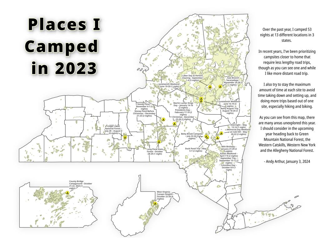
Places I Camped in 2023

Martin Luther Kings Day – January 14-16 (2 nights)

To start out my camping adventures in 2023, I drove out to Charles Baker State Forest and Brookfield Horse Camp. There wasn’t a lot of snow — just a dusting but it was a fun weekend, topped off by a beautiful sun-full glittery hike up Tassell Hill after a hoar frost. Explored Lost Pond and several of the trails in the middle of state forest.
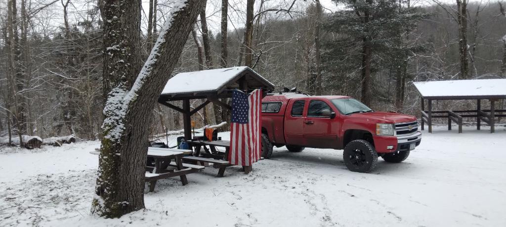
Home for the weekend

40th Birthday – January 27-29 (2 nights)

For my fortieth birthday, I took off the Friday leading up to my 40th birthday to cross country ski and winter camp at Rensselaerville State Forest. It was a beautiful weekend with lots of blue skies, sufficient snow for skiing but not so much that was a ton of snowmobiles out on the trails.
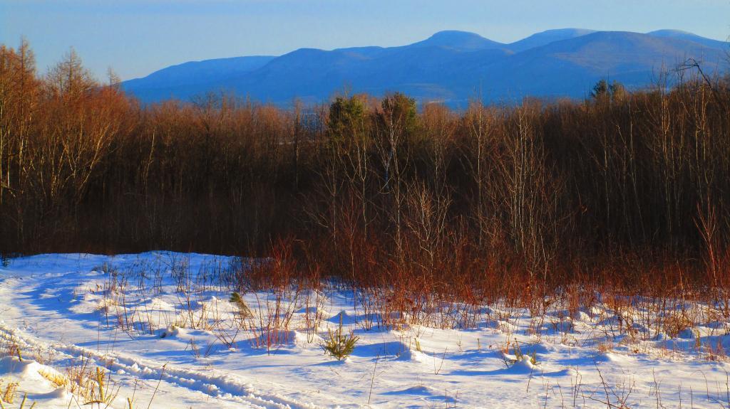
Beautiful Day of Skiing

Presidents Day – February 17-19 (2 nights)

I decided for Presidents Day Weekend to do another trip out to Charles Baker State Forest and Brookfield Horse Camp. Slightly more snow then last time but again largely a snow-less winter, with some nice days for hikes through the various truck and horse trails. I hiked around much of state forest, especially the more southern part of the forest.
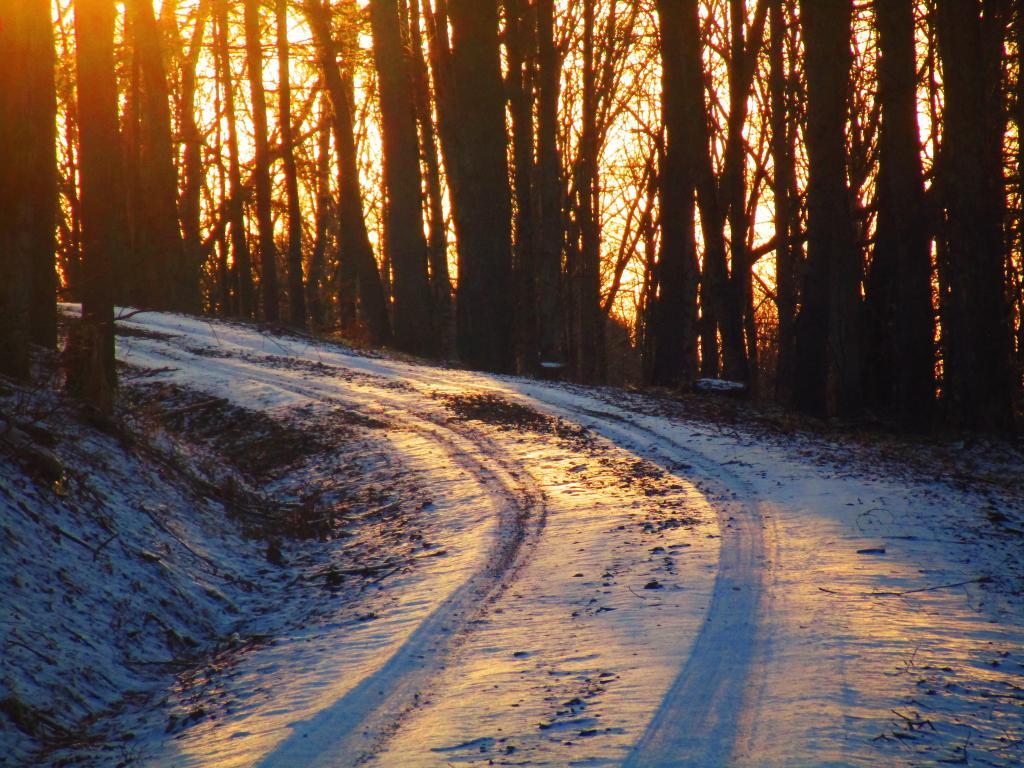
Evening on Truck Trail 13

Easter Weekend – April 7-9 (2 nights)

On Good Friday through Easter I camped at at Rensselaerville State Forest. The snow was gone and it was fairly mild though at times it was a bit cool. Spent a fair amount of time walking around and exploring the new OSI Parcel that has been recently added to state forest and is still largely open fields with sweeping views of the Catskill Mountains.
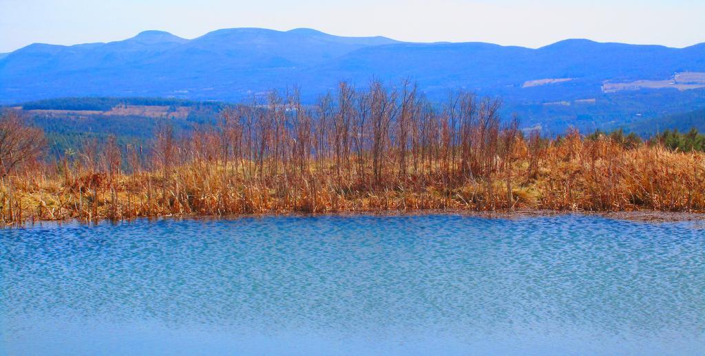
Hillcross Farm Pond

Duck Pond Trip – May 5-7 (2 nights)

The first Friday in May I took a half day from work and headed out to Schoharie County to camp at Duck Pond at Burnt-Rossman Hills State Forest. Originally the plan was to camp two nights at Duck Pond, hiking along the Long Path and exploring the state forest and then on Sunday hiking the Catskill Scenic Trail. That part of the trip changed when driving along Duck Pond Road the low tire pressure light came on I found a pallet nail in my truck tire. I was able to top off the truck tire and then change the tire when I got home and got the nail pulled and plugged. But it wasn’t the best way ever to end a trip early.
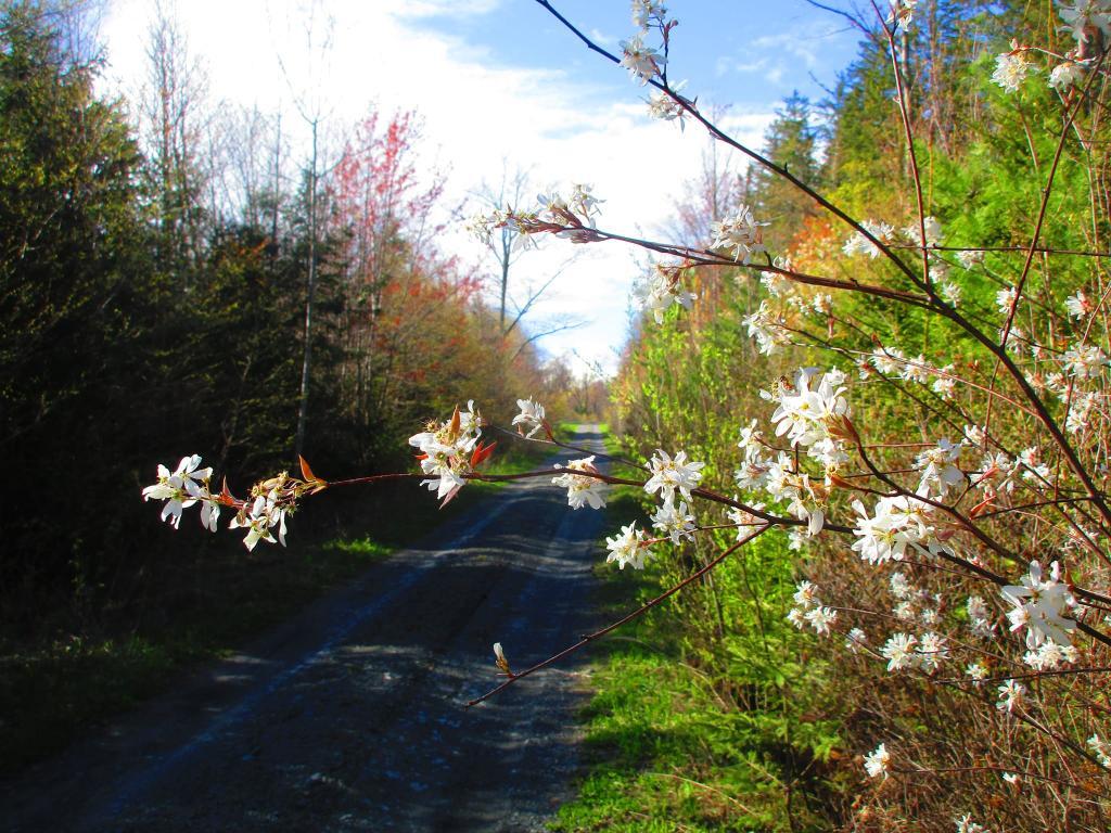
Spring

Overnight at Cole Hill – May 13-14 (1 night)

After visiting the folks on Mother’s Day Weekend, I decided to do a quick overnight hammock camp on Cole Hill State Forest in Berne. Nothing fancy or formal, it was as much a way to test out sleeping in my hammock with the bug screen. Kind of a chilly night, I took camp down fairly and headed home early in the morning.
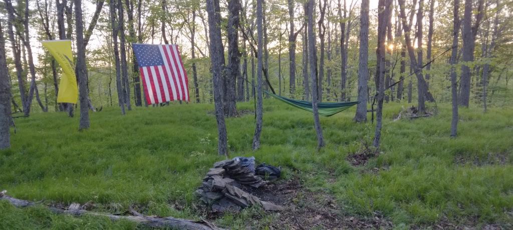
Hammock Camping on Cole Hill

Memorial Day Weekend at Cole Hill – May 20-22 (2 nights)

This year I decided to eschew the Adirondacks and Greene Mountains for Memorial Day Weekend due to the black flies, my desire to look at bicycles, and work I had to do on the Saturday morning leading up to the holiday weekend. I decided to hammock camp again Cole Hill State Forest in Berne. This was a three-day two night trip, so it it gave me a chance to bring more gear up the mountain, set up a more formal camp. Cooked on the fire, hiked around the forest. It was a warm weekend, but I enjoy the solitude, along with having good cell service for listening to podcasts and watching videos.
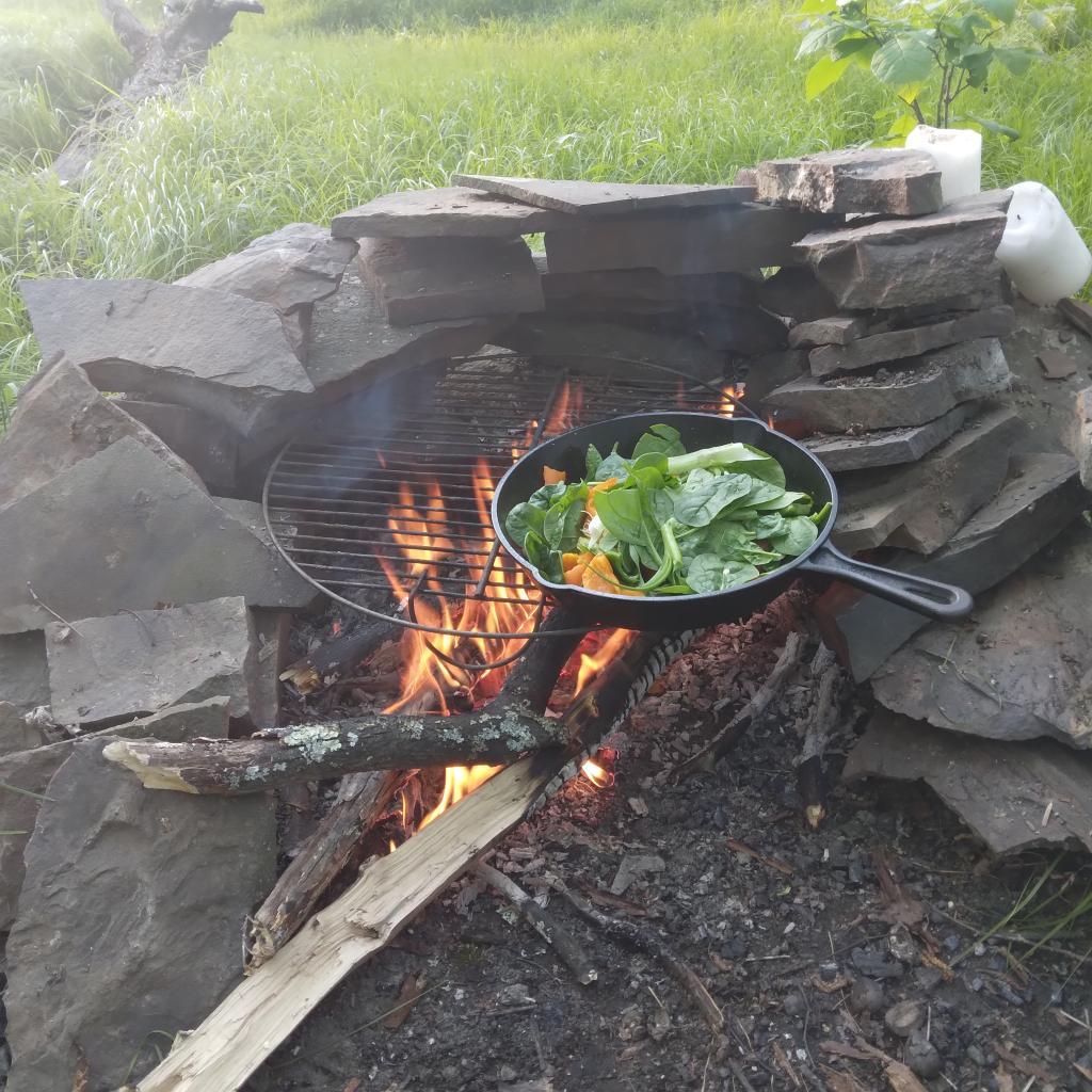
Cooking down dinner

Juneteenth Weekend on Piseco-Powley – June 15-20 (4 nights)

To kick off summer, I did my usual Juneteenth weekend camping trip, tacking on some days on the Juneteenth Holiday Weekend. It was a bit of a cool and rainy weekend to kick off summer, one that would actually be followed by many cool and rainy weekends where I would stay home. Camped at House Pond for the first three nights, spending time down floating in the tube on East Branch while the final night I camped up at Powley Bridge site and kayaked along the East Branch. Really, like often is the case, the best weather was the day I took down camp.
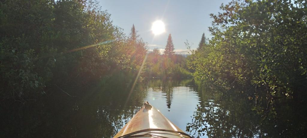
Evening on East Canada Creek

Catskill Scenic Trail Trip – July 22-24 (3 nights)

After several months of researching and visiting various bike shops, I finally got a mountain bike. I decided it would be fun to do as much of the Catskill Scenic Trail as I could before my summer vacation got underway. Actually did quite a bit of riding and hiking that weekend — started out hiking Pratts Rock’s then riding from Grand George to Hobart. Sunday, I rode from Fultonham to Middleburgh on NY 30, doing a quick climb up Vromans Nose, then stopping at the farm market then going to Mine Kill State Park to swim. Monday I rode from Hobart down to Bloomville, getting caught in a major thunderstorm and downpour a few miles north of Bloomville with no shelter in sight. The trail became super boggy, then I went to Mine Kill State Park for one more swim, and then out to folks house for Sunday dinner a day later then usual.
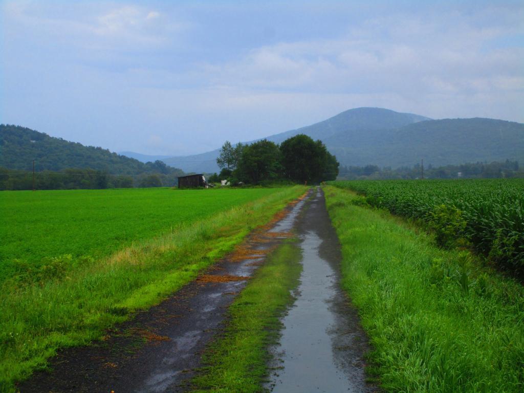
After the rain showers

Finger Lakes National Forest – July 28 – August 6 (9 nights)

Every year for nearly a decade and a half I’ve been doing summer vacation out in the Finger Lakes — camping in the National Forest and exploring as much as possible during my days there. The past few years I’ve been driving there on a Friday, to get a better campsite before they’re taken by the weekend campers. This year was no exception. With Blackie, my mountain bike, I did nearly all of the bike trails in the near vicinity, from the Black Diamond Trail to the Cayuta Valley Trail to Dresden – Penn Yan Canal Trail. Kayaked on both Cayuga and Scenic Lakes, swam many days at Watkins Glen State Park and Taughannock State Park, explored the Cornell Campus and Botanical Gardens on my bike. Got some good ice cream at the Spotted Duck, explored the Geneva Waterfront along with the Cayuga-Seneca Canalway. Some rain but compared to the wet summer that was, this was a pretty good week.
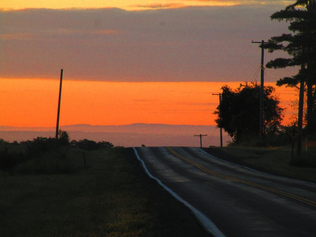
Morning on Searsburg Road

Piseco-Powley – House Pond Campsite – August 18-20 (3 nights)

The next few weeks for rainy and by the time I got away for one more long weekend, it promised to be fairly nice weekend but turned out to be fairly cool and cloudy with some rain. Back at the House Pond Campsite, did some swimming in East Branch, but with the mercury in the 60s most of the weekend, I didn’t spend a lot of time in the water. Hardly what I had dreamed when the I planned the weekend. Rode Blackie up to Goldmine Stream Falls and relaxed down by the falls for a bit, also sat down by the swimming hole off of the Old Edick Road Snowmobile Trail, watching the rain fall, bemoaning the wet and cold weather. Still it was good to get away for a bit, and I did do a fair amount of reading in hammock, under the protection of the bug net, as the bugs were bad after such a wet summer.
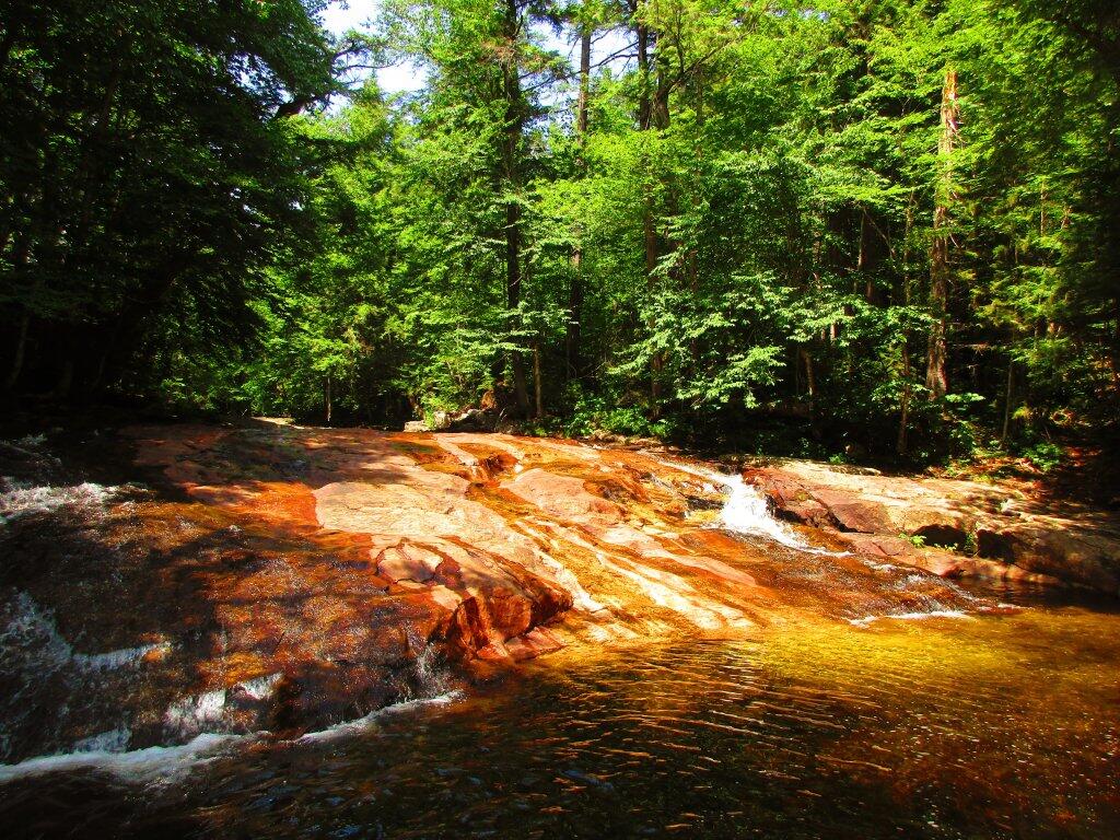
Gentle Drop Into A Golden Pool

Labor Day at Perkins Clearing – September 1-4 (3 nights)

I took the Friday off before Labor Day to get a jump on the holiday season travel, and set up camp at the site I really enjoy up at Perkins Clearing overlooking the mountains. Did a fair amount of riding along the various dirt roads of Perkins Clearing, including over to Mason Lake and on Sunday rode most of the way to the Spruce Lake Trailhead, though didn’t make it there in time as I got a bit of a late start as I spent the balance of the day reading and swimming in the Jessup River Bridge swimming hole. Labor Day, I rode around the Spectulator Tree Farm, doing a large loop, through the tree farm, past the north end of Elm Lake, then down to Austin Falls and Old Route 8B. I had hoped to get ice cream, but by the time I got to the ice cream shop they were out of soft-ice cream, and there was a long line. Summer was dragging to a close.
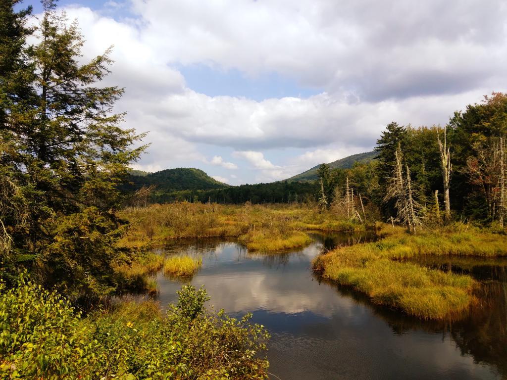
Kunjamunk River from Long Level Bridge

September Trip to Rensselearville State Forest – September 15-17 (2 nights)

With time being fairly tight and the weather only so-so I decided to do a two night trip close to home out in Rennselearville to ride some of the gravel trails, explore the OSI Parcel further and just enjoy an early autumn weekend camping.
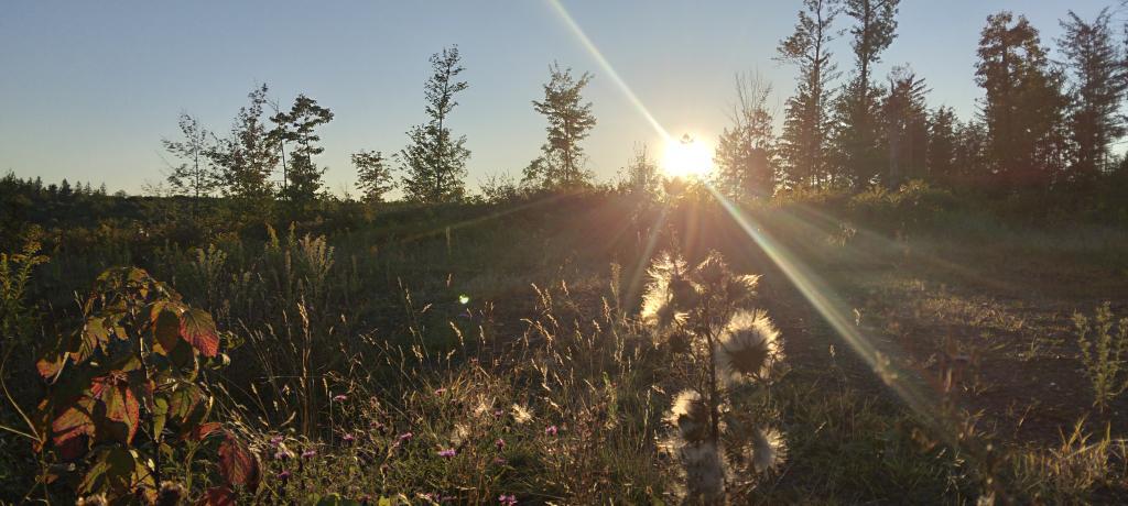
Evening

Columbus Day at Rensselearville State Forest – October 8-9 (1 night)

Columbus Day Weekend was cold and rainy for the first half of the weekend, but the Sunday heading into Columbus Day was nice, so I decided to head out to Rensselaerville for a quick overnight at the campsite on CCC Road. Leaves were late this year, so not a lot of color, but it still was nice to get away for a night and ride some of the trails around.
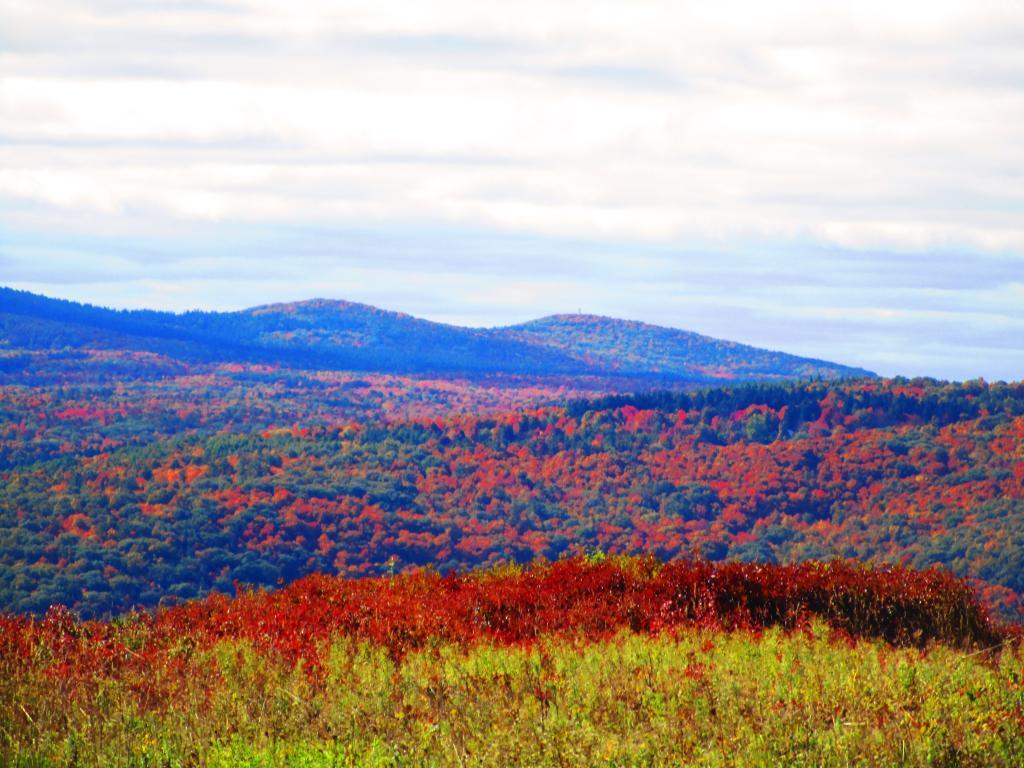
Leonard Hill

West Virginia Trip – October 21-29 (8 nights)

The banner trip of the year was my trip down to West Virigina. While it started and ended in rain, it was a very enjoyable trip with lots of new adventures this year. Camped the balance of the week — 6 nights in Canaan Heights — doing day trips from that area. Overnighted one night driving down at County Bridge Campground in Pennsylvania, and a on the way back camped overnight at Long Pond State Forest in New York. Adventures in West Virginia included hiking at Dolly Sods, mountain biking at night in the sods of Canaan Heights, riding up and hiking to Table Rock, exploring Blackwater Falls State Park on the mountain bike, MonPower Mountain Bike Park, Thomas Rail Grade and the Olson Firetower. Rode part of the Great Allegheny Trail through the Cumberland Passage, and the two sections of the Chesapeake and Ohio Canalway, including the Paw Paw Tunnel.
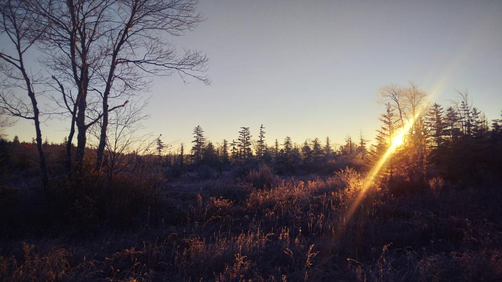
Sunrise

Stoney Pond – November 4-7 (3 nights)

A little over a week back from West Virginia, I headed out to Madison County to ride the Tassel Hill Mountain Bike Trails at Alfred Woodford, the Chenango Canal Trail in Hamilton and Erie Canalway from Chittenango to Green Lakes State Park and then to Canastota and Wampsville. The first night was cold at Stoney Pond but the subsequent nights were quite pleasant and mild.

Old Canal Warehouse in Chittenango  [Expires November 19 2023]

Prospect Mountain – East Branch Sacanadaga – Buttermilk Falls/Hudson Special Management Area – November 24-28 (3 nights)

Strangely enough, I had never been up Prospect Mountain. So I decided the day after Thanksgiving (Black Friday) to hike up Prospect Mountain, and then spend the next two nights camping on East Branch of the Sacandaga River. The Saturday and Sunday was fairly cold, so I ended up spending the bulk of day hanging around camp, doing a bit of hiking around Fox Lair. Sunday, evening around 8 PM it started to sleet, then snow, then rain, Monday morning, it turned into a white globby snow, and I ended up taking down camp fairly early after discovering I was out of propane and then spent much of the day exploring the Hudson River Special Management Area – Buttermilk Falls.
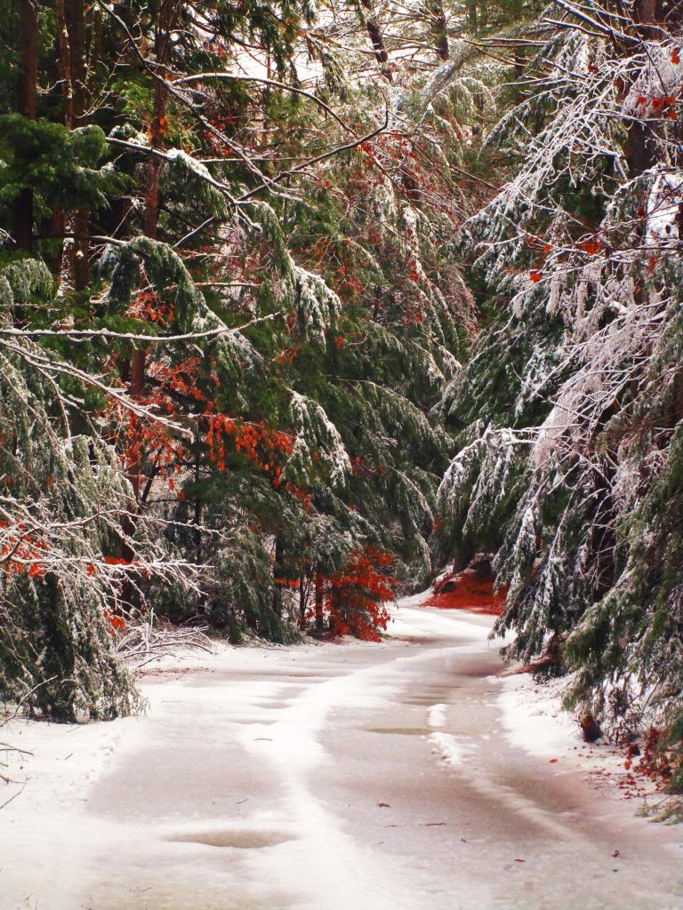
Icy River Road

Stoney Pond – Charles Baker – December 21-26 (5 nights)

On the days leading up to Christmas I decided to take a second trip to Madison County. I was originally planning to camp two nights at Stoney Pond then two nights at the Charles Baker Horse Camp but my family’s holiday plans were cancelled due to illness in my family, so I ended up staying an extra night at the horse camp, through the day after Christmas. On Friday, I rode the Erie Canalway from Canastota to East Verona, nearly to Rome. On Christmas Day I rode around many of truck trails at Charles Baker with my mountain bike, leaving my face splattered with mud. Many of the days were fairly cold and cloudy, but that’s too be expected in late December. Still it was a special way to spend Christmas.
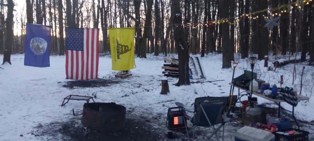
Camp on this cold but still morning ?

Another work week draws to a close with the holiday party today 🀢

One week until the start of the Christmas Weekend and two until New Years Eve Weekend. Both weeks will be abbreviated as I plan to take off next Friday and the following Monday and Tuesday after Christmas where I work are holidays. Lot of work projects on my desk as I pack up my office and get ready to do a trip out to Madison County next week. Today is Bill of Rights Day and also the 56th anniversary of the Silver Bridge Disaster down in Point Pleasant, WV.

Good morning! Happy Friday. Only two more left this year. Mostly clear at the freezing point πŸŒ… in Delmar, NY. There is a south-southeast breeze at 6 mph. πŸƒ. Going to be a nice day. Will be a bit cold for riding into work but I’ve done it in much colder weather for sure. Time goes by so quickly it seems.

The ride to work 🚲 was pleasant and if leave early from the party πŸŽ‰ I’ll be able to ride home after getting a beer 🍻 at City Beer Hall. I haven’t decided what’s for dinner tonight, last night fried up some left over riggis from last week’s Sunday dinner with corn, butternut squash, tofu, mushrooms and onions. Not too bad. Had some more of that rye bread I made up. Maybe I should stop frying things up, but it’s so good especially with some spices, and a little avocado oil isn’t the most unhealthy thing ever. You need some fats in your diet to absorb fat soluble vitamins, and omega-3 fats are the healthier option to do so.

Today will be sunny 🌞, with a high of 50 degrees at 1pm. 12 degrees above normal, which is similar to a typical day around November 15th. South wind 6 to 16 mph becoming northwest in the afternoon. A year ago, we had mostly sunny skies in the morning with some clearing in the afternoon. The high last year was 33 degrees. The record high of 61 was set in 2015. 8.2 inches of snow fell back in 1968.❄

The cookies πŸͺ I baked for cookie share day were kind of disappointing in my book, rather bland and too tart. The whole wheat flour I used was grainy, the stevia wasn’t sweet enough and had an after taste not balancing out the cranberries well. πŸ’ I need to experiment with other sweeteners like monk fruit, or maybe honey or pure maple syrup, or just plain old sugar. Not everything has to be perfectly healthy, though I don’t want to get in the habit of consuming large amounts of unhealthy sugar, though I guess it’s somewhat balanced by the whole-wheat red flour adding fiber. Truth is I’ve kind of gotten to really dislike the taste of stevia — I first got into it for sweetening lemonade in the summer as a healthy low-calorie alternative to beer while camping, but the after taste it leaves in my mouth is kind of yucky, and I don’t like how it tastes with baking those cookies.

Solar noon 🌞 is at 11:51 am with sun having an altitude of 24.1° from the due south horizon (-46.7° vs. 6/21). A six foot person will cast a 13.4 foot shadow today compared to 2.2 feet on the first day of summer. The golden hour πŸ… starts at 3:38 pm with the sun in the southwest (231°). πŸ“Έ The sunset is in the west-southwest (239°) with the sun dropping below the horizon at 4:23 pm after setting for 3 minutes and 24 seconds with dusk around 4:54 pm, which is 14 seconds later than yesterday. πŸŒ‡ At dusk you’ll see the Waxing Crescent πŸŒ’ Moon in the south-southwest (213°) at an altitude of 15° from the horizon, 228,509 miles away. πŸš€ The best time to look at the stars is after 5:31 pm. At sunset, look for clear skies πŸŒ„ and temperatures around 47 degrees. There will be a northwest breeze at 13 mph. Today will have 9 hours and 7 minutes of daytime, a decrease of 30 seconds over yesterday.

Tonight will have increasing clouds ☁, with a low of 34 degrees at 5am. 11 degrees above normal, which is similar to a typical night around November 9th. Northwest wind around 7 mph becoming northeast after midnight. In 2022, we had cloudy skies in the evening, which became light rain by the early hours of the morning. It got down to 33 degrees. The record low of -11 occurred back in 1917.

It’s annoying having that broken burner on my stove, ♨️ so I need to get that part this weekend. I am pretty sure it’s a standard 6 inch burner, and I can get that at Lowes for $11 so I am not going to bother my landlord. I’ll replace the drip trays again, which after about 3 or 4 years have burned through again. I really enjoy cooking, πŸ‘©‍🍳 so I want to make sure my stove is in top shape, especially as I often find myself using all four burners, and that’s the largest burner on my stove.

On December 15, 1967, the Silver Bridge collapsed under the weight of rush-hour traffic, resulting in the deaths of 46 people. Two of the victims were never found. πŸŒ‰ The Silver Bridge was an eyebar-chain suspension bridge built in 1928 and named for the color of its aluminum paint. The bridge carried U.S. Route 35 over the Ohio River, connecting Point Pleasant, West Virginia, and Gallipolis, Ohio. Investigation of the wreckage pointed to the cause of the collapse being the failure of a single eyebar in a suspension chain, due to a small defect 0.1 inches (2.5 mm) deep. Analysis showed that the bridge was carrying much heavier loads than it had originally been designed for and had been poorly maintained. The collapsed bridge was replaced by the Silver Memorial Bridge, which was completed in 1969.

Also, today in 2000, was an the end of an era at the infamous Chernobyl Power Plant. Reactor No. 4 was the site of the Chernobyl disaster in 1986, and the power plant is now within a large restricted area known as the Chernobyl Exclusion Zone. βš› Both the zone and the former power plant are administered by the State Agency of Ukraine on Exclusion Zone Management. The three remaining reactors remained operational after the accident; all three were eventually shut down by 2000, and the plant remains in the process of decommissioning as of 2019. Nuclear clean-up is scheduled for completion in 2065.

Tomorrow will be partly sunny 🌞, with a high of 45 degrees at 12pm. Seven degrees above normal, which is similar to a typical day around November 27th. West wind 6 to 8 mph becoming north in the afternoon. A year ago, we had mostly sunny skies in the morning with some clearing in the afternoon. The high last year was 35 degrees. The record high of 61 was set in 2021. 9.5 inches of snow fell back in 1981.❄

Planning on riding to the French’s Mills 🚲 and maybe the Pine Bush tomorrow. Should be a good day for a nice ride. Also need to put the hub caps back on my truck. I am thinking either Saturday night to go shopping and get the replacement burner or maybe Sunday morning. Depends how tired I am from lots of biking.

Looking ahead to Sunday, rain likely, mainly after 1pm. β˜” Cloudy, with a high near 47. Southeast wind 7 to 10 mph. Chance of precipitation is 60%. New precipitation amounts of less than a tenth of an inch possible. Typical average high for the weekend is 38 degrees.

Sunday going to the Nutcracker πŸ‘ͺ with the family, that is after going grocery shopping early in the morning. Then probably bake some bread later on in the day. 🍞 And head to bed fairly early.

Looking ahead to longer days and ultimately summer, next Friday is Days are Getting Longer β˜€οΈ when the sun will be setting at 4:27 pm with dusk at 4:57 pm. By then we’ve already gained almost five minutes in the evening. First full day of winter. But probably won’t feel that way. On that day in 2022, we had partly cloudy, rain showers and temperatures between 34 and 19 degrees. Typically, the high temperature is 36 degrees. We hit a record high of 60 back in 1990.

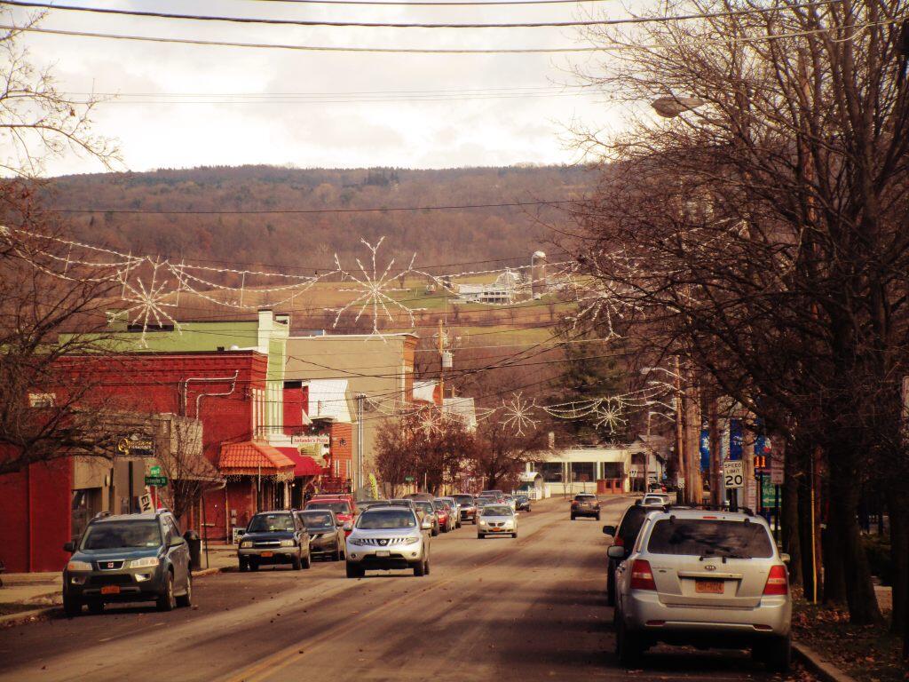
 Downtown

Homes in Albany County Built Before the Revolutionary War

State tax records list 86 homes that were built in Albany County prior to the Revolutionary War in 1776. Often these dates are wrong in the assessment records, but these still are some very old and historic properties in the county.

TownAddressYear Built
Albany369 Washington Ave1760
Altamont271 Brandle Rd1767
Altamont108 Main St1767
Berne520 Cole Hill Rd1700
Berne528 Cole Hill Rd1700
Berne228 Brookhaven Dr1700
Berne328 Woodstock Rd1720
Berne879 Bradt Hollow Rd1750
Berne52 Warner-Hayden Rd1750
Bethlehem190 Old Quarry Rd1658
Bethlehem5 Anders Ln1700
Bethlehem259 Beaver Dam Rd1730
Bethlehem156 Creble Rd1735
Bethlehem629 Route 9W1738
Bethlehem1463 New Scotland Rd1742
Bethlehem168 Van Wies Point Rd1750
Bethlehem500 Feura Bush Rd1750
Bethlehem470 Old Quarry Rd1760
Bethlehem738 River Rd1760
Coeymans1356 Sr 1431700
Coeymans161 Blossom Hill Rd1700
Coeymans98-102 Stanton Rd1700
Coeymans28 Stone House Hill Rd1720
Coeymans173 Lawson Lake Rd1730
Coeymans72 Morehouse Rd1735
Coeymans92 Marshall Rd1742
Coeymans508 Biers Rd1750
Coeymans294 Old Ravena Rd1755
Coeymans29 Second St1760
Coeymans20 Main St1767
Coeymans276 Cr 1011774
Cohoes1 Van Schaick Ave1735
Colonie385 Wvlt Shaker Rd1700
Colonie477 Old Nisk Rd1762
Colonie34 Johnson Rd1770
Guilderland843 Alt-Voorh Rd1700
Guilderland429 Rt 1461734
Guilderland648 Alt-Voorh Rd1740
Guilderland100 Truax Ln Pr1742
Guilderland6130 Nott Rd1750
Guilderland100 Ballybay Ln Pr1750
Guilderland100 Mynderse Ln Pr1750
Guilderland6370-6374 Frenchs Hollow Rd1760
Guilderland590 Rt 1461760
Guilderland3069 Furbeck Rd1760
Guilderland6492 Dunnsville Rd1764
Guilderland1 Wallace Ln Pr1768
Guilderland100-102 Cerutti Ln Pr1770
Guilderland1934 W Old State Rd1770
Guilderland3981 Western Tpke1775
Knox1378 Township Rd1700
Knox301 Quay Rd1700
Knox485 Bozenkill Rd1731
Knox1576 Township Rd1750
Knox183 Bell Rd1750
New Scotland1940 Tarrytown Rd1690
New Scotland43 Brownrigg Rd1700
New Scotland57 Dryden Ln1711
New Scotland1376 Indian Fields Rd1746
New Scotland397 Rowe Rd1754
New Scotland361 Onesquethaw Creek Rd1755
New Scotland299 New Scotland South Rd1757
New Scotland1 Picard Rd1760
New Scotland1983 Indian Fields Rd1762
New Scotland1715 Tarrytown Rd1766
New Scotland85 Brownrigg Rd1767
New Scotland261 Clipp Rd1769
New Scotland2051 Indian Fields Rd1770
New Scotland60 Badgley Ln1770
New Scotland447 Picard Rd1770
Ravena50 Van Buren Ave1768
Rensselaerville162 CR 3541700
Rensselaerville162 CR 121725
Rensselaerville120 Grevatt Rd1749
Rensselaerville3073 SR 1451750
Rensselaerville151 Willsey Rd1750
Rensselaerville359 Cheese Hill Rd1750
Rensselaerville795 Cheese Hill Rd1750
Rensselaerville1468 CR 3511750
Rensselaerville128 Field Rd1768
Rensselaerville2 Snyder Ln1770
Rensselaerville44 Miller Rd1770
Watervliet633 Broadway1770
Westerlo47 Cty Rte 11700
Westerlo3 May Rd1700
Westerlo978 Cty Rte 4011750