Search Results for: map old route 30

A very pleasant summer morning 🌅

Cool enough this morning to be reminded of what fall feels like without the humidity and wildfire smoke mugging you the moment you step outside. That said, autumn is just around the corner as is August. It will come quickly come August 8th when I’m back from summer vacation, and I loose all the sunlight in the evening as I’ll be back farther east.

Good morning! Mostly clear 🌅 and 61 degrees in Delmar, NY. Calm wind. The dew point is 56 degrees.

Out walking 🚶 at 6:15 am which probably isn’t good idea as I didn’t get to bed until much too late after the late return from the hike last night, which I followed by sitting out back for a while and then running inside, taking a shower 🚿 and checking carefully for ticks before bed 🛏. A hard boiled egg 🥚 and some grapes 🍇 for protein and sugar before the morning walk. Whole grain oatmeal with fresh blueberries and black berries with more black coffee after the morning walk.🫐🍓 Plus maybe some carrots 🥕 for a fiber boost.

Today will be sunny 🌞, with a high of 85 degrees at 4pm. One degree above normal. Maximum dew point of 61 at 10am. Calm wind becoming southeast around 6 mph in the afternoon. A year ago, we had mostly sunny skies. It was sticky. The high last year was 97 degrees. The record high of 97 was set in 1991.

Finally finished my bike build. 🚲 I’m much happier with Blackie now that I got all the accessories installed except the heavy gauge u-lock holder 🔒 because I’m debating if I should mountain on the frame or on the rack, for better balance center and axle wise versus blocking the location for future additional water storage unit under bike lights for safer nighttime riding for finding potholes and rough terrain on the trail. The waterproof phone holder is great with the Zeopoxa Cycling app which not only tells me my speed but also distanced traveled and provides a map of my route. And every mile it barks out how many miles traveled, average speed and calories burnt. 🗣️

That said, I think the feature I like the most about my bicycle is the 13×15 crate I have mounted on my bike rack, now with a MIK adapter for quick release so I can load the box when it’s not on the bicycle or take off for transit on the bus or in my truck. 🧺 Or what riding in real rough country or greater efficiency. It’s great, you just throw whatever gear you want in it and go. Hammock, backpack, water, lunch, tools, etc. Also makes a good grocery carrier for heading home from the store. 🏪 Detach the crate, load in the store and I never have to worry buying too much groceries to haul home. Probably use it tonight for that purpose. Toss in the Bluetooth speaker 🔊 and have tunes 🎶 and podcasts to listen to plenty loud over the roar of traffic. Ended up using six plastic cable zip ties to secure the basket to the MIK adapter, it just worked better than bolts and washee with my particular crate. The crate is the weakest link, not the twist ties but I feel confident it could safely carry 20-30 lb of supplies or groceries. 🍏 While the rack is rated for 30 kg or 66 lb, the mount is 20 kg or 44 lb, I think the lightweight crate I installed probably couldn’t handle that much. But I don’t often get juice or milk at the grocery store — milk but usually at Stewarts where I walk, and only a gallon at most of the time. Bicycle water bottle holders are inexpensive, but I’m not sure the advantage over just tossing the water in the back. Maybe for long trips I’d want additional water closer to the front axle.

Solar noon 🌞 is at 1:02 pm with sun having an altitude of 68.1° from the due south horizon (-2.7° vs. 6/21). A six foot person will cast a 2.4 foot shadow today compared to 2.2 feet on the first day of summer. The golden hour 🏅 starts at 7:47 pm with the sun in the west-northwest (293°). 📸 The sunset is in the west-northwest (300°) with the sun dropping below the horizon at 8:29 pm after setting for 3 minutes and 19 seconds with dusk around 9:01 pm, which is 48 seconds earlier than yesterday. 🌇 At dusk you’ll see the Waxing Crescent 🌒 Moon in the west (275°) at an altitude of 15° from the horizon, 251,882 miles away. 🚀 The best time to look at the stars is after 9:44 pm. At sunset, look for partly clear skies 🌄 and temperatures around 76 degrees. The dew point will be 62 degrees. There will be a calm wind. Today will have 14 hours and 55 minutes of daytime, a decrease of one minute and 43 seconds over yesterday.

Well that certainly was an interesting evening hiking in the Norman’s Kill Ravine Preserve. 🚶 The loop trail was just longer than I expected and the terrain was more rugged then I would expect for suburban Delmar. Not even all that exciting, just a lot of ridges and swamps along a flatwater, very muddy from the recent rain ☔. I think the trails are a bit rougher than I would want to take my new mountain bike on but might walk them again come the autumn when things are colorful and the views are better. 🍂

Tonight will be mostly cloudy 🌥, with a low of 67 degrees at 4am. Four degrees above normal. Maximum dew point of 64 at 4am. South wind 3 to 7 mph. In 2022, we had mostly clear skies in the evening, which became partly cloudy by the early hours of the morning. It became very sticky as the night progressed. It got down to 72 degrees. The record low of 45 occurred back in 1974.

I am thinking tonight maybe of checking out another nature preserve along the Normans Kill, the Normans Kill Preserve behind the Justice Center on Normans Kill Boulevard next to Delaware Plaza. 🐸🌸 This preserve looks much more interesting then Normans Kill Ravines Preserve, and is much smaller / quicker hike, though a slightly longer bus ride. I was thinking I could go there and then go grocery shopping for the weekend thereafter, all using my bicycle. 🚴

On this day in 1969, Apollo 11’s crew successfully makes the first landing on the Moon 🌕 in the Sea of Tranquility. Americans Neil Armstrong and Buzz Aldrin became the first humans to walk on the Moon, well at least in England. Us Americans would get to watch it the next day. 📺 Funny how time zones work. The world conquered the moon, returned a half dozen times or so and got bored and gave up visiting the moon only three years later. 🌎 Worldly problems like Vietnam, pollution and inflation somehow seemed more important than visiting the moon. I guess they were, but to give up so quickly after a goal 🥅 was reached seems like a major societal cop out.

Continues to be a nice weekend on tap. ☺ That said, the muggers will return after the rain tonight into tomorrow. Saturday, isolated showers, with thunderstorms also possible after 2pm. Partly sunny, with a high near 80. West wind 6 to 9 mph. Chance of precipitation is 20%. Maximum dew point of 63 at 8am. Sunday, sunny, with a high near 84. Maximum dew point of 63 at 7pm. Typical average high for the weekend is 84 degrees.

The plan continues to be to head out of town for the weekend. 🏕 I am thinking early Saturday morning through mid-day Monday, after the rain stops. I am leaning towards Catskill Scenic Trail on Saturday morning from Grand Gorge to Stamford, then swim in Mine Kill State Park, then Sunday maybe mountain bike around Burnt-Rossman Hills State Forest truck trails. 🚴 I do want to get Shaul’s too, I haven’t decided if that will be Saturday or Sunday. 🌶 Probably Sunday as Shaul’s closes at 5 PM. ⌛ Maybe that could be another pool and bicycle day. 🏊 Biking along NY 30 from the Blenhiem Bridge and maybe doing another afternoon at Mine Kill Pool could be good for Sunday, even though I’d rather hang out at camp for the day and not have to take down camp or at least lock things up, and then have the fun of getting out of that rough site and the bumpy roads. But whatever. Then maybe more of the Catskill Scenic Trail on Monday morning, such as Stamford south to Bloomville. 🐮 🏊 And another swim before heading out to the folks house. 🏖 Truth is I don’t want to get home too late on Monday as I need to pack for summer vacation like the next day.

Looking ahead, there are 2 weeks until Campfire Day 🔥 when the sun will be setting at 8:15 pm with dusk at 8:45 pm. On that day in 2022, we had hot, mostly sunny and temperatures between 90 and 64 degrees. Typically, the high temperature is 83 degrees. We hit a record high of 97 back in 1975.

Across Cedar River Flow

At times I can be so impatient 🚲

Like waiting to pick up my mountain bike, Blackie, from the store or any time Big Red is in the shop which hopefully isn’t anytime soon though I still need to do that passenger seat air bag recall later this summer. The General keeps reminding me about the recall, but I rarely have passengers in my truck, so it’s not a top priority of mine, especially as it’s pain to take Red to dealership.

Good morning! What day is it? We’re climbing the Hump Day, of course. I’m also impatient for the weekend. Mostly sunny ☀ with some light fog and 66 degrees in Delmar, NY. Calm wind. The dew point is 63 degrees.

Nice morning today, lots of runners 🏃 🐶 and dog walkers out this morning including all the usual’s though both aren’t exclusive groups. It’s funny how when you do the same walk every day you see the same people and commuters driving to work every day. Now that I’ve gotten in better shape 🦵I’ve thought about maybe adding some jogging to my exercise program but I’d probably want to wear the sneakers 👟 I have in my closet, along with learning more about pacing and posture. Kind of had to run down to the bus stop 🚏for the express bus 🚍 yesterday that never came as apparently the driver pulled too far off the shoulder and got stuck in the mud letting a passenger on. I got a ride in with one of the other passengers. 🚘 Happens, it’s been wet, ⚡ and those electric buses they’ve been running on the Voorheesville Route are mad heavy compared to the normal buses.

11 3/4 miles walked and 40 flights of stairs up and down yesterday. 🚶 2 1/2 weeks of doing the stairs at work. I told one of my colleagues I’m now doing the stairs at work, and I got this look of you work on the 18th floor. Yesterday was cream of wheat, frozen blueberries and a dap of Greek yogurt for breakfast. So good but for a change eggs with spinach, mushroom, tomatoes and onions today. 🍳 It should make two breakfasts, maybe I’ll save it for Friday or Saturday might be good if I’m leaving early Saturday to head out of town. 🚲 Black beans, peppers, tomatoes and mushrooms for lunch – cold lunches are good in the heat. 🍱 Dinner was the remaining red kidney beans with sugar free maple syrup, plus a little of the mackerel – spinach/kale pasta salad, though I’m trying to limit that as it’s a bit greasy and is high in carbs from the pasta. 🍲

Today will have isolated showers, then scattered showers and thunderstorms after 11am. I am pretty sure thats just template text for summer. Mostly sunny ☀, with a high of 85 degrees at 3pm. One degree above normal. Maximum dew point of 68 at 10am. Calm wind becoming northwest 5 to 8 mph in the morning. Chance of precipitation is 40%. New rainfall amounts of less than a tenth of an inch, except higher amounts possible in thunderstorms. A year ago, we had mostly sunny skies. It became sticky as the day progressed. The high last year was 91 degrees. The record high of 96 was set in 1935.

Today I want to get to the farmers market on the Plaza 🌽 🍅 mostly in search 🔎 of tomatoes and sweet corn, basically in that order. I could almost kill for a fresh tomatoes but also sweet corn would be good. I know Stantons has both but they’re not convenient for me to get to, I’d have to drive out there. 🫐 Maybe more of the overpriced blueberries, they were good but I have frozen ones already in my freezer. I tend to prefer frozen fruits and vegetables at home while reserving good fresh ones for camping 🏕 not just as I lack freezer capacity but it gives me something to look forward to at camp, replacing the cookies 🍪 and junk food of the past. Maybe I can get fruits and vegetables in the Schoharie Valley this weekend. I should take an early lunch to ensure that I can get the best fruits and vegetables today, remembering to bring my reusable bag.

Accidentally double paid my credit card 💳 bill though it’s okay as I wanted to retire any outstanding debt before getting the bicycle 🚲 and then also before vacation 🏖 just so I had a safe margin in case of emergency on vacation. I’ll use the statement credit to cover it. Money is going to be a bit tight through next pay day on Tuesday but if I have to dip into rainy day for a few days not the end of the world. 💵

Solar noon 🌞 is at 1:02 pm with sun having an altitude of 69.4° from the due south horizon (-1.4° vs. 6/21). A six foot person will cast a 2.3 foot shadow today compared to 2.2 feet on the first day of summer. The golden hour 🏅 starts at 7:52 pm with the sun in the west-northwest (295°). 📸 The sunset is in the west-northwest (302°) with the sun dropping below the horizon at 8:34 pm after setting for 3 minutes and 23 seconds with dusk around 9:07 pm, which is 31 seconds earlier than yesterday. 🌇 The best time to look at the stars is after 9:52 pm. At sunset, look for partly cloudy skies 🌃 and temperatures around 76 degrees. The dew point will be 68 degrees. There will be a south breeze at 5 mph. Today will have 15 hours and 7 minutes of daytime, a decrease of one minute and 18 seconds over yesterday.

Today I will phone the bike shop 📞 to see how progress is going on building my bike if they don’t call by one or so. If it’s ready, I’ll try to sneak out of work at 4 pm with permission of course, get home get my truck and hurry over to the shop. I would like to start to breaking it in 🚲 even if I don’t have all the accessories I want before the weekend. 🌇 With the earlier sunsets, I would like to be able to bicycle out to Voorheesville or Five Rivers in evening, and then spend the evening out before riding home. I thought about walking to Five Rivers last night 🐸 but it’s a lot of walking in the sprawl either on Fisher Boulevard or the narrow NY 443, and I’d rather spend more time in the woods. But the bicycle could let me speed through that boring crap.

Honestly, the question most biting into my mind is will the Borranger MIK Rack fit on the XXL version of the Trek Marlin 6, 😕 which the internet doesn’t seem to have a good answer for or the cost since the recent inflationary increases. ⚙ I guess worse comes to worse, there are other rack systems you get online like the AVS and RackSystem, but I want something with a quick release for adding and removing the milk crate / storage basket I want to mount on there for hauling gear but be able to take off when the bike is in transit or I’m on narrow trails or otherwise don’t need the weight of the carrying container on the back. Getting adapters and quick release connectors on a generic bike rack might end up costing more 💰 so I’d rather stick with MIK as it seems like if I get it built in the rack, then I can get just get the plate I need for the milk crate.
Tonight will have scattered thunderstorms, mainly before 7pm. Mostly cloudy ☁️, with a low of 64 degrees at 6am. One degree above normal. Maximum dew point of 68 at 8pm. South wind around 5 mph becoming calm in the evening. Chance of precipitation is 30%. New precipitation amounts of less than a tenth of an inch, except higher amounts possible in thunderstorms. In 2022, we had mostly clear skies in the evening, which became cloudy by the early hours of the morning. It was somewhat humid. It got down to 62 degrees. The record low of 45 occurred back in 1939.

On this day in 1967, the Newark Riots begin with over six days of rioting, looting, and destruction leaving 26 dead. We really are fortunate that despite living troubled times, there has been no rioting in our cities this year. 🌆 2020 with all it’s disorder seems like a one shot deal, though I swear downtown is a lot rougher than it used to be before the pandemic but maybe I forgot after two years of remote work.

A very summer like weekend. 🏖 Saturday, showers likely and possibly a thunderstorm after 2pm. Partly sunny, with a high near 87. Chance of precipitation is 60%. Maximum dew point of 72 at 4pm. Sunday, a chance of showers, then showers likely and possibly a thunderstorm after 2pm. Mostly cloudy, with a high near 85. Chance of precipitation is 60%. Maximum dew point of 73 at 11am. Typical average high for the weekend is 84 degrees.

As of now I’m still on track for going out to Schoharie ⛺ 🚲 but things could change in the mean time. I’m watching the Sunday forecast closely. I’d really like to get two days of swimming 🏊 in the pool under my belt to prepare for summer vacation but not if Sunday is going to be bad weather. The auto show at the Power Authority would be fun, as riding the Catskill Scenic Trail.

One month 📅 from now will be Last Sunset After 8 PM 🌆 with dusk at 8:32 pm. Come August due to earth wobble we loose a lot of evening daylight though morning daylight declines slower.

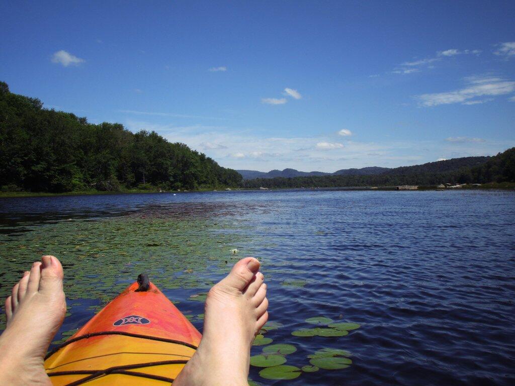
 Out On Lilly Lake

Empire Trail, Erie Canalway, Champlain Valley Trail Parking Areas

Name Address Latitude Longitude
Mohawk Hudson Bike Hike Trail (Albany to Peebles Island State Park) – 10.8 miles
Riverfront Garage 2 Columbia St, Albany, NY 12207 42.65149 -73.74890
Corning Preserve Parking Area Quay St, Albany, NY 12207 42.65346 -73.74496
Corning Preserve Boat Launch Parking Water St, Albany, NY 12207 42.65612 -73.74286
Mohawk Hudson Bike Hike Trail 330 Broadway, Watervliet, NY 12189 42.70950 -73.70495
Peebles Island State Park 1 Delaware Ave North, Cohoes, NY 12047 42.78469 -73.68042
Waterford Parking Lot Front St, Waterford, NY 12188 42.78592 -73.67788
Hudson Shores Park 23rd Street, Watervliet, NY 12189 42.73216 -73.69710
Green Island Trail Parking 260 Cannon St, Green Island, NY 12183 42.75824 -73.68804
Champlain Canalway Trail (Peebles Island State Park to Halfmoon) – 5.6 miles
Waterford Harbor Visitor Center 1 Tugboat Alley, Waterford, NY 12188 42.78741 -73.67902
Park at the Point 61 South St, Waterford, NY 12188 42.78823 -73.68159
Town of Halfmoon Trailhead Parking Brookwood Rd, Waterford, NY 12188 42.83700 -73.67586
Town of Halfmoon Trailhead Upper Newtown Rd, Mechanicville, NY 12118 42.86098 -73.68230
Lighthouse Park Halfmoon 597 Hudson River Rd, Waterford, NY 12188 42.83821 -73.67215
CCT Parking Schoolhouse Ln @ Bells Ln, Waterford, NY 12188 42.81920 -73.67628
On-Road Section (Halfmoon to Schuylerville) – 18.7 miles
Zim Smith East Trailhead 1044 Elizabeth St Exd, Mechanicville, NY 12118 42.90909 -73.70276
Champlain Canalway Trail (Schuylerville to Fort Miller) – 6.7 miles
Old Schuylerville Junction Lock County Rt 42, Schuylerville, NY 12871 43.11263 -73.57849
Hudson Crossing Park Co Rd 42, Schuylerville, NY 12871 43.11456 -73.57742
Schuylerville Visitor Center 30 Ferry St, Schuylerville, NY 12871 43.10001 -73.57954
Fort Hardy Park Reds Rd, Schuylerville, NY 12871 43.10025 -73.57857
Champlain Canalway Trail (Fort Edward to Fort Ann) – 11.9 miles
Fort Edward Adult Exercise Park 39 Mc Intyre St, Fort Edward, NY 12828 43.27362 -73.57990
Feeder Canal Trail Parking Towpath Ln, Fort Edward, NY 12828 43.28390 -73.56889
Champlain Canalway Trail Parking Baldwin Corners Rd, Fort Ann, NY 12827 43.39027 -73.48666
Champlain Canal Lock C-9 2450 NY-149, Fort Ann, NY 12827 43.35247 -73.49676
Champlain Canalway Trail New Swamp Rd, Hudson Falls, NY 12839 43.33236 -73.51177
Feeder Canal Trail Parking 2425 Burgoyne Ave, Hudson Falls, NY 12839 43.29780 -73.56977
Champlain Canalway Trail (Fort Ann to Comstock) – 5.1 miles
Fort Ann Canal Park Ann St, Fort Ann, NY 12827 43.41416 -73.48546
Champlain On-Road Bicycle Route (Whitehall to Ticonderoga) – 25.5 miles
TR41-Whitehall NEW Skenesborough Dr, Whitehall, NY 12887 43.55176 -73.40285
Champlain On-Road Bicycle Route (Ticonderoga to Westport) – 26.8 miles
Bicentennial Park McCormick St, Ticonderoga, NY 12883 43.84908 -73.42144
Westport Trailhead Main St (Route 9N), Westport, NY 12993 44.18174 -73.43264
Champlain On-Road Bicycle Route (Westport to Keeseville) – 30.8 miles
Keeseville Trailhead Front St, Keeseville, NY12944 44.50545 -73.48007
Champlain On-Road Bicycle Route (Keeseville to Plattsburgh) – 14.1 miles
Terry Gordon Bike Path Nevada Oval, Plattsburgh, NY 12901 44.67275 -73.44310
Champlain On-Road Bicycle Route (Plattsburgh to Rouses Point) – 25.8 miles
Plattsburgh Public Parking Green St, Plattsburgh, NY 12901 44.69910 -73.44864
Terry Gordon Bike Path Hamilton & Jay St, Plattsburgh, NY 12901 44.69380 -73.44494
Rouses Point Trailhead 39 Lake St, Rouses Point, NY 12979 44.99658 -73.36542
Shoreline Trail – 8 miles
Fishing and Kayaking South St, Buffalo, NY 14204 42.86554 -78.86801
Buffalo Harbor State Park Boat Launch 1111 Fuhrmann Boulevard, Buffalo, NY 14203 42.84629 -78.86315
Tifft Nature Preserve 1200 Fuhrmann Boulevard, Buffalo, NY 14203 42.84627 -78.85944
Buffalo Harbor State Park 1111 Fuhrmann Boulevard, Buffalo, NY 14203 42.84517 -78.86158
Shoreline Trail (Buffalo) – 8 miles
Lasalle Park DAR Drive, Buffalo, NY 14202 42.89368 -78.89556
Erie Canalway Trail (Tonawanda to Amherst) – 9.4 miles
Tonawanda EST Gateway 72 E Niagara St, Tonawanda, NY 14150 43.02244 -78.87073
Shoreline Trail (Buffalo to Tonawanda) – 9.4 miles
Riverwalk Parking 200 Niagara St, Tonawanda, NY 14150 43.01935 -78.88756
Niawanda Park 200 Niagara St, Tonawanda, NY 14150 43.01781 -78.88921
Riverwalk Parking 200 Niagara St, Tonawanda, NY 14150 43.01549 -78.89387
Niawanda Park Shoreline Trail, Tonawanda, NY 14150 43.01300 -78.90021
Niawanda Park 600 Niagara St, Tonawanda, NY 14150 43.01111 -78.90557
Niawanda Park 600 Niagara St, Tonawanda, NY 14150 43.00952 -78.91018
Niawanda Park 600 Niagara St, Tonawanda, NY 14150 43.00837 -78.91334
Niawanda Park 600 Niagara St, Tonawanda, NY 14150 43.00715 -78.91629
Isle View County Park 796 Niagara St, Tonawanda, NY 14150 43.00175 -78.92581
Aqua Lane Park 128 Aqua Ln, Tonawanda, NY 14150 42.96398 -78.92198
Black Rock Harbor Road Fort Ontario, Buffalo, NY 14207 42.94669 -78.90924
Black Rock Canal Park Aqua Ln, Buffalo, NY 14207 42.94531 -78.90952
Ontario Boat Launch Dog Park Fort Ontario, Buffalo, NY 14207 42.94442 -78.90943
Shoreline Trail – 9.4 miles
Towpath Park Hertel Ave, Buffalo, NY 14207 42.93993 -78.90773
Erie Canalway Trail (Tonawanda to Amherst) – 10 miles
Buffalo Niagara Heritage Village 3755 Tonawanda Creek Rd, Amherst, NY 14228 43.08452 -78.72916
Nature View Park Entrance 1087 Tonawanda Creek Rd, Buffalo, NY 14228 43.06125 -78.80003
Creekside Drive Picnic Area Creekside Dr, Tonawanda, NY 14150 43.02968 -78.82829
Creekside Drive Picnic Area Creekside Dr, Tonawanda, NY 14150 43.02484 -78.83238
Amherst Veterans Canal Park Tonawanda Creek Rd, Amherst, NY 14228 43.06492 -78.80158
Erie Canalway Trail (Amherst to Lockport) – 7.2 miles
Lockport Canal Bike Trail 151-217 State Rd, Lockport, NY 14094 43.16407 -78.70088
East Canal Road Parking E Canal Rd, Lockport, NY 14094 43.13259 -78.72467
Erie Canalway Trail Parking 5557-5599 Feigle Rd, Lockport, NY 14094 43.11317 -78.73737
Erie Canalway Trail (Lockport to Middleport) – 12 miles
Erie Canalway Trail Day Rd & N Canal Rd, Lockport, NY 14094 43.19173 -78.64967
Erie Canalway Trail Parking 7839 LA-57, Lockport, NY 14094 43.18668 -78.66616
Erie Canalway Trail Parking Peet St, Middleport, NY 14105 43.21479 -78.50538
Erie Canalway Trail Parking Hartland Rd, Gasport, NY 14067 43.19985 -78.57615
Lockport Gateway Parking Canal St, Lockport, NY 14094 43.17069 -78.69381
Erie Canalway Trail (Middleport to Albion) – 18.8 miles
Erie Canalway Trail Parking Bates Rd, Medina, NY 14103 43.23052 -78.37135
Erie Canalway Trail Parking Horan Rd, Medina, NY 14103 43.22577 -78.38031
Erie Canalway Trail Parking North Gravel Rd, Medina, NY 14103 43.22573 -78.39221
Middleport Trailhead Front St, Middleport, NY 14105 43.21348 -78.47537
Erie Canalway Trail Parking N Main St, Albion, NY 14411 43.24927 -78.19254
Erie Canalway Trail (Albion to Brockport) – 11.4 miles
Sans Souci Canal Park 4159 County Line Rd, Brockport, NY 14420 43.22226 -77.99676
Erie Canalway Trail Parking 1 Holley Falls Park Rd, Holley, NY 14470 43.22795 -78.02189
Erie Canalway Trail Parking Densmore Rd, Albion, NY 14411 43.25000 -78.13532
Brockport Trailhead Redman Rd (Rt 31), Brockport, NY 14420 43.21436 -77.96716
Erie Canalway Trail Parking N Main St, Brockport, NY 14420 43.21703 -77.93834
Erie Canalway Trail (Brockport to Rochester) – 19.2 miles
Erie Canalway Trail N Union St (Rt 259), Spencerport, NY 14559 43.19388 -77.80052
Erie Canalway Trail Access Lee Rd, Rochester, NY 14606 43.17123 -77.68022
Greece Canal Park 343 Elmgrove Rd, Rochester, NY 14626 43.19127 -77.73625
Greece Canal Park 343 Elmgrove Rd, Rochester, NY 14626 43.19877 -77.73751
Henpeck Park 2901 Ridgeway Ave, Rochester, NY 14626 43.18833 -77.73134
Genesee Valley Park 149 Elmwood Ave, Rochester, NY 14611 43.12358 -77.64017
Erie Canalway Trail (Rochester to Fairport) – 14.7 miles
Erie Canalway Trail Parking Marsh Rd, Pittsford, NY 14534 43.07433 -77.49283
Great Embankment Park Marsh Rd, Pittsford, NY 14534 43.07355 -77.49023
Lock 32 Canal Park 2759 Clover St, Pittsford, NY 14534 43.09300 -77.54798
Meridian Centre Park 2025 Meridian Centre Blvd, Rochester, NY 14618 43.10523 -77.59538
Erie Canalway Trail Parking S Clinton St, Rochester, NY 14618 43.10621 -77.59950
Erie Canalway Trail Parking 3 Schoen Pl, Pittsford, NY 14534 43.09200 -77.51250
Genesee Valley Park Hawthorne Dr, Rochester, NY 14620 43.11628 -77.63802
Lock 33 Canal Park Trailhead 1159-1175 Edgewood Ave, Rochester, NY 14618 43.09616 -77.56898
Perinton Community Park 99 O’Connor Rd, Fairport, NY 14450 43.10078 -77.45640
Genesee Valley Park Gateway Moore Rd, Rochester, NY 14620 43.11977 -77.63706
Erie Canalway Trail (Fairport to Palmyra) – 10.2 miles
Erie Canalway Trail Parking Wayneport Rd, Macedon, NY 14502 43.07609 -77.36101
Erie Canalway Trail Parking Cobb’s Ln, Fairport, NY 14450 43.09620 -77.43081
Macedon Bridge Parking O’Neil Rd, Macedon, NY 14502 43.07035 -77.28931
Erie Canalway Trail (Palmyra to Newark) – 10.2 miles
Pal-Mac Park 555 W Main St, Palmyra, NY 14522 43.06407 -77.24792
Erie Canalway Trail (Palmyra to Newark) – 9.6 miles
Harder Canal Park West Shore Rd, Newark, NY 14513 43.05272 -77.12667
On-Street Parking Van Buren St, Newark, NY 14513 43.04786 -77.09380
Swift Landing County Park Hogback Hill Rd, Palmyra, NY 14522 43.06683 -77.18848
Palmyra Marina Division St, Palmyra, NY 14522 43.06573 -77.22933
Erie Canalway Trail (Newark to Savannah) – 20.4 miles
Galen Boat Launch Water St, Clyde, NY 14433 43.08016 -76.87079
Abbey Park Trailhead 177 Water St, Lyons, NY 14489 43.06384 -77.00222
Erie Canalway Trail Parking Old Lyons Rd, Newark, NY 14513 43.06357 -77.02061
Lock 28B Canal Park 106 N Clinton St, Newark, NY 14513 43.04724 -77.08449
Empire State Bicycle Route (Savannah to Port Byron) – 10.2 miles
Old Erie Canal Heritage Park 1575 Rooker Dr, Port Byron, NY 13140 43.03579 -76.63501
Erie Canalway Trail (Port Byron to Camillus) – 20.2 miles
Nancy Brown Wildlife Sanctuary Warners Rd, Camillus, NY 13031 43.06302 -76.26889
Lock 51 Parking Route 31, Jordan, NY 13080 43.06668 -76.49592
Erie Canalway Trail Parking Route 31 (Erie Dr), Weedsport, NY 13166 43.04336 -76.57577
Nine Mile Creek Aqueduct Thompson Rd, Camillus, NY 13031 43.05869 -76.28733
Erie Canal Park 5750 Devoe Rd, Camillus, NY 13031 43.05262 -76.30320
Warners Park Newport Rd, Warners, NY 13164 43.07605 -76.32720
Schasel Park Trailhead 20-28 Utica St, Port Byron, NY 13140 43.03748 -76.61930
Empire State Trail (Camillus to Syracuse) – 9.2 miles
Inner Harbor Creekwalk W Kirkpatrick St, Syracuse, NY 13204 43.05922 -76.16602
Gere Lock Parking Horan Rd, Syracuse, NY 13209 43.06878 -76.23436
Loop the Lake Trail 280 Restoration Way, Syracuse, NY 13209 43.06680 -76.19696
Creekwalk Parking Bear St W, Syracuse, NY 13204 43.06129 -76.16960
State Fairgrounds Trailhead Gate 2 State Fair Blvd, Syracuse, NY 13209 43.07324 -76.21563
Reed Webster Park Warners Rd, Camillus, NY 13031 43.06405 -76.26878
Erie Canalway Trail (DeWitt to Chittenango) – 10.6 miles
Cedar Bay Park Lyndon Rd, Fayetteville, NY 13066 43.04328 -76.03750
Old Erie Canal State Park – Minoa Green Lakes Rd, Fayetteville, NY 13066 43.05389 -76.00029
Old Erie Canal State Park N Burdick St, East Syracuse, NY 13057 43.04350 -76.02227
Old Erie Canal State Park Kirkville Rd N, Kirkville, NY 13082 43.07030 -75.94932
Old Erie Canal State Park – Poolsbrook Andrus Rd, Kirkville, NY 13082 43.07335 -75.92142
DeWitt – Old Erie Canal State Park Butternut Dr, East Syracuse, NY 13057 43.04440 -76.05074
Erie Canalway Trail (Chittenango to Erie Canal Lock 21) – 19.6 miles
Old Erie Canal State Park Beebe Bridge Rd, Canastota, NY 13032 43.07399 -75.78531
Old Erie Canal State Park N Court St, Canastota, NY 13032 43.08891 -75.71069
Old Erie Canal State Park – Chittenango Lakeport Rd, Chittenango, NY 13037 43.06041 -75.87072
Erie Canalway Trail (Erie Canal Lock 21 to Rome) – 9.3 miles
Empire State Heritage Park NY-46, Rome, NY 13440 43.22640 -75.50188
Erie Canalway Trail (Rome to Utica) – 16.5 miles
Erie Canalway Trail Mohawk St, Marcy, NY 13403 43.13433 -75.27838
Lock 20 Trailhead 5842 NY-291, Marcy, NY 13403 43.14433 -75.29771
Oriskany Flats Wildlife Management Area Oriskany Rd (Rt 32), Oriskany, NY 13424 43.16634 -75.32525
Erie Canalway Trail Parking NY-69, Oriskany, NY 13424 43.16014 -75.33278
Erie Canalway Trail Parking Rome Oriskany Road, Rome, NY 13440 43.19383 -75.43258
Bellmay Harbor Park 139 E Whitesboro St #111, Rome, NY 13440 43.20229 -75.44865
Erie Canalway Trial Parking E Whitesboro St, Rome, NY 13440 43.20200 -75.45406
Gyziec Field Parking S James St & Muck Rd, Rome, NY 13440 43.20253 -75.46768
NYSCC-Utica 39-99 Harbor Lock Rd E, Utica, NY 13502 43.11242 -75.21740
Erie Canalway Trail (Frankfort to Little Falls) – 10.8 miles
Mohawk Boat Launch 102 E Main St, Mohawk, NY 13407 43.01485 -74.99466
Ilion Marina 190 Central Ave, Ilion, NY 13357 43.02058 -75.03039
German Flatts Town Park 575 NY-5S, Mohawk, NY 13407 43.01797 -74.95521
Erie Canalway Trail Parking W Shore St, Little Falls, NY 13365 43.03757 -74.86073
Erie Canal Lock E-18 State Route 5S, Mohawk, NY 13407 43.01600 -74.91772
Erie Canalway Trail (Little Falls to Canajoharie) – 18.7 miles
Erie Canalway Trail Parking Bridge St @ S Saint Johnsville Rd, Fort Plain, NY 13339 42.99223 -74.68075
Canajoharie Trailhead Old Fort Plain Rd, Canajoharie, NY 13317 42.90505 -74.58544
Herkimer Home SHS 200 NY-169, Little Falls, NY 13365 43.02756 -74.81748
Erie Canalway Trail (Canajoharie to Amsterdam) – 22.9 miles
Canalway Bike Parking Lot Bridge St, Amsterdam, NY 12010 42.93480 -74.19961
Auriesville Pilgrimage Lunch Area Queen Anne Road, Amsterdam, NY 12010 42.95260 -74.23838
Schoharie Crossing State Historic Site 129 Schoharie St, Fort Hunter, NY 12069 42.93994 -74.28280
Erie Canalway Trail (Amsterdam to Schenectady) – 16.9 miles
Erie Canalway Trail Parking Rice Rd, Schenectady, NY 12306 42.81765 -73.98462
Lock 8 Park 106 Rice Rd, Schenectady, NY 12306 42.82872 -73.99157
Rotterdam Kiwanis Park Route 5S, Rotterdam, NY 12306 42.84652 -74.01414
Erie Canalway Trail Parking Route 5S (River Rd), Pattersonville, NY 12137 42.89111 -74.08159
Mohawk River Gateway 1 Bridge St, Amsterdam, NY 12010 42.93520 -74.19560
Erie Canalway Trail (Schenectady to Niskayuna) – 10.9 miles
Lions Park 3439 Rosendale Rd, Niskayuna, NY 12309 42.77743 -73.82407
Lock 7 Park Lock 7 Rd, Schenectady, NY 12309 42.80253 -73.84749
Jeff Blatnick Park River Rd, Schenectady, NY 12309 42.81600 -73.86341
Erie Canalway Trail (Niskayuna to Green Island) – 10.5 miles
MHBHT Parking 27 Alexander St, Cohoes, NY 12047 42.76083 -73.70414
Erie Canalway Trail (Niskayuna to Cohoes) – 10.5 miles
MHBHT Parking Loudon Rd, Cohoes, NY 12047 42.79801 -73.73423
Colonie Mohawk River Park 71 Schermerhorn Rd, Cohoes, NY 12047 42.79498 -73.74503
Mohawk Riverside Landing Park 4071 River Rd, Schenectady, NY 12309 42.77184 -73.81475
Manhattan Greenway Trail (The Battery to Inwood Hill) – 13 miles
Riverside Park (limited parking) Henry Hudson Pkway Northbound @ W 96th St, Manhattan, NY 10025 40.79789 -73.97613
NYC On-Road Section (Inwood Hill to Van Cortlandt Park) – 3 miles
Manhattan Greenway Trail On-Street Parking 348 Dyckman St, New York, NY 10034 40.86824 -73.93033
Bronx and Westchester South County Trail (Van Cortlandt Park to Elmsford) – 13.6 miles
HF Redmond Park Redmond Park, Yonkers, NY 10701 40.93827 -73.86921
South County Trail Parking 132 Tuckahoe Rd, Yonkers, NY 10701 40.95519 -73.86624
South County Trail Parking Farragut Ave, Hastings-On-Hudson, NY 10706 40.98298 -73.86601
Great Hunger Memorial (VE Macy Park) Saw Mill River Parkway, Elmsford, NY 10523 41.02507 -73.84579
Tibbets Brook Park 355 Midland Ave, Yonkers, NY 10704 40.92976 -73.87722
Van Cortlandt Park Van Cortlandt Park S, The Bronx, NY 10463 40.88900 -73.89336
Tibbets Brook Park 355 Midland Ave, Yonkers, NY 10704 40.93049 -73.87427
South County Trail Parking Grey Oaks Ave, Yonkers, NY 10710 40.97597 -73.86766
On-Street Parking Broadway @ W 242nd St, Bronx, NY 10471 40.88919 -73.89824
Westchester North County Trail (Elmsford to New Castle) – 9.8 miles
South County Trail Parking Old Saw Mill River Rd (Route 303), Elmsford, NY 10523 41.08039 -73.82943
Tarrytown Lakes Park 209 Neperan Rd, Tarrytown, NY 10591 41.07811 -73.84834
Park and Ride Lot Old Saw Mill River Rd (Route 303), Elmsford, NY 10523 41.08239 -73.83067
North County Trail Parking Bedford Rd (Route 117), Pleasantville, NY 10570 41.12339 -73.81113
Walter Law Memorial Park Library Rd, Briarcliff Manor, NY 10510 41.14573 -73.82451
North County Trail Parking Route 100/N State Rd, Ossining, NY 10562 41.17522 -73.81163
Westchester Landing (Gov. Mario M. Cuomo Bridge) 333 S Broadway, Tarrytown, NY 10591 41.06540 -73.86343
Rockland Landing (Gov. Mario M. Cuomo Bridge) 267 S Broadway, Nyack, NY 10960 41.08169 -73.92205
Westchester North County Trail & Putnam Trailway (New Castle to Mahopac) – 16.1 miles
Mahopac Park and Ride Bucks Hollow Rd, Mohopac, NY 10541 41.37285 -73.73082
Putnam Trailway Parking Mt Hope Rd, Mahopac, NY 10541 41.37291 -73.72876
North County Trail Parking Station Rd (Route 133), Chappaqua, NY 10514 41.18680 -73.80079
Millwood Municipal Parking Route 133/Station Rd, Chappaqua, NY 10514 41.18968 -73.79717
North County Trail Parking Route 118 (Saw Mill River Rd), Yorktown Heights, NY 10598 41.23136 -73.77910
Yorktown Municipal Parking Kear St, Yorktown Heights, NY 10598 41.27055 -73.77999
Yorktown Heights Parking 363 Underhill Ave, Yorktown Heights, NY 10598 41.26911 -73.78163
Junior Lake Park 1939 Edgewater St, Yorktown Heights, NY 10598 41.27637 -73.77495
North County Trail Parking Route 118-Tomahawk St, Baldwin Place, NY 10505 41.34469 -73.75518
Bucks Hollow Rd Parking Bucks Hollow Rd (Off Route 6), Mahopac, NY 10541 41.36744 -73.73981
Putnam Trailway (Mahopac to Brewster) – 8 miles
Putnam Trailway Parking Mud Pond Rd, Mohapac, NY 10541 41.37876 -73.72301
Putnam Trailway Parking Willow Rd, Carmel Hamlet, NY 10512 41.41461 -73.68627
Putnam Trailway Parking 30 Tilly Foster Rd, Brewster, NY 10509 41.41327 -73.63908
Carmel Hamlet Parking 1808 US-6 (Stoneleigh Ave), Carmel Hamlet, NY 10512 41.41868 -73.67240
Maybrook Trailway (Brewster to Pawling) – 9.3 miles
Maybrook Trailway Parking – Lake Tonetta 146 Pumphouse Rd, Brewster, NY 10509 41.41778 -73.61374
Maybrook Trailway (Pawling to Hopewell Junction) – 14.8 miles
Maybrook Trailway Parking South Green Haven Rd, Poughquag, NY 12570 41.57587 -73.70843
Maybrook Trailway Parking 237 NY-292, Pawling, NY 12531 41.52423 -73.64727
Dutchess Rail Trail (Hopewell Junction to Poughkeepsie) – 13.6 miles
Dutchess Rail Trail Parking Diddell Rd, Wappingers Falls, NY 12590 41.62286 -73.85113
Dutchess Rail Trail Parking Van Wyck Lane, Wappingers Falls, NY 12590 41.60340 -73.83655
Dutchess Rail Trail Parking Railroad Ave, Hopewell Junction, NY 12533 41.58550 -73.80697
Victor Waryas Park 75 N Water St, Poughkeepsie, NY 12601 41.70748 -73.94009
Waryas Park 75 N Water St, Poughkeepsie, NY 12601 41.70700 -73.93943
Morgan Lake Park 51 Creek Rd, Poughkeepsie, NY 12601 41.71728 -73.90699
Overocker Rd Parking Area Overocker Rd, Arlington, NY 12603 41.69363 -73.88423
Old Manchester Rd Trail Parking Old Manchester Rd, Poughkeepsie, NY 12603 41.68336 -73.86533
LaGrange Trail Parking Old Machester Rd, Poughkeepsie, NY 12603 41.68297 -73.86347
Dutchess Rail Trail Parking 258 Titusville Rd, Poughkeepsie, NY 12603 41.65609 -73.85640
Dutchess Rail Trail Parking Lake Walton Rd, Hopewell Junction, NY 12533 41.60174 -73.83602
Walkway Over the Hudson 61 Parker Ave, Poughkeepsie, NY 12601 41.71244 -73.92491
Love Rd Parking Area 35-99 Love Rd, Arlington, NY 12603 41.69878 -73.88619
Hudson Valley Rail Trail (Lloyd to New Paltz) – 10.5 miles
Hudson Valley Rail Trail Haviland Rd Lot, Highland, NY 12528 41.71032 -73.95717
Hudson Valley Rail Trail Commercial Ave, Highland, NY 12528 41.71906 -73.96886
Hudson Valley Rail Trail New Paltz Rd, Highland, NY 12528 41.73418 -73.97483
Tony Williams Park S Riverside Rd, Highland, NY 12528 41.73595 -74.00204
HRVT South St Parking 565-557 NY-299, Highland, NY 12528 41.73749 -74.03449
Walkway Over the Hudson 87 Haviland Rd, Highland, NY 12528 41.71027 -73.95510
Sojourner Truth Park 55 Plains Rd, New Paltz, NY 12561 41.74322 -74.09299
Wallkill Valley Rail Trail (New Paltz to South Kingston) – 13.2 miles
DEC Wallkill Boat Launch 395 Springtown Rd, New Paltz, NY 12561 41.80199 -74.08566
WVRT Binnewater Parking 720 Binnewater Rd, Rosendale, NY 12472 41.84813 -74.08809
Ulster County Municipal Parking North Chestnut St, New Paltz, NY 12561 41.75464 -74.08436
Wallkill Valley Rail Trail Rt 32 and Rockwell Ln, Kingston, NY 12401 41.91026 -74.02140
WVRT Parking Coffey Rd, New Paltz, NY 12561 41.78143 -74.09244
Municipal Parking Lot Huguenot St, New Paltz, NY 12561 41.75075 -74.08973
Kingston Section (South Kingston – East Kingston) – 6.7 miles
City of Kingston Public Parking Dock St, Kingston, NY 12401 41.91696 -73.98465
West Strand Park Parking E Strand St, Kingston, NY 12401 41.91834 -73.98221
Rondout Landing Street Parking Rondout Lndg, Kingston, NY 12401 41.91917 -73.98089
Kingston Pt Rail Trail Parking East Chestnut St, Kingston, NY 12401 41.92687 -73.99380
Kingston Point Beach Delaware Ave Parking Lot, Kingston, NY 12401 41.92991 -73.96511
Hudson Valley On-Road Section (East Kingston to Tivoli) – 11.9 miles
Poets Walk Park 776 River Rd, Red Hook, NY 12571 41.98197 -73.91851
Tivoli Community Lot Broadway, Tivoli, NY 12583 42.05881 -73.91215
Tivoli Bays Wildlife Management Area Off Kidd Lane, Tivoli, NY 12583 42.03886 -73.91442
Hudson Brickyard Trail John St, Kingston, NY 12401 41.95186 -73.96395
Tivoli Bays Wildlife Management Area Kidd Lane, Tivoli, NY 12583 42.04595 -73.90676
Kingston-Rhinecliff Bridge Toll Plaza State Route 199 (NY-199), Kingston, NY  12402 41.98025 -73.96296
Kingston-Rhinecliff Bridge East Approach Parking State Route 199 (NY-199), Kingston, NY 12402 41.97267 -73.92535
Hudson Valley On-Road Section (Tivoli to Olana) – 16.1 miles
Clermont State Historic Site 1 Clermont Ave, Germantown, NY 12526 42.08409 -73.91881
Germantown Municipal Parking 189 Main St, Germantown, NY 12526 42.13217 -73.88266
Hudson Valley On-Road Section (Olana to Hudson) – 6.7 miles
Hudson Trailhead N 2nd St & Dock St, Hudson, NY 12534 42.25761 -73.78941
Hudson Skywalk Trailhead Routes 9G and 23, Hudson, NY 12534 42.21932 -73.83254
Albany-Hudson Electric Trail (Hudson to Kinderhook) – 10.5 miles
Stottville Park Trailhead Atlantic Ave, Stottville, NY 12172 42.28591 -73.73847
Stuyvesant Falls Trailhead CR 25A (Hudson Ave), Stuyvesant, NY 12174 42.35813 -73.73331
Stuyvesant Falls Park Lindenwald Ave, Stuyvesant, NY 12174 42.35723 -73.73241
Albany-Hudson Electric Trail (Kinderhook to Nassau) – 11.1 miles
Kinderhook Village Playground Park Rothermel Ave, Kinderhook, NY 12106 42.39639 -73.70419
Kinderhook / Valatie Trailhead Routes 9 & 9H, Valatie, NY 12184 42.40878 -73.69047
Niverville Trailhead Rt 203 and Main St (CR 28), Niverville, NY 12130 42.43335 -73.65889
Albany-Hudson Electric Trail (Nassau to East Greenbush) – 10.5 miles
Village of Nassau Trailhead John Street, Nassau, NY 12123 42.51454 -73.61221
Nassau Lake Trailhead County Route 7, Nassau, NY 12123 42.53585 -73.60887
North Chatham Trailhead Depot Street, North Chatham, NY 12132 42.47592 -73.63326
On-Road Section (East Greenbush to Albany) – 3.5 miles
Riverfront Park Trailhead Broadway, Rensselaer, NY 12144 42.64291 -73.74536
Clinton Street Trailhead Clinton St. and Columbia Turnpike (Rt 20), East Greenbush, NY 12061 42.61908 -73.73343
East Greenbush Trailhead Southern Avenue (at the intersection with Hudson Ave West), Rensselaer, NY 12144 42.61742 -73.73073

February 21, 2023 Night

Good evening! Cloudy and 38 degrees on this Tuesday evening for the walk. 🌥 There is a west-northwest breeze at 14 mph. 🍃. They were talking about rain but I haven’t gotten wet yet. Did rain a bit earlier looking out my office window.

It was a busy day at work 🏢 followed by a busy day of projects at home. But I managed to get in more than 17k steps today. You get the steps in early then there are more opportunities to get steps in later in the day. 👣

Tonight will have a slight chance of rain showers, mixing with snow after 9pm, then gradually ending. Partly cloudy 🌧, with a low of 29llgl degrees at 6am. 10 degrees above normal, which is similar to a typical night around March 24th. West wind 10 to 15 mph. Chance of precipitation is 20%. In 2022, we had clear skies in the evening, which became cloudy by the early hours of the morning. It got down to 19 degrees. The record low of -08 occurred back in 1963.

I was surprised to open my mail 📮 and see the State Board of Elections sent me the Albany County Voter File on a DVD 📀. Didn’t charge for it either. I had assumed that it would be a drop box link 🔗 to download. Of course it’s a bit of a problem as my computer no longer had a DVD player installed as my other hard drive is there. I didn’t know people used DVDs with bandwidth being so cheap. I feel silly for only requesting just the county file 📂 and not the state. But I only really plan to model on county data and help local candidates this year. Next year I’ll get the state file.

Tonight will have a Waxing Crescent 🌒 Moon with 4% illuminated. The Worm 🐛 Moon is on Tuesday, March 7. The darkest hour is at 12:10 am, followed by dawn at 6:16 am, and sun starting to rise at 6:45 am in the east-southeast (104°) and last for 2 minutes and 59 seconds. Sunrise is one minute and 30 seconds earlier ggGt porthan yesterday. 🌄 The golden hour ends at 7:24 am with sun in the east-southeast (111°). Tonight will have 13 hours and 4 minutes of darkness, a decrease of 2 minutes and 47 seconds over last night.

Working on another mapping project 🗺 for another local environment group. 🌎 This is kind of a fun project looking at potential routes for a bike 🚲 trail. It’s a little different than another one I’m doing with calculating distance of houses from a local hazardous waste site.☣️ Government databases and some statistical programming has gotten so powerful in recent years.

Tomorrow will have a chance of rain, mainly after 4pm. Increasing clouds 🌞 👉 🌥 , with a high of 41 degrees at 12pm. Three degrees above normal, which is similar to a typical day around March 3rd. Northwest wind 5 to 9 mph becoming southeast in the afternoon. Chance of precipitation is 30%. New precipitation amounts of less than a tenth of an inch possible. A year ago, we had mostly sunny skies in the morning with sunny skies in the afternoon. The high last year was 30 degrees. The record high of 68 was set in 1997. 14.8 inches of snow fell back in 1893.❄

This week marks a week until spring 🌷 though I’m sure it will get cold before then. But who knows it’s been a mild winter. Based on past experiences I don’t think it will get particularly warm out until about two months out from now.

In four weeks on March 21 the sun will be setting in the west (271°) at 7:09 pm (Daylight Savings Time),🌄 which is one hour, 33 minutes and 46 seconds later then tonight. In 2021 on that day, we had sunny and temperatures between 63 and 25 degrees. Typically, you have temperatures between 47 and 28 degrees. The record high of 78 degrees was set back in 1921.

Looking ahead, tommorow is , Average High is 40 ☀️ is Next Tuesday, First Day of Spring 💮 is a month away, Average High is 50 🌸 is in 5 weeks, Primary Day 🗳️ is in 17 weeks, Summer ️⛱️ is in 4 months, Independence Day 🇺🇸 is in 19 weeks, World Population Day 👩‍👩‍👧‍👧 is in 20 weeks, August 🌻 is in 23 weeks, World Mosquito Day 🐞 is in 6 months, Halloween 🎃 is in 36 weeks, Average High is 50 🍂 is in 38 weeks, Election Day 🗳️ is in 38 weeks, Repeal of Prohibition Day 🍺 is in 41 weeks, First Day of Winter ☃️ is in 10 months and Boxing Day 🥊 is in 44 weeks.

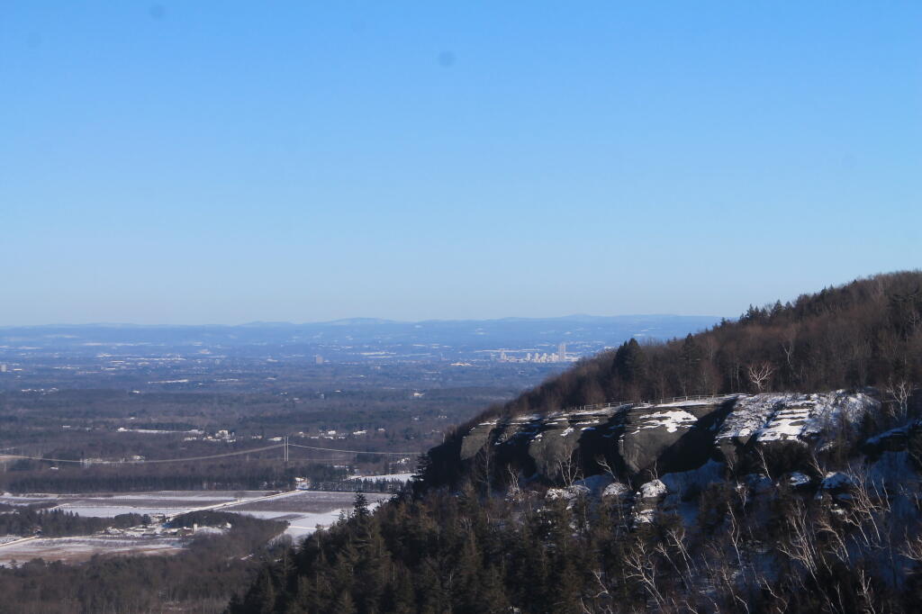
 Escarptment on Clear Winter Afternoon

The Catskill Wilderness Areas

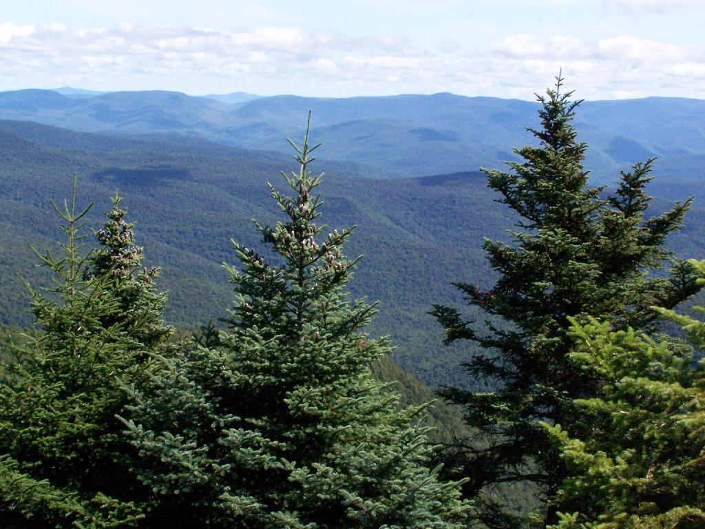
Trees and Mountains

The text of today’s fodder is based on the Catskill Park State Lands Master Plan, as revised in 2008. Maps were rendered by myself, using Quantum GIS and DEC Lands and Forests data.

Big Indian Wilderness

(Formerly Big Indian – Beaverkill Range Wilderness Area)

This wilderness is located in the Towns of Hardenburgh, Denning and Shandaken in Ulster County. It lies generally west of Oliverea and the Frost Valley Road, south of Belleayre Ski Center, east of Seager and Hardenburgh and north of Willowemoc and Claryville. The area ranges in width from 1 to 5 miles, is about 19 miles long and contains approximately 33,500 acres of land. Elevations range from 1,500 feet in McKenley Hollow to 3,840 feet where the state boundary crosses Doubletop Mountain. The mountains in the northeastern portion of the area are quite rugged, while those to the south and west are more characteristic of high hills. Water from the area flows into three New York City water supply reservoirs and the Delaware River Basin. Nine mountains or ridges with elevations of over 3000 feet make up the area.

Peaks

Doubletop* 3,860′
Haynes 3,420′
Big Indian 3,700′
Spruce 3,380′
Fir 3,620′
Eagle 3,600′
Hemlock 3,240′
Balsam* 3,600′
Beaver Kill Range 3,377′

* Maximum elevations given are not necessarily located within the Wilderness Area.

The forest cover is predominantly hardwood mixtures in various associations. Spruce and fir, while present at some of the higher elevations, are less noticeable here than in other Catskill wilderness areas.

Interior facilities consisting of foot trails and lean-tos are generally considered adequate.

Area statistics:

Approximate Area 33,500 Acres
Roads (non conforming) 1.4 Miles
Foot Trails 29.4 Miles
Lean-tos 6
Designated Campsites 5
Parking Lots 5
Public Use (visitors/year) 4,500
Exterior Boundary Line 67 Miles
Minimum Elevation 1,500′
Maximum Elevation 3,840′

Non-conforming uses:

Motor vehicle use of Black Bear Road from the wilderness boundary to Fall Brook Lean-to.

A UMP for this area was completed in June of 1993.

Hunter – West Kill Wilderness

(Formerly West Kill – North Dome Wilderness, Ox Clove Wild Forest, and a portion of the former Hunter Mountain Wild Forest)

The unit generally lies within the following boundaries: New York State Route 42 on the west, the Shandakan Wild Forest and NYS Route 28 to the south, and NYS Route 214 on the east. The northern extent of the unit is County Route 6, and continues along a line 100′ parallel to, and south or east of, the edge of Spruceton trailhead parking area and the centerline of the Spruceton Truck Trail, to the junction of the Colonel’s Chair Trail. A corridor, 100 feet either side of the center line of the Spruceton Truck Trail, from the Colonel’s Chair Trail to the summit of Hunter Mountain, culminating in a circle 175′ in radius from the center of the chimney on the observer’s cabin shall be within the Rusk Mountain Wild Forest.

The unit contains approximately 27,000 acres of land, and inside it’s boundaries are found the named mountain peaks of Balsam, Sherrill, North Dome, West Kill, Sheridan, Hunter and Southwest Hunter. Hunter Mountain is the second highest peak in the Catskills at 4,040 feet, and portions of it’s summit, along with a fairly extensive area on the summits of West Kill, North Dome and Sherrill Mountains are within the Catskill High Peaks Bird Conservation Area, and are of special significance in that they provide habitat for high elevation spruce-fir inhabitants such as Bicknell’s Thrush and the Blackpoll Warbler, among others.

There are currently two lean-to’s on the unit, the Diamond Notch lean-to located just off the Diamond Notch Trail, and the Devil’s Acre Lean-to off of the Devil’s Path Trail. Waters from this unit drain into Schoharie and Esopus Creeks and then into the Schoharie and Ashokan Reservoirs, which are in the New York City water supply system.

Area statistics:

Approximate Area 27,000 Acres
Foot Trails 18 Miles
Lean-to’s 2
Parking Lots 5
Minimum Elevation 920′ Maximum Elevation 4,040′

Indian Head Wilderness

(Formerly Plateau Mountain – Indian Head Mountain Wilderness Area)

This wilderness is located in the Town of Hunter, Greene County and the Towns of Saugerties and Woodstock, Ulster County. It lies generally west of the east boundary of the Catskill Park, south of Platte Clove, east of Devil’s Tombstone Campground and north of Lake Hill and Shady. The area ranges from 1 ½ miles to 3 ½ miles in width, is eight miles long and contains approximately 16,800 acres.

Elevations range from 900 to 3840 feet and the four major mountains in the area are visible against the skyline from all directions. Echo Lake, the only natural lake in a Catskill wilderness, is located in the east-central portion of the area. Water from this eastern section flows into the Kingston and Saugerties water supply reservoirs, while drainage from the central and western section flows into two New York City water supply reservoirs. Six named mountain peaks over 3,000 feet in elevation dominate the area.

Peaks

Plateau 3,840′
Indian Head 3,573′
Sugarloaf 3,800′
Olderbark 3,440′
Twin 3,640′
Plattekill 3,100′

The forest cover varies from extensive oak stands on the eastern most slopes to mature spruce-fir on top of Plateau Mountain. An excellent mature stand of northern hardwood and hemlock occupies the slopes south of the Saw Kill.

Echo Lake, unique to the Catskill wilderness, is very popular for undeveloped camping. A small number of scattered primitive tent sites with fire rings have been established and public camping is limited to their capacities.

Public access is provided by several foot trails entering the area, including the old road from Meads to Overlook Mountain.

Area statistics:

Approximate Area 16,800 Acres
Roads 6.6 Miles
Foot Trails 24.1 Miles
Cross-country Ski Trails 5.6
Lean-tos 3
Designated Campsites 10
Parking Lots 1
Public Use (visitors/year) 8,000
Length of Boundary 33 Miles
Minimum Elevation 900′
Maximum Elevation 3,840′

A UMP for this area was completed in October of 1992.

Slide Mountain Wilderness

(Formerly Slide Mountain – Panther Mountain Wilderness Area)

This wilderness is located in the towns of Shandaken, Denning and Olive in Ulster County. It lies generally south of NYS Route 28, west of West Shokan, north of the Peekamoose Road (County Route 42) and east of the Frost Valley Road (County Route 47). It surrounds the Woodland Valley Campground and abuts the Sundown Wild Forest to its south. This area ranges from 1 to 10 miles in width, is about 13 miles long, and contains approximately 47,500 acres of land. The wilderness boundary is 118 miles long.

The terrain is rugged and steep with elevations ranging from 1,100 to 4,180 feet. All water draining from the area eventually reaches three New York City water supply reservoirs by way of the East and West Branches of the Neversink River, Rondout Creek and Esopus Creek. Twelve named mountain peaks with elevations over 3000 feet exist in the area. Of these, six may still be considered trail-less to the extent that they have no marked and maintained trails.

Peaks with Trails

Slide 4,180′
Peekamoose 3,843′
Cornell 3,860′
Wittenberg 3,780′
Table 3,847′
Panther 3,720′

Trail-less Peaks

Lone 3,721′
Rocky 3,508′
Friday 3,694′
Van Wyck 3,206′
Wildcat 3,340′
Balsam Cap 3,623′

The forest cover consists of nearly every possible mixture and association of hardwood and softwood trees native to the mountain region. While hardwoods predominate higher elevations are often covered with red spruce and balsam fir.

This area receives more public use than any other Catskill wilderness. Superb vistas are found on Slide, Wittenberg, Cornell, Giant Ledge and Panther Mountains. Access via foot trails is available from the north, south, east and west.

Area statistics:

Approximate Area 47,500 Acres
Foot Trails 35.3 Miles
Lean-tos 3
Parking Lots 10
Designated Campsites 29
Public Use (visitors/year) 23,000
Length of Boundary 118 Miles
Minimum Elevation 1,100′
Maximum Elevation 4,180′

A UMP for this area was completed in March of 1987 and revised in October of 1998.

Windham – Blackhead Range Wilderness

(Formerly Blackhead Range, and North Mountain Wild Forests, and portions of Windham High Peak, and Black Dome Valley Wild Forests)

The combination of these Wild Forest areas creates the Windham – Blackhead Range Wilderness Area, which lies within the Greene County towns of Cairo, Hunter, Jewett, Windham and Durham. The classification of these former Wild Forest areas was changed to Wilderness because their combined area comprises approximately 17,100 acres and contains rugged, high elevation land that clearly exhibits wilderness character. This newly classified area has seven named mountain peaks over 3,000 feet in elevation.

They are:

Peaks Black Dome 3,980′
Windham High Pk 3,520′
Blackhead 3,940′
Stoppel Point 3,420′
Thomas Cole 3,940′
Burnt Knob 3,180′
Acra Point 3,100′

The unit also contains six unnamed peaks over 3,000 feet, which range from 3,040 feet to 3,540 feet in elevation. Of the five highest peaks in the Catskills, three – Black Dome, Thomas Cole and Blackhead – are in this unit. This concentration of 13 peaks over 3,000 feet, within an area of approximately 28 square miles, with limited access, structures and improvements (30 miles of maintained foot trails and two lean-to’s) make the Windham – Blackhead Range Unit an area with excellent wilderness character.

A fairly extensive area of old growth forest can be found on this unit at the higher elevations, along the ridge stretching from an area west of Thomas Cole Mountain to Blackhead Mountain, and on Windham High Peak. The presence of this old growth forest, with its distinctive flora and fauna, add to the wilderness character of the unit. The unit also includes the headwaters of the Batavia Kill and, to the south over the Blackhead Range, the headwaters of the East Kill. Both of these rivers flow into Schoharie Creek, and are an integral part of the New York City Watershed system.

The western boundary of this unit shall be the east side of the Elm Ridge Trail, Black Dome Trail leaving it within the Elm Ridge Wild Forest, continuing north along the drainage to the Catskill Park boundary. The southern boundary of the unit shall be the Escarpment Trail approximately one half mile south of Stoppel Point to a point on the Escarpment Trail where it comes closest to the eastern Forest Preserve boundary. Both North Point and Stoppel Point will be within the Wilderness area. Lands to the south of the south edge of the Escarpment Trail in this area, will be in the Kaaterskill Wild Forest.

Because the Windham – Blackhead Range Wilderness surrounds the smaller Colgate Lake Wild Forest Unit, and because they are linked together by public use, the Unit Management Plans for the two units shall be contained in one document.

Area statistics:

Approximate Area 18,0000 Acres
Foot Trails 30 Miles
Lean-tos 2
Parking Lots 1
Minimum Elevation 980′
Maximum Elevation 3,980′

East Branch of Sacandaga River and NY 8

Interactive Map

Here is an interactive map of the campsites and trails along the East Branch of Sacandaga River.

Printable Map

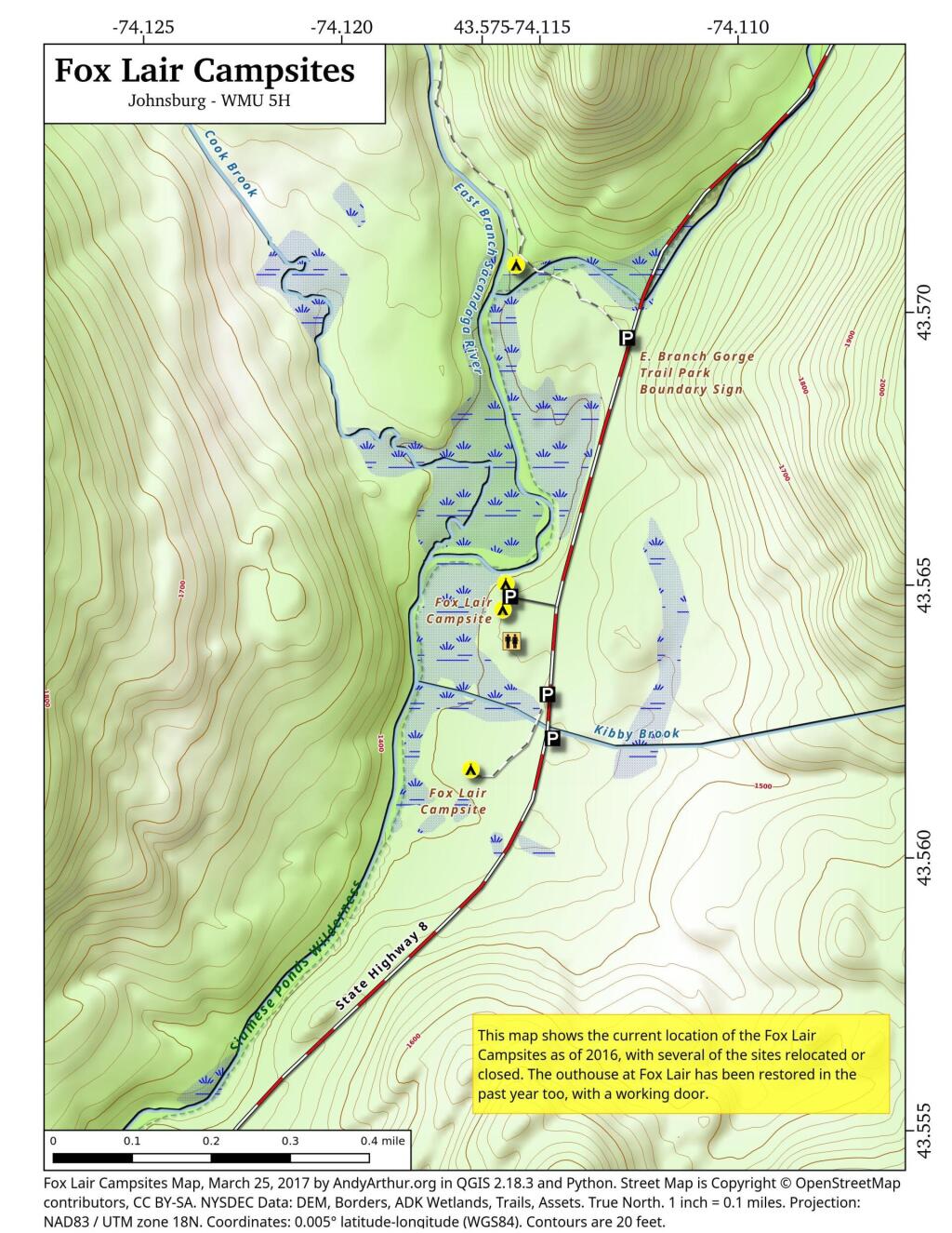
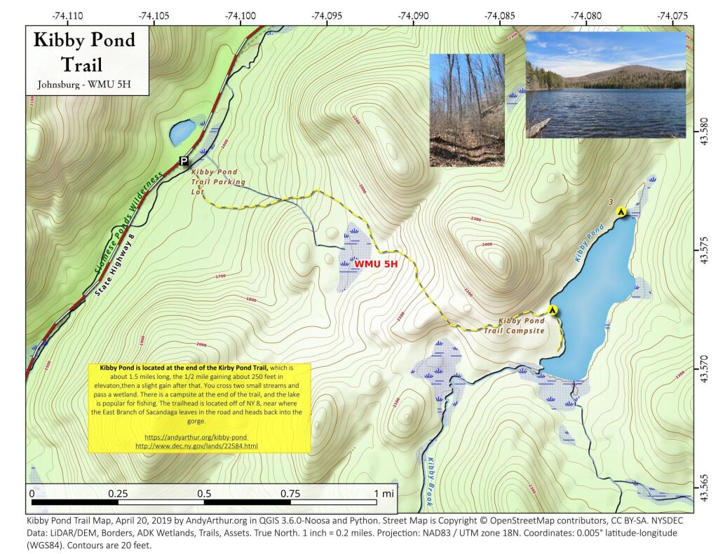
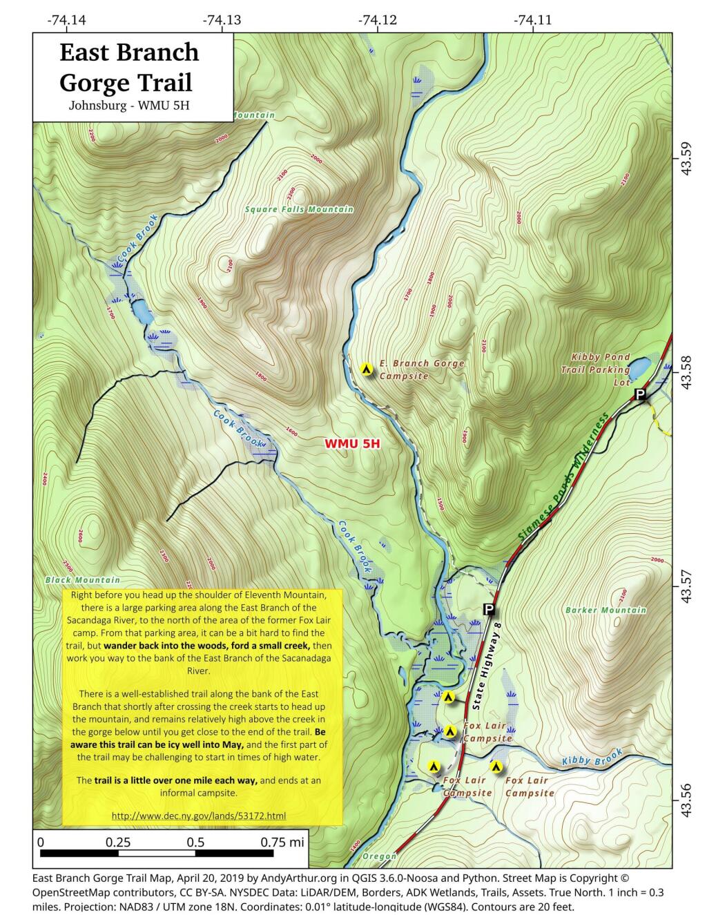
Here are several helpful printable maps.

 Fox Lair Campsites

 Kibby Pond Trail

 East Branch Gorge Trail

List and Coordinates for Campsites and Trailheads

Here is a list of campsites, trailheads and other destinations along NY 8 and East Branch Sacandaga River. You can also get this as a Google Sheets.

NameDetailsLatitudeLongitude
11th Mountain Parking LotLarge > 20 Cars43.5903782-74.0900314
11th Mountain Trailhead CampsiteNear large parking area for 11th Mountain43.5901834-74.0910822
Boulder Rock CampsiteCave-Like Site Against Large Erratic43.5384607-74.1215703
Cod Pond Parking LotMedium 5 – 20 Cars, across from campsite 7 and 843.5301580-74.1455890
Cod Pond Trail CampsiteAt end of Cod Pond trail on pond43.5176969-74.1437559
County Line Brook Trail CampsiteAlong County Line Trail43.5242772-74.1892664
County Line CampsiteEnd of County Line Trail43.5022688-74.1828085
E. Branch Gorge CampsiteEnd of East Branch George, near Waterfalls43.5803187-74.1209517
E. Branch Gorge Trail Parking AreaSmall < 5 Cars43.5690250-74.1132232
Eagle Pond CampsiteNear Eagle Pond43.5401509-74.1167243
East Sacandaga River Parking Picnic AreaDOT Maintained Roadside Parking And Picnic Area43.4783862-74.2010766
Forks Mountain Trail – Bushwhack to Auger Falls43.4685687-74.2457562
Georgia Creek Parking LotMedium 5 – 20 Cars43.4915171-74.1892866
Girrad Sugarbush Trailhead43.4764458-74.2043731
Griffin Connector Parking Lot At Route 8Medium 5 – 20 Cars43.4703209-74.2248680
Kibby Pond Campsite #3Far End of Lake43.5766649-74.0781098
Kibby Pond Trail #2End of Trail43.5725581-74.0821443
Kibby Pond Trail Parking LotSmall <5 Cars43.5789951-74.1033601
Little Joe Pond CampsiteAt Little Joe Pond43.5055662-74.1423052
Little Joe Pond Picnic Site43.5039558-74.1422817
Mud Ponds CampsiteAt Mud Point43.5650797-74.1739273
NY 8 Campsite 1Old Routing of 8, Near Kibby Pond Area43.5771279-74.1054574
NY 8 Campsite 2Overlooks Cliff43.5650960-74.1160232
NY 8 Campsite 3Long dirt road to open area43.5616391-74.1169664
NY 8 Campsite 4Dirt road to campsite above Kibby Brook43.5612062-74.1138524
NY 8 Campsite 5Old home site, sits on ledge above NY 843.5542527-74.1234025
NY 8 Campsite 71/4 mile north of Cod Pond Parking43.5328656-74.1440210
NY 8 Campsite 8Near Cod Pond Parking43.5316564-74.1459341
NY 8 Campsite 9 (Seasonal Use)Route 8 Near Little Joe Trail Pulloff With Fire Ring (Campsite Removed During Winter)43.5149220-74.1583197
NY 8 Campsite 10Gravel Pit 1/4 mile south of Girrad Sugarbush Trailhead43.4761691-74.2072253
Oregon Trail Primitive CampsiteBeyond Stewart Creek Snomwobile Bridge43.5194607-74.1339532
Parking LotMedium 5 – 20 Cars43.5355769-74.1414217
Shanty Brook Trail CampsiteAlong Shanty Brook Trail43.5460737-74.1459537
Shanty Falls Parking LotSmall <543.5376556-74.1409559
Square Falls43.5814233-74.1218099
Stewart Creek Bridge43.5204188-74.1356239
Stewart Creek Flume43.5204188-74.1356239
Stewart Creek Lower Falls43.5225332-74.1365675
Teachout Road Bridge Over Griffin Falls43.4733545-74.2236654
Teachout Road Parking at Griffin Falls43.4737995-74.2238438

Catskill Trailhead Parking Coordinates 🅿️ 🏔 👣

Below is a listing of DEC parking areas in the Catskill Park with coordinates and addresses, nearby trails and the roads they are located on.

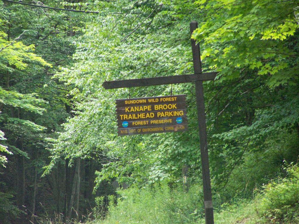
Trailhead Parking Lot Sign

TrailRoadNameNotesStreetCityStZIPLatitudeLongitude
Ashokan High PointWatson Hollow RoadKanape Valley Parking Lot 826 Watson Hollow RdWest ShokanNY1249441.9357923141228-74.3281141901214
Beaverkill RoadBeaverkill RoadBeaverkill Road Parking Lot 2795 Beaverkill RdLivingston ManorNY1275842.0117166110155-74.6223767934834
Beaverkill RoadTurnwood RoadBeaverkill Road Parking Lot 2952 Beaverkill RdLivingston ManorNY1275842.0233290355646-74.5995306115641
Becker Hollow TrailLane RoadBecker Hollow Parking Lot6 Vehicle Capacity3940 Route 214Elka ParkNY1242742.1816084527769-74.1969812784753
Bengle Hill TrailPeekamoose RoadEastern Upper Field Parking Lot 359 Peekamoose RdGrahamsvilleNY1274041.9166423616552-74.4377863112221
Bengle Hill TrailPeekamoose RoadLower Field Parking Lot 194 Peekamoose RdGrahamsvilleNY1274041.9101942400042-74.452852499381
Bengle Hill TrailPeekamoose RoadMiddle Field Parking Lot 304 Peekamoose RdGrahamsvilleNY1274041.9158997405029-74.443422031256
Bengle Hill TrailPeekamoose RoadNorth Middle Field Parking Lot 304 Peekamoose RdGrahamsvilleNY1274041.9164180048779-74.4416441135141
Bengle Hill TrailPeekamoose RoadTrailer Feild Parking Lot 359 Peekamoose RdGrahamsvilleNY1274041.9162603251141-74.4346555497984
Bengle Hill TrailPeekamoose RoadWestern Upper Field 359 Peekamoose RdGrahamsvilleNY1274041.9169982073948-74.4396463051141
Big Pond – Alder LakeBarkaboom RoadBarkaboom Road Parking LotLocated On Barkaboom Road, 6 Cars288 Barkaboom RdAndesNY1373142.0426860004001-74.7267519998891
Big Pond – Alder LakeCross Mountain RoadAlder Lake Parking Lot 2 Cross Mountain RdLivingston ManorNY1275842.0497953211373-74.6827571604492
Black Dome TrailBig Hollow RoadBig Hollow Road Parking Lot7 Vehicle Capacity947 Route 56MaplecrestNY1245442.2889033425096-74.1151262941519
Campbell Mountain TrailCat Hollow RoadRoute 206 Parking Lot5 Vehicle Capacity1611 County Road 7RoscoeNY1277642.051659649187-74.9147231839428
Cic – Esopus TrailState Route 28Parking Area For Esopus Creek Fishing AccessParking Area For Esopus Creek Fishing Access – Cic5067 Route 28Mount TremperNY1245742.0254799892217-74.2717292519349
Cic Hill TrailWittenberg RoadWittenberg Road Parking Lot 1298 Wittenberg RdMount TremperNY1245742.0279684988885-74.2620571929729
Colgate Lake Trail To Dutcher NotchColgate RoadColgate Lake Lower Parking Lot50 Vehicle Capacity525 Colgate RdEast JewettNY1242442.2384696568264-74.1233979344461
Colgate Lake Trail To Dutcher NotchColgate RoadColgate Lake Parking Lot2 Vehicle Capacity524 Colgate RdEast JewettNY1242442.2385040003097-74.1206960003026
Colgate Lake Trail To Dutcher NotchColgate RoadColgate Lake Trail Parking Lot8 Vehicle Capacity653 Colgate RdEast JewettNY1242442.2384599994304-74.1163269993959
Condon Hollow Rd.Condon Hollow RoadCondon Hollow Road Parking Lot3 Vehicle Capacity139 Condon Hollow RdWest KillNY1249242.2161010059593-74.4163349850283
Condon Hollow Rd.Elk Creek RoadElk Creek Road Parking Lot5 Vehicle Capacity734 Elk Creek RdFleischmannsNY1243042.1996047835286-74.4451315908425
Condon Hollow Rd.South Beech Ridge RoadBeech Road Parking Lot4 Vehicle Capacity291 S Beech Ridge RdWest KillNY1249242.2139020709257-74.4012095700882
Condon Hollow Rd.State Highway 42Rte 42 Parking Lot3 Vehicle Capacity1088 Route 42ShandakenNY1248042.1851525975488-74.4149115068685
Denman Mountain Snowmobile TrailGlade Hill RoadDenman Parking Lot 327 Glade Hill RdGrahamsvilleNY1274041.8853341886314-74.5320280123605
Denman Mountain Snowmobile TrailMoore Hill RoadHogs Roack Plot Parking Lot 578 Alpha RdGrahamsvilleNY1274041.9003387815796-74.5274487605523
Devil’s PathBroadstreet Hollow RoadBroadstreer Hollow Parking Lot2 Vehicle Capacity619 Broadstreet Hollow RdShandakenNY1248042.1394450770105-74.3308357356817
Devil’s PathSpruceton RoadSpruceton Road Parking Lot5 Vehicle Capacity1518 Spruceton RdWest KillNY1249242.1920191641918-74.3238474073796
Devil’s PathPrediger RoadPrediger Road 75 Prediger RdElka ParkNY1242742.1338909995054-74.1042720006852
Diamond Notch TrailDiamond Notch RoadSouth Diamond Notch Parking Lot2 Vehicle Capacity508 Diamond Notch RdWest KillNY1249242.147861770123-74.2646596008456
Diamond Notch TrailSpruceton RoadDiamond Notch Parking Lot8 Vehicle Capacity2778 Spruceton RdWest KillNY1249242.1823740001994-74.2695430002389
Dry Brook Ridge TrailMill Brook RoadDry Brook Ridge Parking Lot 12 Balsam Mountain Camp RdMargaretvilleNY1245542.0715022570921-74.5738756337513
Dry Brook Ridge TrailSouth Side SpurNorth End Of Dry Brook Ridge Parking Lot 301 Southside SpurMargaretvilleNY1245542.1446292458628-74.649333317932
Elm Ridge TrailPeck RoadPeck Road Parking Lot10 Vehicle Capacity189 Peck RdMaplecrestNY1245442.2965789997488-74.1693680002929
Fluggertown Road Long Pond TrailFluggertown RoadFlugertown Road Parking Lot 191 Flugertown RdLivingston ManorNY1275841.9347657909639-74.649696950272
Flynn TrailMongaup RoadMongaup Road Parking Lot 1 Beech Mountain RdLivingston ManorNY1275841.9467974587868-74.7052771774711
Giant Ledge-Panther Mountian-Fox Hollow TrailFox Hollow RoadFox Hollow Road Parking Lot 67 Mountain DrShandakenNY1248042.1008382907335-74.3904559601097
Giant Ledge-Panther Mountian-Fox Hollow TrailPeck Hollow RoadPeck Hollow Road Parking Lot 254 Peck Hollow RdShandakenNY1248042.1357649784827-74.3712920364471
Giant Ledge-Panther Mountian-Fox Hollow TrailPeck Hollow RoadEsopus Creek Fishing Access (Upper)Gravel7019 Route 28PheoniciaNY1246442.1065553340012-74.3519924442835
Giggle Hollow TrailNY 23 – BelleayrBelleayre Day Use Parking Lot 33 Friendship Manor RdPine HillNY1246542.1256810090987-74.4731178408634
Harding Road Spur TrailWhites RoadWhites Road Parking Lot4 Vehicle Capacity274 White RdPalenvilleNY1246342.1823951680298-74.0261906353256
Harding Road TrailHarding RoadHarding Road Parking Lot5 Vehicle Capacity3525 Route 23APalenvilleNY1246342.1762358120255-74.0304949714876
Huckleberry North TrailHill RoadHill Road Parking Lot4 Vehicle Capacity1209 Hill RdMargaretvilleNY1245542.1166129796449-74.6486105632054
Huckleberry North TrailHuckleberry Brook Spur RoadHuckleberry Brook Road Parking Lot6 Vehicle Capacity1613 Huckleberry Brook RdMargaretvilleNY1245542.1130238724914-74.6515523618233
Huckleberry South TrailHuckleberry Brook Spur RoadHuckleberry Road Parking Lot5 Vehicle Capacity1073 Huckleberry Brook RdMargaretvilleNY1245542.1152546105706-74.6636037740616
Huckleberry South TrailHull RoadPloutz Road4 Vehicle Capacity1634 Ploutz RdMargaretvilleNY1245542.0938719675255-74.6204457323272
Huggins Lake TrailBerry Brook RoadHuggins Lake Road Parking Lot4 Vehicle Capacity2414 Holiday And Berry Brook RdRoscoeNY1277642.0157959909969-74.8436914198853
Jockey Hill Bicycle TrailWood RoadWood Road Parking Lot 334 Woods RdKingstonNY1240141.9777439980953-74.0501113306995
Kaaterskill Falls TrailState Highway 23aMolly Smith Parking LotDot Facility, 20 Vehicles4729 Route 23AElka ParkNY1242742.1898508772368-74.074111945438
Kaaterskill Rail TrailLaurel House RdLaurel House Rd 103 Laurel House RdTannersvilleNY1248542.1956250050266-74.063093393786
Kelly Hollow Long Loop TrailMill Brook RoadEast Kelly Hollow Parking Lot 5163 Mill Brook RdMargaretvilleNY1245542.078800277463-74.6497556922038
Kelly Hollow Long Loop TrailMill Brook RoadWest Kelly Hollow Parking Lot 5163 Mill Brook RdMargaretvilleNY1245542.0795848697519-74.6545040693769
Long PathSteenburg RoadSteenburgh Road 2425 Platte Clove RdElka ParkNY1242742.1337889994516-74.0819709994867
Long PathRoute 23Route 23 Parking Lot20 Vehicle Capacity3 Cross RdWindhamNY1249642.312706999584-74.1904309994766
Long Pond South LoopWillowemock RoadWild Meadow Road Parking Lot 136 Round Pond RdClaryvilleNY1272541.9435338737706-74.5864488816452
Lost Clove TrailLost Clove RoadLost Clove Parking Lot 343 Lost Clove RdBig IndianNY1241042.1054379266455-74.4700849794812
Mary Smith TrailHolliday Brook RoadHoliday And Berry Brook Road Parking Lot5 Vehicle Capacity3851 Holiday And Berry Brook RdRoscoeNY1277642.0386999995498-74.8473909994493
Mckinley Hollow TrailMc Kinley Hollow RoadMckinly Hollow Parking Lot 200 McKinley Hollow RdBig IndianNY1241042.0704132895809-74.4740296153462
Mckinley Hollow TrailRider Hollow RoadRider Hollow Parking Lot 12 Warren Todd Subdivision DrArkvilleNY1240642.1018368545182-74.5170339246663
Mckinley Hollow TrailBurnham Hollow RoadBurnham Hollow Parking Lot 17 Sagmore TrlBig IndianNY1241042.05564157218-74.4669789486585
Middle Mountain TrailMary Smith Hill RoadMary Smith Hill Road Parking Lot3 Vehicle Capacity865 Mary Smith Hill RdAndesNY1373142.0401290003224-74.8089319993063
Mink Hollow TrailMink Hollow RoadLake Hill 599 Mink Hollow RdBearsvilleNY1244842.1051314008054-74.1735651990356
Mount Pleasant-Romer MountainState Highway 28Sawmill Lot50×50 Parking Area – Trailless6331 Route 28PhoeniciaNY1246442.1008585056075-74.3445327399439
Mud Pond TrailCounty Road 179aOld Rte 17 Fishing Access6 Vehicle Capacity6175 State Route 17 WRoscoeNY1277641.9497668355721-74.9281906252666
Mud Pond TrailHorton Brook RoadLittle Fuller Brook Parking Lot6 Vehicle Capacity845 Horton Brook RdRoscoeNY1277642.0159481159029-74.9790550095988
Onteora Lake Parking AccessState Highway 28Onteora Lake Trailhead Upper Lot 881 Route 28KingstonNY1240141.9807660434687-74.0853059041223
Onteora Lake Yellow TralNY 23Onteora Lake Parking 960 Route 28KingstonNY1240141.9840941553893-74.0827910535657
Overlook Spur Trail ExtensionMacdaniiel RoadMeads Meadow Parking Area 452 MacDaniel RdBearsvilleNY1240942.0756312690235-74.1276188121255
Overlook TrailMeads Mountain RoadOverlook Mountain Trailhead 334 Meads Mountain RdWoodstockNY1249842.0710794980857-74.1224765106456
Peekamoose-Table TrailPeekamoose RoadPeekamoose Road Parking Lot 415 Peekamoose RdGrahamsvilleNY1274041.9233895882109-74.4128616227944
Peekamoose-Table TrailPeekamoose RoadPeekamose Mountian Trail Head Parking Lot 415 Peekamoose RdGrahamsvilleNY1274041.9149365156904-74.4289858455429
Pelnor Hollow TrailBeaver Kill RoadWaneta Lake Parking Lot 732 Beaverkill RdLivingston ManorNY1275841.9676202925977-74.8292314401778
Phoenicia East Branch TrailDenning RoadDenning Road Parking Lot 3381 Denning RdClaryvilleNY1272541.9690314347788-74.4486958819482
Phoenicia East Branch TrailOliverea-Slide Mountain RoadOliverea Road North Parking Lot 1453 Oliverea RdBig IndianNY1241042.0265659167754-74.4038665935078
Phoenicia East Branch TrailOliverea-Slide Mountain RoadOliverea Road South Parking Lot 19 Shandaken Rod Gun ClbBig IndianNY1241042.0078280894865-74.4268762683237
Phoenicia TrailPlank RoadTremper Mountain Parking AreaGravel Lot5636 Route 28PhoeniciaNY1246442.0705625579484-74.3024012416267
Pine Hill West Branch TrailWest Branch RoadBiscuit Brook Parking Lot 1886 Frost Valley RdClaryvilleNY1272541.990833872737-74.4845571593918
PowerlineBeech Ridge Road 1Vinegar Hill Parking Area 1060 N Beech Ridge RdPrattsvilleNY1246842.2449000123037-74.4075985539776
Red Hill Fire Tower TrailRed Hill RoadRed Hill Fire Tower Parking Lot 129 Coons RdClaryvilleNY1272541.9302938486155-74.5073498606472
Roaring Kill TrailDale LaneRoaring Kill6 Vehicle Capacity155 Roaring Kill RdElka ParkNY1242742.1511360000949-74.1310779997324
Rochester HollowShaft RoadShaft 6 Parking20 Vehicle Capacity73 Shaft RdShandakenNY1248042.166173156258-74.4083342114093
Rochester HollowSpisak WayRochester Hollow Parking Lot 51 Matyas RdBig IndianNY1241042.1179698674129-74.4517651458059
Seager Big Indian TrailDry Brook RoadSeager Parking Lot 5672 Dry Brook RdArkvilleNY1240642.0578836653667-74.5396998623234
Spencer RoadTrails End RoadTrails End Parking Lot 197 Trails End RdKerhonksonNY1244641.8835868385135-74.3594081701432
Spruceton TrailSpruceton RoadSpruceton Trail Parking Lot20 Vehicle Capacity2628 Spruceton RdWest KillNY1249242.1846329998217-74.2719879999707
Touch-Me-Not-TrailBarkaboom RoadBig Pond Parking LotLocated Off Barkaboom Road, 6 Cars366 Barkaboom RdAndesNY1373142.0433679998314-74.7277000006876
Touch-Me-Not-TrailBeech Hill RoadBeech Hill Road Parking Lot3 Vehicle Capacity2054 Beech Hill RdAndesNY1373142.0506230001697-74.7789470006467
Touch-Me-Not-TrailDeerlick Brook RoadDeerlick Road Parking Lot3 Vehicle Capacity1553 Deerlick Brook RdAndesNY1373142.0814567992576-74.7365160981546
Touch-Me-Not-TrailBarkaboom RoadForest Preserve Access ParkingEast Of Barkaboom Road 3 Cars1954 Barkaboom RdAndesNY1373142.0655363440977-74.7284401046935
Trout Pond Access RouteRussell Brook RoadRussell Brook Road Parking Lot10 Vehicle Capacity4348 Russell Brook RdRoscoeNY1277641.9943949997582-74.941432999876
Trout Pond TrailCampbell Brook RoadCampbell Brook Road Parking Lot 4747 Campbell Brook RdDownsvilleNY1375542.0306374772623-74.9384473452279
Trout Pond TrailCampbell Mountain RoadCampbell Mountain Road Parking Lot5 Vehicle Capacity3693 Campbell Mountain RdDownsvilleNY1375542.0433291750688-74.9358959381363
Vernooy Kill Falls Snowmobile TrailDymond RoadDymond Road Parking Lot 498 Yeagerville RdNapanochNY1245841.8792625226568-74.4012606035291
Vernooy Kill Falls Snowmobile TrailUpper Cherrytown RoadUpper Cherry Town Road Trail Head Parking Lot 559 Upper Cherrytown RdKerhonksonNY1244641.8643822024537-74.3454535201223
Willow TrailAbbey RoadMount Toblas Parking Lot 439 Abbey RdMount TremperNY1245742.0537752508176-74.2306894602594
Willow TrailJessup RoadWillow Trailhead Parking6 Vehicle Capacity218 Jessop RdWillowNY1249542.078213053797-74.2442314353898