Search Results for: map hill higher state forest 2

The second half of vacation week forecast 🏖

It looks like the second half of the week for vacation is going to be decent though not perfect. 👌

Today, paddle Seneca Lake it’s very calm, then Watkins Glen pool, 🏊‍♂️, Glen Dairy Bar, get water, maple syrup, propane and beer. Lake should be very calm!

Thursday, Trumansburg, swim in Cayuga Lake, 🏊‍♂️ and Taughannock State Park, Black 🖤 Diamond 🔹 Trail and maybe Ithaca if I can’t get propane in Watkins Glen today.

Friday, I might stay in camp or just do the short drive over to the Queen’s Castle 🏰 on the lake which is a free National Forest Boat Camp Ground on a point on Seneca Lake that is nice to just sit down by and Ride my bike around the National Forest and read. 📖

Weekend looks nice TBD, probably Ithaca on Sunday – maybe Robert Treman or kayak 🛶 Cayuga Lake around the canal and Ithaca area. Saturday who knows, maybe Sugar Hill bike and hike then Watkins Glen pool.

Today.
Feels like …
September 11th.

Sunny

Sunny.

South wind 3 to 5 mph.

and

76 degrees , 53 max dew point, 8:28
sunset.
Tonight.
Feels like …
August 20th.

Partly Cloudy

Partly cloudy.

South wind 7 to 14 mph.

and

60 degrees , 5:59
sunrise.
Thursday.
Feels like …
August 28th.

Mostly Sunny then Slight Chance of T-storms

A slight chance of showers between 1pm and 2pm, then a slight chance of showers and thunderstorms after 2pm. Mostly sunny.

Southwest wind 9 to 15 mph. Chance of precipitation is 20%.

and

80 degrees , 61 max dew point, 8:26
sunset.
Thursday Night.
Feels like …
July 15th.

Chance of T-storms then Showers is likely

A chance of showers and thunderstorms, then showers likely and possibly a thunderstorm after 2am. Mostly cloudy.

South wind 13 to 15 mph. Chance of precipitation is 60%. New rainfall amounts of less than a tenth of an inch, except higher amounts possible in thunderstorms.

and

63 degrees , 62 max dew point, 6:00
sunrise.
Friday.
Feels like …
September 17th.

Showers is likely then T-storms is likely

Showers and thunderstorms likely, mainly before 5pm, then showers likely and possibly a thunderstorm after 5pm. Some of the storms could produce gusty winds. Partly sunny.

South wind around 11 mph becoming west in the afternoon. Chance of precipitation is 60%.

and

74 degrees , 65 max dew point, 8:25
sunset.
Friday Night.
Feels like …
August 26th.

Showers is likely then Slight Chance of Showers

Showers likely and possibly a thunderstorm before 8pm, then a slight chance of showers between 8pm and 2am. Partly cloudy.

Chance of precipitation is 60%.

and

59 degrees , 6:01
sunrise.
Saturday.
Feels like …
September 19th.

Mostly Sunny

Mostly sunny.

and

73 degrees , 59 max dew point, 8:24
sunset.
Saturday Night.
Feels like …
September 9th.

Partly Cloudy

Partly cloudy.

and

55 degrees , 6:03
sunrise.
Sunday.
Feels like …
September 14th.

Partly Sunny

Partly sunny.

and

75 degrees , 58 max dew point, 8:23
sunset.
Sunday Night.
Feels like …
July 15th.

Mostly Cloudy then Chance of Showers

A chance of showers after 2am. Mostly cloudy.

Chance of precipitation is 30%.

and

63 degrees , 60 max dew point, 6:04
sunrise.
Monday.
Feels like …
September 14th.

Chance of Showers then Chance of T-storms

A chance of showers and thunderstorms. Partly sunny.

Chance of precipitation is 50%.

and

75 degrees , 67 max dew point, 8:21
sunset.
Monday Night.
Feels like …
July 31st.

Chance of T-storms then Chance of Showers

A chance of showers and thunderstorms. Mostly cloudy.

Chance of precipitation is 50%.

and

62 degrees , 66 max dew point, 6:05
sunrise.
Tuesday.
Feels like …
September 19th.

Partly Sunny then Chance of Showers

A chance of showers. Partly sunny.

Chance of precipitation is 30%.

and

73 degrees , 62 max dew point, 8:20
sunset.

Sailor's Warning

Totally agree that walking in that thunderstorm last night wasn’t a great idea ⛈

I didn’t think it would be nice enough to go out walking last night but then I stepped outside it seemed okay, the wind blowing the opposite direction of the clouds to the west. It risk of thunder seemed pretty low, and I wanted to get at least 8 miles in for the day. But the time I was farthest from home the lightening was too close for comfort and five minutes from home the sky opened up. Ultimately I did get in 8 miles for the day, not the ten I normally walk and didn’t make it to the park, but that’s fine.

Good morning! With a few loud cracks of rain and thunder it’s morning. The sun is is rising, the skies are clearing somewhat and let’s call it 66 ⅔ degrees at the 6:30 for the morning walk in the land of the Delmartian. ⛅ Calm wind. The dew point is 64 degrees.

Last night I got home 🏡 from work glad that I didn’t get soaked and figured that the evening walk 🚶 was off the agenda. Then at 6:30 I stepped outside and looked at the radar and decided it would be okay. And it was for a while until the wind shifted and thunder ⚡ pushed closer. In the end it was fine, though I got a bit wet and went to bed early. 🛏 Walked 8 miles for the day plus 39 flights of stairs up and down. I was asleep by around 8 pm and up around 5 am.

As it was still raining out when I awoke 🍳 I decided to have breakfast before walking which was cold black coffee ☕ with cold eggs and spinach from the other day. I also had a half of banana 🍌 from last night. At lunch time yesterday I walked up to Market 32 in Albany and got a bunch of bananas to hold my pantry over until Saturday when I can do a bigger shop 🏪. Cold lunch today with black beans, mushrooms, chopped farmers market tomatoes, peppers. Avoids the line for the microwave at work, though I’ve figured out the technique is to cook lunch at 12:50 PM before the 1 PM rush.

Today will have a chance of showers and thunderstorms, then showers likely and possibly a thunderstorm after 5pm. Some of the storms could produce heavy rain. Patchy fog before 7am. Otherwise, mostly cloudy 🌧, with a high of 83 degrees at 2pm. One degrees below normal, which is similar to a typical day around July 4th. Independence Day! Maximum dew point of 71 at 2pm. Calm wind becoming south around 6 mph in the morning. Chance of precipitation is 60%. New rainfall amounts between a half and three quarters of an inch possible. A year ago, we had partly cloudy skies. It was somewhat humid. The high last year was 85 degrees. The record high of 99 was set in 1995.

I’ll have to keep that Market 32 in Albany in mind 🛒 for when I need stocking up of a few ingredients downtown. Much better than the old Ghetto Chopper and really only a few blocks away from work if I take South Swan to Elm Street. They don’t have much in household supplies – I was hoping to get super glue to fix my boots 👢 – but the fresh fruits and vegetables looked good. It’s small so a fast shop. Probably can’t get frozen things there and I decided to skip getting plain non fat Greek yogurt just because of the hot day walking back to the office and the bus ride home but in the winter I think that’s an option.

Solar noon 🌞 is at 1:02 pm with sun having an altitude of 69.1° from the due south horizon (-1.7° vs. 6/21). A six foot person will cast a 2.3 foot shadow today compared to 2.2 feet on the first day of summer. The golden hour 🏅 starts at 7:51 pm with the sun in the west-northwest (294°). 📸 The sunset is in the west-northwest (301°) with the sun dropping below the horizon at 8:33 pm after setting for 3 minutes and 22 seconds with dusk around 9:06 pm, which is 36 seconds earlier than yesterday. 🌇 The best time to look at the stars is after 9:50 pm. At sunset, look for rain 🌧 and thunderstorms 🌩 and temperatures around 74 degrees. The dew point will be 70 degrees. There will be a south-southeast breeze at 6 mph. Today will have 15 hours and 5 minutes of daytime, a decrease of one minute and 25 seconds over yesterday.

Six months into healthy eating 🍎I am finally starting to notice how much thinner I am. I have a feeling that my BMI is now below 25 though I don’t have a scale so I don’t know but I know I have lost weight since the last time I visited the doctor at the end of May when I was 209 lb and needed to get to 194 lb to be a healthy weight at 6′ 2.5″ though most others say I’m 6′ 4″ or 6′ 5″ with the boots on. My love handles have virtually disappeared and my stomach is much smaller, and I’m pretty sure that size 36 pants 👖 are now the proper size, the smallest since probably I’ve been since elementary school. The problem is finding clothes in my closet that don’t make me look like a clown. 🤡 Still have a little more belly fat I’d look to loose, not just because of the look but because outer fat is associated with inner muscle fat, especially in the heart 💖 which is rather bad. But I feel like I am starting to get in great shape, mostly from eating a nutritious diet but also because I’ve kept up with the walking and stairs. And hopefully cycling too. Steiner, you are biting me with this bicycle thing. 😠

Tonight will have showers and thunderstorms likely, mainly before midnight. Mostly cloudy 🌧, with a low of 66 degrees at 5am. Three degrees above normal. Maximum dew point of 70 at 6pm. Southeast wind around 6 mph becoming calm in the evening. Chance of precipitation is 60%. New rainfall amounts between a quarter and half of an inch possible. In 2022, we had mostly clear skies. It got down to 57 degrees. The record low of 44 occurred back in 1950.

I need to think about getting new boots before vacation. 👟 Or at least rugged sneakers, something I can use for mountain biking and maybe jogging which I tell myself that I’m thinking 💭 about taking up 🏃 maybe half seriously since becoming thinner. Around camp and certainly st the swimming pools and holes the knock off crocks are fun but they’re not appropriate for much else. They have no ankle support, get my feet muddy, and worse of all let in any stones and sticks into my foot 👣 where I can step on them.

On this day in 1969, the $500, $1,000, $5,000 and $10,000 bills are officially withdrawn from circulation. 💵 After this date, if you wanted to buy a large purchase in cash, you needed a lot of hundred dollars in bills. 💰They had last been printed in 1945, and were finally dropped from circulation in 1969, in part as an effort to reduce corruption and money scams. Nowadays a hundred 💯 dollars seems almost a paltry amount with inflation not that I ever carry anything bigger than $5 bills because it’s just easier to use the credit card 💳 for anything bigger.

Tomorrow will have a chance of showers and thunderstorms, mainly after 3pm. Partly sunny 🌞, with a high of 87 degrees at 3pm. Three degrees above normal. Maximum dew point of 72 at 11am. Muggy, swamp weather. South wind 3 to 7 mph. Chance of precipitation is 30%. New rainfall amounts of less than a tenth of an inch, except higher amounts possible in thunderstorms. A year ago, we had partly cloudy skies. It was somewhat humid. The high last year was 86 degrees. The record high of 96 was set in 1997.

Tomorrow I will walk 🚶 early to best the heat. 😰 Then it’s those oatmeal banana pancakes 🍌 🥞 love with blueberries and maybe some sugar free maple syrup and cold black coffee. So good! Then it’s off to Steiners to check on the status of the bicycle 🚲 they promise to be assembling for me. They don’t have it, I’ll test ride the XXL of the Marlin 5 and order and pay for the Marlin 6 as long as they can give me a set date for delivery. 🚚 Otherwise I will order online with another shop. This purchase needs to be closed down this weekend.

Then the next thing to do is get grocery shopping 🛒. I want to get more red kidney beans for maple syrup 🍘 next week and get them soaking to be cooked come Sunday morning. Plus all the usual, more Greek yogurt, 🐮 frozen fruit 🍓, peppers 🫑🌶️, mushrooms 🍄 and the usuals. I also need shampoo and extra deodorant the later this keep in the office 🏢 after climbing the stairs. Then I’m not totally sure. 🏊 If it’s hot and looks like thunderstorms will stay away, maybe go to the town pool. I would have to register though to get a pool fob, maybe I should do that and it’s $5.25 to enter. 😕 And you have to do that in advance. Seems like a pain. If I get the bike, 🚵 ride out to Voorheesville and probably the Black Creek Marsh. If it’s hot and I don’t want to spend money, go to the library for a while 💻 with my computer, then come home, sit by the fan and get through some more of the stack of library books I have at home. 📚

Looking ahead to Sunday, showers and possibly a thunderstorm. Some of the storms could produce heavy rain. High near 83. ⛈️ South wind around 10 mph. Chance of precipitation is 80%. New rainfall amounts between a half and three quarters of an inch possible. Not just a few passing showers. Maximum dew point of 74 at 12pm. Typical average high for the weekend is 84 degrees.

And so is the weekend forecast. 😖 But if I can get this damn bicycle 🚲 thing closed down, I’ll be happy. I am thinking about taking off at least one day next week, where and what to do is to be decided but I need to get a few things ready for my vacation, I’ve taken fewer days off this summer than expected. Maybe it will be to get the rack on the bicycle, break it in or pick it up. 🛠 Maybe the Potholers or Schoharie the second half of the week. 🏊

Two weeks from now, God willing, 🏖 I will be well on my way to the Finger Lakes. I really want to leave by eight AM on that Friday to get the campsite I want in the National Forest ⛺ and then have the afternoon to set up and relax. 🎣 Do some fishing, a nice bicycle 🚲 ride and maybe watch a Finger Lakes sunset 🌇 across a cow pasture in the National Forest.

After vacation, August 11th I have a dentist appointment at 10:15 AM 🦷 which I will follow up probably with a long weekend. Maybe Schoharie or the Adirondacks. Have to be strategic at this point as there are only three weeks left in August at that point before Labor Day Weekend, and I want to have at least a few more long weekends before summer is done. 🏊 🛶 That said, except for the Mine Kill Pool there is no reason I can’t take lots of long weekends come September and October. 🍁 I am not doing a West Virginia trip — or even a week-long trip at this point this autumn, so that leaves other days to allocate. I would like to do some kayaking, fishing, hunting, and bike riding this autumn. Charles Baker State Forest roads probably would be wonderful for autumn bike riding, as would the Chenango Canal Trail and others.

Looking ahead, there are 7 weeks until September 1st 🍂 when the sun will be setting at 7:31 pm with dusk at 7:59 pm. That’s the start of Labor Day Weekend. On that day in 2022, we had mostly sunny skies with rain showers and temperatures between 73 and 55 degrees. Cool day. The average high is 79 degrees. We hit a record high of 96 back in 1953. I might do Spectulator that weekend, especially if they have fire tower lighting that I could observe from I don’t know, Watch Hill (?). 🏕 Some of those truck trails through the Conservation Easement might be nice on the mountain bike, as would be camping up on Hardwood Hill, looking at the stars, lighting off ground fireworks and sparklers. 🎆

Back Out on Open Lake

The Catskill Wilderness Areas

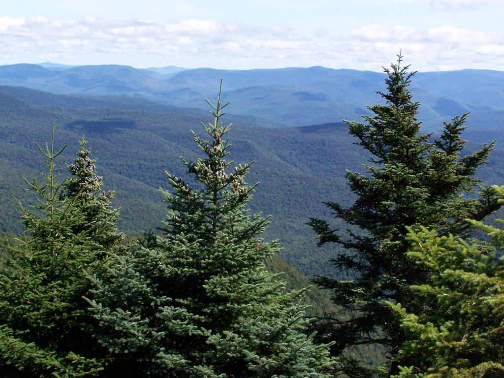
Trees and Mountains

The text of today’s fodder is based on the Catskill Park State Lands Master Plan, as revised in 2008. Maps were rendered by myself, using Quantum GIS and DEC Lands and Forests data.

Big Indian Wilderness

(Formerly Big Indian – Beaverkill Range Wilderness Area)

This wilderness is located in the Towns of Hardenburgh, Denning and Shandaken in Ulster County. It lies generally west of Oliverea and the Frost Valley Road, south of Belleayre Ski Center, east of Seager and Hardenburgh and north of Willowemoc and Claryville. The area ranges in width from 1 to 5 miles, is about 19 miles long and contains approximately 33,500 acres of land. Elevations range from 1,500 feet in McKenley Hollow to 3,840 feet where the state boundary crosses Doubletop Mountain. The mountains in the northeastern portion of the area are quite rugged, while those to the south and west are more characteristic of high hills. Water from the area flows into three New York City water supply reservoirs and the Delaware River Basin. Nine mountains or ridges with elevations of over 3000 feet make up the area.

Peaks

Doubletop* 3,860′
Haynes 3,420′
Big Indian 3,700′
Spruce 3,380′
Fir 3,620′
Eagle 3,600′
Hemlock 3,240′
Balsam* 3,600′
Beaver Kill Range 3,377′

* Maximum elevations given are not necessarily located within the Wilderness Area.

The forest cover is predominantly hardwood mixtures in various associations. Spruce and fir, while present at some of the higher elevations, are less noticeable here than in other Catskill wilderness areas.

Interior facilities consisting of foot trails and lean-tos are generally considered adequate.

Area statistics:

Approximate Area 33,500 Acres
Roads (non conforming) 1.4 Miles
Foot Trails 29.4 Miles
Lean-tos 6
Designated Campsites 5
Parking Lots 5
Public Use (visitors/year) 4,500
Exterior Boundary Line 67 Miles
Minimum Elevation 1,500′
Maximum Elevation 3,840′

Non-conforming uses:

Motor vehicle use of Black Bear Road from the wilderness boundary to Fall Brook Lean-to.

A UMP for this area was completed in June of 1993.

Hunter – West Kill Wilderness

(Formerly West Kill – North Dome Wilderness, Ox Clove Wild Forest, and a portion of the former Hunter Mountain Wild Forest)

The unit generally lies within the following boundaries: New York State Route 42 on the west, the Shandakan Wild Forest and NYS Route 28 to the south, and NYS Route 214 on the east. The northern extent of the unit is County Route 6, and continues along a line 100′ parallel to, and south or east of, the edge of Spruceton trailhead parking area and the centerline of the Spruceton Truck Trail, to the junction of the Colonel’s Chair Trail. A corridor, 100 feet either side of the center line of the Spruceton Truck Trail, from the Colonel’s Chair Trail to the summit of Hunter Mountain, culminating in a circle 175′ in radius from the center of the chimney on the observer’s cabin shall be within the Rusk Mountain Wild Forest.

The unit contains approximately 27,000 acres of land, and inside it’s boundaries are found the named mountain peaks of Balsam, Sherrill, North Dome, West Kill, Sheridan, Hunter and Southwest Hunter. Hunter Mountain is the second highest peak in the Catskills at 4,040 feet, and portions of it’s summit, along with a fairly extensive area on the summits of West Kill, North Dome and Sherrill Mountains are within the Catskill High Peaks Bird Conservation Area, and are of special significance in that they provide habitat for high elevation spruce-fir inhabitants such as Bicknell’s Thrush and the Blackpoll Warbler, among others.

There are currently two lean-to’s on the unit, the Diamond Notch lean-to located just off the Diamond Notch Trail, and the Devil’s Acre Lean-to off of the Devil’s Path Trail. Waters from this unit drain into Schoharie and Esopus Creeks and then into the Schoharie and Ashokan Reservoirs, which are in the New York City water supply system.

Area statistics:

Approximate Area 27,000 Acres
Foot Trails 18 Miles
Lean-to’s 2
Parking Lots 5
Minimum Elevation 920′ Maximum Elevation 4,040′

Indian Head Wilderness

(Formerly Plateau Mountain – Indian Head Mountain Wilderness Area)

This wilderness is located in the Town of Hunter, Greene County and the Towns of Saugerties and Woodstock, Ulster County. It lies generally west of the east boundary of the Catskill Park, south of Platte Clove, east of Devil’s Tombstone Campground and north of Lake Hill and Shady. The area ranges from 1 ½ miles to 3 ½ miles in width, is eight miles long and contains approximately 16,800 acres.

Elevations range from 900 to 3840 feet and the four major mountains in the area are visible against the skyline from all directions. Echo Lake, the only natural lake in a Catskill wilderness, is located in the east-central portion of the area. Water from this eastern section flows into the Kingston and Saugerties water supply reservoirs, while drainage from the central and western section flows into two New York City water supply reservoirs. Six named mountain peaks over 3,000 feet in elevation dominate the area.

Peaks

Plateau 3,840′
Indian Head 3,573′
Sugarloaf 3,800′
Olderbark 3,440′
Twin 3,640′
Plattekill 3,100′

The forest cover varies from extensive oak stands on the eastern most slopes to mature spruce-fir on top of Plateau Mountain. An excellent mature stand of northern hardwood and hemlock occupies the slopes south of the Saw Kill.

Echo Lake, unique to the Catskill wilderness, is very popular for undeveloped camping. A small number of scattered primitive tent sites with fire rings have been established and public camping is limited to their capacities.

Public access is provided by several foot trails entering the area, including the old road from Meads to Overlook Mountain.

Area statistics:

Approximate Area 16,800 Acres
Roads 6.6 Miles
Foot Trails 24.1 Miles
Cross-country Ski Trails 5.6
Lean-tos 3
Designated Campsites 10
Parking Lots 1
Public Use (visitors/year) 8,000
Length of Boundary 33 Miles
Minimum Elevation 900′
Maximum Elevation 3,840′

A UMP for this area was completed in October of 1992.

Slide Mountain Wilderness

(Formerly Slide Mountain – Panther Mountain Wilderness Area)

This wilderness is located in the towns of Shandaken, Denning and Olive in Ulster County. It lies generally south of NYS Route 28, west of West Shokan, north of the Peekamoose Road (County Route 42) and east of the Frost Valley Road (County Route 47). It surrounds the Woodland Valley Campground and abuts the Sundown Wild Forest to its south. This area ranges from 1 to 10 miles in width, is about 13 miles long, and contains approximately 47,500 acres of land. The wilderness boundary is 118 miles long.

The terrain is rugged and steep with elevations ranging from 1,100 to 4,180 feet. All water draining from the area eventually reaches three New York City water supply reservoirs by way of the East and West Branches of the Neversink River, Rondout Creek and Esopus Creek. Twelve named mountain peaks with elevations over 3000 feet exist in the area. Of these, six may still be considered trail-less to the extent that they have no marked and maintained trails.

Peaks with Trails

Slide 4,180′
Peekamoose 3,843′
Cornell 3,860′
Wittenberg 3,780′
Table 3,847′
Panther 3,720′

Trail-less Peaks

Lone 3,721′
Rocky 3,508′
Friday 3,694′
Van Wyck 3,206′
Wildcat 3,340′
Balsam Cap 3,623′

The forest cover consists of nearly every possible mixture and association of hardwood and softwood trees native to the mountain region. While hardwoods predominate higher elevations are often covered with red spruce and balsam fir.

This area receives more public use than any other Catskill wilderness. Superb vistas are found on Slide, Wittenberg, Cornell, Giant Ledge and Panther Mountains. Access via foot trails is available from the north, south, east and west.

Area statistics:

Approximate Area 47,500 Acres
Foot Trails 35.3 Miles
Lean-tos 3
Parking Lots 10
Designated Campsites 29
Public Use (visitors/year) 23,000
Length of Boundary 118 Miles
Minimum Elevation 1,100′
Maximum Elevation 4,180′

A UMP for this area was completed in March of 1987 and revised in October of 1998.

Windham – Blackhead Range Wilderness

(Formerly Blackhead Range, and North Mountain Wild Forests, and portions of Windham High Peak, and Black Dome Valley Wild Forests)

The combination of these Wild Forest areas creates the Windham – Blackhead Range Wilderness Area, which lies within the Greene County towns of Cairo, Hunter, Jewett, Windham and Durham. The classification of these former Wild Forest areas was changed to Wilderness because their combined area comprises approximately 17,100 acres and contains rugged, high elevation land that clearly exhibits wilderness character. This newly classified area has seven named mountain peaks over 3,000 feet in elevation.

They are:

Peaks Black Dome 3,980′
Windham High Pk 3,520′
Blackhead 3,940′
Stoppel Point 3,420′
Thomas Cole 3,940′
Burnt Knob 3,180′
Acra Point 3,100′

The unit also contains six unnamed peaks over 3,000 feet, which range from 3,040 feet to 3,540 feet in elevation. Of the five highest peaks in the Catskills, three – Black Dome, Thomas Cole and Blackhead – are in this unit. This concentration of 13 peaks over 3,000 feet, within an area of approximately 28 square miles, with limited access, structures and improvements (30 miles of maintained foot trails and two lean-to’s) make the Windham – Blackhead Range Unit an area with excellent wilderness character.

A fairly extensive area of old growth forest can be found on this unit at the higher elevations, along the ridge stretching from an area west of Thomas Cole Mountain to Blackhead Mountain, and on Windham High Peak. The presence of this old growth forest, with its distinctive flora and fauna, add to the wilderness character of the unit. The unit also includes the headwaters of the Batavia Kill and, to the south over the Blackhead Range, the headwaters of the East Kill. Both of these rivers flow into Schoharie Creek, and are an integral part of the New York City Watershed system.

The western boundary of this unit shall be the east side of the Elm Ridge Trail, Black Dome Trail leaving it within the Elm Ridge Wild Forest, continuing north along the drainage to the Catskill Park boundary. The southern boundary of the unit shall be the Escarpment Trail approximately one half mile south of Stoppel Point to a point on the Escarpment Trail where it comes closest to the eastern Forest Preserve boundary. Both North Point and Stoppel Point will be within the Wilderness area. Lands to the south of the south edge of the Escarpment Trail in this area, will be in the Kaaterskill Wild Forest.

Because the Windham – Blackhead Range Wilderness surrounds the smaller Colgate Lake Wild Forest Unit, and because they are linked together by public use, the Unit Management Plans for the two units shall be contained in one document.

Area statistics:

Approximate Area 18,0000 Acres
Foot Trails 30 Miles
Lean-tos 2
Parking Lots 1
Minimum Elevation 980′
Maximum Elevation 3,980′

Shenandoah Valley – Not that Exiciting

Probably the greatest disappointment of my October road trip was driving through the Shenandoah Valley. I expected a lot more of the Lee-Jackson Highway, although I probably shouldn’t have because it’s US Route 11, and is historically quite built up from the time before Interstate 81 bypassed it.

Don’t get me wrong, there are some definitely scenic sections of the Lee-Jackson Highway, but much of it is the same used car dealerships, Walmart’s, big boxes and same small towns that you see across America. There are some truly wonderful sections but in many cases housing distracts from the otherwise scenic rolling farm country.

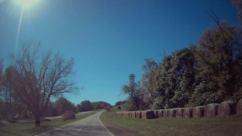
 Haybales Along Lee-Jackson Highway

It was probably my fault for taking US 11. I was originally planning a route in the the western, more remote part of the valley, but I miss placed my Virigina map, so I ended up taking US 250 all the way to Stauton. I guess I didn’t realize what a big city Stauton really is — it’s big enough to warrant a ring road expressway around it — and endless residential sprawl seems to extend in all directions from it. The chicken barns and turkey farms aren’t nearly as scenic as the dairy farms that more common in Upstate NY. There are some cattle farms, and I passed at least one dairy farm, but the land has a distinctively different character then what I had previously experienced in Upstate NY.

The Blue Ridge between Stauton and Buchanan is less impressive then Imagined. Looking up the ridges look more like hills then mountains. I think the ridges in the high country of West Virginia are much higher and more pronounced then Virginia. Certainly the Shenandoah Valley is much wider then most of the valleys in northern West Virginia.

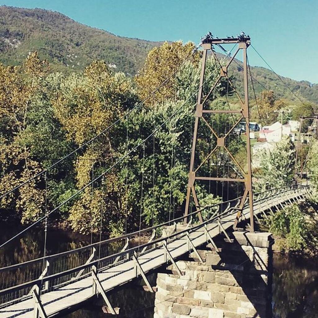
Buchanan Swinging Bridge

I guess I really didn’t know what to expect from driving through the Shenadoah Valley. I just hated how trapped I felt when I was in Shendoah National Park — there are only limited exits from the park due to the need to have paybooths at every entrance. Even the Blue Ridge Parkway seems disconnected from the lands below.

Maybe I should have instead gone to Shenandoah National Park for a few days so I could have been spending my time looking down, rather then up from the valley. Or better yet spent more time in West Virginia. There is a lot of the Monongahela National Forest that I have yet to see. Maybe I should have drove up Spruce Mountain again, so I could say I was at the top of the Mountain State. But I did that already.

 US 33 Heading Back To West Virigina

At any rate, I don’t think I will be visiting the Shenandoah Valley anytime soon again. It’s pretty to look down at from the mountains, but it hardly inspires me looking up at the surrounding ridge lines.

Road Trip to Dimock PA

Roughly 30 miles south of Binghamton, NY is Dimock, PA. I wanted to visit Dimock for some time, because I wanted to see up close the impacts of natural gas drilling in Pennsylvania. Dimock is particularly infamous for a couple of tragic accidents caused by faulting casing in gas wells causing poisonous hydrocarbons to leak out into the surrounding area. Dimock is also the home of Cabot Oil and Gas, one of the most controversial drilling companies in Pennsylvania due to their awful track record with certain wells.

NY 29 to Montrose.

I’d didn’t stop and take any pictures, but I’m including some images from Google Maps, and you’ll just have to imagine the rest from my words.

Dimock is an easy drive to get to from New York State – just take NY Route 7 south from Binghamton (you can access it from I-81 Exit 1 South of Binghamton), and NY Route 7 becomes PA Route 29 as you cross the state border. PA 29 is a very narrow and slow road, going through many hamlets, and the road is in serious need of repairs – although it was in awful shape the last time I drove it in 2008, prior to the big gas boom. Normal commercial and agricultural traffic has long made this road need of a rebuild and widening heading to the Capitol of Susquehanna County. The additional drilling related traffic hasn’t helped this road, as it ages long beyond, it’s time for widening and replacement.

PA 29 is the main road from Binghamton to Montrose. It has for a long time been congested with traffic heading to and from the capital of Susquehanna County. For most part the traffic is to be expected on a rural arterial – lots of folks in pickup trucks, beat up cars, milk trucks, grain trucks, pickups towing horse and cattle trailers. There are also traffic related to gas drilling, such as fresh water haul trucks used for fracking, and residual waste trucks hauling away condensate from gas well. I saw a pickup truck with a goose-neck trailer with drilling bits on it. For the most part traffic was free flowing.

There are small cattle farms in valley below PA 29, and some of the mountains above the road show quarrying activity for Blue Stone and possibly also coal. Nothing too obvious from the roads, but in one or two places, it’s obvious there is some mountains being mined for their products.

Busy Montrose on Saturday.

Eventually you real reach the borough of Montrose. This small city was very busy, but that’s to be expected of the only city in the region on a Saturday. People go to city to pick up groceries, shop, and fill up at the gas station. Walmart – on the outskirts of the city – was particularly crazy there.

There was a mix of truck traffic from different sources – some agricultural, some oil and gas related, some other for other businesses like grocery stores. Busy, but certainly not grid lock. Montrose is a pretty gritty little city, much like other cites in Twin Tier region, with lot of folks in big jacked up pickup trucks with gun racks. It’s certainly not an urban area by any extent of the imagination. Traffic in Montrose reminded me much of busy nature of Wellsboro PA or Watkins Glen NY.

South of Montrose.

South of Montrose is where the country starts to open up along NY 29. There is some rural houses on large lots on NY 29, but it’s mostly farm country. Traffic is very light south of Montrose. There are many farms on hilltops and across the landscape. Just past Dimock Post Office, and a few houses, there is Cabot Oil and Gas offices. Cabot Oil and Gas’ Dimock Headquarters is a one-story ranch-style building, that appears to be formally a rural doctors office or other small business office. It’s not a new building. The parking lot has been expanded with gravel – it’s obvious that once the gas wells are completed in this area, Cabot probably will be closing out this regional office.

This is where you first start to see first gas wells, one right beyond the Cabot Oil and Gas Office, and one on a farm field to the left of the road. This gas well is completed, although there are two condensate tanks on the roughly 4-acres pad. The pad is large, when viewed up close from the road, but there are no equipment on the pad except for the tanks. There is no reason why they could not remove the pad now, except for the access road to condensate tanks for occasional pumping. Farming activity is going up and around the well pad, with alfalfa currently planted around the pad, for the dairy farm on which it is located. Well pads are located on farms that are roughly 250 acres in size on steeply rolling country, so their impact both on farms and landscape is minimal. Spacing requirements limit well pads to one per 160 acres – but realistically terrain and gas fields expand things out further then that.

For the next three miles, as you go up and down several hills, there is no well pads thats can be seen, until one pops up in the distance on right. This well doesn’t produce any condensate or was abandoned, so there are no tanks or equipment above around. From there, it’s kind of hilly, with a lot of forested brush lands, in areas not economical to farm, mostly used for residents in fall to harvest wood for heating, and hunting in fall.

Lemon to Nicholson.

When I got down to an unmarked hamlet known as Lemon, I took a left onto State Route 1006, and started winding around farm country. Climbing out of valley, up towards Seely Hill, there where many well manicured farms, that obviously where well capitalized, professionally run operations without a lot of junk in their yards. None of farms where particularly large, as this area lacks the soils to sustain CAFO-sized farms, but with beautiful old farm houses painted white, and barns painted red. Cows where grazing around, corns, alfalfa, hay, and soybeans where planted following the landscape. Atop some of the hills, you could see for miles.

Not everything was picture perfect. It was a working landscape, and some farms where more messy then other. Passed a junkyard, and some trailers and houses. Almost everybody had burn barrels or pits for trash. Many had targets and stuffed deer statues in their backyards used for plinking. There where some abandoned houses, and grown up fields. It was very much a rural landscape – a bit a beautiful, wild and free landscape. There was rural poverty. It is a scene not unfamiliar to a New Yorker, something not far from one’s imagination, although due to the more southernly latitude allows farming on many hilltops unlike NY State.

You would climb one steep hill, and descend another, and you might see an gas well. After a while of winding on some back road, I saw a gas well under construction. Drilling rigs are big and tall, and there is a lot of trucks holding water, flowback water, chemicals, and drilling bits. I noticed quite a bit of particulate laden steam / smoke from one of compressor rigs – a potential problem – although it seems government regulation to reduce pollution from oil and gas industry will further clean the air. Such minor and localized pollution wasn’t everywhere.

Many places didn’t have any gas drilling activity underway. The further south or west you got from Dimock, and further you got from the gas field around Dimock, and the fewer wells you would see, until you see no more wells dotting the landscape. After a while, there was no more drilling activity going on.

Eventually I ended up in Nicholson, and took US 11 back to New York. The archways of the Lackawanna Railroad Viaduct are quite remarkable as the soar high above this town. US 11 is a delightful road, following a narrow valley along the deep valley of the Martin Creek, until one eventually reaches Great Bend on Susquehanna River and I-81 back to NY State.

Conclusions I Draw from My Trip.

Dimock is one small hamlet across Pennsylvania. It is a pocket of some of the most intense natural gas drilling in Pennsylvania. Gas drilling is not without impacts, but it is not the industrialization or utter destruction of rural life. Farms continue after gas drilling, and modest rural housing continues to exist. Small towns continue to be small towns, even if there is a benefit of greater employment and higher standard of living in these small towns.

Dimock is still primarily about farming and rural life – it is not suburban – but enjoys the boost that gas drilling gives to the town. Gas drilling does not urbanize rural areas or turn them into industrial wastelands, but instead provides

… do take this trip on your own. It’s not that long of a drive from Albany, and it’s a very interesting and beautiful drive for sure.

The Scale of New York

Notes on the Re-Run for Wednesday, April 25th.

— Andy

I was wondering how big the New York City-metro area is compared to other regions in our state. What does New York City-metro area look like compared to Albany County, the Plattsburgh and North Country-area, and the Ithaca-Watkins Glen Finger Lakes-area?

All of these maps are exactly the same scale, 75 pixels per 5 miles of real land below it. You can visually compare the size with these maps, and look at urban density and farm uses, via the color of the land below. It will not display in the RSS feed or Facebook, so view at andyarthur.org.

New York City-Metro Area.

This map includes part of Westchester County and Nassau County, but gives you an idea of the size of the metropolitan area that is most associated with what people think of when they think of NYC. Not all of this area is highly urbanized, much of the surrounding area that appears with higher levels of green is suburbs.

Albany County (Albany & Schenectady).

As you can see the New York City metro area would cover all of Albany County, plus significant portions of Northern Greene and Eastern Schoharie County. You could easily fit Albany and Schenectady within the borders of New York City, along with surrounding suburbs. NYC is not only populous, it’s also fairly big.

Clinton County (Plattsburgh).

Clinton County is much larger and rural then Albany County and New York City. There is relatively less of Essex and Franklin County in this map then there is Westchester and Nassau County in the NYC-metro map. Even Albany County appears small compared to Clinton County. Notice the darkness of the highly-forested Adirondack Park, and the light green of the fertile Champlain Valley farmlands.

Ithaca and Watkins Glen.

This map shows Ithaca and Watkins Glen. You can see the public forest lands and pastures of the Finger Lakes National Forest, Sugar Hill State Forest, Ithaca, and Watkins Glen. You go into the Allegany Mountains in the south and in the north the sloped landscape that is the norm of the Finger Lakes.