Camp
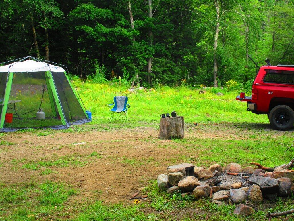
A simple, very open campsite for relaxing, near Speculator. No complaints there, although my cell service was a bit weak.
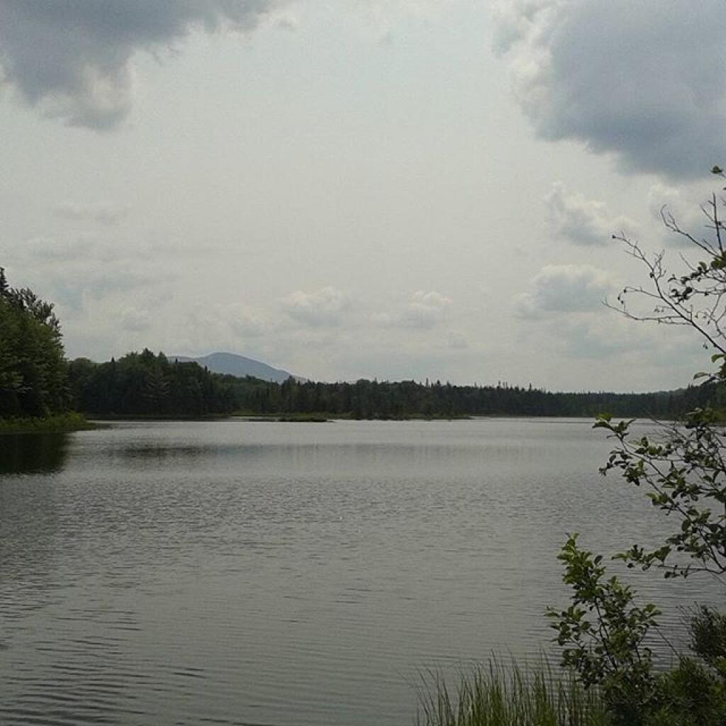
Taken on Wednesday July 22, 2020 at Spectulator.
A simple, very open campsite for relaxing, near Speculator. No complaints there, although my cell service was a bit weak.
Taken on Wednesday July 22, 2020 at Spectulator.Good morning! Happy Tuesday, back to work from Speculator. Partly sunny and 59 degrees in Speculator, NY. There is a northwest breeze at 5 mph. 🍃.
By working up here I could stay another day in the Adirondacks and if I camp overnight, ⛺ I’ll drive home Wednesday evening about when the weather gets more stormy. I’ve been off the internet all weekend as I had no service which is nice for a change, it’s good to be away from work and everything else. 💼 With the primaries and everything else going on it seems like most of weekends previously were quite busy.
Today will be mostly sunny 🌞, with a high of 77 degrees at 4pm. Six degrees below normal, which is similar to a typical day around September 1st. Maximum dew point of 59 at 8am. West wind 5 to 7 mph. A year ago, we had cloudy skies in the morning with more sun in the afternoon. It was humid. The high last year was 91 degrees. The record high of 101 was set in 1930.
Solar noon 🌞 is at 1:05 pm with sun having an altitude of 66.9° from the due south horizon (-3.1° vs. 6/21). A six foot person will cast a 2.6 foot shadow today compared to 2.2 feet on the first day of summer. The golden hour 🏅 starts at 7:50 pm with the sun in the west-northwest (293°). 📸 The sunset is in the west-northwest (300°) with the sun dropping below the horizon at 8:32 pm after setting for 3 minutes and 22 seconds with dusk around 9:05 pm, which is 52 seconds earlier than yesterday. 🌇 At dusk you’ll see the Waxing Crescent 🌒 Moon in the west-northwest (293°) at an altitude of 5° from the horizon, 232,588 miles away. 🚀 The best time to look at the stars is after 9:49 pm. At sunset, look for partly clear skies 🌄 and temperatures around 71 degrees. The dew point will be 57 degrees. There will be a northwest breeze at 6 mph. Today will have 14 hours and 54 minutes of daytime, a decrease of one minute and 50 seconds over yesterday.
Tonight will be partly cloudy 🌤, with a low of 58 degrees at 5am. Four degrees below normal, which is similar to a typical night around August 27th. Maximum dew point of 57 at 8pm. Northwest wind around 6 mph becoming light and variable after midnight. In 2019, we had mostly clear skies in the evening, which became cloudy by the early hours of the morning. It became humid as the night progressed. It got down to 66 degrees. The record low of 47 occurred back in 1970.
It was a nice long weekend camping at Piseco Powley Road, at times quite nice but for a while Sunday evening when the wind died down it was rather muggy. 😰 But when the breeze picked up it was pretty cold nice. Rained from a thunderstorm late Sunday night. ⚡ I’ve enjoyed being off the grid, having no cell service 📱 or ability to take calls all of the long weekend. I’ll upload some pictures later in the day. 📷
Saturday I walked the closed portion of Piseco Powley Road. 🚧 The south bridge is damaged from the October 31st storm and repairs will be necessary for Stratford to fix the other sections. That said, beyond the substructure of the bridge being rebuilt and some fill and a culvert needing replacing, most of the tools to rebuild the road shouldn’t be particularly difficult or unusual to implement.
On Saturday I also patched the hole in the screen tent. 🎪 It isn’t pretty as it doesn’t quite match in color and I wish I had had gotten the fabric a little tighter but it provides a good bug free area for camping. 🐜 Bugs have been bad this weekend, especially the deer fly although not so bad in the Potholers and times in the screen tent have been nice. After dark and early mornings I’ve been using the hammock a fair bit as the deer flies aren’t as bad then.
The Potholers were nice in the heat 🏊, I spent several hours laying in them and cooling off. I sat down there listening to podcasts 🎧and just enjoying the cold water 💦 and hot sun ☀. During the weekend there was a fair number of people there although I expect I would see a lot more were the road to be fully open. I am hopeful though that once the bridge is repaired, they can get the road repaired relatively quickly. I’m still thinking it might be done by hunting season. That will certainly make visiting the Potholers a lot more of an option come 2021.
Only one real shit moment at camp. 😮 On Monday evening after parking at camp I noticed something hanging out below the front axle like something was broken. Turned out to be just a root but I was afraid that I had broken something on my truck. Just a silly shadow of a root. Pulled it up and tossed it in the woods. This campsite is a bit of a mud wallow at the parking spot but has been as long as I’ve camped here. At least it’s very quiet here with the road closed heading south bound from the Potholers – the only traffic is those going down there.
I thought about moving down to Powley Place last evening so I could enjoy the stars ✨but ultimately I decided against that. It was fine, I was in by 9:30 and at that point wouldn’t have seen many stars. But I did stop by Powley Bridge briefly this morning to see the new temporary bridge and observe what has changed since the October 31st flood last year.
On this day in 1925, Dayton, Tennessee high school biology teacher John T. Scopes is found guilty of teaching evolution in class and fined $100. 👮 Darn criminals ruining our country. The judge incorrectly set the fine, rather then letting the jury do it, so his conviction was overturned on appeal. 🏫 The law would remain on the books until it was repealed 1967. Also in 1983, the world’s lowest temperature in an inhabited location is recorded at Vostok Station, Antarctica at −89.2 °C (−128.6 °F). ⛄ They should build a pipe and send it up north to cool off people efficently.
Been doing a lot of reading 📖 while up in camp. Re-read Heather Thomas’ Raising Beef Cattle 🐮 which is an interesting book on the ins and outs of cows. They’re pretty amazing animals which do pretty good most of the time on grasses, water, salt and some careful human hands to train them and take care of their needs. Beef cattle don’t have the complicated nutritional needs of the high performance Holstein cows 🐄 used on most dairies.
Should be a great weekend. 😎 Saturday, mostly sunny, with a high near 82. Maximum dew point of 59 at 8am. Sunday, a chance of showers and thunderstorms. Partly sunny, with a high near 83. Chance of precipitation is 40%. Maximum dew point of 63 at 7pm. Typical average high for the weekend is 83 degrees.
I haven’t decided if I will stay all week in the Adirondacks. 🗻 Only three nights until the weekend so I could get a campsite near Speculator and work up here to the weekend and then go back to Piseco Powley Road. I’m undecided though because working and camping can be kind of tiring, especially if I don’t get enough sleep. 😴
Looking ahead, there are 15 weeks until Election Day 2020 🗳️ when the sun will be setting at 4:45 pm with dusk at 5:15 pm (Standard Time). On that day in 2019, we had partly sunny skies with a few rain showers and temperatures between 53 and 30 degrees. Typically, the high temperature is 53 degrees. I was really sick that day last year with Lyme disease. We hit a record high of 75 back in 1990.
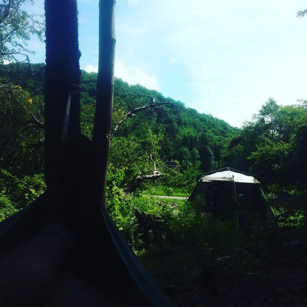
Laying back with laptop in my hammock, a relaxing way to work.
Taken on Wednesday July 15, 2020 at Green Mountain National Forest.An overview map and list of campsites and their locations at the Moose River Recreation Area.
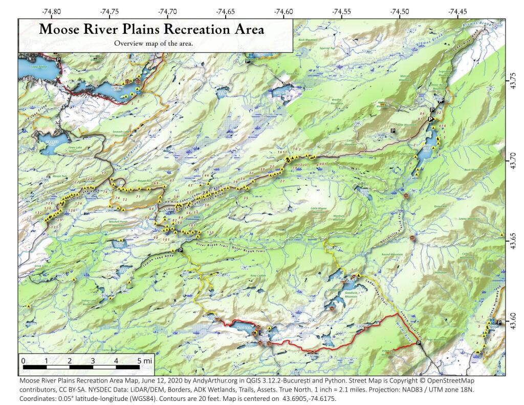
| Milepoint | Name | Feature | Notes | Access | Location | |||
|---|---|---|---|---|---|---|---|---|
| Cedar River Flow 1 | Cedar River Flow | Tent site on flow | Boat | 43.702924803151, -74.4871304116533 | ||||
| Cedar River Flow 2 | Cedar River Flow | Tent site on flow | Boat | 43.7104737708879, -74.4802343768254 | ||||
| Cedar River Flow 3 | Cedar River Flow | Tent site on flow | Boat | 43.7145237017622, -74.4679264444554 | ||||
| Cedar River Flow 5 | Cedar River Flow | Tent site on flow | Boat | 43.7111711590583, -74.4675178486588 | ||||
| Cedar River Flow 6 | Cedar River Flow | Tent site on flow | Boat | 43.7084767866376, -74.4717703157492 | ||||
| Beaver Lake Campsite | Beaver Lake | Site overlooks Beaver Lake | Hike | 43.6516613421651, -74.7407833400961 | ||||
| 81 | Icehouse Pond | Accessible site at Icehouse Pond with privy | Hike | 43.6646602166505, -74.7029502913239 | ||||
| 140A | Indian Lake | Campsite on Indian Lake, outhouse in bad condition | Hike | 43.6154753632731, -74.7499942080732 | ||||
| East of Muskrat Pond | Indian Lake Trail | Former roadside campsite, largely abandoned | Hike | 43.645116528704, -74.696221627206 | ||||
| 46 | Lost Ponds Trail | Beyond the end of current Lost Ponds Road | Hike | 43.6868179572109, -74.6655581886723 | ||||
| 47 | Lost Ponds Trail | Above Lost Ponds | Hike | 43.6859472953826, -74.6722052916864 | ||||
| Mitchell Pond 1 | Mitchell Pond | Tent site, bushwhack | Hike | 43.6729475881673, -74.7502538624373 | ||||
| Mitchell Pond 2 | Mitchell Pond | Tent site, bushwhack | Hike | 43.6716991892117, -74.7432124817486 | ||||
| 64A | Mitchell Pond (Accessible Campsite at End of Gravel Trail) | Gravel path to site, wildrness privy | Hike | 43.6706136251028, -74.7387363015355 | ||||
| 10 | 89 | Beaver Lake Road | Off Otter Brook Road, Sand Plains | Vehicle | 43.6583112347181, -74.7012491214803 | |||
| 11 | 90 | Beaver Lake Road | Off Otter Brook Road, Sand Plains | Vehicle | 43.6577446555162, -74.7038760912165 | |||
| 16 | 1 | Cedar River – Limekiln Lake Road | Driveway Along Tributary of Silver Run | Vehicle | 43.7033162602551, -74.5742148239156 | |||
| 16 | 3 | Cedar River – Limekiln Lake Road | Along Silver Run | Vehicle | 43.7027301523306, -74.5757742464803 | |||
| 16 | 4 | Cedar River – Limekiln Lake Road | Along Silver Run, driveway at Sharp S Turn | Vehicle | 43.7026421104662, -74.5769731929134 | |||
| 16 | 7 | Cedar River – Limekiln Lake Road | Along Silver Run | Vehicle | 43.7040070126376, -74.5809411044503 | |||
| 15 | 10 | Cedar River – Limekiln Lake Road | Old gravel pit, accessible | Vehicle | 43.7031498027862, -74.5893864145496 | |||
| 15 | 11 | Cedar River – Limekiln Lake Road | Across from 12 | Vehicle | 43.702458607149, -74.5926546451668 | |||
| 15 | 12 | Cedar River – Limekiln Lake Road | Across from 11 | Vehicle | 43.7028667147947, -74.5929833340894 | |||
| 15 | 13 | Cedar River – Limekiln Lake Road | Along Silver Run | Vehicle | 43.7010402113051, -74.5956355707995 | |||
| 15 | 14 | Cedar River – Limekiln Lake Road | Along Silver Run | Vehicle | 43.7010328498576, -74.597457469967 | |||
| 14 | 16 | Cedar River – Limekiln Lake Road | Access Road for 16/17/18 Group | Vehicle | 43.7025294616695, -74.5969885248639 | |||
| 14 | 17 | Cedar River – Limekiln Lake Road | Access Road for 16/17/18 Group | Vehicle | 43.7021028692463, -74.5966599329259 | |||
| 14 | 18 | Cedar River – Limekiln Lake Road | Access Road for 16/17/18 Group | Vehicle | 43.7023846304313, -74.5978818600647 | |||
| 14 | 19 | Cedar River – Limekiln Lake Road | Along Silver Run | Vehicle | 43.7003546491841, -74.5964872856253 | |||
| 14 | 21 | Cedar River – Limekiln Lake Road | Across road from Silver Run | Vehicle | 43.6957217888458, -74.6020563094081 | |||
| 13 | 22 | Cedar River – Limekiln Lake Road | Across road from Silver Run | Vehicle | 43.6935817523545, -74.6036764840587 | |||
| 13 | 27 | Cedar River – Limekiln Lake Road | Across road from Silver Run | Vehicle | 43.6926540634024, -74.6082201775478 | |||
| 13 | 30 | Cedar River – Limekiln Lake Road | Open Area in Woods | Vehicle | 43.6918525577623, -74.6118452191364 | |||
| 13 | 31 | Cedar River – Limekiln Lake Road | Near Marsh off Silver Run | Vehicle | 43.6881856235873, -74.6271629609656 | |||
| 12 | 34 | Cedar River – Limekiln Lake Road | Open Field Near Old Sly Pond Road | Vehicle | 43.6846954329325, -74.634678249126 | |||
| 12 | 35 | Cedar River – Limekiln Lake Road | Former Sly Pond Road | Vehicle | 43.6836690328942, -74.6318552827363 | |||
| 11 | 38 | Cedar River – Limekiln Lake Road | On Hill Overlooking Road, near start of Lost Ponds Area | Vehicle | 43.6836029270341, -74.6401393590772 | |||
| 11 | 39 | Cedar River – Limekiln Lake Road | Above CRLLR, start of Lost Ponds Area | Vehicle | 43.6841476346233, -74.6487511980121 | |||
| 11 | 40 | Cedar River – Limekiln Lake Road | Above CRLLR, start of Lost Ponds Area | Vehicle | 43.682942162164, -74.6537793571789 | |||
| 11 | 41 | Cedar River – Limekiln Lake Road | Above CRLLR, start of Lost Ponds Area | Vehicle | 43.681311345096, -74.6589116717693 | |||
| 10 | 42 | Cedar River – Limekiln Lake Road | Above CRLLR, start of Lost Ponds Area | Vehicle | 43.6799039050817, -74.6646031695507 | |||
| 10 | 43 | Cedar River – Limekiln Lake Road | Above CRLLR, start of Lost Ponds Area | Vehicle | 43.6793727911294, -74.6664156654099 | |||
| 10 | 44 | Cedar River – Limekiln Lake Road | West of Lost Ponds Road, Sand Plains | Vehicle | 43.678808787762, -74.6696555368193 | |||
| 10 | 50 | Cedar River – Limekiln Lake Road | West of Lost Ponds Road, Sand Plains | Vehicle | 43.677986610504, -74.6732025802129 | |||
| 10 | 51 | Cedar River – Limekiln Lake Road | Pull-Off, Small Site, Sand Plains | Vehicle | 43.6775108499728, -74.6750146421403 | |||
| 10 | 52 | Cedar River – Limekiln Lake Road | Old gravel pit, short loop below CRLLR | Vehicle | 43.6748840847288, -74.6815273754233 | |||
| 10 | 53 | Cedar River – Limekiln Lake Road | Access Road for 55/54/55 Group, Sand Plains | Vehicle | 43.6733317629897, -74.6820452615144 | |||
| 10 | 54 | Cedar River – Limekiln Lake Road | Access Road for 55/54/55 Group, Sand Plains | Vehicle | 43.673268538603, -74.6822820352903 | |||
| 9 | 55 | Cedar River – Limekiln Lake Road | Access Road for 55/54/55 Group, Sand Plains | Vehicle | 43.6733705968856, -74.6827076379887 | |||
| 9 | 56 | Cedar River – Limekiln Lake Road | Driveway, East of Former Dump, Sand Plains | Vehicle | 43.673126585883, -74.6891475571674 | |||
| 9 | 57 | Cedar River – Limekiln Lake Road | Has Trail to Moose River | Vehicle | 43.6736673106707, -74.6902687046523 | |||
| 8 | 64 | Cedar River – Limekiln Lake Road | Near Mitchell Pond Trail | Vehicle | 43.6757521870177, -74.707500815672 | |||
| 8 | 66 | Cedar River – Limekiln Lake Road | Near Pine Creek | Vehicle | 43.6784203854214, -74.7068492021325 | |||
| 7 | 67 | Cedar River – Limekiln Lake Road | Benedict Creek Road, Wooded | Vehicle | 43.6851041444828, -74.7031887110586 | |||
| 7 | 69 | Cedar River – Limekiln Lake Road | Remote site, perched over the road | Vehicle | 43.6834516958835, -74.7168906980223 | |||
| 6 | 70 | Cedar River – Limekiln Lake Road | Large loop off of CRLLR | Vehicle | 43.6839906014562, -74.7249870178447 | |||
| 6 | 71 | Cedar River – Limekiln Lake Road | Very sandy site near Mitchells Pond Upper Loop | Vehicle | 43.6833776353921, -74.7321947941391 | |||
| 5 | 72 | Cedar River – Limekiln Lake Road | At end of Bear Pond Loop Road (Accessable) | Vehicle | 43.6828956047277, -74.7359084701559 | |||
| 4 | 73 | Cedar River – Limekiln Lake Road | Very sandy site near Mitchells Pond Upper Loop | Vehicle | 43.6835777053685, -74.7387188889593 | |||
| 4 | 74 | Cedar River – Limekiln Lake Road | On a hill overlooking road and marshy area | Vehicle | 43.6839187521201, -74.742285779317 | |||
| 4 | 76 | Cedar River – Limekiln Lake Road | Very sandy site near Mitchells Pond Upper Loop | Vehicle | 43.6864452702399, -74.7471689344191 | |||
| 4 | 77 | Cedar River – Limekiln Lake Road | Near Red River, Bear Pond Loop, Sand Plains | Vehicle | 43.6897961458669, -74.7484803840413 | |||
| 10 | 58 | Helldiver Pond Road | Near Helldiver Pond | Vehicle | 43.6735979105991, -74.6920316000423 | |||
| 10 | 59 | Helldiver Pond Road | Near Helldiver Pond | Vehicle | 43.6723766419894, -74.6929318681131 | |||
| 10 | 60 | Helldiver Pond Road | Near Helldiver Pond | Vehicle | 43.6713193532923, -74.692758456613 | |||
| 10 | 61 | Helldiver Pond Road | Accessible site at end of Helldiver Pond Road | Vehicle | 43.6705019900204, -74.6921751440693 | |||
| 15 | West of Brooktrout Trail | Indian Lake Road | Past Brooktrout Trail, on a hill over road | Vehicle | 43.6254538914434, -74.7337300739322 | |||
| 10 | 48 | Lost Pond Road | Sand Plains, Marshes Aroubnd | Vehicle | 43.6814268347573, -74.6667101324338 | |||
| 11 | 49 | Lost Pond Road | Sand Plains, Marshes Aroubnd | Vehicle | 43.6819456385478, -74.6670131106595 | |||
| 10 | 80 | Otter Brook Road | Has Trail to Moose River | Vehicle | 43.6620917920003, -74.7112181918076 | |||
| 11 | 98 | Otter Brook Road | Above Moose River on Hill | Vehicle | 43.6588725644731, -74.6966603409996 | |||
| 11 | 101 | Otter Brook Road | Sand Plains | Vehicle | 43.6564420559443, -74.6938956128147 | |||
| 11 | 103 | Otter Brook Road | Sand Plains | Vehicle | 43.657108724794, -74.6873446316172 | |||
| 12 | 104 | Otter Brook Road | Wooded Site | Vehicle | 43.6560617426567, -74.6832992891923 | |||
| 12 | 106 | Otter Brook Road | Wooded Site | Vehicle | 43.6565121581975, -74.6789913497265 | |||
| 13 | 110 | Otter Brook Road | Wooded Site | Vehicle | 43.6566072628101, -74.6733859460379 | |||
| 13 | 111 | Otter Brook Road | Near Otter Brook Bridge | Vehicle | 43.6539235327721, -74.6747718892435 | |||
| 23 | 1 | Wakely Dam Camping Area | Accessible site | Vehicle (before gate) | 43.7266767212397, -74.474100266424 | |||
| 23 | 2 | Wakely Dam Camping Area | Field Camping | Vehicle (before gate) | 43.7266515010084, -74.4733110730078 | |||
| 23 | 3 | Wakely Dam Camping Area | Field Camping | Vehicle (before gate) | 43.7259595122959, -74.473899965642 | |||
| 23 | 4 | Wakely Dam Camping Area | On Driveway to Lake | Vehicle (before gate) | 43.7260676922081, -74.4742326471903 | |||
| 23 | 5 | Wakely Dam Camping Area | On Driveway to Lake | Vehicle (before gate) | 43.7255637908987, -74.4741751228291 | |||
| 23 | 6 | Wakely Dam Camping Area | On Driveway to Lake | Vehicle (before gate) | 43.7252231337487, -74.4745830371916 | |||
| 23 | 9 | Wakely Dam Camping Area | Across bridge | Vehicle (before gate) | 43.726275356142, -74.4717840349063 | |||
| 23 | 10 | Wakely Dam Camping Area | Across bridge | Vehicle (before gate) | 43.7266308152758, -74.4712600272389 | |||
| 10 | 82 | Otter Brook Road | On Moose River | Vehicle (driveway) | 43.6603083771227, -74.7010353925305 | |||
| 11 | 84 | Otter Brook Road | On Moose River | Vehicle (driveway) | 43.6619962517853, -74.6957783254417 | |||
| 6 | 120 | Natural Rock Dam Road | Sand Plains near Red River | Vehicle (Opens July) | 43.6848543033273, -74.7664253595203 | |||
| 6 | 122 | Natural Rock Dam Road | Wooded Site | Vehicle (Opens July) | 43.684367353989, -74.7717171949716 | |||
| 6 | 123 | Natural Rock Dam Road | Wooded Site | Vehicle (Opens July) | 43.6804228755091, -74.7782951743141 | |||
| 6 | 124 | Natural Rock Dam Road | Wooded Site | Vehicle (Opens July) | 43.6792030487765, -74.7847972548314 | |||
| 7 | 125 | Natural Rock Dam Road | Wooded Site | Vehicle (Opens July) | 43.6783559964111, -74.7880327043169 | |||
| 7 | 126 | Natural Rock Dam Road | Wooded Site | Vehicle (Opens July) | 43.6748535298235, -74.790591643043 | |||
| 7 | 127 | Natural Rock Dam Road | Wooded Site | Vehicle (Opens July) | 43.6739776362472, -74.7910844137006 | |||
| 7 | 128 | Natural Rock Dam Road | Wooded Site | Vehicle (Opens July) | 43.6751413481917, -74.7924842843025 | |||
| 8 | 129 | Natural Rock Dam Road | Wooded Site | Vehicle (Opens July) | 43.6703784784539, -74.7926312803463 | |||
| 8 | 130 | Natural Rock Dam Road | Wooded Site | Vehicle (Opens July) | 43.6666270858056, -74.8019151989726 | |||
| 8 | 131 | Natural Rock Dam Road | Wooded Site | Vehicle (Opens July) | 43.6643581634434, -74.8054154753831 | |||
| 8 | 132 | Natural Rock Dam Road | Wooded Site | Vehicle (Opens July) | 43.6652083016168, -74.8036826184027 | |||
| 5 | 119A | Natural Rock Dam Road | Sand Plains near Red River | Vehicle (Opens July) | 43.6844716021433, -74.7646961785253 | |||
| 6 | 123A | Natural Rock Dam Road | Wooded Site | Vehicle (Opens July) | 43.6802422604152, -74.782965042166 | |||
| 6 | 124A | Natural Rock Dam Road | Wooded Site | Vehicle (Opens July) | 43.6785899888224, -74.7864319884685 | |||
| 6 | 125A | Natural Rock Dam Road | Wooded Site | Vehicle (Opens July) | 43.6776017274889, -74.7902229325712 | |||
| 7 | 126A | Natural Rock Dam Road | Wooded Site | Vehicle (Opens July) | 43.6756110574941, -74.7901645681643 | |||
| 8 | 129A | Natural Rock Dam Road | Wooded Site | Vehicle (Opens July) | 43.6689370211979, -74.7948887917477 | |||
| 8 | 129AA | Natural Rock Dam Road | Wooded Site | Vehicle (Opens July) | 43.6674497436753, -74.7980604042935 | |||
| 8 | 130A | Natural Rock Dam Road | Wooded Site | Vehicle (Opens July) | 43.6661052974262, -74.8016557609016 | |||
| 8 | 130AA | Natural Rock Dam Road | Wooded Site | Vehicle (Opens July) | 43.6669094078356, -74.8007390664074 |
Good evening! Rain and 74 degrees in Delmar, NY. ☁ There is a east breeze at 8 mph. 🍃. The dew point is 71 degrees.
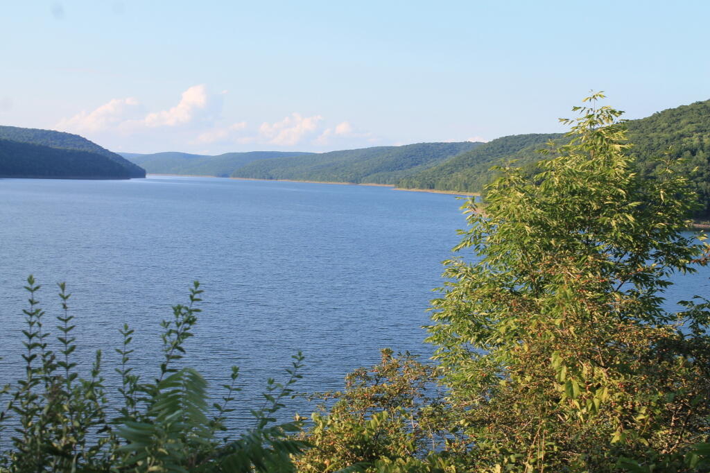
Back home from the Green Mountains. 🏡 It was nice to get away and avoid the heat and humidity but I didn’t feel like camping in the rain ☔ and it looked like all Saturday would be rainy. While it would be nice to have the day off from work when I had more time to play around in the mountains Saturday didn’t look very nice so I came home. I really liked that campsite down by the Deerfield River swimming hole 🏊 but it’s not normally easy to get unless you go up there midweek.
I didn’t like how much litter 🚮 and toilet paper flowers I found up there but I tried to clean things up to the best of my ability. I didn’t take home the junk tire or the multiple bags of garbage I found dumped back in the brush but I did burn and pack out cans for recycling from the one bag of litter I found out front. ♻ Campsite is a lot cleaner than when I found it.
The drive back home was uneventful 🚘 started to rain hard as I left but it helped with the very wash board Somerset Road. The rest of the trip was quiet except for getting onto the Molly Stark Highway at rush hour – kind of busy. 🚚 🚙
The Hoosick Valley was a bit pungent of cow manure, 💩 they were spreading it on hay fields before the rain probably so it soaks into the ground good and to keep the slurry tank from overflowing should we get a ton of rain. 🐮
It was odd driving past the state employees overflow parking lot 🅿 and seeing it all barricaded and closed but I’m guessing it’s not needed or used and the shuttles aren’t running 🚍 with most state workers telecommuting during the pandemic.
Tonight will have showers and possibly a thunderstorm. Some of the storms could produce heavy rainfall. 🌧 Low of 71 degrees at 5am. 10 degrees above normal. Maximum dew point of 72 at 11pm. 🏖️ East wind 7 to 9 mph. Chance of precipitation is 80%. New rainfall amounts between a half and three quarters of an inch possible. In 2019, we had partly cloudy skies in the evening, which became light rain by the early hours of the morning. It became very sticky as the night progressed. It got down to 71 degrees. The record low of 48 occurred back in 1986.
Tonight will have a Waining Gibbous 🌖 Moon with 67% illuminated. The darkest hour is at 1:01 am, followed by dawn at 4:54 am, and sun starting to rise at 5:28 am in the east-northeast (58°) and last for 3 minutes and 24 seconds. Sunrise is 45 seconds later than yesterday. 🌄 The golden hour ends at 6:10 am with sun in the east-northeast (65°). Tonight will have 8 hours and 54 minutes of darkness, an increase of one minute and 15 seconds over last night.
Tomorrow will have a chance of showers, then showers and thunderstorms likely after noon. Some of the storms could produce heavy rain. Mostly cloudy 🌧, with a high of 88 degrees at 2pm. Six degrees above normal. Maximum dew point of 73 at 9am. South wind 6 to 9 mph. Chance of precipitation is 70%. New rainfall amounts between a half and three quarters of an inch possible. A year ago, we had mostly sunny skies. It became humid as the day progressed. The high last year was 86 degrees. The record high of 98 was set in 1936.
In four weeks on August 7 the sun will be setting in the west-northwest (293°) at 8:07 pm,🌄 which is 26 minutes and 10 seconds earlier then tonight. In 2019 on that day, we had humid, partly sunny, thunderstorm and temperatures between 84 and 69 degrees. Come August we loose daylight in the evening quickly. Typically, you have temperatures between 82 and 61 degrees. The record high of 102 degrees was set back in 1918.
Listening 👂 to the rain, I’m glad I’m home at camping in wet weather isn’t much fun. Just everything gets wet and smokey. I still should plan on taking a summer vacation 🏊 in a few weeks and with remote work not expected to end anytime soon I have plenty of opportunities to head back to the Green Mountains or anywhere else I have cell service and work remotely from there.
Good evening! Partly clear and 67 degrees at the Green Mountain National Forest. 🌃 There is a west-southwest breeze at 7 mph. 🍃. The dew point is 65 degrees. The muggy weather ends Tuesday around 10 pm. 😓
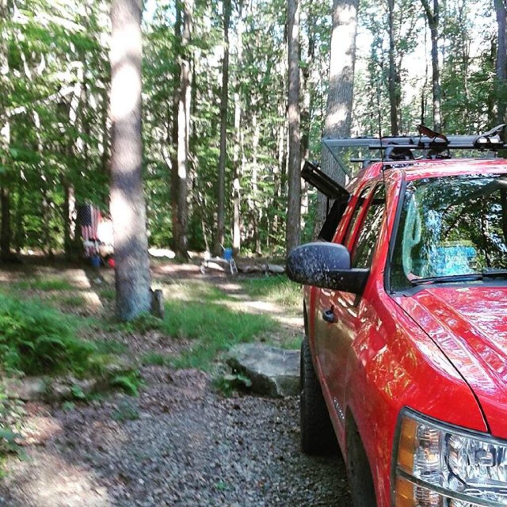
So after my spade ♤ of bad luck 🍀 yesterday I moved to a new campsite near the Somerset Bridge and the Airfield camping area. Not as quiet and remote as the other area, I’m close to a good swimming hole 🏊 and I have a lot more solar power and ability to enjoy the stars ✨ on a clear night. Radio 📻 reception isn’t as good so I have fewer choices on live radio here – no New Hampshire or Vermont Public Radio here.
It was a busy day, warm but not as oppressive as it’s back in the city. 🌆 I did go for a few short swims and cool downs during the day but most of the day I was up to my neck finishing up another one of those 30 page memos 📝 and then this afternoon it was a big spreadsheet project. 📊 Rained for a while, actually it poured for a while at the four o’clock hour so my final hour ⏳ of the day was spent working from inside my truck cap. Internet worked fine most of the day 📶 and I had no trouble accessing the VPN connection for all the files 📂 I needed from the server. I also used the 120 volt fan in the tent 🎪 with my laptop and that worked good to keep things nice and comfortable.
While I’m still finding litter 🚮 at the campsite and are picking it up when I find it, I am quite happy with this campsite near the swimming hole even if it’s not the remote country of yesterday. 🐺 Being able to wash and cool off in the heat 😎 makes it a lot more enjoyable.
I am thinking I will stay through Saturday morning, when it looks like it will be rainy. ☔ By then the worse of the heat wave will likely break and I will have all day to drive home at my own pace rather than rushing home before 9 o’clock or leaving after 5 pm.
Tonight will have isolated showers before 10pm. Patchy fog after midnight. Otherwise, partly cloudy 🌧, with a low of 64 degrees at 4am. Three degrees above normal. Maximum dew point of 66 at 11pm. West wind 5 to 7 mph. Chance of precipitation is 20%. In 2019, we had mostly clear skies. It got down to 59 degrees. The record low of 41 occurred back in 1963.
Tonight will have a Waining Gibbous 🌖 Moon with 83% illuminated. The moon will rise at 11:11 pm. The Buck 🦌 Moon is on Thursday, July 23. The darkest hour is at 12:58 am, followed by dawn at 4:48 am, and sun starting to rise at 5:22 am in the east-northeast (58°) and last for 3 minutes and 26 seconds. Sunrise is 43 seconds later than yesterday. 🌄 The golden hour ends at 6:05 am with sun in the east-northeast (65°). Tonight will have 8 hours and 50 minutes of darkness, an increase of one minute and 8 seconds over last night.
Tomorrow will have a slight chance of showers, then a chance of showers and thunderstorms after 10am. Mostly sunny , with a high of 83 degrees at 3pm. One degree above normal, which is similar to a typical day around July 13th. Maximum dew point of 68 at 10am. Calm wind becoming southwest around 5 mph in the afternoon. Chance of precipitation is 30%. New rainfall amounts between a tenth and quarter of an inch, except higher amounts possible in thunderstorms. A year ago, we had mostly sunny skies. The high last year was 86 degrees. The record high of 103 was set in 1936.
In four weeks on August 5 the sun will be setting in the west-northwest (294°) at 8:07 pm,🌄 which is 24 minutes and 46 seconds earlier then tonight. In 2019 on that day, we had sunny and temperatures between 83 and 54 degrees. Typically, you have temperatures between 82 and 61 degrees. The record high of 99 degrees was set back in 1955.