
Roosa Gap State Forest
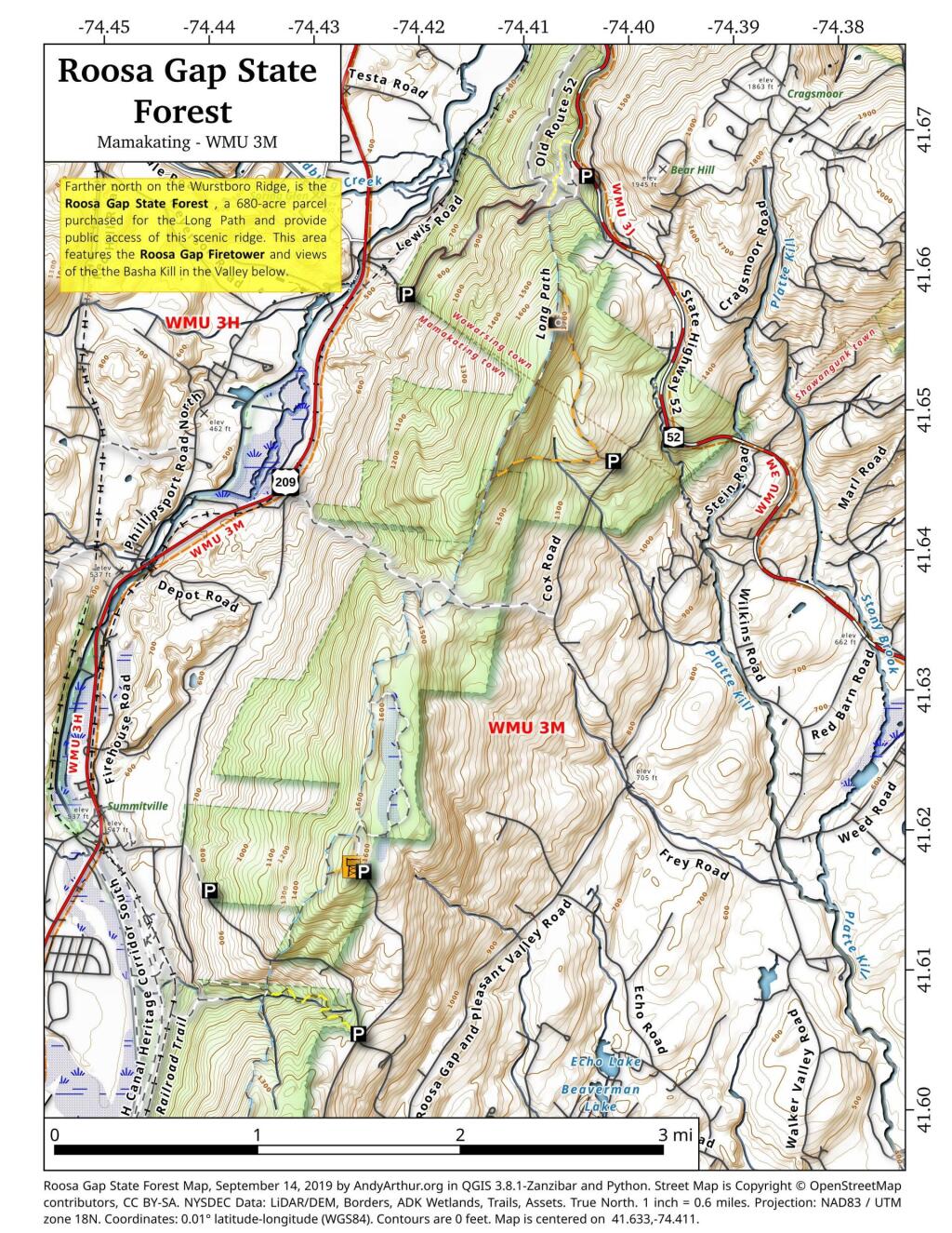
Farther north on the Wurstboro Ridge, is the Roosa Gap State Forest , a 680-acre parcel purchased for the Long Path and provide public access of this scenic ridge. This area features the Roosa Gap Firetower and views of the the Basha Kill in the Valley below.
Wurstboro Ridge State Forest
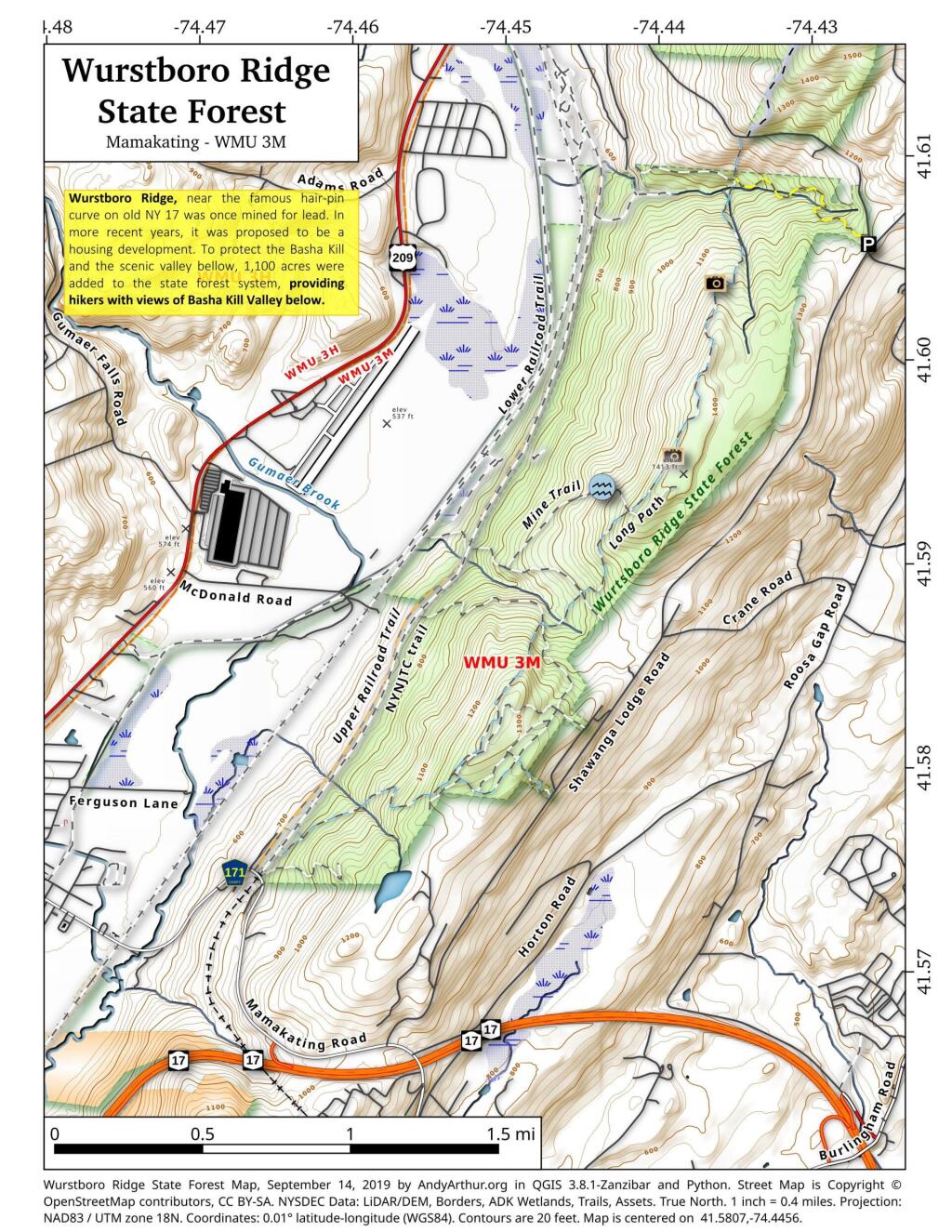
Wurstboro Ridge, near the famous hair-pin curve on old NY 17 was once mined for lead. In more recent years, it was proposed to be a housing development. To protect the Basha Kill and the scenic valley bellow, 1,100 acres were added to the state forest system, providing hikers with views of Basha Kill Valley below.
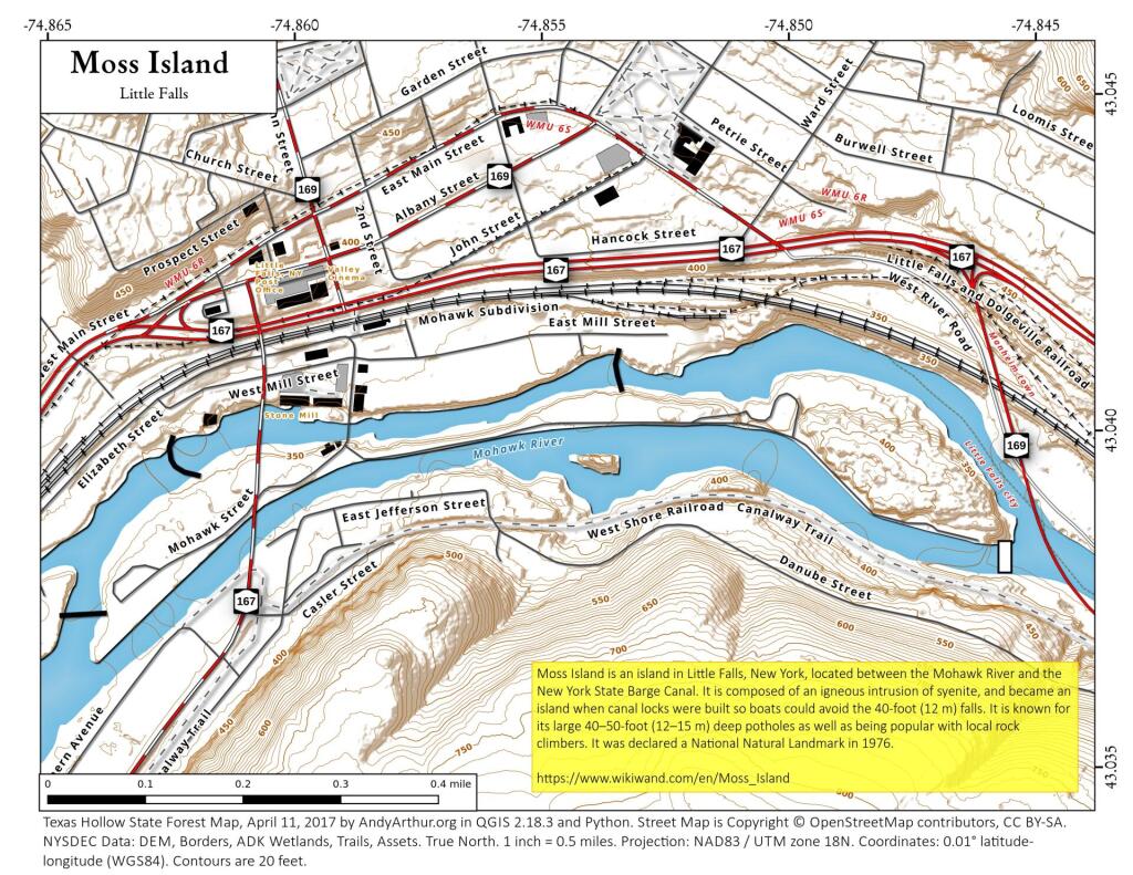
Moss Island
Firearm Ownership In The United States
Lately there has been a lot of people making dot-density maps up, with one dot representing a person or a series of people. I thought those maps were kind of interesting, so I decided to play with QGIS and see what I could make. I found a website that offered an estimate of what percentage of a state's residents own firearms and multiplied it against population. As I figured it would make too many dots to do one dot per gun owner, I made a map of one dot per 1,000 gun owners in each state -- giving people a relative density of gun ownership in each state.
Data Source: https://www.wikiwand.com/en/Gun_violence_in_the_United_States_by_state
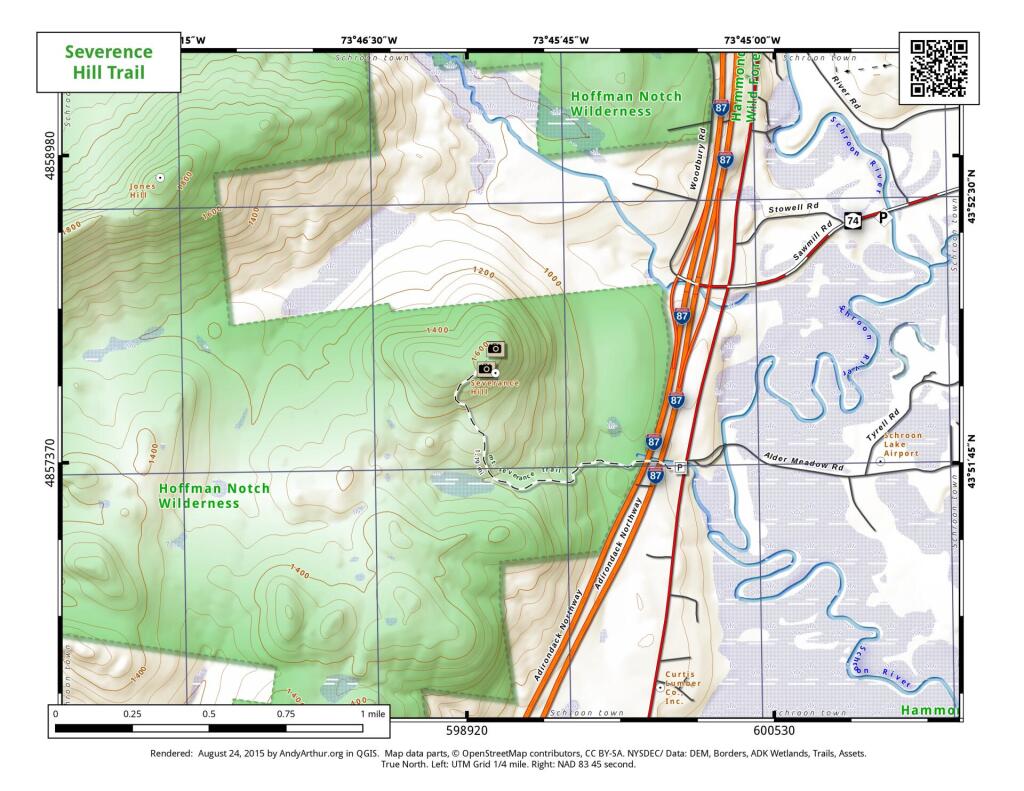
Severence Hill Trail
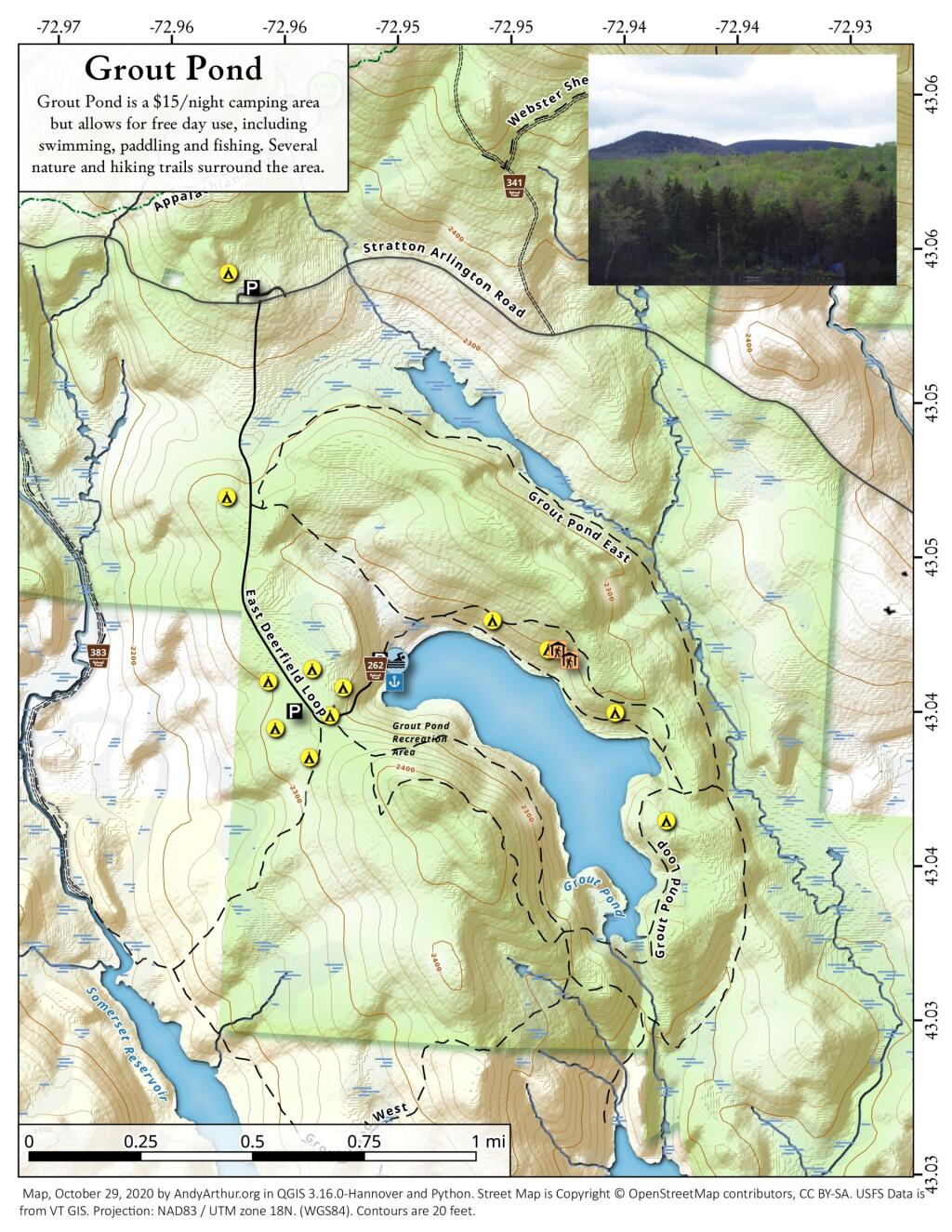
Grout Pond