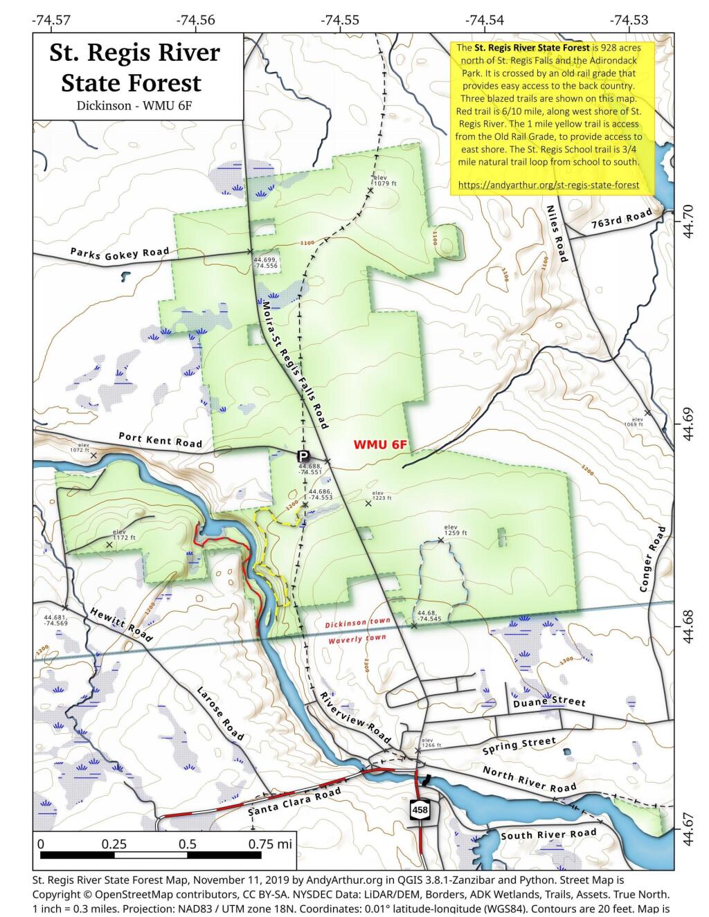
The St. Regis River State Forest is 928 acres north of St. Regis Falls and the Adirondack Park. It is crossed by an old rail grade that provides easy access to the back country. Three blazed trails are shown on this map. Red trail is 6/10 mile, along west shore of St. Regis River. The 1 mile yellow trail is access from the Old Rail Grade, to provide access to east shore. The St. Regis School trail is 3/4 mile natural trail loop from school to south.
More details from NYS DEC on St Regis State Forest.
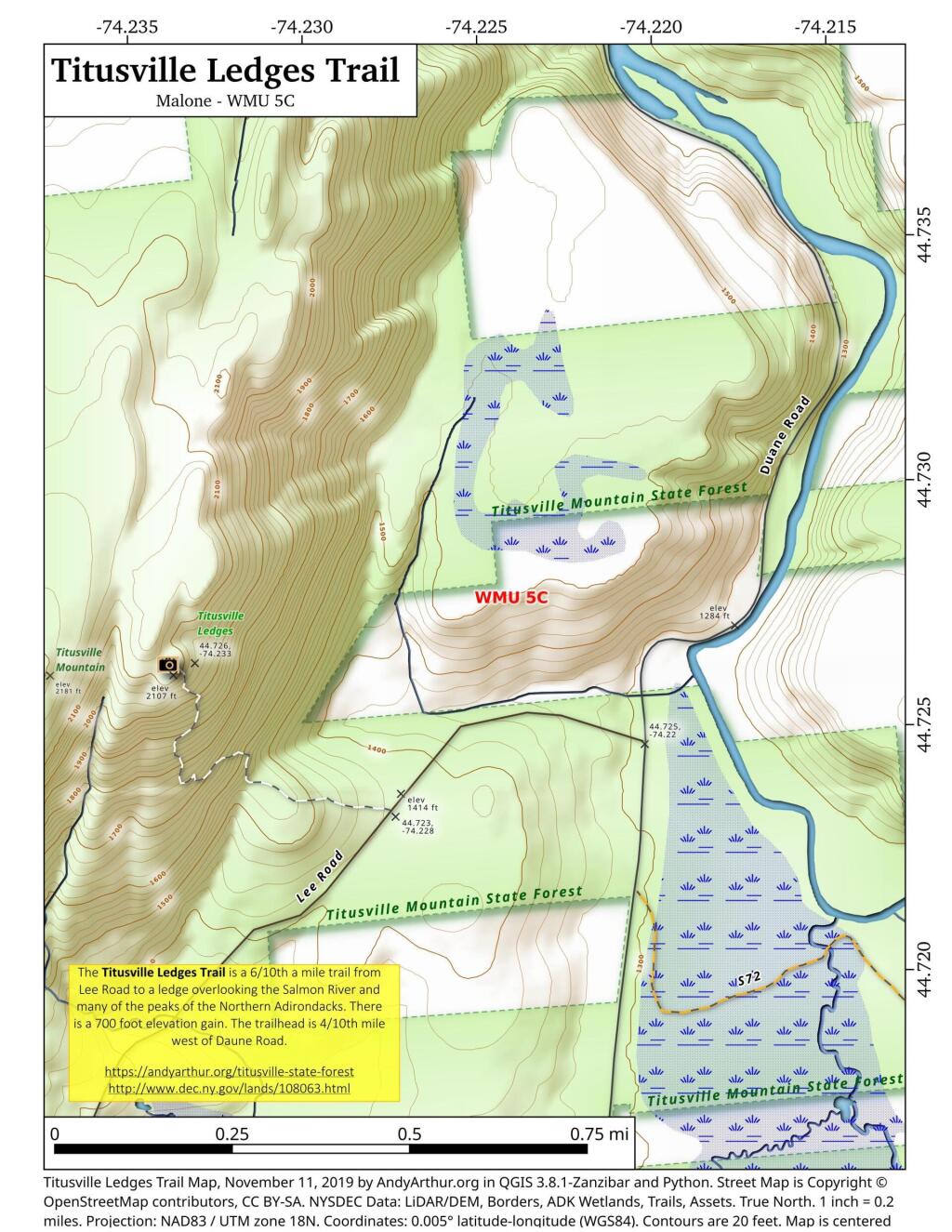
44.72901386716197,-74.23283361086914
The Titusville Ledges Trail is a 6/10th a mile trail from Lee Road to a ledge overlooking the Salmon River and many of the peaks of the Northern Adirondacks. There is a 700 foot elevation gain. The trailhead is 4/10th mile west of Daune Road.
https://andyarthur.org/titusville-state-forest
http://www.dec.ny.gov/lands/108063.html
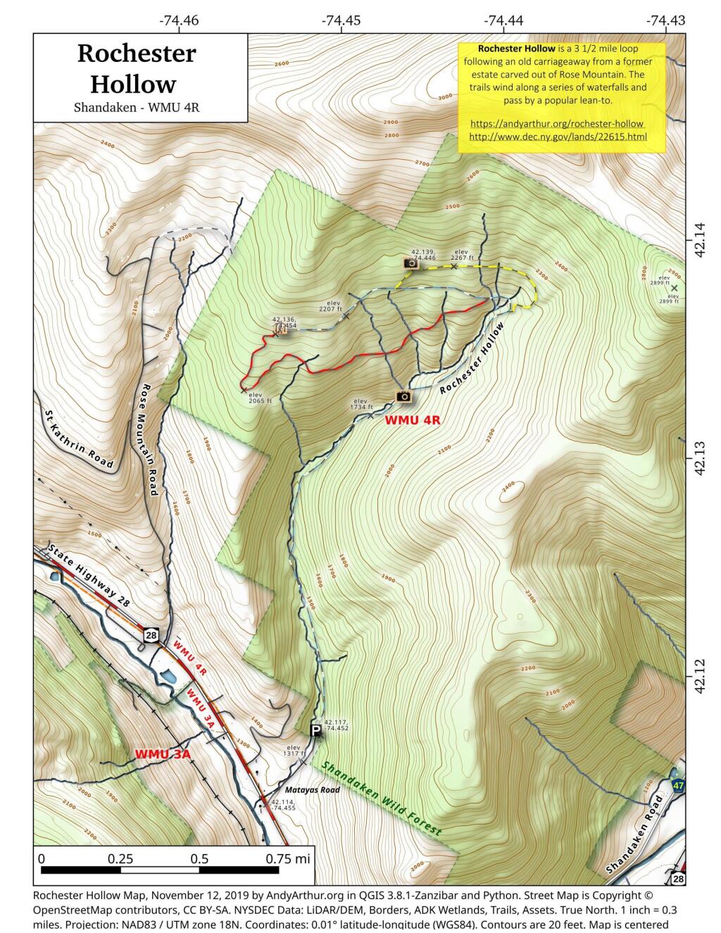
Rochester Hollow is a 3 1/2 mile loop following an old carriageway from a former estate carved out of Rose Mountain. The trails wind along a series of waterfalls and pass by a popular lean-to.
For more information see:
https://upstatedispatch.com/2018/07/rochester-hollow-shandaken-wild-forest/
http://www.watershedpost.com/2015/rochester-hollow-hidden-catskills-trail
https://sceniccatskills.com/map-location/rochester-hollow/?mpfy-pin=706
http://www.dec.ny.gov/lands/22615.html