Silver Lake Wilderness
Chub And Trout Lake
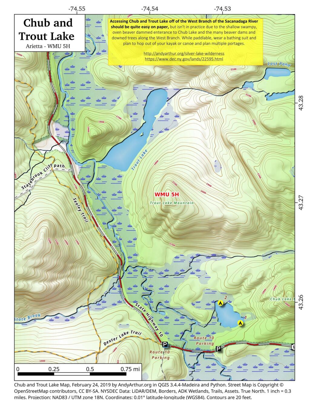
Chub Pond and Trout Lake in principle should be relatively easy to access, they as they are just a little ways from the put in used to access Good Luck Lake. Unfortunately, the West Branch of the Sacanadaga River has numerous strainers and down trees, and streams that flow out out of both Chub Pond and Trout Lake are narrow, shallow, and often impassable in times of low water. They also are very marshy along the shoreline, which can make it challenging to portage around the shallow water.
Second Pond Trail
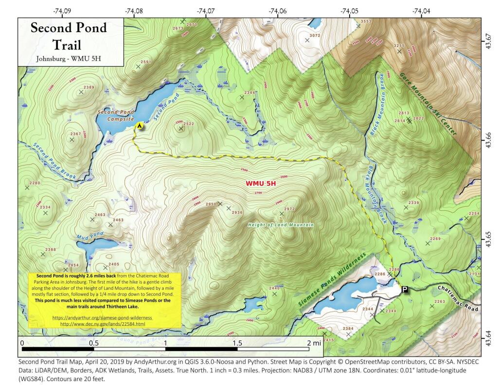
The Second Pond Trail is a 2.5 mile hike back from Chatiemac Lake Road in Bakers Mills. While the trail can be muddy, especially in the spring, this remote lake is good for solitude and brookies.
Silver Lake
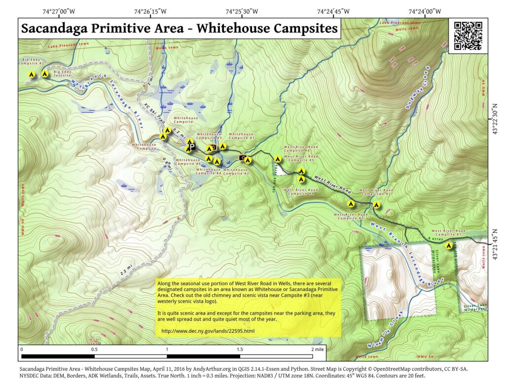
Sacandaga Primitive Area – Whitehouse Campsites
The DEC recently GPS'd the various designated campsites at Whitehouse area of the Sacanadaga Primitive Area along West River Road in Wells. This provides a pretty accurate map of the various campsite locations. West River Road isn't open to motor vehicles yet, but will open later in May once the frost is out of the ground and the dirt road isn't too soft.
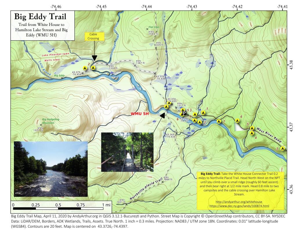
Big Eddy Trail
Big Eddy Trail: Take the White House Connector Trail 0.2 miles to Northville Placid Trail. Head North-West on the NPT until you climb over a small ridge (roughly 60 feet ascent) and then bear right at 1/2 mile mark. Head 0.8 mile to two campsites and the cable crossing over Hamilton Lake Stream.
https://andyarthur.org/whitehouse
https://www.dec.ny.gov/lands/100874.html
