Counties: Albany to Delaware / Dutchess to Livingston / Madison to Otsego / Putnam to Suffolk / Sullivan to Yates
Browse Topographic Maps: Full State / Historical USGS Topographic Maps
Counties: Albany to Delaware / Dutchess to Livingston / Madison to Otsego / Putnam to Suffolk / Sullivan to Yates
Browse Topographic Maps: Full State / Historical USGS Topographic Maps

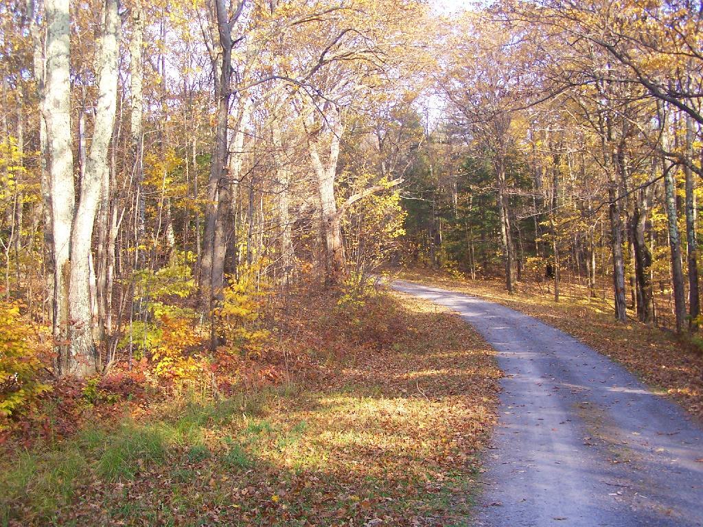
Looking for state land to wheel on? This list shows all of the conservation department-maintained DEC truck trails and public access roads that are more then a 1/2 mile long. This roads are varied, but most of them are dirt roads that take you through the back country. Town maintained roads through state forests are generally not shown on in this listing.
Looking for state land to wheel on? This list shows all of the conservation department-maintained DEC truck trails and public access roads that are more then a 1/2 mile long. This roads are varied, but most of them are dirt roads that take you through the back country. Town maintained roads through state forests are generally not shown on in this listing.
| State Land | Road | Miles |
|---|---|---|
| Albert J. Woodford Memorial State Forest | Truck Trail | 0.7 |
| Albert J. Woodford Memorial State Forest | Janis Road | 1.1 |
| Aldrich Pond Wild Forest | Powell Road | 0.5 |
| Aldrich Pond Wild Forest | Mullins Flow Road | 0.6 |
| Aldrich Pond Wild Forest | Little River Road | 0.7 |
| Aldrich Pond Wild Forest | Silver Dawn Road | 0.7 |
| Aldrich Pond Wild Forest | Jackworks Trail | 1.1 |
| Aldrich Pond Wild Forest | South Creek Lake Road | 1.6 |
| Aldrich Pond Wild Forest | Tyler Road | 3.7 |
| Aldrich Pond Wild Forest | Streeter Lake Road | 4.8 |
| Allen Lake State Forest | George Forest Road | 1.5 |
| Ambler State Forest | Truck Trail | 1.8 |
| Ampersand Primitive Area | Ampersand Park Road | 3.2 |
| Andersen Hill State Forest | Big Pine Public Forest Acess Road | 1.5 |
| Arctic China State Forest | China Public Forest Access Road | 1.1 |
| Arctic China State Forest | Shears Public Forest Access Road | 2 |
| Arctic China State Forest | Dunbar Public Forest Access Road | 2.1 |
| Armlin Hill State Forest | Truck Trail | 1.1 |
| Arnold Lake State Forest | Public Forest Access Road | 0.9 |
| Arnold Lake State Forest | Hartwick Forest Access Road | 1 |
| Ashland Pinnacle State Forest | Ashland Pinnacle Access Road #2 | 0.5 |
| Ashland Pinnacle State Forest | Haul Road #1/Long Path Hiking Trail | 1.4 |
| Avon Regional Office | Goodlake Year Entrance Road | 0.7 |
| Baker School House State Forest | Baker School House Public Forest Acess Road | 1.8 |
| Bald Mountain State Forest | Howe Forest Road | 2.4 |
| Balsam Creek State Forest | Briar Hill Road | 1.5 |
| Barbour Brook State Forest | Barbour Brook Public Forest Access Road | 2 |
| Basswood State Forest | Burlington Public Forest Access Road | 0.5 |
| Basswood State Forest | Basswood Pond Public Forest Access Road | 1 |
| Basswood State Forest | Dr. Crouch Truck Trail | 1.3 |
| Bates State Forest | Pucker Street | 1 |
| Bates State Forest | Bates Forest Road | 2.6 |
| Battle Hill State Forest | Unnamed | 1.3 |
| Bear Pond Primitive Area | Bear Pond Road | 0.8 |
| Bear Swamp State Forest | Karsch Haul Road | 0.5 |
| Bear Swamp State Forest | Joe Chamberlin Public Forest Access Road | 1.6 |
| Bear Swamp State Forest | Roseboom Public Facility Truck Trail | 1.8 |
| Bear Swamp State Forest | Snowmobile Trail | 8.3 |
| Bearpen Mountain State Forest | Ski Run Road | 2.1 |
| Beartown State Forest | Town Road | 0.7 |
| Beartown State Forest | Cotton Road | 0.8 |
| Beartown State Forest | Steam Mill Road | 0.8 |
| Beartown State Forest | Aspen Hollow Road | 2.4 |
| Beaver Creek State Forest | Public Forest Access Road 2, Madison 11 | 0.5 |
| Beaver Creek State Forest | Truck Trail -2-12 | 0.7 |
| Beaver Creek State Forest | Public Forest Access Road 1, Madison 11 | 1.3 |
| Beaver Creek State Forest | Truck Trail -1-12 | 3.6 |
| Beaver Dam State Forest | Sears Public Forest Acess Road | 1.4 |
| Beaver Meadow State Forest | Weir Dam Truck Trail | 0.5 |
| Beebe Hill State Forest | Barrett Pond Road | 1.4 |
| Beebe Hill State Forest | Loop Road | 2.3 |
| Big Brook State Forest | County Line Road Spur | 0.6 |
| Big Brook State Forest | Walasek Mulcoy Road | 0.8 |
| Big Brook State Forest | Hanifin Road | 0.9 |
| Big Brook State Forest | County Line Road | 1.4 |
| Birdseye Hollow State Forest | Sanford Lake Access Road | 0.5 |
| Black Creek State Forest | Stanley Road | 1.1 |
| Black River Wild Forest | Remsen Falls Trail | 0.5 |
| Black River Wild Forest | Woods Lake Road | 0.5 |
| Black River Wild Forest | Gull Lake Road | 0.6 |
| Black River Wild Forest | Flansburg Road | 0.7 |
| Black River Wild Forest | Party Road | 0.7 |
| Black River Wild Forest | Black Creek Road | 0.8 |
| Black River Wild Forest | Cohen Road | 1.7 |
| Black River Wild Forest | Flansberg Road | 2.6 |
| Black River Wild Forest | Black Creek Lake Road | 3 |
| Black River Wild Forest | Haskell Road | 3 |
| Black River Wild Forest | Mill Creek Road | 3.4 |
| Black River Wild Forest | Nicks Lake Campground Roads | 3.5 |
| Black River Wild Forest | Wolf Lake Landing Road | 4.8 |
| Black River Wild Forest | West Creek Road | 6.3 |
| Blenheim Hill State Forest | Ward Allen Road | 1.1 |
| Blenheim Hill State Forest | Quarry Road | 1.2 |
| Blue Mountain Wild Forest | Deer Pond Road | 1.1 |
| Blue Mountain Wild Forest | Chain Lakes Road North | 1.3 |
| Blue Mountain Wild Forest | Polaris Road | 1.3 |
| Bombay State Forest | Cross Haul Road | 0.7 |
| Bombay State Forest | Railroad Bed Public Forest Acess Road | 1.2 |
| Bombay State Forest | Pike Brook Haul Road | 3.1 |
| Bonaparte’s Cave State Forest | Corbine Road | 0.8 |
| Bonaparte’s Cave State Forest | Mud Pond Road | 0.8 |
| Boutwell Hill State Forest | Arab Hill Forest Road, Cha 1 Section | 0.8 |
| Boutwell Hill State Forest | Arab Hill Forest Road, Cha 7 Section | 2.1 |
| Boyce Hill State Forest | Jackson Forest Road | 0.6 |
| Brasher State Forest | Route 53 Haul Road | 0.5 |
| Brasher State Forest | Beaver Pond Trail | 0.6 |
| Brasher State Forest | Kennehan Haul Road | 0.8 |
| Brasher State Forest | Bush Road | 1.1 |
| Brasher State Forest | Buckley Haul Road | 1.2 |
| Brasher State Forest | Cc Dam Public Forest Access Road | 1.2 |
| Brasher State Forest | Mccarthy Public Forest Access Road | 1.6 |
| Brasher State Forest | Liberty Public Forest Access Road | 1.7 |
| Brasher State Forest | Hastings Falls Haul Road | 2.1 |
| Brasher State Forest | Wilson Public Forest Access Road | 2.1 |
| Brasher State Forest | Camp / Larue Public Forest Access Road | 2.2 |
| Brasher State Forest | Pascal Haul Road | 2.4 |
| Brasher State Forest | Bush Public Forest Access Road | 2.9 |
| Brasher State Forest | Railroad Bed Public Forest Access Road | 3.6 |
| Brokenstraw State Forest | Brokenstraw Forest Road | 1.7 |
| Bryant Hill State Forest | Hawk Forest Road | 1.4 |
| Buck Hill State Forest | Hertz Road | 0.7 |
| Buck Hill State Forest | Truck Trail | 1.5 |
| Buck Hill State Forest | Buck Hill Road | 3.1 |
| Bucks Brook State Forest | Access Trail | 0.6 |
| Buckton State Forest | Buckton Haul Road | 0.8 |
| Bucktooth State Forest | Baily Hollow Forest Road | 0.6 |
| Bucktooth State Forest | Manley Hill Forest Road | 1 |
| Bully Hill State Forest | Dixon Forest Road | 1 |
| Bully Hill State Forest | Connection Forest Road | 1.6 |
| Bully Hill State Forest | Stearns Forest Road | 2.1 |
| Burnt-Rossman Hills State Forest | Koenig Road | 0.5 |
| Burnt-Rossman Hills State Forest | Betty Brook Haul Road | 0.6 |
| Burnt-Rossman Hills State Forest | Eminence Dead End Truck Trail | 0.7 |
| Burnt-Rossman Hills State Forest | Duck Pond Road | 1.2 |
| Burnt-Rossman Hills State Forest | Monkey Run Truck Trail East | 1.3 |
| Burnt-Rossman Hills State Forest | Yankee Street Truck Trail | 1.3 |
| Burnt-Rossman Hills State Forest | Betty Brook Road | 1.4 |
| Burnt-Rossman Hills State Forest | Betty Brook Truck Trail | 1.5 |
| Burnt-Rossman Hills State Forest | Duck Pond Truck Trail | 1.5 |
| Burnt-Rossman Hills State Forest | Morey Road Truck Trail | 1.7 |
| Burnt-Rossman Hills State Forest | Eminence Road Truck Trail | 2.6 |
| Burnt-Rossman Hills State Forest | Burnt Hill Road | 2.9 |
| Bush Hill State Forest | Fox Cross Forest Road | 2 |
| California Hill State Forest | Wayawanda Road | 0.7 |
| Canacadea State Forest | Macduff Road | 2.3 |
| Canadaway Creek Wma | Dibble Hill Forest Road | 2 |
| Canaseraga State Forest | Ringelberg Truck Trail | 0.5 |
| Canaseraga State Forest | Right Fork Truck Trail | 1 |
| Canaseraga State Forest | Stanley Road | 1.1 |
| Canaseraga State Forest | Left Fork Truck Trail | 1.4 |
| Caroga Lake Campground | Campground Road | 2 |
| Catherineville State Forest | Santamont Access Trail | 1.1 |
| Catherineville State Forest | Circle Public Forest Access Road | 1.8 |
| Charles E. Baker State Forest | Truck Trail 5 | 0.6 |
| Charles E. Baker State Forest | Truck Trail 2 | 0.9 |
| Charles E. Baker State Forest | Truck Trail 6 | 0.9 |
| Charles E. Baker State Forest | Truck Trail 4 | 1.4 |
| Charles E. Baker State Forest | Truck Trail 12 | 1.5 |
| Charles E. Baker State Forest | Truck Trail 8 | 1.9 |
| Charles E. Baker State Forest | Truck Trail 7 | 2.1 |
| Charles E. Baker State Forest | Truck Trail 1 | 3 |
| Charles E. Baker State Forest | Truck Trail 13 | 3.2 |
| Chazy Highlands State Forest | Spring Road | 0.6 |
| Cherry Valley State Forest | Kniskern Public Access Road | 1.2 |
| Cherry Valley State Forest | Mosse Public Forest Access Road | 1.9 |
| Cinnamon Lake State Forest | Hornby Road Haul Road | 0.7 |
| Clapper Hollow State Forest | Clapper Hollow Truck Trail | 1 |
| Clark Hill State Forest | Abandoned Town Road | 0.8 |
| Clark Hill State Forest | Truck Trail | 0.9 |
| Clark Hill State Forest | Access Road North Of Buck Hill Road | 0.9 |
| Clark Hill State Forest | Class A Truck Trail | 1.2 |
| Clark Hill State Forest | Haul Road | 1.3 |
| Cliffside State Forest | Railroad Haul Road | 1.3 |
| Cobb Brook State Forest | Unnamed Truck Trail | 0.6 |
| Cold Creek State Forest | Headwaters Forest Road | 1.4 |
| Cold Spring Brook State Forest | Cold Spring Brook Public Forest Access Road | 1.9 |
| Cole Hill State Forest | Cr 2 Access Road | 0.8 |
| Coyle Hill State Forest | Warner Spur Forest Road | 0.5 |
| Coyle Hill State Forest | Slawson Forest Road | 0.8 |
| Coyle Hill State Forest | Warner Forest Road | 1.8 |
| Cranberry Lake Campground | Campground Road | 2.5 |
| Cranberry Lake Wild Forest | Grass River Railroad | 6.1 |
| Cuyler Hill State Forest | Jipson Hill Public Forest Acess Road | 1.3 |
| Cuyler Hill State Forest | Cuyler Hill Public Forest Acess Road | 5.1 |
| David A. Sarnoff Preserve | Field Access Road | 0.8 |
| Debar Mountain Wild Forest | Debar Game Refuge Road | 0.5 |
| Debar Mountain Wild Forest | Debar Meadow Road | 0.6 |
| Debar Mountain Wild Forest | Vanderwalker Road | 0.9 |
| Debar Mountain Wild Forest | 4 Mile Road Riffle Season Access Corridor | 1.1 |
| Debar Mountain Wild Forest | Ny Centrail Railroad Bed | 2.2 |
| Deer River State Forest | Ccc Road | 0.6 |
| Deer River State Forest | Hogsback Road | 0.6 |
| Deer River State Forest | Willow Road | 0.6 |
| Deer River State Forest | Glaze Road | 0.7 |
| Deer River State Forest | Avery Lot Road | 0.9 |
| Deer River State Forest | Esseltine Hill Road | 0.9 |
| Deer River State Forest | Ricky’s Number Trail | 1 |
| Deer River State Forest | Horse Barn Road | 1.2 |
| Deer River State Forest | Laramie Road | 1.3 |
| Deer River State Forest | Beanville Road | 1.4 |
| Deer River State Forest | Spruce Road | 1.6 |
| Deer River State Forest | Loope Road | 2 |
| Deer River State Forest | Firewood Road | 2.6 |
| Degrasse State Forest | Burns Flats Road | 0.5 |
| Degrasse State Forest | Loop Road | 1.2 |
| Deruyter State Forest | Tromp Road | 1.5 |
| Dobbins Memorial State Forest | Snowmobile Trail | 3.5 |
| Dog Hollow State Forest | Brewer Public Forest Acess Road | 0.9 |
| Downerville State Forest | River Public Forest Access Road | 1 |
| Dry Run State Forest | Wildcat Hollow | 0.8 |
| Dunkin’s Reserve State Forest | Access Road | 3.5 |
| Dutch Settlement State Forest | Haul Road #1 | 0.6 |
| Dutton Ridge State Forest | Dutton Ridge Access Road | 1.5 |
| Earlville State Forest | Mad 2 Forest Access Road | 1.5 |
| East Osceola State Forest | Malloy Brook Road | 1.1 |
| East Otto State Forest | Kriedeman Forest Road | 1.7 |
| Edgewood Oak Brush Plains Preserve | Edgewood Oak Brush Plains Preserve | 0.5 |
| Edgewood Oak Brush Plains Preserve | Unpaved Forest Road | 0.5 |
| Edgewood Oak Brush Plains Preserve | Old Commack Road | 1.6 |
| English Hill State Forest | Ricketts Forest Road | 0.9 |
| Exeter State Forest | Exeter Public Forest Access Road | 1.3 |
| Fairfield State Forest | Jenksville Hill Public Forest Acess Road | 2 |
| Fall Brook State Forest | Gossner Road | 0.6 |
| Fall Brook State Forest | Haul Road To B-45 Wetland | 0.9 |
| Fall Brook State Forest | Access Road From Co. Rt 67A | 1 |
| Fall Brook State Forest | Forest Access Roaad | 1.2 |
| Ferris Lake Wild Forest | Meco Lake Trail | 0.9 |
| Ferris Lake Wild Forest | Sheriff Lake Trail | 0.9 |
| Ferris Lake Wild Forest | Mud Lake Road | 5.5 |
| Fish Creek State Forest | Forward Road | 0.5 |
| Fish Creek State Forest | Trestle Road | 0.6 |
| Fish Creek Wma | State Highway 184 Access Road | 0.9 |
| Five Rivers Education Center | Goose Lane | 0.5 |
| Flat Rock State Forest | Pedobo Road | 0.8 |
| Flat Rock State Forest | Karsch Haul Road | 0.9 |
| Flat Rock State Forest | Ampersand Park Road | 1.9 |
| Florence Hill State Forest | Florence Hill Road | 1.9 |
| Fort Jackson State Forest | Sheldon Public Forest Access Road | 0.5 |
| Frank E. Jadwin Memorial State Forest | Keesler Road | 0.6 |
| Frank E. Jadwin Memorial State Forest | Old Croghan Road | 0.7 |
| Frank E. Jadwin Memorial State Forest | Henry Road | 0.8 |
| Frank E. Jadwin Memorial State Forest | Nelson Road | 0.8 |
| Frank E. Jadwin Memorial State Forest | Wahalula Road | 0.8 |
| Frank E. Jadwin Memorial State Forest | Q- Road | 1.5 |
| Frank E. Jadwin Memorial State Forest | Patchin Road | 1.7 |
| Frank E. Jadwin Memorial State Forest | Blanchard Creek Road | 2.7 |
| Frank E. Jadwin Memorial State Forest | Wisner Road | 2.7 |
| Frank E. Jadwin Memorial State Forest | Judy Cole Road | 2.8 |
| Frank E. Jadwin Memorial State Forest | Loop Road | 3.2 |
| Fulton Chain Wild Forest | Cary Lake Road | 1.8 |
| Furnace Creek State Forest | Miller Road East | 0.7 |
| Furnace Creek State Forest | Powerline Row | 0.7 |
| Furnace Creek State Forest | Sheehan Road | 1.2 |
| Furnace Creek State Forest | B-29 Road | 1.4 |
| Gates Hill State Forest | Coons Den Truck Trail | 0.6 |
| Gates Hill State Forest | Eviann Road | 1.2 |
| Genegantslet State Forest | South Loomis Road | 0.7 |
| Gillies Hill State Forest | Abbey Forest Road | 0.9 |
| Gillies Hill State Forest | Pettit Forest Road | 1.4 |
| Golden Hill State Forest | Firelane Forest Road | 1.6 |
| Goundry Hill State Forest | Guiren Road | 1 |
| Goundry Hill State Forest | Corbett Hollow Access Road | 1.1 |
| Grant Powell State Forest | Huck Berry Road | 2.1 |
| Grass River Wild Forest | Spruce Mountain Road | 0.8 |
| Grass River Wild Forest | Hollywood Road | 2.5 |
| Grass River Wild Forest | Railroad Grade Road | 2.9 |
| Greenwood Creek State Forest | Grass Pond Public Forest Access Road | 0.9 |
| Grigg’s Gulf State Forest | Grigg’s Gulf Public Forest Acess Road | 1.5 |
| Gulf Unique Area | Gulf R.O.W. Road | 0.5 |
| Gulf Unique Area | Old Skid Road | 1.1 |
| Hall Island State Forest | Unnamed Public Forest Acess Road | 0.7 |
| Hammond Hill State Forest | Redman Run Public Forest Acess Road | 1.1 |
| Hammond Hill State Forest | Cannan Public Forest Acess Road | 1.3 |
| Hammond Pond Wild Forest | Paynes Way | 0.7 |
| Harris Hill State Forest | Sprague Forest Road | 0.8 |
| Harvey Mountain State Forest | Harvey Mt Access Road | 0.9 |
| Harvey Mountain State Forest | East Hill Access Road | 2.4 |
| Hatch Creek State Forest | Hodge Forest Road | 0.6 |
| Hatch Creek State Forest | North Forest Road | 0.8 |
| Hatch Creek State Forest | South Forest Road | 0.9 |
| Hemlock-Canadice State Forest | South Hemlock Access Road | 0.7 |
| Henderson Shores Unique Area | Radar Road | 0.8 |
| Hewitt State Forest | Hewitt Rd | 1.1 |
| Hickok Brook Multiple Use Area | Spur Road | 0.7 |
| Hickok Brook Multiple Use Area | Main Road | 1.1 |
| High Flats State Forest | Chapel Hill Access Trail | 0.5 |
| High Flats State Forest | Crowley Access Trail | 0.5 |
| High Flats State Forest | Close Pond Access Trail | 0.7 |
| High Flats State Forest | Donovan Public Forest Access Road | 1.1 |
| High Knob State Forest | Shale Pit Road | 1.9 |
| High Peaks Wilderness | Northville-Placid Trail-Northern Terminus | 1.1 |
| Hill Higher State Forest | Hill Higher Forest Road | 1.1 |
| Hinckley State Forest | Elm Flats Road | 0.5 |
| Hinckley State Forest | Roberts Road | 0.5 |
| Hinckley State Forest | Lanning Road | 0.8 |
| Hinckley State Forest | Access Road | 1.6 |
| Hinckley State Forest | Black Creek Road | 2 |
| Hogsback State Forest | Forest Access Road | 3 |
| Honey Hill State Forest | Edwards Public Forest Access Road | 1.4 |
| Hooker Mountain State Forest | Norton Public Forest Access Road | 0.8 |
| Horseshoe Lake Wild Forest | Cut Off Road | 0.6 |
| Horseshoe Lake Wild Forest | Lower Dam Road | 0.7 |
| Horseshoe Lake Wild Forest | Otter Brook Trail | 0.9 |
| Horseshoe Lake Wild Forest | Grass River Railroad | 1.7 |
| Horseshoe Lake Wild Forest | Otter Brook Road | 2.2 |
| Hoxie Gorge State Forest | Russel Hill Public Forest Acess Road | 2.5 |
| Huntersfield State Forest | Huntersfield Access Road #2 | 0.7 |
| Huntersfield State Forest | Huntersfield Access Road #1 | 1.9 |
| Hunts Pond State Forest | Truck Trail | 1.7 |
| Independence River State Forest | Assembly Road | 1 |
| Independence River Wild Forest | Blue Jog Road | 0.5 |
| Independence River Wild Forest | Sunday Lake Road | 0.5 |
| Independence River Wild Forest | Evies Pond Road | 0.7 |
| Independence River Wild Forest | Burnt Creek Road | 0.7 |
| Independence River Wild Forest | Elbow Rd | 0.7 |
| Independence River Wild Forest | Shortcut Road | 0.8 |
| Independence River Wild Forest | Fish Pond Road | 1 |
| Independence River Wild Forest | Halfmoon Lake Rd | 1 |
| Independence River Wild Forest | Little Otter Creek Road | 1 |
| Independence River Wild Forest | Long Pond Spur | 1 |
| Independence River Wild Forest | East Loop Road | 1.1 |
| Independence River Wild Forest | Copper Lake Road | 1.2 |
| Independence River Wild Forest | Necessary Dam Road | 1.2 |
| Independence River Wild Forest | Pitcher Pond Road | 1.3 |
| Independence River Wild Forest | Hinchings Pond Road | 1.8 |
| Independence River Wild Forest | Basket Factory Road | 2.1 |
| Independence River Wild Forest | Catspaw Lake Road | 2.4 |
| Independence River Wild Forest | Confusion Flats Road | 2.6 |
| Independence River Wild Forest | Big Otter Lake Road | 3.1 |
| Independence River Wild Forest | Stony Lake Road | 3.1 |
| Independence River Wild Forest | Florence Pond Road | 3.1 |
| Independence River Wild Forest | Steam Mill Road | 3.5 |
| Independence River Wild Forest | Smith Road | 3.7 |
| Indian Pipe State Forest | Dunes Road | 0.7 |
| Indian River Wma | Red Lake Road | 2 |
| Jackson Hill State Forest | Forest Access Road | 2.1 |
| Jersey Hill State Forest | Scholes Forest Road | 1.6 |
| Jessup River Wild Forest | Lake Colby Camp Road | 0.7 |
| Karr Valley Creek State Forest | Frungillo Forest Road | 0.8 |
| Karr Valley Creek State Forest | Norton Forest Road | 1.3 |
| Karr Valley Creek State Forest | Davison Forest Road | 1.4 |
| Keeney Swamp State Forest | Fitch Hill Spur Forest Road | 0.7 |
| Keeney Swamp State Forest | C3D | 0.8 |
| Keeney Swamp State Forest | Fitch Hill Forest Road | 1.2 |
| Keeney Swamp State Forest | Gordon Forest Road | 1.4 |
| Kennedy State Forest | Courtney Hill Public Forest Acess Road | 0.7 |
| Kennedy State Forest | Cotton-Hanlon Public Forest Acess Road | 1 |
| Kennedy State Forest | Kennedy Public Forest Acess Road | 2.5 |
| Kenneth Wilson Campground | Campground Road | 9.7 |
| Ketchumville State Forest | Ketchumville Public Forest Acess Road | 1 |
| Keyserkill State Forest | Guinea Road Truck Trail | 1 |
| Keyserkill State Forest | Keyserkill Truck Trail #1 | 1.3 |
| Klipnocky State Forest | Emery Forest Road | 1.2 |
| Klipnocky State Forest | Marble Forest Road | 1.6 |
| Klondike State Forest | Klondike Public Forest Acess Road | 1.7 |
| Lafayetteville Multiple Use Area | Wilbur Flats Road | 0.9 |
| Lake Durant Campground | Scott Public Forest Acess Road | 0.9 |
| Lake George Wild Forest | Jabe Pond Road | 1 |
| Lake George Wild Forest | Dacy Clearing Road | 1.6 |
| Lake George Wild Forest | Lily Pond Road | 2.1 |
| Lake George Wild Forest | Gay Pond Road | 4 |
| Lake Harris Campground | Campground Road | 0.9 |
| Lakeview Marsh Wma | Skinner Road | 0.7 |
| Leonard Hill State Forest | Leonard Hill Access Road #1 | 0.7 |
| Leonard Hill State Forest | Leonard Hill Access Road #3 | 1.2 |
| Leonard Hill State Forest | Leonard Hill Access Road #2 | 1.6 |
| Lesser Wilderness State Forest | Gomer Hill Road | 0.5 |
| Lesser Wilderness State Forest | Toole Road | 0.6 |
| Lesser Wilderness State Forest | Alguire Road | 0.7 |
| Lesser Wilderness State Forest | Smith Road | 0.8 |
| Lesser Wilderness State Forest | Nob Road | 0.9 |
| Lesser Wilderness State Forest | Seelman Road | 1.3 |
| Lesser Wilderness State Forest | Mcgoldrick Road | 3 |
| Lesser Wilderness State Forest | #9 Road | 4.7 |
| Limekiln Lake Campground | Lime Kiln Lake Campground Trails | 3.9 |
| Linda Gronlund Memorial At Barcelona Neck | Trustee Road West | 1 |
| Linda Gronlund Memorial At Barcelona Neck | Trustee Road East | 1.7 |
| Lonesome Bay State Forest | Alamogin Public Forest Access Road | 2.2 |
| Long Pond State Forest | Access Road | 0.5 |
| Long Pond State Forest | Truck Trail | 0.7 |
| Long Pond State Forest | Long Pond Snowmobile Trail | 0.8 |
| Lookout State Forest | Ball Road | 0.6 |
| Lost Nation State Forest | Brookdale Road / Jenkins Corners Rd / Red Barn Rd | 2.5 |
| Lost Valley State Forest | Lost Valley Haul Road | 1.2 |
| Lowville Demonstration Area | Dadville Road | 0.6 |
| Ludlow Creek State Forest | Trail Road | 1.3 |
| Lutheranville State Forest | Access Road #1 | 0.5 |
| Lutheranville State Forest | Access Road #2 | 1.2 |
| Lyon Brook State Forest | Lyon Brook Truck Trail | 1.2 |
| Mad River State Forest | Thompson Corners Florence Road | 0.5 |
| Mad River State Forest | Bartlett Road | 0.6 |
| Mad River State Forest | Rehm Road | 0.6 |
| Mad River State Forest | Phalen Road South | 1.9 |
| Mad River State Forest | Mcspirit Road | 2.1 |
| Madawaska Flow – Quebec Brook Primitive Area | Benz Pond Road | 2.2 |
| Mallet Pond State Forest | Cemetery Road Truck Trail | 2 |
| Maxon Creek State Forest | Pease Hill Public Forest Acess Road | 1 |
| Mccarthy Hill State Forest | Main Access Road | 0.5 |
| Mccarty Hill State Forest | Ccc Forest Road | 1.5 |
| Mccarty Hill State Forest | Mccarty Hill East Forest Road | 2 |
| Mcdonough State Forest | Ccc Trail | 1 |
| Mcdonough State Forest | Truck Trail 4 | 1.1 |
| Mcdonough State Forest | Finger Lakes Trail | 1.8 |
| Mcdonough State Forest | Truck Trail 3 | 2 |
| Melondy Hill State Forest | Public Forest Access Road | 2.5 |
| Montrose Point State Forest | Through Trail | 0.6 |
| Moose River Plains Wild Forest | Loop Road | 1.2 |
| Moose River Plains Wild Forest | Indian Lake Road | 3.4 |
| Moose River Plains Wild Forest | Otter Brook Road | 3.4 |
| Moose River Plains Wild Forest | Rock Dam Road | 4.2 |
| Moose River Plains Wild Forest | Lime Kiln Lake – Cedar River Road | 16.9 |
| Morgan Hill State Forest | Herlihy Haul Road | 0.6 |
| Morgan Hill State Forest | Keith Gutchess Haul Road | 0.7 |
| Morrow Mountain State Forest | Mollie Road | 2.8 |
| Mount Hunger State Forest | Whalen Road | 0.6 |
| Mount Pisgah State Forest | Mt Pisgah Access Road #1 | 1.3 |
| Mount Pleasant State Forest | Beck Forest Road | 0.6 |
| Mount Pleasant State Forest | Brumagin Forest Road | 0.7 |
| Mount Pleasant State Forest | Spruce Forest Road | 0.8 |
| Mount Tom State Forest | Notch Lane Access Road | 1.4 |
| Mount Tom State Forest | Shaker Hollow Access Trail | 1.4 |
| Muller Hill State Forest | Davenport Road | 1.4 |
| Muller Hill State Forest | Bliss Road | 1.5 |
| New Forge State Forest | New Forge Access Road #2 | 0.5 |
| New Forge State Forest | New Forge Access Road #3 | 0.6 |
| New Forge State Forest | New Forge Access Road | 1.5 |
| Newfield State Forest | Irish Hill Haul Road | 0.8 |
| Nicks Lake Campground | Nicks Lake Campground Roads | 0.6 |
| Nimham Mountain Multiple Use Area | Coles Mills Road | 0.7 |
| Nimham Mountain Multiple Use Area | Tower Road | 0.7 |
| Nine Mile Creek State Forest | North Nine Mile Town Road | 0.5 |
| Nine Mile Creek State Forest | Phearsdorf Forest Road | 0.5 |
| Nine Mile Creek State Forest | North Nine Mile Forest Road | 2.2 |
| North Harmony State Forest | Snake Forest Road | 0.9 |
| North South Lake Campground | South Lake Road | 1.3 |
| North South Lake Campground | North Lake Campground Road | 1.8 |
| Northhampton Beach Campground | Campground Road | 5.5 |
| Oakley Corners State Forest | Oakley Corners North Public Forest Acess Road | 1.6 |
| Ohissa State Forest | Cramers Corner Road | 0.8 |
| Onjebonge State Forest | Lime Quarry Road | 1.3 |
| Onjebonge State Forest | Alice Coffey Road | 2.5 |
| Orebed Creek State Forest | Ritz Road | 1.3 |
| Ossian State Forest | Back Road To Rattlesnake | 0.7 |
| Ossian State Forest | Scoville Access Road | 1 |
| Ossian State Forest | Linzy Road Truck Trail | 1.8 |
| Otselic State Forest | Truck Trail | 3.1 |
| Otsquago State Forest | Wagner Hill Road | 0.8 |
| Otter Creek State Forest | Eatonville Road | 0.6 |
| Otter Creek State Forest | Mikes Road | 1.2 |
| Otter Creek State Forest | Otter Creek Road | 1.5 |
| Palmer’s Pond State Forest | Geitner Forest Road | 0.7 |
| Palmer’s Pond State Forest | Palmer’s Pond Forest Road | 1.5 |
| Palmer’s Pond State Forest | 6 | 2.4 |
| Partridge Run Wma | Boys Camp Road Ext | 2 |
| Patria State Forest | Pleasant Valley Road | 0.6 |
| Patria State Forest | Barkman Road Access | 0.6 |
| Patria State Forest | Hardscrabble Road Access | 0.8 |
| Peck Hill State Forest | Swamp Road | 0.5 |
| Peck Hill State Forest | West Boundary Trail | 0.6 |
| Peck Hill State Forest | Beaver Vly | 0.7 |
| Peck Hill State Forest | Dam Road | 0.7 |
| Penn Mountain State Forest | Star Hill Road | 1 |
| Penn Mountain State Forest | West Gate Road | 2.6 |
| Penn Mountain State Forest | South Gate Road | 3.6 |
| Penn Mountain State Forest | East Gate Road | 3.8 |
| Perch River Wma | Perch Lake Road | 0.5 |
| Perch River Wma | Buckminster Road | 0.9 |
| Perch River Wma | Cook Road | 1.4 |
| Perch River Wma | Allen Road | 2.1 |
| Perch River Wma | State Route 12 | 2.6 |
| Perch River Wma | Vaadi Road | 3 |
| Perch River Wma | Dog Hill Road | 4 |
| Pharsalia Woods State Forest | Nine Mile Truck Trail Snowmobile Trail | 1.6 |
| Piermont Marsh Tidal Wetland | Piermont Pier Access Road | 0.9 |
| Pine Hill State Forest | Bundy Hollow Public Forest Access Road | 1 |
| Pittstown State Forest | State Fire Lane | 2.2 |
| Plainfield State Forest | Hughes Public Forest Access Road | 1.3 |
| Plattekill State Forest | Mountain Brook Road | 1 |
| Plumbottom State Forest | Reddy Forest Road | 3 |
| Point Peninsula Wma | Pine Woods Road | 1.5 |
| Point Peninsula Wma | Beach Road | 2.1 |
| Point Peninsula Wma | Shore Road | 8 |
| Point Rock State Forest | Egger Brrok Raod | 1.3 |
| Popple Pond State Forest | Smith Road | 0.7 |
| Popple Pond State Forest | Haul Road Shared By Oneida 6 And County Forest | 1.6 |
| Popple Pond State Forest | Truck Trail | 3 |
| Potato Hill State Forest | Blackman Hill Rd | 1.1 |
| Potato Hill State Forest | Level Green Rd | 1.2 |
| Pulpit Rock State Forest | Watson Road | 0.6 |
| Punkeyville State Forest | Irish Settlement Road | 0.7 |
| Punkeyville State Forest | River Road | 0.9 |
| R Milton Hick Memorial State Forest | Lafleuer Road | 1.2 |
| Relay State Forest | Relay Public Forest Access Road | 1.2 |
| Rensselaerville State Forest | Kenyon Road Access | 2.4 |
| Ridge Conservation Area And Maintenance Center | Mid-Island Access Road | 0.5 |
| Rock City State Forest | Salamanca Forest Road | 0.8 |
| Rock City State Forest | Eckert Forest Road | 0.9 |
| Rock City State Forest | Little Rock City Forest Road | 2 |
| Rock Creek State Forest | Admin Access Road | 1.3 |
| Rockwood State Forest | Spring Road | 0.5 |
| Rockwood State Forest | B Road | 0.6 |
| Rocky Point Pine Barrens State Forest | Accessible | 0.5 |
| Rocky Point Pine Barrens State Forest | Firestone Road | 1.7 |
| Rural Grove State Forest | Rural Grove Access Road (Shibley Road) | 3.1 |
| Rush Creek State Forest | C2-C | 1.2 |
| Rush Creek State Forest | Russell Forest Road | 3 |
| Sacandaga Campground | Sacandaga Campground | 1.4 |
| Salmon River State Forest | Harpers Ferry Public Forest Acess Road | 0.9 |
| Sand Flats State Forest | Bucks Corners Road | 0.9 |
| Sand Flats State Forest | Obrian Road | 0.9 |
| Sand Flats State Forest | Water Hole Road | 1 |
| Sand Flats State Forest | Y Road | 1.5 |
| Sand Flats State Forest | Powell Road | 1.7 |
| Sand Flats State Forest | Fall Brook Road | 2.2 |
| Saranac Lakes Wild Forest | Horseshoe Pond Trail | 0.5 |
| Saranac Lakes Wild Forest | Little Clear Pond Road | 0.5 |
| Saranac Lakes Wild Forest | Connery Pond Road | 0.6 |
| Saranac Lakes Wild Forest | Little Green Pond Road | 0.6 |
| Saranac Lakes Wild Forest | Rollins Pond Access Road | 0.8 |
| Saranac Lakes Wild Forest | Medow Pond Truck Trail | 0.9 |
| Saranac Lakes Wild Forest | Bartlett Carry Road | 1.2 |
| Saranac Lakes Wild Forest | Floodwood Mountain Road | 1.2 |
| Saranac Lakes Wild Forest | Rat Pond Road | 1.5 |
| Saranac Lakes Wild Forest | Sunday Pond Road | 1.6 |
| Scott Patent State Forest | Scott Patent Access Road | 1.4 |
| Shawangunk Ridge State Forest | Woods Road | 1 |
| Shindagin Hollow State Forest | Ekroos Public Forest Acess Road | 1.4 |
| Skyline Drive State Forest | Skyline Drive Public Forest Acess Road | 2.2 |
| Slader Creek State Forest | Oberdorf Forest Road | 2.1 |
| Sonyea State Forest | Shaker Access Road | 1.9 |
| South Bradford State Forest | Ccc Road | 1.6 |
| South Hill State Forest | South Hill Truck Trail | 0.5 |
| South Hill State Forest | Public Forest Access Road Extension | 0.9 |
| South Hill State Forest | South Hill Public Forest Access Road | 0.9 |
| South Hill State Forest | Kotary Road Extension | 1 |
| South Hill State Forest | Powerline Road | 1 |
| South Mountain State Forest | Ashland Pinnacle Access Road #2 | 0.5 |
| South Mountain State Forest | South Mountain Access Road | 0.9 |
| South Mountain State Forest | Bluebird Road | 1.1 |
| South Valley State Forest | Phillips Brook Fr First Section | 0.7 |
| South Valley State Forest | Phillips Brook Forest Road | 1.2 |
| St. Regis River State Forest | Old Railroad Bed | 1.6 |
| Stammer Creek State Forest | Sugar Bush Haul Road | 1.1 |
| Steam Mill State Forest | Zion Public Forest Access Road #2 | 0.5 |
| Steam Mill State Forest | Glass House Hill Road | 1 |
| Steam Mill State Forest | Assembly Road | 1.1 |
| Steam Mill State Forest | Steammill Rd | 1.4 |
| Steam Mill State Forest | Carroll Hill Public Forest Access Road #2 | 1.9 |
| Steam Mill State Forest | Zion Public Forest Access Road #1 | 2 |
| Steam Mill State Forest | Carroll Hill Public Forest Access Road #3 | 2.5 |
| Stewart State Forest | Great Swamp Road | 0.5 |
| Stewart State Forest | Drakes Ln | 0.6 |
| Stewart State Forest | Orlando Dr | 0.6 |
| Stewart State Forest | Ridge Road South | 0.6 |
| Stewart State Forest | Scofield Lane | 0.7 |
| Stewart State Forest | Armstrong Lane Trail | 0.9 |
| Stewart State Forest | Giles Road | 0.9 |
| Stewart State Forest | Pittman Robertson Pond Road | 0.9 |
| Stewart State Forest | Weed Road | 1.2 |
| Stewart State Forest | Beaver Pond Road | 1.3 |
| Stewart State Forest | Barron Road | 1.8 |
| Stewart State Forest | Barron Road South 208 | 1.8 |
| Stewart State Forest | Ridge Road | 2.8 |
| Stewart State Forest | Maple Ave | 3.1 |
| Stewart State Forest | New Road | 3.4 |
| Stockton State Forest | Blackman Forest Road | 1.4 |
| Stone Store State Forest | Fawn Ridge Road | 2.7 |
| Sugar Hill State Forest | Firetower Access Road | 0.5 |
| Sugar Hill State Forest | Old Westerfield Road | 0.5 |
| Sugar Hill State Forest | A Trail | 1 |
| Sugar Hill State Forest | Pine Knob Road | 1 |
| Sugar Hill State Forest | Maple Lane | 2.1 |
| Summer Hill State Forest | Snowmobile Trail | 5 |
| Sundown Wild Forest | South Mountain Extension | 1 |
| Swancott Hill State Forest | Tower Road | 2.3 |
| Swancott Mill State Forest | Swancott Mill Road | 0.9 |
| Taconic Hereford Multiple Use Area | Pirate Crrek | 0.5 |
| Taconic Hereford Multiple Use Area | Whatchamacallit | 0.5 |
| Taconic Hereford Multiple Use Area | Camp | 0.6 |
| Taconic Hereford Multiple Use Area | Mercury | 0.6 |
| Taconic Hereford Multiple Use Area | Border Trail | 0.8 |
| Taconic Hereford Multiple Use Area | Mustang | 0.8 |
| Taconic Hereford Multiple Use Area | Outer Gut | 0.8 |
| Taconic Hereford Multiple Use Area | Brockway Road | 0.9 |
| Taconic Hereford Multiple Use Area | Green Acres | 1.2 |
| Taconic Hereford Multiple Use Area | Tsp Road | 1.2 |
| Taconic Hereford Multiple Use Area | Pond Gut Road | 1.3 |
| Taconic Hereford Multiple Use Area | Timbuktu | 1.3 |
| Taconic Hereford Multiple Use Area | Fong’s Way | 1.4 |
| Taconic Hereford Multiple Use Area | Getaway | 1.9 |
| Taconic Hereford Multiple Use Area | Upper Snowmobile Trail | 1.9 |
| Taconic Ridge State Forest | Rounds Mountain Rd. | 0.8 |
| Taconic Ridge State Forest | Robinson’s Hollow Road | 0.9 |
| Taconic Ridge State Forest | Green Hollow Access Road | 1.1 |
| Taylor Creek State Forest | T Road Public Forest Access Road | 1 |
| Taylor Valley State Forest | Seacord Hill Spur Public Forest Acess Road | 0.9 |
| Taylor Valley State Forest | Seacord Hill Public Forest Acess Road | 2.1 |
| Taylor Valley State Forest | Mount Roderick Public Forest Acess Road | 4.3 |
| Terry Mountain State Forest | Lynch Mt Road Trail | 1 |
| Terry Mountain State Forest | Red Road | 1.7 |
| Terry Mountain State Forest | Mud Pond Road Trail | 2 |
| Terry Mountain State Forest | Tower Road | 2 |
| Texas Hill State Forest | M8 Access Trail | 0.6 |
| Texas Hill State Forest | Texas Hill Truck Trail | 0.7 |
| Texas School House State Forest | New Lisbon Public Forest Access Road | 1.2 |
| Three Springs State Forest | Three Springs Access Road | 1.6 |
| Tied Lake Primitive Area | Tied Lake Road | 1.2 |
| Titusville Mountain State Forest | Lee Road | 2 |
| Tomannex State Forest | Tomannex Public Forest Access Road | 1 |
| Tomannex State Forest | Haul Road #1 | 4.7 |
| Toothaker Creek State Forest | Garrison Access Trail | 1.1 |
| Tri-County State Forest | Flanagan Road | 0.5 |
| Trout Lake State Forest | Cedar Lake Public Forest Access Road | 0.5 |
| Tug Hill State Forest | Home Run Road | 0.6 |
| Tug Hill State Forest | Babbit Road | 0.8 |
| Tug Hill State Forest | Gruntley Road | 1.3 |
| Tug Hill State Forest | Mile Strip Road | 2.5 |
| Tug Hill State Forest | Denning (West) Road | 2.8 |
| Tug Hill State Forest | Willams Road | 2.9 |
| Tug Hill State Forest | Horace Forward Road | 3.3 |
| Tug Hill Wma | Alphabet Lane Road | 0.8 |
| Tug Hill Wma | Runing George Road | 1.3 |
| Tug Hill Wma | Beech Street Road | 1.7 |
| Tug Hill Wma | Running George Road | 3.8 |
| Tuller Hill State Forest | Snyder Hill Public Forest Acess Road | 1.6 |
| Tuller Hill State Forest | Pipeline Public Forest Acess Road | 1.6 |
| Tuller Hill State Forest | Vinnedge Public Forest Acess Road | 1.7 |
| Turkey Hill State Forest | Turkey Hill Public Forest Acess Road | 1.3 |
| Turkey Ridge State Forest | Turkey Road | 0.7 |
| Turnpike State Forest | Turnpike Forest Road | 2.2 |
| Turnpike State Forest | Stewart Forest Road | 3.1 |
| Upper And Lower Lakes Wma | Canton Access Road | 0.5 |
| Upper And Lower Lakes Wma | Logging Access Road | 0.5 |
| Upper And Lower Lakes Wma | Corning Access Road | 1 |
| Upper And Lower Lakes Wma | Middle Access Road | 1.2 |
| Vandermark State Forest | Allen Forest Road | 1.1 |
| Vandermark State Forest | Bird Forest Road | 1.5 |
| Vanderwhacker Mountain Wild Forest | Cheney Pond Road | 0.5 |
| Vanderwhacker Mountain Wild Forest | Thilo Road | 1.7 |
| Vanderwhacker Mountain Wild Forest | Vanderwhacker Road | 2.6 |
| Watson’s East Triangle Wild Forest | Wolf Creek Road West | 0.5 |
| Watson’s East Triangle Wild Forest | Deep Cuts Road | 0.6 |
| Watson’s East Triangle Wild Forest | Tunnel Road | 0.7 |
| Watson’s East Triangle Wild Forest | Number 1 Road | 2.1 |
| Watson’s East Triangle Wild Forest | Bear Pond Road | 8.4 |
| Webster Hill State Forest | Webster Hill Forest Access Road | 0.8 |
| West Canada Lake Wilderness | Northville-Placid Trail | 2.2 |
| West Parishville State Forest | Scotch Pine Access Trail | 0.5 |
| West Parishville State Forest | Red Pine Access Trail | 0.7 |
| West Parishville State Forest | Kidney Killer Access Trail | 0.9 |
| Whalen Memorial State Forest | Whalen Forest Road | 1.6 |
| Whaupaunaucau State Forest | Haul Road #4 | 0.5 |
| Whaupaunaucau State Forest | Alguire Road | 1 |
| Whaupaunaucau State Forest | C8 – B15 Road | 1.3 |
| Whippoorwill Corners State Forest | Loop Access Road | 1.3 |
| Whiskey Flats State Forest | Capell Access Road | 0.5 |
| Whiskey Flats State Forest | Sochia Pond Public Forest Access Road | 0.5 |
| Whiskey Flats State Forest | Sandy Public Forest Access Road | 0.7 |
| White Pond Multiple Use Area | Farmers Mills Road | 0.9 |
| White Pond Multiple Use Area | White Pond Road | 1 |
| Wilcox Lake Wild Forest | Dorr Road | 0.5 |
| Wilcox Lake Wild Forest | Lizard Pond Road | 0.6 |
| Wilcox Lake Wild Forest | Mud Pond Road | 0.7 |
| Wilcox Lake Wild Forest | Fish Ponds Road | 0.8 |
| Wilcox Lake Wild Forest | Harrisburg Lake Road | 1.5 |
| Wilcox Lake Wild Forest | Pumpkin Hollow Road | 1.5 |
| Wilcox Lake Wild Forest | Oregon Road | 1.7 |
| Wilcox Lake Wild Forest | West Stony Creek Road | 5.4 |
| Wiley Brook State Forest | Finger Lakes Trail | 0.7 |
| William C. Whitney Wilderness | Lake Lila Road | 5.8 |
| Wilson Hill Wma | Sand Road | 0.6 |
| Wilson Hill Wma | Northern Access Road | 1.9 |
| Winona State Forest | Blood Road | 0.7 |
| Winona State Forest | Hessel Road | 0.9 |
| Winona State Forest | Remington | 1.1 |
| Winona State Forest | Hawley Road | 1.5 |
| Winona State Forest | Tucker Road | 2.6 |
| Winona State Forest | Bargy (Main) Road | 3.2 |
| Wolf Lake State Forest | Orbegezo Row | 1.4 |
| Woodland Valley Campground | Woodland Valley Road | 0.5 |
| Woodland Valley Campground | Camping Trail Road | 0.8 |
| Yatesville Falls State Forest | Yatesville Falls Access Road | 1.2 |


Many of the state lands in New York have DEC websites. Here is an index of all of the webpages about various state lands. Some lands do not have state websites, and therefore do not have links to pages. Updated with UMP, acerage and formatting improvements from DEC data produced March 2016.
Here is an updated list of state land websites for March 2023. The topographic map links will bring you to the latest USGS Topographic Maps for the area, or you can use the listing to bulk download the maps or get the quads you need from USGS Store or your local map seller.


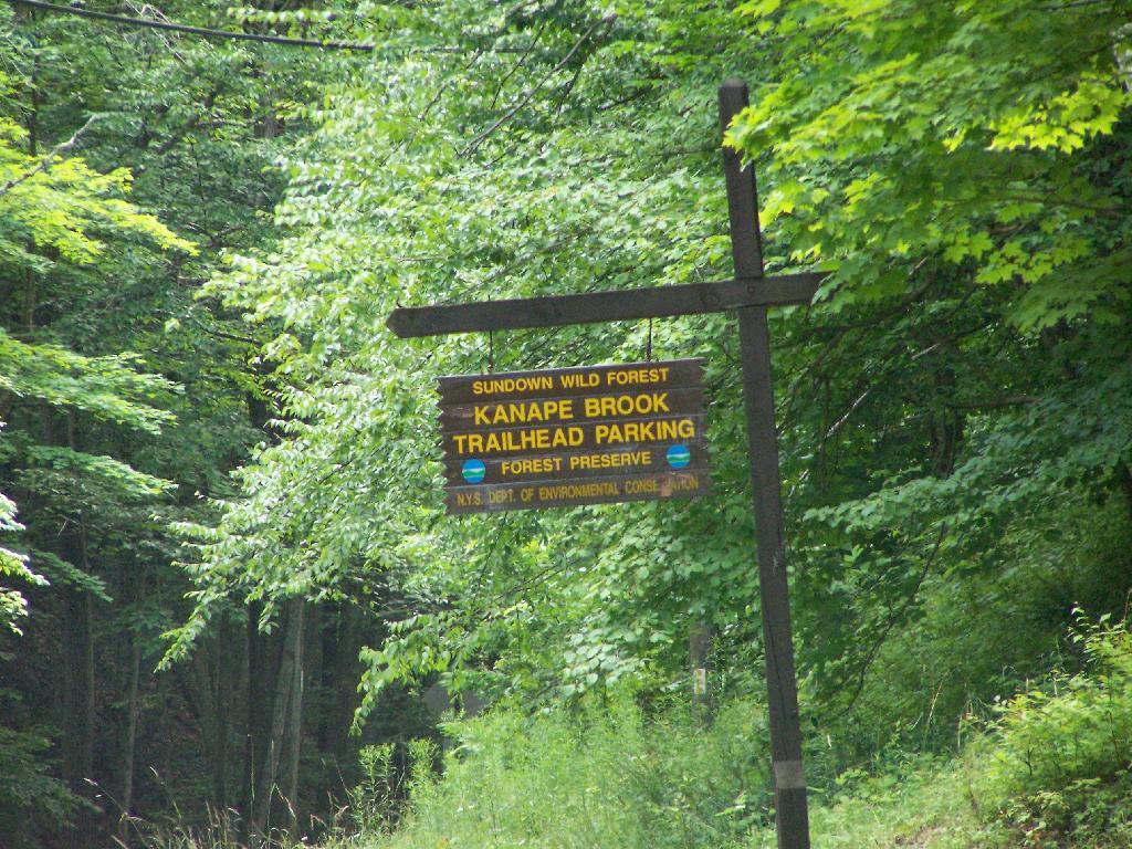
Below is a listing of DEC parking areas in the Catskill Park with coordinates and addresses, nearby trails and the roads they are located on.
| Trail | Road | Name | Notes | Street | City | St | ZIP | Latitude | Longitude |
| Ashokan High Point | Watson Hollow Road | Kanape Valley Parking Lot | 826 Watson Hollow Rd | West Shokan | NY | 12494 | 41.9357923141228 | -74.3281141901214 | |
| Beaverkill Road | Beaverkill Road | Beaverkill Road Parking Lot | 2795 Beaverkill Rd | Livingston Manor | NY | 12758 | 42.0117166110155 | -74.6223767934834 | |
| Beaverkill Road | Turnwood Road | Beaverkill Road Parking Lot | 2952 Beaverkill Rd | Livingston Manor | NY | 12758 | 42.0233290355646 | -74.5995306115641 | |
| Becker Hollow Trail | Lane Road | Becker Hollow Parking Lot | 6 Vehicle Capacity | 3940 Route 214 | Elka Park | NY | 12427 | 42.1816084527769 | -74.1969812784753 |
| Bengle Hill Trail | Peekamoose Road | Eastern Upper Field Parking Lot | 359 Peekamoose Rd | Grahamsville | NY | 12740 | 41.9166423616552 | -74.4377863112221 | |
| Bengle Hill Trail | Peekamoose Road | Lower Field Parking Lot | 194 Peekamoose Rd | Grahamsville | NY | 12740 | 41.9101942400042 | -74.452852499381 | |
| Bengle Hill Trail | Peekamoose Road | Middle Field Parking Lot | 304 Peekamoose Rd | Grahamsville | NY | 12740 | 41.9158997405029 | -74.443422031256 | |
| Bengle Hill Trail | Peekamoose Road | North Middle Field Parking Lot | 304 Peekamoose Rd | Grahamsville | NY | 12740 | 41.9164180048779 | -74.4416441135141 | |
| Bengle Hill Trail | Peekamoose Road | Trailer Feild Parking Lot | 359 Peekamoose Rd | Grahamsville | NY | 12740 | 41.9162603251141 | -74.4346555497984 | |
| Bengle Hill Trail | Peekamoose Road | Western Upper Field | 359 Peekamoose Rd | Grahamsville | NY | 12740 | 41.9169982073948 | -74.4396463051141 | |
| Big Pond – Alder Lake | Barkaboom Road | Barkaboom Road Parking Lot | Located On Barkaboom Road, 6 Cars | 288 Barkaboom Rd | Andes | NY | 13731 | 42.0426860004001 | -74.7267519998891 |
| Big Pond – Alder Lake | Cross Mountain Road | Alder Lake Parking Lot | 2 Cross Mountain Rd | Livingston Manor | NY | 12758 | 42.0497953211373 | -74.6827571604492 | |
| Black Dome Trail | Big Hollow Road | Big Hollow Road Parking Lot | 7 Vehicle Capacity | 947 Route 56 | Maplecrest | NY | 12454 | 42.2889033425096 | -74.1151262941519 |
| Campbell Mountain Trail | Cat Hollow Road | Route 206 Parking Lot | 5 Vehicle Capacity | 1611 County Road 7 | Roscoe | NY | 12776 | 42.051659649187 | -74.9147231839428 |
| Cic – Esopus Trail | State Route 28 | Parking Area For Esopus Creek Fishing Access | Parking Area For Esopus Creek Fishing Access – Cic | 5067 Route 28 | Mount Tremper | NY | 12457 | 42.0254799892217 | -74.2717292519349 |
| Cic Hill Trail | Wittenberg Road | Wittenberg Road Parking Lot | 1298 Wittenberg Rd | Mount Tremper | NY | 12457 | 42.0279684988885 | -74.2620571929729 | |
| Colgate Lake Trail To Dutcher Notch | Colgate Road | Colgate Lake Lower Parking Lot | 50 Vehicle Capacity | 525 Colgate Rd | East Jewett | NY | 12424 | 42.2384696568264 | -74.1233979344461 |
| Colgate Lake Trail To Dutcher Notch | Colgate Road | Colgate Lake Parking Lot | 2 Vehicle Capacity | 524 Colgate Rd | East Jewett | NY | 12424 | 42.2385040003097 | -74.1206960003026 |
| Colgate Lake Trail To Dutcher Notch | Colgate Road | Colgate Lake Trail Parking Lot | 8 Vehicle Capacity | 653 Colgate Rd | East Jewett | NY | 12424 | 42.2384599994304 | -74.1163269993959 |
| Condon Hollow Rd. | Condon Hollow Road | Condon Hollow Road Parking Lot | 3 Vehicle Capacity | 139 Condon Hollow Rd | West Kill | NY | 12492 | 42.2161010059593 | -74.4163349850283 |
| Condon Hollow Rd. | Elk Creek Road | Elk Creek Road Parking Lot | 5 Vehicle Capacity | 734 Elk Creek Rd | Fleischmanns | NY | 12430 | 42.1996047835286 | -74.4451315908425 |
| Condon Hollow Rd. | South Beech Ridge Road | Beech Road Parking Lot | 4 Vehicle Capacity | 291 S Beech Ridge Rd | West Kill | NY | 12492 | 42.2139020709257 | -74.4012095700882 |
| Condon Hollow Rd. | State Highway 42 | Rte 42 Parking Lot | 3 Vehicle Capacity | 1088 Route 42 | Shandaken | NY | 12480 | 42.1851525975488 | -74.4149115068685 |
| Denman Mountain Snowmobile Trail | Glade Hill Road | Denman Parking Lot | 327 Glade Hill Rd | Grahamsville | NY | 12740 | 41.8853341886314 | -74.5320280123605 | |
| Denman Mountain Snowmobile Trail | Moore Hill Road | Hogs Roack Plot Parking Lot | 578 Alpha Rd | Grahamsville | NY | 12740 | 41.9003387815796 | -74.5274487605523 | |
| Devil’s Path | Broadstreet Hollow Road | Broadstreer Hollow Parking Lot | 2 Vehicle Capacity | 619 Broadstreet Hollow Rd | Shandaken | NY | 12480 | 42.1394450770105 | -74.3308357356817 |
| Devil’s Path | Spruceton Road | Spruceton Road Parking Lot | 5 Vehicle Capacity | 1518 Spruceton Rd | West Kill | NY | 12492 | 42.1920191641918 | -74.3238474073796 |
| Devil’s Path | Prediger Road | Prediger Road | 75 Prediger Rd | Elka Park | NY | 12427 | 42.1338909995054 | -74.1042720006852 | |
| Diamond Notch Trail | Diamond Notch Road | South Diamond Notch Parking Lot | 2 Vehicle Capacity | 508 Diamond Notch Rd | West Kill | NY | 12492 | 42.147861770123 | -74.2646596008456 |
| Diamond Notch Trail | Spruceton Road | Diamond Notch Parking Lot | 8 Vehicle Capacity | 2778 Spruceton Rd | West Kill | NY | 12492 | 42.1823740001994 | -74.2695430002389 |
| Dry Brook Ridge Trail | Mill Brook Road | Dry Brook Ridge Parking Lot | 12 Balsam Mountain Camp Rd | Margaretville | NY | 12455 | 42.0715022570921 | -74.5738756337513 | |
| Dry Brook Ridge Trail | South Side Spur | North End Of Dry Brook Ridge Parking Lot | 301 Southside Spur | Margaretville | NY | 12455 | 42.1446292458628 | -74.649333317932 | |
| Elm Ridge Trail | Peck Road | Peck Road Parking Lot | 10 Vehicle Capacity | 189 Peck Rd | Maplecrest | NY | 12454 | 42.2965789997488 | -74.1693680002929 |
| Fluggertown Road Long Pond Trail | Fluggertown Road | Flugertown Road Parking Lot | 191 Flugertown Rd | Livingston Manor | NY | 12758 | 41.9347657909639 | -74.649696950272 | |
| Flynn Trail | Mongaup Road | Mongaup Road Parking Lot | 1 Beech Mountain Rd | Livingston Manor | NY | 12758 | 41.9467974587868 | -74.7052771774711 | |
| Giant Ledge-Panther Mountian-Fox Hollow Trail | Fox Hollow Road | Fox Hollow Road Parking Lot | 67 Mountain Dr | Shandaken | NY | 12480 | 42.1008382907335 | -74.3904559601097 | |
| Giant Ledge-Panther Mountian-Fox Hollow Trail | Peck Hollow Road | Peck Hollow Road Parking Lot | 254 Peck Hollow Rd | Shandaken | NY | 12480 | 42.1357649784827 | -74.3712920364471 | |
| Giant Ledge-Panther Mountian-Fox Hollow Trail | Peck Hollow Road | Esopus Creek Fishing Access (Upper) | Gravel | 7019 Route 28 | Pheonicia | NY | 12464 | 42.1065553340012 | -74.3519924442835 |
| Giggle Hollow Trail | NY 23 – Belleayr | Belleayre Day Use Parking Lot | 33 Friendship Manor Rd | Pine Hill | NY | 12465 | 42.1256810090987 | -74.4731178408634 | |
| Harding Road Spur Trail | Whites Road | Whites Road Parking Lot | 4 Vehicle Capacity | 274 White Rd | Palenville | NY | 12463 | 42.1823951680298 | -74.0261906353256 |
| Harding Road Trail | Harding Road | Harding Road Parking Lot | 5 Vehicle Capacity | 3525 Route 23A | Palenville | NY | 12463 | 42.1762358120255 | -74.0304949714876 |
| Huckleberry North Trail | Hill Road | Hill Road Parking Lot | 4 Vehicle Capacity | 1209 Hill Rd | Margaretville | NY | 12455 | 42.1166129796449 | -74.6486105632054 |
| Huckleberry North Trail | Huckleberry Brook Spur Road | Huckleberry Brook Road Parking Lot | 6 Vehicle Capacity | 1613 Huckleberry Brook Rd | Margaretville | NY | 12455 | 42.1130238724914 | -74.6515523618233 |
| Huckleberry South Trail | Huckleberry Brook Spur Road | Huckleberry Road Parking Lot | 5 Vehicle Capacity | 1073 Huckleberry Brook Rd | Margaretville | NY | 12455 | 42.1152546105706 | -74.6636037740616 |
| Huckleberry South Trail | Hull Road | Ploutz Road | 4 Vehicle Capacity | 1634 Ploutz Rd | Margaretville | NY | 12455 | 42.0938719675255 | -74.6204457323272 |
| Huggins Lake Trail | Berry Brook Road | Huggins Lake Road Parking Lot | 4 Vehicle Capacity | 2414 Holiday And Berry Brook Rd | Roscoe | NY | 12776 | 42.0157959909969 | -74.8436914198853 |
| Jockey Hill Bicycle Trail | Wood Road | Wood Road Parking Lot | 334 Woods Rd | Kingston | NY | 12401 | 41.9777439980953 | -74.0501113306995 | |
| Kaaterskill Falls Trail | State Highway 23a | Molly Smith Parking Lot | Dot Facility, 20 Vehicles | 4729 Route 23A | Elka Park | NY | 12427 | 42.1898508772368 | -74.074111945438 |
| Kaaterskill Rail Trail | Laurel House Rd | Laurel House Rd | 103 Laurel House Rd | Tannersville | NY | 12485 | 42.1956250050266 | -74.063093393786 | |
| Kelly Hollow Long Loop Trail | Mill Brook Road | East Kelly Hollow Parking Lot | 5163 Mill Brook Rd | Margaretville | NY | 12455 | 42.078800277463 | -74.6497556922038 | |
| Kelly Hollow Long Loop Trail | Mill Brook Road | West Kelly Hollow Parking Lot | 5163 Mill Brook Rd | Margaretville | NY | 12455 | 42.0795848697519 | -74.6545040693769 | |
| Long Path | Steenburg Road | Steenburgh Road | 2425 Platte Clove Rd | Elka Park | NY | 12427 | 42.1337889994516 | -74.0819709994867 | |
| Long Path | Route 23 | Route 23 Parking Lot | 20 Vehicle Capacity | 3 Cross Rd | Windham | NY | 12496 | 42.312706999584 | -74.1904309994766 |
| Long Pond South Loop | Willowemock Road | Wild Meadow Road Parking Lot | 136 Round Pond Rd | Claryville | NY | 12725 | 41.9435338737706 | -74.5864488816452 | |
| Lost Clove Trail | Lost Clove Road | Lost Clove Parking Lot | 343 Lost Clove Rd | Big Indian | NY | 12410 | 42.1054379266455 | -74.4700849794812 | |
| Mary Smith Trail | Holliday Brook Road | Holiday And Berry Brook Road Parking Lot | 5 Vehicle Capacity | 3851 Holiday And Berry Brook Rd | Roscoe | NY | 12776 | 42.0386999995498 | -74.8473909994493 |
| Mckinley Hollow Trail | Mc Kinley Hollow Road | Mckinly Hollow Parking Lot | 200 McKinley Hollow Rd | Big Indian | NY | 12410 | 42.0704132895809 | -74.4740296153462 | |
| Mckinley Hollow Trail | Rider Hollow Road | Rider Hollow Parking Lot | 12 Warren Todd Subdivision Dr | Arkville | NY | 12406 | 42.1018368545182 | -74.5170339246663 | |
| Mckinley Hollow Trail | Burnham Hollow Road | Burnham Hollow Parking Lot | 17 Sagmore Trl | Big Indian | NY | 12410 | 42.05564157218 | -74.4669789486585 | |
| Middle Mountain Trail | Mary Smith Hill Road | Mary Smith Hill Road Parking Lot | 3 Vehicle Capacity | 865 Mary Smith Hill Rd | Andes | NY | 13731 | 42.0401290003224 | -74.8089319993063 |
| Mink Hollow Trail | Mink Hollow Road | Lake Hill | 599 Mink Hollow Rd | Bearsville | NY | 12448 | 42.1051314008054 | -74.1735651990356 | |
| Mount Pleasant-Romer Mountain | State Highway 28 | Sawmill Lot | 50×50 Parking Area – Trailless | 6331 Route 28 | Phoenicia | NY | 12464 | 42.1008585056075 | -74.3445327399439 |
| Mud Pond Trail | County Road 179a | Old Rte 17 Fishing Access | 6 Vehicle Capacity | 6175 State Route 17 W | Roscoe | NY | 12776 | 41.9497668355721 | -74.9281906252666 |
| Mud Pond Trail | Horton Brook Road | Little Fuller Brook Parking Lot | 6 Vehicle Capacity | 845 Horton Brook Rd | Roscoe | NY | 12776 | 42.0159481159029 | -74.9790550095988 |
| Onteora Lake Parking Access | State Highway 28 | Onteora Lake Trailhead Upper Lot | 881 Route 28 | Kingston | NY | 12401 | 41.9807660434687 | -74.0853059041223 | |
| Onteora Lake Yellow Tral | NY 23 | Onteora Lake Parking | 960 Route 28 | Kingston | NY | 12401 | 41.9840941553893 | -74.0827910535657 | |
| Overlook Spur Trail Extension | Macdaniiel Road | Meads Meadow Parking Area | 452 MacDaniel Rd | Bearsville | NY | 12409 | 42.0756312690235 | -74.1276188121255 | |
| Overlook Trail | Meads Mountain Road | Overlook Mountain Trailhead | 334 Meads Mountain Rd | Woodstock | NY | 12498 | 42.0710794980857 | -74.1224765106456 | |
| Peekamoose-Table Trail | Peekamoose Road | Peekamoose Road Parking Lot | 415 Peekamoose Rd | Grahamsville | NY | 12740 | 41.9233895882109 | -74.4128616227944 | |
| Peekamoose-Table Trail | Peekamoose Road | Peekamose Mountian Trail Head Parking Lot | 415 Peekamoose Rd | Grahamsville | NY | 12740 | 41.9149365156904 | -74.4289858455429 | |
| Pelnor Hollow Trail | Beaver Kill Road | Waneta Lake Parking Lot | 732 Beaverkill Rd | Livingston Manor | NY | 12758 | 41.9676202925977 | -74.8292314401778 | |
| Phoenicia East Branch Trail | Denning Road | Denning Road Parking Lot | 3381 Denning Rd | Claryville | NY | 12725 | 41.9690314347788 | -74.4486958819482 | |
| Phoenicia East Branch Trail | Oliverea-Slide Mountain Road | Oliverea Road North Parking Lot | 1453 Oliverea Rd | Big Indian | NY | 12410 | 42.0265659167754 | -74.4038665935078 | |
| Phoenicia East Branch Trail | Oliverea-Slide Mountain Road | Oliverea Road South Parking Lot | 19 Shandaken Rod Gun Clb | Big Indian | NY | 12410 | 42.0078280894865 | -74.4268762683237 | |
| Phoenicia Trail | Plank Road | Tremper Mountain Parking Area | Gravel Lot | 5636 Route 28 | Phoenicia | NY | 12464 | 42.0705625579484 | -74.3024012416267 |
| Pine Hill West Branch Trail | West Branch Road | Biscuit Brook Parking Lot | 1886 Frost Valley Rd | Claryville | NY | 12725 | 41.990833872737 | -74.4845571593918 | |
| Powerline | Beech Ridge Road 1 | Vinegar Hill Parking Area | 1060 N Beech Ridge Rd | Prattsville | NY | 12468 | 42.2449000123037 | -74.4075985539776 | |
| Red Hill Fire Tower Trail | Red Hill Road | Red Hill Fire Tower Parking Lot | 129 Coons Rd | Claryville | NY | 12725 | 41.9302938486155 | -74.5073498606472 | |
| Roaring Kill Trail | Dale Lane | Roaring Kill | 6 Vehicle Capacity | 155 Roaring Kill Rd | Elka Park | NY | 12427 | 42.1511360000949 | -74.1310779997324 |
| Rochester Hollow | Shaft Road | Shaft 6 Parking | 20 Vehicle Capacity | 73 Shaft Rd | Shandaken | NY | 12480 | 42.166173156258 | -74.4083342114093 |
| Rochester Hollow | Spisak Way | Rochester Hollow Parking Lot | 51 Matyas Rd | Big Indian | NY | 12410 | 42.1179698674129 | -74.4517651458059 | |
| Seager Big Indian Trail | Dry Brook Road | Seager Parking Lot | 5672 Dry Brook Rd | Arkville | NY | 12406 | 42.0578836653667 | -74.5396998623234 | |
| Spencer Road | Trails End Road | Trails End Parking Lot | 197 Trails End Rd | Kerhonkson | NY | 12446 | 41.8835868385135 | -74.3594081701432 | |
| Spruceton Trail | Spruceton Road | Spruceton Trail Parking Lot | 20 Vehicle Capacity | 2628 Spruceton Rd | West Kill | NY | 12492 | 42.1846329998217 | -74.2719879999707 |
| Touch-Me-Not-Trail | Barkaboom Road | Big Pond Parking Lot | Located Off Barkaboom Road, 6 Cars | 366 Barkaboom Rd | Andes | NY | 13731 | 42.0433679998314 | -74.7277000006876 |
| Touch-Me-Not-Trail | Beech Hill Road | Beech Hill Road Parking Lot | 3 Vehicle Capacity | 2054 Beech Hill Rd | Andes | NY | 13731 | 42.0506230001697 | -74.7789470006467 |
| Touch-Me-Not-Trail | Deerlick Brook Road | Deerlick Road Parking Lot | 3 Vehicle Capacity | 1553 Deerlick Brook Rd | Andes | NY | 13731 | 42.0814567992576 | -74.7365160981546 |
| Touch-Me-Not-Trail | Barkaboom Road | Forest Preserve Access Parking | East Of Barkaboom Road 3 Cars | 1954 Barkaboom Rd | Andes | NY | 13731 | 42.0655363440977 | -74.7284401046935 |
| Trout Pond Access Route | Russell Brook Road | Russell Brook Road Parking Lot | 10 Vehicle Capacity | 4348 Russell Brook Rd | Roscoe | NY | 12776 | 41.9943949997582 | -74.941432999876 |
| Trout Pond Trail | Campbell Brook Road | Campbell Brook Road Parking Lot | 4747 Campbell Brook Rd | Downsville | NY | 13755 | 42.0306374772623 | -74.9384473452279 | |
| Trout Pond Trail | Campbell Mountain Road | Campbell Mountain Road Parking Lot | 5 Vehicle Capacity | 3693 Campbell Mountain Rd | Downsville | NY | 13755 | 42.0433291750688 | -74.9358959381363 |
| Vernooy Kill Falls Snowmobile Trail | Dymond Road | Dymond Road Parking Lot | 498 Yeagerville Rd | Napanoch | NY | 12458 | 41.8792625226568 | -74.4012606035291 | |
| Vernooy Kill Falls Snowmobile Trail | Upper Cherrytown Road | Upper Cherry Town Road Trail Head Parking Lot | 559 Upper Cherrytown Rd | Kerhonkson | NY | 12446 | 41.8643822024537 | -74.3454535201223 | |
| Willow Trail | Abbey Road | Mount Toblas Parking Lot | 439 Abbey Rd | Mount Tremper | NY | 12457 | 42.0537752508176 | -74.2306894602594 | |
| Willow Trail | Jessup Road | Willow Trailhead Parking | 6 Vehicle Capacity | 218 Jessop Rd | Willow | NY | 12495 | 42.078213053797 | -74.2442314353898 |


Below is a list of peaks within the Catskill Park that are on state land. This is based on the OpenStreetMap data combined with the DEC property data. Click location for a map of the property, or click State Land to get more information about the land the peak is located on.

Notifications


