Counties: Albany to Delaware / Dutchess to Livingston / Madison to Otsego / Putnam to Suffolk / Sullivan to Yates
Browse Topographic Maps: Full State / Historical USGS Topographic Maps
Counties: Albany to Delaware / Dutchess to Livingston / Madison to Otsego / Putnam to Suffolk / Sullivan to Yates
Browse Topographic Maps: Full State / Historical USGS Topographic Maps

Looking for state land to wheel on? This list shows all of the conservation department-maintained DEC truck trails and public access roads that are more then a 1/2 mile long. This roads are varied, but most of them are dirt roads that take you through the back country. Town maintained roads through state forests are generally not shown on in this listing.
Looking for state land to wheel on? This list shows all of the conservation department-maintained DEC truck trails and public access roads that are more then a 1/2 mile long. This roads are varied, but most of them are dirt roads that take you through the back country. Town maintained roads through state forests are generally not shown on in this listing.
| State Land | Road | Miles |
|---|---|---|
| Albert J. Woodford Memorial State Forest | Truck Trail | 0.7 |
| Albert J. Woodford Memorial State Forest | Janis Road | 1.1 |
| Aldrich Pond Wild Forest | Powell Road | 0.5 |
| Aldrich Pond Wild Forest | Mullins Flow Road | 0.6 |
| Aldrich Pond Wild Forest | Little River Road | 0.7 |
| Aldrich Pond Wild Forest | Silver Dawn Road | 0.7 |
| Aldrich Pond Wild Forest | Jackworks Trail | 1.1 |
| Aldrich Pond Wild Forest | South Creek Lake Road | 1.6 |
| Aldrich Pond Wild Forest | Tyler Road | 3.7 |
| Aldrich Pond Wild Forest | Streeter Lake Road | 4.8 |
| Allen Lake State Forest | George Forest Road | 1.5 |
| Ambler State Forest | Truck Trail | 1.8 |
| Ampersand Primitive Area | Ampersand Park Road | 3.2 |
| Andersen Hill State Forest | Big Pine Public Forest Acess Road | 1.5 |
| Arctic China State Forest | China Public Forest Access Road | 1.1 |
| Arctic China State Forest | Shears Public Forest Access Road | 2 |
| Arctic China State Forest | Dunbar Public Forest Access Road | 2.1 |
| Armlin Hill State Forest | Truck Trail | 1.1 |
| Arnold Lake State Forest | Public Forest Access Road | 0.9 |
| Arnold Lake State Forest | Hartwick Forest Access Road | 1 |
| Ashland Pinnacle State Forest | Ashland Pinnacle Access Road #2 | 0.5 |
| Ashland Pinnacle State Forest | Haul Road #1/Long Path Hiking Trail | 1.4 |
| Avon Regional Office | Goodlake Year Entrance Road | 0.7 |
| Baker School House State Forest | Baker School House Public Forest Acess Road | 1.8 |
| Bald Mountain State Forest | Howe Forest Road | 2.4 |
| Balsam Creek State Forest | Briar Hill Road | 1.5 |
| Barbour Brook State Forest | Barbour Brook Public Forest Access Road | 2 |
| Basswood State Forest | Burlington Public Forest Access Road | 0.5 |
| Basswood State Forest | Basswood Pond Public Forest Access Road | 1 |
| Basswood State Forest | Dr. Crouch Truck Trail | 1.3 |
| Bates State Forest | Pucker Street | 1 |
| Bates State Forest | Bates Forest Road | 2.6 |
| Battle Hill State Forest | Unnamed | 1.3 |
| Bear Pond Primitive Area | Bear Pond Road | 0.8 |
| Bear Swamp State Forest | Karsch Haul Road | 0.5 |
| Bear Swamp State Forest | Joe Chamberlin Public Forest Access Road | 1.6 |
| Bear Swamp State Forest | Roseboom Public Facility Truck Trail | 1.8 |
| Bear Swamp State Forest | Snowmobile Trail | 8.3 |
| Bearpen Mountain State Forest | Ski Run Road | 2.1 |
| Beartown State Forest | Town Road | 0.7 |
| Beartown State Forest | Cotton Road | 0.8 |
| Beartown State Forest | Steam Mill Road | 0.8 |
| Beartown State Forest | Aspen Hollow Road | 2.4 |
| Beaver Creek State Forest | Public Forest Access Road 2, Madison 11 | 0.5 |
| Beaver Creek State Forest | Truck Trail -2-12 | 0.7 |
| Beaver Creek State Forest | Public Forest Access Road 1, Madison 11 | 1.3 |
| Beaver Creek State Forest | Truck Trail -1-12 | 3.6 |
| Beaver Dam State Forest | Sears Public Forest Acess Road | 1.4 |
| Beaver Meadow State Forest | Weir Dam Truck Trail | 0.5 |
| Beebe Hill State Forest | Barrett Pond Road | 1.4 |
| Beebe Hill State Forest | Loop Road | 2.3 |
| Big Brook State Forest | County Line Road Spur | 0.6 |
| Big Brook State Forest | Walasek Mulcoy Road | 0.8 |
| Big Brook State Forest | Hanifin Road | 0.9 |
| Big Brook State Forest | County Line Road | 1.4 |
| Birdseye Hollow State Forest | Sanford Lake Access Road | 0.5 |
| Black Creek State Forest | Stanley Road | 1.1 |
| Black River Wild Forest | Remsen Falls Trail | 0.5 |
| Black River Wild Forest | Woods Lake Road | 0.5 |
| Black River Wild Forest | Gull Lake Road | 0.6 |
| Black River Wild Forest | Flansburg Road | 0.7 |
| Black River Wild Forest | Party Road | 0.7 |
| Black River Wild Forest | Black Creek Road | 0.8 |
| Black River Wild Forest | Cohen Road | 1.7 |
| Black River Wild Forest | Flansberg Road | 2.6 |
| Black River Wild Forest | Black Creek Lake Road | 3 |
| Black River Wild Forest | Haskell Road | 3 |
| Black River Wild Forest | Mill Creek Road | 3.4 |
| Black River Wild Forest | Nicks Lake Campground Roads | 3.5 |
| Black River Wild Forest | Wolf Lake Landing Road | 4.8 |
| Black River Wild Forest | West Creek Road | 6.3 |
| Blenheim Hill State Forest | Ward Allen Road | 1.1 |
| Blenheim Hill State Forest | Quarry Road | 1.2 |
| Blue Mountain Wild Forest | Deer Pond Road | 1.1 |
| Blue Mountain Wild Forest | Chain Lakes Road North | 1.3 |
| Blue Mountain Wild Forest | Polaris Road | 1.3 |
| Bombay State Forest | Cross Haul Road | 0.7 |
| Bombay State Forest | Railroad Bed Public Forest Acess Road | 1.2 |
| Bombay State Forest | Pike Brook Haul Road | 3.1 |
| Bonaparte’s Cave State Forest | Corbine Road | 0.8 |
| Bonaparte’s Cave State Forest | Mud Pond Road | 0.8 |
| Boutwell Hill State Forest | Arab Hill Forest Road, Cha 1 Section | 0.8 |
| Boutwell Hill State Forest | Arab Hill Forest Road, Cha 7 Section | 2.1 |
| Boyce Hill State Forest | Jackson Forest Road | 0.6 |
| Brasher State Forest | Route 53 Haul Road | 0.5 |
| Brasher State Forest | Beaver Pond Trail | 0.6 |
| Brasher State Forest | Kennehan Haul Road | 0.8 |
| Brasher State Forest | Bush Road | 1.1 |
| Brasher State Forest | Buckley Haul Road | 1.2 |
| Brasher State Forest | Cc Dam Public Forest Access Road | 1.2 |
| Brasher State Forest | Mccarthy Public Forest Access Road | 1.6 |
| Brasher State Forest | Liberty Public Forest Access Road | 1.7 |
| Brasher State Forest | Hastings Falls Haul Road | 2.1 |
| Brasher State Forest | Wilson Public Forest Access Road | 2.1 |
| Brasher State Forest | Camp / Larue Public Forest Access Road | 2.2 |
| Brasher State Forest | Pascal Haul Road | 2.4 |
| Brasher State Forest | Bush Public Forest Access Road | 2.9 |
| Brasher State Forest | Railroad Bed Public Forest Access Road | 3.6 |
| Brokenstraw State Forest | Brokenstraw Forest Road | 1.7 |
| Bryant Hill State Forest | Hawk Forest Road | 1.4 |
| Buck Hill State Forest | Hertz Road | 0.7 |
| Buck Hill State Forest | Truck Trail | 1.5 |
| Buck Hill State Forest | Buck Hill Road | 3.1 |
| Bucks Brook State Forest | Access Trail | 0.6 |
| Buckton State Forest | Buckton Haul Road | 0.8 |
| Bucktooth State Forest | Baily Hollow Forest Road | 0.6 |
| Bucktooth State Forest | Manley Hill Forest Road | 1 |
| Bully Hill State Forest | Dixon Forest Road | 1 |
| Bully Hill State Forest | Connection Forest Road | 1.6 |
| Bully Hill State Forest | Stearns Forest Road | 2.1 |
| Burnt-Rossman Hills State Forest | Koenig Road | 0.5 |
| Burnt-Rossman Hills State Forest | Betty Brook Haul Road | 0.6 |
| Burnt-Rossman Hills State Forest | Eminence Dead End Truck Trail | 0.7 |
| Burnt-Rossman Hills State Forest | Duck Pond Road | 1.2 |
| Burnt-Rossman Hills State Forest | Monkey Run Truck Trail East | 1.3 |
| Burnt-Rossman Hills State Forest | Yankee Street Truck Trail | 1.3 |
| Burnt-Rossman Hills State Forest | Betty Brook Road | 1.4 |
| Burnt-Rossman Hills State Forest | Betty Brook Truck Trail | 1.5 |
| Burnt-Rossman Hills State Forest | Duck Pond Truck Trail | 1.5 |
| Burnt-Rossman Hills State Forest | Morey Road Truck Trail | 1.7 |
| Burnt-Rossman Hills State Forest | Eminence Road Truck Trail | 2.6 |
| Burnt-Rossman Hills State Forest | Burnt Hill Road | 2.9 |
| Bush Hill State Forest | Fox Cross Forest Road | 2 |
| California Hill State Forest | Wayawanda Road | 0.7 |
| Canacadea State Forest | Macduff Road | 2.3 |
| Canadaway Creek Wma | Dibble Hill Forest Road | 2 |
| Canaseraga State Forest | Ringelberg Truck Trail | 0.5 |
| Canaseraga State Forest | Right Fork Truck Trail | 1 |
| Canaseraga State Forest | Stanley Road | 1.1 |
| Canaseraga State Forest | Left Fork Truck Trail | 1.4 |
| Caroga Lake Campground | Campground Road | 2 |
| Catherineville State Forest | Santamont Access Trail | 1.1 |
| Catherineville State Forest | Circle Public Forest Access Road | 1.8 |
| Charles E. Baker State Forest | Truck Trail 5 | 0.6 |
| Charles E. Baker State Forest | Truck Trail 2 | 0.9 |
| Charles E. Baker State Forest | Truck Trail 6 | 0.9 |
| Charles E. Baker State Forest | Truck Trail 4 | 1.4 |
| Charles E. Baker State Forest | Truck Trail 12 | 1.5 |
| Charles E. Baker State Forest | Truck Trail 8 | 1.9 |
| Charles E. Baker State Forest | Truck Trail 7 | 2.1 |
| Charles E. Baker State Forest | Truck Trail 1 | 3 |
| Charles E. Baker State Forest | Truck Trail 13 | 3.2 |
| Chazy Highlands State Forest | Spring Road | 0.6 |
| Cherry Valley State Forest | Kniskern Public Access Road | 1.2 |
| Cherry Valley State Forest | Mosse Public Forest Access Road | 1.9 |
| Cinnamon Lake State Forest | Hornby Road Haul Road | 0.7 |
| Clapper Hollow State Forest | Clapper Hollow Truck Trail | 1 |
| Clark Hill State Forest | Abandoned Town Road | 0.8 |
| Clark Hill State Forest | Truck Trail | 0.9 |
| Clark Hill State Forest | Access Road North Of Buck Hill Road | 0.9 |
| Clark Hill State Forest | Class A Truck Trail | 1.2 |
| Clark Hill State Forest | Haul Road | 1.3 |
| Cliffside State Forest | Railroad Haul Road | 1.3 |
| Cobb Brook State Forest | Unnamed Truck Trail | 0.6 |
| Cold Creek State Forest | Headwaters Forest Road | 1.4 |
| Cold Spring Brook State Forest | Cold Spring Brook Public Forest Access Road | 1.9 |
| Cole Hill State Forest | Cr 2 Access Road | 0.8 |
| Coyle Hill State Forest | Warner Spur Forest Road | 0.5 |
| Coyle Hill State Forest | Slawson Forest Road | 0.8 |
| Coyle Hill State Forest | Warner Forest Road | 1.8 |
| Cranberry Lake Campground | Campground Road | 2.5 |
| Cranberry Lake Wild Forest | Grass River Railroad | 6.1 |
| Cuyler Hill State Forest | Jipson Hill Public Forest Acess Road | 1.3 |
| Cuyler Hill State Forest | Cuyler Hill Public Forest Acess Road | 5.1 |
| David A. Sarnoff Preserve | Field Access Road | 0.8 |
| Debar Mountain Wild Forest | Debar Game Refuge Road | 0.5 |
| Debar Mountain Wild Forest | Debar Meadow Road | 0.6 |
| Debar Mountain Wild Forest | Vanderwalker Road | 0.9 |
| Debar Mountain Wild Forest | 4 Mile Road Riffle Season Access Corridor | 1.1 |
| Debar Mountain Wild Forest | Ny Centrail Railroad Bed | 2.2 |
| Deer River State Forest | Ccc Road | 0.6 |
| Deer River State Forest | Hogsback Road | 0.6 |
| Deer River State Forest | Willow Road | 0.6 |
| Deer River State Forest | Glaze Road | 0.7 |
| Deer River State Forest | Avery Lot Road | 0.9 |
| Deer River State Forest | Esseltine Hill Road | 0.9 |
| Deer River State Forest | Ricky’s Number Trail | 1 |
| Deer River State Forest | Horse Barn Road | 1.2 |
| Deer River State Forest | Laramie Road | 1.3 |
| Deer River State Forest | Beanville Road | 1.4 |
| Deer River State Forest | Spruce Road | 1.6 |
| Deer River State Forest | Loope Road | 2 |
| Deer River State Forest | Firewood Road | 2.6 |
| Degrasse State Forest | Burns Flats Road | 0.5 |
| Degrasse State Forest | Loop Road | 1.2 |
| Deruyter State Forest | Tromp Road | 1.5 |
| Dobbins Memorial State Forest | Snowmobile Trail | 3.5 |
| Dog Hollow State Forest | Brewer Public Forest Acess Road | 0.9 |
| Downerville State Forest | River Public Forest Access Road | 1 |
| Dry Run State Forest | Wildcat Hollow | 0.8 |
| Dunkin’s Reserve State Forest | Access Road | 3.5 |
| Dutch Settlement State Forest | Haul Road #1 | 0.6 |
| Dutton Ridge State Forest | Dutton Ridge Access Road | 1.5 |
| Earlville State Forest | Mad 2 Forest Access Road | 1.5 |
| East Osceola State Forest | Malloy Brook Road | 1.1 |
| East Otto State Forest | Kriedeman Forest Road | 1.7 |
| Edgewood Oak Brush Plains Preserve | Edgewood Oak Brush Plains Preserve | 0.5 |
| Edgewood Oak Brush Plains Preserve | Unpaved Forest Road | 0.5 |
| Edgewood Oak Brush Plains Preserve | Old Commack Road | 1.6 |
| English Hill State Forest | Ricketts Forest Road | 0.9 |
| Exeter State Forest | Exeter Public Forest Access Road | 1.3 |
| Fairfield State Forest | Jenksville Hill Public Forest Acess Road | 2 |
| Fall Brook State Forest | Gossner Road | 0.6 |
| Fall Brook State Forest | Haul Road To B-45 Wetland | 0.9 |
| Fall Brook State Forest | Access Road From Co. Rt 67A | 1 |
| Fall Brook State Forest | Forest Access Roaad | 1.2 |
| Ferris Lake Wild Forest | Meco Lake Trail | 0.9 |
| Ferris Lake Wild Forest | Sheriff Lake Trail | 0.9 |
| Ferris Lake Wild Forest | Mud Lake Road | 5.5 |
| Fish Creek State Forest | Forward Road | 0.5 |
| Fish Creek State Forest | Trestle Road | 0.6 |
| Fish Creek Wma | State Highway 184 Access Road | 0.9 |
| Five Rivers Education Center | Goose Lane | 0.5 |
| Flat Rock State Forest | Pedobo Road | 0.8 |
| Flat Rock State Forest | Karsch Haul Road | 0.9 |
| Flat Rock State Forest | Ampersand Park Road | 1.9 |
| Florence Hill State Forest | Florence Hill Road | 1.9 |
| Fort Jackson State Forest | Sheldon Public Forest Access Road | 0.5 |
| Frank E. Jadwin Memorial State Forest | Keesler Road | 0.6 |
| Frank E. Jadwin Memorial State Forest | Old Croghan Road | 0.7 |
| Frank E. Jadwin Memorial State Forest | Henry Road | 0.8 |
| Frank E. Jadwin Memorial State Forest | Nelson Road | 0.8 |
| Frank E. Jadwin Memorial State Forest | Wahalula Road | 0.8 |
| Frank E. Jadwin Memorial State Forest | Q- Road | 1.5 |
| Frank E. Jadwin Memorial State Forest | Patchin Road | 1.7 |
| Frank E. Jadwin Memorial State Forest | Blanchard Creek Road | 2.7 |
| Frank E. Jadwin Memorial State Forest | Wisner Road | 2.7 |
| Frank E. Jadwin Memorial State Forest | Judy Cole Road | 2.8 |
| Frank E. Jadwin Memorial State Forest | Loop Road | 3.2 |
| Fulton Chain Wild Forest | Cary Lake Road | 1.8 |
| Furnace Creek State Forest | Miller Road East | 0.7 |
| Furnace Creek State Forest | Powerline Row | 0.7 |
| Furnace Creek State Forest | Sheehan Road | 1.2 |
| Furnace Creek State Forest | B-29 Road | 1.4 |
| Gates Hill State Forest | Coons Den Truck Trail | 0.6 |
| Gates Hill State Forest | Eviann Road | 1.2 |
| Genegantslet State Forest | South Loomis Road | 0.7 |
| Gillies Hill State Forest | Abbey Forest Road | 0.9 |
| Gillies Hill State Forest | Pettit Forest Road | 1.4 |
| Golden Hill State Forest | Firelane Forest Road | 1.6 |
| Goundry Hill State Forest | Guiren Road | 1 |
| Goundry Hill State Forest | Corbett Hollow Access Road | 1.1 |
| Grant Powell State Forest | Huck Berry Road | 2.1 |
| Grass River Wild Forest | Spruce Mountain Road | 0.8 |
| Grass River Wild Forest | Hollywood Road | 2.5 |
| Grass River Wild Forest | Railroad Grade Road | 2.9 |
| Greenwood Creek State Forest | Grass Pond Public Forest Access Road | 0.9 |
| Grigg’s Gulf State Forest | Grigg’s Gulf Public Forest Acess Road | 1.5 |
| Gulf Unique Area | Gulf R.O.W. Road | 0.5 |
| Gulf Unique Area | Old Skid Road | 1.1 |
| Hall Island State Forest | Unnamed Public Forest Acess Road | 0.7 |
| Hammond Hill State Forest | Redman Run Public Forest Acess Road | 1.1 |
| Hammond Hill State Forest | Cannan Public Forest Acess Road | 1.3 |
| Hammond Pond Wild Forest | Paynes Way | 0.7 |
| Harris Hill State Forest | Sprague Forest Road | 0.8 |
| Harvey Mountain State Forest | Harvey Mt Access Road | 0.9 |
| Harvey Mountain State Forest | East Hill Access Road | 2.4 |
| Hatch Creek State Forest | Hodge Forest Road | 0.6 |
| Hatch Creek State Forest | North Forest Road | 0.8 |
| Hatch Creek State Forest | South Forest Road | 0.9 |
| Hemlock-Canadice State Forest | South Hemlock Access Road | 0.7 |
| Henderson Shores Unique Area | Radar Road | 0.8 |
| Hewitt State Forest | Hewitt Rd | 1.1 |
| Hickok Brook Multiple Use Area | Spur Road | 0.7 |
| Hickok Brook Multiple Use Area | Main Road | 1.1 |
| High Flats State Forest | Chapel Hill Access Trail | 0.5 |
| High Flats State Forest | Crowley Access Trail | 0.5 |
| High Flats State Forest | Close Pond Access Trail | 0.7 |
| High Flats State Forest | Donovan Public Forest Access Road | 1.1 |
| High Knob State Forest | Shale Pit Road | 1.9 |
| High Peaks Wilderness | Northville-Placid Trail-Northern Terminus | 1.1 |
| Hill Higher State Forest | Hill Higher Forest Road | 1.1 |
| Hinckley State Forest | Elm Flats Road | 0.5 |
| Hinckley State Forest | Roberts Road | 0.5 |
| Hinckley State Forest | Lanning Road | 0.8 |
| Hinckley State Forest | Access Road | 1.6 |
| Hinckley State Forest | Black Creek Road | 2 |
| Hogsback State Forest | Forest Access Road | 3 |
| Honey Hill State Forest | Edwards Public Forest Access Road | 1.4 |
| Hooker Mountain State Forest | Norton Public Forest Access Road | 0.8 |
| Horseshoe Lake Wild Forest | Cut Off Road | 0.6 |
| Horseshoe Lake Wild Forest | Lower Dam Road | 0.7 |
| Horseshoe Lake Wild Forest | Otter Brook Trail | 0.9 |
| Horseshoe Lake Wild Forest | Grass River Railroad | 1.7 |
| Horseshoe Lake Wild Forest | Otter Brook Road | 2.2 |
| Hoxie Gorge State Forest | Russel Hill Public Forest Acess Road | 2.5 |
| Huntersfield State Forest | Huntersfield Access Road #2 | 0.7 |
| Huntersfield State Forest | Huntersfield Access Road #1 | 1.9 |
| Hunts Pond State Forest | Truck Trail | 1.7 |
| Independence River State Forest | Assembly Road | 1 |
| Independence River Wild Forest | Blue Jog Road | 0.5 |
| Independence River Wild Forest | Sunday Lake Road | 0.5 |
| Independence River Wild Forest | Evies Pond Road | 0.7 |
| Independence River Wild Forest | Burnt Creek Road | 0.7 |
| Independence River Wild Forest | Elbow Rd | 0.7 |
| Independence River Wild Forest | Shortcut Road | 0.8 |
| Independence River Wild Forest | Fish Pond Road | 1 |
| Independence River Wild Forest | Halfmoon Lake Rd | 1 |
| Independence River Wild Forest | Little Otter Creek Road | 1 |
| Independence River Wild Forest | Long Pond Spur | 1 |
| Independence River Wild Forest | East Loop Road | 1.1 |
| Independence River Wild Forest | Copper Lake Road | 1.2 |
| Independence River Wild Forest | Necessary Dam Road | 1.2 |
| Independence River Wild Forest | Pitcher Pond Road | 1.3 |
| Independence River Wild Forest | Hinchings Pond Road | 1.8 |
| Independence River Wild Forest | Basket Factory Road | 2.1 |
| Independence River Wild Forest | Catspaw Lake Road | 2.4 |
| Independence River Wild Forest | Confusion Flats Road | 2.6 |
| Independence River Wild Forest | Big Otter Lake Road | 3.1 |
| Independence River Wild Forest | Stony Lake Road | 3.1 |
| Independence River Wild Forest | Florence Pond Road | 3.1 |
| Independence River Wild Forest | Steam Mill Road | 3.5 |
| Independence River Wild Forest | Smith Road | 3.7 |
| Indian Pipe State Forest | Dunes Road | 0.7 |
| Indian River Wma | Red Lake Road | 2 |
| Jackson Hill State Forest | Forest Access Road | 2.1 |
| Jersey Hill State Forest | Scholes Forest Road | 1.6 |
| Jessup River Wild Forest | Lake Colby Camp Road | 0.7 |
| Karr Valley Creek State Forest | Frungillo Forest Road | 0.8 |
| Karr Valley Creek State Forest | Norton Forest Road | 1.3 |
| Karr Valley Creek State Forest | Davison Forest Road | 1.4 |
| Keeney Swamp State Forest | Fitch Hill Spur Forest Road | 0.7 |
| Keeney Swamp State Forest | C3D | 0.8 |
| Keeney Swamp State Forest | Fitch Hill Forest Road | 1.2 |
| Keeney Swamp State Forest | Gordon Forest Road | 1.4 |
| Kennedy State Forest | Courtney Hill Public Forest Acess Road | 0.7 |
| Kennedy State Forest | Cotton-Hanlon Public Forest Acess Road | 1 |
| Kennedy State Forest | Kennedy Public Forest Acess Road | 2.5 |
| Kenneth Wilson Campground | Campground Road | 9.7 |
| Ketchumville State Forest | Ketchumville Public Forest Acess Road | 1 |
| Keyserkill State Forest | Guinea Road Truck Trail | 1 |
| Keyserkill State Forest | Keyserkill Truck Trail #1 | 1.3 |
| Klipnocky State Forest | Emery Forest Road | 1.2 |
| Klipnocky State Forest | Marble Forest Road | 1.6 |
| Klondike State Forest | Klondike Public Forest Acess Road | 1.7 |
| Lafayetteville Multiple Use Area | Wilbur Flats Road | 0.9 |
| Lake Durant Campground | Scott Public Forest Acess Road | 0.9 |
| Lake George Wild Forest | Jabe Pond Road | 1 |
| Lake George Wild Forest | Dacy Clearing Road | 1.6 |
| Lake George Wild Forest | Lily Pond Road | 2.1 |
| Lake George Wild Forest | Gay Pond Road | 4 |
| Lake Harris Campground | Campground Road | 0.9 |
| Lakeview Marsh Wma | Skinner Road | 0.7 |
| Leonard Hill State Forest | Leonard Hill Access Road #1 | 0.7 |
| Leonard Hill State Forest | Leonard Hill Access Road #3 | 1.2 |
| Leonard Hill State Forest | Leonard Hill Access Road #2 | 1.6 |
| Lesser Wilderness State Forest | Gomer Hill Road | 0.5 |
| Lesser Wilderness State Forest | Toole Road | 0.6 |
| Lesser Wilderness State Forest | Alguire Road | 0.7 |
| Lesser Wilderness State Forest | Smith Road | 0.8 |
| Lesser Wilderness State Forest | Nob Road | 0.9 |
| Lesser Wilderness State Forest | Seelman Road | 1.3 |
| Lesser Wilderness State Forest | Mcgoldrick Road | 3 |
| Lesser Wilderness State Forest | #9 Road | 4.7 |
| Limekiln Lake Campground | Lime Kiln Lake Campground Trails | 3.9 |
| Linda Gronlund Memorial At Barcelona Neck | Trustee Road West | 1 |
| Linda Gronlund Memorial At Barcelona Neck | Trustee Road East | 1.7 |
| Lonesome Bay State Forest | Alamogin Public Forest Access Road | 2.2 |
| Long Pond State Forest | Access Road | 0.5 |
| Long Pond State Forest | Truck Trail | 0.7 |
| Long Pond State Forest | Long Pond Snowmobile Trail | 0.8 |
| Lookout State Forest | Ball Road | 0.6 |
| Lost Nation State Forest | Brookdale Road / Jenkins Corners Rd / Red Barn Rd | 2.5 |
| Lost Valley State Forest | Lost Valley Haul Road | 1.2 |
| Lowville Demonstration Area | Dadville Road | 0.6 |
| Ludlow Creek State Forest | Trail Road | 1.3 |
| Lutheranville State Forest | Access Road #1 | 0.5 |
| Lutheranville State Forest | Access Road #2 | 1.2 |
| Lyon Brook State Forest | Lyon Brook Truck Trail | 1.2 |
| Mad River State Forest | Thompson Corners Florence Road | 0.5 |
| Mad River State Forest | Bartlett Road | 0.6 |
| Mad River State Forest | Rehm Road | 0.6 |
| Mad River State Forest | Phalen Road South | 1.9 |
| Mad River State Forest | Mcspirit Road | 2.1 |
| Madawaska Flow – Quebec Brook Primitive Area | Benz Pond Road | 2.2 |
| Mallet Pond State Forest | Cemetery Road Truck Trail | 2 |
| Maxon Creek State Forest | Pease Hill Public Forest Acess Road | 1 |
| Mccarthy Hill State Forest | Main Access Road | 0.5 |
| Mccarty Hill State Forest | Ccc Forest Road | 1.5 |
| Mccarty Hill State Forest | Mccarty Hill East Forest Road | 2 |
| Mcdonough State Forest | Ccc Trail | 1 |
| Mcdonough State Forest | Truck Trail 4 | 1.1 |
| Mcdonough State Forest | Finger Lakes Trail | 1.8 |
| Mcdonough State Forest | Truck Trail 3 | 2 |
| Melondy Hill State Forest | Public Forest Access Road | 2.5 |
| Montrose Point State Forest | Through Trail | 0.6 |
| Moose River Plains Wild Forest | Loop Road | 1.2 |
| Moose River Plains Wild Forest | Indian Lake Road | 3.4 |
| Moose River Plains Wild Forest | Otter Brook Road | 3.4 |
| Moose River Plains Wild Forest | Rock Dam Road | 4.2 |
| Moose River Plains Wild Forest | Lime Kiln Lake – Cedar River Road | 16.9 |
| Morgan Hill State Forest | Herlihy Haul Road | 0.6 |
| Morgan Hill State Forest | Keith Gutchess Haul Road | 0.7 |
| Morrow Mountain State Forest | Mollie Road | 2.8 |
| Mount Hunger State Forest | Whalen Road | 0.6 |
| Mount Pisgah State Forest | Mt Pisgah Access Road #1 | 1.3 |
| Mount Pleasant State Forest | Beck Forest Road | 0.6 |
| Mount Pleasant State Forest | Brumagin Forest Road | 0.7 |
| Mount Pleasant State Forest | Spruce Forest Road | 0.8 |
| Mount Tom State Forest | Notch Lane Access Road | 1.4 |
| Mount Tom State Forest | Shaker Hollow Access Trail | 1.4 |
| Muller Hill State Forest | Davenport Road | 1.4 |
| Muller Hill State Forest | Bliss Road | 1.5 |
| New Forge State Forest | New Forge Access Road #2 | 0.5 |
| New Forge State Forest | New Forge Access Road #3 | 0.6 |
| New Forge State Forest | New Forge Access Road | 1.5 |
| Newfield State Forest | Irish Hill Haul Road | 0.8 |
| Nicks Lake Campground | Nicks Lake Campground Roads | 0.6 |
| Nimham Mountain Multiple Use Area | Coles Mills Road | 0.7 |
| Nimham Mountain Multiple Use Area | Tower Road | 0.7 |
| Nine Mile Creek State Forest | North Nine Mile Town Road | 0.5 |
| Nine Mile Creek State Forest | Phearsdorf Forest Road | 0.5 |
| Nine Mile Creek State Forest | North Nine Mile Forest Road | 2.2 |
| North Harmony State Forest | Snake Forest Road | 0.9 |
| North South Lake Campground | South Lake Road | 1.3 |
| North South Lake Campground | North Lake Campground Road | 1.8 |
| Northhampton Beach Campground | Campground Road | 5.5 |
| Oakley Corners State Forest | Oakley Corners North Public Forest Acess Road | 1.6 |
| Ohissa State Forest | Cramers Corner Road | 0.8 |
| Onjebonge State Forest | Lime Quarry Road | 1.3 |
| Onjebonge State Forest | Alice Coffey Road | 2.5 |
| Orebed Creek State Forest | Ritz Road | 1.3 |
| Ossian State Forest | Back Road To Rattlesnake | 0.7 |
| Ossian State Forest | Scoville Access Road | 1 |
| Ossian State Forest | Linzy Road Truck Trail | 1.8 |
| Otselic State Forest | Truck Trail | 3.1 |
| Otsquago State Forest | Wagner Hill Road | 0.8 |
| Otter Creek State Forest | Eatonville Road | 0.6 |
| Otter Creek State Forest | Mikes Road | 1.2 |
| Otter Creek State Forest | Otter Creek Road | 1.5 |
| Palmer’s Pond State Forest | Geitner Forest Road | 0.7 |
| Palmer’s Pond State Forest | Palmer’s Pond Forest Road | 1.5 |
| Palmer’s Pond State Forest | 6 | 2.4 |
| Partridge Run Wma | Boys Camp Road Ext | 2 |
| Patria State Forest | Pleasant Valley Road | 0.6 |
| Patria State Forest | Barkman Road Access | 0.6 |
| Patria State Forest | Hardscrabble Road Access | 0.8 |
| Peck Hill State Forest | Swamp Road | 0.5 |
| Peck Hill State Forest | West Boundary Trail | 0.6 |
| Peck Hill State Forest | Beaver Vly | 0.7 |
| Peck Hill State Forest | Dam Road | 0.7 |
| Penn Mountain State Forest | Star Hill Road | 1 |
| Penn Mountain State Forest | West Gate Road | 2.6 |
| Penn Mountain State Forest | South Gate Road | 3.6 |
| Penn Mountain State Forest | East Gate Road | 3.8 |
| Perch River Wma | Perch Lake Road | 0.5 |
| Perch River Wma | Buckminster Road | 0.9 |
| Perch River Wma | Cook Road | 1.4 |
| Perch River Wma | Allen Road | 2.1 |
| Perch River Wma | State Route 12 | 2.6 |
| Perch River Wma | Vaadi Road | 3 |
| Perch River Wma | Dog Hill Road | 4 |
| Pharsalia Woods State Forest | Nine Mile Truck Trail Snowmobile Trail | 1.6 |
| Piermont Marsh Tidal Wetland | Piermont Pier Access Road | 0.9 |
| Pine Hill State Forest | Bundy Hollow Public Forest Access Road | 1 |
| Pittstown State Forest | State Fire Lane | 2.2 |
| Plainfield State Forest | Hughes Public Forest Access Road | 1.3 |
| Plattekill State Forest | Mountain Brook Road | 1 |
| Plumbottom State Forest | Reddy Forest Road | 3 |
| Point Peninsula Wma | Pine Woods Road | 1.5 |
| Point Peninsula Wma | Beach Road | 2.1 |
| Point Peninsula Wma | Shore Road | 8 |
| Point Rock State Forest | Egger Brrok Raod | 1.3 |
| Popple Pond State Forest | Smith Road | 0.7 |
| Popple Pond State Forest | Haul Road Shared By Oneida 6 And County Forest | 1.6 |
| Popple Pond State Forest | Truck Trail | 3 |
| Potato Hill State Forest | Blackman Hill Rd | 1.1 |
| Potato Hill State Forest | Level Green Rd | 1.2 |
| Pulpit Rock State Forest | Watson Road | 0.6 |
| Punkeyville State Forest | Irish Settlement Road | 0.7 |
| Punkeyville State Forest | River Road | 0.9 |
| R Milton Hick Memorial State Forest | Lafleuer Road | 1.2 |
| Relay State Forest | Relay Public Forest Access Road | 1.2 |
| Rensselaerville State Forest | Kenyon Road Access | 2.4 |
| Ridge Conservation Area And Maintenance Center | Mid-Island Access Road | 0.5 |
| Rock City State Forest | Salamanca Forest Road | 0.8 |
| Rock City State Forest | Eckert Forest Road | 0.9 |
| Rock City State Forest | Little Rock City Forest Road | 2 |
| Rock Creek State Forest | Admin Access Road | 1.3 |
| Rockwood State Forest | Spring Road | 0.5 |
| Rockwood State Forest | B Road | 0.6 |
| Rocky Point Pine Barrens State Forest | Accessible | 0.5 |
| Rocky Point Pine Barrens State Forest | Firestone Road | 1.7 |
| Rural Grove State Forest | Rural Grove Access Road (Shibley Road) | 3.1 |
| Rush Creek State Forest | C2-C | 1.2 |
| Rush Creek State Forest | Russell Forest Road | 3 |
| Sacandaga Campground | Sacandaga Campground | 1.4 |
| Salmon River State Forest | Harpers Ferry Public Forest Acess Road | 0.9 |
| Sand Flats State Forest | Bucks Corners Road | 0.9 |
| Sand Flats State Forest | Obrian Road | 0.9 |
| Sand Flats State Forest | Water Hole Road | 1 |
| Sand Flats State Forest | Y Road | 1.5 |
| Sand Flats State Forest | Powell Road | 1.7 |
| Sand Flats State Forest | Fall Brook Road | 2.2 |
| Saranac Lakes Wild Forest | Horseshoe Pond Trail | 0.5 |
| Saranac Lakes Wild Forest | Little Clear Pond Road | 0.5 |
| Saranac Lakes Wild Forest | Connery Pond Road | 0.6 |
| Saranac Lakes Wild Forest | Little Green Pond Road | 0.6 |
| Saranac Lakes Wild Forest | Rollins Pond Access Road | 0.8 |
| Saranac Lakes Wild Forest | Medow Pond Truck Trail | 0.9 |
| Saranac Lakes Wild Forest | Bartlett Carry Road | 1.2 |
| Saranac Lakes Wild Forest | Floodwood Mountain Road | 1.2 |
| Saranac Lakes Wild Forest | Rat Pond Road | 1.5 |
| Saranac Lakes Wild Forest | Sunday Pond Road | 1.6 |
| Scott Patent State Forest | Scott Patent Access Road | 1.4 |
| Shawangunk Ridge State Forest | Woods Road | 1 |
| Shindagin Hollow State Forest | Ekroos Public Forest Acess Road | 1.4 |
| Skyline Drive State Forest | Skyline Drive Public Forest Acess Road | 2.2 |
| Slader Creek State Forest | Oberdorf Forest Road | 2.1 |
| Sonyea State Forest | Shaker Access Road | 1.9 |
| South Bradford State Forest | Ccc Road | 1.6 |
| South Hill State Forest | South Hill Truck Trail | 0.5 |
| South Hill State Forest | Public Forest Access Road Extension | 0.9 |
| South Hill State Forest | South Hill Public Forest Access Road | 0.9 |
| South Hill State Forest | Kotary Road Extension | 1 |
| South Hill State Forest | Powerline Road | 1 |
| South Mountain State Forest | Ashland Pinnacle Access Road #2 | 0.5 |
| South Mountain State Forest | South Mountain Access Road | 0.9 |
| South Mountain State Forest | Bluebird Road | 1.1 |
| South Valley State Forest | Phillips Brook Fr First Section | 0.7 |
| South Valley State Forest | Phillips Brook Forest Road | 1.2 |
| St. Regis River State Forest | Old Railroad Bed | 1.6 |
| Stammer Creek State Forest | Sugar Bush Haul Road | 1.1 |
| Steam Mill State Forest | Zion Public Forest Access Road #2 | 0.5 |
| Steam Mill State Forest | Glass House Hill Road | 1 |
| Steam Mill State Forest | Assembly Road | 1.1 |
| Steam Mill State Forest | Steammill Rd | 1.4 |
| Steam Mill State Forest | Carroll Hill Public Forest Access Road #2 | 1.9 |
| Steam Mill State Forest | Zion Public Forest Access Road #1 | 2 |
| Steam Mill State Forest | Carroll Hill Public Forest Access Road #3 | 2.5 |
| Stewart State Forest | Great Swamp Road | 0.5 |
| Stewart State Forest | Drakes Ln | 0.6 |
| Stewart State Forest | Orlando Dr | 0.6 |
| Stewart State Forest | Ridge Road South | 0.6 |
| Stewart State Forest | Scofield Lane | 0.7 |
| Stewart State Forest | Armstrong Lane Trail | 0.9 |
| Stewart State Forest | Giles Road | 0.9 |
| Stewart State Forest | Pittman Robertson Pond Road | 0.9 |
| Stewart State Forest | Weed Road | 1.2 |
| Stewart State Forest | Beaver Pond Road | 1.3 |
| Stewart State Forest | Barron Road | 1.8 |
| Stewart State Forest | Barron Road South 208 | 1.8 |
| Stewart State Forest | Ridge Road | 2.8 |
| Stewart State Forest | Maple Ave | 3.1 |
| Stewart State Forest | New Road | 3.4 |
| Stockton State Forest | Blackman Forest Road | 1.4 |
| Stone Store State Forest | Fawn Ridge Road | 2.7 |
| Sugar Hill State Forest | Firetower Access Road | 0.5 |
| Sugar Hill State Forest | Old Westerfield Road | 0.5 |
| Sugar Hill State Forest | A Trail | 1 |
| Sugar Hill State Forest | Pine Knob Road | 1 |
| Sugar Hill State Forest | Maple Lane | 2.1 |
| Summer Hill State Forest | Snowmobile Trail | 5 |
| Sundown Wild Forest | South Mountain Extension | 1 |
| Swancott Hill State Forest | Tower Road | 2.3 |
| Swancott Mill State Forest | Swancott Mill Road | 0.9 |
| Taconic Hereford Multiple Use Area | Pirate Crrek | 0.5 |
| Taconic Hereford Multiple Use Area | Whatchamacallit | 0.5 |
| Taconic Hereford Multiple Use Area | Camp | 0.6 |
| Taconic Hereford Multiple Use Area | Mercury | 0.6 |
| Taconic Hereford Multiple Use Area | Border Trail | 0.8 |
| Taconic Hereford Multiple Use Area | Mustang | 0.8 |
| Taconic Hereford Multiple Use Area | Outer Gut | 0.8 |
| Taconic Hereford Multiple Use Area | Brockway Road | 0.9 |
| Taconic Hereford Multiple Use Area | Green Acres | 1.2 |
| Taconic Hereford Multiple Use Area | Tsp Road | 1.2 |
| Taconic Hereford Multiple Use Area | Pond Gut Road | 1.3 |
| Taconic Hereford Multiple Use Area | Timbuktu | 1.3 |
| Taconic Hereford Multiple Use Area | Fong’s Way | 1.4 |
| Taconic Hereford Multiple Use Area | Getaway | 1.9 |
| Taconic Hereford Multiple Use Area | Upper Snowmobile Trail | 1.9 |
| Taconic Ridge State Forest | Rounds Mountain Rd. | 0.8 |
| Taconic Ridge State Forest | Robinson’s Hollow Road | 0.9 |
| Taconic Ridge State Forest | Green Hollow Access Road | 1.1 |
| Taylor Creek State Forest | T Road Public Forest Access Road | 1 |
| Taylor Valley State Forest | Seacord Hill Spur Public Forest Acess Road | 0.9 |
| Taylor Valley State Forest | Seacord Hill Public Forest Acess Road | 2.1 |
| Taylor Valley State Forest | Mount Roderick Public Forest Acess Road | 4.3 |
| Terry Mountain State Forest | Lynch Mt Road Trail | 1 |
| Terry Mountain State Forest | Red Road | 1.7 |
| Terry Mountain State Forest | Mud Pond Road Trail | 2 |
| Terry Mountain State Forest | Tower Road | 2 |
| Texas Hill State Forest | M8 Access Trail | 0.6 |
| Texas Hill State Forest | Texas Hill Truck Trail | 0.7 |
| Texas School House State Forest | New Lisbon Public Forest Access Road | 1.2 |
| Three Springs State Forest | Three Springs Access Road | 1.6 |
| Tied Lake Primitive Area | Tied Lake Road | 1.2 |
| Titusville Mountain State Forest | Lee Road | 2 |
| Tomannex State Forest | Tomannex Public Forest Access Road | 1 |
| Tomannex State Forest | Haul Road #1 | 4.7 |
| Toothaker Creek State Forest | Garrison Access Trail | 1.1 |
| Tri-County State Forest | Flanagan Road | 0.5 |
| Trout Lake State Forest | Cedar Lake Public Forest Access Road | 0.5 |
| Tug Hill State Forest | Home Run Road | 0.6 |
| Tug Hill State Forest | Babbit Road | 0.8 |
| Tug Hill State Forest | Gruntley Road | 1.3 |
| Tug Hill State Forest | Mile Strip Road | 2.5 |
| Tug Hill State Forest | Denning (West) Road | 2.8 |
| Tug Hill State Forest | Willams Road | 2.9 |
| Tug Hill State Forest | Horace Forward Road | 3.3 |
| Tug Hill Wma | Alphabet Lane Road | 0.8 |
| Tug Hill Wma | Runing George Road | 1.3 |
| Tug Hill Wma | Beech Street Road | 1.7 |
| Tug Hill Wma | Running George Road | 3.8 |
| Tuller Hill State Forest | Snyder Hill Public Forest Acess Road | 1.6 |
| Tuller Hill State Forest | Pipeline Public Forest Acess Road | 1.6 |
| Tuller Hill State Forest | Vinnedge Public Forest Acess Road | 1.7 |
| Turkey Hill State Forest | Turkey Hill Public Forest Acess Road | 1.3 |
| Turkey Ridge State Forest | Turkey Road | 0.7 |
| Turnpike State Forest | Turnpike Forest Road | 2.2 |
| Turnpike State Forest | Stewart Forest Road | 3.1 |
| Upper And Lower Lakes Wma | Canton Access Road | 0.5 |
| Upper And Lower Lakes Wma | Logging Access Road | 0.5 |
| Upper And Lower Lakes Wma | Corning Access Road | 1 |
| Upper And Lower Lakes Wma | Middle Access Road | 1.2 |
| Vandermark State Forest | Allen Forest Road | 1.1 |
| Vandermark State Forest | Bird Forest Road | 1.5 |
| Vanderwhacker Mountain Wild Forest | Cheney Pond Road | 0.5 |
| Vanderwhacker Mountain Wild Forest | Thilo Road | 1.7 |
| Vanderwhacker Mountain Wild Forest | Vanderwhacker Road | 2.6 |
| Watson’s East Triangle Wild Forest | Wolf Creek Road West | 0.5 |
| Watson’s East Triangle Wild Forest | Deep Cuts Road | 0.6 |
| Watson’s East Triangle Wild Forest | Tunnel Road | 0.7 |
| Watson’s East Triangle Wild Forest | Number 1 Road | 2.1 |
| Watson’s East Triangle Wild Forest | Bear Pond Road | 8.4 |
| Webster Hill State Forest | Webster Hill Forest Access Road | 0.8 |
| West Canada Lake Wilderness | Northville-Placid Trail | 2.2 |
| West Parishville State Forest | Scotch Pine Access Trail | 0.5 |
| West Parishville State Forest | Red Pine Access Trail | 0.7 |
| West Parishville State Forest | Kidney Killer Access Trail | 0.9 |
| Whalen Memorial State Forest | Whalen Forest Road | 1.6 |
| Whaupaunaucau State Forest | Haul Road #4 | 0.5 |
| Whaupaunaucau State Forest | Alguire Road | 1 |
| Whaupaunaucau State Forest | C8 – B15 Road | 1.3 |
| Whippoorwill Corners State Forest | Loop Access Road | 1.3 |
| Whiskey Flats State Forest | Capell Access Road | 0.5 |
| Whiskey Flats State Forest | Sochia Pond Public Forest Access Road | 0.5 |
| Whiskey Flats State Forest | Sandy Public Forest Access Road | 0.7 |
| White Pond Multiple Use Area | Farmers Mills Road | 0.9 |
| White Pond Multiple Use Area | White Pond Road | 1 |
| Wilcox Lake Wild Forest | Dorr Road | 0.5 |
| Wilcox Lake Wild Forest | Lizard Pond Road | 0.6 |
| Wilcox Lake Wild Forest | Mud Pond Road | 0.7 |
| Wilcox Lake Wild Forest | Fish Ponds Road | 0.8 |
| Wilcox Lake Wild Forest | Harrisburg Lake Road | 1.5 |
| Wilcox Lake Wild Forest | Pumpkin Hollow Road | 1.5 |
| Wilcox Lake Wild Forest | Oregon Road | 1.7 |
| Wilcox Lake Wild Forest | West Stony Creek Road | 5.4 |
| Wiley Brook State Forest | Finger Lakes Trail | 0.7 |
| William C. Whitney Wilderness | Lake Lila Road | 5.8 |
| Wilson Hill Wma | Sand Road | 0.6 |
| Wilson Hill Wma | Northern Access Road | 1.9 |
| Winona State Forest | Blood Road | 0.7 |
| Winona State Forest | Hessel Road | 0.9 |
| Winona State Forest | Remington | 1.1 |
| Winona State Forest | Hawley Road | 1.5 |
| Winona State Forest | Tucker Road | 2.6 |
| Winona State Forest | Bargy (Main) Road | 3.2 |
| Wolf Lake State Forest | Orbegezo Row | 1.4 |
| Woodland Valley Campground | Woodland Valley Road | 0.5 |
| Woodland Valley Campground | Camping Trail Road | 0.8 |
| Yatesville Falls State Forest | Yatesville Falls Access Road | 1.2 |


This lists out the 331 lean-tos with coordinates in the DEC's April 2017 release of Points of Interest Shapefile, that can be obtained from here: http://gis.ny.gov/gisdata/inventories/member.cfm?OrganizationID=529
| Location | Region | Facility | Name | Notes |
|---|---|---|---|---|
| 40.8977396062, -72.6606151038 |
1 | David A. Sarnoff Pine Barrens Preserve | Interior Lean- To | |
| 42.039846675, -74.593646931 |
3 | Balsam Lake Mountain Wild Forest | Balsam Lake Mountain Lean-To | |
| 42.0821851976, -74.5866114487 |
3 | Balsam Lake Mountain Wild Forest | Dry Brook Ridge Lean-To | |
| 42.0669125899, -74.6546347244 |
3 | Balsam Lake Mountain Wild Forest | Kelly Hollow Lean-To | |
| 42.0673682324, -74.5869876883 |
3 | Balsam Lake Mountain Wild Forest | Mill Brook Lean-To | |
| 42.0490509759, -74.644686588 |
3 | Balsam Lake Mountain Wild Forest | Mill Brook Ridge Lean-To | |
| 42.1150311581, -74.4907498238 |
3 | Belleayre Mtn Ski Center | East Ski Lean-To | |
| 42.1177186512, -74.5031992126 |
3 | Belleayre Mtn Ski Center | West Ski Lean-To | |
| 42.009105151, -74.4838519037 |
3 | Big Indian Wildernes Area | Biscuit Brook Lean-To | |
| 41.9980754336, -74.5603918334 |
3 | Big Indian Wildernes Area | Fall Brook Lean-To | |
| 42.0753394054, -74.4858565042 |
3 | Big Indian Wildernes Area | Mckinly Hollow Lean-To | |
| 42.0920121203, -74.50571316 |
3 | Big Indian Wildernes Area | Rider Hollow Lean-To | |
| 42.0502743293, -74.5106001667 |
3 | Big Indian Wildernes Area | Shandaken Brook Lean-To | |
| 42.0697505965, -74.2874492999 |
3 | Phoenicia – Mt. Tobias Wild Forest | Tremper Mountain Lean-To 1 | |
| 42.0719347774, -74.280350018 |
3 | Phoenicia – Mt. Tobias Wild Forest | Tremper Mountain Lean-To 2 | |
| 42.1388242073, -74.4544191301 |
3 | Shandaken Wild Forest | Rochester Hollow Lean-To | |
| 42.1027865494, -74.3948255307 |
3 | Slide Mountain Wilderness | Fox Hollow Lean-To | |
| 41.9591817103, -74.4068771821 |
3 | Slide Mountain Wilderness | Table Mountain Lean-To | |
| 42.0273156785, -74.3356447251 |
3 | Slide Mountain Wilderness | Terrace Mountain Lean-To | |
| 41.9400595492, -74.6320548238 |
3 | Willowemoc Wild Forest | Long Pond Lean-To | |
| 42.1584913515, -75.3620266032 |
4 | Arctic China State Forest | A-40 Lean-To | |
| 42.1528069973, -75.3102096425 |
4 | Barbour Brook State Forest | A-41 Lean To | |
| 42.2276166115, -75.3902198332 |
4 | Beals Pond State Forest | ||
| 42.3354251044, -73.4841812463 |
4 | Beebe Hill State Forest | Beebe Hill Lean-To | |
| 42.543303724, -74.4885945942 |
4 | Burnt-Rossman Hills State Forest | Eminence Lean-To | |
| 42.5282012278, -74.6420043552 |
4 | Clapper Hollow State Forest | Clapper Hollow Lean-To | |
| 42.0491041533, -74.9281738602 |
4 | Delaware Wild Forest | Cat Hollow Lean-To | |
| 42.0118726464, -74.9483763817 |
4 | Delaware Wild Forest | Mud Pond Trail Lean-To | |
| 42.0058597072, -74.8682131934 |
4 | Delaware Wild Forest | Pelnor Hollow Lean-To | |
| 42.0124988931, -74.9472696156 |
4 | Delaware Wild Forest | Trout Pond Trail Lean-To | Built For ADA |
| 42.6294376039, -74.2675434311 |
4 | Dutch Settlement State Forest | Lean-To | |
| 42.2197534864, -74.4391024687 |
4 | Halcott Mountain Wild Forest | Halcott Lean-To | |
| 42.313988005, -73.4414954693 |
4 | Harvey Mountain State Forest | Harvey Mountain Lean-To | |
| 42.1660752671, -74.2304343401 |
4 | Hunter-West Kill Wilderness | Devil’s Acre Lean-To | Good Condition |
| 42.1692897833, -74.2576582937 |
4 | Hunter-West Kill Wilderness | Diamond Notch Lean-To | |
| 42.3550413796, -74.3460668476 |
4 | Huntersfield State Forest | Lean-To | |
| 42.1196391066, -74.0873843029 |
4 | Indian Head Wilderness | Devils Kitchen Lean-To | |
| 42.0985881282, -74.0915994051 |
4 | Indian Head Wilderness | Echo Lake Lean-To | |
| 42.1357750354, -74.1634997793 |
4 | Indian Head Wilderness | Mink Hollow Lean-To | |
| 42.1894936316, -74.239507302 |
4 | Rusk Mountain Wild Forest | John Robb Lean-To | |
| 42.2789596573, -74.1033902943 |
4 | Windham Blackhead Range Wilderness | Batavia Kill Lean-To | |
| 42.3062546068, -74.1744107284 |
4 | Windham Blackhead Range Wilderness | Elm Ridge Lean-To | |
| 43.8755968409, -74.366426237 |
5 | Blue Mountain Wild Forest | O’neill Flow Lean-To | |
| 43.8873444776, -74.3788006261 |
5 | Blue Mountain Wild Forest | Tirrel Pond North Lean-To | |
| 43.829937473, -74.4366163022 |
5 | Blue Ridge Wilderness | Cascade Pond Lean-To | Fair |
| 43.8186736685, -74.4205248717 |
5 | Blue Ridge Wilderness | Stephens Pond Lean-To | Good |
| 43.8201917816, -74.4686803224 |
5 | Blue Ridge Wilderness | Wilson Pond Lean-To | Fair |
| 44.5989256982, -74.2285921246 |
5 | Debar Mtn. Wild Forest | Debar Mountian Lean-To | Debar Mtn Leanto |
| 44.4918501724, -74.2523227309 |
5 | Debar Mtn. Wild Forest | Grass Pond Lean-To | |
| 44.5192586399, -74.2710522386 |
5 | Debar Mtn. Wild Forest | Sheep Meadow Lean-To #1 | |
| 44.5193465505, -74.2711670085 |
5 | Debar Mtn. Wild Forest | Sheep Meadow Lean-To #2 | |
| 44.108205472, -73.7738312581 |
5 | Dix Mountain Wilderness | Bouquet Lean-To | |
| 44.0601596209, -73.8078167801 |
5 | Dix Mountain Wilderness | Lilian Brook Lean-To | |
| 44.044126198, -73.8058583966 |
5 | Dix Mountain Wilderness | Slide Brook Lean-To | |
| 44.1759172265, -73.7215350426 |
5 | Giant Mountain Wilderness | Giant Mtn. Lean-To | |
| 43.8863219437, -73.5641701351 |
5 | Hammond Pond Wild Forest | Eagle Lake Lean-To | |
| 43.9655912049, -73.6440374623 |
5 | Hammond Pond Wild Forest | Moose Mt Pond Lean-To | |
| 44.1447454969, -73.9547665307 |
5 | High Peaks Wilderness | Avalanche | |
| 44.1809734501, -73.8284043214 |
5 | High Peaks Wilderness | Bear Brook Lean-To | |
| 44.121015479, -73.9821264349 |
5 | High Peaks Wilderness | Beaver Point #1 | |
| 44.1207874446, -73.9817139904 |
5 | High Peaks Wilderness | Beaver Point #2 | |
| 44.1825279757, -74.1805220238 |
5 | High Peaks Wilderness | Blueberry Lean-To | |
| 44.1449655863, -73.8833895452 |
5 | High Peaks Wilderness | Bushnell Falls #1 Lean-To | |
| 44.1444007481, -73.8834828976 |
5 | High Peaks Wilderness | Bushnell Falls #2 Lean-To | |
| 44.1129718174, -73.9928913122 |
5 | High Peaks Wilderness | Calamity #1 Lean-To | |
| 44.1448580137, -74.2751710479 |
5 | High Peaks Wilderness | Calkin’s Brook Lean-To | |
| 44.1058294131, -74.3120366857 |
5 | High Peaks Wilderness | Calkin’s Creek Lean-To | |
| 43.9980126927, -74.3927845611 |
5 | High Peaks Wilderness | Catlin Bay #1 Lean-To | |
| 43.9972143811, -74.3959393656 |
5 | High Peaks Wilderness | Catlin Bay #2 Lean-To | |
| 44.1425166432, -74.1303582429 |
5 | High Peaks Wilderness | Cold River #2 Lean-To | |
| 44.091459278, -74.2576417508 |
5 | High Peaks Wilderness | Cold River #3 Lean-To | |
| 44.0913902533, -74.2557348025 |
5 | High Peaks Wilderness | Cold River #4 Lean-To | |
| 44.1427273763, -74.1298402107 |
5 | High Peaks Wilderness | Cold River Lean-To #1 Lean-To | |
| 44.1778467491, -73.833854921 |
5 | High Peaks Wilderness | Deer Brook Lean-To | |
| 44.141626874, -74.1069373468 |
5 | High Peaks Wilderness | Duck Hole #1 Lean-To | |
| 44.1416768647, -74.1065435467 |
5 | High Peaks Wilderness | Duck Hole #2 Lean-To | |
| 44.1142099053, -73.9556152329 |
5 | High Peaks Wilderness | Feldspar Lean-To | |
| 44.1186643668, -73.9840090128 |
5 | High Peaks Wilderness | Flowed Lands #2 Lean-To | |
| 44.1077341951, -73.9912056361 |
5 | High Peaks Wilderness | Griffin Lean-To | |
| 44.1773165403, -74.3218077012 |
5 | High Peaks Wilderness | Hemlock Hill Lean-To | |
| 44.1041784421, -74.0669132937 |
5 | High Peaks Wilderness | Henderson Lake Lean-To | |
| 44.1117549601, -74.0592189223 |
5 | High Peaks Wilderness | Henderson Lean-To | |
| 44.1178828905, -73.9873641274 |
5 | High Peaks Wilderness | Herbert Brook Lean-To | |
| 44.0026552882, -74.3864802633 |
5 | High Peaks Wilderness | Hidden Cove Lean-To | |
| 44.0760291647, -74.3235341651 |
5 | High Peaks Wilderness | Island House Lean-To | |
| 44.1494011459, -73.9557902347 |
5 | High Peaks Wilderness | Kagel Lean-To | |
| 44.0288002362, -74.367307986 |
5 | High Peaks Wilderness | Kelly Point #1 Lean-To | |
| 44.0287025672, -74.3671303487 |
5 | High Peaks Wilderness | Kelly Point #2 Lean-To | |
| 44.1706807759, -73.9050776091 |
5 | High Peaks Wilderness | Klondike Lean-To | |
| 44.1130126221, -73.9888393806 |
5 | High Peaks Wilderness | Livingston Point Lean-To | |
| 44.1469386475, -73.9552287453 |
5 | High Peaks Wilderness | Marcy Brook Lean-To | |
| 44.1579156535, -73.953395811 |
5 | High Peaks Wilderness | Marcy Dam #1 Lean-To | |
| 44.1573119259, -73.9533863686 |
5 | High Peaks Wilderness | Marcy Dam #2 Lean-To | |
| 44.1573817221, -73.9512823564 |
5 | High Peaks Wilderness | Marcy Dam #3 Lean-To | |
| 44.158399029, -73.9510719571 |
5 | High Peaks Wilderness | Marcy Dam #4 Lean-To | |
| 44.1586913289, -73.9524288871 |
5 | High Peaks Wilderness | Marcy Dam #5 Lean-To | |
| 44.1828433824, -74.0736410238 |
5 | High Peaks Wilderness | Moose Pond Lean-To | |
| 44.079589789, -74.2389368367 |
5 | High Peaks Wilderness | Moose Pond Stream Lean-To | |
| 44.0795538786, -74.2391509433 |
5 | High Peaks Wilderness | Moose Pond Stream Lean-To #2 | |
| 44.1992083493, -73.9059885406 |
5 | High Peaks Wilderness | Mr. Van Lean-To | |
| 44.0158171441, -74.1523218843 |
5 | High Peaks Wilderness | Newcomb Lake Lean-To #1 | |
| 44.0205306743, -74.1522782707 |
5 | High Peaks Wilderness | Newcomb Lake Lean-To #2 | |
| 44.1733720177, -74.1571389816 |
5 | High Peaks Wilderness | Number Four #1 Lean-To | |
| 44.1733860424, -74.1561240274 |
5 | High Peaks Wilderness | Number Four #2 Lean-To | |
| 44.1110695692, -73.9924324205 |
5 | High Peaks Wilderness | Opalescent Lean-To | |
| 44.1466502842, -73.8622440861 |
5 | High Peaks Wilderness | Ore Bed Brook Lean-To | |
| 44.1202212816, -74.1874471739 |
5 | High Peaks Wilderness | Ouluska Pass Brook Lean-To | |
| 44.0996351514, -73.9133647612 |
5 | High Peaks Wilderness | Panther Gorge Lean-To | |
| 44.0654422644, -74.3285192442 |
5 | High Peaks Wilderness | Plumley Point #1 Lean-To | |
| 44.0655989161, -74.3276122455 |
5 | High Peaks Wilderness | Plumley Point #2 Lean-To | |
| 44.1472355081, -74.318105399 |
5 | High Peaks Wilderness | Raquette Falls #1 Lean-To | |
| 44.1568302695, -74.3133083456 |
5 | High Peaks Wilderness | Raquette Falls #2 Lean-To | |
| 44.1710800022, -73.9974911766 |
5 | High Peaks Wilderness | Rocky Falls Lean-To | |
| 44.0414093849, -74.3501490964 |
5 | High Peaks Wilderness | Rodney Point #1 Lean-To | |
| 44.0429767454, -74.3493346475 |
5 | High Peaks Wilderness | Rodney Point #2 Lean-To | |
| 44.099413657, -74.1052871721 |
5 | High Peaks Wilderness | Santanoni Lean-To | |
| 44.159177638, -74.013876769 |
5 | High Peaks Wilderness | Scott Clearing Lean-To | |
| 44.1062441377, -74.2091536428 |
5 | High Peaks Wilderness | Seward Lean-To | |
| 44.1247329647, -73.9010796778 |
5 | High Peaks Wilderness | Slant Rock Lean-To | |
| 44.1988046777, -74.3183103111 |
5 | High Peaks Wilderness | Stony Creek Lean-To | |
| 44.1093110139, -73.961729679 |
5 | High Peaks Wilderness | Uphill Lean-To | |
| 44.1191510722, -73.9841831313 |
5 | High Peaks Wilderness | Walker Brook Lean-To | |
| 44.1221483174, -74.0532242803 |
5 | High Peaks Wilderness | Wallface Lean-To | |
| 44.1784419747, -74.1736369919 |
5 | High Peaks Wilderness | Ward Brook Lean-To | |
| 44.161824666, -73.8555947195 |
5 | High Peaks Wilderness | Wm. G. Howard Lean-To | |
| 44.1538919753, -73.8510077515 |
5 | High Peaks Wilderness | Wolf Jaw Lean-To | |
| 44.2530195934, -73.7180348153 |
5 | Hurricane Mountain Primitive Area | Gulf Brook Lean-To | Fair |
| 44.2607301476, -73.7100106669 |
5 | Hurricane Mountain Primitive Area | Lost Pond/Biesemeyer Lean-To | Fair |
| 43.5996600139, -73.5330643346 |
5 | Lake George Wild Forest | Black Mountain Ponds Lean-To | Lean-To With Privy And Fire Ring Black Mtn Pond Trail |
| 43.6193129088, -73.5841121844 |
5 | Lake George Wild Forest | Fifth Peak Lean-To | Lean-To W/ Privy And Fire Ring Tongue Mtn Range Trail |
| 43.5760391953, -73.5361031163 |
5 | Lake George Wild Forest | Fishbrook Pond North Lean-To | Leanto With Privy, Picnic Table And Fire Ring Fishbrook Pd-Lk Grg Shore Trl |
| 43.5738720148, -73.5384766731 |
5 | Lake George Wild Forest | Fishbrook Pond South Lean-To | Leanto With Privy, Picnic Table And Fire Ring Fishbrook Pd E Shore Trl |
| 43.6473357817, -73.5745337831 |
5 | Lake George Wild Forest | Five Mile Mountain Lean-To | Lean-To W/ Privy And Fire Ring Tongue Mtn Range Trail |
| 43.5778037953, -73.5168397538 |
5 | Lake George Wild Forest | Greenland Pond Lean-To | Leanto With Privy, Picnic Table And Fire Ring Greenland Pd Shelter Spur |
| 43.5958213341, -73.5179510245 |
5 | Lake George Wild Forest | Lapland Pond Lean-To | Campsite With Lean-To 13-27 Lapland Pond Lean-To Conector |
| 43.5871682823, -73.5277594231 |
5 | Lake George Wild Forest | Millman Pond Lean-To | Campsite With Lean-To 5-10 Old Farm To Millman Pond Trl |
| 44.3214560457, -74.0307860439 |
5 | Mckenzie Mtn. Wilderness | Placid Lean-To | |
| 44.3442169075, -73.9286469378 |
5 | Mckenzie Mtn. Wilderness | White Face Brook Lean-To | |
| 43.7790246336, -74.7044289121 |
5 | Moose River Plains Wild Forest | 8th Lake Island Lean-To | |
| 43.7801152974, -74.7044390115 |
5 | Moose River Plains Wild Forest | 8th Lake North Shore | |
| 43.7897826664, -74.6985922707 |
5 | Moose River Plains Wild Forest | 8thlake East Shore Lean-To | |
| 43.8316711731, -74.6617561796 |
5 | Moose River Plains Wild Forest | Beaver Bay Lean-To 1 | |
| 43.8316049364, -74.6615109228 |
5 | Moose River Plains Wild Forest | Beaver Bay Lean-To 2 | |
| 43.8314336654, -74.6609019165 |
5 | Moose River Plains Wild Forest | Beaver Bay Lean-To 3 | |
| 43.7478050188, -74.7441985068 |
5 | Moose River Plains Wild Forest | Seventh Lake Lean-To 1 | |
| 43.7507665118, -74.7346427944 |
5 | Moose River Plains Wild Forest | Seventh Lake Lean-To 2 | |
| 43.7563901134, -74.7178174969 |
5 | Moose River Plains Wild Forest | Seventh Lake Lean-To 3 | |
| 43.8145480145, -73.5808194792 |
5 | Pharaoh Lake Wilderness | Berrymill Pond Lean-To | Digitized From National Geographic Map |
| 43.8384100119, -73.5916749102 |
5 | Pharaoh Lake Wilderness | Clear Pond Lean-To | Digitized From National Geographic Map |
| 43.8412911595, -73.6316882519 |
5 | Pharaoh Lake Wilderness | Crab Pond Lean-To | Digitized From National Geographic Map |
| 43.8223693677, -73.5906397879 |
5 | Pharaoh Lake Wilderness | Grizzle Ocean Lean-To | Digitized From National Geographic Map |
| 43.8492027141, -73.6180024108 |
5 | Pharaoh Lake Wilderness | Lillypad Pond Lean-To | Digitized From National Geographic Map |
| 43.8500028762, -73.5895397847 |
5 | Pharaoh Lake Wilderness | Little Rock Pond Lean-To | Digitized From National Geographic Map |
| 43.8405296779, -73.6501782303 |
5 | Pharaoh Lake Wilderness | Oxshoe Pond Lean-To | Digitized From National Geographic Map |
| 43.7945783128, -73.6458567831 |
5 | Pharaoh Lake Wilderness | Pharaoh Lake #1 Lean-To | Digitized From National Geographic Map |
| 43.7966550547, -73.6403349616 |
5 | Pharaoh Lake Wilderness | Pharaoh Lake #2 Lean-To | Digitized From National Geographic Map |
| 43.8049450672, -73.6240085371 |
5 | Pharaoh Lake Wilderness | Pharaoh Lake #3 Lean-To | Digitized From National Geographic Map |
| 43.8049450672, -73.6240085371 |
5 | Pharaoh Lake Wilderness | Pharaoh Lake #3 Lean-To | Digitized From National Geographic Map |
| 43.8121074537, -73.6282851829 |
5 | Pharaoh Lake Wilderness | Pharaoh Lake #4 Lean-To | Digitized From National Geographic Map |
| 43.8021964679, -73.6391689125 |
5 | Pharaoh Lake Wilderness | Pharaoh Lake #5 Lean-To | Digitized From National Geographic Map |
| 43.8505590671, -73.5922949091 |
5 | Pharaoh Lake Wilderness | Rock Pond Lean-To | Digitized From National Geographic Map |
| 43.8581713271, -73.626483712 |
5 | Pharaoh Lake Wilderness | Tubmill Marsh Lean-To | Digitized From National Geographic Map |
| 44.3961331068, -74.3704212658 |
5 | Saint Regis Canoe Area | Fish Pond Site 2 Lean-To | Saint Regis Mountain |
| 44.3913013571, -74.3658071555 |
5 | Saint Regis Canoe Area | Fish Pond Site 5 Lean-To | New Lean-To Built Sept. 2010,Relocated Further From Water |
| 44.3808655111, -74.3200340382 |
5 | Saint Regis Canoe Area | St. Regis Pond Site 3 Lean-To | Lean-To Too Close To Water, Need To Move Back When Major Work Is Needed |
| 44.3250945507, -74.3498966646 |
5 | Saranac Lakes Wild Forest | Follensby Clear Lean-To | |
| 44.2866574735, -74.1626018103 |
5 | Saranac Lakes Wild Forest | Kiwasa Lake Site 3 Lean-To | |
| 44.3322955804, -73.9566258523 |
5 | Saranac Lakes Wild Forest | Lake Placid Site 2 Lean-To | Lake Placid |
| 44.3325954268, -73.9566801194 |
5 | Saranac Lakes Wild Forest | Lake Placid Site 3 Lean-To | Lake Placid |
| 44.2253525405, -74.3803783852 |
5 | Saranac Lakes Wild Forest | Raquette Lean-To | Built In 2013 Relocated From Trombley Landing Site |
| 44.3092299998, -74.1801499997 |
5 | Saranac Lakes Wild Forest | Saranac Islands Site 2 Lean-To | |
| 44.2890999998, -74.2172199999 |
5 | Saranac Lakes Wild Forest | Saranac Islands Site 45 Lean-To | |
| 44.2666999994, -74.2447999995 |
5 | Saranac Lakes Wild Forest | Saranac Islands Site 63 Lean-To | |
| 44.2729500004, -74.27398 |
5 | Saranac Lakes Wild Forest | Saranac Islands Site 81 Lean-To | |
| 44.2878799998, -74.2885399997 |
5 | Saranac Lakes Wild Forest | Saranac Islands Site 87 Lean-To | |
| 44.2287716477, -74.3755334312 |
5 | Saranac Lakes Wild Forest | Trombley Landing Lean-To | |
| 44.3028866826, -74.3026336593 |
5 | Saranac Lakes Wild Forest | Upper Saranac Lake Lean-To | |
| 43.8161997506, -74.6446678086 |
5 | Sargent Ponds Wild Forest | Big Island Lean-To 1 | |
| 43.8170896757, -74.6432509546 |
5 | Sargent Ponds Wild Forest | Big Island Lean-To 2 | |
| 43.8171339137, -74.6437800321 |
5 | Sargent Ponds Wild Forest | Big Island Lean-To 3 | |
| 43.8707715776, -74.6285067054 |
5 | Sargent Ponds Wild Forest | Boucher Point Lean-To #1 | |
| 43.8710064606, -74.6281079204 |
5 | Sargent Ponds Wild Forest | Boucher Point Lean-To #2 | |
| 43.8707202965, -74.629171869 |
5 | Sargent Ponds Wild Forest | Boucher Point Lean-To #3 | |
| 44.1027442039, -74.321862706 |
5 | Sargent Ponds Wild Forest | Deep Hole Lean-To | |
| 43.9262175397, -74.4753958672 |
5 | Sargent Ponds Wild Forest | Deerland Carry # 2 Lean-To | Fair Condition |
| 43.9257807189, -74.4758457554 |
5 | Sargent Ponds Wild Forest | Deerland Carry #1 Lean-To | Fair Condition |
| 43.9028470717, -74.5480629364 |
5 | Sargent Ponds Wild Forest | Forked Lake Lean-To | |
| 44.0814068183, -74.3358291461 |
5 | Sargent Ponds Wild Forest | Long Lake Nw Lean-To #1 | |
| 44.0825043385, -74.3339145725 |
5 | Sargent Ponds Wild Forest | Long Lake Nw Lean-To #2 | |
| 43.8593314968, -74.5626945075 |
5 | Sargent Ponds Wild Forest | Lower Sargents Pond Lean-To | Fair Condition |
| 43.8794136061, -74.6060523536 |
5 | Sargent Ponds Wild Forest | Outlet Bay Lean-To | Hit By Tree, 2011 |
| 43.9066458928, -74.5025901551 |
5 | Sargent Ponds Wild Forest | Pinebrook Lean-To | Fair Condition |
| 43.8368984989, -74.5352656022 |
5 | Sargent Ponds Wild Forest | Utowana Lake Lean-To | |
| 44.3317122951, -73.8997103538 |
5 | Sentinel Range Wilderness | Copperas Pond Lean-To | |
| 43.2171873383, -74.3641178087 |
5 | Shaker Mountain Wild Forest | Chase Lake Lean-To | |
| 43.1885867657, -74.4310218123 |
5 | Shaker Mountain Wild Forest | Holmes Lake Lean-To | |
| 43.6161332228, -74.1506253912 |
5 | Siamese Ponds Wilderness | E. Sacandaga River Lean-To | |
| 43.7007731961, -74.1581732825 |
5 | Siamese Ponds Wilderness | Hour Pond Lean-To | |
| 43.7278247362, -74.2012685562 |
5 | Siamese Ponds Wilderness | John Pond Lean-To | |
| 43.6775543215, -74.1916025718 |
5 | Siamese Ponds Wilderness | Puffer Pond #1 Lean-To | |
| 43.6765395437, -74.1997399401 |
5 | Siamese Ponds Wilderness | Puffer Pond #2 Lean-To | |
| 43.3974135952, -74.45529759 |
5 | Silver Lake Wilderness | Hamilton Lake Stream #1 Lean-To | |
| 43.3426710732, -74.4562907856 |
5 | Silver Lake Wilderness | Mud Lake Lean-To | |
| 43.2919354568, -74.4237351677 |
5 | Silver Lake Wilderness | Silver Lake Lean-To | |
| 44.4897002134, -73.8614267379 |
5 | Taylor Pond Wild Forest | North Shore Taylor Pond Lean-To | Managed By Operations |
| 44.4776887718, -73.881283087 |
5 | Taylor Pond Wild Forest | Northwest Shore Taylor Pond Lean-To | Managed By Operations |
| 44.3997973549, -73.5145569962 |
5 | Taylor Pond Wild Forest | Poke-O-Moonshine Summit Lean-To | |
| 44.4828880086, -73.8537772441 |
5 | Taylor Pond Wild Forest | South East Taylor Pond Lean-To | Managed By Operations |
| 43.9326741166, -73.9690844017 |
5 | Vanderwhacker Mountain Wild Forest | Cheney Pond Lean-To | |
| 43.8387348153, -73.9856219154 |
5 | Vanderwhacker Mountain Wild Forest | Stony Pond Lean-To | |
| 43.6259693968, -74.5492715037 |
5 | West Canada Lake Wilderness | Beaver Pond (AKA Cedar Lakes Lean-To #2) | |
| 43.6787448835, -74.4954982188 |
5 | West Canada Lake Wilderness | Carry Lean-To | |
| 43.628125665, -74.5404732399 |
5 | West Canada Lake Wilderness | Cedar Lakes #1 Lean-To | |
| 43.6084635843, -74.559724172 |
5 | West Canada Lake Wilderness | Cedar Lakes #3 Lean-To | |
| 43.6524139144, -74.4903803529 |
5 | West Canada Lake Wilderness | Colvin Brook Lean-To | |
| 43.5968984709, -74.5316653645 |
5 | West Canada Lake Wilderness | Pillsbury Lake Lean-To | |
| 43.5807608964, -74.576533363 |
5 | West Canada Lake Wilderness | Sampson Lake Lean-To | |
| 43.5872448097, -74.6215788384 |
5 | West Canada Lake Wilderness | South Lake Lean-To | |
| 43.5272841126, -74.6099246975 |
5 | West Canada Lake Wilderness | Spruce Lake #1 Lean-To | |
| 43.5346306298, -74.6080858031 |
5 | West Canada Lake Wilderness | Spruce Lake #2 Lean-To | |
| 43.5371297279, -74.608209628 |
5 | West Canada Lake Wilderness | Spruce Lake #3 Lean-To | |
| 43.4527175892, -74.5822815394 |
5 | West Canada Lake Wilderness | T Lake Lean-To | |
| 43.586987614, -74.613997971 |
5 | West Canada Lake Wilderness | West Canada Creek Lean-To | |
| 43.5931622288, -74.6268866843 |
5 | West Canada Lake Wilderness | West Lake #1 Lean-To | |
| 43.5970642572, -74.6231056496 |
5 | West Canada Lake Wilderness | West Lake #2 Lean-To | |
| 43.5102617091, -74.0492883971 |
5 | Wilcox Lake Wild Forest | Lizard Pond Lean-To | Digitized From National Geographic Map |
| 43.3363734227, -74.2173211966 |
5 | Wilcox Lake Wild Forest | Murphy Lake Lean-To | Digitized From National Geographic Map |
| 43.396075559, -74.1532214824 |
5 | Wilcox Lake Wild Forest | Wilcox Lake #1 Lean-To | Digitized From National Geographic Map |
| 43.39859675, -74.1554639493 |
5 | Wilcox Lake Wild Forest | Wilcox Lake #2 Lean-To | Digitized From National Geographic Map |
| 44.0021452737, -74.7756817712 |
5 | William C. Whitney Wilderness | Lake Lila # 7 Lean-To | |
| 44.4244015852, -73.8486868866 |
5 | Wilmington Wild Forest | Cooper Kill Lean-To | Too Close To Water, Need To Replocate, Do Not Repair |
| 44.1070894301, -75.0674448544 |
6 | Aldrich Pond Wild Forest | Streeter Lake Lean-To | Wood |
| 43.7434886212, -74.8776068003 |
6 | Alger Island Campground | Campsite # 01 | |
| 43.7443528827, -74.8771318496 |
6 | Alger Island Campground | Campsite # 02 | |
| 43.7456011181, -74.8768832894 |
6 | Alger Island Campground | Campsite # 03 | |
| 43.7466942129, -74.8745145576 |
6 | Alger Island Campground | Campsite # 04 | |
| 43.746535972, -74.8735980503 |
6 | Alger Island Campground | Campsite # 05 | |
| 43.7467703384, -74.8722666576 |
6 | Alger Island Campground | Campsite # 06 | |
| 43.7465482669, -74.8718037808 |
6 | Alger Island Campground | Campsite # 07 | |
| 43.7458848539, -74.8729191925 |
6 | Alger Island Campground | Campsite # 08 | |
| 43.7454701717, -74.8727721949 |
6 | Alger Island Campground | Campsite # 09 | |
| 43.7450840439, -74.8725955649 |
6 | Alger Island Campground | Campsite # 10 | |
| 43.744783668, -74.8724088972 |
6 | Alger Island Campground | Campsite # 11 | |
| 43.7441622435, -74.8727256743 |
6 | Alger Island Campground | Campsite # 12 | |
| 43.7440135576, -74.8739878218 |
6 | Alger Island Campground | Campsite # 13 | |
| 43.7431429387, -74.875172598 |
6 | Alger Island Campground | Campsite # 14 | |
| 43.7428736074, -74.8760835968 |
6 | Alger Island Campground | Campsite # 15 | |
| 43.6000735406, -75.0530032053 |
6 | Black River Wild Forest | Bear Lake Lean-To | |
| 43.5245079024, -75.0409215605 |
6 | Black River Wild Forest | Chub Pond #1 Lean-To | Rehabbed In 2008 |
| 43.5298225654, -75.0424937056 |
6 | Black River Wild Forest | Chub Pond #2 Lean-To | Built By Lean-To Permit 1963, Taken Care Of By Plumley Family |
| 43.5537469236, -75.059377614 |
6 | Black River Wild Forest | Gull Lake Lean-To | |
| 43.5341150034, -74.9280935302 |
6 | Black River Wild Forest | Lean-To | |
| 43.6299248982, -75.0362877527 |
6 | Black River Wild Forest | Remsen Falls Lean-To | Rehabbed In 2008 |
| 43.5589136946, -75.0030576033 |
6 | Black River Wild Forest | Sand Lake Falls Lean-To | Rehabbed In 2008 |
| 43.5998849075, -75.0203817469 |
6 | Black River Wild Forest | Woodhull Lake Lean-To | Rehabbed In 2008, Double Sized Lean-To |
| 43.6520754244, -75.0592470923 |
6 | Black River Wildforest | Nelson Lake Trail Lean-To | |
| 43.3445446485, -75.6722203255 |
6 | Cobb Brook State Forest | Leanto | |
| 44.1990987752, -74.8148790735 |
6 | Cranberry Lake Wild Forest | Bear Mountain Lean-To | |
| 44.2105729246, -74.7181527787 |
6 | Cranberry Lake Wild Forest | Burntbridge Pond Lean-To | |
| 44.1533999108, -74.8840290725 |
6 | Cranberry Lake Wild Forest | Ranger School Lean-To | Campsite 41 Aka Inlet Flow Lean-To |
| 44.0529214425, -74.9471939334 |
6 | Five Ponds Wilderness | Big Shallow Lean-To | Cs 30 |
| 44.0528916324, -75.0090580588 |
6 | Five Ponds Wilderness | Cage Lake Lean-To | |
| 44.0931113064, -74.8498397365 |
6 | Five Ponds Wilderness | Cowhorn Pond Lean-To | |
| 44.1123581654, -74.8914922468 |
6 | Five Ponds Wilderness | Janacks Landing Lean-To | With Full Sized Privy |
| 44.0474525004, -74.9526919257 |
6 | Five Ponds Wilderness | Little Shallow Lean-To | Cs 30 |
| 44.1198328093, -74.8454890242 |
6 | Five Ponds Wilderness | Olmstead Pond Lean-To | With Full Sized Privy |
| 44.0689970407, -74.9112845696 |
6 | Five Ponds Wilderness | Oswegatchie River Site 13 Lean-To | Cs 13 Lt |
| 44.0688665373, -74.9093532798 |
6 | Five Ponds Wilderness | Oswegatchie River Site 15 Lean-To | Cs 15 Lt |
| 44.0746275016, -74.9613775006 |
6 | Five Ponds Wilderness | Oswegatchie River Site 34 Lean-To | Cs 34 Lt |
| 44.0843538607, -74.9687312803 |
6 | Five Ponds Wilderness | Oswegatchie River Site 38 Lean-To | Cs 38 Lt |
| 44.0154640897, -75.0054753701 |
6 | Five Ponds Wilderness | Sand Lake Lean-To | Cs 30 |
| 43.9284894776, -74.9448704212 |
6 | Five Ponds Wilderness | Trout Pond Lean-To | |
| 43.9284894776, -74.9448704212 |
6 | Five Ponds Wilderness | Trout Pond Lean-To | |
| 44.0299676783, -74.9801386129 |
6 | Five Ponds Wilderness | Wolf Lake Lean-To | Cs 30 |
| 43.7029255425, -75.0960024266 |
6 | Haderondah | Middle Branch Lake Lean-To | |
| 43.6859486954, -75.0986138399 |
6 | Haderondah | Middle Settlement Lake Lean-To | |
| 44.1511613292, -74.5657606156 |
6 | Horseshoe Lake Wild Forest | Black Bay Lean-To | Checked 11/2015 |
| 44.196860294, -74.5121752893 |
6 | Horseshoe Lake Wild Forest | Eagle Landing Lean-To | Tupper Lake Site #5 |
| 43.8235350455, -75.1693122081 |
6 | Independence River Wild Forest | Panther Pond Lean-To | |
| 43.7083935125, -75.14645298 |
6 | Independence River Wild Forest | Pine Lake Lean-To | |
| 43.8089062032, -75.474955964 |
6 | Lowville Demonstration Area | Lowville Forestry Demonstration Area | |
| 43.8558345419, -74.804220953 |
6 | Pigeon Lake Wilderness | Andes Creek Lean-To | |
| 43.8575116443, -74.8252446695 |
6 | Pigeon Lake Wilderness | Gull Lake Lean-To | |
| 43.8764050748, -74.7655286668 |
6 | Pigeon Lake Wilderness | Lower Sister Lake Lean-To | |
| 43.8421644493, -74.8055993839 |
6 | Pigeon Lake Wilderness | Russian Lake Lean-To | |
| 43.8139160683, -74.7983685471 |
6 | Pigeon Lake Wilderness Area | Queer Lake Lean-To | Campsite With Lean-To |
| 43.8348742486, -75.8607286637 |
6 | Tug Hill State Forest | Electric Loop Lean-Too | Wooden Lean-Too Built In 1982, By Steve Wood Troop 7 |
| 44.3578220602, -75.3160008277 |
6 | Wolf Lake State Forest | Beaver Flow Lean-To | Beaver Flow Leanto |
| 44.3242717044, -75.3337383742 |
6 | Wolf Lake State Forest | Huckleberry Lake Lean-To | Huckleberry Lake Leanto |
| 44.3322757137, -75.3211717792 |
6 | Wolf Lake State Forest | Moon Pond Lean-To | Moon Lake Leanto |
| 44.3322757137, -75.3211717792 |
6 | Wolf Lake State Forest | Moon Pond Lean-To | Moon Lake Leanto |
| 44.3322757137, -75.3211717792 |
6 | Wolf Lake State Forest | Moon Pond Lean-To | Moon Lake Leanto |
| 44.3322757137, -75.3211717792 |
6 | Wolf Lake State Forest | Moon Pond Lean-To | Moon Lake Leanto |
| 44.3363136709, -75.313863327 |
6 | Wolf Lake State Forest | Wolf Lake Lean-To | Wolf Lake Leanto |
| 42.746653083, -75.3797255193 |
7 | Charles E. Baker State Forest | Trail 17 Lean-To | Primitive Campsite With Fire Pit |
| 42.7627233838, -75.379619514 |
7 | Charles E. Baker State Forest | Woodland Pond Lean-To | Primitive Campsite With Hore Tie Rail And Fire Pit |
| 42.3270424066, -76.4900608723 |
7 | Danby State Forest | Chestnut Lean-To | |
| 42.3176423354, -76.4225442513 |
7 | Danby State Forest | Tamarack Lean-To | |
| 42.8201846305, -75.8591052772 |
7 | Deruyter State Forest | Deruyter Lean-To | |
| 42.4228873052, -75.7674346807 |
7 | Genegantslet State Forest | Top Ten Lean-To | 20′ X 20′ Log Cabin |
| 42.4728525684, -76.1787322193 |
7 | Kennedy State Forest | Foxfire Lean-To | |
| 42.4458019158, -75.7015069607 |
7 | Ludlow Creek State Forest | Ludlow Creek Lean-To | 8′ X 10′ Constructed 2002 |
| 42.723126977, -75.8709545002 |
7 | Mariposa State Forest | Mariposa Finger Lakes Lean-To | |
| 42.7672022335, -76.0112561891 |
7 | Morgan Hill State Forest | Morgan Hill Lean-To | |
| 42.6423073773, -75.7437663179 |
7 | Perkins Pond State Forest | Flt Lean-To Lean-To | |
| 42.3905962266, -76.2718006242 |
7 | Robinson Hollow State Forest | Kimme Lean-To | |
| 42.3276442724, -76.3290355678 |
7 | Shindagin Hollow State Forest | Shindagin Lean-T0 | Scheduled For Replacement In 2004 |
| 42.5122011517, -76.1208238604 |
7 | Tuller Hill State Forest | Woodchuck Hollow Lean-To | Rebuilt In 2002 From Local State Forest Red Pine, Built By Volunteers From Suny Cortland |
| 42.6060629372, -75.4671141039 |
7 | Whaupaunaucau State | Leanto | |
| 42.3132130609, -77.5663734584 |
8 | Burt Hill State Forest | On Finger Lake Trail Lean-To | |
| 42.625051213, -77.3586638233 |
8 | High Tor Wma | High Tor North Lean-To | Campsite With Stone Firepit And Privy Updated By Emily Bonk Forest Tech |
| 42.6146971076, -77.3661109424 |
8 | High Tor Wma | High Tor South Lean-To | Campsite With Firepit And Privy Updated By Emily Bonk Forest Tech |
| 42.0965007548, -77.1964378403 |
8 | Mccarthy Hill State Forest | Mccarthy Hill Leanto | Built By Fltc 2012 |
| 42.2891155929, -77.1188809327 |
8 | South Bradford State Forest | Moss Hill Lean-To | |
| 42.3730816642, -76.9554800047 |
8 | Sugar Hill State Forest | Buck Settlement Lean-To | Built 2006 By Fltc |
| 42.369515888, -77.0127591279 |
8 | Sugar Hill State Forest | Parks Hollow Lean-To | |
| 42.3690917205, -77.0130036276 |
8 | Sugar Hill State Forest | Parks Hollow Lean-To | Log Built 2011 |
| 42.3822533326, -77.0026799995 |
8 | Sugar Hill State Forest | The Twin Lean-To’s | 2 Lean-To At This Location |
| 42.3898077706, -76.9725898373 |
8 | Sugar Hill State Forest | Vanzandt Lean-To | |
| 42.3340314562, -78.532889311 |
9 | Boyce Hill State Forest | Flt Lean To | Log Lean To Built In 2012 By Flt Club |
| 42.53472215, -73.9623319605 |
Cabins | |||
| 42.3492343019, -77.8075299409 |
Flt |


Many of the state lands in New York have DEC websites. Here is an index of all of the webpages about various state lands. Some lands do not have state websites, and therefore do not have links to pages. Updated with UMP, acerage and formatting improvements from DEC data produced March 2016.
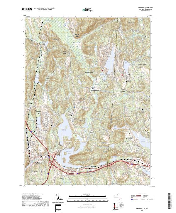
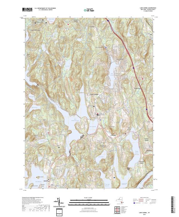
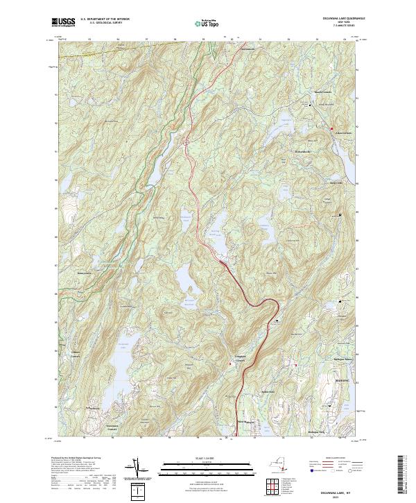
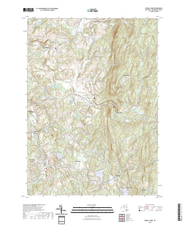
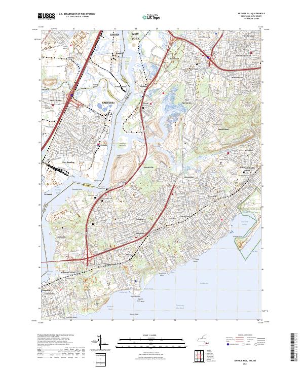
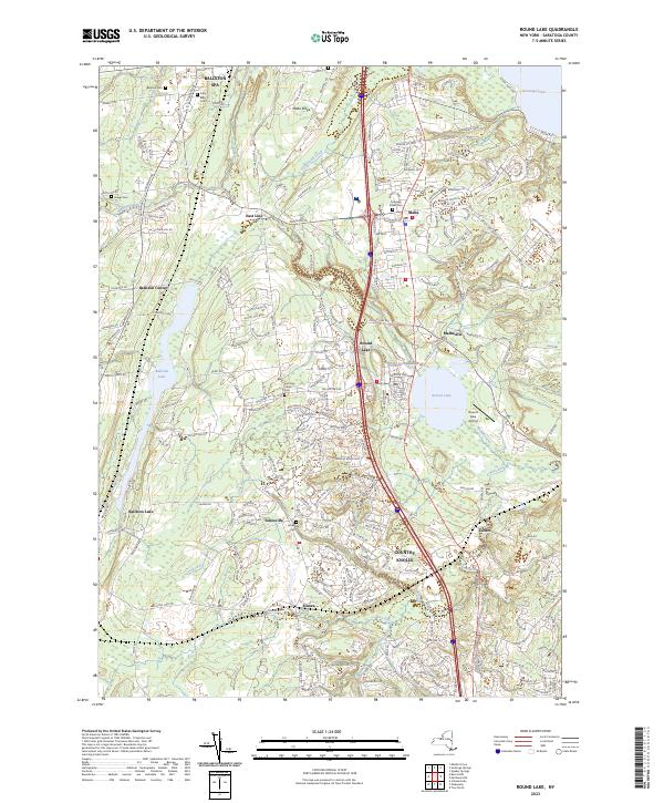
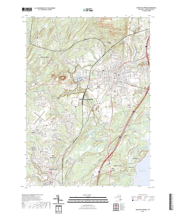
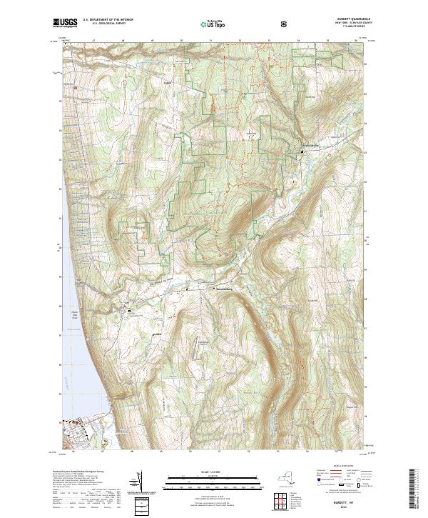
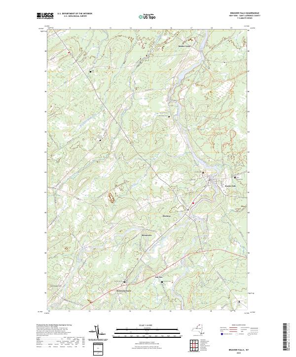
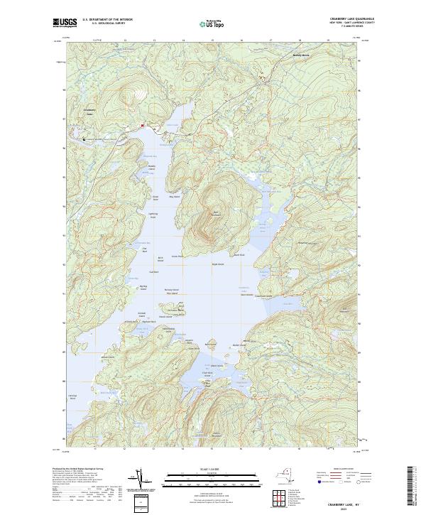
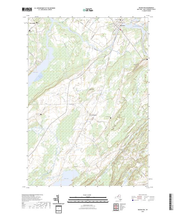
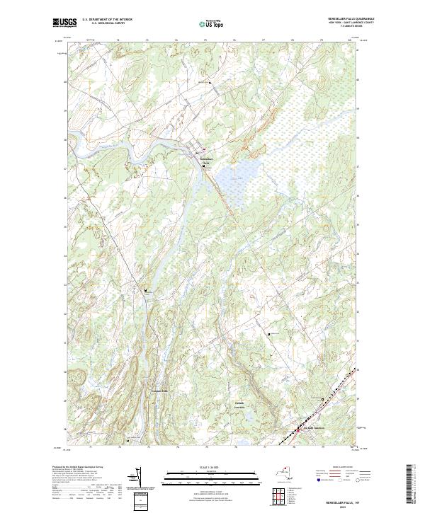
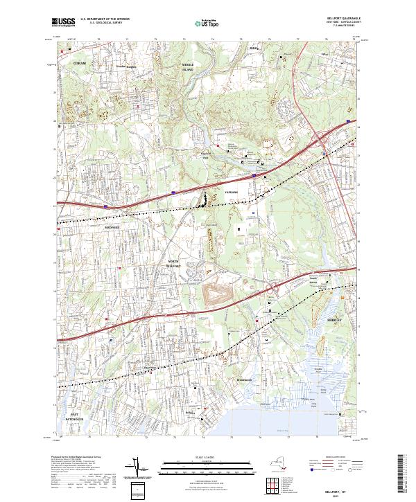
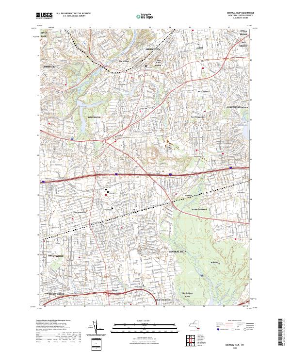
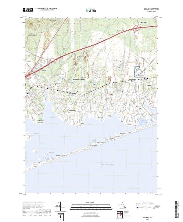
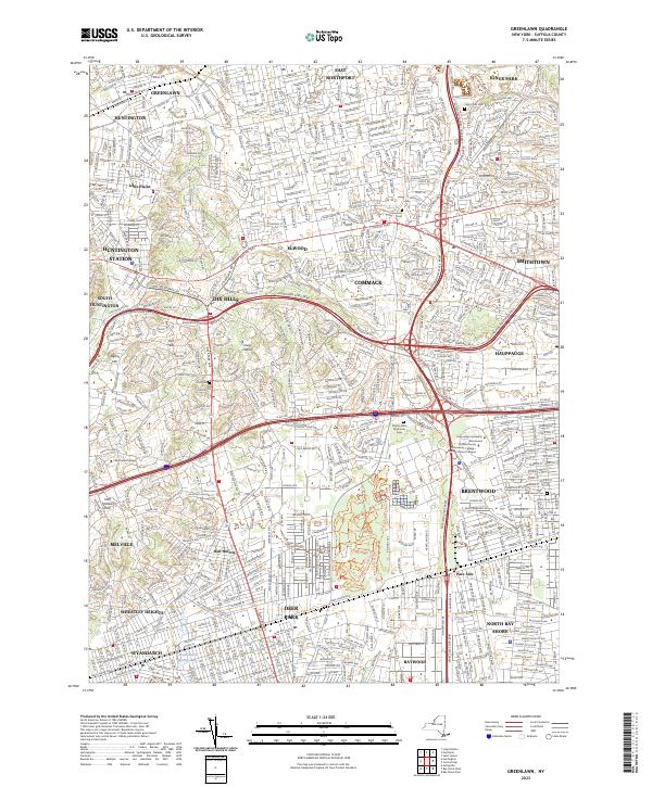
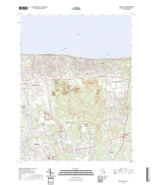
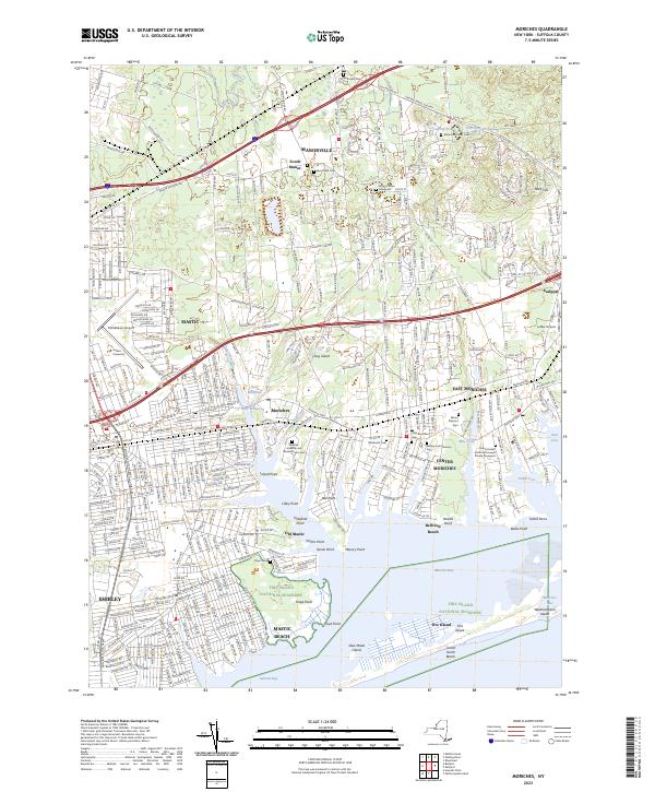
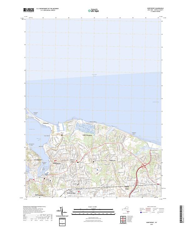
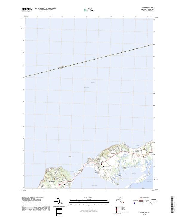
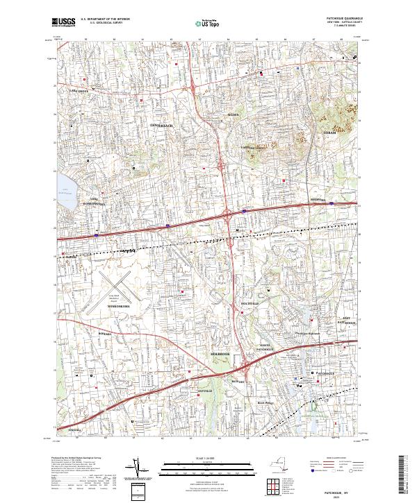
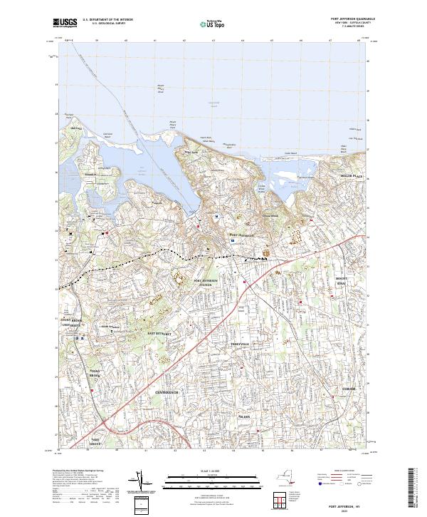
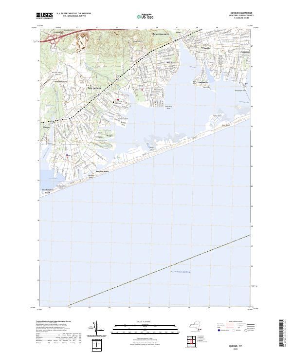
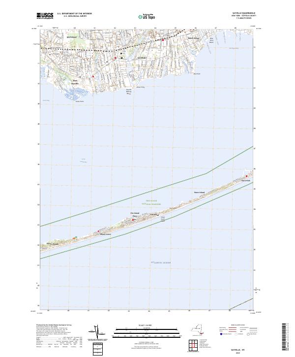
Here is an updated list of state land websites for March 2023. The topographic map links will bring you to the latest USGS Topographic Maps for the area, or you can use the listing to bulk download the maps or get the quads you need from USGS Store or your local map seller.

About a month ago, I took a trip I gave the name “Gorging on Gorges”. As the name would suggest, most of the trip involved visiting various gorges, taking photographs of them, and otherwise exploring them. About half of them I had previously been to, while the rest were new. I also visited several other state parks, state forests, and national forests – and did something I haven’t done in a long time – camped one night in a developed campground.
I started out my trip from Albany, taking US Route 20 West from I-88. I really wanted to avoid expressways for the bulk of my trip, is my general view is that expressways are the best way to get across America without really seeing anything. It’s more then a philosophical argument for me – what’s the purpose of a vacation if your rushing from point “A” to point “B”.
The first part of the trip, I drove to Chittenango Falls State Park via Nelson and beautiful farm country so high above. I walked down into the gorge, and up and around the falls. The color was somewhat muted, but it still was quite pretty. Then I headed off, taking some side roads as recommended by my GPS’s most direct route, and ended up passing a few miles from Labrador Hollow and the beautiful Labrador Pond, and said, heck, I got to stop on by there.
I drove down to Labrador Pond parking area, and hiked down to the pond. The colors were still not fully-turned on Jones Hill, but on Labrador Mountain were well past peak. Despite the crowds of fall foliage peepers from Syracuse, crowding the area, there were adequate opportunities for solitude. I walked down to the lake, snapped a few photos, then hiked the nature trail/boardwalk. It was nice. It also was great to see the boardwalk being used by a disabled man – he could get out and enjoy nature, despite his difficulties he had walking. One of the large dairies in the area was spreading something on fields nearby, and it sure stunk – it seemed nastier then fermented grain, although that’s probably what it was. Didn’t stick around too long, as I had places to go.
Drove down through Prebles, another deep, rich agricultural valley, dotted by large dairies that take advantage of the area’s rich soils for producing many bushels of corn on each acre. Got held up for about 5 minutes during a paving job, where they had the road restricted to one lane, for what had to been a half mile or so. Noticed how most of remaining trash burning barrels had disappeared from the landscape, that might have only been there 3 or 4 years ago.
Then it was off to Homer, where I passed a moose, made out of welded scrap metal along the road. It was kind of a neat roadside attraction, and I really should have stopped and got a picture, but I had a tight schedule and was burning daylight. I would come to later regret not getting that picture, but heck, I figure I can probably find a picture of it on the Internet using Google Images or Flickr. If not, it will certainly be there, the next time I find myself going through this roadside wilderness.
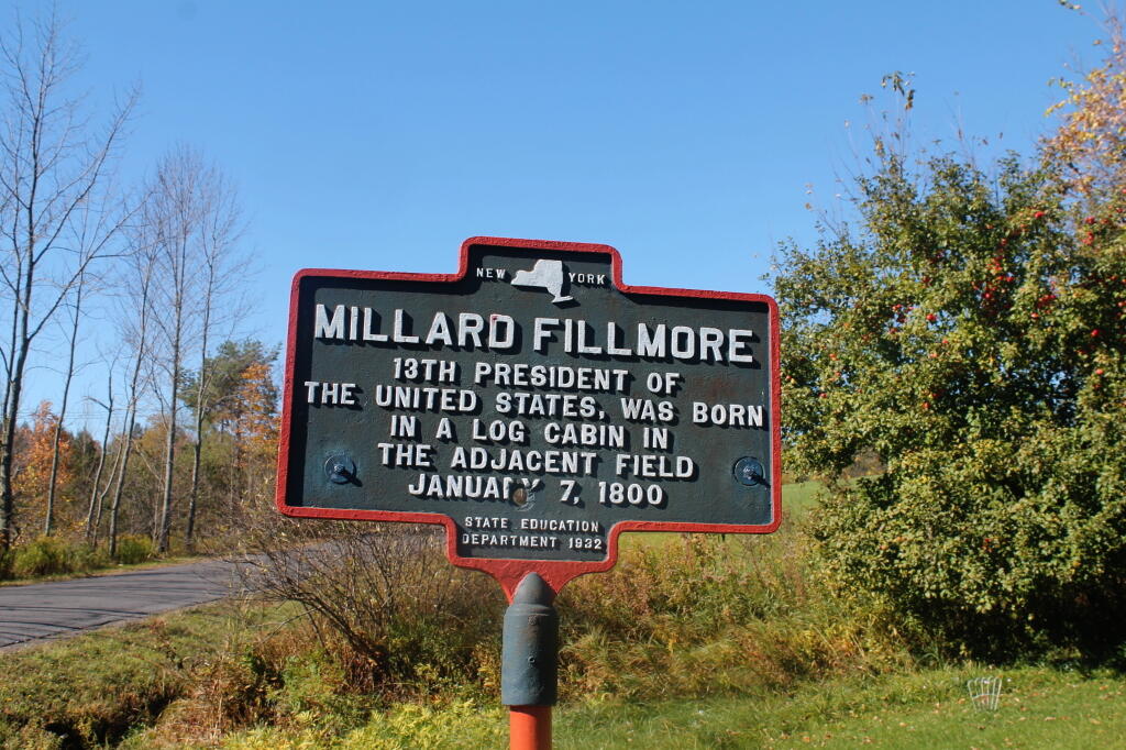
I got lost on my way to Moravia. Not really lost, because I was following the GPS, but because I had programmed the “most direct route” rather then “fastest route”, the GPS.decided to take me up a rough dirt road through Hewitt State Forest. I declined, and eventually the GPS found a new route, that happened to take me past Milton Fillmore’s birthplace. There is now a picnic pavilion and a some landscaping in that location. I turned around, snapped a few pictures, and explored it briefly. I wanted to a get a picture for dad for his historical markers collection.
Then it was off to Fillmore Glen. I was running a bit late at this point, but it’s a pleasant drive down to Filmore. The landscape is pretty rural until you drop, rather quickly into Moravia. Moravia is a pretty, small rural town; the glen is located at far southernly end of the town. There was a bridge being replaced in town, and you had to wait, for what seemed like an eternity for the light to green on the on-one lane bridge.
Finally, I got to the park entrance. The older guy there, grumbled when I said I had an Empire Pass. He was like “where is it – I can’t see it”. The rear window on my truck where the Empire Pass is tinted, but not that dark. I was slightly annoyed that the park entrance guy wasn’t friendly, and I forgot to ask for a map. I was kind of rushing. Got parked, and there was a big wedding going on, complete with horse drawn carriage. Crossed the “Dry Creek” and started up the trail, first to the Cow Shed falls, then decided to take the Northern Rim Trail. It wasn’t apparent at first that it was the rim trail, but I didn’t have a map. I actually printed up a map, and had it my truck, but I of course forgot it.
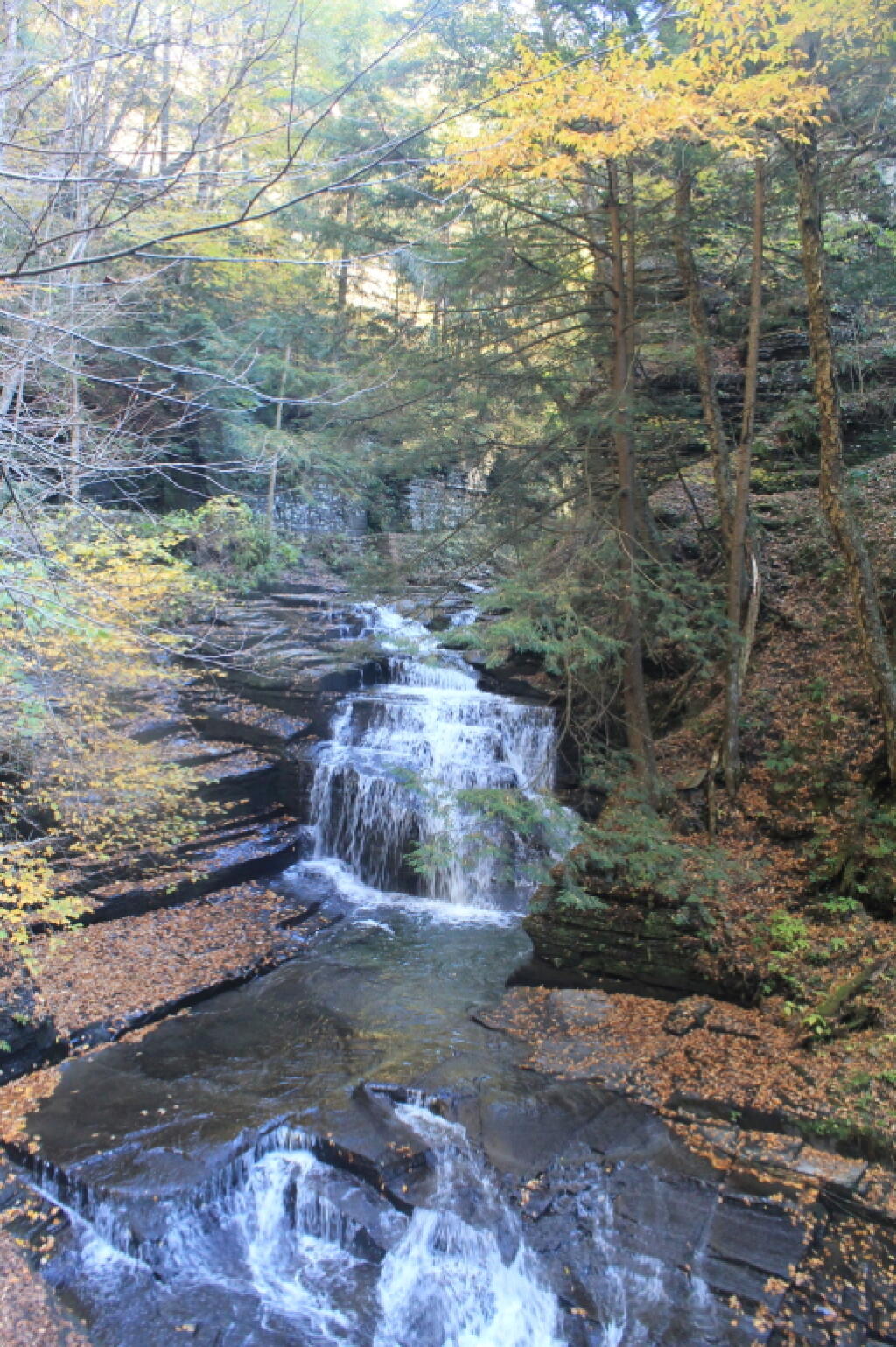
The Northern Rim climbs a fair bit, then runs along the rim, with very limited and occasional views. It crosses a pretty little creek that tumbles down the gorge, and eventually leads to a path down to the gorge trail, three-quarters the way up the gorge. I decided to hike down to the gorge trail, and then head back down the gorge towards the parking area. I missed a bit of the gorge trail, and the overlook, but so be it, time was tight.
The Gorge trail was scenic, but certainly not the most scenic of gorges. There were several small waterfalls, and some stairs and bridges, although most of the trail was gravel along the edge. The “Dry Creek” had plenty of water, but in general, the gorges was smaller then other Finger Lake gorges. There were several glens of interest, but the most beautiful portion of the glen was the Cow Sheds in the button of the gorge. Cow Sheds falls, are the wider portion of the gorge, where at one time, historically, cows would gather for shelter in severe or cold weather.
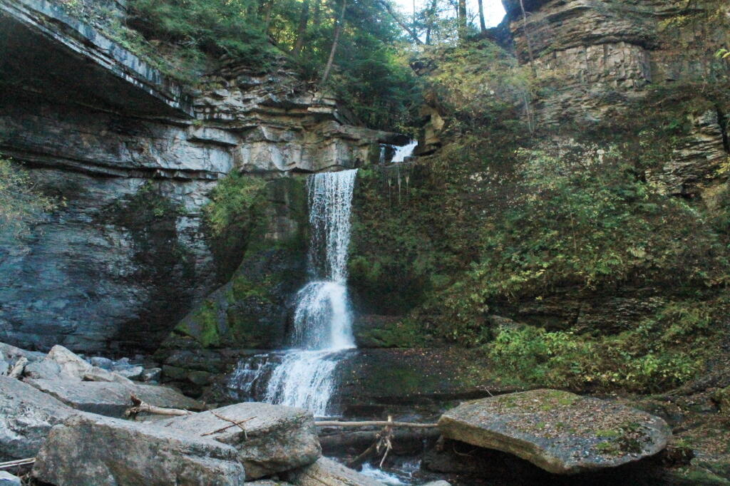
Snapped a few more pictures of Fillmore Glen, and it was off to Ithaca. I made pretty good time to Ithaca, although I admit I certainly wasn’t poking along. I really should have stopped more places, but I wanted to get to the Finger Lakes National Forest relatively early so I could set up camp and/or make alternative plans should my desired campsite on Chicken Coop Road be unavailable. Passed a giant bull statue on a farm, along NY 38, a few miles south of Moravia. I really should have stopped for a picture, but I was burning daylight, and the Finger Lakes National Forest, was over an hour away. I think this is the one, that the farmer paid like $10,000 to haul from an abandoned Steakhouse in Binghamton to the farm. I am sure the bull will be there for a long time – in case anybody forgot what is raised on farms.
Then it was down to Freeville.. The only thing real remarkable about that town, was the pine barrens and swamps, consisting of heading into it. When you think of the Finger Lakes, you tend to think open landscapes and farms, at least until you get mostly south of them of them, or in the highest points to the west. But not here. The Finger Lakes Trust owns some land, on the north side, where it the land is mostly the backwaters of the Oswaco Inlet.
Finally made it to Ithaca by 4:45 PM. I was lucky at this hour that traffic wasn’t too much of a slog by Ithaca standards, then I was off heading up Trumansberg Road. It seemed like an endless drive. Finally made it to Perry City, and then to the Finger Lakes National Forest. There was no sign of the government closure when I got there, but a bit disappointed, my favorite campsite on Chicken Coop Road was already taken. It was off to campsite on Potamac Road, just past the hunting camp.
I wasn’t thrilled by campsite, a big field campsite, but it had some trees along one edge for hanging the flag and lights. It was pretty good site for observing the stars, although there was a hunting camp down the road a little ways, so I had to keep the music down. I really don’t want to piss off the hunters. I gathered up some firewood from the woods, and got a fire started. The sun was fading fast, but so be it. I wired up my lights, some Christmas lights, and got the spot light on the flag.
It got dark, and I tuned into the Ithaca Progressive Radio Station, and gazed on the stars for a couple of hours. Nibbled on some snacks, cracked open a beer or two. Tossed some more wood on fire, and was happy to finally be on vacation.
![Untitled [Expires August 10 2024]](https://andyarthur.org//data/photo_016389_large.jpg)

Notifications