Search Results for: map developed areas in new york state

The Cost of New York Being on the Cutting Edge

Lately there have been a lot of discussion on why New York State is such a high tax state compared to others, and why our state gets relatively little back in funding compared to other states.

The common refrains are that New York is a liberal state, so we invest a lot more in human services, healthcare, welfare and education. That is true to a certain extent. But it’s also not totally true either. Red states actually have a lot better public services then many blue staters want to believe. Another common refrain is that New York is a wealthy state, so we aren’t eligible for nearly the same amount of transfer payments are poorer states. That is also true, although New York also has plenty of pockets of poverty — but we are also the financial capital of the world and home to our nation’s biggest city. Some say corruption is worse in New York then other states. I’m a bit skeptical on that point, I think there are more watch dogs on government then other states — being a such a big state with well funded newspapers. Are Albany politicians really going to pull a fast one over on the New York Times and New York Post at the same time?

But there is another truth that is often ignored. New York often rejects a lot of federal funding. While contemporary reasons for rejecting federal funding may be ideological in nature, the original reason our state rejected federal funding was we chose to be out in front of the federal government — on canals, on highways, on parks, on forests, etc. New York chose to build a lot of it’s infrastructure without federal funding, because we built before the funding was avaliable. Being out front is good, but sometimes it’s really costly to taxpayers.

The New York State Thruway is a prime example of this. Why do people pay tolls to drive on the Thruway, while most other highways are free in New York? Because in early 1950s, the legislature decided our state needed a superhighway. Rather then wait to see if federal funding would become avaliable to build the highway, we decided to do it on our own. A cost bourne 100% by New York taxpayers. While the Adirondack Northway recieved 90% of it’s funding from the federal gas tax, the Thruway recieved 0% of it’s funding from the federal gas tax.

Now could the state have removed the toll booths and recieved federal funding for the highway for maintaince? Possiblity but not likely. The federal interstate act did not allow for grandfathering in existing routes, although some free routes did get upgrades to interstate standards under the act. Rather then eliminate the tolls and seek federal funding for the Thruway, our state has chosen to pay fror it upkeep 100% from state funding, namely tolls but also general fund revenue. If we made it eligable for federal funding, New York would also have to pick up the difference between federal funding and state funding, and it’s not always easy to find extra funding in the gas tax.

We are in the same boat with many of our state’s bridges and tunnels. Could the state have waited a few years and got funding for free crossing over the Hudson River and the New York City metropolitian crossings? Probably yes, as most of the Western States have no tolls, even on their biggest Interstate Bridges. Our state certainly could have gotten 50% of the cost of building and maintaining back on the Hudson River crossings, and 90% in some cases. But we chose to build them before federal funding was avaliable. Now we are stuck with the clunky Bridge Authorities and Triborough Authority, which pays 100% of the bridge expenses through local tolls. Even if we eliminated the tolls, it”s not clear we cold get federal funding at this point. Nor is it clear if we would want to — by refusing federal funding — our state has the “freedom” to set whatever standards it wants on the bridges, including advertising and geometery. Federal highway standards don’t apply to non-federally funded roads.

The federal government maintains locks and canals on most rivers. Our state doesn’t get to take advantage of federal maintaince to our canals. We have the Erie Canal, which is entirely paid again by state taxpayers and those who traverse the canal. We talk about Clinton’s Ditch as being a great advance for our state. It certainly was at it’s time. But we could have had the federal government build it for us had we waited a few years — and put up with the federal government’s dicates. Certainly the Army Corp or Engineers maintains a lot of the nation’s canals. But not in New York. We chose once again to go it alone on our canal system.

One could have imagined that New York City could have gotten the federal government to finance their drinking water reserviors, had that waited a little while longer, and been willing to put up with creation of a federal public authority like the Tennessee Valley Authority. Maybe New York City’s drinking water reserviors would have not only produced clean water, but also greater recreational opporunities and more hydropower had the federal government, not the city built them. But no, our state had go out in front of the federal government — a cost picked up federal government in other states.

No state in America has as big of a state operated wild forest or wilderness as New York does. That’s not saying other states don’t have great public lands that are a mixature of managed forest and wilderness, operated by the federal government. The Adirondack Park is tiny compared to some of the National Forests and Bureau of Public Lands out west. Other states also have developed parks and recreation areas, but many of them are funded and directly operated by the federal government. But not New York, bar a few small historic battle sites, and the relatively small Finger Lakes National Forest. Why not? Our state got out ahead of federal funding and furthermore rejected federal operation of our Adirondack and Catskill Parks.

New York State certainly could have been home to the Adirondack National Forest or the Adirondack National Park. But no, our state rejected that idea off-hand. Vermont decided to protect it’s wild upcountry and mountains with the Green Mountain National Forest, but not New York. Our state once again got out ahead of the federal government, and rather then create a managed forest, we were stuck in the mid-1800s line of thought that all logging was bad and we could only preserve the land by banning all timber cutting for any purposes.

By rejecting creation of a Adirondack National Forest or National Park, our state once again passed up on billions of federal funding. Rather then have the federal government pay for maintaining roads, parking areas, campsites and trails in Adirondack, New York taxpayers are 100% on the hook. The Green Mountain National Forest in contrast has federally funded forest rangers, federally funded maps and recreational facilities, federally funded campgrounds and much more. Instead, our state has chosen to take up this cost because we wanted ideological control over the land — rather let distant Washington politicians decide how to maintain the lands.

There is somewhat a myth that red states have awful public services, while blue states have a much better government. While blue states like New York are often on the cutting edge, getting out on cutting edge before the federal government means New York residents pay dearly. Forgoing federal funds by getting a decade out ahead of other states might have some short term advantages, but it often means our state residents ends up paying for a lot of other things that federal government would have otherwise paid for in coming years.

Developed Areas in New York

Developed Areas in New York

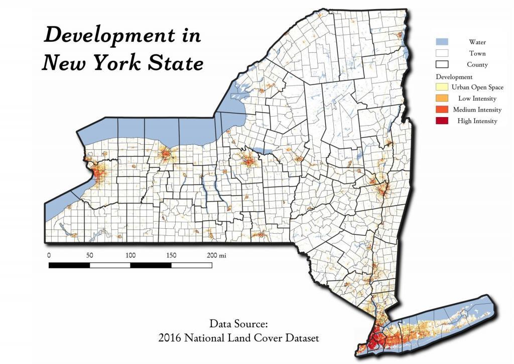
While you can pretty easily see this on satelight images, this map shows the 3.1 million acres of New York State that is developed -- which works out to be 8.9 percent of state's landmass.

The Catskill Wilderness Areas

Trees and Mountains

The text of today’s fodder is based on the Catskill Park State Lands Master Plan, as revised in 2008. Maps were rendered by myself, using Quantum GIS and DEC Lands and Forests data.

Big Indian Wilderness

(Formerly Big Indian – Beaverkill Range Wilderness Area)

This wilderness is located in the Towns of Hardenburgh, Denning and Shandaken in Ulster County. It lies generally west of Oliverea and the Frost Valley Road, south of Belleayre Ski Center, east of Seager and Hardenburgh and north of Willowemoc and Claryville. The area ranges in width from 1 to 5 miles, is about 19 miles long and contains approximately 33,500 acres of land. Elevations range from 1,500 feet in McKenley Hollow to 3,840 feet where the state boundary crosses Doubletop Mountain. The mountains in the northeastern portion of the area are quite rugged, while those to the south and west are more characteristic of high hills. Water from the area flows into three New York City water supply reservoirs and the Delaware River Basin. Nine mountains or ridges with elevations of over 3000 feet make up the area.

Peaks

Doubletop* 3,860′
Haynes 3,420′
Big Indian 3,700′
Spruce 3,380′
Fir 3,620′
Eagle 3,600′
Hemlock 3,240′
Balsam* 3,600′
Beaver Kill Range 3,377′

* Maximum elevations given are not necessarily located within the Wilderness Area.

The forest cover is predominantly hardwood mixtures in various associations. Spruce and fir, while present at some of the higher elevations, are less noticeable here than in other Catskill wilderness areas.

Interior facilities consisting of foot trails and lean-tos are generally considered adequate.

Area statistics:

Approximate Area 33,500 Acres
Roads (non conforming) 1.4 Miles
Foot Trails 29.4 Miles
Lean-tos 6
Designated Campsites 5
Parking Lots 5
Public Use (visitors/year) 4,500
Exterior Boundary Line 67 Miles
Minimum Elevation 1,500′
Maximum Elevation 3,840′

Non-conforming uses:

Motor vehicle use of Black Bear Road from the wilderness boundary to Fall Brook Lean-to.

A UMP for this area was completed in June of 1993.

Hunter – West Kill Wilderness

(Formerly West Kill – North Dome Wilderness, Ox Clove Wild Forest, and a portion of the former Hunter Mountain Wild Forest)

The unit generally lies within the following boundaries: New York State Route 42 on the west, the Shandakan Wild Forest and NYS Route 28 to the south, and NYS Route 214 on the east. The northern extent of the unit is County Route 6, and continues along a line 100′ parallel to, and south or east of, the edge of Spruceton trailhead parking area and the centerline of the Spruceton Truck Trail, to the junction of the Colonel’s Chair Trail. A corridor, 100 feet either side of the center line of the Spruceton Truck Trail, from the Colonel’s Chair Trail to the summit of Hunter Mountain, culminating in a circle 175′ in radius from the center of the chimney on the observer’s cabin shall be within the Rusk Mountain Wild Forest.

The unit contains approximately 27,000 acres of land, and inside it’s boundaries are found the named mountain peaks of Balsam, Sherrill, North Dome, West Kill, Sheridan, Hunter and Southwest Hunter. Hunter Mountain is the second highest peak in the Catskills at 4,040 feet, and portions of it’s summit, along with a fairly extensive area on the summits of West Kill, North Dome and Sherrill Mountains are within the Catskill High Peaks Bird Conservation Area, and are of special significance in that they provide habitat for high elevation spruce-fir inhabitants such as Bicknell’s Thrush and the Blackpoll Warbler, among others.

There are currently two lean-to’s on the unit, the Diamond Notch lean-to located just off the Diamond Notch Trail, and the Devil’s Acre Lean-to off of the Devil’s Path Trail. Waters from this unit drain into Schoharie and Esopus Creeks and then into the Schoharie and Ashokan Reservoirs, which are in the New York City water supply system.

Area statistics:

Approximate Area 27,000 Acres
Foot Trails 18 Miles
Lean-to’s 2
Parking Lots 5
Minimum Elevation 920′ Maximum Elevation 4,040′

Indian Head Wilderness

(Formerly Plateau Mountain – Indian Head Mountain Wilderness Area)

This wilderness is located in the Town of Hunter, Greene County and the Towns of Saugerties and Woodstock, Ulster County. It lies generally west of the east boundary of the Catskill Park, south of Platte Clove, east of Devil’s Tombstone Campground and north of Lake Hill and Shady. The area ranges from 1 ½ miles to 3 ½ miles in width, is eight miles long and contains approximately 16,800 acres.

Elevations range from 900 to 3840 feet and the four major mountains in the area are visible against the skyline from all directions. Echo Lake, the only natural lake in a Catskill wilderness, is located in the east-central portion of the area. Water from this eastern section flows into the Kingston and Saugerties water supply reservoirs, while drainage from the central and western section flows into two New York City water supply reservoirs. Six named mountain peaks over 3,000 feet in elevation dominate the area.

Peaks

Plateau 3,840′
Indian Head 3,573′
Sugarloaf 3,800′
Olderbark 3,440′
Twin 3,640′
Plattekill 3,100′

The forest cover varies from extensive oak stands on the eastern most slopes to mature spruce-fir on top of Plateau Mountain. An excellent mature stand of northern hardwood and hemlock occupies the slopes south of the Saw Kill.

Echo Lake, unique to the Catskill wilderness, is very popular for undeveloped camping. A small number of scattered primitive tent sites with fire rings have been established and public camping is limited to their capacities.

Public access is provided by several foot trails entering the area, including the old road from Meads to Overlook Mountain.

Area statistics:

Approximate Area 16,800 Acres
Roads 6.6 Miles
Foot Trails 24.1 Miles
Cross-country Ski Trails 5.6
Lean-tos 3
Designated Campsites 10
Parking Lots 1
Public Use (visitors/year) 8,000
Length of Boundary 33 Miles
Minimum Elevation 900′
Maximum Elevation 3,840′

A UMP for this area was completed in October of 1992.

Slide Mountain Wilderness

(Formerly Slide Mountain – Panther Mountain Wilderness Area)

This wilderness is located in the towns of Shandaken, Denning and Olive in Ulster County. It lies generally south of NYS Route 28, west of West Shokan, north of the Peekamoose Road (County Route 42) and east of the Frost Valley Road (County Route 47). It surrounds the Woodland Valley Campground and abuts the Sundown Wild Forest to its south. This area ranges from 1 to 10 miles in width, is about 13 miles long, and contains approximately 47,500 acres of land. The wilderness boundary is 118 miles long.

The terrain is rugged and steep with elevations ranging from 1,100 to 4,180 feet. All water draining from the area eventually reaches three New York City water supply reservoirs by way of the East and West Branches of the Neversink River, Rondout Creek and Esopus Creek. Twelve named mountain peaks with elevations over 3000 feet exist in the area. Of these, six may still be considered trail-less to the extent that they have no marked and maintained trails.

Peaks with Trails

Slide 4,180′
Peekamoose 3,843′
Cornell 3,860′
Wittenberg 3,780′
Table 3,847′
Panther 3,720′

Trail-less Peaks

Lone 3,721′
Rocky 3,508′
Friday 3,694′
Van Wyck 3,206′
Wildcat 3,340′
Balsam Cap 3,623′

The forest cover consists of nearly every possible mixture and association of hardwood and softwood trees native to the mountain region. While hardwoods predominate higher elevations are often covered with red spruce and balsam fir.

This area receives more public use than any other Catskill wilderness. Superb vistas are found on Slide, Wittenberg, Cornell, Giant Ledge and Panther Mountains. Access via foot trails is available from the north, south, east and west.

Area statistics:

Approximate Area 47,500 Acres
Foot Trails 35.3 Miles
Lean-tos 3
Parking Lots 10
Designated Campsites 29
Public Use (visitors/year) 23,000
Length of Boundary 118 Miles
Minimum Elevation 1,100′
Maximum Elevation 4,180′

A UMP for this area was completed in March of 1987 and revised in October of 1998.

Windham – Blackhead Range Wilderness

(Formerly Blackhead Range, and North Mountain Wild Forests, and portions of Windham High Peak, and Black Dome Valley Wild Forests)

The combination of these Wild Forest areas creates the Windham – Blackhead Range Wilderness Area, which lies within the Greene County towns of Cairo, Hunter, Jewett, Windham and Durham. The classification of these former Wild Forest areas was changed to Wilderness because their combined area comprises approximately 17,100 acres and contains rugged, high elevation land that clearly exhibits wilderness character. This newly classified area has seven named mountain peaks over 3,000 feet in elevation.

They are:

Peaks Black Dome 3,980′
Windham High Pk 3,520′
Blackhead 3,940′
Stoppel Point 3,420′
Thomas Cole 3,940′
Burnt Knob 3,180′
Acra Point 3,100′

The unit also contains six unnamed peaks over 3,000 feet, which range from 3,040 feet to 3,540 feet in elevation. Of the five highest peaks in the Catskills, three – Black Dome, Thomas Cole and Blackhead – are in this unit. This concentration of 13 peaks over 3,000 feet, within an area of approximately 28 square miles, with limited access, structures and improvements (30 miles of maintained foot trails and two lean-to’s) make the Windham – Blackhead Range Unit an area with excellent wilderness character.

A fairly extensive area of old growth forest can be found on this unit at the higher elevations, along the ridge stretching from an area west of Thomas Cole Mountain to Blackhead Mountain, and on Windham High Peak. The presence of this old growth forest, with its distinctive flora and fauna, add to the wilderness character of the unit. The unit also includes the headwaters of the Batavia Kill and, to the south over the Blackhead Range, the headwaters of the East Kill. Both of these rivers flow into Schoharie Creek, and are an integral part of the New York City Watershed system.

The western boundary of this unit shall be the east side of the Elm Ridge Trail, Black Dome Trail leaving it within the Elm Ridge Wild Forest, continuing north along the drainage to the Catskill Park boundary. The southern boundary of the unit shall be the Escarpment Trail approximately one half mile south of Stoppel Point to a point on the Escarpment Trail where it comes closest to the eastern Forest Preserve boundary. Both North Point and Stoppel Point will be within the Wilderness area. Lands to the south of the south edge of the Escarpment Trail in this area, will be in the Kaaterskill Wild Forest.

Because the Windham – Blackhead Range Wilderness surrounds the smaller Colgate Lake Wild Forest Unit, and because they are linked together by public use, the Unit Management Plans for the two units shall be contained in one document.

Area statistics:

Approximate Area 18,0000 Acres
Foot Trails 30 Miles
Lean-tos 2
Parking Lots 1
Minimum Elevation 980′
Maximum Elevation 3,980′

Allegheny National Forest Dispersed Campsites

Allegheny National Forest Dispersed Campsites (shown on this map with a round Yellow Camp logo) are free-to-use with a 14-day stay limit in any 30 day period. Many of these campsites are informal areas used for camping, others like along Forest Road 160 and 259 near Jakes Rock;s and along Lolita Grade have enhanced gravel pads/parking areas. Unlike New York State, they do not have formal markings at the sites.

In the Allegheny National Forest there are a variety of back country roads, offering primitive roadside camping.

  • Campsites are free to use, and have no facilities except for a fire ring and a pull-off from the road, and sometimes a site reinforced with gravel.
  • As noted below, some campsites have additional facilities.
  • Don't make a mess of campsites, pack out any garbage left over.
  • Burn only dead and down trees, don't bring in wood from out of state.
  • You can camp up to 14 days per 30 day period in Allegheny National Forest -- no permits are required.

Updated 5/11/2020 - Additional sites along Loleta Grade shown on this map, this new map separated out from NYS campsite map and includes additional information about developed recreation areas, roads and trails.

Please see also information on dispersed, roadside and back-country camping in New York State, Pennsylvania (including DCNR's free-Motor Vehicle Camping program) and West Virginia.

Camping Areas in Southern Adirondacks

Camping Areas in Southern Adirondacks โ›บ

East Branch of Sacanadaga River, NY 8 – Roughly 10 campsites along NY 8. These are easily accessed throughout the year, as the road is plowed except when the snow banks are high during the winter. East Branch is not good for fishing due to wide variance in water levels, however there are some nice pools in sections of river for summer swimming. Lots of road noise. Some of the sites have cell service. Nearby locations include Cod Pond, East Branch Trail and Kibby Pond Trail.

Edick Road – There are a handful of very hidden campsites off of Edick Road. This road may be closed to vehicles due to wash outs autumn 2019, but worth a walk to explore this area.

Fawn Lake – A 1/2 mile hike back to a scenic lake ringed by primitive campsites outside of Lake Pleasant. Two miles beyond it is the scenic Willis Vly, which doesn’t have developed campsites but it’s remote wilderness where you might see a Moose or other wildlife.

Garnet LakeTent sites, some with drive-up access along the lake. No cell service, much of the upper road here is not maintained in the winter. Popular in the summer, no cell service.

Good Luck Lake – Scenic lake off of the West Branch Sacanadaga River that is ringed with tent sites that can be walked in from the Good Luck Lake parking area area or paddled in.

Hope Falls Road – Two or three campsites along the end of Hope Falls Road, some are drive-in only tent sites. Near the Tenant Creek Falls Trail. No cell service. Open June to autumn snowfall.

Harrisburg Road – There is a set of very rustic designated campsites along the rough Harrisburg Road past Harrisburg Lake. Somewhat near Crane Mountain, a couple mile hike to and Wilcox Lake. No cell service.

Lester Flow and Cheney Pond – Scenic lake that is popular for paddling. The 1/2 mile road down from Boreas Road as of June 2020 is closed due to washouts. Tent sites exist along the lake, along with one drive-to site on the road down there.

Mason Lake – Small lake located about 10 miles north of Speculator and 5 miles south of Lewey Lake that has several tent and drive-in campsites along it’s shore. Good to fair cell service here. Nice to hear loons, one of the best bass ponds in the area.

North Lake Reservoir – There are roughly 15 campsites on the east shore of North Lake Reservoir. Popular place in the summer, regularly staffed by conservation students. Noise from motorboats. No cell service. Nice if you want to camp right on water, hear loons at night..

Northwood Club Road – In Minerva, this road crosses the Boreas River and has several roadside campsites, and passes by Huntley Pond, the NL Tahawus Railroad (which can be hiked to the Boreas River at Hudson River), and the Blue Ledges on the Hudson tailhead.

Perkins Clearing – Conservation easement lands. Good to fair cell service here. Great place for hunting and wildlife observation as it’s mixed timber country. Near Mason Lake, Speculator, Pillsbury Mountain and Cedar Lakes.

Piseco-Powley Road – A dozen campsites along a 13 mile road with short hikes including Big Alderbed, House Pond, Sand Lake and the popular Potholers/Brayhouse Brook waterfall for swimming. As of June 2020, road is closed in Stratford/Fulton County portion, road is open north of Potholers/Brayhouse Brook (access via Piseco). Very limited cell service here.

Pumpkin Hollow Road – Three campsites above Willis Lake. Remote country except for the site on Willis Lake, no cell service. On the Willis – Wilcox Lake Trail. Very quiet area. Open June to autumn snowfall. No cell service here.

Rockwood State Forest – Three campsites along the end of Church Road which can be accessed by driving past the cemetery in the hamlet. Scenic lake, good fishing. Cell service available, but bring a trash bucket and gloves as litter can be a problem. Nice trails to stroll around in the old Rockwood Estate.

Stewart Landing – There are four campsites on a rough road that loops off of Stewart Landing Road. Popular area in the summer, Canada Lake is great for paddling and informal swimming. Also consider hiking back to Hilderbrandt Vly and Glassgow Lake from here. Moderate to poor cell service here.

Vanderwhacker Road -Five or six campsites exist along Vanderwhacker Road, which can be muddy in the spring and icy in late autumn. Additional designates campsites exist near where NY 28N crosses the Vanderwhacker River. Near the trail to the Vanderwhacker Firetower, No cell service.

White House, Wells – A grouping of 5 or 6 campsites at the end of White House in West River Road. Scenic area, old camp, with fields and a chimney. Campsites are kind of close together, not a wilderness experience. Near the North Country Placid Trail, lots of blueberries in mid-summer. No cell service. Open June to autumn snowfall.

Woodhull Lake Reservoir – Off of NY 28 in McKeevers, about 10 miles south of Old Forge. Not only is this beautiful reservoir to paddle, there are some campsites along the shore, with drive-to campsites along Wolf Lake Landing Road which leads to it. Part of Wolf Lake Landing Road is erroded, but other parts are fresh stone-dust. It’s remote wilderness but there good cell service in mcuh of the area.

WINONA STATE FOREST UMP

Senior Forester Ed Sykes
NYS Department of Environmental Conservation, Region 6
7327 State Route 812
Lowville, NY 13367

July 15, 2013

Dear Mr. Sykes:

ย RE: WINONA STATE FOREST UMP

The Draft Winona State Forest UMP appears to be incorrect as it relates to the Facilities Inventory, subsection โ€œDesignated Campsitesโ€ on page 24:

There are three designated campsites on Winona, and their locations are as follows:

ย โ€ข Co. Rte. 90, 0.1 mile east of the intersection of Brown and Co Rt. 90;

โ€ข On Bargy Rd., 0.3 mile south of CCC Camp;

โ€ข On Tucker Rd., 0.4 mile east of the intersection of Bargy and Tucker Road

Based on my casual inspection of these locations, I was unable to locate these campsites. It is possible that these sites have not been mowed, reverted to woods, and/or do not have the required โ€œCamp Hereโ€ disks pursuant to NYCRR 6 Part 190.

There is however, one relatively well-used campsite near GPS location N 43.69528 W 75.97681. This site is located roughly 300 feet south of the intersection of Bargy Road and Dog Leg Trail. It is indicated by a โ€œCamp Hereโ€ disk, and is consists of a stone fire ring, and a hardened-with-gravel camping pad.

Many traveling New Yorkers enjoy having drive-to, โ€œroad-side campsitesโ€, that provide minimal facilitiesย  but allow one to camp there with a pickup truck with a camper top, or a small-tow along camper, such a pop-up or tear-drop camper. Likewise, people with families appreciate being able to pull into a campsite, set up a tent, without having to carry it back to the woods. In the western Tug Hill Plateau, this is the only location that offers this essentially primitive-style camping.

The DEC should designate five (5) roadside campsites along the various roads in Winona State Forest.

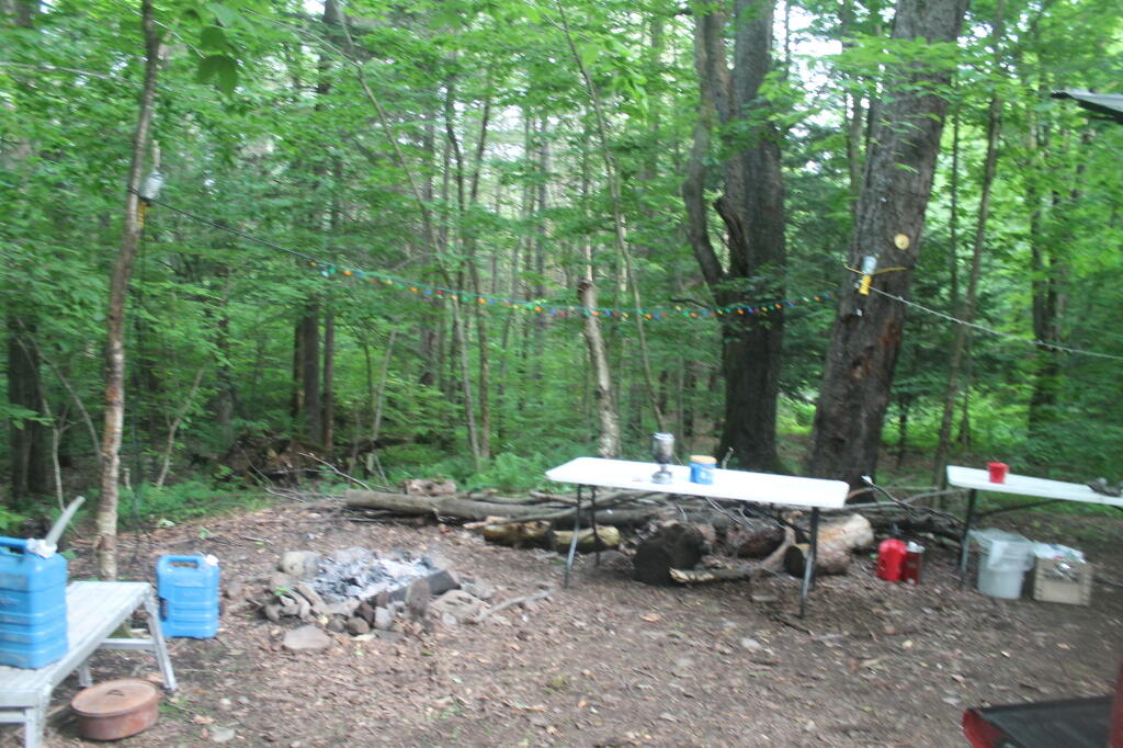
The Next Morning

ย These campsites should follow the design of roadside campsites in the Adirondack Park, e.g.

all campsites should be at least a quarter mile apart (at least out of eye-shot/ear-shot each other),

  • be properly designated with โ€œCamp Hereโ€ disks,
  • set back at least 150 ft from water, trails, and other facilities; and
  • consist of a gravel-hardened pull off with shading from the road, and a small stone-fire ring.
  • No other facilities should be a provided, except for outhouses, as decided based on usage.

Standard policies under NYCRR 6 Part 190, such as requiring a camping permit for stays longer then 3 nights, should apply.

DEC operations staff should be instructed to occasionally maintain the campsites, such as mowing and litter removal, similar to what is currently done along roadsides and in parking/assembly areas. DEC Forest Rangers and law enforcement should also occasionally patrol the area, especially on Friday evenings in May and June, to discourage littering and abuse by young adults during the end of school year.

Finally, the DEC Forester should GPS the location of such campsites. and provide such data to the centralized DEC Maintenance Management System (MMS) in Albany, and provide campsite locations on maps and informational kiosks.

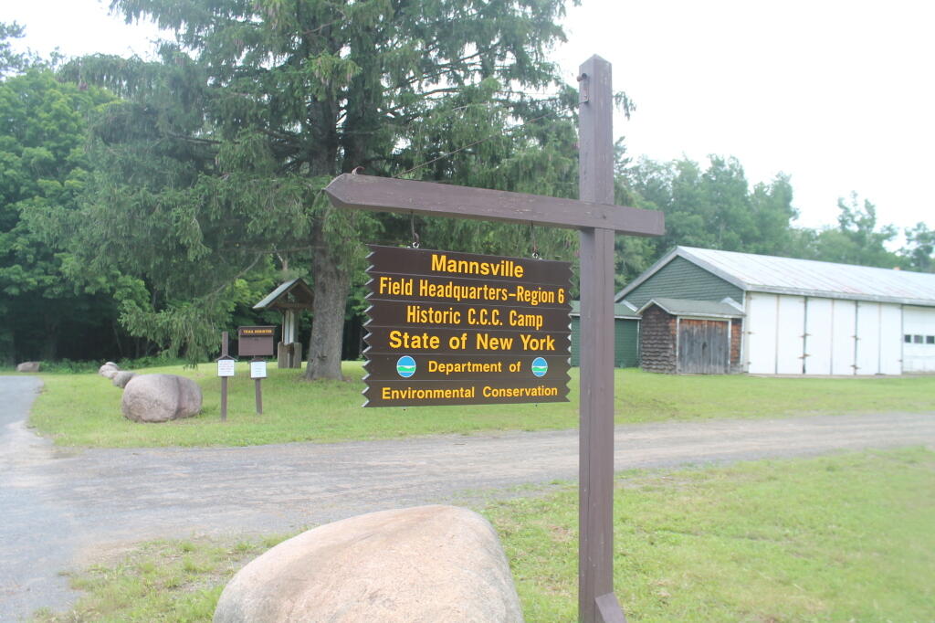
Winona Forest CCC Camp

Many people choose roadside camping over state and private campgrounds, or primitive camping the backcountry on undesigned and undeveloped sites. Many like the privacy of roadside camping, the social nature of it, the ability to listen to music without disturbing others in the close-proximity conditions that exist in state campgrounds. By expanding roadside camping opportunities on this state land, it will expand the use of these lands in summer months.

Winona State Forest offers a lot to the visitor, including miles of hiking, mountain biking, and horse trails. The miles of roads provide scenic driving, and access to the interior forest for hunting and nature observation. The forest is a short drive to Salmon River Reservoir and Lakeview Marsh WMA which offer fishing, boating, and other opportunities. Expanding camping opportunities will enhance the publicโ€™s use of this area.

Thank you for reviewing these comments. I look forward to reviewing the revised draft Winona UMP.

Sincerely,

Andy Arthur

Our Urban State

A while back I showed off the population of New York State in 2010, based on every town’s population. We looked at population density of various towns, and how it’s very dense in a few towns, and very spread out in most of state. Today, let’s look at a map of the developed areas of NY State.

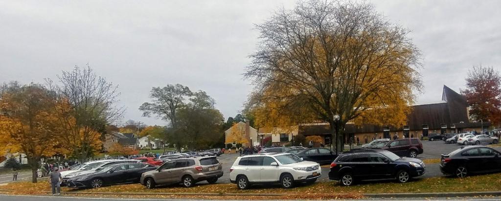
Craziness at the Early Vote place

Roughly 10% of the state is urbanized… the rest of state is rural.

So what goes on in the rest of state? About 24% of the state is farmed โ€” lots of cows, corn, alfalfa and hay, but an even bigger portion is essentially wildlands, covered with water or forest lands.

Distance to State Parks

It’s not to say people don’t live in other areas โ€” they do. But small rural houses and farm steads are just footnotes, in a largely wild, forested or farmed landscape that makes up most of New York.