Search Results for: photo upper end

August 10, 2020 Morning

Good morning! Monday’s come back around again. Hardly a bummer during summer vacation. I’m hiking the Finger Lakes Trail this morning 🚶🏽, getting nice and hot and sweaty before going to the swimming pool 🏊🏻‍♂️ later. Two weeks to until the Average High Falls To 79 ️Degrees ⛱️️️. But you won’t think that today. Partly sunny and 87 degrees at the Watkins Glen State Park. There is a southwest breeze at 5 mph. 🍃. The dew point is 69 degrees. The muggy weather ends Wednesday around 7 pm. 😓

Yeah, it doesn’t get much hotter in the Finger Lakes. 💥 It’s a hot one for sure. But I’m enjoying my hike up past the Upper Reservoirs and Group Camp on Glen Falls and I might even hike as far west as Sugar Hill State Forest. One consideration with the heat though is I better not get to th pool too late lest thunderstorms ⛈ come rolling through and they close.

Absolutely stunningly beautiful day ☀ but it’s already hot.🌡️Already quite hazy and the air conditioning in Big Red is pissing moisture like a cow pisses. 🐄💦But it’s cool up here at the park 🏞 and camping up on backbone. 🗻 Fixed my dash cam so hopefully I won’t be getting a ton of pictures of the sky today. 🌞

Well I got a bit of a late start due to sleeping 😴 in as I as I ended up staying up late last night, laying back in the hammock after my walk to Foster Pond🌌. Still can’t believe how many people were camping 🏕 up that way. Honestly, I don’t mind not having cell service at camp 📶 and having

Regardless, I made it to Watkins Glen by a little after 10am and was able to get parking by the pool 🅿 even during the pandemic.👾 I was worried they’d be limiting parking and it would be closed if I got there after 10. Pools open at eleven in the Finger Lakes. I have my bandana on and are flipping it up as necessary as a mask. 😷 I’m staying out of the gorge as I think that would more difficult to maintain social distancing there. 👨‍👩‍👧‍👦➡️👱🏼‍♂️Bought some crackers and cheese 🧀 to snack on for lunch.

I really wanted to get goggles as my old ones broke and needed to be replaced so my eyes 👀 don’t get irritated by the chlorine.👁️‍🗨️ But after trying two stores they’re gone for the year. It might be 90 degrees out but all they’re selling is Halloween Candy 🍬 and Thanksgiving Turkey. 🦃

Today will have scattered showers and thunderstorms, mainly after 5pm. Mostly sunny 🌞, with a high of 90 degrees at 3pm. Nine degrees above normal. Maximum dew point of 69 at 10am. That’s a cooker for the Finger Lakes. 🌡️People must be roasting back in Albany. Southwest wind 5 to 7 mph. Chance of precipitation is 30%. New rainfall amounts of less than a tenth of an inch, except higher amounts possible in thunderstorms. A year ago, we had partly cloudy skies in the morning with some clearing in the afternoon. The high last year was 76 degrees. The record high of 96 was set in 1949.

This afternoon I plan to spend most of my time at the pool 🏊🏻‍♂️ and then get ice cream 🍦at Glen Dairy Bar and groceries at Tops. Then I’ll sit at Clute Park and fish 🐠 and watch as the sun starts to drop. 🌇

Solar noon 🌞 is at 1:14 pm with sun having an altitude of 63° from the due south horizon (-7.9° vs. 6/21). A six foot person will cast a 3.1 foot shadow today compared to 2.2 feet on the first day of summer. The golden hour 🏅 starts at 7:38 pm with the sun in the west-northwest (285°). 📸 The sunset is in the west-northwest (292°) with the sun dropping below the horizon at 8:17 pm after setting for 3 minutes and 7 seconds with dusk around 8:45 pm, which is one minute and 21 seconds earlier than yesterday. 🌇 The best time to look at the stars is after 9:25 pm. Not sure if I’ll hike back to Foster Pond this evening 🌃 but I will probably spend some time at Clute Park fishing 🎣 before heading back to camp. At sunset, look for thunderstorms 🌩 and temperatures around 81 degrees. The dew point will be 68 degrees. There will be a south breeze at 5 mph. Today will have 14 hours and 5 minutes of daytime, a decrease of 2 minutes and 25 seconds over yesterday.

Tonight will have isolated showers and thunderstorms before 9pm. Mostly clear 🌃, with a low of 69 degrees at 6am. Eight degrees above normal. Maximum dew point of 68 at 6pm. South wind around 6 mph. Chance of precipitation is 20%. In 2019, we had mostly clear skies in the evening, which became partly cloudy by the early hours of the morning. It got down to 54 degrees. The record low of 46 occurred back in 1941.

Saturday may not be the greatest day ever. 😞 Saturday, a chance of showers and thunderstorms. Mostly cloudy, with a high near 83. Chance of precipitation is 40%. Maximum dew point of 67 at 8am. Sunday, a chance of showers and thunderstorms. Partly sunny, with a high near 84. Chance of precipitation is 50%. Maximum dew point of 65 at 7am. Typical average high for the weekend is 81 degrees.

As previously noted, there are 2 weeks until Average High Falls To 79 ️Degrees ⛱️️️ when the sun will be setting at 7:54 pm with dusk at 8:23 pm. On that day in 2019, we had partly sunny and temperatures between 75 and 53 degrees. Typically, the high temperature is 79 degrees. We hit a record high of 95 back in 1947.

August 9, 2020 Night

Good evening! Partly clear and 72 degrees at Foster Pond. There is a west breeze at 7 mph. 🍃. The dew point is 64 degrees. Nice starry night 🌃 at least at times. Crickets are cricketing, cows are mooing with occasional hoots of an owl and the blood curling sound of a coyote. 🦉

Didn’t get kayaking 🛶 today but that’s fine, I ended up doing a lot of reading 📖 and hiking, taking in the vast landscapes of the grass lands known as the Finger Lakes National Forest. 🖼 Sometimes I like days when I don’t have to drive or take things down or secured for heading out of camp. Read a bunch of Gebe Brown’s book 📙 on Regentative Agriculture. While he is a shameless promoter of doing things his “new way” on his farm, he does have some interesting insights into the land much like Joel Saltin. Do I agree hundred 💯 percent with both of them? No but it’s interesting to hear their voice – same reason for trying to listen and be an informed person.

Hiking a bunch of Interloken Trail today was nice 🚶 and it’s been dry enough lately that the trail wasn’t too mucky. Often the shallow soils of the Hector Backbone mean lots of mud. 👢 Saw and heard lots of cows 🐮 and the ponds are small but nice. One of these days I’m going to have to do some fishing in some of them. 🎣

I have a bunch more pictures to upload to the blog ⤴️ but they’ll have to wait until tomorrow 📸 when I have a more reliable internet connection down in the village. My uploader works poorly on a bad connection. It’s quite pretty in the Finger Lakes and I’m really digging my new camera phone and being able to post more things close to live. 📱

This evening I hiked down to Foster Pond which is about a mile from camp 🚶 but I was a nice walk. Really didn’t need my flashlight much 🔦, I know the area pretty well and I always enjoy a good night hike. I did carry a flashlight mostly for safety on the road so any approaching cars could spot me early on. I am surprised how many people are camping 🏕 up by Foster Pond, usually it’s quiet on weeknights. I wonder if the folks frogging 🐸 got some to eat this evening. Certainly a lot of frogs on the lake but none real big. I’m actually glad I’m a bit farther away from Foster Pond than usual with it being so busy this week.

Tonight will be partly cloudy 🌃 , with a low of 67 degrees at 5am. Six degrees above normal. Maximum dew point of 64 at 10pm. West wind around 7 mph. In 2019, we had light rain in the evening, which became partly cloudy by the early hours of the morning. It got down to 57 degrees. The record low of 48 occurred back in 1955.

Tonight will have a Last Quarter 🌗 Moon with 64% illuminated. The moon will rise at 11:25 pm. The darkest hour is at 1:13 am, followed by dawn at 5:38 am, and sun starting to rise at 6:09 am in the east-northeast (68°) and last for 3 minutes and 7 seconds. Sunrise is one minute and 3 seconds later than yesterday. 🌄 The golden hour ends at 6:48 am with sun in the east-northeast (74°). Tonight will have 9 hours and 52 minutes of darkness, an increase of 2 minutes and 25 seconds over last night.

Tomorrow will have a slight chance of showers and thunderstorms after 1pm. Sunny 🌞, with a high of 87 degrees at 3pm. Six degrees above normal. Maximum dew point of 67 at 10am. Southwest wind around 7 mph. Chance of precipitation is 20%. A year ago, we had partly cloudy skies in the morning with some clearing in the afternoon. The high last year was 76 degrees. The record high of 96 was set in 1949.

The plan for tomorrow is get a relatively early start ☕ and do some hiking in the Upper Gorge Trail above the main park and then swim 🏊 at the Watkins Glen Park Pool. Also need to buy some food and ice – I’m very low, and then maybe fish 🎣 and take in the sunset 🌇 or at least the evening at Clute Park.

In four weeks on September 6 the sun will be setting in the west (279°) at 7:32 pm,🌄 which is 44 minutes and 21 seconds earlier then tonight. In 2019 on that day, we had partly cloudy and temperatures between 72 and 52 degrees. Typically, you have temperatures between 76 and 55 degrees. The record high of 91 degrees was set back in 2018.

Looking ahead, Average High 70 🎑 is in 6 weeks, More Night then Day 🌌 is in 7 weeks, Last Sunset After 6:30 PM 🌆 is in 8 weeks, November 🥧 is in 12 weeks, First Sunday of Advent ✝️ is in 17 weeks, Saint Nicholas Day 🎅 is in 17 weeks, Earliest Sunset of the Year ⌛️ is in 4 months, Latest Sunrise of the Winter 🌄️ is in 21 weeks, Static Electric Shock Day 🧼 is in 5 months and Valentines Day ❤️ is in 27 weeks.

Exploring Mine Kill

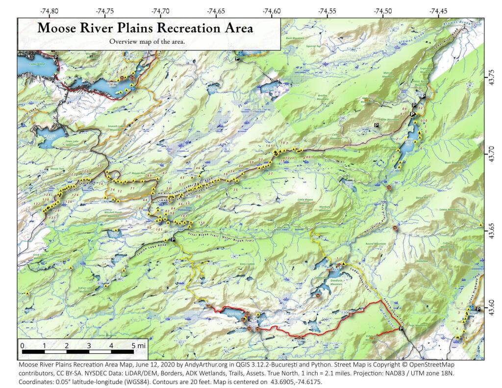
Moose River Plains Campsites

Interactive Map of Lean-Tos and Campsites

An overview map and list of campsites and their locations at the Moose River Recreation Area.

 Moose River Plains Recreation Area

Maps

Campsites

Milepoint Name Feature Notes Access Location
Cedar River Flow 1 Cedar River Flow Tent site on flow Boat 43.702924803151, -74.4871304116533
Cedar River Flow 2 Cedar River Flow Tent site on flow Boat 43.7104737708879, -74.4802343768254
Cedar River Flow 3 Cedar River Flow Tent site on flow Boat 43.7145237017622, -74.4679264444554
Cedar River Flow 5 Cedar River Flow Tent site on flow Boat 43.7111711590583, -74.4675178486588
Cedar River Flow 6 Cedar River Flow Tent site on flow Boat 43.7084767866376, -74.4717703157492
Beaver Lake Campsite Beaver Lake Site overlooks Beaver Lake Hike 43.6516613421651, -74.7407833400961
81 Icehouse Pond Accessible site at Icehouse Pond with privy Hike 43.6646602166505, -74.7029502913239
140A Indian Lake Campsite on Indian Lake, outhouse in bad condition Hike 43.6154753632731, -74.7499942080732
East of Muskrat Pond Indian Lake Trail Former roadside campsite, largely abandoned Hike 43.645116528704, -74.696221627206
46 Lost Ponds Trail Beyond the end of current Lost Ponds Road Hike 43.6868179572109, -74.6655581886723
47 Lost Ponds Trail Above Lost Ponds Hike 43.6859472953826, -74.6722052916864
Mitchell Pond 1 Mitchell Pond Tent site, bushwhack Hike 43.6729475881673, -74.7502538624373
Mitchell Pond 2 Mitchell Pond Tent site, bushwhack Hike 43.6716991892117, -74.7432124817486
64A Mitchell Pond (Accessible Campsite at End of Gravel Trail) Gravel path to site, wildrness privy Hike 43.6706136251028, -74.7387363015355
10 89 Beaver Lake Road Off Otter Brook Road, Sand Plains Vehicle 43.6583112347181, -74.7012491214803
11 90 Beaver Lake Road Off Otter Brook Road, Sand Plains Vehicle 43.6577446555162, -74.7038760912165
16 1 Cedar River – Limekiln Lake Road Driveway Along Tributary of Silver Run Vehicle 43.7033162602551, -74.5742148239156
16 3 Cedar River – Limekiln Lake Road Along Silver Run Vehicle 43.7027301523306, -74.5757742464803
16 4 Cedar River – Limekiln Lake Road Along Silver Run, driveway at Sharp S Turn Vehicle 43.7026421104662, -74.5769731929134
16 7 Cedar River – Limekiln Lake Road Along Silver Run Vehicle 43.7040070126376, -74.5809411044503
15 10 Cedar River – Limekiln Lake Road Old gravel pit, accessible Vehicle 43.7031498027862, -74.5893864145496
15 11 Cedar River – Limekiln Lake Road Across from 12 Vehicle 43.702458607149, -74.5926546451668
15 12 Cedar River – Limekiln Lake Road Across from 11 Vehicle 43.7028667147947, -74.5929833340894
15 13 Cedar River – Limekiln Lake Road Along Silver Run Vehicle 43.7010402113051, -74.5956355707995
15 14 Cedar River – Limekiln Lake Road Along Silver Run Vehicle 43.7010328498576, -74.597457469967
14 16 Cedar River – Limekiln Lake Road Access Road for 16/17/18 Group Vehicle 43.7025294616695, -74.5969885248639
14 17 Cedar River – Limekiln Lake Road Access Road for 16/17/18 Group Vehicle 43.7021028692463, -74.5966599329259
14 18 Cedar River – Limekiln Lake Road Access Road for 16/17/18 Group Vehicle 43.7023846304313, -74.5978818600647
14 19 Cedar River – Limekiln Lake Road Along Silver Run Vehicle 43.7003546491841, -74.5964872856253
14 21 Cedar River – Limekiln Lake Road Across road from Silver Run Vehicle 43.6957217888458, -74.6020563094081
13 22 Cedar River – Limekiln Lake Road Across road from Silver Run Vehicle 43.6935817523545, -74.6036764840587
13 27 Cedar River – Limekiln Lake Road Across road from Silver Run Vehicle 43.6926540634024, -74.6082201775478
13 30 Cedar River – Limekiln Lake Road Open Area in Woods Vehicle 43.6918525577623, -74.6118452191364
13 31 Cedar River – Limekiln Lake Road Near Marsh off Silver Run Vehicle 43.6881856235873, -74.6271629609656
12 34 Cedar River – Limekiln Lake Road Open Field Near Old Sly Pond Road Vehicle 43.6846954329325, -74.634678249126
12 35 Cedar River – Limekiln Lake Road Former Sly Pond Road Vehicle 43.6836690328942, -74.6318552827363
11 38 Cedar River – Limekiln Lake Road On Hill Overlooking Road, near start of Lost Ponds Area Vehicle 43.6836029270341, -74.6401393590772
11 39 Cedar River – Limekiln Lake Road Above CRLLR, start of Lost Ponds Area Vehicle 43.6841476346233, -74.6487511980121
11 40 Cedar River – Limekiln Lake Road Above CRLLR, start of Lost Ponds Area Vehicle 43.682942162164, -74.6537793571789
11 41 Cedar River – Limekiln Lake Road Above CRLLR, start of Lost Ponds Area Vehicle 43.681311345096, -74.6589116717693
10 42 Cedar River – Limekiln Lake Road Above CRLLR, start of Lost Ponds Area Vehicle 43.6799039050817, -74.6646031695507
10 43 Cedar River – Limekiln Lake Road Above CRLLR, start of Lost Ponds Area Vehicle 43.6793727911294, -74.6664156654099
10 44 Cedar River – Limekiln Lake Road West of Lost Ponds Road, Sand Plains Vehicle 43.678808787762, -74.6696555368193
10 50 Cedar River – Limekiln Lake Road West of Lost Ponds Road, Sand Plains Vehicle 43.677986610504, -74.6732025802129
10 51 Cedar River – Limekiln Lake Road Pull-Off, Small Site, Sand Plains Vehicle 43.6775108499728, -74.6750146421403
10 52 Cedar River – Limekiln Lake Road Old gravel pit, short loop below CRLLR Vehicle 43.6748840847288, -74.6815273754233
10 53 Cedar River – Limekiln Lake Road Access Road for 55/54/55 Group, Sand Plains Vehicle 43.6733317629897, -74.6820452615144
10 54 Cedar River – Limekiln Lake Road Access Road for 55/54/55 Group, Sand Plains Vehicle 43.673268538603, -74.6822820352903
9 55 Cedar River – Limekiln Lake Road Access Road for 55/54/55 Group, Sand Plains Vehicle 43.6733705968856, -74.6827076379887
9 56 Cedar River – Limekiln Lake Road Driveway, East of Former Dump, Sand Plains Vehicle 43.673126585883, -74.6891475571674
9 57 Cedar River – Limekiln Lake Road Has Trail to Moose River Vehicle 43.6736673106707, -74.6902687046523
8 64 Cedar River – Limekiln Lake Road Near Mitchell Pond Trail Vehicle 43.6757521870177, -74.707500815672
8 66 Cedar River – Limekiln Lake Road Near Pine Creek Vehicle 43.6784203854214, -74.7068492021325
7 67 Cedar River – Limekiln Lake Road Benedict Creek Road, Wooded Vehicle 43.6851041444828, -74.7031887110586
7 69 Cedar River – Limekiln Lake Road Remote site, perched over the road Vehicle 43.6834516958835, -74.7168906980223
6 70 Cedar River – Limekiln Lake Road Large loop off of CRLLR Vehicle 43.6839906014562, -74.7249870178447
6 71 Cedar River – Limekiln Lake Road Very sandy site near Mitchells Pond Upper Loop Vehicle 43.6833776353921, -74.7321947941391
5 72 Cedar River – Limekiln Lake Road At end of Bear Pond Loop Road (Accessable) Vehicle 43.6828956047277, -74.7359084701559
4 73 Cedar River – Limekiln Lake Road Very sandy site near Mitchells Pond Upper Loop Vehicle 43.6835777053685, -74.7387188889593
4 74 Cedar River – Limekiln Lake Road On a hill overlooking road and marshy area Vehicle 43.6839187521201, -74.742285779317
4 76 Cedar River – Limekiln Lake Road Very sandy site near Mitchells Pond Upper Loop Vehicle 43.6864452702399, -74.7471689344191
4 77 Cedar River – Limekiln Lake Road Near Red River, Bear Pond Loop, Sand Plains Vehicle 43.6897961458669, -74.7484803840413
10 58 Helldiver Pond Road Near Helldiver Pond Vehicle 43.6735979105991, -74.6920316000423
10 59 Helldiver Pond Road Near Helldiver Pond Vehicle 43.6723766419894, -74.6929318681131
10 60 Helldiver Pond Road Near Helldiver Pond Vehicle 43.6713193532923, -74.692758456613
10 61 Helldiver Pond Road Accessible site at end of Helldiver Pond Road Vehicle 43.6705019900204, -74.6921751440693
15 West of Brooktrout Trail Indian Lake Road Past Brooktrout Trail, on a hill over road Vehicle 43.6254538914434, -74.7337300739322
10 48 Lost Pond Road Sand Plains, Marshes Aroubnd Vehicle 43.6814268347573, -74.6667101324338
11 49 Lost Pond Road Sand Plains, Marshes Aroubnd Vehicle 43.6819456385478, -74.6670131106595
10 80 Otter Brook Road Has Trail to Moose River Vehicle 43.6620917920003, -74.7112181918076
11 98 Otter Brook Road Above Moose River on Hill Vehicle 43.6588725644731, -74.6966603409996
11 101 Otter Brook Road Sand Plains Vehicle 43.6564420559443, -74.6938956128147
11 103 Otter Brook Road Sand Plains Vehicle 43.657108724794, -74.6873446316172
12 104 Otter Brook Road Wooded Site Vehicle 43.6560617426567, -74.6832992891923
12 106 Otter Brook Road Wooded Site Vehicle 43.6565121581975, -74.6789913497265
13 110 Otter Brook Road Wooded Site Vehicle 43.6566072628101, -74.6733859460379
13 111 Otter Brook Road Near Otter Brook Bridge Vehicle 43.6539235327721, -74.6747718892435
23 1 Wakely Dam Camping Area Accessible site Vehicle (before gate) 43.7266767212397, -74.474100266424
23 2 Wakely Dam Camping Area Field Camping Vehicle (before gate) 43.7266515010084, -74.4733110730078
23 3 Wakely Dam Camping Area Field Camping Vehicle (before gate) 43.7259595122959, -74.473899965642
23 4 Wakely Dam Camping Area On Driveway to Lake Vehicle (before gate) 43.7260676922081, -74.4742326471903
23 5 Wakely Dam Camping Area On Driveway to Lake Vehicle (before gate) 43.7255637908987, -74.4741751228291
23 6 Wakely Dam Camping Area On Driveway to Lake Vehicle (before gate) 43.7252231337487, -74.4745830371916
23 9 Wakely Dam Camping Area Across bridge Vehicle (before gate) 43.726275356142, -74.4717840349063
23 10 Wakely Dam Camping Area Across bridge Vehicle (before gate) 43.7266308152758, -74.4712600272389
10 82 Otter Brook Road On Moose River Vehicle (driveway) 43.6603083771227, -74.7010353925305
11 84 Otter Brook Road On Moose River Vehicle (driveway) 43.6619962517853, -74.6957783254417
6 120 Natural Rock Dam Road Sand Plains near Red River Vehicle (Opens July) 43.6848543033273, -74.7664253595203
6 122 Natural Rock Dam Road Wooded Site Vehicle (Opens July) 43.684367353989, -74.7717171949716
6 123 Natural Rock Dam Road Wooded Site Vehicle (Opens July) 43.6804228755091, -74.7782951743141
6 124 Natural Rock Dam Road Wooded Site Vehicle (Opens July) 43.6792030487765, -74.7847972548314
7 125 Natural Rock Dam Road Wooded Site Vehicle (Opens July) 43.6783559964111, -74.7880327043169
7 126 Natural Rock Dam Road Wooded Site Vehicle (Opens July) 43.6748535298235, -74.790591643043
7 127 Natural Rock Dam Road Wooded Site Vehicle (Opens July) 43.6739776362472, -74.7910844137006
7 128 Natural Rock Dam Road Wooded Site Vehicle (Opens July) 43.6751413481917, -74.7924842843025
8 129 Natural Rock Dam Road Wooded Site Vehicle (Opens July) 43.6703784784539, -74.7926312803463
8 130 Natural Rock Dam Road Wooded Site Vehicle (Opens July) 43.6666270858056, -74.8019151989726
8 131 Natural Rock Dam Road Wooded Site Vehicle (Opens July) 43.6643581634434, -74.8054154753831
8 132 Natural Rock Dam Road Wooded Site Vehicle (Opens July) 43.6652083016168, -74.8036826184027
5 119A Natural Rock Dam Road Sand Plains near Red River Vehicle (Opens July) 43.6844716021433, -74.7646961785253
6 123A Natural Rock Dam Road Wooded Site Vehicle (Opens July) 43.6802422604152, -74.782965042166
6 124A Natural Rock Dam Road Wooded Site Vehicle (Opens July) 43.6785899888224, -74.7864319884685
6 125A Natural Rock Dam Road Wooded Site Vehicle (Opens July) 43.6776017274889, -74.7902229325712
7 126A Natural Rock Dam Road Wooded Site Vehicle (Opens July) 43.6756110574941, -74.7901645681643
8 129A Natural Rock Dam Road Wooded Site Vehicle (Opens July) 43.6689370211979, -74.7948887917477
8 129AA Natural Rock Dam Road Wooded Site Vehicle (Opens July) 43.6674497436753, -74.7980604042935
8 130A Natural Rock Dam Road Wooded Site Vehicle (Opens July) 43.6661052974262, -74.8016557609016
8 130AA Natural Rock Dam Road Wooded Site Vehicle (Opens July) 43.6669094078356, -74.8007390664074

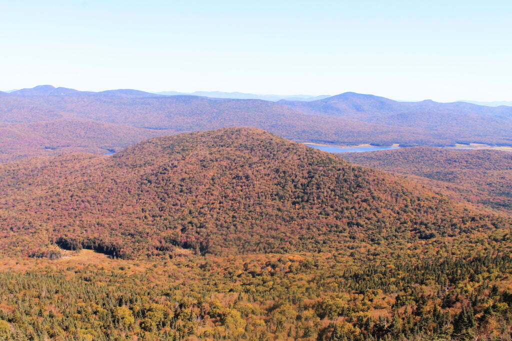
Payne Mountain with Cedar River Flow Beyond It

July 1, 2020 Morning

Good morning! Happy July! It’s a pretty cloudy and 66 degrees in Delmar, NY. ☁ Calm wind. The dew point is 64 degrees. Not a real nice day but wait there is more. The skies will clear around 8 pm.

Today will have a slight chance of showers, then a chance of showers and thunderstorms after 11am. Mostly cloudy ⛅, with a high of 79 degrees at 1pm. Two degrees below normal, which is similar to a typical day around June 21st. Maximum dew point of 65 at 11am. Northwest wind 3 to 5 mph. Chance of precipitation is 40%. New rainfall amounts between a tenth and quarter of an inch, except higher amounts possible in thunderstorms. A year ago, we had mostly sunny skies. The high last year was 85 degrees. The record high of 99 was set in 1913.

Solar noon 🌞 is at 1:00 pm with sun having an altitude of 70.5° from the due south horizon (-0.4° vs. 6/21). A six foot person will cast a 2.1 foot shadow today compared to 2.2 feet on the first day of summer. The golden hour 🏅 starts at 7:55 pm with the sun in the west-northwest (296°). 📸 The sunset is in the west-northwest (303°) with the sun dropping below the horizon at 8:38 pm after setting for 3 minutes and 27 seconds with dusk around 9:11 pm, which is 8 seconds earlier than yesterday. 🌇 At dusk you’ll see the Waxing Gibbous 🌔 Moon in the south-southeast (164°) at an altitude of 28° from the horizon, 229,292 miles away. 🚀 The best time to look at the stars is after 9:57 pm. At sunset, look for rain 🌧 and thunderstorms 🌩 and temperatures around 75 degrees. The dew point will be 64 degrees. There will be a calm wind. Today will have 15 hours and 15 minutes of daytime, a decrease of 40 seconds over yesterday.

Tonight will have a chance of showers and thunderstorms before 10pm, then a slight chance of showers between 10pm and 11pm. Patchy fog after 2am. Otherwise, mostly cloudy ☁, with a low of 62 degrees at 4am. Two degrees above normal. Maximum dew point of 64 at 6pm. Calm wind. Chance of precipitation is 30%. New precipitation amounts of less than a tenth of an inch, except higher amounts possible in thunderstorms. In 2019, we had mostly clear skies. It became somewhat humid as the night progressed. It got down to 65 degrees. The record low of 40 occurred back in 1978.

On this day in 1963, ZIP codes are introduced for United States mail. ✉ It is obvious that they added the zip code to the sign of the Tupper Lake Post Office sometime after the rest of the building because the font is very wrong for the obsessive compulsive in our community. After all, if you get a zip code wrong, the best thing that can happen is you have a very scornful postal clerk, and the worst thing that can happen is your mail isn’t delivered. Always double check zip codes.

Also in 1968, the UAW becomes a seperate entity from AFL-CIO over policy disputes. 🔧 The UAW would rejoin the AFL-CIO 13 years later in 1981. That basically is irrelevant ancient history at this point. Most people in the seventies were smoking 🚬 pot while assembling cars during the malaise era and its all but been forgotten.

Saturday will hot 🔥. It will be mostly sunny, with a high near 86. Maximum dew point of 65 at 7pm. Typical average high for the weekend is 82 degrees. Might be a nice day for fishing 🎣 and maybe a paddle. 🚣

I am thinking of Sunday possibly going out to Vermont. ⛺ I am thinking of camping up along the Deerfield River and working up there from the tent. Might be a nice cool place to beat the heat and a change from the Adirondacks. Best of all I can stay for up to 14 days in a 30 day period but I doubt I’d stay that long. But it would be nice to have a camp and not have to move every three days but I would need to get ice frequently due to the heat. ❄ Albany County with fewer than 400 Coronavirus cases per million is not subject to the Vermont quarantine anymore.

Evening Shadow

Camping Areas in Southern Adirondacks

Camping Areas in Southern Adirondacks ⛺

East Branch of Sacanadaga River, NY 8 – Roughly 10 campsites along NY 8. These are easily accessed throughout the year, as the road is plowed except when the snow banks are high during the winter. East Branch is not good for fishing due to wide variance in water levels, however there are some nice pools in sections of river for summer swimming. Lots of road noise. Some of the sites have cell service. Nearby locations include Cod Pond, East Branch Trail and Kibby Pond Trail.

Edick Road – There are a handful of very hidden campsites off of Edick Road. This road may be closed to vehicles due to wash outs autumn 2019, but worth a walk to explore this area.

Fawn Lake – A 1/2 mile hike back to a scenic lake ringed by primitive campsites outside of Lake Pleasant. Two miles beyond it is the scenic Willis Vly, which doesn’t have developed campsites but it’s remote wilderness where you might see a Moose or other wildlife.

Garnet LakeTent sites, some with drive-up access along the lake. No cell service, much of the upper road here is not maintained in the winter. Popular in the summer, no cell service.

Good Luck Lake – Scenic lake off of the West Branch Sacanadaga River that is ringed with tent sites that can be walked in from the Good Luck Lake parking area area or paddled in.

Hope Falls Road – Two or three campsites along the end of Hope Falls Road, some are drive-in only tent sites. Near the Tenant Creek Falls Trail. No cell service. Open June to autumn snowfall.

Harrisburg Road – There is a set of very rustic designated campsites along the rough Harrisburg Road past Harrisburg Lake. Somewhat near Crane Mountain, a couple mile hike to and Wilcox Lake. No cell service.

Lester Flow and Cheney Pond – Scenic lake that is popular for paddling. The 1/2 mile road down from Boreas Road as of June 2020 is closed due to washouts. Tent sites exist along the lake, along with one drive-to site on the road down there.

Mason Lake – Small lake located about 10 miles north of Speculator and 5 miles south of Lewey Lake that has several tent and drive-in campsites along it’s shore. Good to fair cell service here. Nice to hear loons, one of the best bass ponds in the area.

North Lake Reservoir – There are roughly 15 campsites on the east shore of North Lake Reservoir. Popular place in the summer, regularly staffed by conservation students. Noise from motorboats. No cell service. Nice if you want to camp right on water, hear loons at night..

Northwood Club Road – In Minerva, this road crosses the Boreas River and has several roadside campsites, and passes by Huntley Pond, the NL Tahawus Railroad (which can be hiked to the Boreas River at Hudson River), and the Blue Ledges on the Hudson tailhead.

Perkins Clearing – Conservation easement lands. Good to fair cell service here. Great place for hunting and wildlife observation as it’s mixed timber country. Near Mason Lake, Speculator, Pillsbury Mountain and Cedar Lakes.

Piseco-Powley Road – A dozen campsites along a 13 mile road with short hikes including Big Alderbed, House Pond, Sand Lake and the popular Potholers/Brayhouse Brook waterfall for swimming. As of June 2020, road is closed in Stratford/Fulton County portion, road is open north of Potholers/Brayhouse Brook (access via Piseco). Very limited cell service here.

Pumpkin Hollow Road – Three campsites above Willis Lake. Remote country except for the site on Willis Lake, no cell service. On the Willis – Wilcox Lake Trail. Very quiet area. Open June to autumn snowfall. No cell service here.

Rockwood State Forest – Three campsites along the end of Church Road which can be accessed by driving past the cemetery in the hamlet. Scenic lake, good fishing. Cell service available, but bring a trash bucket and gloves as litter can be a problem. Nice trails to stroll around in the old Rockwood Estate.

Stewart Landing – There are four campsites on a rough road that loops off of Stewart Landing Road. Popular area in the summer, Canada Lake is great for paddling and informal swimming. Also consider hiking back to Hilderbrandt Vly and Glassgow Lake from here. Moderate to poor cell service here.

Vanderwhacker Road -Five or six campsites exist along Vanderwhacker Road, which can be muddy in the spring and icy in late autumn. Additional designates campsites exist near where NY 28N crosses the Vanderwhacker River. Near the trail to the Vanderwhacker Firetower, No cell service.

White House, Wells – A grouping of 5 or 6 campsites at the end of White House in West River Road. Scenic area, old camp, with fields and a chimney. Campsites are kind of close together, not a wilderness experience. Near the North Country Placid Trail, lots of blueberries in mid-summer. No cell service. Open June to autumn snowfall.

Woodhull Lake Reservoir – Off of NY 28 in McKeevers, about 10 miles south of Old Forge. Not only is this beautiful reservoir to paddle, there are some campsites along the shore, with drive-to campsites along Wolf Lake Landing Road which leads to it. Part of Wolf Lake Landing Road is erroded, but other parts are fresh stone-dust. It’s remote wilderness but there good cell service in mcuh of the area.

June 25, 2020 Evening

Good evening! Heavy rain and 73 degrees at the Jones Pond. ☔ Glad I’m tired 😴 and decided to bail for the truck early. It’s wet! There is a west-southwest breeze at 9 mph. 🍃 with gusts up to 24 mph 💨💨💨. The dew point is 45 degrees. The skies will clear around 5 pm.

Just a rain storm 💦 but quite wet for now. I’m not sure if good because of all the weather warnings ⚠ of how dry it is. That said, this week has had a lot of showers and Saturday could be quite wet.

Today I stopped by Bog River Falls then spent some time at the Tupper Lake Library. 💻 Been a pretty quiet time at work but I’ve been working on coming up with polling regions for one of my clients. Spent a little time at Tupper Lake Park and then bought a few very expensive groceries at the independent in Tupper Lake.

I forgot to get gas and ended up driving 🚘 through Saranac Lake on the way up to camp. It probably was about the same amount of time as going through pokey Fish Creek Ponds. Pretty drive between Tupper Lake and Saranac Lake, I didn’t realize how much of a drop its down to Saranac Lake. The village of Saranac Lake reminds me of a bit of Galenton, PA with the mountains and the ponds but much bigger and less hillbilly.

Occasionally I’ve been hearing a clinking noise when I turn my steering wheel 🚙 which is bothering me to no end after spending all that money on the front end of the truck. 💵 If something else is wearing out I would have hoped the shop would have pointed it out and asked me if I wanted it fixed. Maybe it’s nothing, there is nothing I can do about it for now, but it’s still annoying. It’s not effecting drivablity and it’s still happening only rarely. At times I get overly sensitive about auto noises.

Jones Pond is nice but they’ve reduced it to two drive in campsites ⛺ – the site I really like and the one in the boat launch parking area 🅿. You can guess which one I am at tonight. It’s fine though, only two nights here ✌ and it’s still on the lake and it’s close to the road so no rough roads to drive and quick to leave come Saturday when I head home. 🏡 Plus I have decent cell service for work. 📱

Tonight will have a 20 percent chance of showers before 9pm. Partly cloudy 🌧, with a low of 53 degrees at 5am. Six degrees below normal, which is similar to a typical night around June 5th. Maximum dew point of 52 at 10pm. Southwest wind 5 to 8 mph becoming calm in the evening. In 2019, we had mostly clear skies in the evening, which became partly cloudy by the early hours of the morning. It was somewhat humid. It got down to 61 degrees. The record low of 39 occurred back in 1979.

Tonight will have a Waxing Crescent 🌒 Moon with 23% illuminated. At 5 PM, the moon was in the south (178°) at an altitude of 61° from the horizon, some 229,463 miles away from where you are looking up from the earth. 🚀 At the state speed limit of 55 mph, you’ll make it there by December 16th. Buckle up for safety! 💺 The Buck 🦌 Moon is on Sunday, July 5. The darkest hour is at 1:01 am, followed by dawn at 4:40 am, and sun starting to rise at 5:16 am in the northeast (56°) and last for 3 minutes and 37 seconds. Sunrise is 22 seconds later than yesterday. 🌄 The golden hour ends at 6:01 am with sun in the east-northeast (63°). Tonight will have 8 hours and 30 minutes of darkness, an increase of 21 seconds over last night.

Tomorrow will be mostly sunny 🌞, with a high of 78 degrees at 5pm. Three degrees below normal, which is similar to a typical day around June 16th. Maximum dew point of 56 at 8am. Southwest wind 8 to 11 mph. A year ago, we had rain in the morning with more sun in the afternoon. It was humid. The high last year was 87 degrees. The record high of 99 was set in 1952.

In four weeks on July 23 the sun will be setting in the west-northwest (299°) at 8:32 pm,🌄 which is 13 minutes and 39 seconds earlier then today. In 2019 on that day, we had rain and temperatures between 79 and 65 degrees. Typically, you have temperatures between 83 and 62 degrees. The record high of 96 degrees was set back in 1955.

Looking ahead,

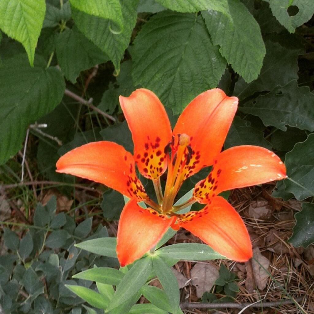
Before the rain comes this evening check out the tons of woods lilies. The flowers won't likely survive the rain.

June 24, 2020 Night

Good evening! Mostly clear and 56 degrees at Horseshoe Lake. 🌃 There is a west-southwest breeze at 5 mph. 🍃. The dew point is 48 degrees. Final night here, my three nights here expires comes morning.

So the plan is to break camp early tomorrow ⛺ and then head down to Horseshoe Lake for a paddle. Already the flags 🎌 are down, hammock and gear is organized for a quick pack. At lunch time I’ll go to Tupper Lake for milk and ice ❄ and work using the village maybe upload some stuff to the blog. At five o’clock I’m going to head up to the Saranac Lake Wild Forest or St. Regis Canoe Area where I have cell service and work there Friday and then drive home Saturday I think. 🚣👯

Tonight will be partly cloudy 🌤, with a low of 52 degrees at 6am. Seven degrees below normal, which is similar to a typical night around June 1st. Maximum dew point of 51 at 12am. Southwest wind 3 to 8 mph. In 2019, we had mostly clear skies in the evening, which became rain by the early hours of the morning. It became sticky as the night progressed. It got down to 68 degrees. The record low of 45 occurred back in 1982.

Busy day at work, preparing a large memorandum report that ended up getting shelved 📚 for another project. The laptop battery held up fine and during lunch and later in the afternoon I plugged it into the truck to top it off.

Lows Ledge was pretty but clouds pushed in at the wrong time ☁ – they came in slightly after I arrive and departed after I left casting dark shadows on the land but I got some nice pictures 📷 at the end. Beautiful country up there. I’d love to paddle Hitchens Pond but with work and everything else I just don’t have the time. ⌚ I’m getting to hang out in some beautiful country but work has been crazy. It’s a road trip yes, but not really a vacation. I’m working every day including for a while on the weekend.

While seeing the bear and cubs 🐻 play in the tree was kind of cool, I wasn’t not happy seeing the bear so close to camp. He’s too comfortable with humans and I don’t want him breaking into my truck or tearing up camp. 👣 I thought about sending some bird shot in the woods away from him to send him packing but at the time my truck was parked out on the road soaking up sun for the solar and I didn’t have my shotgun right pm me. Hopefully he won’t be a problem tonight after tonight she’s somebody else’s problem.

Tonight will have a Waxing Crescent 🌒 Moon with 16% illuminated. At 10 PM, the moon was in the west (280°) at an altitude of 17° from the horizon, some 231,151 miles away from where you are looking up from the earth. 🚀 At the state speed limit of 55 mph, you’ll make it there by December 17th. Buckle up for safety! 💺 The moon will set in the west-northwest (296°) at 11:41 pm. The Buck 🦌 Moon is on Saturday, July 4. The darkest hour is at 1:01 am, followed by dawn at 4:39 am, and sun starting to rise at 5:16 am in the northeast (55°) and last for 3 minutes and 36 seconds. Sunrise is 20 seconds later than yesterday. 🌄 The golden hour ends at 6:00 am with sun in the east-northeast (63°). Tonight will have 8 hours and 29 minutes of darkness, an increase of 16 seconds over last night.

Tomorrow will be mostly sunny 🌞, with a high of 74 degrees at 5pm. Six degrees below normal, which is similar to a typical day around June 2nd. Maximum dew point of 53 at 8am. Southwest wind 10 to 15 mph. A year ago, we had partly cloudy skies in the morning, remaining cloudy in the afternoon. The high last year was 86 degrees. The record high of 95 was set in 1898.

In four weeks on July 22 the sun will be setting in the west-northwest (299°) at 8:33 pm,🌄 which is 12 minutes and 38 seconds earlier then tonight. In 2019 on that day, we had rain and temperatures between 74 and 66 degrees. Typically, you have temperatures between 83 and 62 degrees. The record high of 102 degrees was set back in 1926.

East