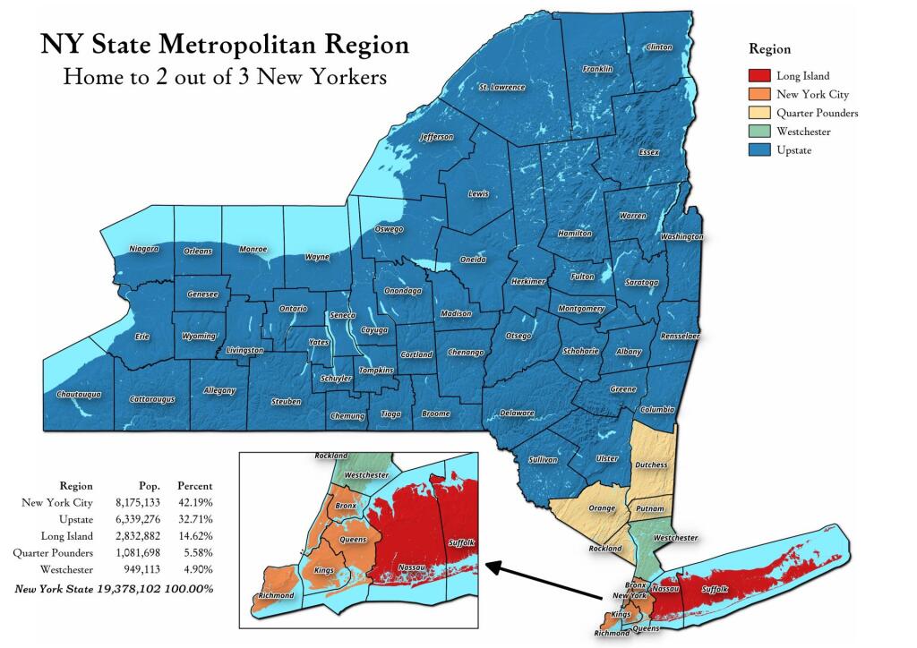
Somebody was asking about a map of the Quarter Pounders, along with Long Island, Westchester, and New York City -- versus Upstate map. This map shows this regions, along with the respective population in each region. The Quarter Pounders -- Dutchess, Orange, Putnam and Rockland Counties have this name, as they each have a quarter weighted vote on the MTA Board.
Maybe a fairly unremarkable rural valley in Chenango, Cortland and Madison counties but a pleasant drive and worth an exploration.
Harlan is a home rule-class city in and the county seat of Harlan County, Kentucky, United States. The population was 1,745 at the 2010 census, down from 2,081 at the 2000 census.
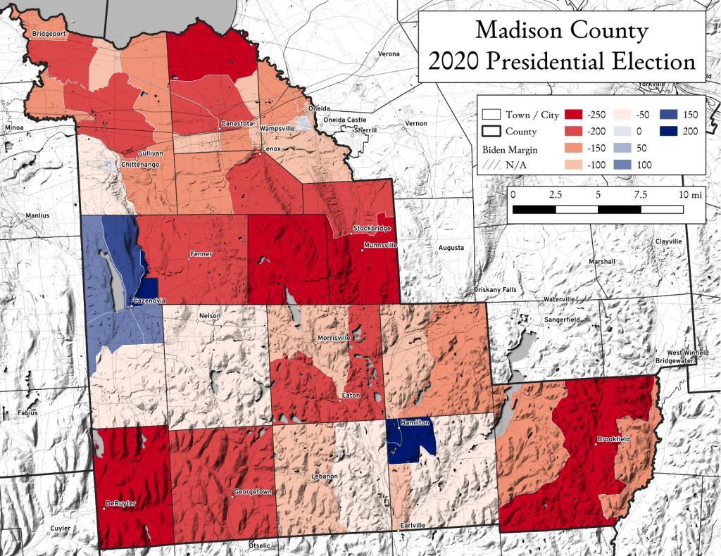
Madison County, NY went pretty red during the 2020 Presidential Election, which is not uncommon for rural counties across America. Notable exceptions is the area around Cazenovia and Hamilton (home to Colgate College) and the newer, wealthier election district on the outskirts of the City of Oneida.
That should be no surprise to anyone. It's one of the biggest agriculture producers in the nation, although south of Des Monies there is more woods and grazing to be found. The famously fertile soils of the Great Plains in Northern and Central Iowa aren't as great as you south of Des Monies.
My fascination with all things New Jersey continues. Here is an interactive aerial photo of New Jersey, so you can take a closer look at the cities and the farms both in South Jersey and Northwest Jersey by the Delaware Water Gap.
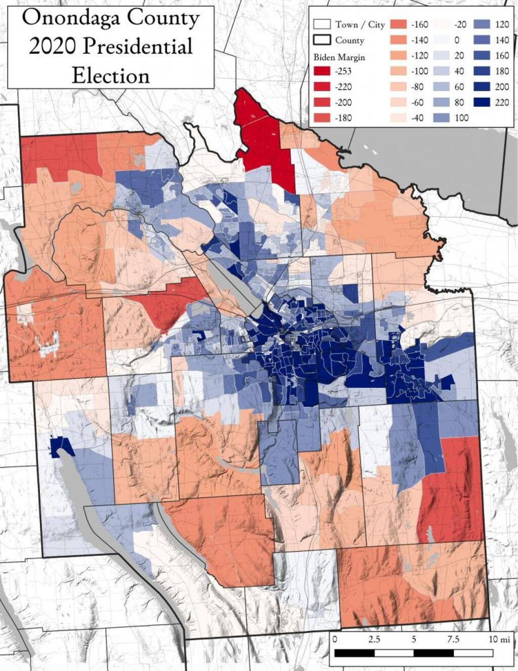
While I have made several maps of presidential and local elections in Albany County, I thought I should take a look at other counties now that I have figured out how to get this data from the Arc MapServer.


