Search Results for: photo campsite 11

Chautauqua County State Forests with Designated Campsites

The following state forests in Chautauqua County have designated campsites …

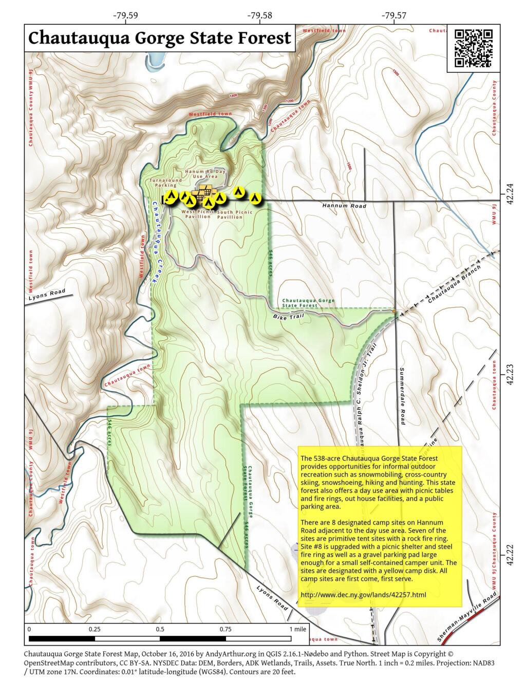
  • Chautauqua Gorge State Forest totals 538 acres. This state forest is located in the north western area of Chautauqua County in the town of Chautauqua, west of Mayville.
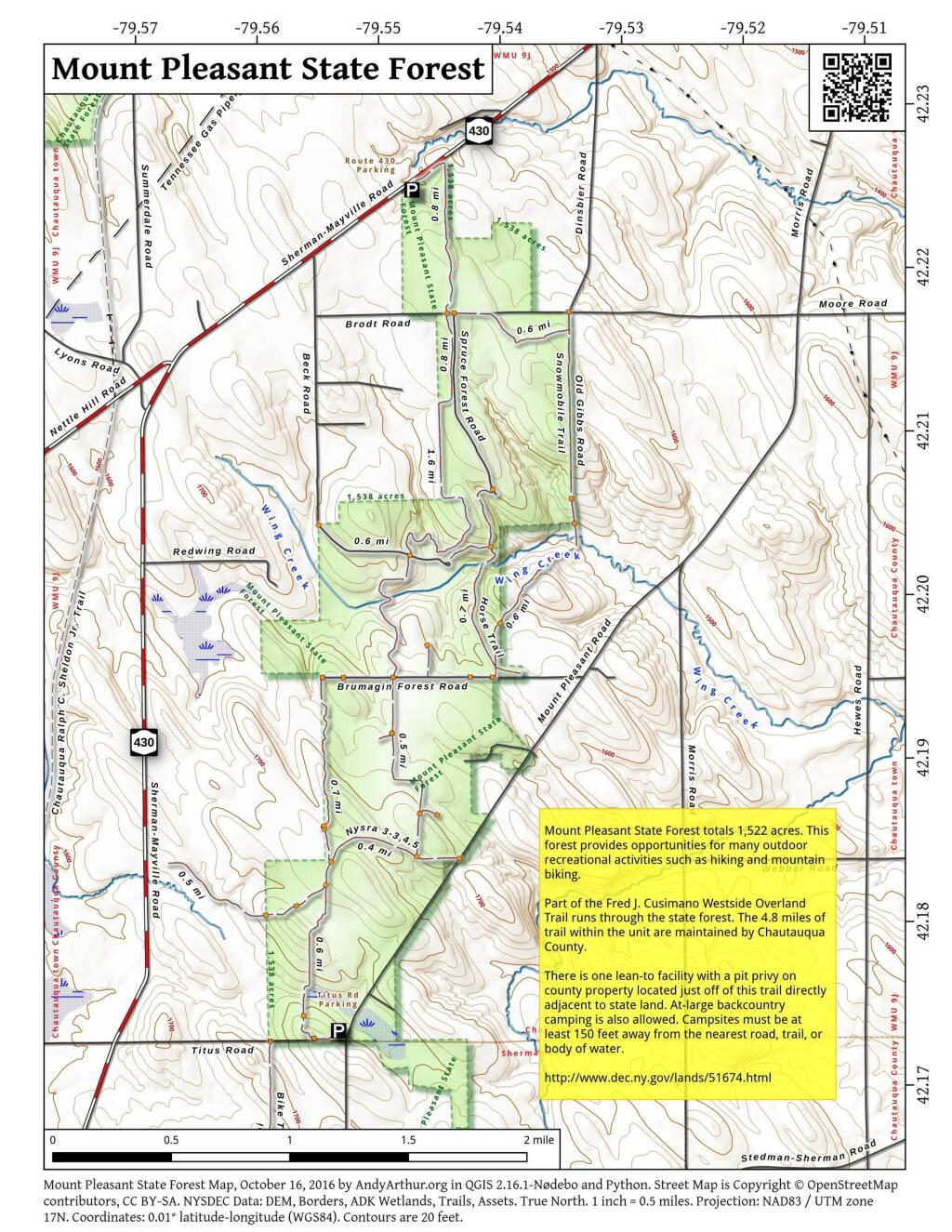
  • Mounnt Pleasant State Forest totals 1,522 acres and is located in the Town of Chautauqua in the western area of Chautauqua County.
  • North Harmony State Forest totals 2,561 acres and is used for many outdoor recreational opportunities such as cross-country skiing, snowshoeing, hiking, snowmobiling, and hunting.
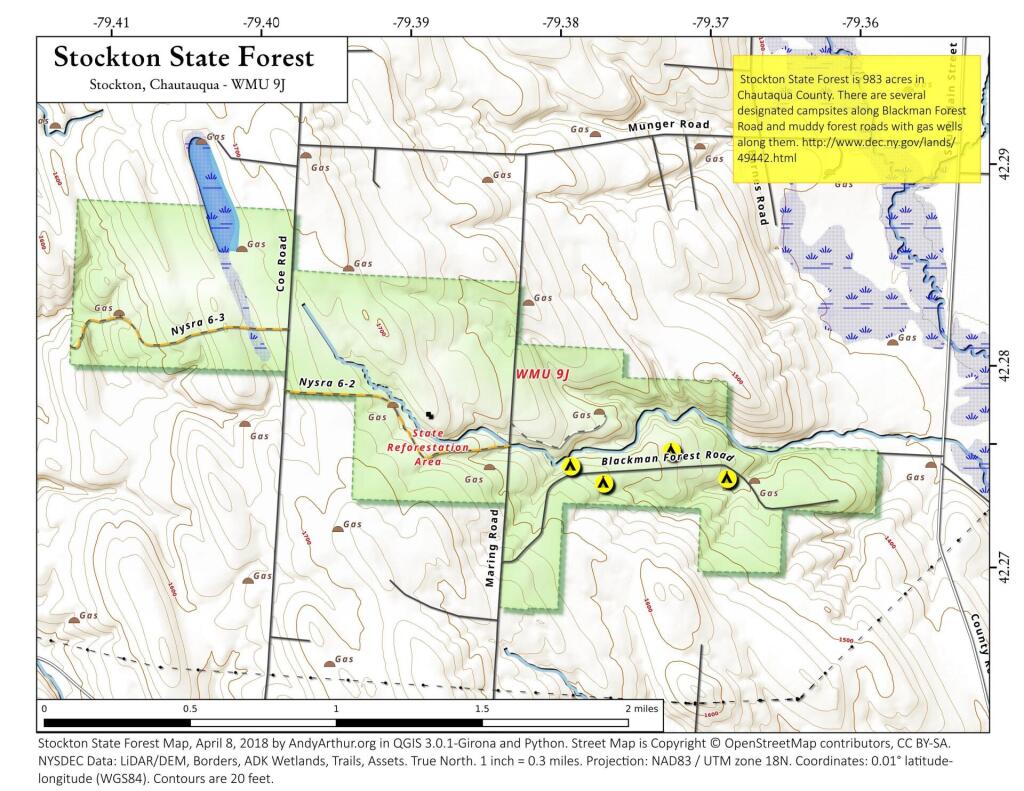
  • Stockton State Forest totals 977 acres. This state forest provides opportunities for many outdoor recreational activities, including snowmobiling, cross-country skiing, snowshoeing, hiking, horseback riding and hunting.

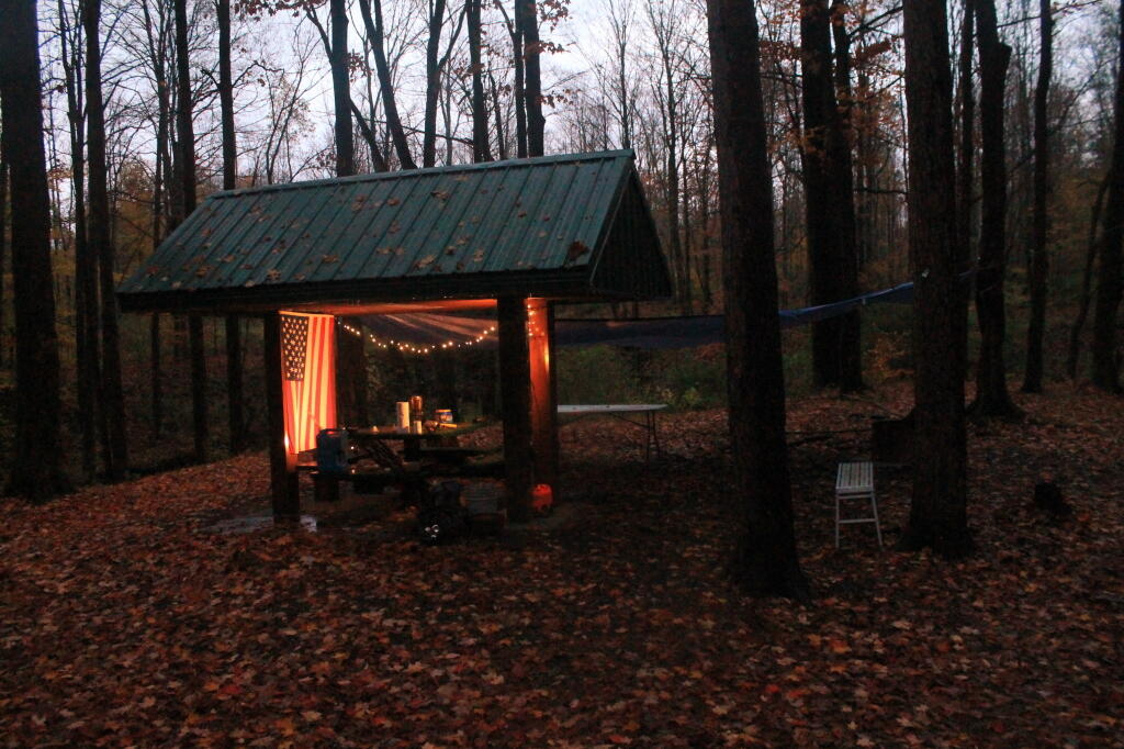
Camp Pavlion Lit Up

Coordinates for Chautauqua County Campsites

Campsite State Forest Latitude Longitude
Designated Camp Sites Chautauqua Gorge State Forest 42.24 -79.586
Designated Camp Sites Chautauqua Gorge State Forest 42.24 -79.584
Designated Camp Sites Chautauqua Gorge State Forest 42.24 -79.586
Designated Camp Sites Chautauqua Gorge State Forest 42.24 -79.583
Designated Camp Sites Chautauqua Gorge State Forest 42.24 -79.581
Designated Camp Sites Chautauqua Gorge State Forest 42.24 -79.587
Designated Camp Sites Chautauqua Gorge State Forest 42.24 -79.582
Designated Camp Sites Chautauqua Gorge State Forest 42.24 -79.587
Beck Forest Road Mount Pleasant State Forest 42.202 -79.546
Designated Camp Site North Harmony State Forest 42.087 -79.529
Designated Camp Site North Harmony State Forest 42.089 -79.528
Designated Camp Site North Harmony State Forest 42.089 -79.53
Designated Camp Site North Harmony State Forest 42.095 -79.511
Designated Camp Site North Harmony State Forest 42.089 -79.529
Designated Camp Site North Harmony State Forest 42.095 -79.512
Designated Camp Site North Harmony State Forest 42.098 -79.507
Designated Camp Site North Harmony State Forest 42.102 -79.518
Designated Camp Site North Harmony State Forest 42.088 -79.529
Designated Camp Site Stockton State Forest 42.274 -79.376
Designated Camp Site Stockton State Forest 42.274 -79.373
Designated Camp Site Stockton State Forest 42.274 -79.37

Chautauqua Gorge State Forest Map

 Chautauqua Gorge State Forest

Mount Pleasant State Forest Map

 Mount Pleasant State Forest

North Harmony State Forest Map

Stockton State Forest Map

 Stockton State Forest

Snake Forest Road 1

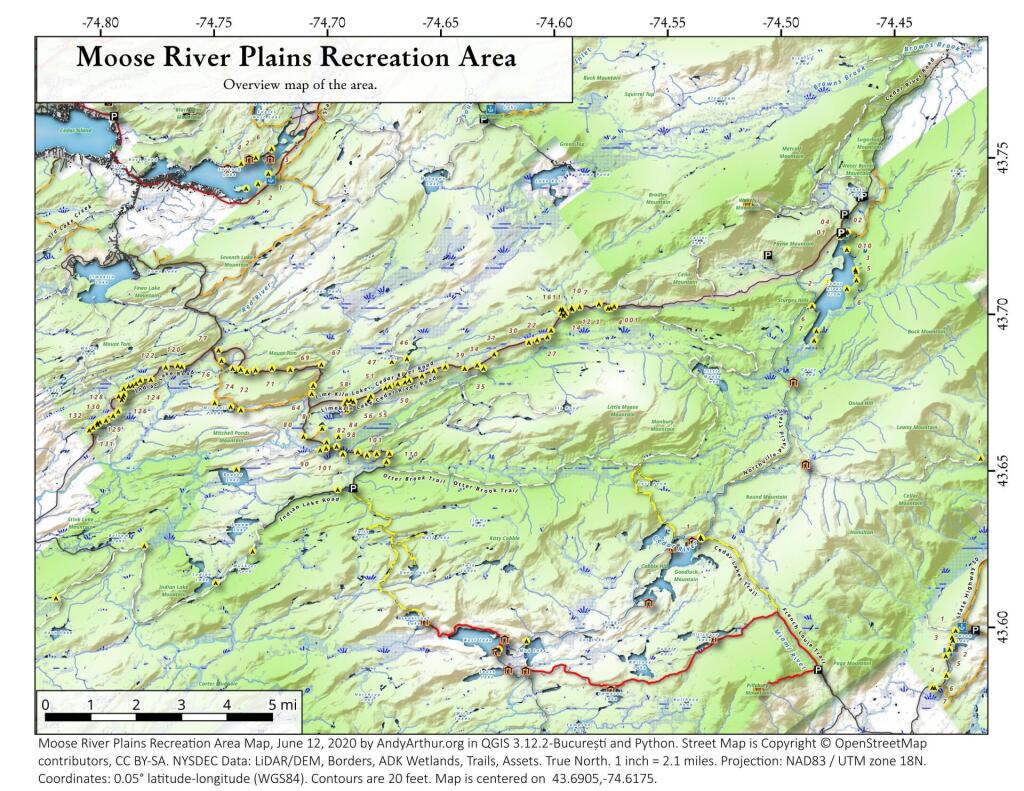
Moose River Plains Campsites

Interactive Map of Lean-Tos and Campsites

An overview map and list of campsites and their locations at the Moose River Recreation Area.

 Moose River Plains Recreation Area

Maps

Campsites

Milepoint Name Feature Notes Access Location
Cedar River Flow 1 Cedar River Flow Tent site on flow Boat 43.702924803151, -74.4871304116533
Cedar River Flow 2 Cedar River Flow Tent site on flow Boat 43.7104737708879, -74.4802343768254
Cedar River Flow 3 Cedar River Flow Tent site on flow Boat 43.7145237017622, -74.4679264444554
Cedar River Flow 5 Cedar River Flow Tent site on flow Boat 43.7111711590583, -74.4675178486588
Cedar River Flow 6 Cedar River Flow Tent site on flow Boat 43.7084767866376, -74.4717703157492
Beaver Lake Campsite Beaver Lake Site overlooks Beaver Lake Hike 43.6516613421651, -74.7407833400961
81 Icehouse Pond Accessible site at Icehouse Pond with privy Hike 43.6646602166505, -74.7029502913239
140A Indian Lake Campsite on Indian Lake, outhouse in bad condition Hike 43.6154753632731, -74.7499942080732
East of Muskrat Pond Indian Lake Trail Former roadside campsite, largely abandoned Hike 43.645116528704, -74.696221627206
46 Lost Ponds Trail Beyond the end of current Lost Ponds Road Hike 43.6868179572109, -74.6655581886723
47 Lost Ponds Trail Above Lost Ponds Hike 43.6859472953826, -74.6722052916864
Mitchell Pond 1 Mitchell Pond Tent site, bushwhack Hike 43.6729475881673, -74.7502538624373
Mitchell Pond 2 Mitchell Pond Tent site, bushwhack Hike 43.6716991892117, -74.7432124817486
64A Mitchell Pond (Accessible Campsite at End of Gravel Trail) Gravel path to site, wildrness privy Hike 43.6706136251028, -74.7387363015355
10 89 Beaver Lake Road Off Otter Brook Road, Sand Plains Vehicle 43.6583112347181, -74.7012491214803
11 90 Beaver Lake Road Off Otter Brook Road, Sand Plains Vehicle 43.6577446555162, -74.7038760912165
16 1 Cedar River – Limekiln Lake Road Driveway Along Tributary of Silver Run Vehicle 43.7033162602551, -74.5742148239156
16 3 Cedar River – Limekiln Lake Road Along Silver Run Vehicle 43.7027301523306, -74.5757742464803
16 4 Cedar River – Limekiln Lake Road Along Silver Run, driveway at Sharp S Turn Vehicle 43.7026421104662, -74.5769731929134
16 7 Cedar River – Limekiln Lake Road Along Silver Run Vehicle 43.7040070126376, -74.5809411044503
15 10 Cedar River – Limekiln Lake Road Old gravel pit, accessible Vehicle 43.7031498027862, -74.5893864145496
15 11 Cedar River – Limekiln Lake Road Across from 12 Vehicle 43.702458607149, -74.5926546451668
15 12 Cedar River – Limekiln Lake Road Across from 11 Vehicle 43.7028667147947, -74.5929833340894
15 13 Cedar River – Limekiln Lake Road Along Silver Run Vehicle 43.7010402113051, -74.5956355707995
15 14 Cedar River – Limekiln Lake Road Along Silver Run Vehicle 43.7010328498576, -74.597457469967
14 16 Cedar River – Limekiln Lake Road Access Road for 16/17/18 Group Vehicle 43.7025294616695, -74.5969885248639
14 17 Cedar River – Limekiln Lake Road Access Road for 16/17/18 Group Vehicle 43.7021028692463, -74.5966599329259
14 18 Cedar River – Limekiln Lake Road Access Road for 16/17/18 Group Vehicle 43.7023846304313, -74.5978818600647
14 19 Cedar River – Limekiln Lake Road Along Silver Run Vehicle 43.7003546491841, -74.5964872856253
14 21 Cedar River – Limekiln Lake Road Across road from Silver Run Vehicle 43.6957217888458, -74.6020563094081
13 22 Cedar River – Limekiln Lake Road Across road from Silver Run Vehicle 43.6935817523545, -74.6036764840587
13 27 Cedar River – Limekiln Lake Road Across road from Silver Run Vehicle 43.6926540634024, -74.6082201775478
13 30 Cedar River – Limekiln Lake Road Open Area in Woods Vehicle 43.6918525577623, -74.6118452191364
13 31 Cedar River – Limekiln Lake Road Near Marsh off Silver Run Vehicle 43.6881856235873, -74.6271629609656
12 34 Cedar River – Limekiln Lake Road Open Field Near Old Sly Pond Road Vehicle 43.6846954329325, -74.634678249126
12 35 Cedar River – Limekiln Lake Road Former Sly Pond Road Vehicle 43.6836690328942, -74.6318552827363
11 38 Cedar River – Limekiln Lake Road On Hill Overlooking Road, near start of Lost Ponds Area Vehicle 43.6836029270341, -74.6401393590772
11 39 Cedar River – Limekiln Lake Road Above CRLLR, start of Lost Ponds Area Vehicle 43.6841476346233, -74.6487511980121
11 40 Cedar River – Limekiln Lake Road Above CRLLR, start of Lost Ponds Area Vehicle 43.682942162164, -74.6537793571789
11 41 Cedar River – Limekiln Lake Road Above CRLLR, start of Lost Ponds Area Vehicle 43.681311345096, -74.6589116717693
10 42 Cedar River – Limekiln Lake Road Above CRLLR, start of Lost Ponds Area Vehicle 43.6799039050817, -74.6646031695507
10 43 Cedar River – Limekiln Lake Road Above CRLLR, start of Lost Ponds Area Vehicle 43.6793727911294, -74.6664156654099
10 44 Cedar River – Limekiln Lake Road West of Lost Ponds Road, Sand Plains Vehicle 43.678808787762, -74.6696555368193
10 50 Cedar River – Limekiln Lake Road West of Lost Ponds Road, Sand Plains Vehicle 43.677986610504, -74.6732025802129
10 51 Cedar River – Limekiln Lake Road Pull-Off, Small Site, Sand Plains Vehicle 43.6775108499728, -74.6750146421403
10 52 Cedar River – Limekiln Lake Road Old gravel pit, short loop below CRLLR Vehicle 43.6748840847288, -74.6815273754233
10 53 Cedar River – Limekiln Lake Road Access Road for 55/54/55 Group, Sand Plains Vehicle 43.6733317629897, -74.6820452615144
10 54 Cedar River – Limekiln Lake Road Access Road for 55/54/55 Group, Sand Plains Vehicle 43.673268538603, -74.6822820352903
9 55 Cedar River – Limekiln Lake Road Access Road for 55/54/55 Group, Sand Plains Vehicle 43.6733705968856, -74.6827076379887
9 56 Cedar River – Limekiln Lake Road Driveway, East of Former Dump, Sand Plains Vehicle 43.673126585883, -74.6891475571674
9 57 Cedar River – Limekiln Lake Road Has Trail to Moose River Vehicle 43.6736673106707, -74.6902687046523
8 64 Cedar River – Limekiln Lake Road Near Mitchell Pond Trail Vehicle 43.6757521870177, -74.707500815672
8 66 Cedar River – Limekiln Lake Road Near Pine Creek Vehicle 43.6784203854214, -74.7068492021325
7 67 Cedar River – Limekiln Lake Road Benedict Creek Road, Wooded Vehicle 43.6851041444828, -74.7031887110586
7 69 Cedar River – Limekiln Lake Road Remote site, perched over the road Vehicle 43.6834516958835, -74.7168906980223
6 70 Cedar River – Limekiln Lake Road Large loop off of CRLLR Vehicle 43.6839906014562, -74.7249870178447
6 71 Cedar River – Limekiln Lake Road Very sandy site near Mitchells Pond Upper Loop Vehicle 43.6833776353921, -74.7321947941391
5 72 Cedar River – Limekiln Lake Road At end of Bear Pond Loop Road (Accessable) Vehicle 43.6828956047277, -74.7359084701559
4 73 Cedar River – Limekiln Lake Road Very sandy site near Mitchells Pond Upper Loop Vehicle 43.6835777053685, -74.7387188889593
4 74 Cedar River – Limekiln Lake Road On a hill overlooking road and marshy area Vehicle 43.6839187521201, -74.742285779317
4 76 Cedar River – Limekiln Lake Road Very sandy site near Mitchells Pond Upper Loop Vehicle 43.6864452702399, -74.7471689344191
4 77 Cedar River – Limekiln Lake Road Near Red River, Bear Pond Loop, Sand Plains Vehicle 43.6897961458669, -74.7484803840413
10 58 Helldiver Pond Road Near Helldiver Pond Vehicle 43.6735979105991, -74.6920316000423
10 59 Helldiver Pond Road Near Helldiver Pond Vehicle 43.6723766419894, -74.6929318681131
10 60 Helldiver Pond Road Near Helldiver Pond Vehicle 43.6713193532923, -74.692758456613
10 61 Helldiver Pond Road Accessible site at end of Helldiver Pond Road Vehicle 43.6705019900204, -74.6921751440693
15 West of Brooktrout Trail Indian Lake Road Past Brooktrout Trail, on a hill over road Vehicle 43.6254538914434, -74.7337300739322
10 48 Lost Pond Road Sand Plains, Marshes Aroubnd Vehicle 43.6814268347573, -74.6667101324338
11 49 Lost Pond Road Sand Plains, Marshes Aroubnd Vehicle 43.6819456385478, -74.6670131106595
10 80 Otter Brook Road Has Trail to Moose River Vehicle 43.6620917920003, -74.7112181918076
11 98 Otter Brook Road Above Moose River on Hill Vehicle 43.6588725644731, -74.6966603409996
11 101 Otter Brook Road Sand Plains Vehicle 43.6564420559443, -74.6938956128147
11 103 Otter Brook Road Sand Plains Vehicle 43.657108724794, -74.6873446316172
12 104 Otter Brook Road Wooded Site Vehicle 43.6560617426567, -74.6832992891923
12 106 Otter Brook Road Wooded Site Vehicle 43.6565121581975, -74.6789913497265
13 110 Otter Brook Road Wooded Site Vehicle 43.6566072628101, -74.6733859460379
13 111 Otter Brook Road Near Otter Brook Bridge Vehicle 43.6539235327721, -74.6747718892435
23 1 Wakely Dam Camping Area Accessible site Vehicle (before gate) 43.7266767212397, -74.474100266424
23 2 Wakely Dam Camping Area Field Camping Vehicle (before gate) 43.7266515010084, -74.4733110730078
23 3 Wakely Dam Camping Area Field Camping Vehicle (before gate) 43.7259595122959, -74.473899965642
23 4 Wakely Dam Camping Area On Driveway to Lake Vehicle (before gate) 43.7260676922081, -74.4742326471903
23 5 Wakely Dam Camping Area On Driveway to Lake Vehicle (before gate) 43.7255637908987, -74.4741751228291
23 6 Wakely Dam Camping Area On Driveway to Lake Vehicle (before gate) 43.7252231337487, -74.4745830371916
23 9 Wakely Dam Camping Area Across bridge Vehicle (before gate) 43.726275356142, -74.4717840349063
23 10 Wakely Dam Camping Area Across bridge Vehicle (before gate) 43.7266308152758, -74.4712600272389
10 82 Otter Brook Road On Moose River Vehicle (driveway) 43.6603083771227, -74.7010353925305
11 84 Otter Brook Road On Moose River Vehicle (driveway) 43.6619962517853, -74.6957783254417
6 120 Natural Rock Dam Road Sand Plains near Red River Vehicle (Opens July) 43.6848543033273, -74.7664253595203
6 122 Natural Rock Dam Road Wooded Site Vehicle (Opens July) 43.684367353989, -74.7717171949716
6 123 Natural Rock Dam Road Wooded Site Vehicle (Opens July) 43.6804228755091, -74.7782951743141
6 124 Natural Rock Dam Road Wooded Site Vehicle (Opens July) 43.6792030487765, -74.7847972548314
7 125 Natural Rock Dam Road Wooded Site Vehicle (Opens July) 43.6783559964111, -74.7880327043169
7 126 Natural Rock Dam Road Wooded Site Vehicle (Opens July) 43.6748535298235, -74.790591643043
7 127 Natural Rock Dam Road Wooded Site Vehicle (Opens July) 43.6739776362472, -74.7910844137006
7 128 Natural Rock Dam Road Wooded Site Vehicle (Opens July) 43.6751413481917, -74.7924842843025
8 129 Natural Rock Dam Road Wooded Site Vehicle (Opens July) 43.6703784784539, -74.7926312803463
8 130 Natural Rock Dam Road Wooded Site Vehicle (Opens July) 43.6666270858056, -74.8019151989726
8 131 Natural Rock Dam Road Wooded Site Vehicle (Opens July) 43.6643581634434, -74.8054154753831
8 132 Natural Rock Dam Road Wooded Site Vehicle (Opens July) 43.6652083016168, -74.8036826184027
5 119A Natural Rock Dam Road Sand Plains near Red River Vehicle (Opens July) 43.6844716021433, -74.7646961785253
6 123A Natural Rock Dam Road Wooded Site Vehicle (Opens July) 43.6802422604152, -74.782965042166
6 124A Natural Rock Dam Road Wooded Site Vehicle (Opens July) 43.6785899888224, -74.7864319884685
6 125A Natural Rock Dam Road Wooded Site Vehicle (Opens July) 43.6776017274889, -74.7902229325712
7 126A Natural Rock Dam Road Wooded Site Vehicle (Opens July) 43.6756110574941, -74.7901645681643
8 129A Natural Rock Dam Road Wooded Site Vehicle (Opens July) 43.6689370211979, -74.7948887917477
8 129AA Natural Rock Dam Road Wooded Site Vehicle (Opens July) 43.6674497436753, -74.7980604042935
8 130A Natural Rock Dam Road Wooded Site Vehicle (Opens July) 43.6661052974262, -74.8016557609016
8 130AA Natural Rock Dam Road Wooded Site Vehicle (Opens July) 43.6669094078356, -74.8007390664074

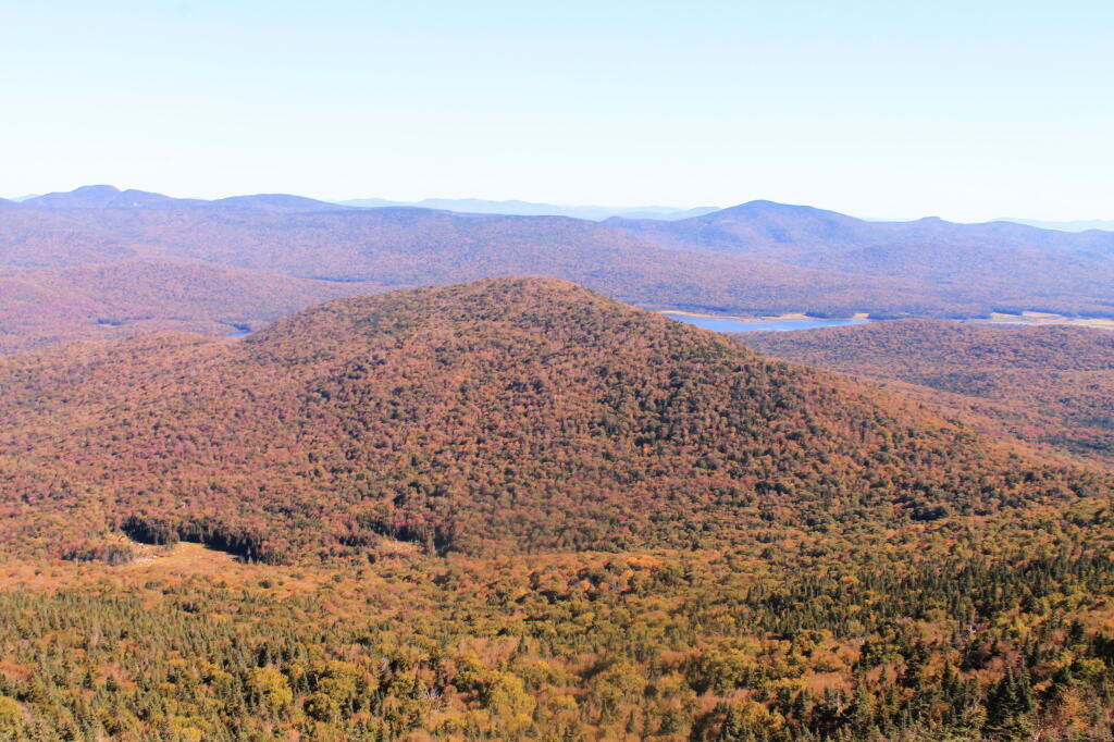
Payne Mountain with Cedar River Flow Beyond It

August 11, 2019 Morning

Good morning! Happy Sunday. Three weeks to the last Sunset Before 7:30 PM ๐ŸŒ†. Sunny and 63 degrees at the Burnt-Rossman State Forest. ๐ŸŒž There is a west-northwest breeze at 8 mph. Maybe even a bit more breezy here on the mountain ๐Ÿƒ. The dew point is 52 degrees. It’s actually warming up quite quickly this morning and the sun is nice on this mid August morning. Shocking to think how fast though summer is coming to a close.

I kind of slept in this morning as lately I’ve been not getting enough sleep. ๐Ÿ˜ด It’s such a pleasant morning and by the time I awoke I fell nice and refreshed. I do really love the wild country of the Northern Catskills and Schoharie County and this campsite is nice being a little more open and having cellphone service. Duck Pond is pretty on a nice morning like today and it’s nice to be away from it all for a while.

Today will be sunny ๐ŸŒž, with a high of 72 degrees at 3pm. Nine degrees below normal, which is similar to a typical day around September 16th. Maximum dew point of 53 at 10am. Northwest wind 8 to 11 mph. A year ago, we had light rain in the morning, which became light rain by afternoon. It became humid as the day progressed. The high last year was 71 degrees. The record high of 98 was set in 1944.

The sun will set at 8:04 pm with dusk around 8:35 pm, which is one minute and 23 seconds earlier than yesterday. ๐ŸŒ‡ At sunset, look for clear skies ๐ŸŒ„ and temperatures around 65 degrees. The dew point will be 52 degrees. There will be a west breeze at 7 mph. Today will have 14 hours and 3 minutes of daytime, an increase of 2 minutes and 26 seconds over yesterday.

Tonight will be mostly clear ๐ŸŒƒ, with a low of 56 degrees at 1am. Five degrees below normal, which is similar to a typical night around September 3rd. Maximum dew point of 52 at 6pm. Southwest wind around 7 mph. In 2018, we had light drizzle in the evening, which became mostly clear by the early hours of the morning. It was humid. It got down to 67 degrees. The record low of 46 occurred back in 1987.

I should think about taking down camp in a bit. โ›บ So I can get out fishing ๐ŸŽฃ and on with my day. It’s going to be another busy week but at least I hope to try to get to bed at a reasonable hour this week so I don’t get so tired out by the end of the week. It’s nice Schoharie County for a while and see the open country when it seems like the rest of the world is closing in. ๐ŸŒŽ It’s nice to know the whole world isn’t like Albany

As previously noted, there are 3 weeks until Sunset Before 7:30 PM ๐ŸŒ† when the sun will be setting at 7:31 pm with dusk at 8:00 pm. On that day in 2018, we had mostly cloudy and temperatures between 79 and 66 degrees. Typically, the high temperature is 77 degrees. We hit a record high of 96 back in 1953.

Sailor's Warning

June 11, 2019 Night

Good evening! Clear and 60 degrees in Delmar, NY. There is a northwest breeze at 7 mph. ๐Ÿƒ. The dew point is 48 degrees. Not a half bad evening for sitting out back but the migraine headache and achiness returned a bit. I was reading about somebody I’m Facebook friends with who was hospitalized after collapsing with after complications from Lyme disease. But who knows, it could also be mold exposure at home. But I did do my evening walk to burn off some calories from the work picnic.

Tonight will be clear ๐ŸŒƒ, with a low of 50 degrees at 5am. Six degrees below normal, which is similar to a typical night around May 26th. West wind 3 to 7 mph. In 2018, we had mostly clear skies. It got down to 57 degrees. The record low of 38 occurred back in 1972.

Tonight will have a Waxing Gibbous Moon ๐ŸŒ” with 80% illuminated. The moon will set at 2:38 am. The ๐ŸŒ• is on Sunday night with partly cloudy skies. The sun will rise at 5:17 am with the first light at 4:42 am, which is 7 seconds earlier than yesterday. ๐ŸŒ„ Tonight will have 8 hours and 43 minutes of darkness, a decrease of 37 seconds over last night.

Tomorrow will be sunny ๐ŸŒž, with a high of 77 degrees at 5pm. Typical for that day. Maximum dew point of 50 at 8am. Calm wind becoming south 5 to 7 mph in the afternoon. Should be a nice day if you’re not stuck in the office. I’ll try to walk outside to the capitol. A year ago, we had mostly sunny skies. The high last year was 82 degrees. The record high of 95 was set in 2017.

Nice weather expected for Saturday based on the latest forecast. Saturday, partly sunny, with a high near 78. โ˜€ Maximum dew point of 57 at 7pm. Sunday, a chance of showers and thunderstorms. Mostly cloudy, with a high near 78. โ˜ Chance of precipitation is 50%. Maximum dew point of 65 at 5pm. Typical average high for the weekend is 78 degrees.

Unless something changes I doubt I’ll get out of town for the weekend. But I will hopefully have time for a few more projects around home. ๐Ÿก Even if I’m not working Saturday I expect a late night on Friday so I’ll be too tired to get packed and head out of town. Once I finish my next wiring project on the truck I’ll doubt I’ll ever change things again. It will be interesting having the power meter on solar panel to see how much power is actually being produced.

I got the three USB cables I ordered a few weeks back from China. ๐Ÿ”Œ They’re like $2.80 for 1.5 meter or roughly 5 foot high quality cables on AliExpress. Sure they took like 3 weeks to arrive but they’re better quality than Walmart for a fraction of the price. These will be left in my truck for powering various devices. I have similar ones I use inside that have proven to be very durable and long lasting. UGreen is a great brand on AliExpress and also very lightly packaged for minimal waste.

I was kind of hoping for the barometric pressure sensors to arrive but no luck on that front. They’ll get here eventually from China. I think they’ll be a lot of fun to program when I get them and wire them up to the VMS display in my bedroom. ๐Ÿ“Ÿ I really should make more time with the soldering iron.

I’m looking at the third week of July for my summer vacation this year. A week earlier than many years due to my dentist appointment. โ›บ I’ve thought about going to the Adirondacks and camping at different locations throughout the week but I really enjoy spending my summer vacation at the campsite on Chicken Coop Road in the Finger Lakes National Forest and visiting state parks throughout the week. Although maybe the Adirondacks would be nice for a change, especially poking around the Western Adirondacks which I haven’t done in several years. ๐Ÿ—ป

In four weeks on July 9 the sun will be setting at 8:34 pm,๐ŸŒ„ which is one minute and 17 seconds later then tonight. In 2018 on that day, we had hot, sunny and temperatures between 92 and 61 degrees. Typically, you have temperatures between 82 and 61 degrees. The record high of 103 degrees was set back in 1936.

Looking ahead, Primary Day ๐Ÿ—ณ๏ธ is in 2 weeks, Last Sunset After 8:30 PM ๐ŸŒ† is in 5 weeks, September 11th ๐Ÿ‡ธ is in 3 months, Constitution Day ๐Ÿ“œ is in 14 weeks, October ๐Ÿ›ฅ is in 16 weeks and Election Day 2020 ๐Ÿ—ณ๏ธ is in 73 weeks.

I expect a long day at work tomorrow so I should probably retire to bed. Good night. ๐Ÿ˜ด

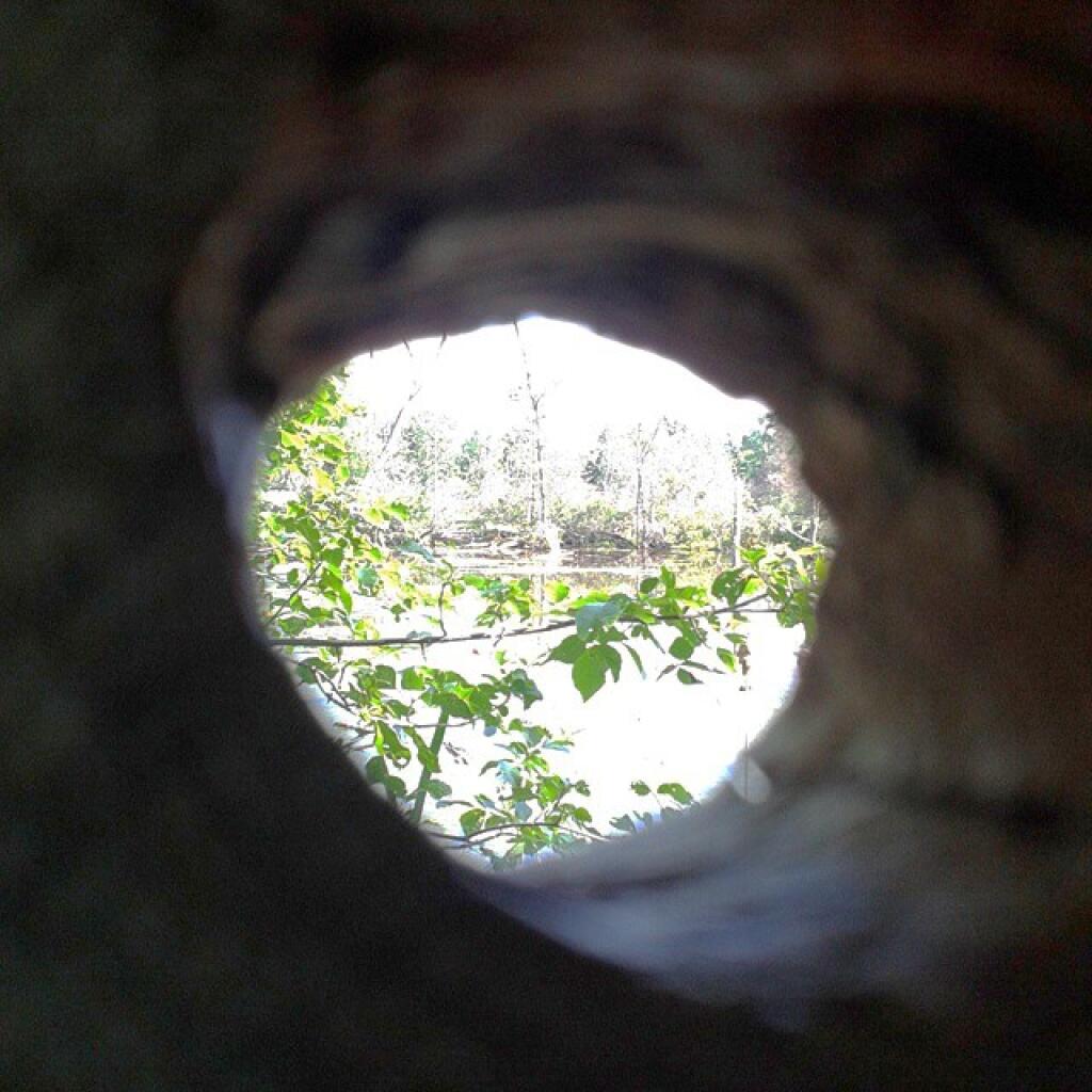
Hole

May 11, 2019 Night

Good evening! Partly cloudy and 50 degrees with the moon overhead camping here at Stewart Landing. ๐ŸŒœ There is a north breeze at 6 mph. ๐Ÿƒ. The skies will clear Wednesday around 9 am.

Laying back in the hammock, listening to music, relaxing. ๐ŸŽถ A very nice evening for sure. I have all warm white lights hung up for a change, I bought one of the strings at an after Christmas sale. They are in some ways nicer than the colored strings. The hammock is nice, first time using it camping since Labor Day although it still fairly cold so I’ll sleep in the truck.

The truth be told I’m not a big fan of the campsites up at Stewart Landing as they are too closely spaced in my book for a true wilderness experience and they are muddy with too much litter but it was a nice day hiking back to Hilderbrant Vly and Glasgow Pond, finally spelled correctly. ๐Ÿšถ Ten mile round trip and the trail is lightly used, not too eroded although lots of flooding and mud holes due to the old roads being lower than the surrounding lands. I doubt I’ll ever come up here again but change is good as are new adventures. I have to say this was first adventure I’ve done in a long time I’ve truly enjoyed. I like being in the wilderness and doing something new and different for a change.

I’ve fallen into the trap of doing the same thing week after week but sometimes changing things up can make time go by slower,โณand make things more memorable and enjoyable. I mean that I like the potholers but I feel like I go up to Piseco-Powley Road and Moose River Plains so much it’s getting boring. I haven’t made any decisions yet but I really should do something different for my summer vacation and not do the same thing in the Finger Lakes National Forest yet again.

Once black fly season is done, ๐Ÿœ I’m going to do more wilderness lightweight hammock camping. โ›บ I would probably truck cap camp the first night driving up from Albany and on Saturday hike back in the wilderness with minimal gear – flashlight, hammock, can of something for dinner or frozen hot dogs, pan for cooking, phone for music, and a battery pack for backup.

Tonight will be mostly cloudy ๐ŸŒฅ, with a low of 41 degrees at 4am. Five degrees below normal, which is similar to a typical night around April 27th. North wind around 6 mph becoming light and variable after midnight. In 2018, we had cloudy skies in the evening, which became light rain by the early hours of the morning. It got down to 48 degrees. The record low of 29 occurred back in 1969. I don’t think we have to worry about ice tonight.

Tonight will have a Waxing Gibbous Moon ๐ŸŒ” with 62% illuminated. The moon will set at 2:27 am. The Full Moon whose name I forget ๐ŸŒ• is on Friday night with a chance of showers. The sun will rise at 5:39 am with the first light at 5:06 am, which is one minute and 9 seconds earlier than yesterday. ๐ŸŒ„ I wake up so early with the early sunrise. Tonight will have 9 hours and 26 minutes of darkness, a decrease of 2 minutes and 13 seconds over last night.

Tomorrow will have a chance of rain, mainly after 3pm. Cloudy ๐ŸŒง, with a high of 53 degrees at 4pm. 15 degrees below normal, which is similar to a typical day around April 4th. Southeast wind around 9 mph. Chance of precipitation is 30%. New precipitation amounts of less than a tenth of an inch possible. A year ago, we had mostly sunny skies. The high last year was 50 degrees. The record high of 91 was set in 1881. There was a dusting of snow in 1996.โ„

In four weeks on June 8 the sun will be setting at 8:37 pm,๐ŸŒ„ which is 25 minutes and 10 seconds later then tonight. Remarkable to think June is only a month away. That weekend I might be up at Piseco-Powley Road and might do the potholers and maybe visit Little Falls. In 2018 on that day, we had mostly sunny and temperatures between 80 and 58 degrees. Typically, you have temperatures between 76 and 54 degrees. The record high of 93 degrees was set back in 2011.

Looking ahead, okay I remember the Flower Moon ๐ŸŒ• is in 1 week, June ๐Ÿน is in 3 weeks, Average High is 80 ๐Ÿ– is in 6 weeks, Hottest Time of the Year ๐Ÿ˜… is in 9 weeks, Ugly Truck Day ๐Ÿšš is in 10 weeks, Average High Falls To 79 ๏ธDegrees โ›ฑ๏ธ๏ธ๏ธ is in 15 weeks, September 11th ๐Ÿ‡ธ is in 4 months and Average High 70 ๐ŸŽ‘ is in 19 weeks.

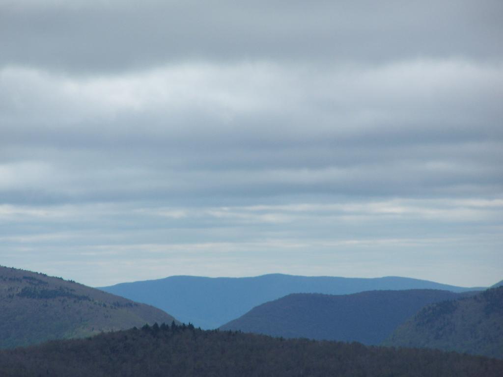
Sheridan Mountain Beyond Devil's Clove

May 11, 2019 Morning

Good morning! Happy Saturday. Finally the weekend! The Sunday before Mother’s Day. ๐Ÿšบ Next Saturday is Flower Moon ๐ŸŒ•. Partly cloudy, but clearing and 53 degrees โ›… up at Stewart Landing campsites in the Adirondacks. ๐Ÿ—ป There is a west-northwest breeze at 9 mph. ๐Ÿƒ. A bit chilly when the sun dips under the clouds, laying back in the hammock with the breeze blowing around. The skies will clear around 11 am.

At 4:15 pm Friday I decided to come up camping. โ›บ I had nothing packed or bought for food ๐Ÿฒ but I decided to leave work, grab my camping gear and head out. I figured I would beat the severe thunderstorm getting home โšก and then get packed while it was ongoing and from there after it was over, after rush hour head out of town. I stopped for some groceries and gas and went out to Stewart Landing. I got caught off at the same exit on the Crosstown Arterial in Albany I got rear ended on five years ago but this time I was able to avoid an crash though horns were mashed and brakes slammed. I may have urinated a bit in my pants over that. Yikes. ๐Ÿ˜ฎ People ask why I ducking hate motoring so much. The Thruway was completely blocked for a while due to a motorcycle crash, according to the CB radio ๐Ÿ“ป but after 15 minutes it freed up and I was moving. It such a ducking bad drive up here with smearing rain the whole way.

Because I had to shop, get gas and get packed, despite leaving work early, I didn’t get to camp until close to 8:15 around dusk ๐ŸŒ† but the campsite was fine except for the litter ๐Ÿšฎ, broken glass and thumb tack ๐Ÿ“ I had to clean up. A lot of litter around here I had to pick up which was annoying but the campsite is mostly cleaned up and I fixed up the fire pit. I’ll bring some of the litter home but the bigger stuff – burnt chair frame, burnt out car radio, lots of burnt wire – I’ll just toss in the pile of other debris back in the woods. It’s at least out of the way for now. I wish people wouldn’t litter – pack out your garbage. If something doesn’t burn fully, haul it out. I don’t understand why they wouldn’t scrap the burnt wire at least that was all over the campsite. Nobody wants to be tripping over wire or broken glass in the darkness.

Things are fairly dry up here ๐Ÿ‘ขbut there is a pretty deep and rocky mud hole on the driveway to the campsite โ›บ so I don’t want to drive through it unnecessarily to visit Little Falls today and I’m kind of annoyed about what happened yesterday driving up here. I just don’t want to hit one of those big rocks and bend or break a suspension component. Instead I’ll probably hike back to Hildervaldnt Vly from camp and enjoy the beautiful day in the wilderness. The sun is already charging the battery ๐Ÿ”‹ and I expect a good charge with all of the sun.

After I started setting up, somebody took the campsite just down the road, started a big fire ๐Ÿ”ฅ then packed up and left. Odd. That’s one of the reasons I’ve never camped down here as there isn’t a lot of space between the campsites – the nearest one is about 250 ft away. Not the mile plus of many of the Pisceo Powley sites. But quiet up here today, I can certainly listen to my music later on without bothering folks.

Today will be partly sunny ๐ŸŒž, with a high of 57 degrees at 2pm. 11 degrees below normal, which is similar to a typical day around April 13th. Northwest wind around 10 mph. A year ago, we had mostly sunny skies. The high last year was 66 degrees. The record high of 90 was set in 1911. .5 inches of snow fell back in 1907.โ„

The sun will set at 8:11 pm with dusk around 8:44 pm, which is one minute and 6 seconds later than yesterday. ๐ŸŒ‡ At sunset, look for partly cloudy skies ๐ŸŒƒ and temperatures around 52 degrees. There will be a northwest breeze at 7 mph. Today will have 14 hours and 32 minutes of daytime, an increase of 2 minutes and 15 seconds over yesterday.

Tonight will be mostly cloudy ๐ŸŒฅ, with a low of 38 degrees at 6am. Eight degrees below normal, which is similar to a typical night around April 18th. Northwest wind 5 to 7 mph becoming light and variable in the evening. In 2018, we had cloudy skies in the evening, which became light rain by the early hours of the morning. It got down to 48 degrees. The record low of 29 occurred back in 1969.

As previously noted, next Saturday is Flower Moon ๐ŸŒ• when the sun will be setting at 8:19 pm with dusk at 8:52 pm. On that day in 2018, we had partly cloudy and temperatures between 73 and 51 degrees. Typically, the high temperature is 70 degrees. We hit a record high of 94 back in 2017.

I should probably finish securing camp and head out on the trail. The hammock, sun and breeze are nice although I did just see my first black fly ๐Ÿœ of the year…..

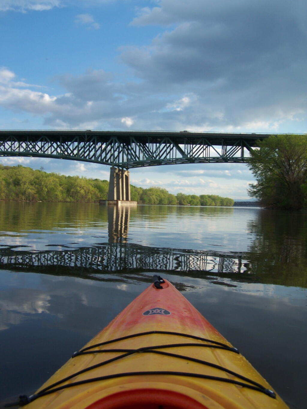
Patroon Island Bridge Reflects Onto the River