Search Results for: mountain home road

I decided to go on a little road trip

I really haven’t gotten much out of the Capital Region in recent months bar the December trip to Kingston and Mount Tremper, along with the January 1st trip to North-South Lake, and my mini-trip to Schoharie County. It was cold out and I really wanted to get out, and not spend another boring Saturday night at home. Gas is cheap, figured I’d take a trip before it gets really expensive again.

I decided to take US 20 out to Pittsfield MA and then head east on MA 9 towards Northampton. Never been over that road, and I knew once I got out of Pittsfield I would loose the traffic and it would be quite scenic.

Rural Massachusetts state roads kind of sucks. They are narrow, windy, and steep. But the scenery is well worth it, especially MA 9 as it winds through various mountains and state forests. I kind of wanted to see the Pioneer Valley as it had been years since I had been out that way.

I forgot how built up the Pioneer Valley really is. I thought I’d be out in the sticks in farm country for most of the trip but Northampton and towns North of it in the Pioneer Valley are fairly populous suburbs of the Springfield MA metropolitan area.

It’s not to say there aren’t farms in the Pioneer Valley, it’s just there more smaller crop farms that were formerly tobacco farms. Still many of the tobacco drying barns still exist – they’re pretty neat, large barns. But I was envisioning Preble NY with it’s large dairies, not a lot of sprawl and only a little open land.

Got on MA 116 heading towards Ashland and Conway. What a pokey little road, that literally is an unimproved except for blacktop road. They certainly didn’t remove any curves from it. The gorges and streams it followed were beautiful, wild country but like most of New England, there were plenty of uppity little but bustling villages. Outside of the villages there really was nothing.

I think in the whole time I was in Massachusetts, I saw one operating dairy farm and maybe one other farm that had a few beef cows. Just not a lot of agriculture going on in Western Massachusetts. I guess the soil is too poor to grow field crops like New York.

Western Mass also seemed a lot more populous, although the population was a lot more concentrated than upstate, at least away from the Erie Canal and Hudson River.

It started to get dark as I reached Buckland, which is as podunky as it sounds. Which sucked, as I ended up driving the Mohawk Trail from the Pioneer Valley outskirts to North Adams, which is basically a blacktop trail through the mountains. The headlights worked fine except they were a bit dim but still blinded folks. Silly headlights on my lifted truck.

The Hairpin Overlook was pretty after dark. As was the Taconic Trail Overlook, although the snow was deep when I went for a short hike up there. Couldn’t see the Empire Plaza buildings from there, but it was pretty.

A long trip but pretty. I like getting out and seeing new places in the wild country – the shacks, the mountains, the farms, and everything else not so perfectly dominated by man.

Weekend at Bear Springs Mountain, Delaware Wild Forest, Warren Highlands

Based on the forecast for the long weekend, I decided to head down to the Western Catskills rather then Moose River Plains. It certainly was a bit sunnier, drier, and less snowy then it looks like they got up at Moose Plains. I simply did not another Memorial Day Weekend at Moose Plains, sitting in rain and snow showers.

I ended up heading down to the Western Catskills. Didnโ€™t leave home until after 10 AM, because I was putzing around. So be it. I also had to stop at Walmart to buy another blaze orange hat, for hiking, because I lost mine. I knew it would be hunting season down there, and figured better safe then sorry. The previous night, they didnโ€™t have one at Glenmont Walmart, so had to visit the Decided to head out the Warren Anderson Expressway (I-88) down to NY 10, and take that all the way south to Walton.
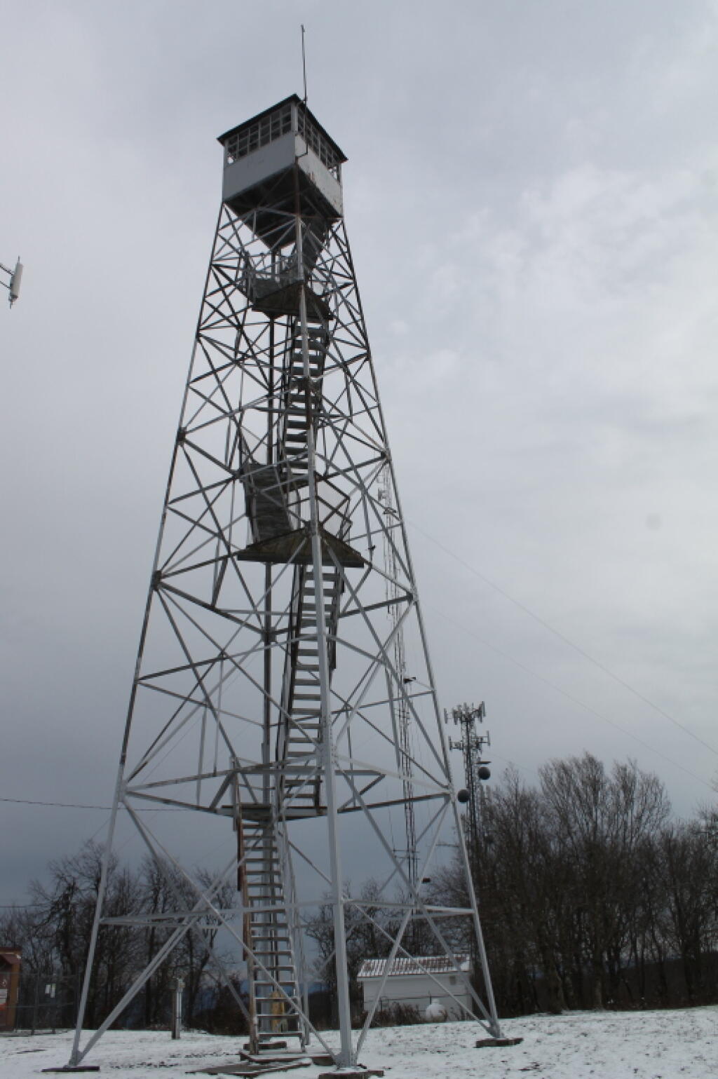
Fire Tower

Driving down NY 10, as soon as I reached Summit, you could see a dusting of snow on the summits around. Stopped in Stamford, drove up to Mount Utsaythana. There was a dusting of snow there too, in parts it looked like a winter wonderland. Then it was down to Walton, following NY 10 and the East Branch of Delaware River. Drove through Delhi, a small rural college town. I had been through Delhi years ago, meandering around Stamford, but not in years. Then I went down to Walton, climbed an enormous hill in the truck, and was at the Bear Spring Mountain Wildlife Management Area (aka Public Hunting Grounds).

At Bear Spring Mountain WMA there is a state DEC campground known as Bear Spring Mountain Campground. It consists of two parts, a fully developed campground with hot showers that is open during the summer months near Launt Pond, and the Spring Brook area with stud pends and a pit privy, similar to Charles Baker State Forest. Both areas are a $18 a night in summer, but from October to the end of hunting season, the lower area is free, but the water is shut-off down there. The designated campsites there are crunched together, and there is no privacy, so I canโ€™t imagine itโ€™s much fun camping there, especially with the smell of horses on a hot summerโ€™s afternoon.

By the time I got down there, it was fairly early, so decided to explore a bit. Drove up to Corbett, explored the Corbett Suspension Bridge, and an old chimney from the โ€œacid factoryโ€, which made an acid from tree bark for smokelesss gunpowder. Decided to head back and explore Bear Spring Mountain WMA a bit more, and drove up West Trout Brook Road, past several hunters. There are some limited views from end of East Trout Brook Road, namely at the summit Bear Spring Mountain. There are better views from NY 206, climbing up from Walton, but with few view points. Also explored Beers Brook Road, which had some limited but nice views into the valley below, and Russ Gray Pond.
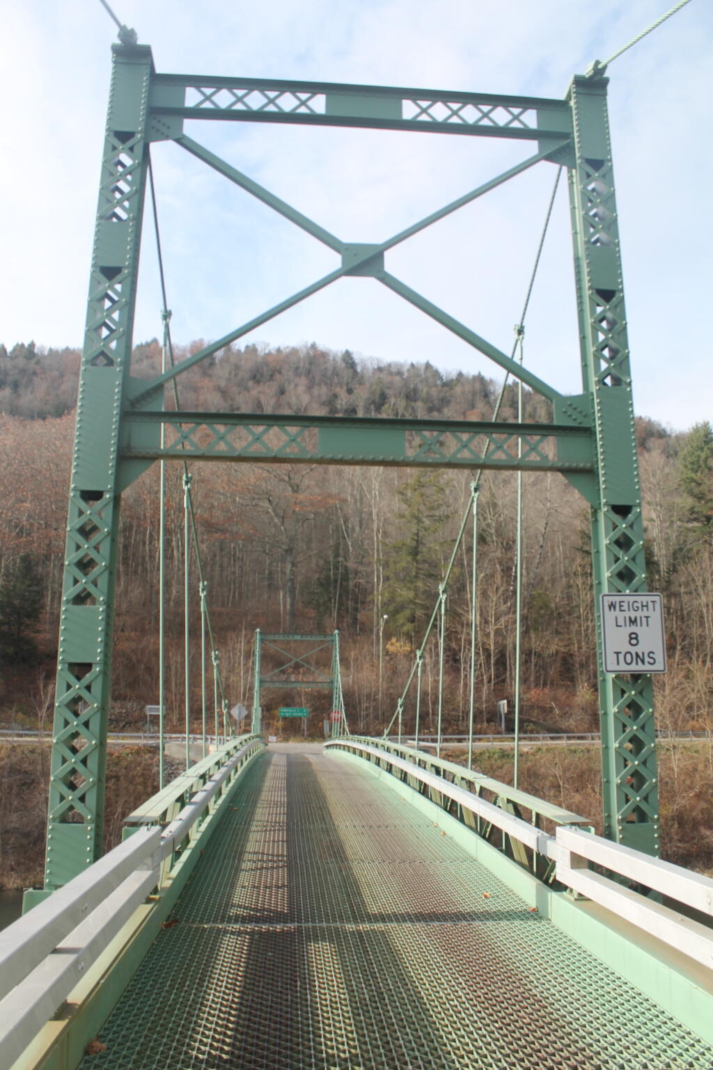
Bridge Tower

Bear Spring WMA, being a federally-funded public hunting grounds, does not allow camping. The only camping there is those tiny, smashed together developed campgrounds known as the Bear Spring State Campground, operated by the DEC. I decided it was getting late, and I would camp there tonight, especially because it looked like one of campers had packed up, and the only other person around, was a female bow hunter, on far end of the campground. I wasnโ€™t thrilled, as it meant I would have to keep the music down, but at least the campground was deep in the valley, protected from the wind.

It wasnโ€™t a bad night though. The pit privies were kind of gross, but probably not worst then most of the outhouses in the woods. There was surprisingly a lot of wood in woods near the campground. The truck worked well with keeping the lights on, since switching the truckโ€™s radio back to the starting battery and evenly discharging both batteries. The radio shuts off automatically when the starting battery is starting to get a bit low, and Big Redโ€™s DIC says โ€œBattery Low: Start Engine Lowโ€. Previously, with the starting battery at full charge, hooked up to the discharged auxiliary battery, the alternator wouldnโ€™t kick up to full charge, so the auxiliary battery would fail to get fully charged. Now, with the starting battery slightly discharged โ€“ but with enough charge to crank the engine, things kept working well all night long. There was a little bit of sleet in the evening, but nothing major.
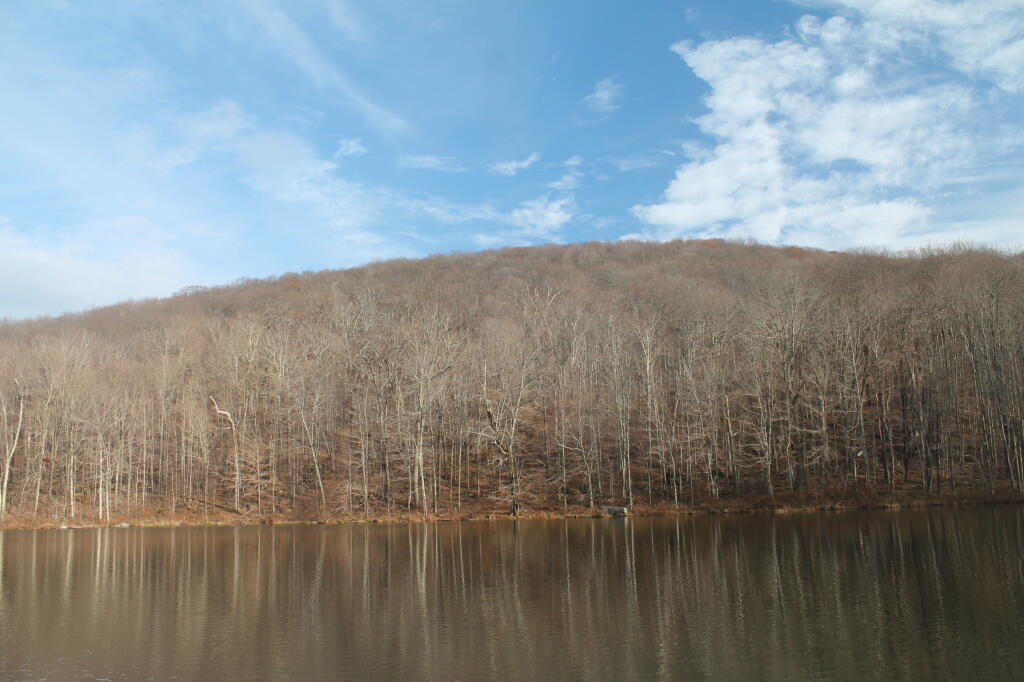
Russ Grey Pond

The next morning, I got a slow start. It was drizzling, and I kind of slept in. I didnโ€™t have a tarp set up, which didnโ€™t help. I probably didnโ€™t break camp until 10:30 AM..I was thinking of hiking the NYC DEP trail that overlooks the Pepacton Reservoir, but I ended up turning off onto Holiday Brook Road, and deciding to check out Huggins Lake. Hugging Lake was a nice hike back, following an old woods road back there. There is a campsite down by the lake. Apparently on the ridge above Huggins Lake, there is an old growth forest, but I never got back there.

Then it was off to Mary Smith Road. On Campground Road, one of the cut-over roads, I got to a cover bridge, which had a clearance of 6โ€™6โ€, which is about an inch too low for my pickup truck with the cap and racks on. So I had to turn around, and back track for about 5 miles. That sucked. Stopped and grabed a few pictures. When I got on Mary Smith Road, and back in forest preserve, I was pleasantly surprised to find three roadside campsites on it. I ended up camping at the most used of the sites โ€“ as witnessed by vegetation โ€“ along the Finger Lakes Trail/Mary Smith Trail/Middle Mountain Trail. It was a pretty nice roadside campsite.

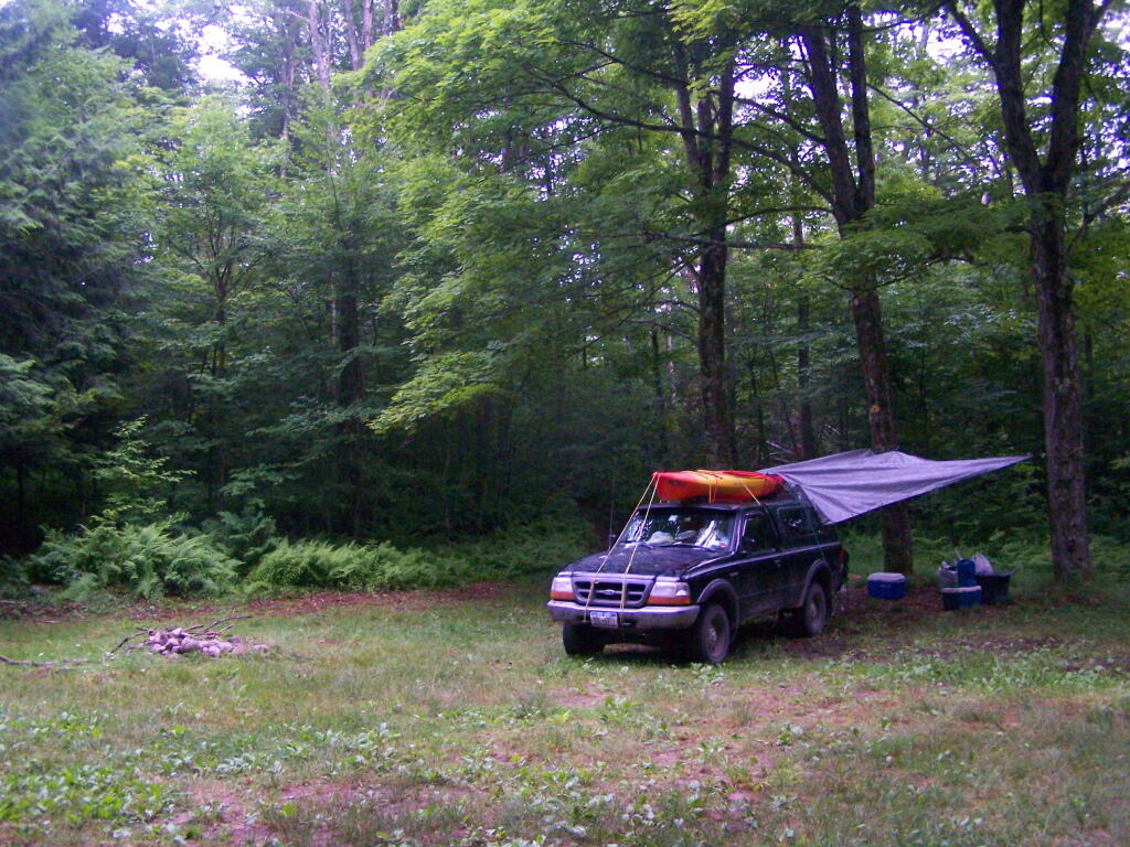
About as soon as I scoped out the campsite, I realized it would be a pretty night up there. Despite the mountains on both sides, the north wind was whipping along the col. But I liked the campsite, and there was plenty of trees to hang a tarp up. I starting setting up camp at 2:30 PM โ€“ which was kind of early โ€“ but I figured it was too late to hike Mary Smith Hill (which wasnโ€™t true), but it did start to rain/sleet a bit. Got the tarp up, then the lights strung up and flag up. A heavy sleet squall pounded the col, for a while bad enough I hid out in the cab of the truck. Then I went out, built a fire, and spent sometime listening to a podcast and reading a book about the 1964 World Fair in New York.

The new 60-watt equivalent LED bulb I bought worked real well in the cold, which got down below freezing that night.. But with the bulb focused on the book, it was easy reading and plenty bright. In the cold, the 60-watt equivalent LED bulb was actually brighter then the 100-watt florescent bulb I had at camp, even after fully warming up, because the cold wind made it impossible for the florescent tube to get warm enough to fully atomize the mercury in the fixture.

At times the wind picked up, and it was pretty darn cold, to say the least. I end up putting the fire out cold before bed, to reduce the risk of the fire spreading, and because the tarp partially covered the fire pit, I was afraid it could fall into the fire, and possibly set the truck on fire or cause dripping plastic to fall on it. The fire was out cold, and I went to bed around 10:30 PM. No nightmares.
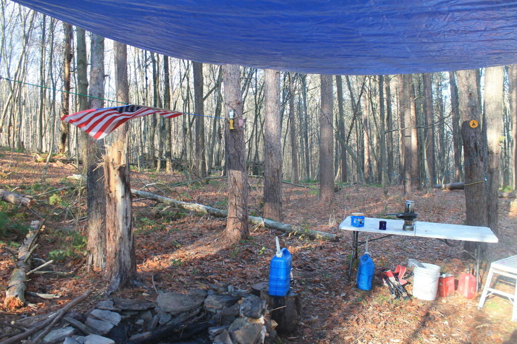
Mary Smith Hill Roadside Campsite 1

After bedding down, the wind started to whip around. It literally was howling, and the tarp was snapping up and down, making quite a bit of noise. Morning came, and it was beautiful blue skies, but very cold. That was when I first saw car actually pass by on Mary Smith Hill Road โ€“ despite being a through-road, and not a super remote road at that. Had another slow breakfast, and built a small fire to burn up some camp garbage. Usually I donโ€™t start fires in the morning, but I was chilly, and knowing that it may be a while until I got out camping again, I wanted to have a fire.

Once I finally got going, I hiked up Mary Smith Hill to the overlook. It really was a lot less further then I expected, and ha+d some interesting views to the north. Nothing totally breathtaking, but still an interesting short hike of maybe 20 minutes each way. Then I drove over to Russell Brook Falls, making a wrong turn and ending up going through Livingston Manor and the world famous fly fishing town, Roscoe. My impression of Roscoe, was it was a very a long and pokey 30 MPH zone, but with more stores then one would expect in such a rural, small town. I probably should have stopped, but I was burning daylight.

Finally made it to Morton Hill Road, and passed a Game Warden in a unmarked green suburbanite-style Jeep. The only reason I know that, was I saw him outside of the car talking to somebody in full uniform. Morton Hill Road climbs a lot from Roscoe out to where it hits Russell Brook Road. There are three campsites along Russell Brook Road, although in all of them there is a boulder barrier between the campsite and fire pit. One might still be able to use them for a pickup with a camper on them, I guess.
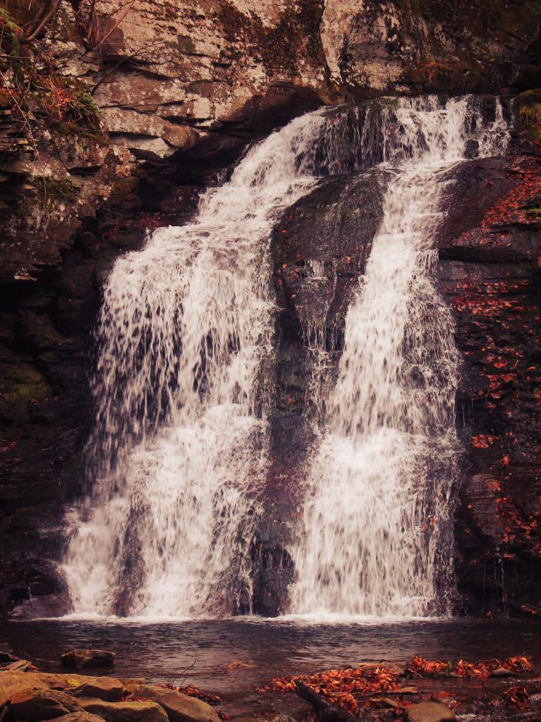
Russell Brook Falls 2

I hiked back to Russell Brook Falls โ€“ a beautiful but relatively unknown set of falls โ€“ at least to non-regulars to that part of state. They are less then quarter mile from the Russell Brook Falls parking area. I stopped and grabbed some pictures. Then, itโ€™s easy hike back to back to Trout Pond, following a gated road 9/10th of a mile from the parking area. There is a slight incline on the road, but nothing to make one break a sweat, even a fat out of shape dude like me, who spends too much time sipping cold buds in the woods. The road is a designated route for people with disabilities โ€“ somebody very strong with a wheel chair could theoretically get back there, or maybe with a CP-4 disabled with an ATV permit.

Back at Trout Pond, there is a campsite on the easterly end, and the gated road continues to the west end of lake. On the west end of the lake, there are two other campsites, spaced a ยผ mile apart, along with two lean-tos. All are designed for those with disabilities. There is also a trout spawning shelter on one of the creeks leading into lake. One of the lean-tos was well equipped โ€“ somebody left behind some nice pots and pans, all cleaned up, and a selection of perfectly good adult beverages and soda along the back wall of the lean-to. Talk about paying it forward to the next person who will use that lean-to โ€“ most certainly a hunter this time of year.

Itโ€™s small game hunting season, heard several small game bullets ring out, while hiking back there. No hunters nearby, as far as I could see, but I did wear plenty of blaze orange. I am sure next week, there will be a lot more hunters back there. Wish them luck. Hiked back to my truck and explored Campbell Mountain Road and Campbell Brook Road, looking for additional roadside campsites, preferably the kind you can back a pickup all the way back to. No such luck. Oh, well.
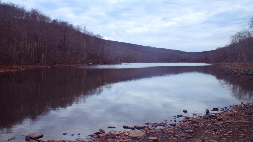
Trout Pond

Then I drove down NY 30, through the hamlet of Harvard, then East Branch. Took Old Route 17 to Hancock, then poked around the Poconos and the Warren Highlands in Pennsyltucky, before eventually ending up in Susquehanna and Great Bend. The area around Hancock is very mountainous and beautiful. The Warren Highlands were rough, mostly hunting and rural landscape country, with a relatively small amount of farming going on. Lots of open burning going on too โ€“ I love Pennsylvania..

I love that wild country, and everything Pennsylvania. Fueled up, picked up certain Pennsylvania products not legal in New York and/or cheaper then New York, then hopped on I-88/Warren Anderson Expressway, and made a bee-line back to Delmar, stopping only momentarily at the rest stop on I-88. That place was creepy as all hell after dark, and not well lit either. I seriously thought of just taking a piss in some farm

I made it back to Delmar around 7 PM. It was a good adventure. Burned through more gasoline, then I had planned, although on the trip back along I-88, I average 19.9 mpg in my Big Red Silverado pickup, so not complaining.

A long-weekend trip in early November to explore the the Western Catskills.

Smith Road Campsite 1

There are three major dead-end roads in the Independence River Wild Forest, which each have 10 campsites on them. This review focuses Smith Road Campsite 1, which is the nearest campsite to the end of Smith Road, near where it intersects Number 4 Road. This campsite is located where the old ranger’s cabin was located, and there is a trail in the woods, to the location of the long-removed Number 4 Firetower.

Rankings: Campsites are ranked from 0 to 10, based on the described attributes.

Overall 8 Lack of Enforcement Presence 6
Scenic Beauty 5 Facilities 7
Cleanliness 9 On-Site Attractions 2
Privacy 8 Nearby Attractions 5
Layout 10 Cellphone and Data Services 8

Rainy Morning

Location:
  • Roughly 1/8th mile south of Number Four Road at Smith Road, Number Four, NY
  • Roughly 18 miles east of Lowville
  • N 43.85489 W 75.19837
Cost:
  • No charge
  • 3-nights maximum stay at this site except by FREE camping permit for up to 2-weeks which can be obtained from Forest Ranger John Scanlon at 315-376-3225, Cell: 315-542-4773 (more info).
Facilities:
  • 6 hardened gravel campsites.
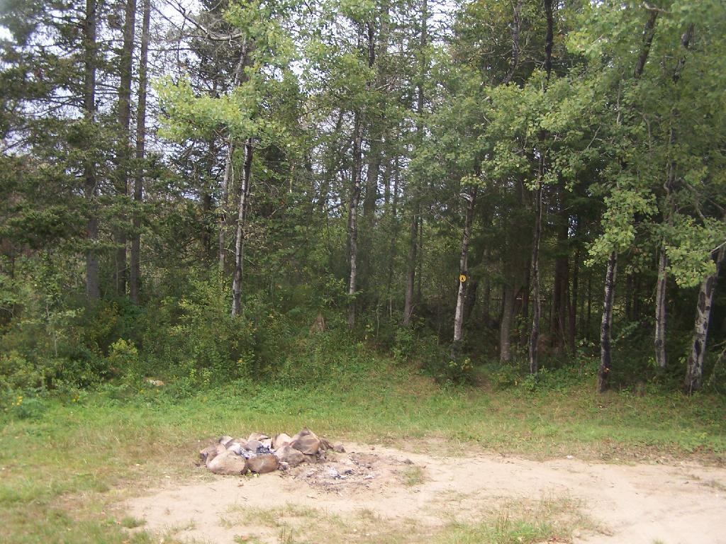
  • Stone fire ring.
  • Open, grassy field.
  • No outhouses.
  • Good cellphone, modest 3G data service.
Vehicles:
  • Small trailer
  • Large trailer
  • Tent
Attractions on Site:
  • Former site of Number Four Firetower. The fire tower has been moved to the Lowville Demostration site.
Attractions Nearby:
  • Francis Lake (5 miles east on Stillwater Road)
  • Stillwater Lake (12 miles east on Stillwater Road)
  • Otter Creek Trail System โ€“ Equestrian, Off-Roading, Open Lands, Mountain Bike (20 mi south-east)
  • Lowville village (18 miles north west)
  • Lowville Demonstration Site (22 miles north west)
  • Tug Hill State Forest/The Gulf (45 miles north west)
Sanitation:
  • Water from Otter Creek โ€“ Boil before drinking or cooking
  • No outhouses โ€“ Dig hole in woods, burn toilet paper
  • Burn combustible garbage, take cans home for recycling
  • Make sure firepits and campsite are clean before leaving
Restrictions on Use:
  • 3-nights maximum stay at this site.
  • Except by FREE camping permit for up to 2-weeks which can be obtained from Forest Ranger John Scanlon at 315-376-3225, Cell: 315-542-4773 (more info).
  • Seasonal use road, the last 1/8 mile from Number Four Road.

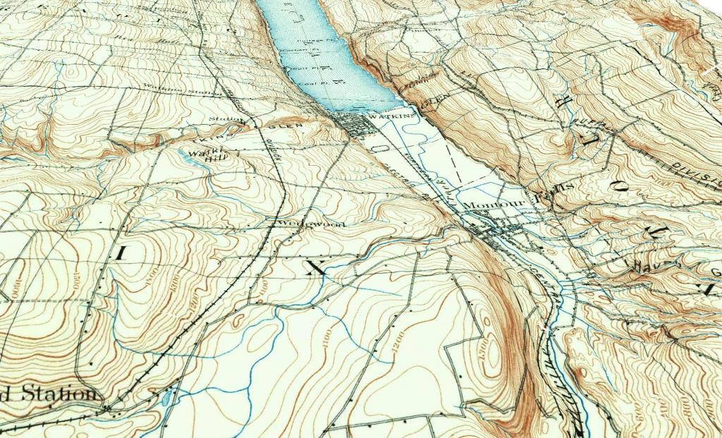
Watkins Glen - Montour Falls 1898

Road Trip to Dimock PA

Roughly 30 miles south of Binghamton, NY is Dimock, PA. I wanted to visit Dimock for some time, because I wanted to see up close the impacts of natural gas drilling in Pennsylvania. Dimock is particularly infamous for a couple of tragic accidents caused by faulting casing in gas wells causing poisonous hydrocarbons to leak out into the surrounding area. Dimock is also the home of Cabot Oil and Gas, one of the most controversial drilling companies in Pennsylvania due to their awful track record with certain wells.

NY 29 to Montrose.

I’d didn’t stop and take any pictures, but I’m including some images from Google Maps, and you’ll just have to imagine the rest from my words.

Dimock is an easy drive to get to from New York State – just take NY Route 7 south from Binghamton (you can access it from I-81 Exit 1 South of Binghamton), and NY Route 7 becomes PA Route 29 as you cross the state border. PA 29 is a very narrow and slow road, going through many hamlets, and the road is in serious need of repairs – although it was in awful shape the last time I drove it in 2008, prior to the big gas boom. Normal commercial and agricultural traffic has long made this road need of a rebuild and widening heading to the Capitol of Susquehanna County. The additional drilling related traffic hasn’t helped this road, as it ages long beyond, it’s time for widening and replacement.

PA 29 is the main road from Binghamton to Montrose. It has for a long time been congested with traffic heading to and from the capital of Susquehanna County. For most part the traffic is to be expected on a rural arterial – lots of folks in pickup trucks, beat up cars, milk trucks, grain trucks, pickups towing horse and cattle trailers. There are also traffic related to gas drilling, such as fresh water haul trucks used for fracking, and residual waste trucks hauling away condensate from gas well. I saw a pickup truck with a goose-neck trailer with drilling bits on it. For the most part traffic was free flowing.

There are small cattle farms in valley below PA 29, and some of the mountains above the road show quarrying activity for Blue Stone and possibly also coal. Nothing too obvious from the roads, but in one or two places, it’s obvious there is some mountains being mined for their products.

Busy Montrose on Saturday.

Eventually you real reach the borough of Montrose. This small city was very busy, but that’s to be expected of the only city in the region on a Saturday. People go to city to pick up groceries, shop, and fill up at the gas station. Walmart – on the outskirts of the city – was particularly crazy there.

There was a mix of truck traffic from different sources – some agricultural, some oil and gas related, some other for other businesses like grocery stores. Busy, but certainly not grid lock. Montrose is a pretty gritty little city, much like other cites in Twin Tier region, with lot of folks in big jacked up pickup trucks with gun racks. It’s certainly not an urban area by any extent of the imagination. Traffic in Montrose reminded me much of busy nature of Wellsboro PA or Watkins Glen NY.

South of Montrose.

South of Montrose is where the country starts to open up along NY 29. There is some rural houses on large lots on NY 29, but it’s mostly farm country. Traffic is very light south of Montrose. There are many farms on hilltops and across the landscape. Just past Dimock Post Office, and a few houses, there is Cabot Oil and Gas offices. Cabot Oil and Gas’ Dimock Headquarters is a one-story ranch-style building, that appears to be formally a rural doctors office or other small business office. It’s not a new building. The parking lot has been expanded with gravel – it’s obvious that once the gas wells are completed in this area, Cabot probably will be closing out this regional office.

This is where you first start to see first gas wells, one right beyond the Cabot Oil and Gas Office, and one on a farm field to the left of the road. This gas well is completed, although there are two condensate tanks on the roughly 4-acres pad. The pad is large, when viewed up close from the road, but there are no equipment on the pad except for the tanks. There is no reason why they could not remove the pad now, except for the access road to condensate tanks for occasional pumping. Farming activity is going up and around the well pad, with alfalfa currently planted around the pad, for the dairy farm on which it is located. Well pads are located on farms that are roughly 250 acres in size on steeply rolling country, so their impact both on farms and landscape is minimal. Spacing requirements limit well pads to one per 160 acres – but realistically terrain and gas fields expand things out further then that.

For the next three miles, as you go up and down several hills, there is no well pads thats can be seen, until one pops up in the distance on right. This well doesn’t produce any condensate or was abandoned, so there are no tanks or equipment above around. From there, it’s kind of hilly, with a lot of forested brush lands, in areas not economical to farm, mostly used for residents in fall to harvest wood for heating, and hunting in fall.

Lemon to Nicholson.

When I got down to an unmarked hamlet known as Lemon, I took a left onto State Route 1006, and started winding around farm country. Climbing out of valley, up towards Seely Hill, there where many well manicured farms, that obviously where well capitalized, professionally run operations without a lot of junk in their yards. None of farms where particularly large, as this area lacks the soils to sustain CAFO-sized farms, but with beautiful old farm houses painted white, and barns painted red. Cows where grazing around, corns, alfalfa, hay, and soybeans where planted following the landscape. Atop some of the hills, you could see for miles.

Not everything was picture perfect. It was a working landscape, and some farms where more messy then other. Passed a junkyard, and some trailers and houses. Almost everybody had burn barrels or pits for trash. Many had targets and stuffed deer statues in their backyards used for plinking. There where some abandoned houses, and grown up fields. It was very much a rural landscape – a bit a beautiful, wild and free landscape. There was rural poverty. It is a scene not unfamiliar to a New Yorker, something not far from one’s imagination, although due to the more southernly latitude allows farming on many hilltops unlike NY State.

You would climb one steep hill, and descend another, and you might see an gas well. After a while of winding on some back road, I saw a gas well under construction. Drilling rigs are big and tall, and there is a lot of trucks holding water, flowback water, chemicals, and drilling bits. I noticed quite a bit of particulate laden steam / smoke from one of compressor rigs – a potential problem – although it seems government regulation to reduce pollution from oil and gas industry will further clean the air. Such minor and localized pollution wasn’t everywhere.

Many places didn’t have any gas drilling activity underway. The further south or west you got from Dimock, and further you got from the gas field around Dimock, and the fewer wells you would see, until you see no more wells dotting the landscape. After a while, there was no more drilling activity going on.

Eventually I ended up in Nicholson, and took US 11 back to New York. The archways of the Lackawanna Railroad Viaduct are quite remarkable as the soar high above this town. US 11 is a delightful road, following a narrow valley along the deep valley of the Martin Creek, until one eventually reaches Great Bend on Susquehanna River and I-81 back to NY State.

Conclusions I Draw from My Trip.

Dimock is one small hamlet across Pennsylvania. It is a pocket of some of the most intense natural gas drilling in Pennsylvania. Gas drilling is not without impacts, but it is not the industrialization or utter destruction of rural life. Farms continue after gas drilling, and modest rural housing continues to exist. Small towns continue to be small towns, even if there is a benefit of greater employment and higher standard of living in these small towns.

Dimock is still primarily about farming and rural life – it is not suburban – but enjoys the boost that gas drilling gives to the town. Gas drilling does not urbanize rural areas or turn them into industrial wastelands, but instead provides

… do take this trip on your own. It’s not that long of a drive from Albany, and it’s a very interesting and beautiful drive for sure.

Ferris Lake Designated Roadside Campsites

The most popular area in Ferris Lake Wild Forest is to camp along the 20-mile long Piseco-Powley, a spectacular seasonally-gated, state truck trail. Other roads in area provide more remote roadside camping opporunities and are listed below.

Campsite North of Powley Place

The Ferris Lake Wild Forest Unit Management Plan mentions the following about Roadside Camping in the area…

“The FLWF provides a variety of different camping opportunities. The interior portion of the unit contains numerous primitive tent sites that are located along the shores of the more popular lakes. These sites are designated with a yellow camping disk and often contain a fire ring. There are also a number of car accessible sites located along secondary access roads, such as the Powley-Piseco Road, G Lake Road, Mountain Home Road Extension and Edick Road. Most of these sites can accommodate small camper trailers. There are no lean-tos within the unit.”

— NYSDEC Ferris Lake Wild Forest UMP.

Roadside Campsites Designated in UMP.

Road Number of Campsites
Edick Road 2
G-Lake Road 3
Jerseyfield Road 2
Mountain Home Road Extension (Rough Truck Trail Past the Floe) 6
Powley-Piesco Road (Open Late Spring-December)
Northern Hardwoods Section Near Mud Pond
Central Section Near Marshlands of Powley Place
Southern Section Near Potholers
Total: 22
5
10
7

More Resources…

Location of Roads with Camping in Ferris Lake UMP.

Designated Campsites Along Edick Road.

This map is from the Ferris Lake Wild Forest UMP.

East

Designated Campsites Along G Lake Road.

Please note that the roadside campsites are noted by “GLR”. The “GL” sites are traditional primative tent sites, beyond the gated end of G Lake Road, that you have to backpack into. This map is from the Ferris Lake Wild Forest UMP.

Designated Campsites Along Piseco-Powley Road.

These maps are from the Ferris Lake Wild Forest UMP.

 Cascade Lake

Strawberry Moon

Renters vs Population Density - NY Census Tracts

Designated Campsites Along Mountain Home.

This map is from the Ferris Lake Wild Forest UMP.

Betty Brook Road

Plains of East Canada Creek

Campsite Set Back Off the Road

North Up to Piseco-Powley


I guess I’ll be getting some bike tires tomorrow ๐Ÿšฒ

I mean the bike shop wasn’t wrong when they said the worn out tires would be prone to flats and would ride like a pig, especially with the more worn one on the front tire. Another flat up front and I’m not riding anywhere until I get a new tire and maybe a tube in case I can’t patch it.

Good morning! Today 8:30 PM Dusk ๐ŸŒ† . Most cloudy and 70 degrees here in Delmar, NY. ๐ŸŒฅ๏ธ Calm wind. Hey at least it’s not raining this morning but the temperature will drop through the day and only get cloudier.

Today will be be mostly clouds with some breaks of sun especially in the morning , ๐ŸŒฅ with a high of 70 degrees at 6am. Two degrees above normal, which is similar to a typical day around May 10th. South wind 7 to 10 mph. A year ago, we had partly cloudy skies in the morning with some clearing in the afternoon. The high last year was 60 degrees. The record high of 91 was set in 1944. There was a dusting of snow in 1986.โ„

Another shitty kind of weekend ahead, ๐Ÿ’ฉ but at least this morning Mr. Preskta isn’t out working on the unit next door ๐Ÿšช shortly after getting done with the milking and feeding – – cow ๐Ÿฎ chores at 6:30 AM in the morning. Enjoying the quiet for now, and will probably just end up spending my day at Five Rivers Environmental Education Center, ๐Ÿธ reading in the woods. The original plan called for riding over to Pebbles Island and go for a walk there, ๐Ÿšถ but honestly the weather isn’t that impressive today. Plus I need to get a tire and maybe a tube – – at least as a back up should the patch fail.

Truth is after that crash I got into Thursday, ๐Ÿ’ฅ my knee still needs time to heal. ๐Ÿฉน A weekend off from riding is a good thing in my perspective. I will continue to research tires today ๐Ÿ”Žand stop by the bike store tomorrow and buy two tires โšซ and maybe also a bike tube in case my patch fails or for an emergency it wouldn’t be bad to keep in storage for while camping or riding should I get another flat. I should be back on the road by Monday assuming they have the tire in stock.

Solar noon ๐ŸŒž is at 12:53 pm with sun having an altitude of 63.5ยฐ from the due south horizon (-7.3ยฐ vs. 6/21). A six foot person will cast a 3 foot shadow today compared to 2.2 feet on the first day of summer. The golden hour ๐Ÿ… starts at 7:20 pm with the sun in the west-northwest (287ยฐ). ๐Ÿ“ธ The sunset is in the west-northwest (293ยฐ) with the sun dropping below the horizon at 8:00 pm after setting for 3 minutes and 9 seconds with dusk around 8:30 pm, which is one minute and 7 seconds later than yesterday. ๐ŸŒ‡ The best time to look at the stars is after 9:09 pm. At sunset, look for mostly cloudy skies ๐ŸŒฅ and temperatures around 61 degrees. There will be a calm wind. Today will have 14 hours and 17 minutes of daytime, an increase of 2 minutes and 24 seconds over yesterday.

After such a busy week riding back and forth to work, ๐Ÿšถ I am okay with taking life slow and going for a walk today. And not doing much but a lot of reading and observing nature. I was at Five Rivers last night too, rode out there, hiked and red until dusk ๐ŸŒ‡ and it was a good evening. I’m just not feeling really ambitious today and I don’t feel like driving anywhere. ๐Ÿš˜ I ended up riding back through the suburban subdivision last night, getting home in the pitch black around 10 of nine. I thought about riding out to Feura Bush for some ice cream ๐Ÿฆ but I think I’ll wait for warmer weather then last night – – wasn’t a super warm day.

Tonight will have a chance of showers, mainly after 3am. Mostly cloudy ๐ŸŒง, with a low of 48 degrees at 6am. Three degrees above normal, which is similar to a typical night around May 14th. South wind around 10 mph. Chance of precipitation is 30%. New precipitation amounts of less than a tenth of an inch possible. In 2023, we had mostly clear skies. It got down to 40 degrees. The record low of 29 occurred back in 1974.

That great cabin / acerage I was looking at in Rensselaer County was only accessible via Easement, so after talking to the real estate agent I decided to pass on further investigation. ๐Ÿก Great location, not a bad commute, and really what I wanted – – off-grid pole-and-beam cabin with water and septic on 6 acres but the Easement road was a deal breaker. The price wasn’t cheap but including the cabin it was reasonable for the location if only it didn’t involve the Easement road. Might be a good hunting cabin, but it would not be possible to improve the road and even a written easement gets complicated. Maybe I’m hoping too much that I can fine the perfect turnkey solution, but what I need to do build my own. ๐Ÿ‘ทI’m continuing to research and learn everything I can.

I am still hoping that next weekend I can get out to Schoharie County, โ›บ take Friday off camp and ride throughout the weekend. Right now the weekend looks cold and showery ๐ŸŒง๏ธ but things could certainly change into he mean-time. I would like to ride the Catskill Scenic Trail, but I need new tires in the before I can do that as I don’t want to deal with another flat. And maybe find some good ramps to eat in the woods. ๐Ÿง…It’s spring turkey, ๐Ÿฆƒ so probably not hiking before noontime.

Possibly the following weekend, I might do a family trip ๐Ÿš˜ out to the Roger’s Center in Central New York, and then I believe the week after that is Memorial Day Weekend ๐Ÿ‡บ๐Ÿ‡ธ which I’ll have to decide where and if I want to get eaten alive by the black flies. ๐Ÿœ Last year the trip out to Cole Hill for two nights was a lot of fun hammock camping, so that’s another option. There is something simple and beautiful about laying back in the hammock as the sky gets dark and cooking over the fire. ๐Ÿ”ฅ At some point I want to get down to Catskill Mountain Cabins, the big show room in Kingston near the Thruway to look at the pre-fab cabins that have at the showroom there, but I think that’s more likely to be a June thing. Plus thoughts of the Potholers are on my mind ๐ŸŠโ€โ™‚๏ธ come later in June but that gets hard to do in the sense that as summer progresses I’ll be busier with work at the campaign committee preparing for the autumn campaign season, running data exports and processing data.

Looking ahead, there are 4 weeks until 9 PM Dusk ๐ŸŒ† when the sun will be setting at 8:28 pm. On that day in 2023, we had rain and temperatures between 69 and 60 degrees. Typically, the high temperature is 76 degrees. We hit a record high of 94 back in 1918.

Along Edge of Alder Pond

Cold mid-April morning ๐ŸŒฅ๏ธ

Started out my day bright and early around 5 AM cooking up a big pan of veggies, eggs and some cornmeal with lots of turmeric and red chili peppers to ensure my nose still ran well. Did some reading, finishing up the e-book on green building I had form the library, continuing that e-book on sustainable farming and java programming.

Good morning! Happy Saturday. Another shit weather weekend. ๐Ÿ’ฉ That’s how I feel about this weekend’s forecast, now that the windows are closed in my apartment. ๐ŸชŸ I like the fresh air, the lack of it makes me a bit cranky. Mostly cloudy with a few hints of sun, ๐ŸŒฅ๏ธ and 48 degrees in Delmar. Much colder then yesterday, and certainly quite a bit below normal. There is a south-southwest breeze at 13 mph. ๐Ÿƒ. The skies will clear around 10 pm.

One of the first things on my agenda ๐Ÿ”ง is to perform the usual adjustments on my bike  ๐Ÿšฒ๏ธ to keep the gears working well. I also want to do scrub down some of the walls in my apartment and floor as the floors were soaked yesterday after all the rain and wet weather we’ve been having lately. ๐ŸŒง๏ธ I could smell the mold starting to grow once again. This place is such a run down dump, ๐Ÿš๏ธ but let’s be honest, I kind of like it as it is. That said, I do like having the windows open. Fresh air is good.

Today will have a chance of showers. Cloudy ๐ŸŒฆ, with a high of 49 degrees at 6am. Nine degrees below normal, which is similar to a typical day around March 26th. Breezy, with a southwest wind 13 to 20 mph becoming west in the afternoon. Winds could gust as high as 38 mph. S Chance of precipitation is 50%. Going to be a fairly cool day by mid-April standards. New precipitation amounts of less than a tenth of an inch possible. A year ago, we had sunny skies. The high last year was 89 degrees, breaking the previously set record. But not today. 5.5 inches of snow fell back in 1950.โ„

Thinking of heading out early for a ride out to Voorheesville ๐Ÿšด‍โ™‚๏ธ before the wind picks up an things cloud up. I am actually happy to see a bit of blue sky ๐ŸŒฌ๏ธ but I know it’s not going to last with rain more likely later. I might then go down to the library. ๐Ÿ“š๏ธ They are renovating the unit next door now that my neighbor with the big garbage pile moved out. A bit noisy with all the construction going on. ๐Ÿ‘ท‍โ™€๏ธ New landlord seems to be pretty good at maintaining the yard so far and has been friendly. Rent is going up in June, but it’s not that much — $800 a  month in these inflationary times isn’t bad. ๐Ÿ˜๏ธ I’m kind of hoping for a new lease, so I can stay another year while I continue to evaluate my options.

Solar noon ๐ŸŒž is at 12:56 pm with sun having an altitude of 56.6° from the due south horizon (-14.2° vs. 6/21). A six foot person will cast a 4 foot shadow today compared to 2.2 feet on the first day of summer. The golden hour ๐Ÿ… starts at 6:58 pm with the sun in the west (277°). ๐Ÿ“ธ The sunset is in the west-northwest (284°) with the sun dropping below the horizon at 7:36 pm after setting for 2 minutes and 58 seconds with dusk around 8:04 pm, which is one minute and 8 seconds later than yesterday. ๐ŸŒ‡ At dusk you’ll see the First Quarter ๐ŸŒ“ Moon in the west-southwest (256°) at an altitude of 57° from the horizon, 240,404 miles away. ๐Ÿš€ The best time to look at the stars is after 8:40 pm. At sunset, look for rain ๐ŸŒง and temperatures around 46 degrees. Breezy, 22 mph breeze โ›… from the west-northwest with gusts up to 46mph. Today will have 13 hours and 22 minutes of daytime, an increase of 2 minutes and 47 seconds over yesterday.

Yesterday evening, did a nice bike ride out to Five Rivers. ๐Ÿšด‍โ™‚๏ธ It was a nice evening, with the spring peepers ๐Ÿธ singing their songs and red-winged black birds chirping along. ๐Ÿฆ๏ธ One of the cows was out loose on Meads Lane  ๐Ÿฎ . It was a pleasant evening, came home and read for a while,  ๐Ÿ“– the headed off to bed.

Tonight will be cloudy, then gradually becoming partly cloudy ๐ŸŒƒ, with a low of 39 degrees at 6am. Three degrees above normal, which is similar to a typical night around April 20th. Breezy, with a west wind 13 to 22 mph, with gusts as high as 44 mph. In 2023, we had mostly clear skies in the evening, which became partly cloudy by the early hours of the morning. It got down to 58 degrees. The record low of 19 occurred back in 1973. More rain come Sunday.

I’m hoping next week to get out camping.  ๐Ÿ•๏ธ It all depends on how things go weather wise, but it’s been a few weeks since I last spent a night in the wilderness. Thinking about the Green Mountains, maybe taking a three day weekend, but it depends on what roads are open. I could also do Rensslearville State Forest or maybe Madison County. Not sure, I need to think about it a bit more.

As previously noted, there are 2 weeks until Arbor Day ๐ŸŒณ when the sun will be setting at 7:52 pm with dusk at 8:21 pm. On that day in 2023, we had partly cloudy, patches of fog and temperatures between 62 and 40 degrees. Typically, the high temperature is 65 degrees. We hit a record high of 91 back in 1962.

Gore and Vanderwhacker Mountain