Search Results for: map eagle lake

The Catskill Wilderness Areas

Trees and Mountains

The text of today’s fodder is based on the Catskill Park State Lands Master Plan, as revised in 2008. Maps were rendered by myself, using Quantum GIS and DEC Lands and Forests data.

Big Indian Wilderness

(Formerly Big Indian – Beaverkill Range Wilderness Area)

This wilderness is located in the Towns of Hardenburgh, Denning and Shandaken in Ulster County. It lies generally west of Oliverea and the Frost Valley Road, south of Belleayre Ski Center, east of Seager and Hardenburgh and north of Willowemoc and Claryville. The area ranges in width from 1 to 5 miles, is about 19 miles long and contains approximately 33,500 acres of land. Elevations range from 1,500 feet in McKenley Hollow to 3,840 feet where the state boundary crosses Doubletop Mountain. The mountains in the northeastern portion of the area are quite rugged, while those to the south and west are more characteristic of high hills. Water from the area flows into three New York City water supply reservoirs and the Delaware River Basin. Nine mountains or ridges with elevations of over 3000 feet make up the area.

Peaks

Doubletop* 3,860′
Haynes 3,420′
Big Indian 3,700′
Spruce 3,380′
Fir 3,620′
Eagle 3,600′
Hemlock 3,240′
Balsam* 3,600′
Beaver Kill Range 3,377′

* Maximum elevations given are not necessarily located within the Wilderness Area.

The forest cover is predominantly hardwood mixtures in various associations. Spruce and fir, while present at some of the higher elevations, are less noticeable here than in other Catskill wilderness areas.

Interior facilities consisting of foot trails and lean-tos are generally considered adequate.

Area statistics:

Approximate Area 33,500 Acres
Roads (non conforming) 1.4 Miles
Foot Trails 29.4 Miles
Lean-tos 6
Designated Campsites 5
Parking Lots 5
Public Use (visitors/year) 4,500
Exterior Boundary Line 67 Miles
Minimum Elevation 1,500′
Maximum Elevation 3,840′

Non-conforming uses:

Motor vehicle use of Black Bear Road from the wilderness boundary to Fall Brook Lean-to.

A UMP for this area was completed in June of 1993.

Hunter – West Kill Wilderness

(Formerly West Kill – North Dome Wilderness, Ox Clove Wild Forest, and a portion of the former Hunter Mountain Wild Forest)

The unit generally lies within the following boundaries: New York State Route 42 on the west, the Shandakan Wild Forest and NYS Route 28 to the south, and NYS Route 214 on the east. The northern extent of the unit is County Route 6, and continues along a line 100′ parallel to, and south or east of, the edge of Spruceton trailhead parking area and the centerline of the Spruceton Truck Trail, to the junction of the Colonel’s Chair Trail. A corridor, 100 feet either side of the center line of the Spruceton Truck Trail, from the Colonel’s Chair Trail to the summit of Hunter Mountain, culminating in a circle 175′ in radius from the center of the chimney on the observer’s cabin shall be within the Rusk Mountain Wild Forest.

The unit contains approximately 27,000 acres of land, and inside it’s boundaries are found the named mountain peaks of Balsam, Sherrill, North Dome, West Kill, Sheridan, Hunter and Southwest Hunter. Hunter Mountain is the second highest peak in the Catskills at 4,040 feet, and portions of it’s summit, along with a fairly extensive area on the summits of West Kill, North Dome and Sherrill Mountains are within the Catskill High Peaks Bird Conservation Area, and are of special significance in that they provide habitat for high elevation spruce-fir inhabitants such as Bicknell’s Thrush and the Blackpoll Warbler, among others.

There are currently two lean-to’s on the unit, the Diamond Notch lean-to located just off the Diamond Notch Trail, and the Devil’s Acre Lean-to off of the Devil’s Path Trail. Waters from this unit drain into Schoharie and Esopus Creeks and then into the Schoharie and Ashokan Reservoirs, which are in the New York City water supply system.

Area statistics:

Approximate Area 27,000 Acres
Foot Trails 18 Miles
Lean-to’s 2
Parking Lots 5
Minimum Elevation 920′ Maximum Elevation 4,040′

Indian Head Wilderness

(Formerly Plateau Mountain – Indian Head Mountain Wilderness Area)

This wilderness is located in the Town of Hunter, Greene County and the Towns of Saugerties and Woodstock, Ulster County. It lies generally west of the east boundary of the Catskill Park, south of Platte Clove, east of Devil’s Tombstone Campground and north of Lake Hill and Shady. The area ranges from 1 ½ miles to 3 ½ miles in width, is eight miles long and contains approximately 16,800 acres.

Elevations range from 900 to 3840 feet and the four major mountains in the area are visible against the skyline from all directions. Echo Lake, the only natural lake in a Catskill wilderness, is located in the east-central portion of the area. Water from this eastern section flows into the Kingston and Saugerties water supply reservoirs, while drainage from the central and western section flows into two New York City water supply reservoirs. Six named mountain peaks over 3,000 feet in elevation dominate the area.

Peaks

Plateau 3,840′
Indian Head 3,573′
Sugarloaf 3,800′
Olderbark 3,440′
Twin 3,640′
Plattekill 3,100′

The forest cover varies from extensive oak stands on the eastern most slopes to mature spruce-fir on top of Plateau Mountain. An excellent mature stand of northern hardwood and hemlock occupies the slopes south of the Saw Kill.

Echo Lake, unique to the Catskill wilderness, is very popular for undeveloped camping. A small number of scattered primitive tent sites with fire rings have been established and public camping is limited to their capacities.

Public access is provided by several foot trails entering the area, including the old road from Meads to Overlook Mountain.

Area statistics:

Approximate Area 16,800 Acres
Roads 6.6 Miles
Foot Trails 24.1 Miles
Cross-country Ski Trails 5.6
Lean-tos 3
Designated Campsites 10
Parking Lots 1
Public Use (visitors/year) 8,000
Length of Boundary 33 Miles
Minimum Elevation 900′
Maximum Elevation 3,840′

A UMP for this area was completed in October of 1992.

Slide Mountain Wilderness

(Formerly Slide Mountain – Panther Mountain Wilderness Area)

This wilderness is located in the towns of Shandaken, Denning and Olive in Ulster County. It lies generally south of NYS Route 28, west of West Shokan, north of the Peekamoose Road (County Route 42) and east of the Frost Valley Road (County Route 47). It surrounds the Woodland Valley Campground and abuts the Sundown Wild Forest to its south. This area ranges from 1 to 10 miles in width, is about 13 miles long, and contains approximately 47,500 acres of land. The wilderness boundary is 118 miles long.

The terrain is rugged and steep with elevations ranging from 1,100 to 4,180 feet. All water draining from the area eventually reaches three New York City water supply reservoirs by way of the East and West Branches of the Neversink River, Rondout Creek and Esopus Creek. Twelve named mountain peaks with elevations over 3000 feet exist in the area. Of these, six may still be considered trail-less to the extent that they have no marked and maintained trails.

Peaks with Trails

Slide 4,180′
Peekamoose 3,843′
Cornell 3,860′
Wittenberg 3,780′
Table 3,847′
Panther 3,720′

Trail-less Peaks

Lone 3,721′
Rocky 3,508′
Friday 3,694′
Van Wyck 3,206′
Wildcat 3,340′
Balsam Cap 3,623′

The forest cover consists of nearly every possible mixture and association of hardwood and softwood trees native to the mountain region. While hardwoods predominate higher elevations are often covered with red spruce and balsam fir.

This area receives more public use than any other Catskill wilderness. Superb vistas are found on Slide, Wittenberg, Cornell, Giant Ledge and Panther Mountains. Access via foot trails is available from the north, south, east and west.

Area statistics:

Approximate Area 47,500 Acres
Foot Trails 35.3 Miles
Lean-tos 3
Parking Lots 10
Designated Campsites 29
Public Use (visitors/year) 23,000
Length of Boundary 118 Miles
Minimum Elevation 1,100′
Maximum Elevation 4,180′

A UMP for this area was completed in March of 1987 and revised in October of 1998.

Windham – Blackhead Range Wilderness

(Formerly Blackhead Range, and North Mountain Wild Forests, and portions of Windham High Peak, and Black Dome Valley Wild Forests)

The combination of these Wild Forest areas creates the Windham – Blackhead Range Wilderness Area, which lies within the Greene County towns of Cairo, Hunter, Jewett, Windham and Durham. The classification of these former Wild Forest areas was changed to Wilderness because their combined area comprises approximately 17,100 acres and contains rugged, high elevation land that clearly exhibits wilderness character. This newly classified area has seven named mountain peaks over 3,000 feet in elevation.

They are:

Peaks Black Dome 3,980′
Windham High Pk 3,520′
Blackhead 3,940′
Stoppel Point 3,420′
Thomas Cole 3,940′
Burnt Knob 3,180′
Acra Point 3,100′

The unit also contains six unnamed peaks over 3,000 feet, which range from 3,040 feet to 3,540 feet in elevation. Of the five highest peaks in the Catskills, three – Black Dome, Thomas Cole and Blackhead – are in this unit. This concentration of 13 peaks over 3,000 feet, within an area of approximately 28 square miles, with limited access, structures and improvements (30 miles of maintained foot trails and two lean-to’s) make the Windham – Blackhead Range Unit an area with excellent wilderness character.

A fairly extensive area of old growth forest can be found on this unit at the higher elevations, along the ridge stretching from an area west of Thomas Cole Mountain to Blackhead Mountain, and on Windham High Peak. The presence of this old growth forest, with its distinctive flora and fauna, add to the wilderness character of the unit. The unit also includes the headwaters of the Batavia Kill and, to the south over the Blackhead Range, the headwaters of the East Kill. Both of these rivers flow into Schoharie Creek, and are an integral part of the New York City Watershed system.

The western boundary of this unit shall be the east side of the Elm Ridge Trail, Black Dome Trail leaving it within the Elm Ridge Wild Forest, continuing north along the drainage to the Catskill Park boundary. The southern boundary of the unit shall be the Escarpment Trail approximately one half mile south of Stoppel Point to a point on the Escarpment Trail where it comes closest to the eastern Forest Preserve boundary. Both North Point and Stoppel Point will be within the Wilderness area. Lands to the south of the south edge of the Escarpment Trail in this area, will be in the Kaaterskill Wild Forest.

Because the Windham – Blackhead Range Wilderness surrounds the smaller Colgate Lake Wild Forest Unit, and because they are linked together by public use, the Unit Management Plans for the two units shall be contained in one document.

Area statistics:

Approximate Area 18,0000 Acres
Foot Trails 30 Miles
Lean-tos 2
Parking Lots 1
Minimum Elevation 980′
Maximum Elevation 3,980′

East Branch of Sacandaga River and NY 8

Interactive Map

Here is an interactive map of the campsites and trails along the East Branch of Sacandaga River.

Printable Map

Here are several helpful printable maps.

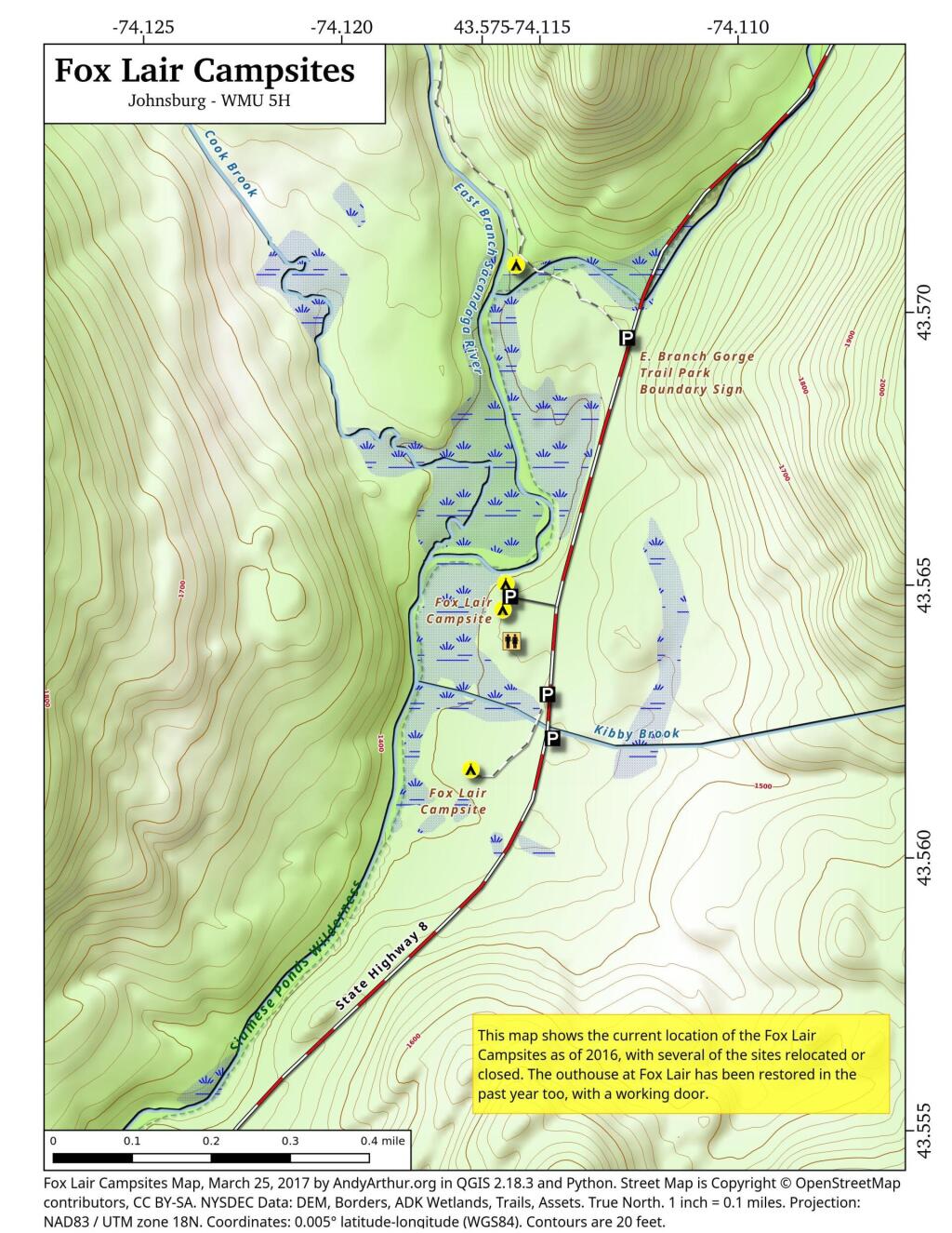
 Fox Lair Campsites

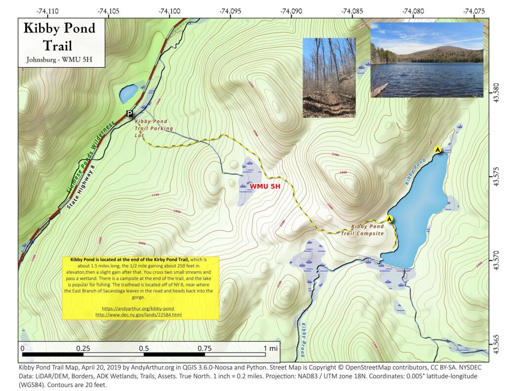
 Kibby Pond Trail

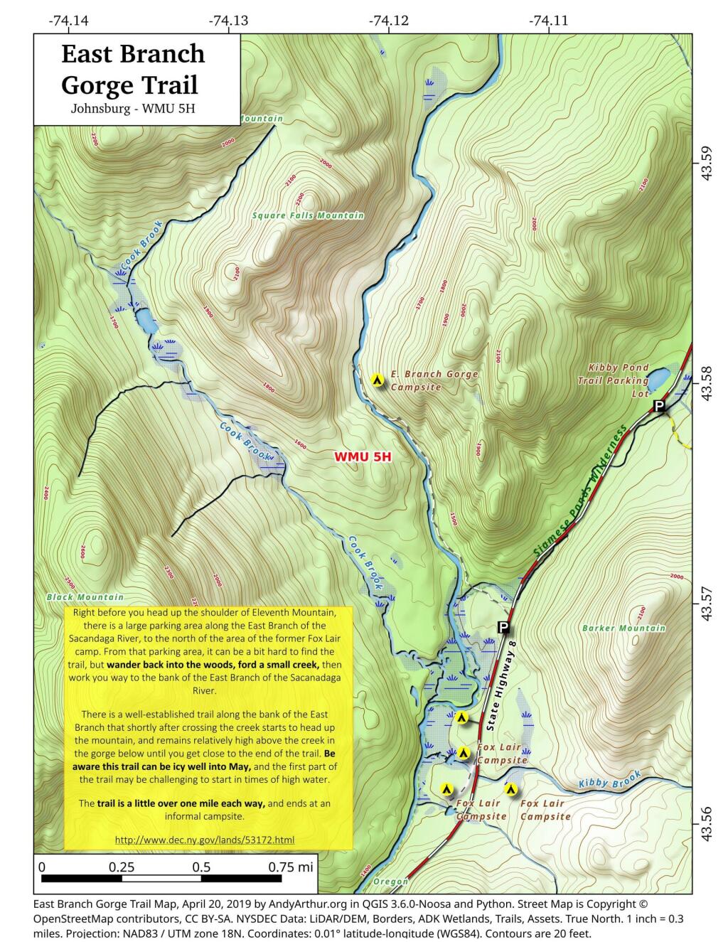
 East Branch Gorge Trail

List and Coordinates for Campsites and Trailheads

Here is a list of campsites, trailheads and other destinations along NY 8 and East Branch Sacandaga River. You can also get this as a Google Sheets.

NameDetailsLatitudeLongitude
11th Mountain Parking LotLarge > 20 Cars43.5903782-74.0900314
11th Mountain Trailhead CampsiteNear large parking area for 11th Mountain43.5901834-74.0910822
Boulder Rock CampsiteCave-Like Site Against Large Erratic43.5384607-74.1215703
Cod Pond Parking LotMedium 5 – 20 Cars, across from campsite 7 and 843.5301580-74.1455890
Cod Pond Trail CampsiteAt end of Cod Pond trail on pond43.5176969-74.1437559
County Line Brook Trail CampsiteAlong County Line Trail43.5242772-74.1892664
County Line CampsiteEnd of County Line Trail43.5022688-74.1828085
E. Branch Gorge CampsiteEnd of East Branch George, near Waterfalls43.5803187-74.1209517
E. Branch Gorge Trail Parking AreaSmall < 5 Cars43.5690250-74.1132232
Eagle Pond CampsiteNear Eagle Pond43.5401509-74.1167243
East Sacandaga River Parking Picnic AreaDOT Maintained Roadside Parking And Picnic Area43.4783862-74.2010766
Forks Mountain Trail – Bushwhack to Auger Falls43.4685687-74.2457562
Georgia Creek Parking LotMedium 5 – 20 Cars43.4915171-74.1892866
Girrad Sugarbush Trailhead43.4764458-74.2043731
Griffin Connector Parking Lot At Route 8Medium 5 – 20 Cars43.4703209-74.2248680
Kibby Pond Campsite #3Far End of Lake43.5766649-74.0781098
Kibby Pond Trail #2End of Trail43.5725581-74.0821443
Kibby Pond Trail Parking LotSmall <5 Cars43.5789951-74.1033601
Little Joe Pond CampsiteAt Little Joe Pond43.5055662-74.1423052
Little Joe Pond Picnic Site43.5039558-74.1422817
Mud Ponds CampsiteAt Mud Point43.5650797-74.1739273
NY 8 Campsite 1Old Routing of 8, Near Kibby Pond Area43.5771279-74.1054574
NY 8 Campsite 2Overlooks Cliff43.5650960-74.1160232
NY 8 Campsite 3Long dirt road to open area43.5616391-74.1169664
NY 8 Campsite 4Dirt road to campsite above Kibby Brook43.5612062-74.1138524
NY 8 Campsite 5Old home site, sits on ledge above NY 843.5542527-74.1234025
NY 8 Campsite 71/4 mile north of Cod Pond Parking43.5328656-74.1440210
NY 8 Campsite 8Near Cod Pond Parking43.5316564-74.1459341
NY 8 Campsite 9 (Seasonal Use)Route 8 Near Little Joe Trail Pulloff With Fire Ring (Campsite Removed During Winter)43.5149220-74.1583197
NY 8 Campsite 10Gravel Pit 1/4 mile south of Girrad Sugarbush Trailhead43.4761691-74.2072253
Oregon Trail Primitive CampsiteBeyond Stewart Creek Snomwobile Bridge43.5194607-74.1339532
Parking LotMedium 5 – 20 Cars43.5355769-74.1414217
Shanty Brook Trail CampsiteAlong Shanty Brook Trail43.5460737-74.1459537
Shanty Falls Parking LotSmall <543.5376556-74.1409559
Square Falls43.5814233-74.1218099
Stewart Creek Bridge43.5204188-74.1356239
Stewart Creek Flume43.5204188-74.1356239
Stewart Creek Lower Falls43.5225332-74.1365675
Teachout Road Bridge Over Griffin Falls43.4733545-74.2236654
Teachout Road Parking at Griffin Falls43.4737995-74.2238438

List of Peaks in the Catskill Park

Below is a list of peaks within the Catskill Park that are on state land. This is based on the OpenStreetMap data combined with the DEC property data. Click location for a map of the property, or click State Land to get more information about the land the peak is located on.

Region 3 – Ulster County

Peak Name Elevation in Feet State Land Class UMP Region County Location
Balsam Cap 3621 Slide Mountain Wilderness Wilderness Slide Mountain 3 Ulster 41.9770369, -74.3573722
Balsam Lake Mountain 3726 Balsam Lake Mountain Wild Forest Wild Forest Balsam Lake Mountain 3 Ulster 42.0459236, -74.5940438
Balsam Mountain 3601 Big Indian Wilderness Wilderness Big Indian 3 Ulster 42.0909235, -74.4882082
Beaver Kill Range 3310 Big Indian Wilderness Wilderness Big Indian 3 Ulster 41.9903736, -74.5999302
Beaver Kill Range 3211 Big Indian Wilderness Wilderness Big Indian 3 Ulster 41.9937721, -74.5912442
Belleayre Mountain 3431 Belleayre Mountain Ski Center Intensive Use Belleayre Mountain Ski Center 3 Ulster 42.1287084, -74.5187223
Big Indian Mountain 3680 Big Indian Wilderness Wilderness Big Indian 3 Ulster 42.0349959, -74.4966494
Breath Hill 2568 Slide Mountain Wilderness Wilderness Slide Mountain 3 Ulster 41.9366557, -74.3493054
Carl Mountain 2883 Phoenicia – Mt. Tobias Wild Forest Wild Forest Phoenicia – Mt. Tobias 3 Ulster 42.0959235, -74.2482011
Cornell Mountain 3851 Slide Mountain Wilderness Wilderness Slide Mountain 3 Ulster 42.001553, -74.3569987
Cross Mountain 2503 Slide Mountain Wilderness Wilderness Slide Mountain 3 Ulster 42.0195363, -74.3165372
Dink 3641 Slide Mountain Wilderness Wilderness Slide Mountain 3 Ulster 41.9970242, -74.3629146
Eagle Mountain 3601 Big Indian Wilderness Wilderness Big Indian 3 Ulster 42.0620352, -74.50932
East Wildcat 3339 Slide Mountain Wilderness Wilderness Slide Mountain 3 Ulster 41.9877507, -74.4406309
Edgewood Mountain 2998 Phoenicia – Mt. Tobias Wild Forest Wild Forest Phoenicia – Mt. Tobias 3 Ulster 42.1206399, -74.2305807
Fir Mountain 3628 Big Indian Wilderness Wilderness Big Indian 3 Ulster 42.0275916, -74.4690414
Friday Mountain 3690 Slide Mountain Wilderness Wilderness Slide Mountain 3 Ulster 41.9875924, -74.3620944
Garfield Mountain 2581 Slide Mountain Wilderness Wilderness Slide Mountain 3 Ulster 42.0912014, -74.3665379
Haynes Mountain 3424 Big Indian Wilderness Wilderness Big Indian 3 Ulster 42.0792571, -74.5079309
Hemlock Mountain 3247 Big Indian Wilderness Wilderness Big Indian 3 Ulster 42.0128698, -74.4390407
High Falls Ridge 3198 Big Indian Wilderness Wilderness Big Indian 3 Ulster 41.9919309, -74.5454022
Hirams Knob 2883 Big Indian Wilderness Wilderness Big Indian 3 Ulster 42.0981453, -74.5418203
Lone Mountain 3720 Slide Mountain Wilderness Wilderness Slide Mountain 3 Ulster 41.9691794, -74.3900258
Millbrook Ridge 3542 Balsam Lake Mountain Wild Forest Wild Forest Balsam Lake Mountain 3 Ulster 42.0523606, -74.6329273
Mongaup Mountain 3175 Big Indian Wilderness Wilderness Big Indian 3 Ulster 41.9934945, -74.6993963
Mongaup Mountain 2762 Big Indian Wilderness Wilderness Big Indian 3 Ulster 41.9909235, -74.6840456
Mount Pleasant 2811 Slide Mountain Wilderness Wilderness Slide Mountain 3 Ulster 42.0342583, -74.3082035
Mount Tobias 2542 Phoenicia – Mt. Tobias Wild Forest Wild Forest Phoenicia – Mt. Tobias 3 Ulster 42.0584244, -74.2157003
Overlook Mountain 3136 Overlook Mountain Wild Forest Wild Forest Overlook Mountain 3 Ulster 42.0850905, -74.0931954
Panther Mountain 3723 Slide Mountain Wilderness Wilderness Slide Mountain 3 Ulster 42.0564799, -74.3945946
Peekamoose Mountain 3844 Slide Mountain Wilderness Wilderness Slide Mountain 3 Ulster 41.9531481, -74.398207
Red Hill 2985 Sundown Wild Forest Wild Forest Sundown 3 Ulster 41.9242591, -74.5176554
Rocky Mountain 3493 Slide Mountain Wilderness Wilderness Slide Mountain 3 Ulster 41.9728703, -74.3726505
Romer Mountain 1978 Slide Mountain Wilderness Wilderness Slide Mountain 3 Ulster 42.0581466, -74.3187592
Sand Pond Mountain 3060 Big Indian Wilderness Wilderness Big Indian 3 Ulster 41.9851406, -74.6483978
Silver Hollow Notch Mountain 3008 Phoenicia – Mt. Tobias Wild Forest Wild Forest Phoenicia – Mt. Tobias 3 Ulster 42.1228609, -74.2271869
Slide Mountain 4152 Slide Mountain Wilderness Wilderness Slide Mountain 3 Ulster 41.999065, -74.3854779
Spruce Mountain 3385 Big Indian Wilderness Wilderness Big Indian 3 Ulster 42.0175919, -74.4498744
Table Mountain 3847 Slide Mountain Wilderness Wilderness Slide Mountain 3 Ulster 41.958642, -74.4048687
Terrace Mountain 2365 Slide Mountain Wilderness Wilderness Slide Mountain 3 Ulster 42.0275917, -74.33626
Ticetonyk Mountain 2509 Phoenicia – Mt. Tobias Wild Forest Wild Forest Phoenicia – Mt. Tobias 3 Ulster 42.0029749, -74.2173846
Tremper Mountain 2719 Phoenicia – Mt. Tobias Wild Forest Wild Forest Phoenicia – Mt. Tobias 3 Ulster 42.0745351, -74.2782022
Unnamed Peak 1791 Shawangunk Ridge State Forest Shawangunk Ridge 3 Ulster 41.6558434, -74.4070089
Unnamed Peak 3109 Balsam Lake Mountain Wild Forest Wild Forest Balsam Lake Mountain 3 Ulster 42.0274543, -74.6670466
Unnamed Peak 3159 Balsam Lake Mountain Wild Forest Wild Forest Balsam Lake Mountain 3 Ulster 42.0368578, -74.661665
Unnamed Peak 3178 Balsam Lake Mountain Wild Forest Wild Forest Balsam Lake Mountain 3 Ulster 42.0635553, -74.6666829
Unnamed Peak 3218 Balsam Lake Mountain Wild Forest Wild Forest Balsam Lake Mountain 3 Ulster 42.0565122, -74.6545078
Unnamed Peak 3375 Belleayre Mountain Ski Center Intensive Use Belleayre Mountain Ski Center 3 Ulster 42.1157723, -74.4975655
Unnamed Peak 2217 Big Indian Wilderness Wilderness Big Indian 3 Ulster 41.9659811, -74.6257213
Unnamed Peak 2988 Big Indian Wilderness Wilderness Big Indian 3 Ulster 41.9883105, -74.6775609
Unnamed Peak 2863 Big Indian Wilderness Wilderness Big Indian 3 Ulster 41.9914939, -74.6886245
Unnamed Peak 2755 Big Indian Wilderness Wilderness Big Indian 3 Ulster 41.9683169, -74.6448015
Unnamed Peak Big Indian Wilderness Wilderness Big Indian 3 Ulster 41.9833327, -74.660781
Unnamed Peak 2266 Big Indian Wilderness Wilderness Big Indian 3 Ulster 41.9677074, -74.6112706
Unnamed Peak 2808 Big Indian Wilderness Wilderness Big Indian 3 Ulster 41.9631866, -74.5913118
Unnamed Peak 2863 Big Indian Wilderness Wilderness Big Indian 3 Ulster 41.9788505, -74.5846009
Unnamed Peak 3296 Big Indian Wilderness Wilderness Big Indian 3 Ulster 42.004323, -74.5252835
Unnamed Peak 3208 Big Indian Wilderness Wilderness Big Indian 3 Ulster 42.0100949, -74.4705858
Unnamed Peak 3369 Big Indian Wilderness Wilderness Big Indian 3 Ulster 42.0171511, -74.4968178
Unnamed Peak 695 Bluestone Wild Forest Wild Forest Bluestone 3 Ulster 41.9413993, -74.1495688
Unnamed Peak 1696 Phoenicia – Mt. Tobias Wild Forest Wild Forest Phoenicia – Mt. Tobias 3 Ulster 41.990803, -74.2432915
Unnamed Peak 2900 Shandaken Wild Forest Wild Forest Shandaken 3 Ulster 42.1378009, -74.4295925
Unnamed Peak 2900 Shandaken Wild Forest Wild Forest Shandaken 3 Ulster 42.1378167, -74.4295943
Unnamed Peak 3444 Slide Mountain Wilderness Wilderness Slide Mountain 3 Ulster 41.9689055, -74.3556714
Unnamed Peak 2873 Slide Mountain Wilderness Wilderness Slide Mountain 3 Ulster 41.9453545, -74.3403039
Unnamed Peak 3086 Slide Mountain Wilderness Wilderness Slide Mountain 3 Ulster 41.9624268, -74.3454966
Unnamed Peak 2378 Slide Mountain Wilderness Wilderness Slide Mountain 3 Ulster 42.0646385, -74.4489903
Unnamed Peak 2355 Slide Mountain Wilderness Wilderness Slide Mountain 3 Ulster 42.0942486, -74.4384674
Unnamed Peak 3437 Slide Mountain Wilderness Wilderness Slide Mountain 3 Ulster 42.0712077, -74.396964
Unnamed Peak 2840 Slide Mountain Wilderness Wilderness Slide Mountain 3 Ulster 42.0578201, -74.3757381
Unnamed Peak 2952 Slide Mountain Wilderness Wilderness Slide Mountain 3 Ulster 42.1006889, -74.4121968
Unnamed Peak 2558 Slide Mountain Wilderness Wilderness Slide Mountain 3 Ulster 42.0539223, -74.3536646
Unnamed Peak 2831 Sundown Wild Forest Wild Forest Sundown 3 Ulster 41.9544141, -74.5265058
Unnamed Peak 1269 Vernooy Kill State Forest Sundown 3 Ulster 41.7928566, -74.3930704
Unnamed Peak 1328 Vernooy Kill State Forest Sundown 3 Ulster 41.7926582, -74.3698082
Unnamed Peak 2552 Willowemoc Wild Forest Wild Forest Willowemoc 3 Ulster 41.9710083, -74.5595555
Van Wyck Mountain 3201 Slide Mountain Wilderness Wilderness Slide Mountain 3 Ulster 41.9523147, -74.4354304
Wildcat Mountain 3162 Slide Mountain Wilderness Wilderness Slide Mountain 3 Ulster 41.9775924, -74.4759867
Willowemoc Mountain 3224 Big Indian Wilderness Wilderness Big Indian 3 Ulster 41.9902739, -74.6285258
Winnisook Lake Mountain (Western Summit) Big Indian Wilderness Wilderness Big Indian 3 Ulster 42.0181188, -74.4269859
Wittenberg Mountain 3782 Slide Mountain Wilderness Wilderness Slide Mountain 3 Ulster 42.0083192, -74.3472214
Woodpecker Ridge 3467 Balsam Lake Mountain Wild Forest Wild Forest Balsam Lake Mountain 3 Ulster 42.0393575, -74.617348

Region 4 – Delaware County

Peak Name Elevation in Feet State Land Class UMP Region County Location
Barkaboom Mountain 3004 Dry Brook Ridge Wild Forest Wild Forest Dry Brook Ridge 4 Delaware 42.0717554, -74.7201571
Barkaboom Mountain 3100 Dry Brook Ridge Wild Forest Wild Forest Dry Brook Ridge 4 Delaware 42.0619162, -74.7025722
Beech Hill 2844 Delaware Wild Forest Wild Forest Delaware 4 Delaware 42.0456442, -74.7854363
Bouchoux Hill 1765 Hancock Fp Detached Parcel Wild Forest 4 Delaware 41.8806433, -75.1698924
Brock Mountain 2758 Delaware Wild Forest Wild Forest Delaware 4 Delaware 42.0439174, -74.8962771
Brock Mountain 2512 Delaware Wild Forest Wild Forest Delaware 4 Delaware 42.052135, -74.9032495
Brock Mountain 2503 Delaware Wild Forest Wild Forest Delaware 4 Delaware 42.0525879, -74.9032173
Cabot 2968 Delaware Wild Forest Wild Forest Delaware 4 Delaware 42.0535303, -74.7612944
Campbell Mountain 2352 Delaware Wild Forest Wild Forest Delaware 4 Delaware 42.0604872, -74.9595139
Campbell Mountain 2221 Delaware Wild Forest Wild Forest Delaware 4 Delaware 42.0567543, -74.9479407
Carroll Hill 2148 Steam Mill State Forest Treaty Line 4 Delaware 42.183417, -75.296841
Cherry Ridge 2601 Delaware Wild Forest Wild Forest Delaware 4 Delaware 42.0240696, -74.9710699
Cherry Ridge 2627 Delaware Wild Forest Wild Forest Delaware 4 Delaware 42.0127288, -74.9609419
Clabber Peak 2152 Tompkins Fp Detached Parcel Wild Forest 4 Delaware 42.1298068, -75.2787843
Cross Mountain 2342 Dry Brook Ridge Wild Forest Wild Forest Dry Brook Ridge 4 Delaware 42.080922, -74.6957121
Dry Brook Ridge 3470 Dry Brook Ridge Wild Forest Wild Forest Dry Brook Ridge 4 Delaware 42.1130364, -74.6041347
Fork Mountain 2430 Bear Spring Mountain WMA 4 Delaware 42.1009197, -75.0704441
Fuller Hill 2463 Delaware Wild Forest Wild Forest Delaware 4 Delaware 42.0203657, -74.9912753
Hunt Hill 2348 Delaware Wild Forest Wild Forest Delaware 4 Delaware 42.0746419, -74.803095
Mary Smith Hill 2775 Delaware Wild Forest Wild Forest Delaware 4 Delaware 42.0436995, -74.833771
Middle Mountain 2972 Delaware Wild Forest Wild Forest Delaware 4 Delaware 42.0403664, -74.7954366
Pakatakan Mountain 2437 Dry Brook Ridge Wild Forest Wild Forest Dry Brook Ridge 4 Delaware 42.1381438, -74.6409887
Rodgers Hill 2476 Delaware Wild Forest Wild Forest Delaware 4 Delaware 41.9817551, -74.9412742
Starkweather Hill 2545 Bear Spring Mountain WMA 0 4 Delaware 42.127864, -75.0509992
Sugarloaf Mountain 2125 Delaware Wild Forest Wild Forest Delaware 4 Delaware 42.0686987, -74.926829
Sugarloaf Mountain 2135 Delaware Wild Forest Wild Forest Delaware 4 Delaware 42.0619719, -74.9175266
Touchmenot Mountain 2762 Delaware Wild Forest Wild Forest Delaware 4 Delaware 42.0481444, -74.740713
Unnamed Peak 1673 Delaware Wild Forest Wild Forest Delaware 4 Delaware 41.9810251, -74.9580186
Unnamed Peak 2519 Delaware Wild Forest Wild Forest Delaware 4 Delaware 42.022626, -74.9451568
Unnamed Peak 2230 Delaware Wild Forest Wild Forest Delaware 4 Delaware 42.0556575, -74.969054
Unnamed Peak 2526 Delaware Wild Forest Wild Forest Delaware 4 Delaware 42.0354957, -74.9401226
Unnamed Peak 2460 Delaware Wild Forest Wild Forest Delaware 4 Delaware 42.0470575, -74.9330147
Unnamed Peak 2611 Delaware Wild Forest Wild Forest Delaware 4 Delaware 42.02054, -74.912359
Unnamed Peak 2549 Delaware Wild Forest Wild Forest Delaware 4 Delaware 42.0435821, -74.9242729
Unnamed Peak 2512 Delaware Wild Forest Wild Forest Delaware 4 Delaware 41.9925937, -74.8795669
Unnamed Peak 2485 Delaware Wild Forest Wild Forest Delaware 4 Delaware 41.9998257, -74.8803694
Unnamed Peak 2521 Delaware Wild Forest Wild Forest Delaware 4 Delaware 42.0060898, -74.8751327
Unnamed Peak 2483 Delaware Wild Forest Wild Forest Delaware 4 Delaware 42.0011803, -74.8576575
Unnamed Peak 2598 Delaware Wild Forest Wild Forest Delaware 4 Delaware 42.0111026, -74.8035778
Unnamed Peak 2670 Delaware Wild Forest Wild Forest Delaware 4 Delaware 42.0173224, -74.8650151
Unnamed Peak 2444 Delaware Wild Forest Wild Forest Delaware 4 Delaware 42.0139118, -74.8548144
Unnamed Peak 2435 Delaware Wild Forest Wild Forest Delaware 4 Delaware 42.0385161, -74.8801795
Unnamed Peak 2309 Delaware Wild Forest Wild Forest Delaware 4 Delaware 42.0173083, -74.8366494
Unnamed Peak 2974 Delaware Wild Forest Wild Forest Delaware 4 Delaware 42.0399261, -74.7949904
Unnamed Peak 2909 Delaware Wild Forest Wild Forest Delaware 4 Delaware 42.0581708, -74.7714717
Unnamed Peak 2831 Dry Brook Ridge Wild Forest Wild Forest Dry Brook Ridge 4 Delaware 42.09821, -74.6268576
Unnamed Peak 2768 Dry Brook Ridge Wild Forest Wild Forest Dry Brook Ridge 4 Delaware 42.1071828, -74.6752039

Region 4 – Greene County

Peak Name Elevation in Feet State Land Class UMP Region County Location
Acra Point 3109 Windham-Blackhead Range Wilderness Wilderness Windham-Blackhead Range 4 Greene 42.2964745, -74.0998591
Arizona Mountain 3405 Windham-Blackhead Range Wilderness Wilderness Windham-Blackhead Range 4 Greene 42.2589767, -74.0899676
Balsam Mountain 3352 Hunter-West Kill Wilderness Wilderness Hunter-West Kill 4 Greene 42.1836992, -74.387371
Black Dome 4006 Windham-Blackhead Range Wilderness Wilderness Windham-Blackhead Range 4 Greene 42.2701836, -74.122551
Blackhead 3963 Windham-Blackhead Range Wilderness Wilderness Windham-Blackhead Range 4 Greene 42.2677434, -74.104636
Burnt Knob 3188 Windham-Blackhead Range Wilderness Wilderness Windham-Blackhead Range 4 Greene 42.3020297, -74.1190264
Camel”s Hump 3593 Windham-Blackhead Range Wilderness Wilderness Windham-Blackhead Range 4 Greene 42.2713509, -74.1497955
Caudal 3319 Windham-Blackhead Range Wilderness Wilderness Windham-Blackhead Range 4 Greene 42.2690287, -74.1608906
Cave Mountain 3106 Elm Ridge Wild Forest Wild Forest Elm Ridge 4 Greene 42.2859185, -74.2462543
East Rusk 3311 Rusk Mountain Wild Forest Wild Forest Rusk Mountain 4 Greene 42.2006614, -74.2601981
Evergreen Mountain 3369 Rusk Mountain Wild Forest Wild Forest Rusk Mountain 4 Greene 42.2117542, -74.3079238
Halcott Mountain 3523 Halcott Mountain Wild Forest Wild Forest Halcott Mountain 4 Greene 42.1800882, -74.4379281
Hunter Mountain 4044 Hunter-West Kill Wilderness Wilderness Hunter-West Kill 4 Greene 42.1778662, -74.2304216
Indian Head Mountain 3552 Indian Head Wilderness Wilderness Indian Head 4 Greene 42.116201, -74.1145846
Kaaterskill High Peak 3644 Kaaterskill Wild Forest Wild Forest Kaaterskill 4 Greene 42.162055, -74.0805665
Little Rocky Mountain 3050 Indian Head Wilderness Wilderness Indian Head 4 Greene 42.1150898, -74.2040325
Mount Sherrill 3549 Hunter-West Kill Wilderness Wilderness Hunter-West Kill 4 Greene 42.1756439, -74.3729262
North Dome 3595 Hunter-West Kill Wilderness Wilderness Hunter-West Kill 4 Greene 42.1737318, -74.3490098
North Mountain 3185 Windham-Blackhead Range Wilderness Wilderness Windham-Blackhead Range 4 Greene 42.2175881, -74.0487469
Olderbark Mountain 3437 Indian Head Wilderness Wilderness Indian Head 4 Greene 42.1142565, -74.1909765
Plateau Mountain 3844 Indian Head Wilderness Wilderness Indian Head 4 Greene 42.1378671, -74.1743088
Plattekill Mountain 3090 Indian Head Wilderness Wilderness Indian Head 4 Greene 42.1073123, -74.0865281
Roundtop Mountain 3451 Kaaterskill Wild Forest Wild Forest Kaaterskill 4 Greene 42.1684222, -74.094583
Rusk Mountain 3677 Rusk Mountain Wild Forest Wild Forest Rusk Mountain 4 Greene 42.2006434, -74.2770897
Saint Anne”s Peak 0 Hunter-West Kill Wilderness Wilderness Hunter-West Kill 4 Greene 42.1714402, -74.3207927
Sheridan Mountain 2221 Hunter-West Kill Wilderness Wilderness Hunter-West Kill 4 Greene 42.1039789, -74.3279255
Sleeping Lion 3408 Halcott Mountain Wild Forest Wild Forest Halcott Mountain 4 Greene 42.1976194, -74.4168462
South Mountain 2467 North/South Lake Campground Intensive Use North/South Lake Camp 4 Greene 42.1892553, -74.0518031
Southwest Hunter Mountain 3739 Hunter-West Kill Wilderness Wilderness Hunter-West Kill 4 Greene 42.1623721, -74.2436771
Stoppel Point 3421 Windham-Blackhead Range Wilderness Wilderness Windham-Blackhead Range 4 Greene 42.2250879, -74.0651364
Sugarloaf Mountain 3805 Indian Head Wilderness Wilderness Indian Head 4 Greene 42.1312006, -74.1501414
Thomas Cole Mountain 3977 Windham-Blackhead Range Wilderness Wilderness Windham-Blackhead Range 4 Greene 42.270546, -74.1355667
Twin Mountain 3631 Indian Head Wilderness Wilderness Indian Head 4 Greene 42.1256453, -74.1290294
Unnamed Peak 2883 Hunter-West Kill Wilderness Wilderness Hunter-West Kill 4 Greene 42.1515598, -74.3900499
Unnamed Peak 2801 Hunter-West Kill Wilderness Wilderness Hunter-West Kill 4 Greene 42.1246724, -74.3256104
Unnamed Peak 2889 Indian Head Wilderness Wilderness Indian Head 4 Greene 42.1029236, -74.1373223
Unnamed Peak 3559 Indian Head Wilderness Wilderness Indian Head 4 Greene 42.1185867, -74.1254157
Unnamed Peak 2539 Kaaterskill Wild Forest Wild Forest Kaaterskill 4 Greene 42.1338082, -74.0630825
Vly Mountain 3529 Bearpen Mountain State Forest Mt. Pisgah 4 Greene 42.2453645, -74.4459834
West Kill Mountain 3890 Hunter-West Kill Wilderness Wilderness Hunter-West Kill 4 Greene 42.1678663, -74.2895904
Windham High Peak 3533 Windham-Blackhead Range Wilderness Wilderness Windham-Blackhead Range 4 Greene 42.3147961, -74.1432647

Ashokan Mountain

2017 NYSDEC Lean-To Listing

Location Region Facility Name Notes
40.8977396062,
-72.6606151038
1 David A. Sarnoff Pine Barrens Preserve Interior Lean- To
42.039846675,
-74.593646931
3 Balsam Lake Mountain Wild Forest Balsam Lake Mountain Lean-To
42.0821851976,
-74.5866114487
3 Balsam Lake Mountain Wild Forest Dry Brook Ridge Lean-To
42.0669125899,
-74.6546347244
3 Balsam Lake Mountain Wild Forest Kelly Hollow Lean-To
42.0673682324,
-74.5869876883
3 Balsam Lake Mountain Wild Forest Mill Brook Lean-To
42.0490509759,
-74.644686588
3 Balsam Lake Mountain Wild Forest Mill Brook Ridge Lean-To
42.1150311581,
-74.4907498238
3 Belleayre Mtn Ski Center East Ski Lean-To
42.1177186512,
-74.5031992126
3 Belleayre Mtn Ski Center West Ski Lean-To
42.009105151,
-74.4838519037
3 Big Indian Wildernes Area Biscuit Brook Lean-To
41.9980754336,
-74.5603918334
3 Big Indian Wildernes Area Fall Brook Lean-To
42.0753394054,
-74.4858565042
3 Big Indian Wildernes Area Mckinly Hollow Lean-To
42.0920121203,
-74.50571316
3 Big Indian Wildernes Area Rider Hollow Lean-To
42.0502743293,
-74.5106001667
3 Big Indian Wildernes Area Shandaken Brook Lean-To
42.0697505965,
-74.2874492999
3 Phoenicia – Mt. Tobias Wild Forest Tremper Mountain Lean-To 1
42.0719347774,
-74.280350018
3 Phoenicia – Mt. Tobias Wild Forest Tremper Mountain Lean-To 2
42.1388242073,
-74.4544191301
3 Shandaken Wild Forest Rochester Hollow Lean-To
42.1027865494,
-74.3948255307
3 Slide Mountain Wilderness Fox Hollow Lean-To
41.9591817103,
-74.4068771821
3 Slide Mountain Wilderness Table Mountain Lean-To
42.0273156785,
-74.3356447251
3 Slide Mountain Wilderness Terrace Mountain Lean-To
41.9400595492,
-74.6320548238
3 Willowemoc Wild Forest Long Pond Lean-To
42.1584913515,
-75.3620266032
4 Arctic China State Forest A-40 Lean-To
42.1528069973,
-75.3102096425
4 Barbour Brook State Forest A-41 Lean To
42.2276166115,
-75.3902198332
4 Beals Pond State Forest
42.3354251044,
-73.4841812463
4 Beebe Hill State Forest Beebe Hill Lean-To
42.543303724,
-74.4885945942
4 Burnt-Rossman Hills State Forest Eminence Lean-To
42.5282012278,
-74.6420043552
4 Clapper Hollow State Forest Clapper Hollow Lean-To
42.0491041533,
-74.9281738602
4 Delaware Wild Forest Cat Hollow Lean-To
42.0118726464,
-74.9483763817
4 Delaware Wild Forest Mud Pond Trail Lean-To
42.0058597072,
-74.8682131934
4 Delaware Wild Forest Pelnor Hollow Lean-To
42.0124988931,
-74.9472696156
4 Delaware Wild Forest Trout Pond Trail Lean-To Built For ADA
42.6294376039,
-74.2675434311
4 Dutch Settlement State Forest Lean-To
42.2197534864,
-74.4391024687
4 Halcott Mountain Wild Forest Halcott Lean-To
42.313988005,
-73.4414954693
4 Harvey Mountain State Forest Harvey Mountain Lean-To
42.1660752671,
-74.2304343401
4 Hunter-West Kill Wilderness Devil’s Acre Lean-To Good Condition
42.1692897833,
-74.2576582937
4 Hunter-West Kill Wilderness Diamond Notch Lean-To
42.3550413796,
-74.3460668476
4 Huntersfield State Forest Lean-To
42.1196391066,
-74.0873843029
4 Indian Head Wilderness Devils Kitchen Lean-To
42.0985881282,
-74.0915994051
4 Indian Head Wilderness Echo Lake Lean-To
42.1357750354,
-74.1634997793
4 Indian Head Wilderness Mink Hollow Lean-To
42.1894936316,
-74.239507302
4 Rusk Mountain Wild Forest John Robb Lean-To
42.2789596573,
-74.1033902943
4 Windham Blackhead Range Wilderness Batavia Kill Lean-To
42.3062546068,
-74.1744107284
4 Windham Blackhead Range Wilderness Elm Ridge Lean-To
43.8755968409,
-74.366426237
5 Blue Mountain Wild Forest O’neill Flow Lean-To
43.8873444776,
-74.3788006261
5 Blue Mountain Wild Forest Tirrel Pond North Lean-To
43.829937473,
-74.4366163022
5 Blue Ridge Wilderness Cascade Pond Lean-To Fair
43.8186736685,
-74.4205248717
5 Blue Ridge Wilderness Stephens Pond Lean-To Good
43.8201917816,
-74.4686803224
5 Blue Ridge Wilderness Wilson Pond Lean-To Fair
44.5989256982,
-74.2285921246
5 Debar Mtn. Wild Forest Debar Mountian Lean-To Debar Mtn Leanto
44.4918501724,
-74.2523227309
5 Debar Mtn. Wild Forest Grass Pond Lean-To
44.5192586399,
-74.2710522386
5 Debar Mtn. Wild Forest Sheep Meadow Lean-To #1
44.5193465505,
-74.2711670085
5 Debar Mtn. Wild Forest Sheep Meadow Lean-To #2
44.108205472,
-73.7738312581
5 Dix Mountain Wilderness Bouquet Lean-To
44.0601596209,
-73.8078167801
5 Dix Mountain Wilderness Lilian Brook Lean-To
44.044126198,
-73.8058583966
5 Dix Mountain Wilderness Slide Brook Lean-To
44.1759172265,
-73.7215350426
5 Giant Mountain Wilderness Giant Mtn. Lean-To
43.8863219437,
-73.5641701351
5 Hammond Pond Wild Forest Eagle Lake Lean-To
43.9655912049,
-73.6440374623
5 Hammond Pond Wild Forest Moose Mt Pond Lean-To
44.1447454969,
-73.9547665307
5 High Peaks Wilderness Avalanche
44.1809734501,
-73.8284043214
5 High Peaks Wilderness Bear Brook Lean-To
44.121015479,
-73.9821264349
5 High Peaks Wilderness Beaver Point #1
44.1207874446,
-73.9817139904
5 High Peaks Wilderness Beaver Point #2
44.1825279757,
-74.1805220238
5 High Peaks Wilderness Blueberry Lean-To
44.1449655863,
-73.8833895452
5 High Peaks Wilderness Bushnell Falls #1 Lean-To
44.1444007481,
-73.8834828976
5 High Peaks Wilderness Bushnell Falls #2 Lean-To
44.1129718174,
-73.9928913122
5 High Peaks Wilderness Calamity #1 Lean-To
44.1448580137,
-74.2751710479
5 High Peaks Wilderness Calkin’s Brook Lean-To
44.1058294131,
-74.3120366857
5 High Peaks Wilderness Calkin’s Creek Lean-To
43.9980126927,
-74.3927845611
5 High Peaks Wilderness Catlin Bay #1 Lean-To
43.9972143811,
-74.3959393656
5 High Peaks Wilderness Catlin Bay #2 Lean-To
44.1425166432,
-74.1303582429
5 High Peaks Wilderness Cold River #2 Lean-To
44.091459278,
-74.2576417508
5 High Peaks Wilderness Cold River #3 Lean-To
44.0913902533,
-74.2557348025
5 High Peaks Wilderness Cold River #4 Lean-To
44.1427273763,
-74.1298402107
5 High Peaks Wilderness Cold River Lean-To #1 Lean-To
44.1778467491,
-73.833854921
5 High Peaks Wilderness Deer Brook Lean-To
44.141626874,
-74.1069373468
5 High Peaks Wilderness Duck Hole #1 Lean-To
44.1416768647,
-74.1065435467
5 High Peaks Wilderness Duck Hole #2 Lean-To
44.1142099053,
-73.9556152329
5 High Peaks Wilderness Feldspar Lean-To
44.1186643668,
-73.9840090128
5 High Peaks Wilderness Flowed Lands #2 Lean-To
44.1077341951,
-73.9912056361
5 High Peaks Wilderness Griffin Lean-To
44.1773165403,
-74.3218077012
5 High Peaks Wilderness Hemlock Hill Lean-To
44.1041784421,
-74.0669132937
5 High Peaks Wilderness Henderson Lake Lean-To
44.1117549601,
-74.0592189223
5 High Peaks Wilderness Henderson Lean-To
44.1178828905,
-73.9873641274
5 High Peaks Wilderness Herbert Brook Lean-To
44.0026552882,
-74.3864802633
5 High Peaks Wilderness Hidden Cove Lean-To
44.0760291647,
-74.3235341651
5 High Peaks Wilderness Island House Lean-To
44.1494011459,
-73.9557902347
5 High Peaks Wilderness Kagel Lean-To
44.0288002362,
-74.367307986
5 High Peaks Wilderness Kelly Point #1 Lean-To
44.0287025672,
-74.3671303487
5 High Peaks Wilderness Kelly Point #2 Lean-To
44.1706807759,
-73.9050776091
5 High Peaks Wilderness Klondike Lean-To
44.1130126221,
-73.9888393806
5 High Peaks Wilderness Livingston Point Lean-To
44.1469386475,
-73.9552287453
5 High Peaks Wilderness Marcy Brook Lean-To
44.1579156535,
-73.953395811
5 High Peaks Wilderness Marcy Dam #1 Lean-To
44.1573119259,
-73.9533863686
5 High Peaks Wilderness Marcy Dam #2 Lean-To
44.1573817221,
-73.9512823564
5 High Peaks Wilderness Marcy Dam #3 Lean-To
44.158399029,
-73.9510719571
5 High Peaks Wilderness Marcy Dam #4 Lean-To
44.1586913289,
-73.9524288871
5 High Peaks Wilderness Marcy Dam #5 Lean-To
44.1828433824,
-74.0736410238
5 High Peaks Wilderness Moose Pond Lean-To
44.079589789,
-74.2389368367
5 High Peaks Wilderness Moose Pond Stream Lean-To
44.0795538786,
-74.2391509433
5 High Peaks Wilderness Moose Pond Stream Lean-To #2
44.1992083493,
-73.9059885406
5 High Peaks Wilderness Mr. Van Lean-To
44.0158171441,
-74.1523218843
5 High Peaks Wilderness Newcomb Lake Lean-To #1
44.0205306743,
-74.1522782707
5 High Peaks Wilderness Newcomb Lake Lean-To #2
44.1733720177,
-74.1571389816
5 High Peaks Wilderness Number Four #1 Lean-To
44.1733860424,
-74.1561240274
5 High Peaks Wilderness Number Four #2 Lean-To
44.1110695692,
-73.9924324205
5 High Peaks Wilderness Opalescent Lean-To
44.1466502842,
-73.8622440861
5 High Peaks Wilderness Ore Bed Brook Lean-To
44.1202212816,
-74.1874471739
5 High Peaks Wilderness Ouluska Pass Brook Lean-To
44.0996351514,
-73.9133647612
5 High Peaks Wilderness Panther Gorge Lean-To
44.0654422644,
-74.3285192442
5 High Peaks Wilderness Plumley Point #1 Lean-To
44.0655989161,
-74.3276122455
5 High Peaks Wilderness Plumley Point #2 Lean-To
44.1472355081,
-74.318105399
5 High Peaks Wilderness Raquette Falls #1 Lean-To
44.1568302695,
-74.3133083456
5 High Peaks Wilderness Raquette Falls #2 Lean-To
44.1710800022,
-73.9974911766
5 High Peaks Wilderness Rocky Falls Lean-To
44.0414093849,
-74.3501490964
5 High Peaks Wilderness Rodney Point #1 Lean-To
44.0429767454,
-74.3493346475
5 High Peaks Wilderness Rodney Point #2 Lean-To
44.099413657,
-74.1052871721
5 High Peaks Wilderness Santanoni Lean-To
44.159177638,
-74.013876769
5 High Peaks Wilderness Scott Clearing Lean-To
44.1062441377,
-74.2091536428
5 High Peaks Wilderness Seward Lean-To
44.1247329647,
-73.9010796778
5 High Peaks Wilderness Slant Rock Lean-To
44.1988046777,
-74.3183103111
5 High Peaks Wilderness Stony Creek Lean-To
44.1093110139,
-73.961729679
5 High Peaks Wilderness Uphill Lean-To
44.1191510722,
-73.9841831313
5 High Peaks Wilderness Walker Brook Lean-To
44.1221483174,
-74.0532242803
5 High Peaks Wilderness Wallface Lean-To
44.1784419747,
-74.1736369919
5 High Peaks Wilderness Ward Brook Lean-To
44.161824666,
-73.8555947195
5 High Peaks Wilderness Wm. G. Howard Lean-To
44.1538919753,
-73.8510077515
5 High Peaks Wilderness Wolf Jaw Lean-To
44.2530195934,
-73.7180348153
5 Hurricane Mountain Primitive Area Gulf Brook Lean-To Fair
44.2607301476,
-73.7100106669
5 Hurricane Mountain Primitive Area Lost Pond/Biesemeyer Lean-To Fair
43.5996600139,
-73.5330643346
5 Lake George Wild Forest Black Mountain Ponds Lean-To Lean-To With Privy And Fire Ring Black Mtn Pond Trail
43.6193129088,
-73.5841121844
5 Lake George Wild Forest Fifth Peak Lean-To Lean-To W/ Privy And Fire Ring Tongue Mtn Range Trail
43.5760391953,
-73.5361031163
5 Lake George Wild Forest Fishbrook Pond North Lean-To Leanto With Privy, Picnic Table And Fire Ring Fishbrook Pd-Lk Grg Shore Trl
43.5738720148,
-73.5384766731
5 Lake George Wild Forest Fishbrook Pond South Lean-To Leanto With Privy, Picnic Table And Fire Ring Fishbrook Pd E Shore Trl
43.6473357817,
-73.5745337831
5 Lake George Wild Forest Five Mile Mountain Lean-To Lean-To W/ Privy And Fire Ring Tongue Mtn Range Trail
43.5778037953,
-73.5168397538
5 Lake George Wild Forest Greenland Pond Lean-To Leanto With Privy, Picnic Table And Fire Ring Greenland Pd Shelter Spur
43.5958213341,
-73.5179510245
5 Lake George Wild Forest Lapland Pond Lean-To Campsite With Lean-To 13-27 Lapland Pond Lean-To Conector
43.5871682823,
-73.5277594231
5 Lake George Wild Forest Millman Pond Lean-To Campsite With Lean-To 5-10 Old Farm To Millman Pond Trl
44.3214560457,
-74.0307860439
5 Mckenzie Mtn. Wilderness Placid Lean-To
44.3442169075,
-73.9286469378
5 Mckenzie Mtn. Wilderness White Face Brook Lean-To
43.7790246336,
-74.7044289121
5 Moose River Plains Wild Forest 8th Lake Island Lean-To
43.7801152974,
-74.7044390115
5 Moose River Plains Wild Forest 8th Lake North Shore
43.7897826664,
-74.6985922707
5 Moose River Plains Wild Forest 8thlake East Shore Lean-To
43.8316711731,
-74.6617561796
5 Moose River Plains Wild Forest Beaver Bay Lean-To 1
43.8316049364,
-74.6615109228
5 Moose River Plains Wild Forest Beaver Bay Lean-To 2
43.8314336654,
-74.6609019165
5 Moose River Plains Wild Forest Beaver Bay Lean-To 3
43.7478050188,
-74.7441985068
5 Moose River Plains Wild Forest Seventh Lake Lean-To 1
43.7507665118,
-74.7346427944
5 Moose River Plains Wild Forest Seventh Lake Lean-To 2
43.7563901134,
-74.7178174969
5 Moose River Plains Wild Forest Seventh Lake Lean-To 3
43.8145480145,
-73.5808194792
5 Pharaoh Lake Wilderness Berrymill Pond Lean-To Digitized From National Geographic Map
43.8384100119,
-73.5916749102
5 Pharaoh Lake Wilderness Clear Pond Lean-To Digitized From National Geographic Map
43.8412911595,
-73.6316882519
5 Pharaoh Lake Wilderness Crab Pond Lean-To Digitized From National Geographic Map
43.8223693677,
-73.5906397879
5 Pharaoh Lake Wilderness Grizzle Ocean Lean-To Digitized From National Geographic Map
43.8492027141,
-73.6180024108
5 Pharaoh Lake Wilderness Lillypad Pond Lean-To Digitized From National Geographic Map
43.8500028762,
-73.5895397847
5 Pharaoh Lake Wilderness Little Rock Pond Lean-To Digitized From National Geographic Map
43.8405296779,
-73.6501782303
5 Pharaoh Lake Wilderness Oxshoe Pond Lean-To Digitized From National Geographic Map
43.7945783128,
-73.6458567831
5 Pharaoh Lake Wilderness Pharaoh Lake #1 Lean-To Digitized From National Geographic Map
43.7966550547,
-73.6403349616
5 Pharaoh Lake Wilderness Pharaoh Lake #2 Lean-To Digitized From National Geographic Map
43.8049450672,
-73.6240085371
5 Pharaoh Lake Wilderness Pharaoh Lake #3 Lean-To Digitized From National Geographic Map
43.8049450672,
-73.6240085371
5 Pharaoh Lake Wilderness Pharaoh Lake #3 Lean-To Digitized From National Geographic Map
43.8121074537,
-73.6282851829
5 Pharaoh Lake Wilderness Pharaoh Lake #4 Lean-To Digitized From National Geographic Map
43.8021964679,
-73.6391689125
5 Pharaoh Lake Wilderness Pharaoh Lake #5 Lean-To Digitized From National Geographic Map
43.8505590671,
-73.5922949091
5 Pharaoh Lake Wilderness Rock Pond Lean-To Digitized From National Geographic Map
43.8581713271,
-73.626483712
5 Pharaoh Lake Wilderness Tubmill Marsh Lean-To Digitized From National Geographic Map
44.3961331068,
-74.3704212658
5 Saint Regis Canoe Area Fish Pond Site 2 Lean-To Saint Regis Mountain
44.3913013571,
-74.3658071555
5 Saint Regis Canoe Area Fish Pond Site 5 Lean-To New Lean-To Built Sept. 2010,Relocated Further From Water
44.3808655111,
-74.3200340382
5 Saint Regis Canoe Area St. Regis Pond Site 3 Lean-To Lean-To Too Close To Water, Need To Move Back When Major Work Is Needed
44.3250945507,
-74.3498966646
5 Saranac Lakes Wild Forest Follensby Clear Lean-To
44.2866574735,
-74.1626018103
5 Saranac Lakes Wild Forest Kiwasa Lake Site 3 Lean-To
44.3322955804,
-73.9566258523
5 Saranac Lakes Wild Forest Lake Placid Site 2 Lean-To Lake Placid
44.3325954268,
-73.9566801194
5 Saranac Lakes Wild Forest Lake Placid Site 3 Lean-To Lake Placid
44.2253525405,
-74.3803783852
5 Saranac Lakes Wild Forest Raquette Lean-To Built In 2013 Relocated From Trombley Landing Site
44.3092299998,
-74.1801499997
5 Saranac Lakes Wild Forest Saranac Islands Site 2 Lean-To
44.2890999998,
-74.2172199999
5 Saranac Lakes Wild Forest Saranac Islands Site 45 Lean-To
44.2666999994,
-74.2447999995
5 Saranac Lakes Wild Forest Saranac Islands Site 63 Lean-To
44.2729500004,
-74.27398
5 Saranac Lakes Wild Forest Saranac Islands Site 81 Lean-To
44.2878799998,
-74.2885399997
5 Saranac Lakes Wild Forest Saranac Islands Site 87 Lean-To
44.2287716477,
-74.3755334312
5 Saranac Lakes Wild Forest Trombley Landing Lean-To
44.3028866826,
-74.3026336593
5 Saranac Lakes Wild Forest Upper Saranac Lake Lean-To
43.8161997506,
-74.6446678086
5 Sargent Ponds Wild Forest Big Island Lean-To 1
43.8170896757,
-74.6432509546
5 Sargent Ponds Wild Forest Big Island Lean-To 2
43.8171339137,
-74.6437800321
5 Sargent Ponds Wild Forest Big Island Lean-To 3
43.8707715776,
-74.6285067054
5 Sargent Ponds Wild Forest Boucher Point Lean-To #1
43.8710064606,
-74.6281079204
5 Sargent Ponds Wild Forest Boucher Point Lean-To #2
43.8707202965,
-74.629171869
5 Sargent Ponds Wild Forest Boucher Point Lean-To #3
44.1027442039,
-74.321862706
5 Sargent Ponds Wild Forest Deep Hole Lean-To
43.9262175397,
-74.4753958672
5 Sargent Ponds Wild Forest Deerland Carry # 2 Lean-To Fair Condition
43.9257807189,
-74.4758457554
5 Sargent Ponds Wild Forest Deerland Carry #1 Lean-To Fair Condition
43.9028470717,
-74.5480629364
5 Sargent Ponds Wild Forest Forked Lake Lean-To
44.0814068183,
-74.3358291461
5 Sargent Ponds Wild Forest Long Lake Nw Lean-To #1
44.0825043385,
-74.3339145725
5 Sargent Ponds Wild Forest Long Lake Nw Lean-To #2
43.8593314968,
-74.5626945075
5 Sargent Ponds Wild Forest Lower Sargents Pond Lean-To Fair Condition
43.8794136061,
-74.6060523536
5 Sargent Ponds Wild Forest Outlet Bay Lean-To Hit By Tree, 2011
43.9066458928,
-74.5025901551
5 Sargent Ponds Wild Forest Pinebrook Lean-To Fair Condition
43.8368984989,
-74.5352656022
5 Sargent Ponds Wild Forest Utowana Lake Lean-To
44.3317122951,
-73.8997103538
5 Sentinel Range Wilderness Copperas Pond Lean-To
43.2171873383,
-74.3641178087
5 Shaker Mountain Wild Forest Chase Lake Lean-To
43.1885867657,
-74.4310218123
5 Shaker Mountain Wild Forest Holmes Lake Lean-To
43.6161332228,
-74.1506253912
5 Siamese Ponds Wilderness E. Sacandaga River Lean-To
43.7007731961,
-74.1581732825
5 Siamese Ponds Wilderness Hour Pond Lean-To
43.7278247362,
-74.2012685562
5 Siamese Ponds Wilderness John Pond Lean-To
43.6775543215,
-74.1916025718
5 Siamese Ponds Wilderness Puffer Pond #1 Lean-To
43.6765395437,
-74.1997399401
5 Siamese Ponds Wilderness Puffer Pond #2 Lean-To
43.3974135952,
-74.45529759
5 Silver Lake Wilderness Hamilton Lake Stream #1 Lean-To
43.3426710732,
-74.4562907856
5 Silver Lake Wilderness Mud Lake Lean-To
43.2919354568,
-74.4237351677
5 Silver Lake Wilderness Silver Lake Lean-To
44.4897002134,
-73.8614267379
5 Taylor Pond Wild Forest North Shore Taylor Pond Lean-To Managed By Operations
44.4776887718,
-73.881283087
5 Taylor Pond Wild Forest Northwest Shore Taylor Pond Lean-To Managed By Operations
44.3997973549,
-73.5145569962
5 Taylor Pond Wild Forest Poke-O-Moonshine Summit Lean-To
44.4828880086,
-73.8537772441
5 Taylor Pond Wild Forest South East Taylor Pond Lean-To Managed By Operations
43.9326741166,
-73.9690844017
5 Vanderwhacker Mountain Wild Forest Cheney Pond Lean-To
43.8387348153,
-73.9856219154
5 Vanderwhacker Mountain Wild Forest Stony Pond Lean-To
43.6259693968,
-74.5492715037
5 West Canada Lake Wilderness Beaver Pond (AKA Cedar Lakes Lean-To #2)
43.6787448835,
-74.4954982188
5 West Canada Lake Wilderness Carry Lean-To
43.628125665,
-74.5404732399
5 West Canada Lake Wilderness Cedar Lakes #1 Lean-To
43.6084635843,
-74.559724172
5 West Canada Lake Wilderness Cedar Lakes #3 Lean-To
43.6524139144,
-74.4903803529
5 West Canada Lake Wilderness Colvin Brook Lean-To
43.5968984709,
-74.5316653645
5 West Canada Lake Wilderness Pillsbury Lake Lean-To
43.5807608964,
-74.576533363
5 West Canada Lake Wilderness Sampson Lake Lean-To
43.5872448097,
-74.6215788384
5 West Canada Lake Wilderness South Lake Lean-To
43.5272841126,
-74.6099246975
5 West Canada Lake Wilderness Spruce Lake #1 Lean-To
43.5346306298,
-74.6080858031
5 West Canada Lake Wilderness Spruce Lake #2 Lean-To
43.5371297279,
-74.608209628
5 West Canada Lake Wilderness Spruce Lake #3 Lean-To
43.4527175892,
-74.5822815394
5 West Canada Lake Wilderness T Lake Lean-To
43.586987614,
-74.613997971
5 West Canada Lake Wilderness West Canada Creek Lean-To
43.5931622288,
-74.6268866843
5 West Canada Lake Wilderness West Lake #1 Lean-To
43.5970642572,
-74.6231056496
5 West Canada Lake Wilderness West Lake #2 Lean-To
43.5102617091,
-74.0492883971
5 Wilcox Lake Wild Forest Lizard Pond Lean-To Digitized From National Geographic Map
43.3363734227,
-74.2173211966
5 Wilcox Lake Wild Forest Murphy Lake Lean-To Digitized From National Geographic Map
43.396075559,
-74.1532214824
5 Wilcox Lake Wild Forest Wilcox Lake #1 Lean-To Digitized From National Geographic Map
43.39859675,
-74.1554639493
5 Wilcox Lake Wild Forest Wilcox Lake #2 Lean-To Digitized From National Geographic Map
44.0021452737,
-74.7756817712
5 William C. Whitney Wilderness Lake Lila # 7 Lean-To
44.4244015852,
-73.8486868866
5 Wilmington Wild Forest Cooper Kill Lean-To Too Close To Water, Need To Replocate, Do Not Repair
44.1070894301,
-75.0674448544
6 Aldrich Pond Wild Forest Streeter Lake Lean-To Wood
43.7434886212,
-74.8776068003
6 Alger Island Campground Campsite # 01
43.7443528827,
-74.8771318496
6 Alger Island Campground Campsite # 02
43.7456011181,
-74.8768832894
6 Alger Island Campground Campsite # 03
43.7466942129,
-74.8745145576
6 Alger Island Campground Campsite # 04
43.746535972,
-74.8735980503
6 Alger Island Campground Campsite # 05
43.7467703384,
-74.8722666576
6 Alger Island Campground Campsite # 06
43.7465482669,
-74.8718037808
6 Alger Island Campground Campsite # 07
43.7458848539,
-74.8729191925
6 Alger Island Campground Campsite # 08
43.7454701717,
-74.8727721949
6 Alger Island Campground Campsite # 09
43.7450840439,
-74.8725955649
6 Alger Island Campground Campsite # 10
43.744783668,
-74.8724088972
6 Alger Island Campground Campsite # 11
43.7441622435,
-74.8727256743
6 Alger Island Campground Campsite # 12
43.7440135576,
-74.8739878218
6 Alger Island Campground Campsite # 13
43.7431429387,
-74.875172598
6 Alger Island Campground Campsite # 14
43.7428736074,
-74.8760835968
6 Alger Island Campground Campsite # 15
43.6000735406,
-75.0530032053
6 Black River Wild Forest Bear Lake Lean-To
43.5245079024,
-75.0409215605
6 Black River Wild Forest Chub Pond #1 Lean-To Rehabbed In 2008
43.5298225654,
-75.0424937056
6 Black River Wild Forest Chub Pond #2 Lean-To Built By Lean-To Permit 1963, Taken Care Of By Plumley Family
43.5537469236,
-75.059377614
6 Black River Wild Forest Gull Lake Lean-To
43.5341150034,
-74.9280935302
6 Black River Wild Forest Lean-To
43.6299248982,
-75.0362877527
6 Black River Wild Forest Remsen Falls Lean-To Rehabbed In 2008
43.5589136946,
-75.0030576033
6 Black River Wild Forest Sand Lake Falls Lean-To Rehabbed In 2008
43.5998849075,
-75.0203817469
6 Black River Wild Forest Woodhull Lake Lean-To Rehabbed In 2008, Double Sized Lean-To
43.6520754244,
-75.0592470923
6 Black River Wildforest Nelson Lake Trail Lean-To
43.3445446485,
-75.6722203255
6 Cobb Brook State Forest Leanto
44.1990987752,
-74.8148790735
6 Cranberry Lake Wild Forest Bear Mountain Lean-To
44.2105729246,
-74.7181527787
6 Cranberry Lake Wild Forest Burntbridge Pond Lean-To
44.1533999108,
-74.8840290725
6 Cranberry Lake Wild Forest Ranger School Lean-To Campsite 41 Aka Inlet Flow Lean-To
44.0529214425,
-74.9471939334
6 Five Ponds Wilderness Big Shallow Lean-To Cs 30
44.0528916324,
-75.0090580588
6 Five Ponds Wilderness Cage Lake Lean-To
44.0931113064,
-74.8498397365
6 Five Ponds Wilderness Cowhorn Pond Lean-To
44.1123581654,
-74.8914922468
6 Five Ponds Wilderness Janacks Landing Lean-To With Full Sized Privy
44.0474525004,
-74.9526919257
6 Five Ponds Wilderness Little Shallow Lean-To Cs 30
44.1198328093,
-74.8454890242
6 Five Ponds Wilderness Olmstead Pond Lean-To With Full Sized Privy
44.0689970407,
-74.9112845696
6 Five Ponds Wilderness Oswegatchie River Site 13 Lean-To Cs 13 Lt
44.0688665373,
-74.9093532798
6 Five Ponds Wilderness Oswegatchie River Site 15 Lean-To Cs 15 Lt
44.0746275016,
-74.9613775006
6 Five Ponds Wilderness Oswegatchie River Site 34 Lean-To Cs 34 Lt
44.0843538607,
-74.9687312803
6 Five Ponds Wilderness Oswegatchie River Site 38 Lean-To Cs 38 Lt
44.0154640897,
-75.0054753701
6 Five Ponds Wilderness Sand Lake Lean-To Cs 30
43.9284894776,
-74.9448704212
6 Five Ponds Wilderness Trout Pond Lean-To
43.9284894776,
-74.9448704212
6 Five Ponds Wilderness Trout Pond Lean-To
44.0299676783,
-74.9801386129
6 Five Ponds Wilderness Wolf Lake Lean-To Cs 30
43.7029255425,
-75.0960024266
6 Haderondah Middle Branch Lake Lean-To
43.6859486954,
-75.0986138399
6 Haderondah Middle Settlement Lake Lean-To
44.1511613292,
-74.5657606156
6 Horseshoe Lake Wild Forest Black Bay Lean-To Checked 11/2015
44.196860294,
-74.5121752893
6 Horseshoe Lake Wild Forest Eagle Landing Lean-To Tupper Lake Site #5
43.8235350455,
-75.1693122081
6 Independence River Wild Forest Panther Pond Lean-To
43.7083935125,
-75.14645298
6 Independence River Wild Forest Pine Lake Lean-To
43.8089062032,
-75.474955964
6 Lowville Demonstration Area Lowville Forestry Demonstration Area
43.8558345419,
-74.804220953
6 Pigeon Lake Wilderness Andes Creek Lean-To
43.8575116443,
-74.8252446695
6 Pigeon Lake Wilderness Gull Lake Lean-To
43.8764050748,
-74.7655286668
6 Pigeon Lake Wilderness Lower Sister Lake Lean-To
43.8421644493,
-74.8055993839
6 Pigeon Lake Wilderness Russian Lake Lean-To
43.8139160683,
-74.7983685471
6 Pigeon Lake Wilderness Area Queer Lake Lean-To Campsite With Lean-To
43.8348742486,
-75.8607286637
6 Tug Hill State Forest Electric Loop Lean-Too Wooden Lean-Too Built In 1982, By Steve Wood Troop 7
44.3578220602,
-75.3160008277
6 Wolf Lake State Forest Beaver Flow Lean-To Beaver Flow Leanto
44.3242717044,
-75.3337383742
6 Wolf Lake State Forest Huckleberry Lake Lean-To Huckleberry Lake Leanto
44.3322757137,
-75.3211717792
6 Wolf Lake State Forest Moon Pond Lean-To Moon Lake Leanto
44.3322757137,
-75.3211717792
6 Wolf Lake State Forest Moon Pond Lean-To Moon Lake Leanto
44.3322757137,
-75.3211717792
6 Wolf Lake State Forest Moon Pond Lean-To Moon Lake Leanto
44.3322757137,
-75.3211717792
6 Wolf Lake State Forest Moon Pond Lean-To Moon Lake Leanto
44.3363136709,
-75.313863327
6 Wolf Lake State Forest Wolf Lake Lean-To Wolf Lake Leanto
42.746653083,
-75.3797255193
7 Charles E. Baker State Forest Trail 17 Lean-To Primitive Campsite With Fire Pit
42.7627233838,
-75.379619514
7 Charles E. Baker State Forest Woodland Pond Lean-To Primitive Campsite With Hore Tie Rail And Fire Pit
42.3270424066,
-76.4900608723
7 Danby State Forest Chestnut Lean-To
42.3176423354,
-76.4225442513
7 Danby State Forest Tamarack Lean-To
42.8201846305,
-75.8591052772
7 Deruyter State Forest Deruyter Lean-To
42.4228873052,
-75.7674346807
7 Genegantslet State Forest Top Ten Lean-To 20′ X 20′ Log Cabin
42.4728525684,
-76.1787322193
7 Kennedy State Forest Foxfire Lean-To
42.4458019158,
-75.7015069607
7 Ludlow Creek State Forest Ludlow Creek Lean-To 8′ X 10′ Constructed 2002
42.723126977,
-75.8709545002
7 Mariposa State Forest Mariposa Finger Lakes Lean-To
42.7672022335,
-76.0112561891
7 Morgan Hill State Forest Morgan Hill Lean-To
42.6423073773,
-75.7437663179
7 Perkins Pond State Forest Flt Lean-To Lean-To
42.3905962266,
-76.2718006242
7 Robinson Hollow State Forest Kimme Lean-To
42.3276442724,
-76.3290355678
7 Shindagin Hollow State Forest Shindagin Lean-T0 Scheduled For Replacement In 2004
42.5122011517,
-76.1208238604
7 Tuller Hill State Forest Woodchuck Hollow Lean-To Rebuilt In 2002 From Local State Forest Red Pine, Built By Volunteers From Suny Cortland
42.6060629372,
-75.4671141039
7 Whaupaunaucau State Leanto
42.3132130609,
-77.5663734584
8 Burt Hill State Forest On Finger Lake Trail Lean-To
42.625051213,
-77.3586638233
8 High Tor Wma High Tor North Lean-To Campsite With Stone Firepit And Privy Updated By Emily Bonk Forest Tech
42.6146971076,
-77.3661109424
8 High Tor Wma High Tor South Lean-To Campsite With Firepit And Privy Updated By Emily Bonk Forest Tech
42.0965007548,
-77.1964378403
8 Mccarthy Hill State Forest Mccarthy Hill Leanto Built By Fltc 2012
42.2891155929,
-77.1188809327
8 South Bradford State Forest Moss Hill Lean-To
42.3730816642,
-76.9554800047
8 Sugar Hill State Forest Buck Settlement Lean-To Built 2006 By Fltc
42.369515888,
-77.0127591279
8 Sugar Hill State Forest Parks Hollow Lean-To
42.3690917205,
-77.0130036276
8 Sugar Hill State Forest Parks Hollow Lean-To Log Built 2011
42.3822533326,
-77.0026799995
8 Sugar Hill State Forest The Twin Lean-To’s 2 Lean-To At This Location
42.3898077706,
-76.9725898373
8 Sugar Hill State Forest Vanzandt Lean-To
42.3340314562,
-78.532889311
9 Boyce Hill State Forest Flt Lean To Log Lean To Built In 2012 By Flt Club
42.53472215,
-73.9623319605
Cabins
42.3492343019,
-77.8075299409
Flt

Lean-To Side

This lists out the 331 lean-tos with coordinates in the DEC's April 2017 release of Points of Interest Shapefile, that can be obtained from here: http://gis.ny.gov/gisdata/inventories/member.cfm?OrganizationID=529

July 3, 2016 Afternoon

Good afternoon! Sunny and 72 degrees  on the Skyline Trail in Eagle Bay. There is a west-southwest breeze at 13 mph. The dew point is 52 degrees. Certainly not a blazing hot Independence Day Weekend in the Adirondacks but still quite pleasant. 

This afternoon will be mostly sunny, with a high near 76. Six degrees below normal. West wind around 10 mph. The record high of 102 was set in 1911.Tonight the sun will set at 8:43 pm with dusk around 9:17 pm, which is 15 seconds earlier than yesterday. Today will have 15 hours and 13 minutes of daylight, a decrease of 52 seconds over yesterday.

Tonight will be mostly clear, with a low around 50. 11 degrees below normal. Northwest wind around 5 mph becoming calm. The record low of 44 occurred back in 1971.

On this day in 1886, the New York Tribune becomes the first newspaper to use a linotype machine, eliminating typesetting by hand. The times have certainly change. 

Summer is an endangered species. Be warned that there  are only 10 weeks until September 11th when the sun will be setting at 7:17 pm with dusk at 7:45 pm. The average high temperature is 74 degrees, with a record high of 98 in 1931.

Last night was definily a pretty nice evening, although a bit cool at times. Finally my boots dried out and the sun came back out. Spent some time exploring the Red River Plains, hiked a bit along the upper  Mitchell’s Pond trail, then around sunset drove down to the Moose River to watch the sunset there. 

I got the new red white and blue star globe lights I bought last week, strung high over the campsite. Flag was prominently hung so both I and passers-by could enjoy old glory bathed in light. Lit off one of those sparkler fountains. I had a bit of trouble lighting it but once it got going it was nice.  Combined with a nice campfire, it was a very nice evening, although I definitely needed by blaze orange hoodie to stay warm. The low was 45 degrees last night and even at 11, it was already 50.The bugs haven’t been too bad up here, except a little bit in the evening. As beautiful as the sand plains are, they can be buggy as a lot of them are quite swampy. 

Griddle worked pretty good for making pancakes this morning. Fresh maple syrup and sausage topped it off. Walking around the plains, it looks like the blueberries are not out yet. A nice morning for sure. Did some plinking with the 22 this morning, and now I’m hiking on the Skyline Trail after checking out Moss,  Bub and Sis Lakes. Nice hike but the Skyline Trail is kind of short on good views. Later I plan to swing by Limekiln Lake for a paddle, a swim, and maybe a quick hot shower. 

Tomorrow I pack up and will probably stop by Cedar River Flow or Wakely Pond and toss a line while  I’m there. Then it’s back home. And in less than three weeks, it’s off to the Finger Lakes National Forest and playing a beach bum at the Finger Lakes State Park and other gorge parks. 

The Lights of the City from Wakely Dam

The other night around quarter to midnight, I walked out across Wakely Dam at the Cedar River Flow in the Moose River Plains of Adirondack Mountains. With a new moon, I expected to see very dark skies with good views of the stars, and little light pollution in the distance.

While the stars were clear compared to any place around Albany, their was in the distance, across the Moose River Plains and mountains of the West Canada Wilderness, a very distinct warm color light, from the street lights along the hamlets that dot the Fulton Chain of Lakes — Old Forge, Eagle Bay, Inlet, etc. All of these hamlets are 30 to 50 miles away, and due to Wilderness and Forest Preserve, it’s unlikely to be from any source nearer.

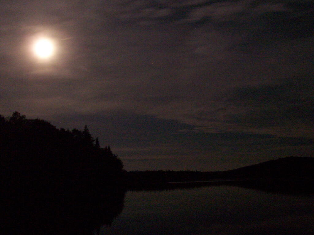
Moonlight on Cedar River Flow

Most of the light I saw in the sky probably was from street lights, parking lot lights, exterior building lights on lodges and businesses alike along the Fulton Chain of Lakes. It probably would not have been noticable in a more urbanized area, but due to the fact I was in wilderness and almost complete darkness, it shown brightly across the sky.

It’s unfortunate that it disturbs the views of the stars, despite my remoteness. It is much more unfortunate to think of the energy waste it represents. All those lights are supposed to be lighting a section of street, parking lots, deck, or some specific other purpose. They are not intended to be lighting sky or sending light 50 miles away to an observer standing on the Wakely Dam.

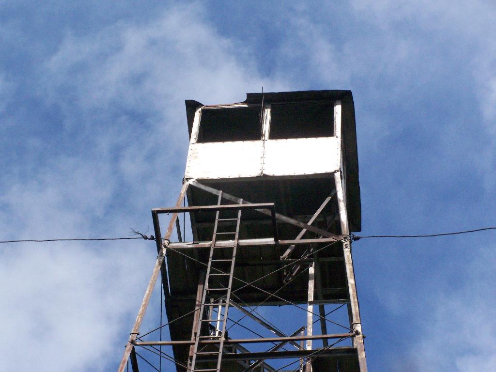
Firetower Cabin

That light did not come from some free source. It came from a power plant that fed electricity in our state-wide electrical grid and sent a small fraction all the way up to the hamelts along the Fulton Chain of Lakes.

While some will argue that their is excess electricity in grid at night or that most of the power locally is generated by hydropower, the reality is electricity on the grid is fungiable, and one unit of hydropower here could be used elsewheres to offset the use of coal or natural gas. Even in low energy use times, the grid still relies on a lot of dirty and polluting fossil fuels.

So I ask myself, why is a hamlet 50 miles away, sending energy in the form of light into wilderness? A lot has to do with technological inefficency that wastes energy, even more has to do with energy being so cheap, that it’s affordable to light up lands 50 miles away with wasted energy. Yet, it seems like such a waste.

Rocky Mountain (Inlet)

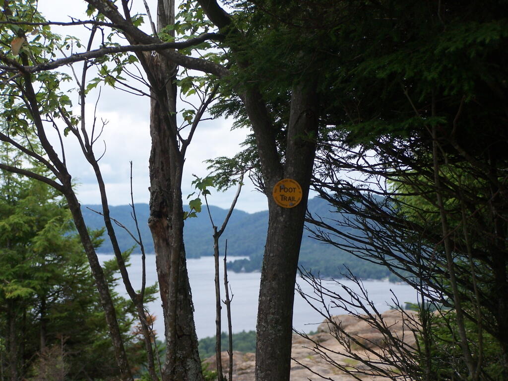
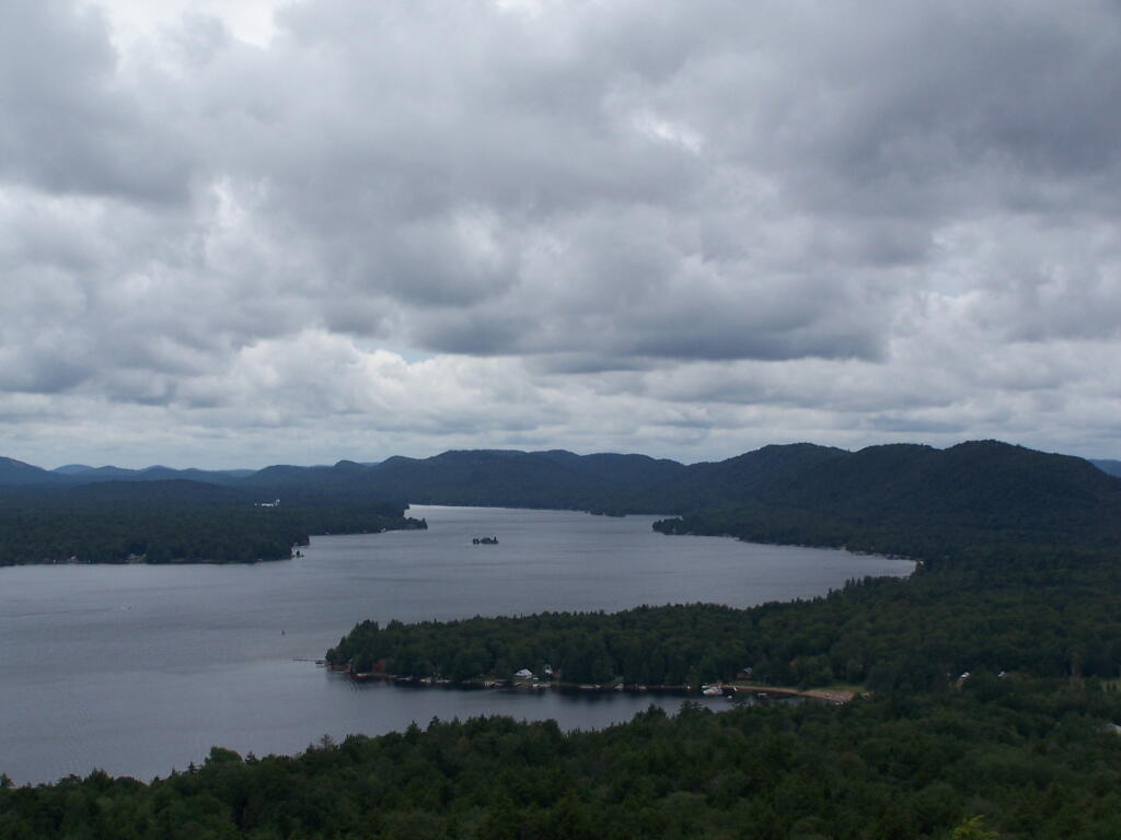
Near Inlet, NY there is a small ledge above Sixth Lake, that is a popular short hike with views of Sixth Lake and surrounding lands. The views aren’t as good as Rondaxe/Bald Mountain, but still are an interesting, half hour hike.

Foot Trail

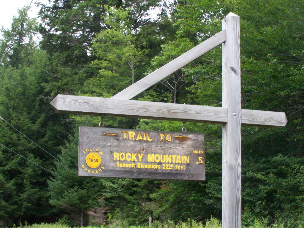
Rocky Mountain Trailhead Sign. Which is great they tell us the elevation of the mountain, but what is the elevation of the parking area? While I know the hike is only an ascent of 400 feet, why couldn’t they just tell us that fact? Silly DEC!

Rocky Mountain Trailhead Sign

The Rocky Mountain Trail while short, is fairly steep, with a few places being almost a scramble.

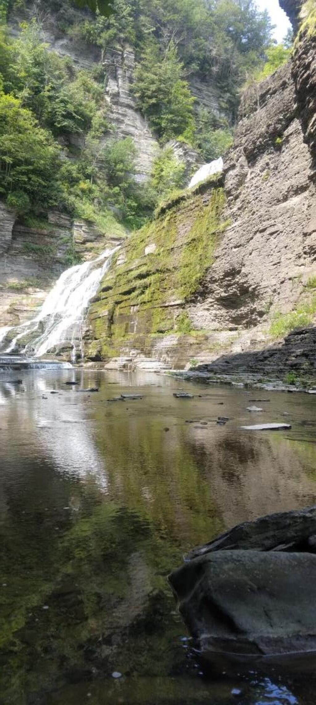
Below Lucifer Falls in the forbidden zone ?

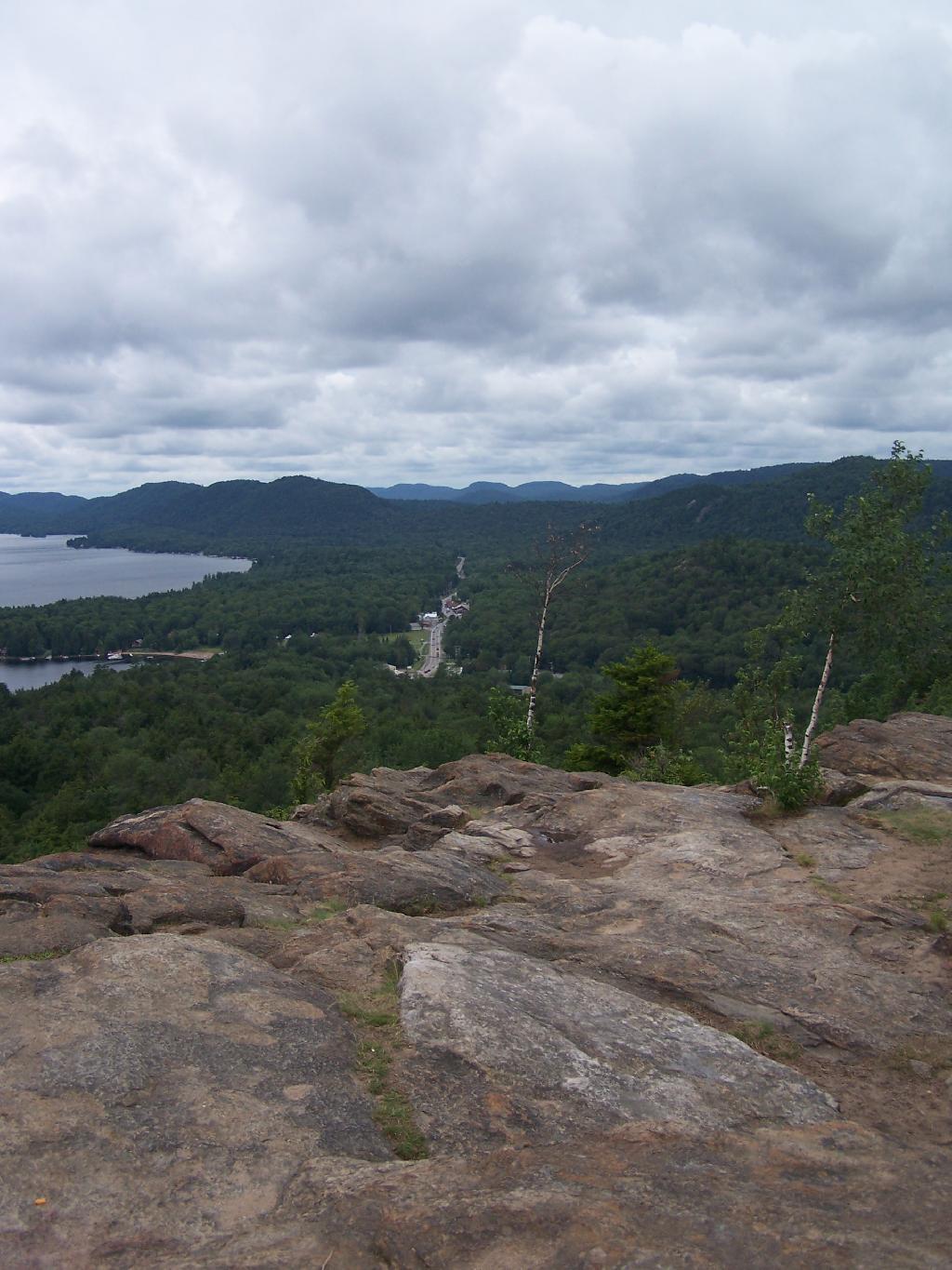
The views off Rocky Mountain are somewhat interesting, but not spectacular as those from Rondaxe just a little ways down the road. Forth Lake is the closest lake, and the one you get the best view from her.

Off Rocky Mountain

Fourth Lake

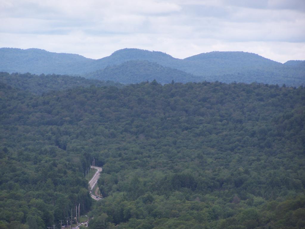
You have many good views of NY 28, such as this one widing down southernly toward Eagle Bay.

NY 28 South Toward Eagle Bay

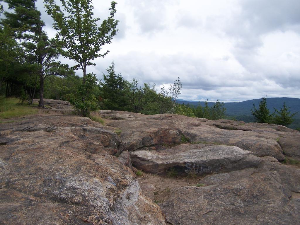
A top Rocky, you can see how this mountain got it’s name.

A Top Rocky

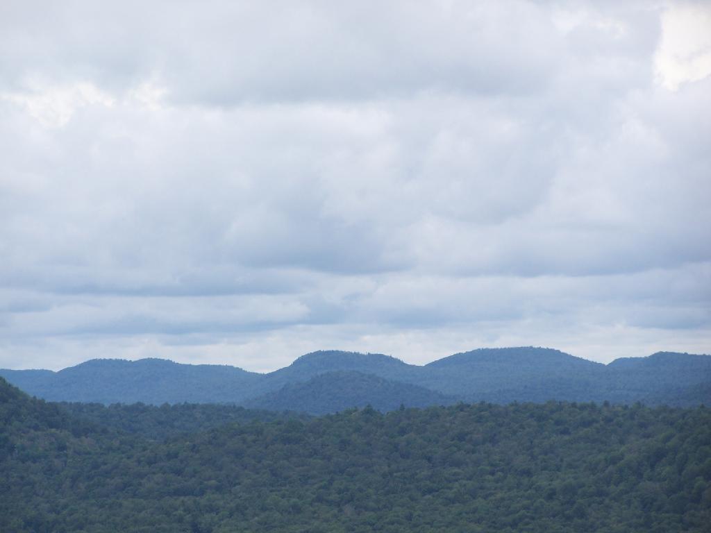
The ridges in this part of the Adirondacks, remind me a little bit farther south around Good Luck Cliffs and NY 10.

Westernly Ridge

Here is a map of the hike.


View Rocky Inlet Map in a larger map