Search Results for: map blue ridge trail

It’s going to get hot out later โ˜€

Those lazy, hazy crazy days of summer are here minus maybe the hot dogs, pretzels and beer. Time is marching on the world changes in your forties.

Good morning! Happy Hot Thursday. To be predicted, it’s the hottest time of the year. Mostly sunny ๐Ÿ˜Žwith fog ๐ŸŒซ around and 69 degrees in Delmar, NY. Calm wind. The dew point is 67 degrees. The muggy weather ends Wednesday around 7 pm. ๐Ÿ˜“

Another hot summer day ahead ๐Ÿ– though I’ll be spending it my air conditioned office and usually it will be cooling down by evening when I get home. Out for the morning walk before it gets too hot out. 10 1/2 miles walked yesterday, climbed up and down 36 flights of stairs in the office as usual.

Red kidney are cooking down in the kitchen, ๐Ÿฒ they will be good with maple ๐Ÿ syrup in the evening when it’s hot out. I got fresh blueberries at the farmers market which where $7 which seems much too expensive but inflation. ๐Ÿ”ต I’m running low on food and supplies but I don’t know what I want to buy and eat with the heat. ๐Ÿ›’ Next time I go shopping, I do want to get some freezer bags, as they’re good for freezing rice and also things like black beans for compact carrying while camping. They can be reused a few times too.

This morning I’m thinking just black coffee โ˜• cream of wheat with the fresh blueberries for breakfast ๐Ÿฅฃ. I do need to get milk ๐Ÿฅ› as what I have in the refrigerator has spoiled. But not this morning. I’m also out of cottage cheese and Greek yogurt and frozen fruit.

Yesterday’s meals where too bland. Too much kale and brown rice. ๐Ÿš Easy and healthy but bleh. Makes it easy and healthy but not so easy to keep on the diet going forward. I was really into kale for a while eating multiple pounds of week, but I’m getting tired of it, much like the tofu. Today I am doing chicken, peas, corn, black beans and red peppers for lunch. Pre-cooked shrimp ๐Ÿฆ are thawing in the fridge, I’m going to mix with the brown rice and tomatoes for dinner and have red kidney beans with maple syrup for dessert. I put chickpeas in the fridge for soaking, I’ll either roast them to toss in with fresh blueberries, strawberries and raspberries with walnuts with a snack. Walnuts are good but loaded with fat, though at least it has a decent ratio of Omega 3. I might also make hummus, which I’ll either need to get tahini or sesame seeds to cook up.

Today will be sunny and hot โ˜€ , with a high of 91 degrees at 2pm. Seven degrees above normal. Maximum dew point of 71 at 9am. Heat index values as high as 95. Calm wind becoming south around 6 mph in the afternoon. A year ago, we had partly cloudy skies. It was somewhat humid. The high last year was 81 degrees. The record high of 97 was set in 1886.

As I’m back on the Trek FX 2 bicycle as my choice, I might try to get up to the Downtube to talk to them about potentially buying that bicycle ๐Ÿšฒ and doing a test ride. I’m getting tired of studying the pros and cons of bicycles and want to commit sooner than later so I can take delivery of the bike and finally be on the road, both for commuting and getting around town. I want to break the bicycle in well before heading out to the Finger Lakes in three weeks. An additional expense I overlooked was a good quality U-lock that resists bolt cutters โœ‚๏ธ which is going to add $75-100 go the cost, but I might be better off getting that on the internet rather than at the bike shop. I also want to get a rear luggage rack so I can tie a small milk crate style storage containers for keeping lunch and supplies on me when doing day trips on the bicycle ๐Ÿšฒ in the Finger Lakes. ๐Ÿ’ธ Looking at around or maybe slightly below $50 for that. Then another under $50 for the combination of buying a very basic digit speedometer / odometers and lights both for safety and do night riding in the National Forest after watching the sun set. ๐ŸŒ‡

Solar noon ๐ŸŒž is at 1:01 pm with sun having an altitude of 70.1° from the due south horizon (-0.7° vs. 6/21). The golden hour ๐Ÿ… starts at 7:54 pm with the sun in the west-northwest (296°). ๐Ÿ“ธ The sunset is in the west-northwest (303°) with the sun dropping below the horizon at 8:37 pm after setting for 3 minutes and 26 seconds with dusk around 9:10 pm, which is 19 seconds earlier than yesterday. ๐ŸŒ‡ The best time to look at the stars is after 9:56 pm. At sunset, look for partly clear skies ๐ŸŒ„ and temperatures around 82 degrees. The dew point will be 69 degrees. There will be a south breeze at 5 mph. Today will have 15 hours and 14 minutes of daytime, a decrease of 57 seconds over yesterday.

Tonight will be partly cloudy ๐ŸŒƒ , with a low of 68 degrees at 6am. Six degrees above normal. Maximum dew point of 69 at 7pm. South wind 5 to 7 mph. Another sticky night sleeping ๐Ÿ˜ด with the fan roaring. In 2022, we had mostly clear skies. It got down to 58 degrees. The record low of 44 occurred back in 1979.

On this day in 1947, The AK-47 goes into production in the Soviet Union. Even after almost seven decades, the model and its variants remain the most popular and widely used assault rifles in the world ๐Ÿช– because of their substantial reliability under harsh conditions, low production costs compared to contemporary Western weapons, availability in virtually every geographic region and ease of use. โš” I bet it would be fun to own one someday, in a freer state when I own my own land. Probably fun for ventilating a burn barrel, lol.

A hot summer weekend ahead. ๐Ÿ– Saturday, a chance of showers and thunderstorms after 2pm. Partly sunny, with a high near 86. Northwest wind around 5 mph becoming southwest in the afternoon. Chance of precipitation is 30%. New rainfall amounts of less than a tenth of an inch, except higher amounts possible in thunderstorms. Maximum dew point of 69 at 9am. Sunday, a chance of showers, then showers likely and possibly a thunderstorm after 2pm. Mostly cloudy, with a high near 81. Chance of precipitation is 70%. Maximum dew point of 70 at 10am. Typical average high for the weekend is 84 degrees.

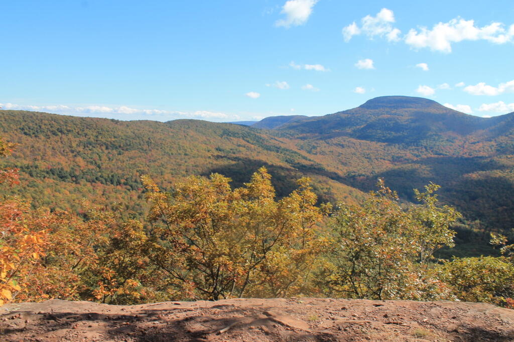
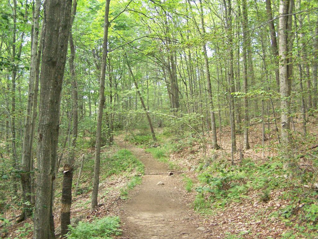
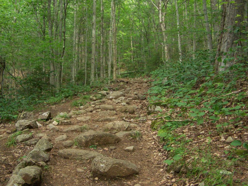
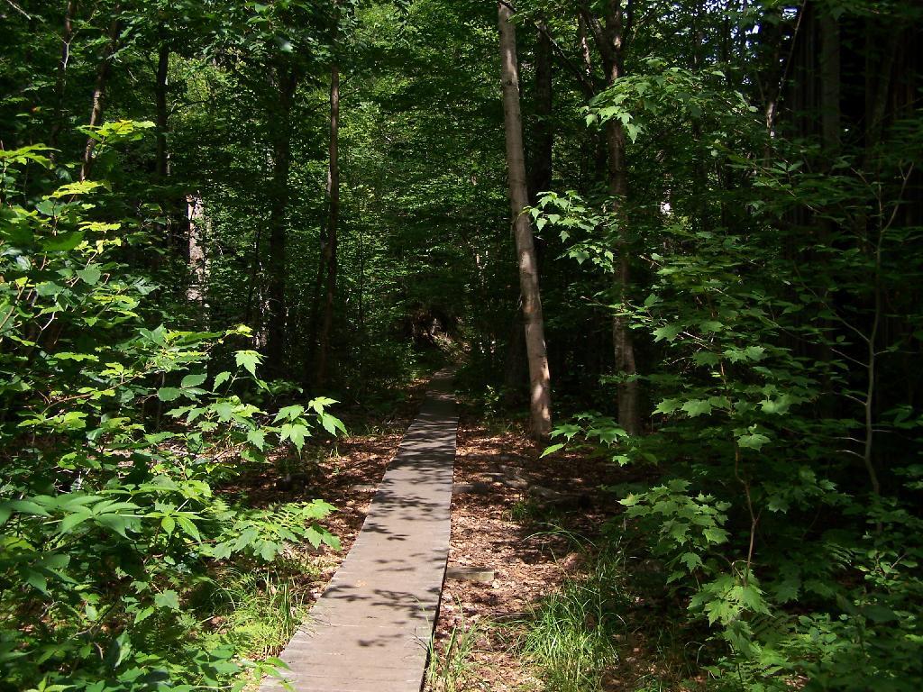
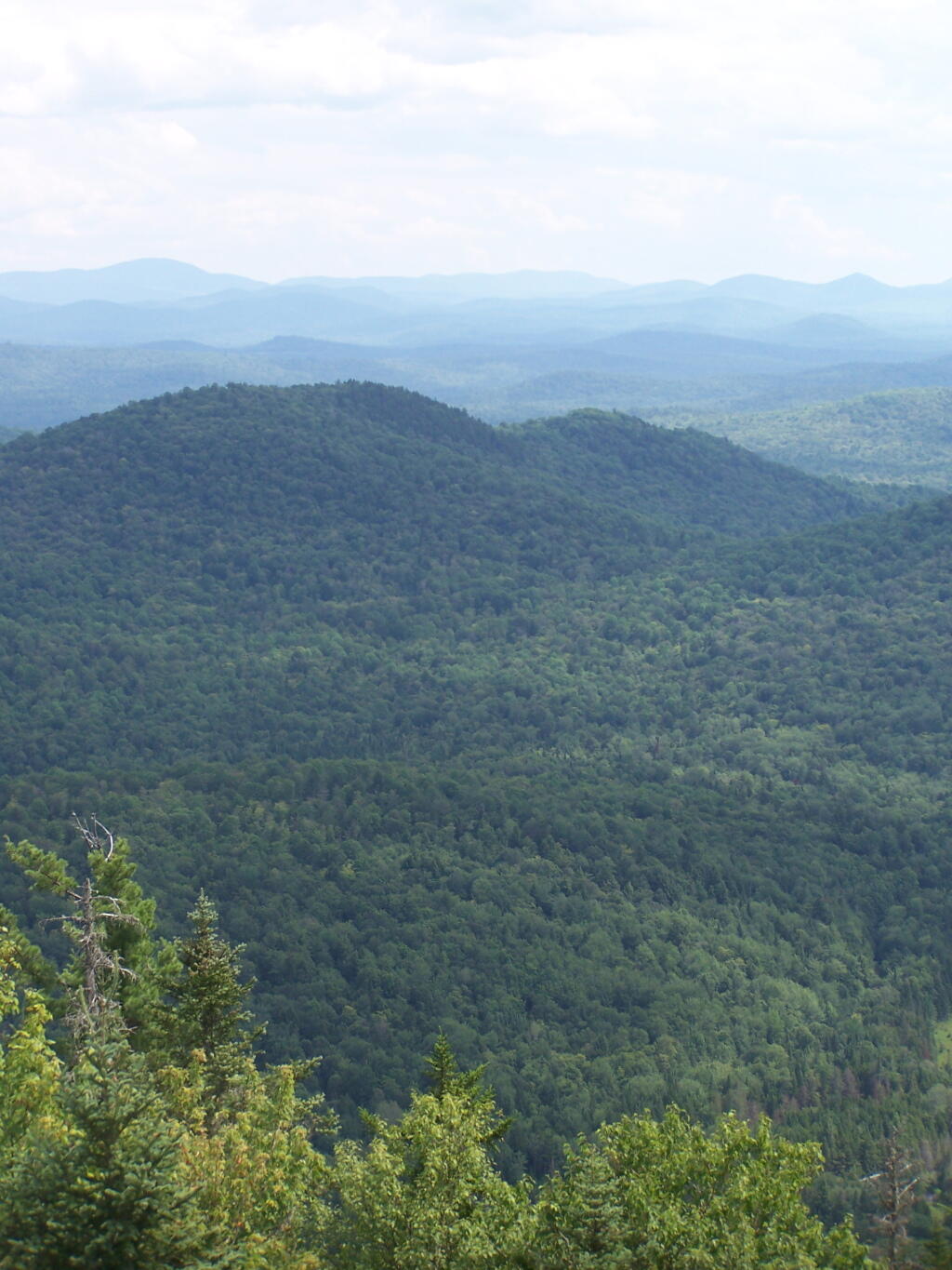
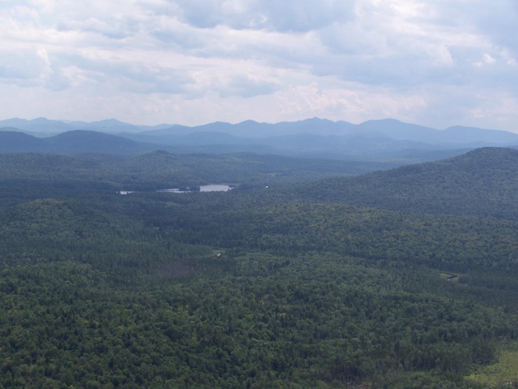
That said, maybe not the nicest weekend ever especially Sunday with the clouds. ๐Ÿคท‍โ™‚๏ธ One more weekend to decide and acquire a bicycle ๐Ÿšฒ then hopefully get out camping ๐Ÿ• the following weekend after my dentist appointment ๐Ÿฆท assuming that the weather is decent. I’m thinking Schoharie County, the Mine Kill Pool, the Catskill Scenic Trail from Grand Gorge to Stamford it maybe even beyond there. ๐Ÿšฒ Also maybe on the Saturday bike from Old Blenheim Bridge up and over Bear Ladder Road ๐Ÿป then down to Fultonhsm by Shauls to get ice cream. ๐Ÿฆ If I have the rack on the bicycle by then not only can I carry lunch but also get some veggies. If not both of these things are good for the following week or after summer vacation. ๐Ÿ– Pool closes Labor Day but the best bicycling and farm stand finds are certainly in September and October. ๐ŸŽƒ

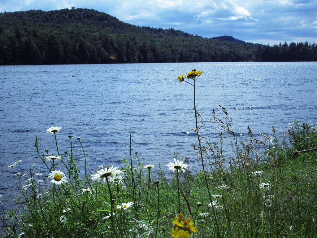
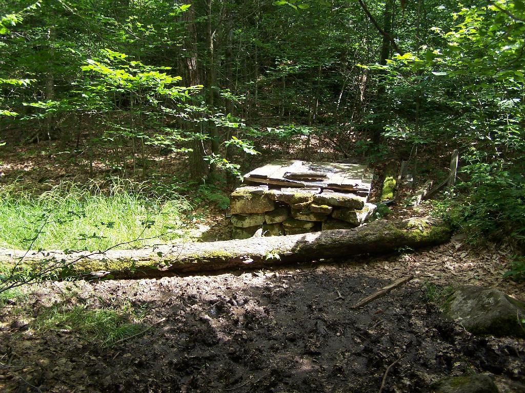
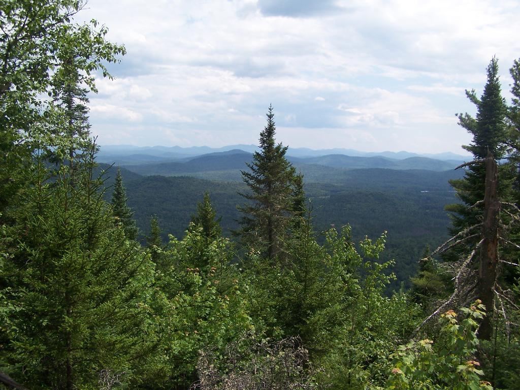
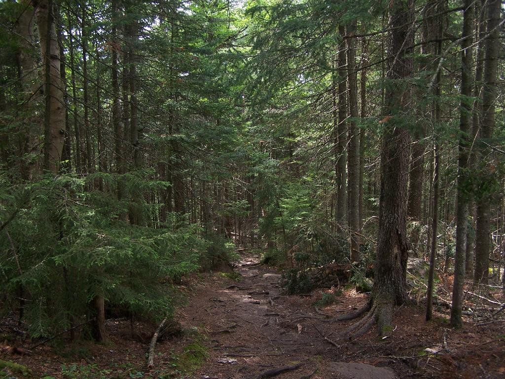
Summer vacation starts Friday July 29th ๐Ÿ– with plans to head straight out to the Finger Lakes National Forest and set up camp โ›บ by noon time. Then have all afternoon to unpack and do a nice bicycle ๐Ÿšฒ ride and enjoy the afternoon from the forest maybe with some fishing ๐ŸŽฃ and a sunset ๐ŸŒ‡ to a start things off. Watkins Glen on Saturday to paddle and swim ๐ŸŠ‍โ™‚๏ธ, though I may want to get to the park ๐Ÿž early to ensure parking ๐Ÿ…ฟ.

Looking ahead, there are 2 weeks until Ugly Truck Day ๐Ÿšš when the sun will be setting at 8:29 pm with dusk at 9:01 pm. On that day in 2022, we had hot, humid, mostly sunny, thunderstorm and temperatures between 97 and 72 degrees. Typically, the high temperature is 84 degrees. We hit a record high of 97 back in 1991.

 Wildflowers Along Cascade Lake

Peaks Over 3,000 Feet Elevation in New York State

There are 229 summits in New York State greater then 3,000 feet elevation.

Tallest Peak Summit Name Elevation County USGS Topo Map Name State Land Trail Location
1 Mount Marcy 5,344 Essex Mount Marcy High Peaks Wilderness NA 44.112733,
-73.9237833
2 Algonquin Peak 5,105 Essex North Elba High Peaks Wilderness Algonquin Trail 44.1436636,
-73.9865357
3 Mount Haystack 4,924 Essex Mount Marcy High Peaks Wilderness Haystack Trail Via Barklet Ridge 44.1056093,
-73.9004196
4 Mount Skylight 4,908 Essex Mount Marcy High Peaks Wilderness Skylight Trail 44.0994987,
-73.9306986
5 Basin Mountain 4,852 Essex Mount Marcy High Peaks Wilderness State Range Trail 44.1211639,
-73.8862527
6 Iroquois Peak 4,829 Essex North Elba High Peaks Wilderness Iroquois Herd Path Via Boundary Peak 44.1369973,
-73.9982027
7 Boundary Peak 4,826 Essex North Elba High Peaks Wilderness Iroquois Herd Path Via Boundary Peak 44.1397749,
-73.9937582
8 Whiteface Mountain 4,816 Essex Lake Placid Whiteface Mountain Ski Center Whiteface Landing To Whiteface Mtn. Trail 44.3658804,
-73.9026456
9 Dix Mountain 4,813 Essex Dix Mountain High Peaks Wilderness Elk Lake To Dix Mountain Trail 44.0822756,
-73.7862471
10 Gray Peak 4,800 Essex Mount Marcy High Peaks Wilderness Mount Marcy Trail Via Opalescent River 44.1114427,
-73.9348658
11 Schofield Cobble 4,744 Essex Mount Marcy High Peaks Wilderness NA 44.1089427,
-73.9270876
12 Little Marcy 4,728 Essex Mount Marcy High Peaks Wilderness Van Hoevenberg Trail To Marcy 44.1197753,
-73.910976
13 Gothics 4,724 Essex Keene Valley High Peaks Wilderness Beaver Meadow Falls Trail 44.1281079,
-73.8570849
14 Mount Colden 4,708 Essex North Elba High Peaks Wilderness Mount Colden Via Lake Arnold 44.1269976,
-73.9598674
15 Beck-horn 4,695 Essex Dix Mountain High Peaks Wilderness Elk Lake To Dix Mountain Trail 44.0800534,
-73.7845802
16 Little Haystack 4,678 Essex Mount Marcy High Peaks Wilderness Haystack Trail Via Slant Rock 44.1103313,
-73.9004197
17 Giant Mountain 4,623 Essex Rocky Peak Ridge Giant Mountain Wilderness North Trail To Giant Mtn. 44.161165,
-73.720279
18 Mount Redfield 4,603 Essex Mount Marcy High Peaks Wilderness Mt Redfield Trail 44.094777,
-73.949866
19 Santanoni Peak 4,596 Essex Santanoni Peak High Peaks Wilderness Bradley Pond Trail 44.0822811,
-74.1309855
20 Wright Peak 4,564 Essex North Elba High Peaks Wilderness Wright Peak Spur Trail 44.1517187,
-73.9801468
21 Nippletop 4,554 Essex Dix Mountain High Peaks Wilderness Nipple Top Trail 44.0892202,
-73.8159708
22 Saddleback Mountain 4,534 Essex North Elba High Peaks Wilderness State Range Trail 44.1264414,
-73.8748634
23 Panther Peak 4,455 Essex Santanoni Peak High Peaks Wilderness Bradley Pond Trail 44.0983915,
-74.132097
24 Rocky Peak 4,403 Essex Rocky Peak Ridge Giant Mountain Wilderness East Trail To Giant Mtn. Via Rocky Peak Ridge 44.1542177,
-73.7051718
25 Macomb Mountain 4,396 Essex Dix Mountain High Peaks Wilderness Macomb-E. Dix Trail 44.0517211,
-73.7801349
26 Hough Peak 4,393 Essex Dix Mountain High Peaks Wilderness S. Dix-Hough Trail 44.0694981,
-73.7776352
27 Mount Marshall 4,380 Essex Street Mountain High Peaks Wilderness Mt Marshall Trail 44.1275538,
-74.0118142
28 Armstrong Mountain 4,360 Essex Keene Valley High Peaks Wilderness Adk Range Trail 44.1347741,
-73.8490291
29 Seward Mountain 4,327 Franklin Ampersand Lake High Peaks Wilderness Seymour Mountain Herd Path 44.1597799,
-74.1993239
30 Allen Mountain 4,321 Essex Mount Marcy High Peaks Wilderness Mt Redfield Trail 44.0708892,
-73.9395871
31 Table Top Mountain 4,295 Essex North Elba High Peaks Wilderness Table Top Mountain Trail 44.143663,
-73.9070876
32 Big Slide Mountain 4,232 Essex Keene Valley High Peaks Wilderness Big Slide Trail 44.1822721,
-73.8704202
33 Esther Mountain 4,232 Essex Franklin Falls Wilmington Wild Forest Esther Mt Trail 44.3869916,
-73.8898673
34 MacIntyre Mountains 4,193 Essex Street Mountain High Peaks Wilderness Mt Marshall Trail 44.1308868,
-74.008203
35 Lower Wolfjaw Mountain 4,190 Essex Keene Valley High Peaks Wilderness W.a. White Trail 44.1483845,
-73.8326399
36 Upper Wolfjaw Mountain 4,190 Essex Keene Valley High Peaks Wilderness Adk Range Trail 44.1406072,
-73.8451402
37 Slide Mountain 4,167 Ulster Peekamoose Mountain Slide Mountain Wilderness Burroughs Range Trail-Wittenberg-Cornell 41.9987034,
-74.3862617
38 Phelps Mountain 4,137 Essex North Elba High Peaks Wilderness Phelps Mtn. Trail 44.1569957,
-73.9209775
39 Cascade Mountain 4,094 Essex Keene Valley High Peaks Wilderness Casade Mountain Trail 44.2186594,
-73.860143
40 South Dix 4,088 Essex Dix Mountain High Peaks Wilderness Macomb-E. Dix Trail 44.060054,
-73.7743014
41 Lookout Mountain 4,078 Essex Franklin Falls Whiteface Mountain Ski Center Esther Mt Trail 44.3778249,
-73.887645
42 Donaldson Mountain 4,062 Franklin Ampersand Lake High Peaks Wilderness Seymour Mountain Herd Path 44.1539471,
-74.210991
43 Seymour Mountain 4,055 Franklin Ampersand Lake High Peaks Wilderness Seymour Mountain Herd Path 44.1578347,
-74.1721003
44 Colvin Range 4,049 Essex Dix Mountain High Peaks Wilderness Colvin Trail 44.0939424,
-73.8345829
45 Mount Colvin 4,049 Essex Dix Mountain High Peaks Wilderness Colvin Trail 44.0939424,
-73.8345829
46 Hunter Mountain 4,045 Greene Hunter Hunter-West Kill Wilderness Spruceton Trail 42.1778662,
-74.2304216
47 Mount Emmons 4,022 Franklin Ampersand Lake High Peaks Wilderness Northville-Placid Trail 44.1436698,
-74.2140464
48 Street Mountain 4,022 Essex Street Mountain High Peaks Wilderness Street Mountain Trail 44.1797741,
-74.0437616
49 Grace Peak 4,006 Essex Dix Mountain High Peaks Wilderness Macomb-E. Dix Trail 44.0653314,
-73.7573564
50 Yard Mountain 3,999 Essex North Elba High Peaks Wilderness Big Slide Trail Via Yard Mtn. 44.1747725,
-73.8845874
51 MacNaughton Mountain 3,983 Essex Street Mountain High Peaks Wilderness Wall Face Ponds Trail 44.1397768,
-74.064317
52 Dial Mountain 3,980 Essex Dix Mountain High Peaks Wilderness Leach Trail 44.1058859,
-73.7959703
53 Blake Peak 3,976 Essex Dix Mountain High Peaks Wilderness Pinnacle Trail 44.081443,
-73.844583
54 Green Mountain 3,976 Essex Rocky Peak Ridge Giant Mountain Wilderness North Trail To Giant Mtn. 44.182272,
-73.714858
55 Black Dome 3,973 Greene Freehold Windham-Blackhead Range Wilderness Blackhead Range Trail 42.2700864,
-74.1226382
56 Thomas Cole Mountain 3,944 Greene Hensonville Windham-Blackhead Range Wilderness Blackhead Range Trail 42.2709196,
-74.1365275
57 Cliff Mountain 3,940 Essex Mount Marcy High Peaks Wilderness Mount Marcy Trail Via Opalescent River 44.1031102,
-73.9751452
58 McDonnel Mountain 3,940 Essex Mount Marcy High Peaks Wilderness Mt Redfield Trail 44.0803332,
-73.9340315
59 Blackhead 3,930 Greene Freehold Windham-Blackhead Range Wilderness Blackhead Mountain Spur Trail 42.2678644,
-74.1045818
60 West Kill Mountain 3,891 Greene Lexington Hunter-West Kill Wilderness Devil’s Path 42.1678663,
-74.2895904
61 Doubletop Mountain 3,875 Ulster Seager NA Seager Big Indian Trail 42.0275913,
-74.5282095
62 Nye Mountain 3,871 Essex Street Mountain High Peaks Wilderness Nye Mountain Trail 44.1931062,
-74.0240387
63 Kilburn Mountain 3,868 Essex Lake Placid Sentinel Range Wilderness Copperas Owen Pond Trl 44.3028247,
-73.8818114
64 Moose Mountain 3,868 Essex McKenzie Mountain Mckenzie Mountain Wilderness Mckenzie Mtn. Trail 44.3506029,
-74.0032049
65 Howard Mountain 3,852 Essex North Elba High Peaks Wilderness Klondike Notch Trail 44.1583844,
-73.8912539
66 Cornell Mountain 3,848 Ulster Phoenicia Slide Mountain Wilderness Burroughs Range Trail-Wittenberg-Cornell 42.0014812,
-74.3568163
67 Graham Mountain 3,848 Ulster Seager NA Seager Big Indian Trail 42.0392576,
-74.5495986
68 Plateau Mountain 3,845 Greene Hunter Indian Head Wilderness Devil’s Path 42.1378671,
-74.1743088
69 McKenzie Mountain 3,842 Essex McKenzie Mountain Mckenzie Mountain Wilderness Mckenzie Mtn. Trail 44.3361593,
-74.0320951
70 Rist Mountain 3,839 Essex Mount Marcy High Peaks Wilderness Boreas Road 44.027559,
-73.987366
71 Sentinel Mountain 3,835 Essex Keene Sentinel Range Wilderness Winch Pond 44.3061581,
-73.8523658
72 Lyon Mountain 3,829 Clinton Moffitsville Chazy Highlands Wild Forest New Lyon Mountain Trail 44.7036537,
-73.8645877
73 T R Mountain 3,829 Essex North Elba High Peaks Wilderness Lake Arnold Crossover 44.143941,
-73.9354222
74 Snowy Mountain 3,825 Hamilton Snowy Mountain NA Snowy Mt 43.7003432,
-74.3859856
75 Table Mountain 3,819 Ulster Peekamoose Mountain Slide Mountain Wilderness Peekamoose-Table Trail 41.9587036,
-74.4048739
76 Peekamoose Mountain 3,812 Ulster Peekamoose Mountain Slide Mountain Wilderness Peekamoose-Table Trail 41.9531481,
-74.398207
77 Avalanche Mountain 3,809 Essex North Elba High Peaks Wilderness Avalanche Pass Trail 44.1361639,
-73.9695903
78 Averill Peak 3,806 Clinton Lyon Mountain Chazy Highlands Wild Forest New Lyon Mountain Trail 44.6928208,
-73.8809768
79 Sugarloaf Mountain 3,806 Greene Hunter Indian Head Wilderness Devil’s Path 42.1312006,
-74.1501414
80 Couchsachraga Peak 3,793 Essex Santanoni Peak High Peaks Wilderness Cold River Horse Trail 44.0956146,
-74.1601539
81 Boreas Mountain 3,779 Essex Mount Marcy NA Gulf Brook Road 44.0031138,
-73.8806937
82 Wittenberg Mountain 3,766 Ulster Phoenicia Slide Mountain Wilderness Burroughs Range Trail-Wittenberg-Cornell 42.0081478,
-74.3473716
83 Panther Mountain 3,763 Hamilton Snowy Mountain NA Snowy Mt 43.7367317,
-74.3907093
84 Burroughs Range 3,760 Ulster Phoenicia Slide Mountain Wilderness Burroughs Range Trail-Wittenberg-Cornell 42.0084255,
-74.3476494
85 Blue Mountain 3,750 Hamilton Blue Mountain Lake Blue Mountain Wild Forest Blue Mountain Trail 43.8725634,
-74.4009917
86 Porter Mountain 3,750 Essex Keene Valley High Peaks Wilderness Porter Mountain Trail Via Marcy Field 44.2153262,
-73.8434754
87 Wakely Mountain 3,750 Hamilton Wakely Mountain Wakely Mountain Primitive Area Wakely Mountain Trail 43.7358986,
-74.5151595
88 Little Nippletop 3,720 Essex Mount Marcy High Peaks Wilderness Elk Lake To Marcy Trail 44.0853327,
-73.9201422
89 Wallface Mountain 3,720 Essex Street Mountain High Peaks Wilderness Indian Pass Trail 44.1378317,
-74.0365378
90 Panther Mountain 3,714 Ulster Shandaken Slide Mountain Wilderness Giant Ledge-Panther Mountian-Fox Hollow Trail 42.0564799,
-74.3945946
91 Balsam Lake Mountain 3,707 Ulster Seager Balsam Lake Mountain Wild Forest Balsam Lake Mountain Trail 42.0459236,
-74.5940438
92 Henderson Mountain 3,707 Essex Mount Adams High Peaks Wilderness Bradley Pond Trail 44.0978353,
-74.0976509
93 Hoffman Mountain 3,701 Essex Blue Ridge Hoffman Notch Wilderness Hoffman Notch Trail 43.9114489,
-73.8168
94 Lone Mountain 3,697 Ulster Peekamoose Mountain Slide Mountain Wilderness Peekamoose-Table Trail 41.9692592,
-74.3893177
95 Big Indian Mountain 3,694 Ulster Shandaken Big Indian Wilderness Pine Hill West Branch Trail 42.0350915,
-74.4965421
96 Hurricane Mountain 3,688 Essex Rocky Peak Ridge Hurricane Mountain Wilderness East Hurricane Mtn Trial 44.235326,
-73.7106926
97 Friday Mountain 3,681 Ulster West Shokan Slide Mountain Wilderness Burroughs Range Trail-Wittenberg-Cornell 41.9875924,
-74.3620944
98 Rusk Mountain 3,678 Greene Lexington Rusk Mountain Wild Forest Spruceton Trail 42.2006434,
-74.2770897
99 Cheney Cobble 3,674 Essex Mount Marcy High Peaks Wilderness East River Trail 44.0445021,
-73.9648654
100 Lewey Mountain 3,665 Hamilton Snowy Mountain West Canada Lake Wilderness Sucker Brook Trail 43.6642328,
-74.4412649
101 Seward Mountains 3,665 Franklin Ampersand Lake High Peaks Wilderness Calkins Creek Truck Trail 44.1561694,
-74.2148801
102 Santanoni Mountains 3,661 Essex Santanoni Peak High Peaks Wilderness Bradley Pond Trail 44.0881144,
-74.138486
103 Buell Mountain 3,652 Hamilton Snowy Mountain NA Snowy Mt 43.7161764,
-74.4065426
104 High Peak 3,645 Greene Kaaterskill Clove Kaaterskill Wild Forest Kaaterskill High Peak Trail 42.1620334,
-74.0801381
105 Little Whiteface Mountain 3,638 Essex Lake Placid Whiteface Mountain Ski Center Whiteface Landing To Whiteface Mtn. Trail 44.3558804,
-73.891534
106 Burtons Peak 3,632 Essex Keene Valley NA The Brothers Trail 44.1925,
-73.8586111
107 Fir Mountain 3,629 Ulster Shandaken Big Indian Wilderness Pine Hill West Branch Trail 42.0275916,
-74.4690414
108 Twin Mountain 3,629 Greene Hunter Indian Head Wilderness Devil’s Path 42.1256453,
-74.1290294
109 Little Moose Mountain 3,609 Hamilton Wakely Mountain Little Moose Wilderness Otter Brook Trail 43.6700663,
-74.5707151
110 Balsam Mountain 3,606 Ulster Shandaken Big Indian Wilderness Pine Hill West Branch Trail 42.0909235,
-74.4882082
111 Calamity Mountain 3,606 Essex Mount Adams High Peaks Wilderness Calamity Brook Trail 44.1028328,
-74.0043132
112 Sunrise Mountain 3,606 Essex Dix Mountain High Peaks Wilderness Elk Lake To Dix Mountain Trail 44.0247778,
-73.7904124
113 Balsam Cap 3,602 Ulster West Shokan Slide Mountain Wilderness Burroughs Range Trail-Wittenberg-Cornell 41.9770369,
-74.3573722
114 Stewart Mountain 3,602 Essex Keene Sentinel Range Wilderness Winch Pond 44.3261581,
-73.8562549
115 North Dome 3,596 Greene Lexington Hunter-West Kill Wilderness Devil’s Path 42.1734217,
-74.3490366
116 Pillsbury Mountain 3,589 Hamilton Spruce Lake West Canada Lake Wilderness Pillsbury Mountain Trail 43.580901,
-74.5120992
117 Slide Mountain 3,586 Essex Lake Placid Sentinel Range Wilderness Barkeater Cliffs Campsite Trail 44.2767136,
-73.8862561
118 Eagle Mountain 3,573 Ulster Seager Big Indian Wilderness Pine Hill West Branch Trail 42.0620352,
-74.50932
119 Dun Brook Mountain 3,563 Hamilton Dun Brook Mountain NA Deer Pond Road 43.890897,
-74.3187666
120 Saddleback Mountain 3,560 Essex Jay Mountain Jay Mountain Wilderness Jay Mountain Trail 44.2953258,
-73.6676367
121 Indian Head Mountain 3,553 Greene Woodstock Indian Head Wilderness Devil’s Path 42.116201,
-74.1145846
122 Fishing Brook Mountain 3,550 Essex Dun Brook Mountain Blue Mountain Wild Forest Deer Pond Road 43.9342303,
-74.2946002
123 Mount Sherrill 3,550 Greene Lexington Hunter-West Kill Wilderness Devil’s Path 42.1756439,
-74.3729262
124 Gooseberry Mountain 3,540 Essex Keene Valley High Peaks Wilderness Orebed Brook Trail 44.1367187,
-73.8731969
125 Bearpen Mountain 3,530 Delaware Prattsville Bearpen Mountain State Forest Access Trail 42.2734189,
-74.4840396
126 Vly Mountain 3,530 Greene West Kill Bearpen Mountain State Forest Snowmobile Trail 42.2453645,
-74.4459834
127 Windham High Peak 3,527 Greene Hensonville Windham-Blackhead Range Wilderness Escarpment Trail 42.3148069,
-74.1434718
128 Halcott Mountain 3,524 Greene West Kill Halcott Mountain Wild Forest Condon Hollow Rd. 42.1800882,
-74.4379281
129 Mount Adams 3,520 Essex Mount Adams High Peaks Wilderness Mt Adams Trail 44.0867231,
-74.0257027
130 Pitchoff Mountain 3,501 Essex North Elba Sentinel Range Wilderness Pitchoff Mountain Trail 44.2375474,
-73.8776443
131 Noonmark Mountain 3,491 Essex Keene Valley High Peaks Wilderness Stimson Trail 44.1289404,
-73.7720809
132 Rocky Mountain 3,478 Ulster West Shokan Slide Mountain Wilderness Peekamoose-Table Trail 41.9728703,
-74.3726505
133 Little Santanoni Mountain 3,471 Essex Santanoni Peak High Peaks Wilderness Moose Pond Horse Trail 44.0731156,
-74.1670981
134 Spotted Mountain 3,461 Essex Underwood High Peaks Wilderness Macomb-E. Dix Trail 44.0769975,
-73.7440228
135 Manbury Mountain 3,455 Hamilton Wakely Mountain Little Moose Wilderness Otter Brook Trail 43.6653442,
-74.5532143
136 Blue Ridge Mountain 3,451 Essex Blue Ridge Hoffman Notch Wilderness Hoffman Notch Trail 43.9247817,
-73.8148558
137 Roundtop 3,451 Delaware Prattsville Bearpen Mountain State Forest Ski Run Road 42.2939737,
-74.4904283
138 Roundtop Mountain 3,451 Greene Kaaterskill Clove Kaaterskill Wild Forest Kaaterskill High Peak Trail 42.1684222,
-74.094583
139 Olderbark Mountain 3,438 Greene Bearsville Indian Head Wilderness Mink Hollow Trail 42.1142565,
-74.1909765
140 Puffer Mountain 3,438 Hamilton Bullhead Mountain Siamese Ponds Wilderness Puffer Pond Brook Trail 43.6617318,
-74.1993082
141 Morgan Mountain 3,432 Essex Wilmington Wilmington Wild Forest Cooper Kill Trail 44.4186582,
-73.8593108
142 Wolf Pond Mountain 3,425 Essex Cheney Pond NA Gulf Brook Road 43.9892253,
-73.8781933
143 Stoppel Point 3,422 Greene Kaaterskill Clove Windham-Blackhead Range Wilderness Escarpment Trail 42.2250879,
-74.0651364
144 Huntersfield Mountain 3,419 Greene Ashland Huntersfield State Forest Huntersfield Access Trail #8/Long Path Access 42.355638,
-74.3465339
145 Cellar Mountain 3,405 Hamilton Wakely Mountain Moose River Plains Wild Forest Cellar Pond Trail 43.7122879,
-74.5429375
146 Haynes Mountain 3,405 Ulster Seager Big Indian Wilderness Pine Hill West Branch Trail 42.0792571,
-74.5079309
147 Sawtooth Mountains 3,402 Franklin Street Mountain High Peaks Wilderness Northville-Placid Trail 44.1928314,
-74.1134874
148 Bear Den Mountain 3,389 Essex Dix Mountain High Peaks Wilderness Leach Trail 44.1194964,
-73.792915
149 Pinnacle 3,389 Essex Dix Mountain High Peaks Wilderness Pinnacle Trail Spur To Summit 44.0583887,
-73.8640277
150 Vanderwhacker Mountain 3,389 Essex Vanderwhacker Mountain Vanderwhacker Mountain Wild Forest Vanderwhacker Firetower Trail 43.8983963,
-74.0959781
151 Jay Mountain 3,379 Essex Jay Mountain Jay Mountain Wilderness Jay Mountain Trail 44.3125477,
-73.685693
152 Spruce Top 3,379 Greene Hunter NA Devil’s Path 42.1506447,
-74.1679195
153 Spruce Mountain 3,376 Ulster Shandaken Big Indian Wilderness Phoenicia East Branch Trail 42.0175919,
-74.4498744
154 Belle Ayr Mountain 3,373 Ulster Shandaken Belleayre Mountain Ski Center NA 42.1159229,
-74.4979304
155 Evergreen Mountain 3,369 Greene Lexington Rusk Mountain Wild Forest Devil’s Path 42.2117542,
-74.3079238
156 Hedgehog Mountain 3,366 Essex Keene Valley High Peaks Wilderness Rooster Comb And Hedgehog Trail 44.159495,
-73.8109724
157 Balsam Mountain 3,353 Greene West Kill Hunter-West Kill Wilderness Condon Hollow Rd. 42.1836992,
-74.387371
158 Kempshall Mountain 3,350 Hamilton Kempshall Mountain High Peaks Wilderness Northville-Placid Trail 44.0236734,
-74.3271041
159 Buck Mountain 3,346 Hamilton Snowy Mountain West Canada Lake Wilderness Snowy Mt 43.6947879,
-74.4368212
160 Mount Pisgah 3,340 Delaware Margaretville NA Mountain Brook Road 42.2211973,
-74.7357125
161 MacDonough Mountain 3,320 Essex Jay Mountain Jay Mountain Wilderness Jay Mountain Trail 44.3050482,
-73.644025
162 Debar Mountain 3,317 Franklin Debar Mountain Debar Mountain Wild Forest Debar Mountain Trail 44.6033852,
-74.2204351
163 Bullhead Mountain 3,314 Warren Bullhead Mountain Siamese Ponds Wilderness John Pond Crossover Trail 43.7017316,
-74.1804199
164 Laramore Mountain 3,314 Essex Keene Valley High Peaks Wilderness Casade Mountain Trail 44.2258813,
-73.8501427
165 Tripod Mountain 3,307 Essex Rocky Peak Ridge Giant Mountain Wilderness Hopkin Via Direct Trail 44.1983824,
-73.736248
166 Metcalf Mountain 3,304 Hamilton Blue Mountain Lake Blue Ridge Wilderness Gould Road 43.7522873,
-74.4957146
167 Wyman Mountain 3,304 Essex Underwood High Peaks Wilderness Macomb-E. Dix Trail 44.0581093,
-73.7445779
168 Jay Mountains 3,297 Essex Jay Mountain Jay Mountain Wilderness Jay Mountain Trail 44.308659,
-73.6704147
169 Eleventh Mountain 3,294 Warren Bakers Mills Siamese Ponds Wilderness Bog Meadow Trail 43.6142322,
-74.0720783
170 Schultice Mountain 3,284 Delaware Roxbury NA Ski Run Road 42.3186948,
-74.5157062
171 Cellar Mountain 3,281 Hamilton Snowy Mountain West Canada Lake Wilderness Sucker Brook Trail 43.6411776,
-74.4443199
172 Plattekill Mountain 3,268 Delaware Hobart Plattekill State Forest Mountain Brook/ Harold Roberts Access Trail 42.2667522,
-74.6482102
173 South Pond Mountain 3,258 Hamilton South Pond Mountain Siamese Ponds Wilderness County Line Brook Trail 43.5900656,
-74.2204175
174 Hemlock Mountain 3,248 Ulster Shandaken Big Indian Wilderness Phoenicia East Branch Trail 42.0128698,
-74.4390407
175 Peaked Mountain 3,235 Essex Jay Mountain Hurricane Mountain Wilderness Soda Range Trail 44.2656034,
-73.6993039
176 Onteora Mountain 3,232 Greene Hunter NA Blackhead Range Trail 42.2223098,
-74.1679184
177 Kitty Cobble 3,225 Hamilton Wakely Mountain West Canada Lake Wilderness Otter Brook Trail 43.6295111,
-74.6229377
178 Baldwin Hill 3,218 Essex Franklin Falls Mckenzie Mountain Wilderness Esther Mt Trail 44.3847694,
-73.9195905
179 Richmond Mountain 3,218 Greene Ashland Mount Pisgah State Forest Long Path Hiking Trail 42.367582,
-74.270976
180 Squaw Mountain 3,218 Hamilton Indian Lake NA Snowy Mt 43.7270094,
-74.3420956
181 Dug Mountain 3,215 Hamilton Kunjamuk River NA Long Pond Trail 43.583122,
-74.345146
182 Hamilton Mountain 3,215 Hamilton Wells Silver Lake Wilderness West River Road 43.412013,
-74.3673645
183 Mount Alton 3,212 Essex Lake Placid Mckenzie Mountain Wilderness Whiteface Mountain Trail 44.3717139,
-73.9662589
184 Utsayantha Mountain 3,209 Delaware Stamford NA Ward Allen Road 42.3992472,
-74.5895953
185 Van Wyck Mountain 3,202 Ulster Peekamoose Mountain Slide Mountain Wilderness Phoenicia East Branch Trail 41.9523147,
-74.4354304
186 Colonels Chair 3,199 Greene Hunter NA Colonel’s Chair Trail 42.2006434,
-74.2306991
187 Gore Mountain 3,199 Warren Gore Mountain Gore Mountain Ski Center Schaefer Trail 43.6764539,
-74.035134
188 Chase Mountain 3,192 Essex Rocky Peak Ridge Hurricane Mountain Wilderness North Hurricane Trail 44.2417145,
-73.7248599
189 Knob Lock Mountain 3,192 Essex Rocky Peak Ridge Giant Mountain Wilderness Hurricane Trail From 9n 44.2003271,
-73.7073583
190 McGregor Mountain 3,192 Delaware Stamford Stamford Fp Detached Parcel Relay Public Forest Access Road 42.3900808,
-74.5790396
191 Weston Mountain 3,192 Essex Jay Mountain Hurricane Mountain Wilderness Soda Range Trail 44.2642144,
-73.7079152
192 Burnt Knob 3,189 Greene Freehold Windham-Blackhead Range Wilderness Escarpment Trail 42.3020297,
-74.1190264
193 Burgess Mountain 3,189 Hamilton Rock Lake NA Bear Trap Brook Trail 43.7520092,
-74.3565416
194 North Mountain 3,186 Greene Kaaterskill Clove Windham-Blackhead Range Wilderness Escarpment Trail 42.2175881,
-74.0487469
195 Payne Mountain 3,182 Hamilton Snowy Mountain Moose River Plains Wild Forest Northville-Placid Trail 43.7231211,
-74.4951582
196 Hopkins Mountain 3,169 Essex Rocky Peak Ridge Giant Mountain Wilderness Hopkins Mtn. Via Spread Eagle Mtn. 44.1833828,
-73.7490257
197 Spruce Lake Mountain 3,163 Hamilton Spruce Lake Mountain West Canada Lake Wilderness Northville-Placid Trail 43.5120126,
-74.6532121
198 Tongue Mountain 3,159 Hamilton Dun Brook Mountain NA Northville-Placid Trail 43.9114522,
-74.3454349
199 Catamount Mountain 3,153 Clinton Wilmington Taylor Pond Wild Forest Catamount Trail 44.459214,
-73.8723668
200 Wildcat Mountain 3,153 Ulster Peekamoose Mountain Slide Mountain Wilderness Pine Hill West Branch Trail 41.9775924,
-74.4759867
201 White Man Mountain 3,146 Delaware Roxbury NA Access Trail 42.2845295,
-74.5340406
202 Bradley Mountain 3,140 Hamilton Wakely Mountain Blue Ridge Wilderness Cellar Pond Trail 43.7378431,
-74.5546055
203 Overlook Mountain 3,136 Ulster Woodstock Overlook Mountain Wild Forest Firetower Spur 42.0850905,
-74.0931954
204 Mount Tamarac 3,127 Essex McKenzie Mountain Mckenzie Mountain Wilderness Jackrabbit Trail 44.3267144,
-74.0204281
205 Mount Morris 3,117 Franklin Tupper Lake NA Goodman Mountain Trail 44.1595046,
-74.475168
206 Acra Point 3,110 Greene Freehold Windham-Blackhead Range Wilderness Escarpment Trail 42.2964745,
-74.0998591
207 Round Mountain 3,107 Essex Keene Valley High Peaks Wilderness Weston Trail Spur To Round Mt 44.1317179,
-73.7515245
208 Cave Mountain 3,104 Greene Hensonville Elm Ridge Wild Forest North Face Trail 42.2859185,
-74.2462543
209 Pete Gay Mountain 3,097 Warren Gore Mountain NA Schaefer Trail 43.6903427,
-74.0443015
210 Plattekill Mountain 3,091 Greene Woodstock Indian Head Wilderness Overlook Trail 42.1073123,
-74.0865281
211 Mount Andrew 3,081 Essex Mount Adams High Peaks Wilderness Bradley Pond Trail 44.0564482,
-74.093483
212 County Line Mountain 3,081 Hamilton South Pond Mountain Siamese Ponds Wilderness Siamese Ponds Trail 43.6114543,
-74.2006952
213 High Point 3,074 Ulster West Shokan Sundown Wild Forest Ashokan High Point 41.9248149,
-74.2879263
214 Rose Mountain 3,074 Ulster West Kill NA Rochester Hollow 42.1506445,
-74.4379284
215 Cowan Mountain 3,068 Delaware Hobart NA Relay Public Forest Access Road 42.3450825,
-74.6498756
216 Round Top 3,068 Delaware Hobart Plattekill State Forest Mountain Brook/ Harold Roberts Access Trail 42.2714741,
-74.6832109
217 Churchill Mountain 3,064 Delaware Stamford NA Relay Public Forest Access Road 42.388692,
-74.6098738
218 Irish Mountain 3,064 Delaware Roxbury NA Ski Run Road 42.3356386,
-74.5262617
219 Swart Mountain 3,061 Hamilton Lake Pleasant Silver Lake Wilderness West River Road 43.3967355,
-74.3815314
220 Scarface Mountain 3,058 Essex McKenzie Mountain Saranac Lakes Wild Forest Scarface Mountain Trail 44.2647717,
-74.0737646
221 T Lake Mountain 3,058 Hamilton Piseco Lake West Canada Lake Wilderness T Lake Trail 43.4470133,
-74.5770967
222 Bailey Hill 3,054 Essex Cheney Pond Hoffman Notch Wilderness Hoffman Notch Trail 43.9108943,
-73.9026366
223 Bald Peak 3,054 Essex Rocky Peak Ridge Giant Mountain Wilderness East Trail To Giant Mtn. Via Rocky Peak Ridge 44.1597731,
-73.6654114
224 Little Rocky Mountain 3,051 Greene Bearsville Indian Head Wilderness Warner Creek Trail 42.1150898,
-74.2040325
225 Denman Mountain 3,048 Sullivan Claryville NA Denman Mountain Snowmobile Trail 41.90287,
-74.5396005
226 Woodhull Mountain 3,045 Ulster Peekamoose Mountain NA Phoenicia East Branch Trail 41.9459259,
-74.4637647
227 Barkaboom Mountain 3,005 Delaware Arena Dry Brook Ridge Wild Forest Touch-Me-Not-Trail 42.0717554,
-74.7201571
228 Stony Creek Mountain 3,002 Franklin Stony Creek Mountain High Peaks Wilderness Ampersand Mountain Trail 44.222002,
-74.2659949
229 Van Dorrien Mountain 3,002 Franklin Ampersand Lake High Peaks Wilderness Ampersand Mountain Trail 44.2222766,
-74.1704351

Burnt Knob Overlook

An interactive map and listing of the 280 peaks over 3,000 feet elevation listed in the Open Street Map database for New York State.

Goodnow Mountain

Goodnow Mountain ๐Ÿ—ป ๐Ÿšถ‍โ™€๏ธ

A couple of weeks ago I hiked up Goodnow Mountain, on a beautiful clear afternoon, that by the time I reached the mountain it started to cloud up and the humidity started to increase. I had previously in the morning attempted to hike up Giant Mountain in the High Peaks, and wanted to do something easier for the afternoon.

Goodnow Mountain is located at the SUNY ESF (Environmental Science-Forestry) College, just south of the Adirondack High Peaks on NY 28, just to the west of Newcomb. It’s a bit of a drive from the Adirondack Northway from the east or even a little ways from Long Lake to the west, but well worth it for the views.

 Trailhead Sign

About a quarter mile up the trail you pass an interesting tree grown over a rock. This is not as uncommon as you might think in the Adirondacks where the soils are poor and the ground is rocky, and trees seek to put down more roots to pick up nuetrants.

Tree Grown Over Rock

At about 1/2 mile you reach the old woods road that at one time, decades ago, provide vehicular access to the tower for forest rangers. Part of the trail is flat, but then it keeps steeper and erosion is noticable on the old road bed, no longer passable by anything then ATV in an emergency.

Trail Follows Old Woods Road


Rougher Part of the Trail

Further up the mountain, the trail follows a series of boardwalks that keeps most of the trail out of the mud and the muck.

Boardwalk

Then you reach an old abandoned barn, a well, and some interesting old debris like what appears to be a tank from a hot water heater storage unit.

Old Barn on Goodnow


Old Well


Old Water Tank

You ascend a ledge, with some limited views to the south.

South East from Ledge

Then their is a thick planation of White Pines along the trail as you make one relatively short ascent to the firetower.

Thick White Pines

Eventually at the last possible moment, you break through the White Pines to see the Goodnow Firetower, and almost instantly want to start climbing it for the views, unless your suffering from heat exhaustion, then you might want to look for the relatively limited shaded but open sections on the mountain.

Goodnow Firetower


Open Window

SUNY ESF has restored to the Ranger’s cabin, and the porch is a farely popular place to sit, enjoy the view, beat the heat for a few moments.

SUNY ESF Ranger's Station

There are many interesting views from the firetower. Here are the High Peaks looking North, the Vanderwhacker Wild Forest to the east, Kempshall Mountain / Long Lake to the west, and Blue Mountain / Blue Ridge to the South.

High Peaks and Newcomb


Vanderwhacker Wild Forest


South from Tower

Here is a map of the hike.

High Peaks Wilderness Parking ๐Ÿ—ป

High Peaks Wilderness Parking ๐Ÿ—ป

Below is a list of DEC parking areas in the High Peaks Wilderness.

Parking Area Description Nearby Trail Road On Lat Lng
Ampersand Parking Lot   Blueberry Horse Trail Amperstand Road 44.1916605216101 -74.2634384334002
Amr Parking Lot Maintained By Dot, 20 Vehicle Capacity Roaring Brook Trailto Giant Mtn. Ausable Club Road 44.1497419915036 -73.7679950097098
West Mill Brook Parking Lot Maintained By Dot, 6 Vehicle Capacity Courtney Pond Trail Dix Wilderness Trail 44.0249442519573 -73.7047623540544
Elk Lake Parking Lot 12 Vehicle Capacity Elk Lake To Marcy Trail Elk Lake Road 44.0196996395741 -73.8266783528032
Cascade Mountain Parking Paved, Roadside Pull-Off Casade Mountain Trail NY 73 44.2196728508921 -73.8858798087473
Cascade Lakes Picnic Parking   Pitchoff Mountain Trail NY 73 44.2255447838164 -73.8751811579178
Cascade Mountain Parking Paved, Roadside Pull-Off Pitchoff Mountain Trail NY 73 44.2189443167024 -73.8874781553099
Cascade Mountain Parking Paved, Roadside Pull-Off Pitchoff Mountain Trail NY 73 44.2183931807012 -73.8894370872999
Zander Scott Trail Head Parking Lot Paved, Maintained By Dot, 40 Vehicle Capacity Ridge Trail To Giant Mountain NY 73 44.138255933091 -73.7436978674947
Pull Off   Round Pond Trail NY 73 44.1368895741045 -73.7422824389762
Round Pond Parking Lot Paved, 8 Vehicle Capacity Round Pond Trail NY 73 44.1320077972245 -73.7319715371644
Chapel Pond Parking Lot Paved, Maintained By Dot, 10 Vehicle Capacity Round Pond Trail NY 73 44.1403322479409 -73.7463981627774
South Branch Bouquet River Parking Lot Maintained By Dot, 11 Vehicle Capacity Round Pond Trail Spur To Campsite NY 73 44.1040542341833 -73.6929545851725
North Branch Bouquet River Parking Lot Maintained By Dot, 10 Vehicle Capacity Round Pond Trail Spur To Campsite NY 73 44.1141894890601 -73.7097647324262
Beerwalls Parking Lot Paved, Maintained By Dot, 24 Vehicle Capacity Weston Trail NY 73 44.1456023560885 -73.7560857515608
Marcy Dam Parking Lot   Marcy Dam Truck Trail South Meadows Road 44.1896114889394 -73.9385542601212
East River Trail Parking   East River Trail Upper Works Road 44.0812112121921 -74.0551293402588
Upper Works Trail Parking   Indian Pass Trail Upper Works Road 44.0891639549695 -74.0564019659383
Walker Brook Parking Lot Maintained By Dot, 6 Vehicle Capacity Bass Lake Trail US 9 43.9994562009087 -73.7090410772457
King Phillips Spring Parking Lot Paved, Maintained By Dot, 25 Vehicle Capacity Deadwater Road US 9 At Northway 44.077412279315 -73.6652084506369

December 20, 2020 Morning

Good morning! Happy Sunday. โ›ช Third Sunday of advent, last day of autumn 2020. Winter 2021 starts tomorrow. That said it’s going to warm up a lot this week with possibly heavy rain on Christmas Eve. ๐ŸŽ„ โ˜” Two weeks to Latest Sunrise of the Winter ๐ŸŒ„๏ธ. Mostly cloudy and 21 degrees in Delmar, NY. โ˜ There is a south breeze at 6 mph. ๐Ÿƒ. The current wind chill is 10. There are 21 inches of snow on the ground. โ˜ƒ ๏ธThings will start to thaw out at tomorrow around 10 am. ๐ŸŒก๏ธ

Yesterday was nice cross country skiing ๐ŸŽฟ at Schodack Island. That said I really enjoyed the Christmas ๐Ÿคถ๐Ÿป Spice Cookies ๐Ÿช they have at Aldi’s. Cheap too and so good. I really need to get over to Rennselear more often. Well with winter I probably will ski more at Schodack Island as there isn’t the hills there to fall on as my skiis are fairly aggressive, designed for groomed trails. I saw a fair number of bright red robins and Blue Jays out there and lots of eastern sparrows. ๐Ÿฆ Kind of a pretty sunset ๐ŸŒ‡ and I ran into one of Albany’s most chatty insiders there ๐Ÿ—ฃ๏ธ and we chatted for a while until right before the park was locked ๐Ÿ”’ for the evening. Fun though, and I got to learn all the gossips about Albany.

I tell you when I own my own land, ๐Ÿ›’ I hope to live near enough a town that has an Aldi’s – they’re cheap, fun and so convenient. While they don’t have the selection of a Wally World or the bulk goods, ๐Ÿฑ I like their product selection. True, sometimes the lower their prices by smaller packages ๐Ÿ“ฆ but as they say, the burn barrel gotta eat too. ๐Ÿ”ฅ Plus a good library to download podcasts, ๐ŸŽง and a laundromat. ๐Ÿ‘š I wouldn’t mind living out in the sticks ๐Ÿฎ in a town that smells like silage and manure some of the year but it’s nice to have access to the basics. Good gun shop ๐Ÿ”ซ too.

You can forget what an agricultural county Rennselear is but while I was shopping ๐Ÿ›’ at Aldi, I spotted a Toyota Tundra with a big metal flask in the backseat. It caught my eye ๐Ÿ‘โ€๐Ÿ—จ and it turned out to be a bucket milker. ๐Ÿฎ Dairy farmer, maybe a small scale operation or maybe they’re using it to milk a cow that is on the withdrawal period from antibiotics or for feeding calves. Big unit though, must be heavy when it’s full of milk but then again Holstein do produce a lot of milk ๐Ÿฅ›. Upstate NY may have fewer farms but there are still a lot of people who homestead and live off the land – and Aldi’s is such an affordable option.

At any rate, yesterday was nice โ˜€ and pretty sunny although a bit cold but nice when I was moving. Getting off the trails though was a bit of slog with the skiis though. ๐ŸŽฟ I thought about going up to Partridge Run but it’s still black powder season ๐ŸฆŒ and I’d be drowned out probably by the noise of snow machines.

Today will snow showers likely, mainly after 3pm. Cloudy ๐ŸŒฆ, with a high of 32 degrees at 5pm. Two degrees below normal, which is similar to a typical day around December 27th. South wind 6 to 9 mph. Chance of precipitation is 60%. Total daytime snow accumulation of less than a half inch possible. A year ago, we had mostly sunny skies in the morning with some clearing in the afternoon. The high last year was 21 degrees. The record high of 61 was set in 1957. 8.4 inches of snow fell back in 1975.โ„

Not a super nice day out today ๐ŸŒจ๏ธ just very gray. I told mom and dad I’d be out for Sunday dinner assuming that it doesn’t snow too much. ๐Ÿฒ It will be nice to see them. I’m really not out and about in the community lately and we’ll stay socially distant. I do go to the supermarket ๐Ÿ›’ from time but I wear a mask ๐Ÿ˜ท and any COVID positive person I might be near its very passing at that.

Dash cam hasn’t been working right for some time now. ๐Ÿ“น It looked like it was crashing. I am going to try reformatting the memory cards ๐ŸŽด and installing the latest firmware update and clean the lens off. I really like capturing some scenes from my trips on the dash cam but it hasn’t been working reliaby all autumn. It is about four years old and though is exposed to all the heat and cold in the windshield so maybe a capictor or the alike is failing.

Solar noon ๐ŸŒž is at 11:54 am with sun having an altitude of 24ยฐ from the due south horizon (-46.9ยฐ vs. 6/21). A six foot person will cast a 13.5 foot shadow today compared to 2.2 feet on the first day of summer. The golden hour ๐Ÿ… starts at 3:40 pm with the sun in the southwest (230ยฐ). ๐Ÿ“ธ The sunset is in the west-southwest (238ยฐ) with the sun dropping below the horizon at 4:25 pm after setting for 3 minutes and 25 seconds with dusk around 4:56 pm, which is 27 seconds later than yesterday. ๐ŸŒ‡ At dusk you’ll see the First Quarter ๐ŸŒ“ Moon in the south (174ยฐ) at an altitude of 37ยฐ from the horizon, 246,764 miles away. ๐Ÿš€ The best time to look at the stars is after 5:33 pm. At sunset, look for snow ๐ŸŒจ and temperatures around 31 degrees. There will be a south-southeast breeze at 9 mph. Today will have 9 hours and 2 minutes of daytime, a decrease of 6 seconds over yesterday.

Tonight will have a slight chance of snow showers before 9pm. Mostly cloudy ๐ŸŒง, with a low of 26 degrees at 4am. Seven degrees above normal, which is similar to a typical night around December 4th. Maximum wind chill around 24 at 4am; South wind 3 to 8 mph. Chance of precipitation is 20%. In 2019, we had light rain. It got down to 8 degrees. The record low of -18 occurred back in 1942.

They still haven’t done the sidewalks near where I live โ„ which is super obnoxious. I thought about a day time walk ๐Ÿšถ๐Ÿป – it’s plowed on the Bypass sidewalks but not Elm at this point. I guess it’s just a lot of snow, there has been budget cuts and probably workers are quarrentined with COVID. ๐Ÿ‘พ I don’t know, it’s frustrating ๐Ÿ˜ค as I sure miss my morning and evening walks, especially as I work from home these days.

Today a train moved very fast in America — that is relatively speaking. ๐Ÿš‰ In 1967, a Pennsylvania Railroad Budd Metroliner exceeds 155 mph on their New York Division, now Amtrak’s Northeast Corridor. But they would never operate that fast and frequently broke down and would be scrapped by the late 1980s or used as coaches towed by diesel locomotives. But the truth is that Penn Central was in bad shape by the 1960s, and while the Northeast Corridor was still profitable to the system, the entire railroad suffered from Penn Central decades of neglect.

Tuesday I am thinking I’ll work down at the library parking lot ๐Ÿ…ฟ for probably the balance of the day. It’s going to be in the upper 30s and sunny โ˜€ so it should be warm enough. I have a Zoom meeting then and I have plenty of cellular bandwidth I still prefer to use the library wifi ๐Ÿ“š as then I can do the Zoom from my laptop do other things while the meeting drags on. Plus I want to do some things with WMS map services and I don’t want to use too much of my limited Hotspot data on my phone. ๐Ÿ“ฑ

It looks like Christmas Eve ๐ŸŽ…๐Ÿป is going to be warm and rainy, โ˜” so I’m hoping that I can go up to the Adirondacks for a long weekend of winter camping ๐Ÿ• with the hot tent starting Christmas Day. Its been a while since I’ve slept outside and that really does wonders for my sleep.

As previously noted, there are 2 weeks until Latest Sunrise of the Winter ๐ŸŒ„๏ธ when the sun will be setting at 4:34 pm with dusk at 5:06 pm. On that day in 2020, we had mostly cloudy, mild, rain showers and temperatures between 47 and 39 degrees. Typically, the high temperature is 31 degrees. We hit a record high of 61 back in 1913.

 Smoke Stacks

Camping Areas in Southern Adirondacks

Camping Areas in Southern Adirondacks โ›บ

East Branch of Sacanadaga River, NY 8 – Roughly 10 campsites along NY 8. These are easily accessed throughout the year, as the road is plowed except when the snow banks are high during the winter. East Branch is not good for fishing due to wide variance in water levels, however there are some nice pools in sections of river for summer swimming. Lots of road noise. Some of the sites have cell service. Nearby locations include Cod Pond, East Branch Trail and Kibby Pond Trail.

Edick Road – There are a handful of very hidden campsites off of Edick Road. This road may be closed to vehicles due to wash outs autumn 2019, but worth a walk to explore this area.

Fawn Lake – A 1/2 mile hike back to a scenic lake ringed by primitive campsites outside of Lake Pleasant. Two miles beyond it is the scenic Willis Vly, which doesn’t have developed campsites but it’s remote wilderness where you might see a Moose or other wildlife.

Garnet LakeTent sites, some with drive-up access along the lake. No cell service, much of the upper road here is not maintained in the winter. Popular in the summer, no cell service.

Good Luck Lake – Scenic lake off of the West Branch Sacanadaga River that is ringed with tent sites that can be walked in from the Good Luck Lake parking area area or paddled in.

Hope Falls Road – Two or three campsites along the end of Hope Falls Road, some are drive-in only tent sites. Near the Tenant Creek Falls Trail. No cell service. Open June to autumn snowfall.

Harrisburg Road – There is a set of very rustic designated campsites along the rough Harrisburg Road past Harrisburg Lake. Somewhat near Crane Mountain, a couple mile hike to and Wilcox Lake. No cell service.

Lester Flow and Cheney Pond – Scenic lake that is popular for paddling. The 1/2 mile road down from Boreas Road as of June 2020 is closed due to washouts. Tent sites exist along the lake, along with one drive-to site on the road down there.

Mason Lake – Small lake located about 10 miles north of Speculator and 5 miles south of Lewey Lake that has several tent and drive-in campsites along it’s shore. Good to fair cell service here. Nice to hear loons, one of the best bass ponds in the area.

North Lake Reservoir – There are roughly 15 campsites on the east shore of North Lake Reservoir. Popular place in the summer, regularly staffed by conservation students. Noise from motorboats. No cell service. Nice if you want to camp right on water, hear loons at night..

Northwood Club Road – In Minerva, this road crosses the Boreas River and has several roadside campsites, and passes by Huntley Pond, the NL Tahawus Railroad (which can be hiked to the Boreas River at Hudson River), and the Blue Ledges on the Hudson tailhead.

Perkins Clearing – Conservation easement lands. Good to fair cell service here. Great place for hunting and wildlife observation as it’s mixed timber country. Near Mason Lake, Speculator, Pillsbury Mountain and Cedar Lakes.

Piseco-Powley Road – A dozen campsites along a 13 mile road with short hikes including Big Alderbed, House Pond, Sand Lake and the popular Potholers/Brayhouse Brook waterfall for swimming. As of June 2020, road is closed in Stratford/Fulton County portion, road is open north of Potholers/Brayhouse Brook (access via Piseco). Very limited cell service here.

Pumpkin Hollow Road – Three campsites above Willis Lake. Remote country except for the site on Willis Lake, no cell service. On the Willis – Wilcox Lake Trail. Very quiet area. Open June to autumn snowfall. No cell service here.

Rockwood State Forest – Three campsites along the end of Church Road which can be accessed by driving past the cemetery in the hamlet. Scenic lake, good fishing. Cell service available, but bring a trash bucket and gloves as litter can be a problem. Nice trails to stroll around in the old Rockwood Estate.

Stewart Landing – There are four campsites on a rough road that loops off of Stewart Landing Road. Popular area in the summer, Canada Lake is great for paddling and informal swimming. Also consider hiking back to Hilderbrandt Vly and Glassgow Lake from here. Moderate to poor cell service here.

Vanderwhacker Road -Five or six campsites exist along Vanderwhacker Road, which can be muddy in the spring and icy in late autumn. Additional designates campsites exist near where NY 28N crosses the Vanderwhacker River. Near the trail to the Vanderwhacker Firetower, No cell service.

White House, Wells – A grouping of 5 or 6 campsites at the end of White House in West River Road. Scenic area, old camp, with fields and a chimney. Campsites are kind of close together, not a wilderness experience. Near the North Country Placid Trail, lots of blueberries in mid-summer. No cell service. Open June to autumn snowfall.

Woodhull Lake Reservoir – Off of NY 28 in McKeevers, about 10 miles south of Old Forge. Not only is this beautiful reservoir to paddle, there are some campsites along the shore, with drive-to campsites along Wolf Lake Landing Road which leads to it. Part of Wolf Lake Landing Road is erroded, but other parts are fresh stone-dust. It’s remote wilderness but there good cell service in mcuh of the area.

The Weekend that Was At Moose River Plains

This past long independence Day Weekend I went up to Moose River Plains. Some observations and notable things from the weekend that was — I’m going to post additional pictures and stories later.

Wednesday

  • I got to leave work early on Wednesday around 3 PM, so I was home by 3:30 PM on the road by 4 PM.
  • Deciding that the traffic would be bad at that hour on all expressways, I decided to shun the main roads for the blue highway.
  • I took State Farm Road (NY 155) to US 20 West to Duanesburg Church Road past Mariaville Farm to NY 30 to Indian Lake then out to Cedar River Road.
  • Driving past the Mariaville Farm, I was noticing how many hogs they had in a barnyard near their home. And I saw a hog taking a piss — they pee like cows. Farming is great but I think I’d want more distance my house and livestock.
  • I still need to visit For the Love of Bacon. It’s just off of the first exit of Interstate 88, I have no excuse not to.
  • Google Maps estimates that the trip via the Northway at normal traffic would take 2 hours and 20 minutes, my shun-pike way took about 3 1/2 hours, although the Northway with delays was looking closer to 3 hours when I checked on Wednesday evening.
  • That said it was worth it because I really hate driving on the expressway.
  • I thought I heard a noise driving up to Moose River Plains that had me a bit worried, turned out just to be strap on the kayak flapping around.
  • Made it to Cedar River Flow by 7:30, took some pictures at the flow and signed in.
  • There are new entrance signs. They say you should call for a camping permit for all stays over three nights even if you plan to camp at a different part of the plains. I think that’s silly and not consistent with the regulations – I stayed four nights but at two different sites.
  • I wouldn’t object to getting a camping permit but it’s a pain to play phone tag with the ranger when you should be able to do it online.
  • As soon as I stepped out of the truck I realized what a buggy weekend it was going to be with a shit ton of horse flies
  • The first night I camped at campsite 26 which is a little ways up from the Silver Run. Nice night, but buggy until it got dark.
  • It was nice to leave work early and not have to set up in the dark. Kept my campsite simple as I planned to break camp early and get a site I really liked around the Moose River so I could walk to a swimming hole from camps.
  • I bought some wood at Quinzal’s on Cedar River Road on the way up and had a good fire with that plus some wood I found in the woods.
  • Stayed up late until around midnight, drank a lot of beer, listened to some podcasts and music until around midnight.

Independence Day

  • The next morning I got up probably too early, stumbled around and took down camp. Headed straight toward the Big T, hoping to find a campsite near water in the plains where I could swim.
  • I ended up choosing campsite 94 which was a short walk to the Moose River Bridge which at the time I set up had no near neighbors
  • It was a nice site, open and airy but well screened and set back from the road. Had a nice new outhouse and picnic table although the fire place was in rough shape.
  • Deer flies were nasty.
  • I tried sitting and reading in my hammock and despite being covered from head to toe in a mixture of Picardin, DEET and PMD it only limited them a bit.
  • Another family on Independence Day took the campsite across the way – a good working class family and they had a pretty wild party up at Moose River Plains on independence Day with lots of country music, fireworks and alcohol.
  • Independence Day was hot and buggy, the deer fly were so bad for a while I left hammock and took a nap in my truck with the fan blowing.
  • Despite napping in my truck a deer fly got inside and bit my lip while napping. It hurt like a mother. I almost thought about taking down camp and heading home.
  • I eventually strapped on my bathing suit and went down to the Moose River to cool off for a few hours.
  • Finished one book started another one. Very pleasant laying in the hammock after dark .
  • Did a night hike to Icehouse Pond and it was nice but buggy.
  • Had a decent size fire, lit off some small fireworks

Friday

  • Friday I hiked back to the Beaver Lake. Been a long time since I’ve been back there. Not many fish biting with the heat.
  • Beaver Pond at least had a steady breeze that limited the horse flies but it was hot.
  • That said while I was down by the lake I got bit by a horse fly and my ear got swollen.
  • I forgot how enormous that
  • Hiked back to camp then back into the Moose River to cool down.
  • In the evening I hiked down Otter Brook Road to the Sly Pond Trailhead.
  • Laid out on the Moose River Bridge for about an hour looking at the stars
  • It was pretty laying back in the hammock watching the stars and my laser light show on the trees above how the light scattered and was beautiful.

Saturday

  • Saturday was a bit more stormy with lots of clouds but only a few showers
  • I had plenty of electricity despite the lack of sun for most the day
  • I did more reading, laid in the hammock, wrote some blog posts and listened to podcasts
  • Disassembled my camp stove and determined it was the burner unit is where the leak is and needs to be replaced.
  • I went to Moose River to swim for a few hours, listening to podcasts.
  • Didn’t gets lot of rain but most of the day was cloudy. Certainly not the heavy rains of Albany.
  • Went back to Icehouse Pond to fish around dusk
  • Sat out on the Moose River Bridge watching the stars into the wee hours of the morning. Much clearer tonight no light pollution

Sunday

  • Sunday I broke camp modestly early although I proscastinated a bit as I wanted to top off the starting battery with solar so it would be healthy to start the truck.
  • Ended up deciding Stillwater was too far away to hike the Fire Tower so decided to paddle Moss Lake.
  • Not a really big late, lots of noise pollution from Big Moose Road and crowds, wouldn’t paddle again and caught nothing.
  • I wish I had done something different but I felt like I should use the kayak having brought it.
  • Headed home shunning the interstates again, taking NY 28 through Old Forge to Remsen then Middleville and NY 169 to Little Falls to NY 5S and then decided to take NY 152 through Rural Grove down to NY 20 and home. Slower than the Thruway but I like seeing all the farms along it.

Campfire