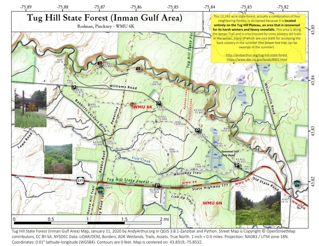
This 12,242-acre state forest, actually a combination of four neighboring forests, is so named because it is located entirely on the Tug Hill Plateau, an area that is renowned for its harsh winters and heavy snowfalls. This area is along the Inman Trail and is criss-crossed by cross country skil trails in the winter, many of which are nice trails for accessing the back country in the summer (the power line trail can be swampy in the summer).
https://andyarthur.org/tug-hill-state-forest
https://www.dec.ny.gov/lands/8001.html
A map of campsites by paid permit in the Delaware State Forest in Milford, PA. You can get a permit and details here: https://www.dcnr.pa.gov/StateForests/FindAForest/Delaware/Pages/Camping.aspx
This map shows the Appalachian Trail in Pennsylvania, including state forests and campsites.
The Brookfield Trail System consists of several state forests with 135 miles of horse and snowmobile trail located between Bridgewater, Sangerfield, Earlville, Sherburne in Southern Madison County, Central New York.
For information on how to get a free permit to camp at these locations outside of Blossburg in Tioga State Forest contact the Tioga State Forest office. https://www.dcnr.pa.gov/StateForests/FindAForest/Tioga/Pages/default.aspx There is also the County Bridge $10 lightly developed campsite at County Bridge Road.
Roadside camping in Benezette Elk Country with a free permit that can be gotten from the Moshannon State Forest office. https://www.dcnr.pa.gov/StateForests/FindAForest/Moshannon/Pages/default.aspx