Search Results for: stone hill state forest

WINONA STATE FOREST UMP

Senior Forester Ed Sykes
NYS Department of Environmental Conservation, Region 6
7327 State Route 812
Lowville, NY 13367

July 15, 2013

Dear Mr. Sykes:

ย RE: WINONA STATE FOREST UMP

The Draft Winona State Forest UMP appears to be incorrect as it relates to the Facilities Inventory, subsection โ€œDesignated Campsitesโ€ on page 24:

There are three designated campsites on Winona, and their locations are as follows:

ย โ€ข Co. Rte. 90, 0.1 mile east of the intersection of Brown and Co Rt. 90;

โ€ข On Bargy Rd., 0.3 mile south of CCC Camp;

โ€ข On Tucker Rd., 0.4 mile east of the intersection of Bargy and Tucker Road

Based on my casual inspection of these locations, I was unable to locate these campsites. It is possible that these sites have not been mowed, reverted to woods, and/or do not have the required โ€œCamp Hereโ€ disks pursuant to NYCRR 6 Part 190.

There is however, one relatively well-used campsite near GPS location N 43.69528 W 75.97681. This site is located roughly 300 feet south of the intersection of Bargy Road and Dog Leg Trail. It is indicated by a โ€œCamp Hereโ€ disk, and is consists of a stone fire ring, and a hardened-with-gravel camping pad.

Many traveling New Yorkers enjoy having drive-to, โ€œroad-side campsitesโ€, that provide minimal facilitiesย  but allow one to camp there with a pickup truck with a camper top, or a small-tow along camper, such a pop-up or tear-drop camper. Likewise, people with families appreciate being able to pull into a campsite, set up a tent, without having to carry it back to the woods. In the western Tug Hill Plateau, this is the only location that offers this essentially primitive-style camping.

The DEC should designate five (5) roadside campsites along the various roads in Winona State Forest.

The Next Morning

ย These campsites should follow the design of roadside campsites in the Adirondack Park, e.g.

all campsites should be at least a quarter mile apart (at least out of eye-shot/ear-shot each other),

  • be properly designated with โ€œCamp Hereโ€ disks,
  • set back at least 150 ft from water, trails, and other facilities; and
  • consist of a gravel-hardened pull off with shading from the road, and a small stone-fire ring.
  • No other facilities should be a provided, except for outhouses, as decided based on usage.

Standard policies under NYCRR 6 Part 190, such as requiring a camping permit for stays longer then 3 nights, should apply.

DEC operations staff should be instructed to occasionally maintain the campsites, such as mowing and litter removal, similar to what is currently done along roadsides and in parking/assembly areas. DEC Forest Rangers and law enforcement should also occasionally patrol the area, especially on Friday evenings in May and June, to discourage littering and abuse by young adults during the end of school year.

Finally, the DEC Forester should GPS the location of such campsites. and provide such data to the centralized DEC Maintenance Management System (MMS) in Albany, and provide campsite locations on maps and informational kiosks.

Winona Forest CCC Camp

Many people choose roadside camping over state and private campgrounds, or primitive camping the backcountry on undesigned and undeveloped sites. Many like the privacy of roadside camping, the social nature of it, the ability to listen to music without disturbing others in the close-proximity conditions that exist in state campgrounds. By expanding roadside camping opportunities on this state land, it will expand the use of these lands in summer months.

Winona State Forest offers a lot to the visitor, including miles of hiking, mountain biking, and horse trails. The miles of roads provide scenic driving, and access to the interior forest for hunting and nature observation. The forest is a short drive to Salmon River Reservoir and Lakeview Marsh WMA which offer fishing, boating, and other opportunities. Expanding camping opportunities will enhance the publicโ€™s use of this area.

Thank you for reviewing these comments. I look forward to reviewing the revised draft Winona UMP.

Sincerely,

Andy Arthur

Eminence State Forest History

From the Eminence State Forest Unit Management Plan

Early settlers were subsistent farmers, relying on the land for the majority of their needs. Evidence of the difficulties associated with clearing the fields can still be seen. The ubiquitous stone walls were built from stones laboriously cleared from fields to make them tillable. Dairy farming was an important activity for the early farmers, with excess milk being shipped to cities in the form of butter. Early crops no longer grown in this area included wheat, tobacco and hops.In 1875, Schoharie County was the fourth largest producer of hops in the State. Hops were said to exhaust soil rapidly and by the late 1800’s, hop production was in rapid decline.

 Butterfly

Forests not cleared for farmland were used for many purposes. Potash and charcoal production were two early farm industries that made use of hardwood forests. Potash was used locally and also shipped to Europe. Charcoal was used in blacksmith shops, tin shops and iron foundries located in every town.

Hemlock was cut for its bark. Tannin extracted from the bark was used in the leather tanning industry. In 1840, there were l4 tanneries in the county. Large tanneries in Gilboa were obtaining bark from the area of the Eminence Management Unit. In addition to its use in the local tanneries, large quantities of tannin were shipped to Europe.

Rossman Fly Road

Other wood based industries included sawmills, shingle mills, cooper shops, wood tool factories and a paper mill. There were mills of various types on Betty Brook, West Kill, Panther Creek, Doney Hollow Creek, Mill Creek, and their tributaries. Portions of these streams are located on the Eminence Management Unit. Early settlers, up to the late l800’s, could not own the land they worked.

This “Patroon” system probably resulted in heavy cutting of the forests because the renters had little interest in the future of their lands. With the widespread cutting taking place, probably every acre of the present day Eminence Management Unit had been cut by the late 1800’s.

The Campsite

Fish and wildlife populations were also decimated during this period. The wild turkey, beaver,black bear, wolf, eagle, and white-tail deer were all extirpated from Schoharie County in the 19th and early 20th century. Stream habitat for native trout and other fish was also damaged by pollution from industry and agriculture. Fish and game laws which established seasons and size limits were non-existent for most of the 19th century.

From the very beginning, these were only marginal farms. By the mid 1800’s, the poor soils of some of these hill top farms had been exhausted, and farms were being abandoned. By l930, large tracts of farmland had been abandoned.In 1931, under the State Reforestation Law, the State began acquisition of some of these abandoned farmlands. Most of these early purchases were for about $4.00 per acre and by l940, land acquisition in the Eminence Management Unit essentially ended.

Rough Lower Section of Burnt Hill Road

In the Spring of l93l, State crews began planting tree seedlings on the open land. A Civilian Conservation Corps camp was established in 1934 at Boucks Falls and the CCC’s joined State Forest crews planting trees. To date, over 6 million trees have been planted on the Eminence Management Unit. Other early projects included timber stand improvement, stream improvement and protection,construction of truck roads, seed collection for the State tree nursery, forest insect and disease control projects and construction of fencing between State and private lands.

Fire Hazard Reduction (FHR) was another project. FHR included construction of water holes, clearing roadsides of slash, building fire breaks around newly established plantations and slash reduction in heavily cut over natural stands.When the State acquired these lands, the previous owners usually reserved cutting rights. They had up to two years to cut any trees down to a six inch stump diameter. As a result of this logging, and other cutting that took place in the decade before the State acquired the land, there was little timber of any value present. Broken and deformed trees were all that was left in the majority of the forested areas.

Marshy Edge of Duck Pond

There were few sales of forest products until the mid 1950’s because of the poor condition of natural forests and the small size of the planted trees. Significant sales did not begin until the 1970’s. To date, about 2 1/2 million board feet of saw timber, 22,000 cords of firewood and 67,000 cords of pulpwood have been sold for a total revenue to the State of over one million dollars. About two-thirds of this revenue came from the plantations which comprise about one-third of the Eminence Management Unit. In the mid 1980’s, harvesting and replanting of mature red pine stands was begun.

The Department of Correction Youth Camp was constructed around 1960 on State lands in the Town of Fulton near Summit. This recently became the Summit Shock Incarceration Camp. Projects accomplished by inmates on State Forests include forest road maintenance, wildlife habitat improvement, stream improvement, recreational trail construction and maintenance, timber stand improvement, tree planting and cone collection for the State tree nursery.Land acquisitions in the 1960’s through the 1980’s improved access to the Eminence Management Unit, enhanced recreational opportunities, provided additional protection for the streams on the unit and consolidated the unit with the acquisition of interior parcels. Six of the State Forests on this unit now contain over 12,000 acres of contiguous public ownership. This large block of public land will become even more valuable in the future, considering recent trends toward subdividing adjacent private lands.

Mallet Pond

Many of the wildlife species that were once extirpated have returned to the area. Their recovery can be attributed to the restoration of natural habitat and the enforcement of hunting and fishing regulations. Now that fish and game are once again abundant, the state lands have become very popular areas for fishing and hunting pursuits.

USGS Topographic Maps – Madison to Otsego Counties

Counties: Albany to Delaware / Dutchess to Livingston / Madison to Otsego / Putnam to Suffolk / Sullivan to Yates

Browse Topographic Maps: Full State / Historical USGS Topographic Maps

Madison County

PDF (50-60 MB Download) Historical USGS Topo Maps State Lands (Links to DEC Website) Towns (Percent of Town’s Area)
Current Brookfield GeoPDF Map
1943 Map No. 123110, 1943 Map No. 123111 Mount Hunger State Forest, Gorton Lake State Forest, Charles E. Baker State Forest, Brookfield Railroad State Forest, Beaver Creek State Forest Bridgewater (4%), Brookfield (63%), Edmeston (6%), Plainfield (0%), Sangerfield (5%)
Current Canastota GeoPDF Map
1957 Map No. 122776, 1957 Map No. 122777, 1957 Map No. 137151 NA Cazenovia (1%), Fenner (8%), Lenox (36%), Lincoln (38%), Sullivan (40%)
Current Cazenovia GeoPDF Map
1943 Map No. 122876, 1943 Map No. 122877, 1943 Map No. 122878, 1943 Map No. 137162 Chittenango Creek Fishing Access, Stoney Pond State Forest, Nelson Swamp Unique Area Cazenovia (41%), Fenner (65%), Nelson (29%)
Current Cleveland GeoPDF Map
1941 Map No. 137657, 1941 Map No. 137658, 1957 Map No. 137662, 1957 Map No. 137663, 1973 Map No. 137178, 1973 Map No. 137664, 1973 Map No. 137665 Training Academy, Unclassifed, Oneida Lake Boat Launch, Cicero Swamp WMA, Oneida Fish Hatchery Cicero (11%), Constantia (34%), Sullivan (19%), Vienna (1%)
Current Cuyler GeoPDF Map
1943 Map No. 137763, 1943 Map No. 137850, 1943 Map No. 137853, 1943 Map No. 137854 East Branch Tioughnioga River Fishing Access, Cuyler Hill State Forest, Dog Hollow State Forest, Maxon Creek State Forest, Taylor Valley State Forest, Morgan Hill State Forest, Mariposa State Forest Cuyler (66%), DeRuyter (5%), Lincklaen (13%), Pitcher (1%), Solon (7%), Taylor (31%), Truxton (21%)
Current Deruyter GeoPDF Map
1943 Map No. 137206 Morgan Hill State Forest, Deruyter State Forest, Fabius Brook Fishing Access Cazenovia (8%), Cuyler (33%), DeRuyter (18%), Fabius (55%), Pompey (8%)
Current Earlville GeoPDF Map
1943 Map No. 137989, 1943 Map No. 137990 Sherburne Sub-Office, Rogers Environmental Education Center, Pigeon Hill State Forest, Lebanon State Forest, Earlville State Forest Hamilton (4%), Lebanon (7%), North Norwich (14%), Plymouth (14%), Sherburne (37%), Smyrna (57%)
Current Erieville GeoPDF Map
1943 Map No. 138236, 1943 Map No. 138237 Three Springs State Forest, Muller Hill State Forest, Morrow Mountain State Forest, Deruyter State Forest, Tioughnioga WMA Cazenovia (20%), DeRuyter (59%), Georgetown (38%), Nelson (24%)
Current Hamilton GeoPDF Map
1943 Map No. 129672, 1943 Map No. 129673, 1943 Map No. 137238 Chenango River Fishing Access, Earlville State Forest, Lebanon Reservoir Fishing Access, Madison Reservoir Fishing Access Eaton (21%), Hamilton (41%), Lebanon (46%), Madison (21%)
Current Hubbardsville GeoPDF Map
1943 Map No. 129928, 1943 Map No. 129929 Gorton Lake State Forest, Charles E. Baker State Forest Brookfield (30%), Hamilton (51%), Madison (20%), Sangerfield (7%)
Current Jewell GeoPDF Map
1941 Map No. 129994, 1957 Map No. 130091, 1957 Map No. 130092, 1957 Map No. 137285 Stone Barn State Forest, Oneida Lake At Jewell Fishing Access Constantia (0%), Lenox (23%), Sullivan (9%), Vienna (41%)
Current Manlius GeoPDF Map
1957 Map No. 130446, 1957 Map No. 130447, 1973 Map No. 130448, 1973 Map No. 137429, 1973 Map No. 137430, 1973 Map No. 137431 Cicero Swamp WMA, Limestone Creek Fishing Access Cazenovia (2%), Cicero (2%), Manlius (59%), Sullivan (32%)
Current Morrisville GeoPDF Map
1943 Map No. 130686, 1943 Map No. 130687 Stoney Pond State Forest Eaton (30%), Fenner (24%), Nelson (25%), Smithfield (91%), Stockbridge (1%)
Current Munnsville GeoPDF Map
1943 Map No. 130731, 1943 Map No. 130732 Chenango River Fishing Access, Leland Pond Fishing Access Augusta (39%), Eaton (26%), Madison (31%), Smithfield (0%), Stockbridge (60%)
Current New Berlin North GeoPDF Map
NA Charles E. Baker State Forest Brookfield (3%), Columbus (56%), Edmeston (43%), New Berlin (8%), Pittsfield (23%)
Current Oneida GeoPDF Map
1947 Map No. 128908, 1955 Map No. 128909, 1955 Map No. 128910, 1955 Map No. 128911, 1955 Map No. 137484 NA Fenner (3%), Lenox (28%), Lincoln (62%), Oneida city (84%), Smithfield (9%), Stockbridge (9%), Vernon (3%), Verona (5%)
Current Oran GeoPDF Map
1942 Map No. 128929, 1943 Map No. 128930, 1973 Map No. 128933, 1973 Map No. 137488 Chittenango Creek Fishing Access, Limestone Creek Fishing Access Parking, Limestone Creek Fishing Access Cazenovia (27%), Manlius (8%), Pompey (55%)
Current Oriskany Falls GeoPDF Map
1943 Map No. 135895, 1943 Map No. 135896, 1943 Map No. 137490, 1944 Map No. 135898 NA Augusta (36%), Kirkland (1%), Madison (29%), Marshall (57%), Sangerfield (44%)
Current Otselic GeoPDF Map
1943 Map No. 135937, 1943 Map No. 135940, 1943 Map No. 136760 Texas Hill State Forest, Pigeon Hill State Forest, Perkins Pond State Forest, Otselic State Forest, Muller Hill State Forest, Lebanon State Forest, Beaver Meadow State Forest, Pharsalia WMA Georgetown (10%), Lebanon (7%), Otselic (58%), Pharsalia (11%), Plymouth (8%), Smyrna (43%)
Current Sherburne GeoPDF Map
1943 Map No. 136155, 1943 Map No. 136156, 1943 Map No. 136914, 1943 Map No. 136915 Skinner Hill State Forest, Pine Ridge State Forest, Charles E. Baker State Forest Brookfield (3%), Columbus (44%), Hamilton (4%), New Berlin (7%), North Norwich (14%), Sherburne (63%)
Current South Otselic GeoPDF Map
1943 Map No. 136928 Perkins Pond State Forest, Otselic State Forest, Muller Hill State Forest, Mariposa State Forest, Lincklaen State Forest, Bucks Brook State Forest, South Otselic Fish Hatchery DeRuyter (19%), Georgetown (10%), Lincklaen (87%), Otselic (42%), Pharsalia (6%), Pitcher (14%)
Current Sylvan Beach GeoPDF Map
1947 Map No. 139931, 1955 Map No. 136943, 1955 Map No. 139933, 1955 Map No. 139934, 1955 Map No. 139935 NA Lenox (13%), Oneida city (4%), Rome city (5%), Verona (39%), Vienna (19%)
Current Unadilla Forks GeoPDF Map
1943 Map No. 139435, 1943 Map No. 139436 Plainfield State Forest, Basswood Pond State Forest Bridgewater (0%), Brookfield (1%), Burlington (18%), Edmeston (16%), Exeter (15%), Plainfield (97%), Richfield (2%), Winfield (19%)
Current Vernon GeoPDF Map
1955 Map No. 139488, 1955 Map No. 139489 NA Augusta (13%), Oneida city (12%), Stockbridge (30%), Vernon (73%), Verona (13%), Westmoreland (0%)
Current West Eaton GeoPDF Map
1943 Map No. 140153, 1943 Map No. 140154 Texas Hill State Forest, Morrow Mountain State Forest, Lebanon State Forest, Eaton Reservoir Boat Launch Eaton (23%), Georgetown (42%), Lebanon (41%), Nelson (22%)

Monroe County

PDF (50-60 MB Download) Historical USGS Topo Maps State Lands (Links to DEC Website) Towns (Percent of Town’s Area)
Current Braddock Heights GeoPDF Map
1934 Map No. 123371, 1934 Map No. 123372, 1934 Map No. 123373, 1952 Map No. 123374, 1952 Map No. 123375, 1952 Map No. 123376, 1952 Map No. 123377, 1971 Map No. 123378, 1971 Map No. 123379 Slater Creek Waterway Access, Braddock Bay WMA Greece (45%), Parma (0%)
Current Brockport GeoPDF Map
1934 Map No. 123100, 1952 Map No. 123101, 1952 Map No. 123102, 1952 Map No. 123103, 1971 Map No. 123104, 1971 Map No. 123106 NA Bergen (9%), Clarendon (2%), Clarkson (38%), Murray (1%), Ogden (11%), Riga (1%), Sweden (99%)
Current Caledonia GeoPDF Map
1950 Map No. 123137, 1950 Map No. 123138, 1950 Map No. 123139, 1950 Map No. 123142 Caledonia Fish Hatchery Avon (22%), Caledonia (68%), Rush (0%), Wheatland (17%), York (21%)
Current Churchville GeoPDF Map
1935 Map No. 122736, 1950 Map No. 122738, 1950 Map No. 122739 NA Bergen (72%), Le Roy (32%), Riga (48%), Wheatland (13%)
Current Clifton GeoPDF Map
1934 Map No. 137669, 1934 Map No. 137670, 1950 Map No. 137671, 1950 Map No. 137672, 1950 Map No. 137673, 1971 Map No. 137674, 1971 Map No. 137675, 1971 Map No. 137676 Cedar Springs Fish Hatchery Chili (54%), Riga (49%), Wheatland (53%)
Current Fairport GeoPDF Map
1932 Map No. 139532, 1934 Map No. 138126, 1952 Map No. 138129, 1952 Map No. 138130, 1952 Map No. 138131, 1952 Map No. 138132, 1971 Map No. 138133, 1971 Map No. 138134, 1971 Map No. 138135 NA East Rochester (98%), Mendon (5%), Penfield (2%), Perinton (97%), Pittsford (16%), Victor (37%)
Current Hamlin GeoPDF Map
1932 Map No. 139631, 1935 Map No. 129677, 1935 Map No. 129678, 1952 Map No. 129679, 1952 Map No. 129680, 1971 Map No. 129681, 1978 Map No. 129682 Sandy Creek Fishing Access Parking, Sandy Creek Wetlands Clarkson (44%), Hamlin (73%), Kendall (4%), Murray (2%)
Current Hilton GeoPDF Map
1934 Map No. 129854, 1934 Map No. 129855, 1952 Map No. 129851, 1952 Map No. 129852, 1952 Map No. 129853, 1971 Map No. 129849, 1971 Map No. 129850 Braddock Bay WMA Clarkson (12%), Greece (0%), Hamlin (27%), Parma (59%)
Current Honeoye Falls GeoPDF Map
1934 Map No. 129754, 1951 Map No. 129752, 1951 Map No. 129753, 1971 Map No. 129750, 1971 Map No. 129751, 1971 Map No. 137256 NA Lima (49%), Mendon (58%), Rush (4%), West Bloomfield (57%)
Current Le Roy GeoPDF Map
1950 Map No. 130235, 1950 Map No. 130236, 1950 Map No. 130237, 1950 Map No. 137314 Groveland Secondary Trailway Caledonia (24%), Le Roy (40%), Pavilion (39%), Wheatland (5%), York (23%)
Current Macedon GeoPDF Map
1951 Map No. 130414, 1951 Map No. 130415, 1951 Map No. 130416, 1951 Map No. 130417 NA Farmington (37%), Macedon (98%), Marion (0%), Penfield (0%), Perinton (3%), Victor (1%), Walworth (2%)
Current Ninemile Point GeoPDF Map
1934 Map No. 128722, 1934 Map No. 128725, 1952 Map No. 128723, 1952 Map No. 128724, 1952 Map No. 128726, 1971 Map No. 128727, 1971 Map No. 137422 NA Ontario (0%), Webster (18%)
Current Pittsford GeoPDF Map
1971 Map No. 129031, 1971 Map No. 129032, 1971 Map No. 129033, 1994 Map No. 136811 NA Brighton (47%), East Rochester (2%), Henrietta (38%), Mendon (29%), Penfield (0%), Pittsford (84%), Rochester city (2%), Rush (5%)
Current Rochester East GeoPDF Map
1931 Map No. 148332, 1935 Map No. 136081, 1935 Map No. 136082, 1935 Map No. 136083, 1952 Map No. 136084, 1952 Map No. 136085, 1952 Map No. 136086, 1971 Map No. 136087, 1971 Map No. 136088, 1971 Map No. 136089 NA Brighton (33%), Greece (1%), Irondequoit (100%), Penfield (15%), Rochester city (54%), Webster (15%)
Current Rochester West GeoPDF Map
1931 Map No. 148335, 1935 Map No. 136091, 1935 Map No. 136092, 1952 Map No. 136093, 1952 Map No. 136094, 1952 Map No. 136095, 1971 Map No. 136096, 1971 Map No. 136097, 1971 Map No. 136860, 1971 Map No. 136861, 1994 Map No. 136862 NA Chili (0%), Gates (95%), Greece (53%), Rochester city (37%)
Current Rush GeoPDF Map
1931 Map No. 148375, 1934 Map No. 129251, 1934 Map No. 129252, 1951 Map No. 129253, 1951 Map No. 129254, 1971 Map No. 129255, 1971 Map No. 129256, 1971 Map No. 136877 Avon Regional Office, Genesee River Waterway Access, Twin Cedars Environmental Area, Rush Oak Openings Unique Area Avon (52%), Caledonia (8%), Lima (22%), Mendon (1%), Rush (70%), Wheatland (3%)
Current Spencerport GeoPDF Map
1932 Map No. 148525, 1934 Map No. 139834, 1934 Map No. 139835, 1952 Map No. 139836, 1952 Map No. 139837, 1952 Map No. 139838, 1971 Map No. 139839, 1971 Map No. 139840 NA Chili (1%), Clarkson (6%), Gates (5%), Greece (1%), Ogden (89%), Parma (41%), Riga (2%), Sweden (1%)
Current Victor GeoPDF Map
1951 Map No. 139496, 1951 Map No. 139497, 1951 Map No. 139498, 1971 Map No. 139499, 1971 Map No. 139500, 1971 Map No. 139501 NA East Bloomfield (74%), Mendon (8%), Victor (59%), West Bloomfield (21%)
Current Webster GeoPDF Map
1932 Map No. 144023, 1934 Map No. 140091, 1934 Map No. 140092, 1934 Map No. 140093, 1952 Map No. 140094, 1952 Map No. 140095, 1952 Map No. 140096, 1971 Map No. 136996, 1971 Map No. 140097, 1971 Map No. 140098 NA Ontario (0%), Penfield (82%), Walworth (0%), Webster (67%)
Current West Henrietta GeoPDF Map
1971 Map No. 140165, 1971 Map No. 140166 Black Creek Waterway Access Brighton (20%), Chili (45%), Henrietta (62%), Rochester city (6%), Rush (20%), Wheatland (10%)

Montgomery County

PDF (50-60 MB Download) Historical USGS Topo Maps State Lands (Links to DEC Website) Towns (Percent of Town’s Area)
Current Amsterdam GeoPDF Map
1954 Map No. 136622, 1954 Map No. 136623, 1954 Map No. 136624, 1954 Map No. 137071 NA Amsterdam city (100%), Amsterdam (56%), Duanesburg (0%), Florida (47%), Perth (28%), Princetown (0%)
Current Canajoharie GeoPDF Map
1944 Map No. 123405, 1944 Map No. 123406 NA Canajoharie (28%), Ephratah (9%), Minden (1%), Palatine (84%), Root (3%), St. Johnsville (9%)
Current Carlisle GeoPDF Map
1943 Map No. 122809, 1943 Map No. 122810 Rural Grove State Forest, Yatesville Falls State Forest Carlisle (36%), Charleston (28%), Glen (5%), Root (56%)
Current Duanesburg GeoPDF Map
1954 Map No. 137906, 1954 Map No. 137907, 1954 Map No. 137909 Featherstonhaugh State Forest Duanesburg (59%), Esperance (0%), Florida (24%)
Current East Springfield GeoPDF Map
1943 Map No. 138023, 1943 Map No. 138024 NA Cherry Valley (34%), Middlefield (19%), Minden (1%), Otsego (0%), Roseboom (4%), Springfield (57%), Stark (3%)
Current Esperance GeoPDF Map
1943 Map No. 138118, 1943 Map No. 138120 Lost Valley State Forest, Charleston State Forest Carlisle (9%), Charleston (72%), Duanesburg (3%), Esperance (54%), Florida (7%), Glen (11%)
Current Fort Plain GeoPDF Map
1944 Map No. 138157, 1944 Map No. 138280 NA Canajoharie (9%), Danube (4%), Manheim (0%), Minden (87%), Palatine (2%), St. Johnsville (25%)
Current Oppenheim GeoPDF Map
1945 Map No. 128927, 1945 Map No. 128928 Fulton FP Detached Parcel, Lassellsville State Forest, Ferris Lake Wild Forest Danube (0%), Manheim (3%), Oppenheim (75%), Salisbury (0%), St. Johnsville (62%), Stratford (1%)
Current Pattersonville GeoPDF Map
1954 Map No. 135974, 1954 Map No. 135975 NA Amsterdam (30%), Charlton (37%), Duanesburg (0%), Florida (5%), Galway (13%), Glenville (40%), Perth (6%), Princetown (7%), Rotterdam (5%)
Current Randall GeoPDF Map
1944 Map No. 136007, 1944 Map No. 136008, 1944 Map No. 136009 Yatesville Falls State Forest Ephratah (1%), Glen (28%), Johnstown city (27%), Johnstown (7%), Mohawk (62%), Palatine (14%), Root (18%)
Current Sharon Springs GeoPDF Map
1943 Map No. 136148, 1943 Map No. 136149, 1943 Map No. 136150 NA Canajoharie (39%), Carlisle (8%), Root (23%), Seward (0%), Sharon (61%)
Current Sprout Brook GeoPDF Map
1943 Map No. 136932, 1943 Map No. 139853, 1943 Map No. 139854 Cherry Valley State Forest, Honey Hill State Forest Canajoharie (24%), Cherry Valley (66%), Minden (9%), Roseboom (9%), Sharon (26%)
Current Tribes Hill GeoPDF Map
1944 Map No. 139361, 1944 Map No. 139363 NA Amsterdam (13%), Florida (17%), Glen (56%), Johnstown city (8%), Johnstown (6%), Mohawk (38%), Perth (8%)
Current Van Hornesville GeoPDF Map
1943 Map No. 139474, 1943 Map No. 139475 Otsquago State Forest, Ohisa State Forest, Van Hornesville Fish Hatchery Danube (69%), Little Falls (7%), Minden (2%), Springfield (6%), Stark (90%), Warren (0%)

Nassau County

PDF (50-60 MB Download) Historical USGS Topo Maps State Lands (Links to DEC Website) Towns (Percent of Town’s Area)
Current Amityville GeoPDF Map
1947 Map No. 136609, 1954 Map No. 136610, 1969 Map No. 136611, 1969 Map No. 136612, 1994 Map No. 137067 Babylon Marsh-Elder And Petteanger Isl Stw Babylon (34%), Hempstead (4%), Oyster Bay (23%)
Current Bayville GeoPDF Map
1954 Map No. 123220, 1954 Map No. 123221, 1967 Map No. 123222, 1967 Map No. 123223, 1967 Map No. 123224 Oyster Bay Western Waterfront Waterway Glen Cove city (9%), Oyster Bay (10%)
Current Far Rockaway GeoPDF Map
1947 Map No. 138136, 1954 Map No. 138137, 1969 Map No. 138139, 1969 Map No. 138140 Norton Basin Natural Resource Area Brooklyn borough (7%), Hempstead (1%), Queens borough (11%)
Current Flushing GeoPDF Map
1947 Map No. 138246, 1947 Map No. 138247, 1955 Map No. 138248, 1955 Map No. 138249, 1966 Map No. 137330, 1966 Map No. 138250, 1966 Map No. 138251, 1966 Map No. 138252, 1995 Map No. 137332 Bronx River Trail Bronx borough (42%), North Hempstead (2%), Queens borough (17%)
Current Freeport GeoPDF Map
1947 Map No. 138178, 1955 Map No. 138179, 1969 Map No. 138180, 1969 Map No. 138181, 1994 Map No. 137214 NA Hempstead (40%), North Hempstead (1%), Oyster Bay (1%)
Current Hicksville GeoPDF Map
1947 Map No. 129919, 1954 Map No. 129917, 1954 Map No. 129918, 1967 Map No. 129914, 1967 Map No. 129915, 1967 Map No. 129916 Old Westbury Unique Area, Underhill Unique Area Glen Cove city (29%), Hempstead (0%), North Hempstead (19%), Oyster Bay (39%)
Current Huntington GeoPDF Map
1947 Map No. 129952, 1954 Map No. 129954, 1954 Map No. 129955, 1967 Map No. 130047, 1967 Map No. 137270 NA Babylon (3%), Huntington (33%), Oyster Bay (20%)
Current Jones Inlet GeoPDF Map
1947 Map No. 129875, 1954 Map No. 130099, 1954 Map No. 130100, 1967 Map No. 130101, 1967 Map No. 130103 Lido Beach State Tidal Wetland Hempstead (12%)
Current Lawrence GeoPDF Map
1947 Map No. 130229, 1954 Map No. 130230, 1966 Map No. 130231, 1966 Map No. 130232, 1966 Map No. 130233 NA Hempstead (11%), Long Beach city (100%), Queens borough (1%)
Current Lloyd Harbor GeoPDF Map
1954 Map No. 130306, 1954 Map No. 130307, 1967 Map No. 130308, 1967 Map No. 137367 NA Huntington (21%), Oyster Bay (1%)
Current Lynbrook GeoPDF Map
1947 Map No. 130380, 1954 Map No. 130381, 1954 Map No. 130382, 1969 Map No. 130383, 1969 Map No. 191791 Oceanside Landing Waterway Access Site, Inwood Bay State Tidal Wetland Hempstead (30%), North Hempstead (7%), Queens borough (9%)
Current Mamaroneck GeoPDF Map
1947 Map No. 130436, 1955 Map No. 130438, 1955 Map No. 130439, 1967 Map No. 130440, 1967 Map No. 137428 NA Glen Cove city (27%), Harrison (30%), Mamaroneck (52%), Rye city (100%), Rye (31%), Scarsdale (3%), White Plains city (9%)
Current Sea Cliff GeoPDF Map
1947 Map No. 136120, 1954 Map No. 136115, 1954 Map No. 136116, 1968 Map No. 136117, 1968 Map No. 136118 Udall’s Cove And Ravine Natural Resource Area, Udall’s Cove And Ravine Natural Resource Area Glen Cove city (36%), North Hempstead (70%), Oyster Bay (2%), Queens borough (2%)
Current West Gilgo Beach GeoPDF Map
NA Babylon Marsh-Elder And Petteanger Isl Stw Babylon (2%), Hempstead (1%), Oyster Bay (4%)

New York County

PDF (50-60 MB Download) Historical USGS Topo Maps State Lands (Links to DEC Website) Towns (Percent of Town’s Area)
Current Brooklyn GeoPDF Map
1947 Map No. 123124, 1956 Map No. 123127, 1956 Map No. 123128, 1967 Map No. 123129, 1967 Map No. 123130, 1967 Map No. 123131, 1967 Map No. 123132, 1995 Map No. 137132 NA Brooklyn borough (47%), Manhattan borough (18%), Queens borough (10%)
Current Central Park GeoPDF Map
1947 Map No. 122894, 1956 Map No. 122895, 1956 Map No. 122896, 1966 Map No. 122897, 1966 Map No. 122898, 1966 Map No. 122899, 1966 Map No. 122900, 1995 Map No. 137165 Bronx River Trail Bronx borough (31%), Manhattan borough (68%), Queens borough (7%)
Current Jersey City GeoPDF Map
NA NA Brooklyn borough (7%), Manhattan borough (12%), Staten Island borough (7%)

Niagara County

PDF (50-60 MB Download) Historical USGS Topo Maps State Lands (Links to DEC Website) Towns (Percent of Town’s Area)
Current Akron GeoPDF Map
1949 Map No. 136539, 1951 Map No. 136540, 1951 Map No. 710097 Onondaga Escarpment Unique Area, John White WMA, Tonawanda WMA Alabama (46%), Newstead (17%), Pembroke (24%), Royalton (6%), Tonawanda Reservation (100%), Tonawanda Reservation (100%), Tonawanda Reservation (100%)
Current Barker GeoPDF Map
1949 Map No. 123175, 1965 Map No. 123176 Hartland Swamp WMA Hartland (45%), Somerset (73%)
Current Cambria GeoPDF Map
1949 Map No. 123146, 1965 Map No. 123148 NA Cambria (92%), Lockport (3%), Newfane (1%), Pendleton (8%), Wheatfield (5%), Wilson (25%)
Current Clarence Center GeoPDF Map
1950 Map No. 137625, 1950 Map No. 137626, 1965 Map No. 137627 Great Baehre Swamp WMA Amherst (28%), Clarence (41%), Lockport (21%), Pendleton (29%)
Current Fort Niagara GeoPDF Map
NA NA Porter (13%)
Current Gasport GeoPDF Map
1950 Map No. 129475, 1965 Map No. 129476 NA Hartland (27%), Lockport (4%), Royalton (55%)
Current Lewiston GeoPDF Map
1950 Map No. 130254, 1965 Map No. 130255 NA Lewiston (37%), Niagara Falls city (3%), Niagara (10%), Porter (17%)
Current Lockport GeoPDF Map
1950 Map No. 130317, 1965 Map No. 130318 NA Hartland (2%), Lockport city (100%), Lockport (69%), Newfane (24%), Pendleton (5%)
Current Lyndonville GeoPDF Map
1951 Map No. 130384, 1951 Map No. 130385 NA Hartland (13%), Ridgeway (34%), Somerset (22%), Yates (59%)
Current Medina GeoPDF Map
1949 Map No. 130524, 1951 Map No. 130527 Tonawanda WMA Alabama (4%), Hartland (9%), Ridgeway (20%), Royalton (16%), Shelby (58%)
Current Newfane GeoPDF Map
1950 Map No. 130845, 1965 Map No. 130846 NA Hartland (4%), Newfane (73%), Somerset (5%)
Current Niagara Falls GeoPDF Map
1949 Map No. 128711, 1965 Map No. 128712 NA Grand Island (9%), Niagara Falls city (67%), Niagara (10%)
Current Ransomville GeoPDF Map
1950 Map No. 136015, 1965 Map No. 136016 NA Cambria (8%), Lewiston (63%), Niagara (15%), Porter (31%), Tuscarora Nation Reservation (100%), Wheatfield (6%), Wilson (5%)
Current Sixmile Creek GeoPDF Map
1949 Map No. 136173, 1965 Map No. 136174, 1973 Map No. 136175 NA Porter (38%), Wilson (10%)
Current Tonawanda East GeoPDF Map
1950 Map No. 139339, 1950 Map No. 139340, 1965 Map No. 139341, 1980 Map No. 139342 NA Amherst (31%), North Tonawanda city (64%), Pendleton (57%), Tonawanda city (41%), Tonawanda (13%), Wheatfield (39%)
Current Tonawanda West GeoPDF Map
1948 Map No. 139343, 1948 Map No. 139344, 1950 Map No. 139345, 1965 Map No. 139347 Spicer Creek WMA Grand Island (66%), Niagara Falls city (30%), Niagara (65%), North Tonawanda city (36%), Tonawanda city (57%), Tonawanda (3%), Wheatfield (51%)
Current Wilson GeoPDF Map
1949 Map No. 140342, 1965 Map No. 140343 NA Newfane (3%), Wilson (60%)
Current Wolcottsville GeoPDF Map
1950 Map No. 140363, 1965 Map No. 140364 Tonawanda WMA, Tonawanda Creek Fishing Access Clarence (25%), Lockport (2%), Newstead (47%), Royalton (23%)

Oneida County

PDF (50-60 MB Download) Historical USGS Topo Maps State Lands (Links to DEC Website) Towns (Percent of Town’s Area)
Current Boonville GeoPDF Map
1945 Map No. 123359, 1955 Map No. 123361, 1955 Map No. 123362, 1955 Map No. 137122 Hogsback State Forest, Buck Hill State Forest, Clark Hill State Forest, Penn Mountain State Forest, Jackson Hill State Forest, Black River Fishing Access Ava (3%), Boonville (59%), Leyden (0%), Steuben (16%), Western (7%)
Current Brookfield GeoPDF Map
1943 Map No. 123110, 1943 Map No. 123111 Mount Hunger State Forest, Gorton Lake State Forest, Charles E. Baker State Forest, Brookfield Railroad State Forest, Beaver Creek State Forest Bridgewater (4%), Brookfield (63%), Edmeston (6%), Plainfield (0%), Sangerfield (5%)
Current Camden East GeoPDF Map
1955 Map No. 123164, 1955 Map No. 123165, 1955 Map No. 137141 Oneida FP Detached Parcel, Fish Creek State Forest, Cobb Brook State Forest, Furnace Creek State Forest, West Branch Fish Creek Fishing Access Annsville (36%), Camden (33%), Florence (3%), Rome city (0%), Vienna (14%)
Current Camden West GeoPDF Map
1943 Map No. 123170, 1960 Map No. 123168, 1960 Map No. 123169, 1960 Map No. 137142 Oneida FP Detached Parcel, Stone Barn State Forest Amboy (1%), Camden (54%), Constantia (2%), Vienna (24%)
Current Cassville GeoPDF Map
1943 Map No. 122832, 1943 Map No. 122833 Sauquoit Creek Fishing Access, Mount Hunger State Forest, Gorton Lake State Forest, Beaver Creek State Forest, Albert J. Woodford Memorial State Forest Bridgewater (55%), Marshall (40%), Paris (48%), Sangerfield (43%)
Current Cleveland GeoPDF Map
1941 Map No. 137657, 1941 Map No. 137658, 1957 Map No. 137662, 1957 Map No. 137663, 1973 Map No. 137178, 1973 Map No. 137664, 1973 Map No. 137665 Training Academy, Unclassifed, Oneida Lake Boat Launch, Cicero Swamp WMA, Oneida Fish Hatchery Cicero (11%), Constantia (34%), Sullivan (19%), Vienna (1%)
Current Clinton GeoPDF Map
1949 Map No. 137768, 1955 Map No. 137769, 1955 Map No. 137770 NA Augusta (11%), Kirkland (58%), Marshall (0%), Vernon (24%), Westmoreland (51%), Whitestown (0%)
Current Florence GeoPDF Map
1955 Map No. 138243, 1955 Map No. 138244, 1955 Map No. 138245 Lewis FP Detached Parcel, Lot 127 FP Detached Parcel, Lot 134 FP Detached Parcel, Salmon River Fishing Access, Big Brook State Forest, Swancott Hill State Forest, Tri-County State Forest, Fall Brook State Forest, Furnace Creek State Forest, Mad River State Forest, West Osceola State Forest, Swancott Mill State Forest, East Osceola State Forest, Salmon River East Branch Fishing Access Annsville (10%), Camden (0%), Florence (51%), Lewis (13%), Osceola (13%)
Current Forestport GeoPDF Map
1945 Map No. 138257, 1945 Map No. 138258, 1945 Map No. 138259, 1945 Map No. 138260 Forestport FP Detached Parcel, Woodhull Creek Fishing Access, Hogsback State Forest, Punkeyville State Forest, Woodhull State Forest, Penn Mountain State Forest, Black River Fishing Access Boonville (16%), Forestport (39%), Remsen (24%), Steuben (7%)
Current Hinckley GeoPDF Map
1946 Map No. 129856, 1946 Map No. 129857, 1946 Map No. 137252 Hinckley State Forest, Ferris Lake Wild Forest, Black River Wild Forest, Hinckley Day Use Area Norway (2%), Ohio (2%), Remsen (23%), Russia (66%), Trenton (1%)
Current Hubbardsville GeoPDF Map
1943 Map No. 129928, 1943 Map No. 129929 Gorton Lake State Forest, Charles E. Baker State Forest Brookfield (30%), Hamilton (51%), Madison (20%), Sangerfield (7%)
Current Jewell GeoPDF Map
1941 Map No. 129994, 1957 Map No. 130091, 1957 Map No. 130092, 1957 Map No. 137285 Stone Barn State Forest, Oneida Lake At Jewell Fishing Access Constantia (0%), Lenox (23%), Sullivan (9%), Vienna (41%)
Current Lee Center GeoPDF Map
1955 Map No. 130240, 1955 Map No. 130241, 1955 Map No. 130242 West Branch State Forest, Canada Creek State Forest, Point Rock State Forest, Rome Sand Plains Unique Area Annsville (30%), Lee (61%), Rome city (10%), Vienna (1%)
Current Mckeever GeoPDF Map
NA Black River Wild Forest Forestport (11%), Lyonsdale (1%), Ohio (6%), Webb (5%)
Current Munnsville GeoPDF Map
1943 Map No. 130731, 1943 Map No. 130732 Chenango River Fishing Access, Leland Pond Fishing Access Augusta (39%), Eaton (26%), Madison (31%), Smithfield (0%), Stockbridge (60%)
Current Newport GeoPDF Map
1943 Map No. 130848, 1943 Map No. 130849, 1943 Map No. 130850, 1982 Map No. 130852 West Canada Creek Fishing Access Deerfield (24%), Herkimer (2%), Newport (85%), Norway (0%), Russia (14%), Schuyler (24%)
Current North Western GeoPDF Map
1955 Map No. 128773, 1955 Map No. 128774 Buck Hill State Forest, South Hill State Forest, Clark Hill State Forest, Penn Mountain State Forest Floyd (43%), Steuben (48%), Trenton (2%), Western (32%)
Current North Wilmurt GeoPDF Map
1946 Map No. 128775, 1946 Map No. 128777 Forestport FP Detached Parcel, Woodhull Detached Parcel, Black River Wild Forest, Black River Fishing Access Forestport (14%), Ohio (10%), Remsen (12%), Russia (11%)
Current Oneida GeoPDF Map
1947 Map No. 128908, 1955 Map No. 128909, 1955 Map No. 128910, 1955 Map No. 128911, 1955 Map No. 137484 NA Fenner (3%), Lenox (28%), Lincoln (62%), Oneida city (84%), Smithfield (9%), Stockbridge (9%), Vernon (3%), Verona (5%)
Current Oriskany GeoPDF Map
1949 Map No. 135899, 1955 Map No. 135900, 1955 Map No. 135902 Mohawk River Fishing Access, Oriskany Flats WMA Floyd (45%), Marcy (66%), Rome city (2%), Trenton (7%), Whitestown (45%)
Current Oriskany Falls GeoPDF Map
1943 Map No. 135895, 1943 Map No. 135896, 1943 Map No. 137490, 1944 Map No. 135898 NA Augusta (36%), Kirkland (1%), Madison (29%), Marshall (57%), Sangerfield (44%)
Current Panther Lake GeoPDF Map
1959 Map No. 135963, 1959 Map No. 135964, 1959 Map No. 136770 Klondike State Forest, Oneida Fish Hatchery Amboy (42%), Camden (1%), Constantia (38%)
Current Point Rock GeoPDF Map
1955 Map No. 129062, 1955 Map No. 129063, 1955 Map No. 136814, 1955 Map No. 136815 Lewis FP Detached Parcel, East Branch Fish Creek Fishing Access, Fish Creek Fishing Access, Fall Brook State Forest, Point Rock State Forest, Raywood Unique Area, Swancott Mill State Forest, East Branch Fish Creek State Forest, Cottrell State Forest, Kotary Road Fishing Access Annsville (23%), Ava (21%), Lee (4%), Lewis (47%)
Current Port Leyden GeoPDF Map
1966 Map No. 129118, 1966 Map No. 129119 Boonville FP Detached Parcel, Lyonsdale FP Detached Parcel, Popple Pond State Forest, Independence River Wild Forest, Black River Wild Forest, Sand Flats State Forest, Black River Fishing Access Boonville (14%), Leyden (48%), Lyonsdale (38%), West Turin (1%)
Current Remsen GeoPDF Map
1955 Map No. 136052, 1955 Map No. 136053, 1955 Map No. 136054, 1955 Map No. 136855 Cincinnati Creek Waterway Access, Penn Mountain State Forest Floyd (1%), Remsen (41%), Russia (9%), Steuben (29%), Trenton (48%)
Current Rome GeoPDF Map
1949 Map No. 136103, 1955 Map No. 136104, 1955 Map No. 136105, 1955 Map No. 136869, 1955 Map No. 136870 Rome WMA Floyd (5%), Rome city (42%), Westmoreland (39%), Whitestown (17%)
Current South Trenton GeoPDF Map
1955 Map No. 136206, 1955 Map No. 136207, 1983 Map No. 136208 NA Deerfield (72%), Marcy (31%), Russia (0%), Schuyler (4%), Trenton (41%), Utica city (2%)
Current Sylvan Beach GeoPDF Map
1947 Map No. 139931, 1955 Map No. 136943, 1955 Map No. 139933, 1955 Map No. 139934, 1955 Map No. 139935 NA Lenox (13%), Oneida city (4%), Rome city (5%), Verona (39%), Vienna (19%)
Current Utica East GeoPDF Map
1943 Map No. 139462, 1955 Map No. 139464, 1955 Map No. 139465, 1983 Map No. 139466 Herkimer FP Detached Parcel, Utica Marsh WMA Deerfield (3%), Frankfort (60%), Litchfield (12%), Marcy (2%), New Hartford (24%), Paris (8%), Schuyler (15%), Utica city (74%)
Current Utica West GeoPDF Map
1949 Map No. 139468, 1955 Map No. 136980, 1955 Map No. 139470 NA Kirkland (41%), Marcy (1%), Marshall (2%), New Hartford (76%), Paris (17%), Utica city (24%), Westmoreland (0%), Whitestown (38%)
Current Vernon GeoPDF Map
1955 Map No. 139488, 1955 Map No. 139489 NA Augusta (13%), Oneida city (12%), Stockbridge (30%), Vernon (73%), Verona (13%), Westmoreland (0%)
Current Verona GeoPDF Map
1948 Map No. 139490, 1955 Map No. 139491, 1955 Map No. 139492, 1955 Map No. 139493 Rome WMA, Rome Sand Plains Unique Area Rome city (28%), Verona (42%), Vienna (0%), Westmoreland (9%)
Current West Leyden GeoPDF Map
1955 Map No. 137009, 1955 Map No. 140171 Buck Hill State Forest, Webster Hill State Forest, Point Rock State Forest, Jackson Hill State Forest, Mohawk Springs State Forest Ava (77%), Boonville (4%), Lee (3%), Lewis (16%), Leyden (13%), West Turin (0%), Western (10%)
Current West Winfield GeoPDF Map
1943 Map No. 137017, 1943 Map No. 140225, 1943 Map No. 140226 NA Bridgewater (41%), Litchfield (63%), Paris (27%), Plainfield (1%), Richfield (0%), Winfield (72%)
Current Westdale GeoPDF Map
1946 Map No. 140228, 1959 Map No. 137018, 1959 Map No. 140230, 1959 Map No. 140231 West Branch Fish Creek Fishing Access, Florence Hill State Forest, Tri-County State Forest, Mad River State Forest, O’hara State Forest, Orton Hollow State Forest, West Osceola State Forest Amboy (5%), Camden (12%), Florence (46%), Osceola (1%), Redfield (7%), Williamstown (33%)
Current Westernville GeoPDF Map
1955 Map No. 140237, 1955 Map No. 140238, 1955 Map No. 140239, 1955 Map No. 140241, 1955 Map No. 140242 Buck Hill State Forest, Rome Fish Hatchery Floyd (5%), Lee (32%), Rome city (14%), Western (51%)
Current Woodgate GeoPDF Map
NA Boonville FP Detached Parcel, Hogsback State Forest, Popple Pond State Forest, Black River Wild Forest, Sand Flats State Forest Boonville (8%), Forestport (36%), Lyonsdale (28%)

Onondaga County

PDF (50-60 MB Download) Historical USGS Topo Maps State Lands (Links to DEC Website) Towns (Percent of Town’s Area)
Current Baldwinsville GeoPDF Map
1948 Map No. 123393, 1957 Map No. 123394, 1957 Map No. 123395, 1973 Map No. 123400, 1973 Map No. 123401, 1973 Map No. 123402 Peter Scott Swamp Freshwater Wetlands, Three Rivers WMA, Seneca River Boat Launch Clay (11%), Granby (6%), Lysander (47%), Salina (0%), Schroeppel (18%), Van Buren (23%)
Current Brewerton GeoPDF Map
1940 Map No. 122993, 1957 Map No. 122998, 1957 Map No. 122999, 1973 Map No. 123000, 1973 Map No. 123001 Seneca River Waterway Access, Hamlin Marsh WMA Cicero (11%), Clay (81%), Hastings (3%), Lysander (2%), Salina (5%), Schroeppel (14%), West Monroe (1%)
Current Camillus GeoPDF Map
1943 Map No. 123173, 1943 Map No. 123174, 1955 Map No. 123068, 1955 Map No. 123069 Split Rock Unique Area, Nine Mile Creek Fishing Access, Camillus Forest Unique Area Camillus (90%), Elbridge (1%), Geddes (14%), Lysander (0%), Marcellus (11%), Onondaga (7%), Salina (0%), Skaneateles (0%), Van Buren (38%)
Current Central Square GeoPDF Map
1956 Map No. 122904, 1956 Map No. 122906, 1956 Map No. 122907, 1956 Map No. 122908, 1956 Map No. 122909 Three Mile Bay WMA Clay (4%), Hastings (76%), Palermo (24%), Schroeppel (17%), West Monroe (1%)
Current Cicero GeoPDF Map
1940 Map No. 137611, 1957 Map No. 137615, 1957 Map No. 137616, 1973 Map No. 137617, 1973 Map No. 137618, 1973 Map No. 137619, 1973 Map No. 137620 Unclassifed, Cicero Swamp WMA, Three Mile Bay WMA Cicero (72%), Constantia (14%), West Monroe (15%)
Current Cleveland GeoPDF Map
1941 Map No. 137657, 1941 Map No. 137658, 1957 Map No. 137662, 1957 Map No. 137663, 1973 Map No. 137178, 1973 Map No. 137664, 1973 Map No. 137665 Training Academy, Unclassifed, Oneida Lake Boat Launch, Cicero Swamp WMA, Oneida Fish Hatchery Cicero (11%), Constantia (34%), Sullivan (19%), Vienna (1%)
Current Deruyter GeoPDF Map
1943 Map No. 137206 Morgan Hill State Forest, Deruyter State Forest, Fabius Brook Fishing Access Cazenovia (8%), Cuyler (33%), DeRuyter (18%), Fabius (55%), Pompey (8%)
Current Jamesville GeoPDF Map
1943 Map No. 129980, 1955 Map No. 129985, 1955 Map No. 129986, 1973 Map No. 129988 Butternut Creek Fishing Access De Witt (15%), LaFayette (60%), Manlius (2%), Onondaga (6%), Pompey (32%), Syracuse city (0%)
Current Jordan GeoPDF Map
1955 Map No. 130109, 1955 Map No. 130110, 1978 Map No. 130111, 1978 Map No. 130112 Cold Brook Parking Area, Carpenter’s Creek Fishing Access, Cross Lake Islands WMA, Cross Lake Waterway Access Brutus (5%), Camillus (0%), Cato (5%), Elbridge (99%), Lysander (4%), Sennett (3%), Skaneateles (5%), Van Buren (19%)
Current Lysander GeoPDF Map
1955 Map No. 130408, 1955 Map No. 130409, 1955 Map No. 137424 Three Rivers WMA Cato (13%), Granby (16%), Ira (15%), Lysander (47%), Van Buren (20%)
Current Manlius GeoPDF Map
1957 Map No. 130446, 1957 Map No. 130447, 1973 Map No. 130448, 1973 Map No. 137429, 1973 Map No. 137430, 1973 Map No. 137431 Cicero Swamp WMA, Limestone Creek Fishing Access Cazenovia (2%), Cicero (2%), Manlius (59%), Sullivan (32%)
Current Marcellus GeoPDF Map
1955 Map No. 130455, 1955 Map No. 130456, 1955 Map No. 130457, 1955 Map No. 130458 Otisco Lake Waterway Access Marcellus (89%), Onondaga (21%), Otisco (14%), Skaneateles (8%), Spafford (13%)
Current Oran GeoPDF Map
1942 Map No. 128929, 1943 Map No. 128930, 1973 Map No. 128933, 1973 Map No. 137488 Chittenango Creek Fishing Access, Limestone Creek Fishing Access Parking, Limestone Creek Fishing Access Cazenovia (27%), Manlius (8%), Pompey (55%)
Current Otisco Valley GeoPDF Map
1955 Map No. 135933, 1955 Map No. 135934, 1955 Map No. 135935, 1955 Map No. 136759 Hewitt State Forest, Tully Lake Fishing Access LaFayette (8%), Otisco (52%), Preble (24%), Scott (20%), Spafford (23%), Tully (59%)
Current Owasco GeoPDF Map
1943 Map No. 135945, 1955 Map No. 135946, 1955 Map No. 135947, 1955 Map No. 135948 Dutch Hollow Brook Parking Area, Frozen Ocean State Forest, Owasco Lake Water Access Moravia (35%), Niles (64%), Owasco (23%), Scipio (7%), Skaneateles (14%), Spafford (1%), Venice (3%)
Current Skaneateles GeoPDF Map
1955 Map No. 136178, 1955 Map No. 136179, 1955 Map No. 136180 Skaneateles Lake Boat Launch Owasco (36%), Sennett (35%), Skaneateles (72%), Spafford (4%)
Current South Onondaga GeoPDF Map
1955 Map No. 136195, 1955 Map No. 136196, 1955 Map No. 136197, 1973 Map No. 136198 NA LaFayette (18%), Onondaga Nation Reservation (100%), Onondaga (50%), Otisco (24%), Syracuse city (8%)
Current Spafford GeoPDF Map
1955 Map No. 139819, 1955 Map No. 139820 Grout Brook Fishing Access, Carpenter Falls Unique Area, Bear Swamp State Forest, Otisco Lake Waterway Access Site Moravia (1%), Niles (33%), Otisco (10%), Scott (8%), Sempronius (39%), Skaneateles (1%), Spafford (60%)
Current Syracuse East GeoPDF Map
1938 Map No. 139939, 1938 Map No. 139940, 1957 Map No. 139943, 1957 Map No. 139944, 1957 Map No. 139945, 1957 Map No. 139947, 1977 Map No. 139946 NA Cicero (4%), De Witt (85%), Manlius (31%), Onondaga (1%), Salina (8%), Syracuse city (25%)
Current Syracuse West GeoPDF Map
1939 Map No. 139950, 1939 Map No. 139952, 1958 Map No. 139953, 1958 Map No. 139954, 1973 Map No. 139955, 1973 Map No. 139956 Onondaga Lake Access, Split Rock Unique Area Camillus (10%), Cicero (0%), Clay (5%), Geddes (86%), Onondaga (14%), Salina (86%), Syracuse city (67%)
Current Tully GeoPDF Map
1943 Map No. 139399, 1955 Map No. 136971, 1955 Map No. 139401, 1955 Map No. 139402, 1955 Map No. 139403 Labrador Hollow Unique Area, Morgan Hill State Forest, Kettlebail State Forest Cuyler (1%), Fabius (45%), LaFayette (14%), Pompey (5%), Preble (17%), Truxton (20%), Tully (41%)

Ontario County

PDF (50-60 MB Download) Historical USGS Topo Maps State Lands (Links to DEC Website) Towns (Percent of Town’s Area)
Current Bristol Center GeoPDF Map
1951 Map No. 123015, 1951 Map No. 123016, 1951 Map No. 123017, 1951 Map No. 137130 Stid Hill Mua Bristol (95%), East Bloomfield (21%), Richmond (18%), South Bristol (7%), West Bloomfield (7%)
Current Bristol Springs GeoPDF Map
1943 Map No. 123020, 1943 Map No. 123021, 1943 Map No. 123022, 1943 Map No. 123023 Honeoye Inlet WMA, High Tor WMA, Stid Hill Mua Canadice (2%), Naples (44%), Richmond (13%), South Bristol (69%), Springwater (3%)
Current Canandaigua GeoPDF Map
1951 Map No. 122761, 1951 Map No. 122762, 1951 Map No. 122764 NA Canandaigua city (89%), Canandaigua (40%), East Bloomfield (3%), Farmington (60%), Victor (2%)
Current Canandaigua Lake GeoPDF Map
1951 Map No. 122751, 1951 Map No. 122752, 1951 Map No. 122753, 1951 Map No. 122754 Bare Hill Unique Area, Skenoh Island WMA, Canandaigua Lake Access Bristol (5%), Canandaigua city (11%), Canandaigua (58%), East Bloomfield (1%), Gorham (21%), Middlesex (8%), South Bristol (4%)
Current Clifton Springs GeoPDF Map
1951 Map No. 137666, 1951 Map No. 137667, 1951 Map No. 137668 Canandaigua Outlet Boat Launch Canandaigua (2%), Farmington (2%), Hopewell (78%), Manchester (58%), Phelps (4%), Seneca (1%)
Current Fairport GeoPDF Map
1932 Map No. 139532, 1934 Map No. 138126, 1952 Map No. 138129, 1952 Map No. 138130, 1952 Map No. 138131, 1952 Map No. 138132, 1971 Map No. 138133, 1971 Map No. 138134, 1971 Map No. 138135 NA East Rochester (98%), Mendon (5%), Penfield (2%), Perinton (97%), Pittsford (16%), Victor (37%)
Current Geneva North GeoPDF Map
1953 Map No. 129490, 1953 Map No. 129491, 1953 Map No. 129492, 1953 Map No. 129493 Junius Pond Unique Area Fayette (6%), Geneva city (29%), Geneva (12%), Junius (65%), Phelps (19%), Waterloo (81%)
Current Geneva South GeoPDF Map
1953 Map No. 129495, 1953 Map No. 129496, 1953 Map No. 129497, 1953 Map No. 129498, 1953 Map No. 129499 NA Benton (6%), Fayette (34%), Geneva city (56%), Geneva city (100%), Geneva (36%), Romulus (0%), Varick (39%), Waterloo (1%)
Current Honeoye GeoPDF Map
1951 Map No. 129741, 1951 Map No. 129742, 1951 Map No. 129743 Hemlock-Canadice State Forest, Honeoye Creek WMA Canadice (14%), Conesus (2%), Lima (17%), Livonia (29%), Richmond (65%), West Bloomfield (15%)
Current Honeoye Falls GeoPDF Map
1934 Map No. 129754, 1951 Map No. 129752, 1951 Map No. 129753, 1971 Map No. 129750, 1971 Map No. 129751, 1971 Map No. 137256 NA Lima (49%), Mendon (58%), Rush (4%), West Bloomfield (57%)
Current Lyons GeoPDF Map
1953 Map No. 130403, 1953 Map No. 130404, 1953 Map No. 130405 Galen WMA Galen (56%), Junius (18%), Lyons (38%), Phelps (3%), Rose (1%)
Current Macedon GeoPDF Map
1951 Map No. 130414, 1951 Map No. 130415, 1951 Map No. 130416, 1951 Map No. 130417 NA Farmington (37%), Macedon (98%), Marion (0%), Penfield (0%), Perinton (3%), Victor (1%), Walworth (2%)
Current Middlesex GeoPDF Map
1942 Map No. 130556, 1942 Map No. 130558, 1942 Map No. 130559 Bare Hill Unique Area, Italy Hill State Forest, High Tor WMA – Clark Gully, High Tor WMA – Parrish Gully, High Tor WMA, Woodville Boat Launch Italy (45%), Middlesex (80%), Naples (3%), Potter (1%), South Bristol (19%)
Current Naples GeoPDF Map
1942 Map No. 130756, 1942 Map No. 130761, 1942 Map No. 137395 High Tor WMA Cohocton (47%), Naples (49%), Prattsburgh (15%), Springwater (3%)
Current Newark GeoPDF Map
1952 Map No. 130822, 1952 Map No. 130823, 1952 Map No. 130824, 1952 Map No. 130825 NA Arcadia (67%), Lyons (37%), Phelps (9%)
Current Palmyra GeoPDF Map
1952 Map No. 135960, 1952 Map No. 135961 NA Arcadia (8%), Farmington (1%), Macedon (2%), Manchester (42%), Marion (0%), Palmyra (98%), Phelps (1%)
Current Phelps GeoPDF Map
1953 Map No. 128973, 1953 Map No. 128974 NA Geneva city (2%), Geneva (12%), Phelps (66%), Seneca (19%)
Current Prattsburg GeoPDF Map
1942 Map No. 129177, 1942 Map No. 129178 Italy Hill State Forest, High Tor WMA – Parrish Gully, High Tor WMA Italy (50%), Naples (4%), Prattsburgh (65%)
Current Rushville GeoPDF Map
1952 Map No. 129258, 1952 Map No. 129259, 1952 Map No. 129260 NA Canandaigua (1%), Gorham (78%), Hopewell (22%), Middlesex (2%), Potter (12%), Seneca (1%)
Current Springwater GeoPDF Map
1942 Map No. 136931, 1942 Map No. 139848, 1942 Map No. 139849, 1942 Map No. 139850 Hemlock-Canadice State Forest, Honeoye Inlet WMA Canadice (84%), Conesus (16%), Richmond (3%), Springwater (38%)
Current Stanley GeoPDF Map
1952 Map No. 139873, 1952 Map No. 139874 NA Benton (13%), Geneva city (13%), Geneva (40%), Gorham (1%), Potter (0%), Seneca (79%)
Current Victor GeoPDF Map
1951 Map No. 139496, 1951 Map No. 139497, 1951 Map No. 139498, 1971 Map No. 139499, 1971 Map No. 139500, 1971 Map No. 139501 NA East Bloomfield (74%), Mendon (8%), Victor (59%), West Bloomfield (21%)

Orange County

PDF (50-60 MB Download) Historical USGS Topo Maps State Lands (Links to DEC Website) Towns (Percent of Town’s Area)
Current Cornwall-on-Hudson GeoPDF Map
1994 Map No. 137191 Moodna Creek Waterway Access, Stewart State Forest, Kowawese Unique Area Blooming Grove (4%), Cornwall (92%), Fishkill (0%), Highlands (12%), New Windsor (54%), Newburgh city (33%), Newburgh (2%), Woodbury (6%)
Current Goshen GeoPDF Map
1942 Map No. 129570, 1957 Map No. 129576, 1957 Map No. 129577, 1957 Map No. 129578 NA Blooming Grove (0%), Chester (2%), Goshen (49%), Hamptonburgh (53%), Montgomery (3%), Wallkill (28%), Wawayanda (0%)
Current Greenwood Lake GeoPDF Map
1954 Map No. 129633, 1954 Map No. 129634, 1954 Map No. 129635, 1954 Map No. 129636, 1954 Map No. 137234 Mount Peter Hawk Watch Trailway Warwick (31%)
Current Maybrook GeoPDF Map
1957 Map No. 130490, 1957 Map No. 130491, 1957 Map No. 130492, 1957 Map No. 130493 Stewart State Forest Blooming Grove (72%), Chester (0%), Hamptonburgh (47%), Montgomery (7%), New Windsor (38%), Woodbury (1%)
Current Middletown GeoPDF Map
1942 Map No. 130561, 1969 Map No. 130564, 1969 Map No. 137445 NA Goshen (10%), Middletown city (100%), Mount Hope (18%), Wallkill (37%), Wawayanda (53%)
Current Monroe GeoPDF Map
1957 Map No. 130608, 1957 Map No. 130609, 1957 Map No. 130610, 1957 Map No. 130611, 1957 Map No. 137458 NA Blooming Grove (24%), Chester (23%), Monroe (100%), Palm Tree (100%), Tuxedo (23%), Warwick (0%), Woodbury (25%)
Current Newburgh GeoPDF Map
1957 Map No. 130832, 1957 Map No. 130833, 1957 Map No. 130834, 1957 Map No. 130835 Ulster FP Detached Parcel Marlborough (18%), Montgomery (0%), New Windsor (1%), Newburgh city (60%), Newburgh (83%), Plattekill (24%)
Current Otisville GeoPDF Map
1942 Map No. 135936, 1969 Map No. 135938, 1969 Map No. 135939 Graham Mountain State Forest, Gobbler’s Knob State Forest, Huckleberry Ridge State Forest, Bashakill WMA Deerpark (25%), Forestburgh (0%), Greenville (46%), Mamakating (0%), Minisink (0%), Mount Hope (78%), Wallkill (1%), Wawayanda (14%)
Current Peekskill GeoPDF Map
1947 Map No. 128944, 1957 Map No. 128946, 1957 Map No. 128948, 1957 Map No. 128949, 1957 Map No. 136783, 1957 Map No. 136784, 1957 Map No. 136785 NA Cortlandt (40%), Highlands (20%), Peekskill city (100%), Philipstown (24%), Putnam Valley (6%), Stony Point (28%)
Current Pine Bush GeoPDF Map
1956 Map No. 128999, 1956 Map No. 129000, 1956 Map No. 136802 NA Crawford (88%), Mamakating (0%), Montgomery (15%), Shawangunk (12%), Wallkill (9%)
Current Pine Island GeoPDF Map
1942 Map No. 129001, 1942 Map No. 129002, 1969 Map No. 136803 Pochuck Mountain State Forest Goshen (22%), Minisink (10%), Warwick (30%), Wawayanda (32%)
Current Pond Eddy GeoPDF Map
1965 Map No. 129064, 1965 Map No. 129065, 1965 Map No. 129066, 1965 Map No. 129067, 1965 Map No. 136816, 1992 Map No. 136817, 1997 Map No. 136818 Hickok Brook Multiple Use Area, Mongaup Valley WMA Deerpark (2%), Forestburgh (0%), Highland (1%), Lumberland (56%)
Current Popolopen Lake GeoPDF Map
1946 Map No. 129072, 1947 Map No. 129074, 1957 Map No. 129075, 1957 Map No. 129076, 1957 Map No. 129077, 1957 Map No. 129078, 1957 Map No. 129079, 1994 Map No. 136820 NA Cornwall (1%), Highlands (47%), Stony Point (30%), Tuxedo (11%), Woodbury (69%)
Current Port Jervis North GeoPDF Map
NA Cherry Island WMA, Huckleberry Ridge State Forest, Mongaup Valley WMA Deerpark (70%), Forestburgh (3%), Greenville (3%), Port Jervis city (68%)
Current Port Jervis South GeoPDF Map
NA Huckleberry Ridge State Forest Deerpark (3%), Greenville (18%), Port Jervis city (32%)
Current Sloatsburg GeoPDF Map
1955 Map No. 136181, 1955 Map No. 136182 NA Haverstraw (7%), Ramapo (31%), Tuxedo (62%), Warwick (1%)
Current Thiells GeoPDF Map
1955 Map No. 136954, 1955 Map No. 140002, 1955 Map No. 140003, 1955 Map No. 140004 NA Clarkstown (11%), Haverstraw (62%), Ramapo (38%), Stony Point (27%), Tuxedo (4%)
Current Unionville GeoPDF Map
1953 Map No. 139444, 1963 Map No. 139445, 1967 Map No. 139446, 1969 Map No. 139447, 1969 Map No. 139448, 1969 Map No. 139449 Huckleberry Ridge State Forest, Pochuck Mountain State Forest Greenville (34%), Minisink (90%), Warwick (3%), Wawayanda (1%)
Current Walden GeoPDF Map
1942 Map No. 139517, 1957 Map No. 139519, 1957 Map No. 139520 Stewart State Forest Crawford (1%), Montgomery (75%), New Windsor (6%), Newburgh (3%), Plattekill (1%), Shawangunk (24%)
Current Wappingers Falls GeoPDF Map
1956 Map No. 140039, 1956 Map No. 140040, 1956 Map No. 140041 Stonykill Environmental Education Center, Baxtertown Woods WMA Beacon city (64%), Fishkill (56%), Marlborough (24%), Newburgh city (3%), Newburgh (12%), Poughkeepsie (17%), Wappinger (60%)
Current Warwick GeoPDF Map
1943 Map No. 140047, 1957 Map No. 136991, 1957 Map No. 140048, 1957 Map No. 140049 NA Chester (75%), Goshen (19%), Warwick (28%)
Current Wawayanda GeoPDF Map
NA NA Warwick (6%)
Current West Point GeoPDF Map
1941 Map No. 140199, 1947 Map No. 140198, 1957 Map No. 137014, 1957 Map No. 140200, 1957 Map No. 140201, 1957 Map No. 140202 NA Beacon city (36%), Cornwall (8%), Fishkill (29%), Highlands (21%), New Windsor (0%), Newburgh city (4%), Philipstown (63%), Putnam Valley (7%)
Current Wurtsboro GeoPDF Map
1943 Map No. 140385, 1943 Map No. 140386, 1969 Map No. 137046, 1969 Map No. 137047, 1969 Map No. 140387 Wurtsboro Ridge State Forest, Roosa Gap State Forest, Bashakill WMA Crawford (10%), Mamakating (36%), Mount Hope (3%), Shawangunk (1%), Wallkill (25%)

Orleans County

PDF (50-60 MB Download) Historical USGS Topo Maps State Lands (Links to DEC Website) Towns (Percent of Town’s Area)
Current Albion GeoPDF Map
1950 Map No. 136565, 1950 Map No. 136566, 1950 Map No. 137062, 1952 Map No. 136570 NA Albion (64%), Barre (64%), Elba (7%), Oakfield (1%)
Current Ashwood GeoPDF Map
1950 Map No. 136715, 1950 Map No. 136716, 1952 Map No. 136717 NA Albion (1%), Carlton (31%), Gaines (26%), Ridgeway (30%), Yates (41%)
Current Brockport GeoPDF Map
1934 Map No. 123100, 1952 Map No. 123101, 1952 Map No. 123102, 1952 Map No. 123103, 1971 Map No. 123104, 1971 Map No. 123106 NA Bergen (9%), Clarendon (2%), Clarkson (38%), Murray (1%), Ogden (11%), Riga (1%), Sweden (99%)
Current Hamlin GeoPDF Map
1932 Map No. 139631, 1935 Map No. 129677, 1935 Map No. 129678, 1952 Map No. 129679, 1952 Map No. 129680, 1971 Map No. 129681, 1978 Map No. 129682 Sandy Creek Fishing Access Parking, Sandy Creek Wetlands Clarkson (44%), Hamlin (73%), Kendall (4%), Murray (2%)
Current Holley GeoPDF Map
1950 Map No. 129882, 1950 Map No. 129883, 1950 Map No. 137254 NA Albion (5%), Barre (5%), Bergen (2%), Byron (7%), Clarendon (98%), Elba (1%), Murray (43%)
Current Kendall GeoPDF Map
1951 Map No. 130013, 1951 Map No. 130014, 1978 Map No. 130015 NA Albion (0%), Carlton (5%), Gaines (5%), Kendall (96%), Murray (55%)
Current Kent GeoPDF Map
1951 Map No. 130020 NA Albion (4%), Carlton (64%), Gaines (69%)
Current Knowlesville GeoPDF Map
1950 Map No. 130142, 1950 Map No. 130143, 1950 Map No. 255469 Oak Orchard WMA Alabama (3%), Albion (26%), Barre (31%), Oakfield (6%), Ridgeway (17%), Shelby (42%)
Current Lyndonville GeoPDF Map
1951 Map No. 130384, 1951 Map No. 130385 NA Hartland (13%), Ridgeway (34%), Somerset (22%), Yates (59%)
Current Medina GeoPDF Map
1949 Map No. 130524, 1951 Map No. 130527 Tonawanda WMA Alabama (4%), Hartland (9%), Ridgeway (20%), Royalton (16%), Shelby (58%)

Oswego County

PDF (50-60 MB Download) Historical USGS Topo Maps State Lands (Links to DEC Website) Towns (Percent of Town’s Area)
Current Baldwinsville GeoPDF Map
1948 Map No. 123393, 1957 Map No. 123394, 1957 Map No. 123395, 1973 Map No. 123400, 1973 Map No. 123401, 1973 Map No. 123402 Peter Scott Swamp Freshwater Wetlands, Three Rivers WMA, Seneca River Boat Launch Clay (11%), Granby (6%), Lysander (47%), Salina (0%), Schroeppel (18%), Van Buren (23%)
Current Boylston Center GeoPDF Map
1959 Map No. 123366, 1959 Map No. 123367, 1959 Map No. 123368 Winona State Forest, Littlejohn WMA Boylston (67%), Lorraine (40%), Redfield (7%), Worth (13%)
Current Brewerton GeoPDF Map
1940 Map No. 122993, 1957 Map No. 122998, 1957 Map No. 122999, 1973 Map No. 123000, 1973 Map No. 123001 Seneca River Waterway Access, Hamlin Marsh WMA Cicero (11%), Clay (81%), Hastings (3%), Lysander (2%), Salina (5%), Schroeppel (14%), West Monroe (1%)
Current Camden West GeoPDF Map
1943 Map No. 123170, 1960 Map No. 123168, 1960 Map No. 123169, 1960 Map No. 137142 Oneida FP Detached Parcel, Stone Barn State Forest Amboy (1%), Camden (54%), Constantia (2%), Vienna (24%)
Current Central Square GeoPDF Map
1956 Map No. 122904, 1956 Map No. 122906, 1956 Map No. 122907, 1956 Map No. 122908, 1956 Map No. 122909 Three Mile Bay WMA Clay (4%), Hastings (76%), Palermo (24%), Schroeppel (17%), West Monroe (1%)
Current Cicero GeoPDF Map
1940 Map No. 137611, 1957 Map No. 137615, 1957 Map No. 137616, 1973 Map No. 137617, 1973 Map No. 137618, 1973 Map No. 137619, 1973 Map No. 137620 Unclassifed, Cicero Swamp WMA, Three Mile Bay WMA Cicero (72%), Constantia (14%), West Monroe (15%)
Current Cleveland GeoPDF Map
1941 Map No. 137657, 1941 Map No. 137658, 1957 Map No. 137662, 1957 Map No. 137663, 1973 Map No. 137178, 1973 Map No. 137664, 1973 Map No. 137665 Training Academy, Unclassifed, Oneida Lake Boat Launch, Cicero Swamp WMA, Oneida Fish Hatchery Cicero (11%), Constantia (34%), Sullivan (19%), Vienna (1%)
Current Dugway GeoPDF Map
1957 Map No. 137912, 1957 Map No. 137913, 1957 Map No. 137914, 1957 Map No. 137915 Happy Valley WMA Albion (40%), Amboy (0%), Hastings (1%), Mexico (0%), Parish (79%), Richland (3%)
Current Ellisburg GeoPDF Map
1958 Map No. 137320, 1958 Map No. 138208 North Pond Sandy Creek Waterway Access, Little Sandy Creek Fishing Access, Lakeview WMA Ellisburg (23%), Sandy Creek (29%)
Current Fulton GeoPDF Map
1955 Map No. 138083, 1955 Map No. 138087, 1955 Map No. 138198, 1955 Map No. 138199 Curtiss Gale WMA Fulton city (100%), Granby (72%), Hannibal (8%), Ira (1%), Minetto (5%), Oswego (1%), Volney (24%)
Current Hannibal GeoPDF Map
1943 Map No. 129704, 1954 Map No. 129707, 1954 Map No. 129708, 1978 Map No. 129709 NA Granby (4%), Hannibal (92%), Ira (5%), Oswego (8%), Sterling (14%), Victory (1%)
Current Lysander GeoPDF Map
1955 Map No. 130408, 1955 Map No. 130409, 1955 Map No. 137424 Three Rivers WMA Cato (13%), Granby (16%), Ira (15%), Lysander (47%), Van Buren (20%)
Current Mallory GeoPDF Map
1957 Map No. 130423, 1957 Map No. 130424, 1957 Map No. 130425 Three Mile Bay WMA, Oneida Fish Hatchery Amboy (1%), Constantia (12%), Hastings (14%), Parish (8%), West Monroe (83%)
Current Mexico GeoPDF Map
1956 Map No. 130542, 1956 Map No. 130543 Grindstone Creek Fishing Access Hastings (7%), Mexico (78%), Palermo (15%), Parish (8%), Richland (9%)
Current New Haven GeoPDF Map
1956 Map No. 130804, 1956 Map No. 130805 NA Mexico (10%), New Haven (82%), Palermo (23%), Scriba (8%), Volney (23%)
Current Orwell GeoPDF Map
1943 Map No. 135904, 1959 Map No. 135905, 1959 Map No. 135906, 1959 Map No. 137491, 1959 Map No. 137492 Stave Mill State Forest, Salmon River North Branch Fishing Access, Salmon River Fishing Access, Lower Salmon River State Forest, Chateaugay State Forest, Hall Island State Forest, Salmon River State Forest, Salmon River Falls Unique Area, Trout Brook State Forest, Salmon River Reservoir Boat Launch, Salmon River Fish Hatchery Albion (8%), Boylston (15%), Orwell (86%), Redfield (8%), Williamstown (4%)
Current Oswego East GeoPDF Map
1954 Map No. 135924, 1954 Map No. 135925, 1954 Map No. 135926 NA Minetto (87%), Oswego city (53%), Oswego (2%), Scriba (79%), Volney (19%)
Current Oswego West GeoPDF Map
1954 Map No. 135927, 1954 Map No. 135928, 1954 Map No. 135929, 1954 Map No. 137498 NA Minetto (8%), Oswego city (47%), Oswego (90%), Sterling (3%)
Current Panther Lake GeoPDF Map
1959 Map No. 135963, 1959 Map No. 135964, 1959 Map No. 136770 Klondike State Forest, Oneida Fish Hatchery Amboy (42%), Camden (1%), Constantia (38%)
Current Pennellville GeoPDF Map
1956 Map No. 128960, 1956 Map No. 128961, 1956 Map No. 128962, 1956 Map No. 128963 Peter Scott Swamp Freshwater Wetlands Granby (1%), Palermo (37%), Schroeppel (51%), Volney (34%)
Current Pulaski GeoPDF Map
1956 Map No. 129192, 1956 Map No. 129193, 1956 Map No. 129194, 1956 Map No. 136834, 1956 Map No. 136836 Salmon River Fishing Access, Grindstone Creek Fishing Access, Salmon River Fishing Access, Deer Creek Marsh WMA Mexico (8%), Richland (54%), Sandy Creek (11%)
Current Redfield GeoPDF Map
1942 Map No. 136039, 1960 Map No. 136040, 1960 Map No. 136041, 1960 Map No. 136042, 1960 Map No. 136854 Stave Mill State Forest, Salmon River North Branch Fishing Access, Salmon River Fishing Access, Battle Hill State Forest, Hall Island State Forest, O’hara State Forest, Salmon River State Forest, West Osceola State Forest, Line Brook State Forest, Mill Stream Fishing Access, Mill Stream Fishing Access Osceola (6%), Redfield (52%)
Current Richland GeoPDF Map
1958 Map No. 136067, 1958 Map No. 136068, 1958 Map No. 136069 Salmon River Fishing Access, Lower Salmon River State Forest, Altmar State Forest, Sandy Creek State Forest, Trout Brook State Forest, Trout Brook Parking Area Albion (35%), Boylston (2%), Orwell (14%), Richland (35%), Sandy Creek (24%)
Current Sandy Creek GeoPDF Map
1942 Map No. 129339, 1958 Map No. 129341, 1958 Map No. 129342, 1958 Map No. 129343, 1958 Map No. 129344 Lindsey Creek Fishing Access, Little Sandy Creek Fishing Access, Winona State Forest Boylston (16%), Ellisburg (31%), Lorraine (10%), Sandy Creek (37%)
Current Texas GeoPDF Map
1955 Map No. 136947, 1955 Map No. 139977, 1955 Map No. 139978 NA Mexico (4%), New Haven (18%), Scriba (1%)
Current West Of Texas GeoPDF Map
NA NA Scriba (12%)
Current Westdale GeoPDF Map
1946 Map No. 140228, 1959 Map No. 137018, 1959 Map No. 140230, 1959 Map No. 140231 West Branch Fish Creek Fishing Access, Florence Hill State Forest, Tri-County State Forest, Mad River State Forest, O’hara State Forest, Orton Hollow State Forest, West Osceola State Forest Amboy (5%), Camden (12%), Florence (46%), Osceola (1%), Redfield (7%), Williamstown (33%)
Current Williamstown GeoPDF Map
1960 Map No. 137031, 1960 Map No. 140303, 1960 Map No. 140304 Kasoag State Forest, Orton Hollow State Forest, Stone Hill State Forest, Happy Valley WMA, Salmon River Fish Hatchery, Fish Creek Fishing Access, West Branch Fish Creek Fishing Access Albion (17%), Amboy (50%), Parish (5%), Redfield (0%), Williamstown (63%)
Current Worth Center GeoPDF Map
1960 Map No. 137044, 1960 Map No. 137045, 1960 Map No. 140382, 1960 Map No. 140383 Tug Hill State Forest, Sears Pond State Forest, Littlejohn WMA Montague (14%), Osceola (1%), Redfield (26%), Worth (44%)

Otsego County

PDF (50-60 MB Download) Historical USGS Topo Maps State Lands (Links to DEC Website) Towns (Percent of Town’s Area)
Current Brookfield GeoPDF Map
1943 Map No. 123110, 1943 Map No. 123111 Mount Hunger State Forest, Gorton Lake State Forest, Charles E. Baker State Forest, Brookfield Railroad State Forest, Beaver Creek State Forest Bridgewater (4%), Brookfield (63%), Edmeston (6%), Plainfield (0%), Sangerfield (5%)
Current Charlotteville GeoPDF Map
1943 Map No. 122912, 1943 Map No. 122913, 1943 Map No. 122916, 1943 Map No. 137167 Schenevus Creek Fishing Access, Lutheranville State Forest, Clapper Hollow State Forest Decatur (1%), Harpersfield (6%), Jefferson (17%), Summit (38%), Worcester (65%)
Current Cooperstown GeoPDF Map
1943 Map No. 137188, 1943 Map No. 137189, 1943 Map No. 137720, 1943 Map No. 137721 NA Hartwick (27%), Middlefield (37%), Otsego (35%), Westford (0%)
Current East Springfield GeoPDF Map
1943 Map No. 138023, 1943 Map No. 138024 NA Cherry Valley (34%), Middlefield (19%), Minden (1%), Otsego (0%), Roseboom (4%), Springfield (57%), Stark (3%)
Current Edmeston GeoPDF Map
1943 Map No. 137351, 1943 Map No. 138041, 1943 Map No. 138042 Texas School House State Forest, Basswood Pond State Forest, Butternut Creek Fishing Access Burlington (48%), Edmeston (34%), New Lisbon (29%), Pittsfield (13%)
Current Franklin GeoPDF Map
1943 Map No. 138167, 1943 Map No. 138168, 1943 Map No. 138171, 1943 Map No. 138172 NA Franklin (38%), Masonville (1%), Otego (4%), Sidney (40%), Unadilla (1%), Walton (2%)
Current Gilbertsville GeoPDF Map
1943 Map No. 129515, 1943 Map No. 129519 NA Butternuts (67%), Guilford (0%), Morris (2%), Otego (0%), Unadilla (40%)
Current Guilford GeoPDF Map
1943 Map No. 129655, 1943 Map No. 129656, 1943 Map No. 129657 South Hill State Forest Butternuts (10%), Guilford (58%), Norwich (27%), Unadilla (5%)
Current Hartwick GeoPDF Map
1943 Map No. 129821, 1943 Map No. 129822, 1943 Map No. 137246, 1943 Map No. 137247 Hartwick State Forest, Texas School House State Forest, Basswood Pond State Forest Burlington (30%), Exeter (0%), Hartwick (46%), New Lisbon (19%), Otsego (24%)
Current Holmesville GeoPDF Map
1943 Map No. 129732, 1943 Map No. 129733, 1943 Map No. 129885, 1943 Map No. 137255 Whaupaunaucau State Forest, Skinner Hill State Forest, Hunts Pond State Forest, Ambler State Forest, Unadilla River Fishing Access Butternuts (3%), Morris (0%), New Berlin (63%), North Norwich (37%), Norwich (32%)
Current Milford GeoPDF Map
1943 Map No. 130570, 1943 Map No. 130571, 1943 Map No. 130573, 1943 Map No. 137449 Crumhorn Mountain WMA, Hooker Mountain State Forest, Susquehanna State Forest, Arnold Lake State Forest, Goodyear Lake Waterway Access Hartwick (10%), Maryland (28%), Middlefield (9%), Milford (61%), Westford (6%)
Current Millers Mills GeoPDF Map
1943 Map No. 130585, 1943 Map No. 130586 Herkimer FP Detached Parcel Columbia (86%), Frankfort (3%), German Flatts (23%), Litchfield (24%), Richfield (19%), Winfield (9%)
Current Morris GeoPDF Map
1943 Map No. 130674, 1943 Map No. 130675, 1943 Map No. 137385 NA Laurens (40%), Morris (41%), New Lisbon (32%), Otego (0%), Pittsfield (21%)
Current Mount Vision GeoPDF Map
NA Milford State Forest, Arnold Lake State Forest Hartwick (18%), Laurens (54%), Milford (28%), New Lisbon (20%), Oneonta (10%)
Current New Berlin North GeoPDF Map
NA Charles E. Baker State Forest Brookfield (3%), Columbus (56%), Edmeston (43%), New Berlin (8%), Pittsfield (23%)
Current New Berlin South GeoPDF Map
NA Morris Reservoir Waterway Access, General Jacob Morris State Forest, Wagner Farm State Forest, Calhoun Creek State Forest, Hunts Pond State Forest Butternuts (12%), Morris (55%), New Berlin (23%), Pittsfield (43%)
Current Oneonta GeoPDF Map
1943 Map No. 128915, 1943 Map No. 128916, 1943 Map No. 128917, 1943 Map No. 128920, 1943 Map No. 128921, 1943 Map No. 137485 Charlotte River Fishing Access Davenport (11%), Franklin (18%), Laurens (3%), Meredith (4%), Milford (2%), Oneonta city (100%), Oneonta (76%), Otego (1%)
Current Otego GeoPDF Map
1943 Map No. 135930, 1943 Map No. 135931, 1943 Map No. 135932 NA Butternuts (9%), Franklin (2%), Laurens (3%), Morris (2%), Oneonta (8%), Otego (95%), Sidney (0%), Unadilla (2%)
Current Richfield Springs GeoPDF Map
1943 Map No. 136062, 1943 Map No. 136063 Maumee Swamp Columbia (0%), Middlefield (2%), Otsego (34%), Richfield (15%), Springfield (35%), Warren (33%)
Current Schenevus GeoPDF Map
1943 Map No. 129435, 1943 Map No. 129436, 1943 Map No. 129439, 1943 Map No. 136899 Schenevus Creek Fishing Access, Hooker Mountain WMA, South Hill State Forest, Hooker Mountain State Forest Davenport (5%), Decatur (1%), Harpersfield (2%), Maryland (61%), Westford (25%), Worcester (22%)
Current Schuyler Lake GeoPDF Map
1943 Map No. 136108, 1943 Map No. 136109, 1943 Map No. 136905 Exeter State Forest, Basswood Pond State Forest Burlington (4%), Columbia (1%), Exeter (85%), Otsego (7%), Plainfield (1%), Richfield (63%), Warren (0%)
Current Sidney GeoPDF Map
1943 Map No. 136165, 1943 Map No. 136166, 1943 Map No. 136167 Pine Hill State Forest, South Hill State Forest, Oak Ridge State Forest Afton (3%), Bainbridge (67%), Guilford (24%), Masonville (9%), Sidney (10%), Unadilla (12%)
Current South Valley GeoPDF Map
1943 Map No. 136210, 1943 Map No. 136211, 1943 Map No. 136212, 1943 Map No. 136929 Bear Swamp State Forest, Cherry Valley State Forest, Decatur State Forest, Honey Hill State Forest, Maple Valley State Forest, R. Milton Hick Memorial State Forest Decatur (95%), Richmondville (4%), Roseboom (58%), Seward (17%), Sharon (6%), Summit (0%), Worcester (13%)
Current Sprout Brook GeoPDF Map
1943 Map No. 136932, 1943 Map No. 139853, 1943 Map No. 139854 Cherry Valley State Forest, Honey Hill State Forest Canajoharie (24%), Cherry Valley (66%), Minden (9%), Roseboom (9%), Sharon (26%)
Current Unadilla GeoPDF Map
1943 Map No. 139426, 1943 Map No. 139427, 1943 Map No. 139433, 1943 Map No. 139434 Pine Hill State Forest Masonville (20%), Sidney (50%), Unadilla (41%)
Current Unadilla Forks GeoPDF Map
1943 Map No. 139435, 1943 Map No. 139436 Plainfield State Forest, Basswood Pond State Forest Bridgewater (0%), Brookfield (1%), Burlington (18%), Edmeston (16%), Exeter (15%), Plainfield (97%), Richfield (2%), Winfield (19%)
Current Van Hornesville GeoPDF Map
1943 Map No. 139474, 1943 Map No. 139475 Otsquago State Forest, Ohisa State Forest, Van Hornesville Fish Hatchery Danube (69%), Little Falls (7%), Minden (2%), Springfield (6%), Stark (90%), Warren (0%)
Current West Davenport GeoPDF Map
1943 Map No. 140148, 1943 Map No. 140149, 1943 Map No. 140150 Davenport FP Detached Parcel, Susquehanna River Fishing Access Davenport (49%), Kortright (1%), Maryland (11%), Meredith (30%), Milford (10%), Oneonta (6%)
Current Westford GeoPDF Map
1943 Map No. 137023, 1943 Map No. 140253, 1943 Map No. 140254 Maple Valley State Forest, R. Milton Hick Memorial State Forest, Roseboom State Forest Decatur (3%), Middlefield (34%), Roseboom (29%), Westford (68%)

Places I Camped in 2023

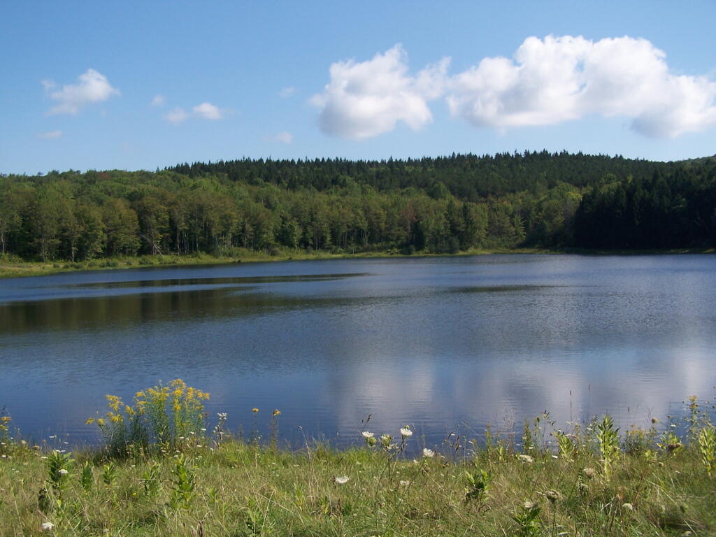
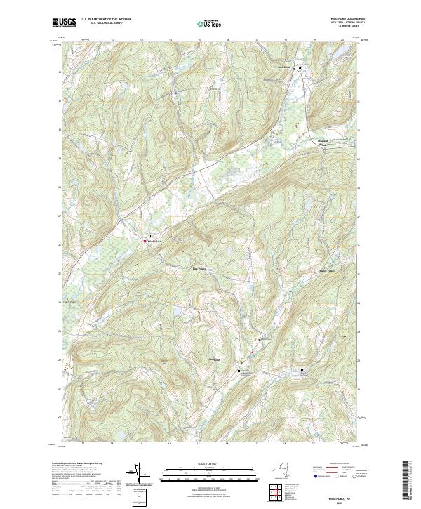
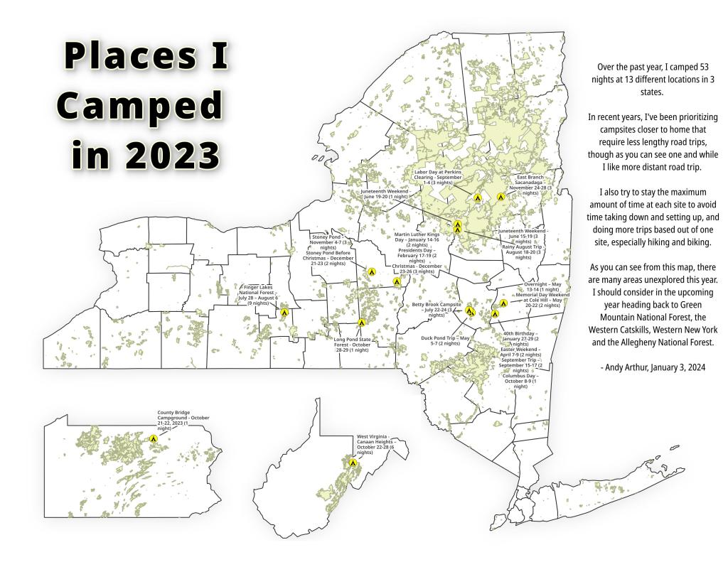
While this year was a rainy one, and it rained during many of my trips, I was able to get out for 53 nights in the wilderness — mostly fairly close to home but I also did a trip down to West Virginia in late October with several trips to the Adirondacks, Central New York and summer vacation in the Finger Lakes.

Places I Camped in 2023

Martin Luther Kings Day โ€“ January 14-16 (2 nights)

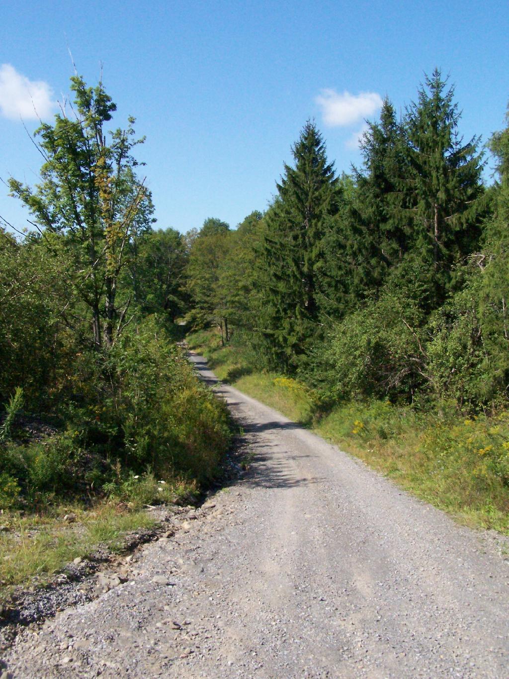
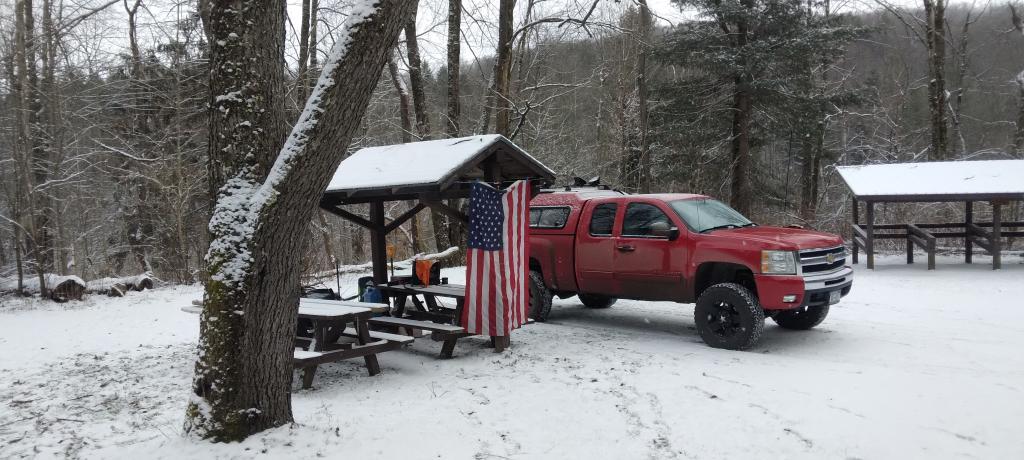
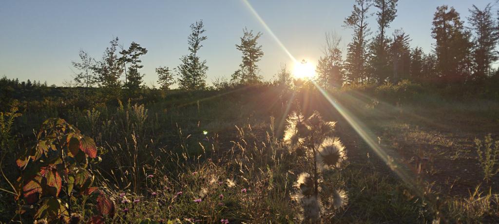
To start out my camping adventures in 2023, I drove out to Charles Baker State Forest and Brookfield Horse Camp. There wasn’t a lot of snow — just a dusting but it was a fun weekend, topped off by a beautiful sun-full glittery hike up Tassell Hill after a hoar frost. Explored Lost Pond and several of the trails in the middle of state forest.

Home for the weekend

40th Birthday โ€“ January 27-29 (2 nights)

For my fortieth birthday, I took off the Friday leading up to my 40th birthday to cross country ski and winter camp at Rensselaerville State Forest. It was a beautiful weekend with lots of blue skies, sufficient snow for skiing but not so much that was a ton of snowmobiles out on the trails.

Beautiful Day of Skiing

Presidents Day โ€“ February 17-19 (2 nights)

I decided for Presidents Day Weekend to do another trip out to Charles Baker State Forest and Brookfield Horse Camp. Slightly more snow then last time but again largely a snow-less winter, with some nice days for hikes through the various truck and horse trails. I hiked around much of state forest, especially the more southern part of the forest.

Evening on Truck Trail 13

Easter Weekend โ€“ April 7-9 (2 nights)

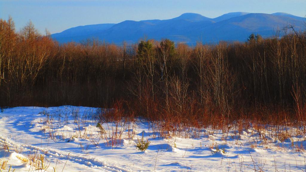
On Good Friday through Easter I camped at at Rensselaerville State Forest. The snow was gone and it was fairly mild though at times it was a bit cool. Spent a fair amount of time walking around and exploring the new OSI Parcel that has been recently added to state forest and is still largely open fields with sweeping views of the Catskill Mountains.

Hillcross Farm Pond

Duck Pond Trip โ€“ May 5-7 (2 nights)

The first Friday in May I took a half day from work and headed out to Schoharie County to camp at Duck Pond at Burnt-Rossman Hills State Forest. Originally the plan was to camp two nights at Duck Pond, hiking along the Long Path and exploring the state forest and then on Sunday hiking the Catskill Scenic Trail. That part of the trip changed when driving along Duck Pond Road the low tire pressure light came on I found a pallet nail in my truck tire. I was able to top off the truck tire and then change the tire when I got home and got the nail pulled and plugged. But it wasn’t the best way ever to end a trip early.

Spring

Overnight at Cole Hill – May 13-14 (1 night)

After visiting the folks on Mother’s Day Weekend, I decided to do a quick overnight hammock camp on Cole Hill State Forest in Berne. Nothing fancy or formal, it was as much a way to test out sleeping in my hammock with the bug screen. Kind of a chilly night, I took camp down fairly and headed home early in the morning.
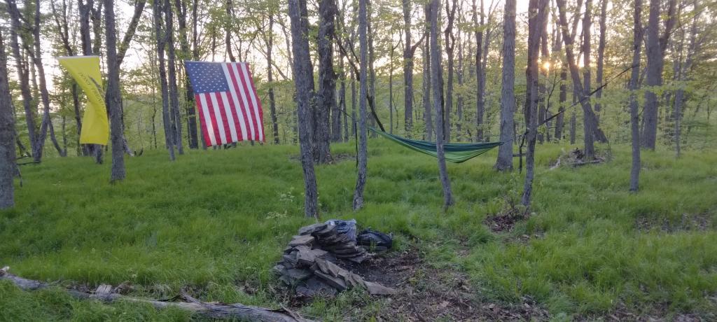
Hammock Camping on Cole Hill

Memorial Day Weekend at Cole Hill โ€“ May 20-22 (2 nights)

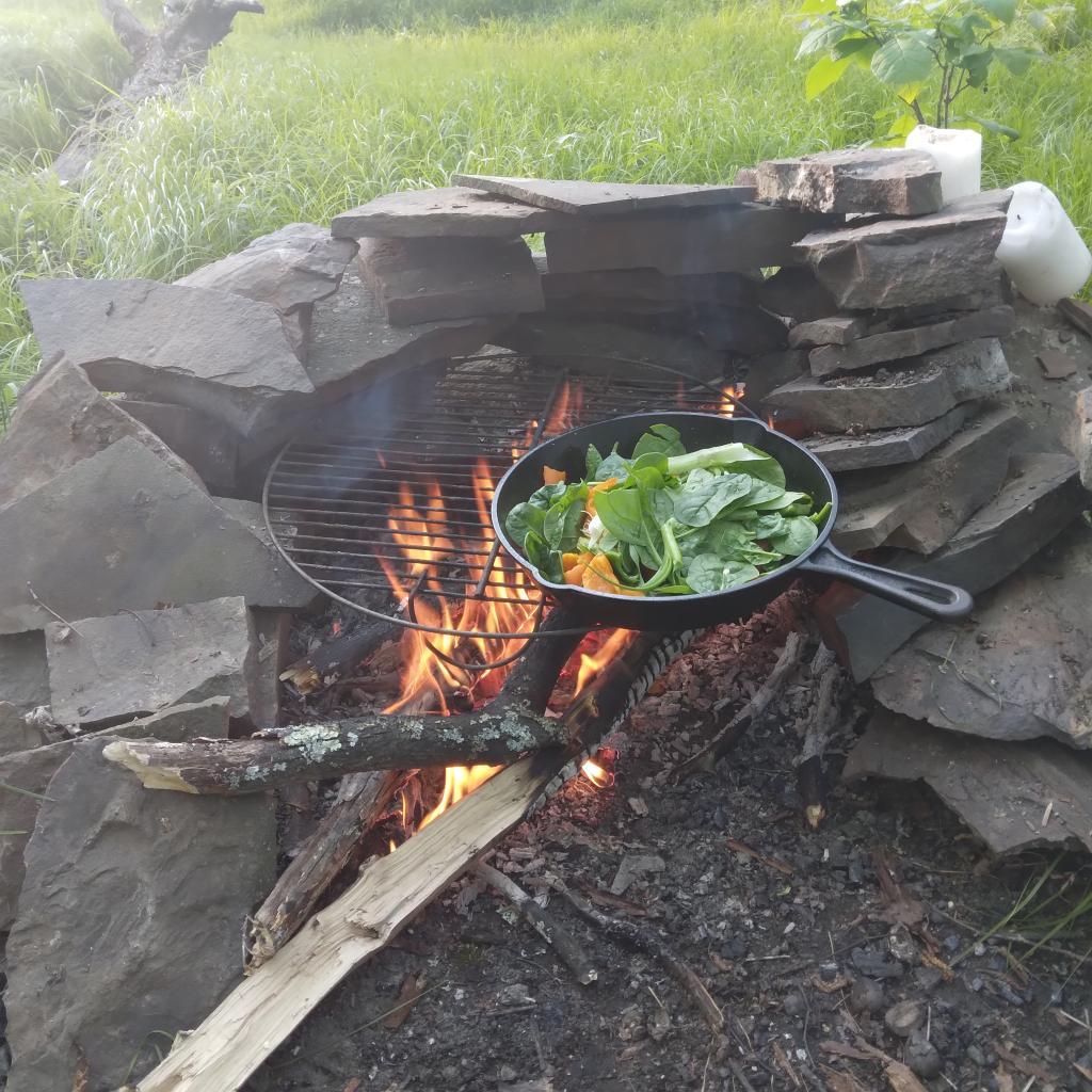
This year I decided to eschew the Adirondacks and Greene Mountains for Memorial Day Weekend due to the black flies, my desire to look at bicycles, and work I had to do on the Saturday morning leading up to the holiday weekend. I decided to hammock camp again Cole Hill State Forest in Berne. This was a three-day two night trip, so it it gave me a chance to bring more gear up the mountain, set up a more formal camp. Cooked on the fire, hiked around the forest. It was a warm weekend, but I enjoy the solitude, along with having good cell service for listening to podcasts and watching videos.

Cooking down dinner

Juneteenth Weekend on Piseco-Powley โ€“ June 15-20 (4 nights)

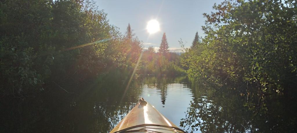
To kick off summer, I did my usual Juneteenth weekend camping trip, tacking on some days on the Juneteenth Holiday Weekend. It was a bit of a cool and rainy weekend to kick off summer, one that would actually be followed by many cool and rainy weekends where I would stay home. Camped at House Pond for the first three nights, spending time down floating in the tube on East Branch while the final night I camped up at Powley Bridge site and kayaked along the East Branch. Really, like often is the case, the best weather was the day I took down camp.

Evening on East Canada Creek

Catskill Scenic Trail Trip โ€“ July 22-24 (3 nights)

After several months of researching and visiting various bike shops, I finally got a mountain bike. I decided it would be fun to do as much of the Catskill Scenic Trail as I could before my summer vacation got underway. Actually did quite a bit of riding and hiking that weekend — started out hiking Pratts Rock’s then riding from Grand George to Hobart. Sunday, I rode from Fultonham to Middleburgh on NY 30, doing a quick climb up Vromans Nose, then stopping at the farm market then going to Mine Kill State Park to swim. Monday I rode from Hobart down to Bloomville, getting caught in a major thunderstorm and downpour a few miles north of Bloomville with no shelter in sight. The trail became super boggy, then I went to Mine Kill State Park for one more swim, and then out to folks house for Sunday dinner a day later then usual.

After the rain showers

Finger Lakes National Forest โ€“ July 28 โ€“ August 6 (9 nights)

Every year for nearly a decade and a half I’ve been doing summer vacation out in the Finger Lakes — camping in the National Forest and exploring as much as possible during my days there. The past few years I’ve been driving there on a Friday, to get a better campsite before they’re taken by the weekend campers. This year was no exception. With Blackie, my mountain bike, I did nearly all of the bike trails in the near vicinity, from the Black Diamond Trail to the Cayuta Valley Trail to Dresden – Penn Yan Canal Trail. Kayaked on both Cayuga and Scenic Lakes, swam many days at Watkins Glen State Park and Taughannock State Park, explored the Cornell Campus and Botanical Gardens on my bike. Got some good ice cream at the Spotted Duck, explored the Geneva Waterfront along with the Cayuga-Seneca Canalway. Some rain but compared to the wet summer that was, this was a pretty good week.

Morning on Searsburg Road

Piseco-Powley โ€“ House Pond Campsite โ€“ August 18-20 (3 nights)

The next few weeks for rainy and by the time I got away for one more long weekend, it promised to be fairly nice weekend but turned out to be fairly cool and cloudy with some rain. Back at the House Pond Campsite, did some swimming in East Branch, but with the mercury in the 60s most of the weekend, I didn’t spend a lot of time in the water. Hardly what I had dreamed when the I planned the weekend. Rode Blackie up to Goldmine Stream Falls and relaxed down by the falls for a bit, also sat down by the swimming hole off of the Old Edick Road Snowmobile Trail, watching the rain fall, bemoaning the wet and cold weather. Still it was good to get away for a bit, and I did do a fair amount of reading in hammock, under the protection of the bug net, as the bugs were bad after such a wet summer.

Gentle Drop Into A Golden Pool

Labor Day at Perkins Clearing – September 1-4 (3 nights)

I took the Friday off before Labor Day to get a jump on the holiday season travel, and set up camp at the site I really enjoy up at Perkins Clearing overlooking the mountains. Did a fair amount of riding along the various dirt roads of Perkins Clearing, including over to Mason Lake and on Sunday rode most of the way to the Spruce Lake Trailhead, though didn’t make it there in time as I got a bit of a late start as I spent the balance of the day reading and swimming in the Jessup River Bridge swimming hole. Labor Day, I rode around the Spectulator Tree Farm, doing a large loop, through the tree farm, past the north end of Elm Lake, then down to Austin Falls and Old Route 8B. I had hoped to get ice cream, but by the time I got to the ice cream shop they were out of soft-ice cream, and there was a long line. Summer was dragging to a close.

Kunjamunk River from Long Level Bridge

September Trip to Rensselearville State Forest โ€“ September 15-17 (2 nights)

With time being fairly tight and the weather only so-so I decided to do a two night trip close to home out in Rennselearville to ride some of the gravel trails, explore the OSI Parcel further and just enjoy an early autumn weekend camping.

Evening

Columbus Day at Rensselearville State Forest โ€“ October 8-9 (1 night)

Columbus Day Weekend was cold and rainy for the first half of the weekend, but the Sunday heading into Columbus Day was nice, so I decided to head out to Rensselaerville for a quick overnight at the campsite on CCC Road. Leaves were late this year, so not a lot of color, but it still was nice to get away for a night and ride some of the trails around.
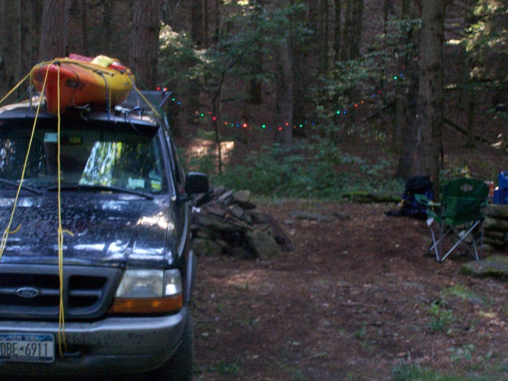
Leonard Hill

West Virginia Trip โ€“ October 21-29 (8 nights)

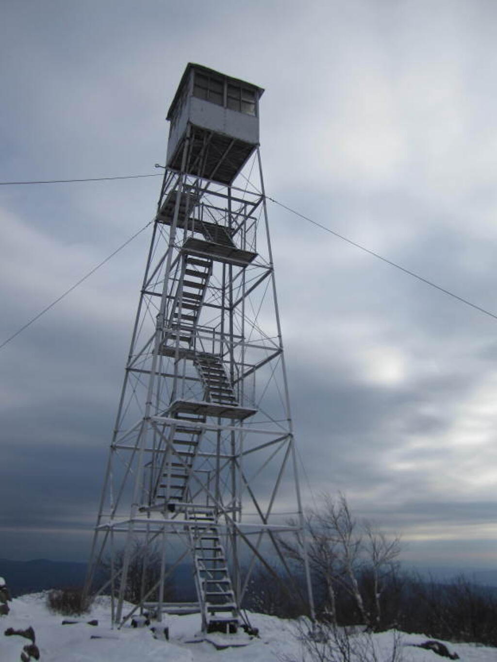
The banner trip of the year was my trip down to West Virigina. While it started and ended in rain, it was a very enjoyable trip with lots of new adventures this year. Camped the balance of the week — 6 nights in Canaan Heights — doing day trips from that area. Overnighted one night driving down at County Bridge Campground in Pennsylvania, and a on the way back camped overnight at Long Pond State Forest in New York. Adventures in West Virginia included hiking at Dolly Sods, mountain biking at night in the sods of Canaan Heights, riding up and hiking to Table Rock, exploring Blackwater Falls State Park on the mountain bike, MonPower Mountain Bike Park, Thomas Rail Grade and the Olson Firetower. Rode part of the Great Allegheny Trail through the Cumberland Passage, and the two sections of the Chesapeake and Ohio Canalway, including the Paw Paw Tunnel.

Sunrise

Stoney Pond โ€“ November 4-7 (3 nights)

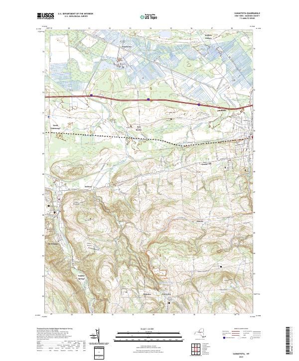
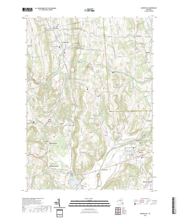
A little over a week back from West Virginia, I headed out to Madison County to ride the Tassel Hill Mountain Bike Trails at Alfred Woodford, the Chenango Canal Trail in Hamilton and Erie Canalway from Chittenango to Green Lakes State Park and then to Canastota and Wampsville. The first night was cold at Stoney Pond but the subsequent nights were quite pleasant and mild.

Old Canal Warehouse in Chittenango  [Expires November 19 2023]

Prospect Mountain – East Branch Sacanadaga โ€“ Buttermilk Falls/Hudson Special Management Area โ€“ November 24-28 (3 nights)

Strangely enough, I had never been up Prospect Mountain. So I decided the day after Thanksgiving (Black Friday) to hike up Prospect Mountain, and then spend the next two nights camping on East Branch of the Sacandaga River. The Saturday and Sunday was fairly cold, so I ended up spending the bulk of day hanging around camp, doing a bit of hiking around Fox Lair. Sunday, evening around 8 PM it started to sleet, then snow, then rain, Monday morning, it turned into a white globby snow, and I ended up taking down camp fairly early after discovering I was out of propane and then spent much of the day exploring the Hudson River Special Management Area – Buttermilk Falls.

Icy River Road

Stoney Pond – Charles Baker โ€“ December 21-26 (5 nights)

On the days leading up to Christmas I decided to take a second trip to Madison County. I was originally planning to camp two nights at Stoney Pond then two nights at the Charles Baker Horse Camp but my family’s holiday plans were cancelled due to illness in my family, so I ended up staying an extra night at the horse camp, through the day after Christmas. On Friday, I rode the Erie Canalway from Canastota to East Verona, nearly to Rome. On Christmas Day I rode around many of truck trails at Charles Baker with my mountain bike, leaving my face splattered with mud. Many of the days were fairly cold and cloudy, but that’s too be expected in late December. Still it was a special way to spend Christmas.

Camp on this cold but still morning ?

Cold and gray for festivus ๐Ÿ’ˆ

It might be a fair bit warmer today but with the breeze and clouds it feels pretty cold. I’m taking down camp to head to Hamilton and ultimately Brookfield to camp and explore that forest through Christmas Day. Then maybe on Christmas I’ll head down to Cooperstown and then home. My parents have been sick with a bad cold so it seems likely Christmas will be remote. I’ll still probably head home on Christmas Day though I also have boxing day off.

Good morning! Cloudy and 31 degrees at the Stoney Pond State Forest. โ˜ There is a south breeze at 9 mph. ๐Ÿƒ. Things will start to thaw out at around 9 am. ๐ŸŒก๏ธ

Oatmeal pancakes ๐Ÿฅž for breakfast though I wish I had more bananas ๐ŸŒ to use in the mix. They blacken in the cold quickly but they’re still good but I eat them all up yesterday. I’ll have to stop at the Price Chopper in Hamilton. ๐Ÿšฒ Thinking I might ride around the village a bit too though it depends on if it’s raining and the weather. Outdoor activities can be tough in December, the weather kind of sucks.

Dropped my phone ๐Ÿ“ฑ this morning when I was stacking wood and couldn’t find it until I heard the hour chime. โฐ I was lucky ๐Ÿ€ I heard that otherwise it would be likely lost. Not that my phone ๐Ÿ“ž is worth much – the touch screen is increasingly malfunctioning. But I’m glad I found it.

Today will have a chance of rain and snow showers before 5pm, then a chance of rain showers. Cloudy ๐ŸŒฆ, with a high of 37 degrees at 1pm. One degree above normal, which is similar to a typical day around December 21st. South wind around 10 mph. Chance of precipitation is 40%. Little or no snow accumulation expected. A year ago, we had mostly sunny skies in the morning, which and some light snow in the afternoon. The high last year was 53 degrees. The record high of 64 was set in 1990. 8.8 inches of snow fell back in 1947.โ„

Not a real nice day ahead ๐ŸŒฅ which is why I figured it would be a good day to move campsites then I can spend the bulk of Christmas Eve exploring Charles Baker State Forest ๐Ÿฆ watching birds and hiking when hopefully it will be somewhat nicer. This weekend after looking beautiful has somewhat slid downhill unfortunately. ๐Ÿ˜”

Solar noon ๐ŸŒž is at 12:02 pm with sun having an altitude of 23.7ยฐ from the due south horizon (-46.8ยฐ vs. 6/21). A six foot person will cast a 13.7 foot shadow today compared to 2.2 feet on the first day of summer. The golden hour ๐Ÿ… starts at 3:47 pm with the sun in the southwest (230ยฐ). ๐Ÿ“ธ The sunset is in the west-southwest (238ยฐ) with the sun dropping below the horizon at 4:33 pm after setting for 3 minutes and 26 seconds with dusk around 5:04 pm, which is 32 seconds later than yesterday. ๐ŸŒ‡ At dusk you’ll see the Full ๐ŸŒ Moon in the east (90ยฐ) at an altitude of 32ยฐ from the horizon, 234,965 miles away. ๐Ÿš€ The best time to look at the stars is after 5:41 pm. At sunset, look for rain ๐ŸŒง and snow ๐ŸŒจ and temperatures around 36 degrees. There will be a south breeze at 9 mph. Today will have 9 hours and 4 minutes of daytime, an increase of 5 seconds over yesterday.

Tonight will have a chance of rain and snow showers before 1am, then rain showers likely. Cloudy ๐ŸŒง, with a low of 34 degrees at 6am. 13 degrees above normal, which is similar to a typical night around November 9th. South wind around 10 mph. Chance of precipitation is 60%. Little or no snow accumulation expected. In 2022, we had light snow in the evening, which became mostly clear by the early hours of the morning. It got down to 7 degrees. The record low of -15 occurred back in 1989.

Yesterday morning got kind of a late start ๐Ÿฅถ because it was so cold out. Plus I wanted to chop wood ๐Ÿชต๐Ÿช“ so I’d be ready when I got back to camp โ›บ. Then I did a hike at Oxbow Falls County Park ๐Ÿž and looked off the escarpment. A fairly clear day.

Rode 36 miles yesterday from Canastota to East Verona on the Old Erie Canal Trail then back via NY 46 to Oneida, then the Oneida Rail Trail to the Oneida Waterline Trail to Wampsville back to Canastota. ๐Ÿšฒ It was cold this morning so I got a late start, plus I visited Oxbow Falls in the morning, but I hit the trail at noon and returned back at four.

Drove back to camp before dark, made turkey soup ๐Ÿฆƒ๐Ÿ…๐Ÿฒ with lots of delicious vegetables. No bacon ๐Ÿฅ“ this meal even though next Saturday is bacon day.

Looking ahead, next Saturday is Bacon Day ๐Ÿฅ“ when the sun will be setting at 4:38 pm with dusk at 5:09 pm. On that day in 2022, we had mostly cloudy, mild and temperatures between 57 and 43 degrees. Typically, the high temperature is 35 degrees. We hit a record high of 53 back in 1984.

Dramatic Firetower

Cold start to the winter camping season โ›บ โ„

While I was warm and comfortable under the covers in my unheated truck cap last night my toes were cold and stiff. Cold getting up but the heater was warm as was the coffee and eggs with all the fixings. Didn’t get up until after seven as the morning was so cold and dark.

Good morning! Partly sunny and 17 degrees at the Stoney Pond State Forest. There is a south-southeast breeze at 5 mph. ๐Ÿƒ. Things will start to thaw out at around 1 pm. ๐ŸŒก๏ธ

That coffee is good. โ˜• Stove is still a bit slow from the plugging to got last time I was camping but it’s working fairly well. The heater is nice and warm. Eggs for breakfast. ๐Ÿณ Plus enjoying a grapefruit. ๐ŸŠWatching the sun rise this morning, very cold but still.

Today will be sunny ๐ŸŒž, with a high of 33 degrees at 2pm. Three degrees below normal, which is similar to a typical day around January 5th. South wind around 6 mph. A year ago, we had mostly sunny skies in the morning, which became light snow by afternoon. The high last year was 34 degrees. The record high of 60 was set in 1990. 12.3 inches of snow fell back in 1969.โ„

The plan for today is to visit Oxbow Falls County Park then head to Canastota. ๐Ÿšฒ I want to ride the Erie Canalway to Rome as time allows. Should be a good day, hoping it warms up a fair amount by midday. โ˜€ At least it shouldn’t be cloudy and it looks like the wind will die down.

Solar noon ๐ŸŒž is at 12:02 pm with sun having an altitude of 23.7ยฐ from the due south horizon (-46.8ยฐ vs. 6/21). A six foot person will cast a 13.7 foot shadow today compared to 2.2 feet on the first day of summer. The golden hour ๐Ÿ… starts at 3:47 pm with the sun in the southwest (230ยฐ). ๐Ÿ“ธ The sunset is in the west-southwest (238ยฐ) with the sun dropping below the horizon at 4:33 pm after setting for 3 minutes and 26 seconds with dusk around 5:04 pm, which is 30 seconds later than yesterday. ๐ŸŒ‡ At dusk you’ll see the Waxing Gibbous ๐ŸŒ” Moon in the east-southeast (104ยฐ) at an altitude of 38ยฐ from the horizon, 232,306 miles away. ๐Ÿš€ The best time to look at the stars is after 5:41 pm. At sunset, look for partly sunny skies ๐ŸŒƒ and temperatures around 31 degrees. There will be a south-southeast breeze at 6 mph. Today will have 9 hours and 4 minutes of daytime, a decrease of over yesterday.

Yesterday when I got to camp it was a mess. ๐Ÿšฏ There had apparently been a party ๐Ÿป at the campsite since I was last here and a ton of broken glass, beer bottles and half burnt pallets everywhere. ๐Ÿ”ฅ Nails too, I’m a bit worried about getting one in my tires. I tried to pick things up to the best of my ability, at first sorting out as many of the recycling as possible โ™ป but ultimately just scooping a lot up into the ever growing ash pile at the edge of the campsite.

Tonight will be partly cloudy ๐ŸŒƒ , with a low of 27 degrees at 6am. Six degrees above normal, which is similar to a typical night around December 2nd. Maximum wind chill around 23 at 6pm; South wind 6 to 9 mph. Much warmer than yesterday. In 2022, we had light rain in the evening, which and it cleared oytby the early hours of the morning. It got down to 9 degrees. The record low of -12 occurred back in 1955.

Last night ๐ŸŒƒ I had a nice camp fire ๐Ÿ”ฅ and the moonlight was great but it was cold โ„ with lows in the single digits and a breeze that slackened a bit as the night progressed. ๐Ÿฅ“ The bacon I got was good though.

Tomorrow will have a slight chance of showers after 1pm. Mostly cloudy ๐ŸŒฆ, with a high of 38 degrees at 2pm. Two degrees above normal, which is similar to a typical day around December 17th. South wind around 11 mph. Chance of precipitation is 20%. A year ago, we had mostly sunny skies in the morning, which became light snow by afternoon. The high last year was 53 degrees. The record high of 64 was set in 1990. 8.8 inches of snow fell back in 1947.โ„

Looking ahead to Sunday, a chance of showers. Cloudy, with a high near 39. South wind 6 to 9 mph. Chance of precipitation is 40%. Typical average high for the weekend is 36 degrees.

The winter camping trip begins โ„ โ›บ

Just reviewing my packing list and finishing getting ready, doing some cleaning and double checking things.

Good morning! Partly cloudy and 31 degrees in Delmar, NY. โ›… There is a north-northeast breeze at 13 mph. ๐Ÿƒ. Things will start to thaw out at Saturday around 10 am. ๐ŸŒก๏ธ

Kind of a cool day to start out my trip with the breeze ๐ŸŒฌ๏ธ but it will be sunnier later and then a cold night ๐ŸŒƒ is ahead. But my propane tank is full ๐Ÿฎ, I’ll have a good fire ๐Ÿ”ฅ and enjoy the cold. Winter starts at 10:27 pm. โ˜ƒ๏ธ Going to be a cold night, I’m not sure if I’ll stay up that late. Maybe.

Today will be partly sunny, then gradually becoming sunny ๐ŸŒž, with a high of 32 degrees at 2pm. Five degrees below normal, which is similar to a typical day around January 15th. North wind 9 to 14 mph. A year ago, we had mostly sunny skies in the morning with some clearing in the afternoon. The high last year was 34 degrees. The record high of 62 was set in 2018. 6.6 inches of snow fell back in 2008.โ„

Today’s plans are to head out to Stoney Pond State Forest ๐Ÿž and camp there. I’m thinking about stopping at For the Love of Bacon ๐Ÿฅ“ to get some of the name sake, and maybe to ride the Chenango Canal Trailway and explore Hamilton NY on my bicycle ๐Ÿšฒ as time allows. That said, the sun sets early this time of year. Looks like it will be a nice day but maybe somewhat cold. But it’s to be expected in December a few days before Christmas.

Solar noon ๐ŸŒž is at 11:54 am with sun having an altitude of 23.9ยฐ from the due south horizon (-46.9ยฐ vs. 6/21). A six foot person will cast a 13.5 foot shadow today compared to 2.2 feet on the first day of summer. The golden hour ๐Ÿ… starts at 3:40 pm with the sun in the southwest (230ยฐ). ๐Ÿ“ธ The sunset is in the west-southwest (238ยฐ) with the sun dropping below the horizon at 4:25 pm after setting for 3 minutes and 25 seconds with dusk around 4:56 pm, which is 28 seconds later than yesterday. ๐ŸŒ‡ At dusk you’ll see the Waxing Gibbous ๐ŸŒ” Moon in the east-southeast (120ยฐ) at an altitude of 43ยฐ from the horizon, 229,997 miles away. ๐Ÿš€ The best time to look at the stars is after 5:33 pm. At sunset, look for sunny skies ๐ŸŒƒ and temperatures around 30 degrees. There will be a north breeze at 9 mph. Tomorrow will have 9 hours and 6 minutes of daytime, an increase of one second over today. Days are getting longer.

Working from home ๐Ÿก or in my case the library ๐Ÿ’ป was good yesterday, it gave me an opportunity to get packed and get supplies before camping ๐Ÿ•. I ended up working late as it took longer than I expected at the store midday ๐Ÿ›’ but all was good. Came home made bread and had it ready to bring camping.

Tonight will be clear ๐ŸŒƒ, with a low of 12 degrees at 5am. Nine degrees below normal. Maximum wind chill around 9 at 12am; North wind 6 to 8 mph. That’s going to be a cold night for sure. In 2022, we had cloudy skies in the evening, which became mostly clear by the early hours of the morning. It got down to 19 degrees. The record low of -8 occurred back in 1955. At least not that cold.

Clouds for the weekend but warmer. โ˜๏ธSaturday, mostly cloudy, with a high near 39. South wind around 7 mph. Sunday, mostly cloudy, with a high near 43. Typical average high for the weekend is 36 degrees.

Looking ahead, next Thursday is 4:30 PM Sunset ๐ŸŒ† when the sun will be setting at 4:30 pm with dusk at 5:01 pm. A sign of longer days ahead. On that day in 2022, we had partly cloudy and temperatures between 41 and 22 degrees. Typically, the high temperature is 35 degrees. We hit a record high of 61 back in 1982.

 Snow Has Stopped