Search Results for: photo camp table

Truck Camping

In the morning, having my cup of coffee and getting ready to face the day's adventures. I need to get a table, so I don't have so much clutter on my tailgate -- there are no picnic tables at Stoney Pond.

Taken on Sunday November 7, 2010 at Stoney Pond State Forest.

15 bean soup kind of day… Good for using up a lot of vegetables in the fridge and counter ๐Ÿฒ

Well folks, I was hoping for a nicer weekend. I am surprised how long the rain is sticking around this morning, maybe it was a good thing I stayed home. That is soup is good, lots of garlic and spices. I know what I’ll be dipping in the fresh homemade whole-wheat bread the rest of today.

Good morning! Where did September go? Got washed away with the rain. I’m glad I’m not camping this morning, though if I headed north or west it probably wouldn’t be too bad. Rain and 55 degrees in Delmar, NY. โ˜” There is a north-northwest breeze at 6 mph. ๐Ÿƒ. The dew point is 54 degrees. Cool and damp, I have my windows closed.

Today will have showers likely, mainly before 11am. Mostly cloudy ๐ŸŒฆ, with a high of 70 degrees at 5pm. Two degrees above normal, which is similar to a typical day around September 27th. Maximum dew point of 59 at 2pm. Northwest wind around 6 mph. Chance of precipitation is 60%. New precipitation amounts of less than a tenth of an inch possible. A year ago, we had mostly sunny skies. The high last year was 62 degrees. The record high of 88 was set in 1905.

Not a great start to the day, I’m procrastinating on my morning walk ๐Ÿšถ. I was up at 5:30 but it’s a dark morning and now it’s raining out. โ˜” The 15 bean soup is done and absolutely delicious. I have bread I made up earlier in the week and took out of the freezer, it will be good dipped in the soup. Nice smokey flavor from the smoked paprika and a nice under-note from the garlic and onions I chopped up on it. ๐Ÿฒ Banana oatmeal pancakes made extra fluffy with baking soda topped with shredded mango and ginger with maple syrup. Yum ๐Ÿ˜‹.

Solar noon ๐ŸŒž is at 12:46 pm with sun having an altitude of 44.7ยฐ from the due south horizon (-26.2ยฐ vs. 6/21). A six foot person will cast a 6.1 foot shadow today compared to 2.2 feet on the first day of summer. The golden hour ๐Ÿ… starts at 6:03 pm with the sun in the west (261ยฐ). ๐Ÿ“ธ The sunset is in the west (267ยฐ) with the sun dropping below the horizon at 6:41 pm after setting for 2 minutes and 54 seconds with dusk around 7:07 pm, which is one minute and 46 seconds earlier than yesterday. ๐ŸŒ‡ The best time to look at the stars is after 7:42 pm. At sunset, look for partly clear skies ๐ŸŒ„ and temperatures around 67 degrees. The dew point will be 58 degrees. There will be a north-northwest breeze at 5 mph. Today will have 11 hours and 50 minutes of daytime, a decrease of 2 minutes and 52 seconds over yesterday.

Not sure what today’s plans are going to look like. ๐Ÿ  I think it’s best to say it will be a stay home kind of day, but assuming it clears out it probably will involve a bike ride later on out to Voorheesville, Five Rivers or maybe both. I should go down to the library and get some books and work on the Internet too. ๐Ÿ“š I don’t think the rain is going to stop early enough though at this point for the sun to dry things out so I can paint over some of the rust spots on Big Red. ๐Ÿšš

Tonight will have patchy fog after 3am. Otherwise, mostly clear ๐ŸŒƒ, with a low of 53 degrees at 6am. Seven degrees above normal, which is similar to a typical night around September 16th. Maximum dew point of 58 at 6pm. Calm wind becoming northwest around 5 mph. In 2022, we had mostly clear skies in the evening, which became partly cloudy by the early hours of the morning. It got down to 46 degrees. The record low of 28 occurred back in 1993.

Ad revenue has been decent on the blog, ๐Ÿ“บ I’ve been pulling in about $2.25 a day since I figured out the placement that I can live with. So that works out to be around $67 a month, though after hunting season is over I expected revenue to drop as there is less demand for my maps but it will pick up come May, might even top $100 a month as people seek places to camp and hike. โ˜บ Not going to make me rich, indeed the government will take probably a quarter in taxes๐Ÿ›๏ธ but I can look forward to a hundred dollar check every two months or so which will cover hosting and more incentive to create useful good content for the blog. ๐Ÿ’ต And it’s not like I’m selling little trinkets soon destine for the landfill or burn barrel. ๐Ÿ›ข๏ธI’m really pleased with the quality of some of the ads I’m getting from local businesses though some are complete crap.

Looking ahead, there are 5 weeks until Daylight Savings Time Ends ๐Ÿ›ฅ๏ธ when the sun will be setting at 5:46 pm with dusk at 6:14 pm. On that day in 2022, we had sunny, rather warm weather for November and temperatures between 71 and 46 degrees. Typically, the high temperature is 54 degrees. But last year didn’t break the record high of 76 back in 1994.

Mount Prospect

There are 80 designated campsites in Cattaraugus County in following state forests

There are 80 designated campsites in Cattaraugus County in following state forests …

Campsite on West Hill Road

Cattaraugus County State Forest Maps

This listing provides the total number of campsites in each forest along with a link to map and photos of forest.

State Forest Map Number of Campsites
Boyce Hill State Forest 2
Bryant Hill State Forest 1
Bucktooth State Forest 1
Bush Hill State Forest 10
Cattaraugus State Forest 3
Dobbins Memorial State Forest 3
East Otto State Forest 14
Farmersville State Forest 2
Golden Hill State Forest 4
Mccarty Hill State Forest 4
Nine Mile Creek State Forest 3
Pine Hill State Forest 12
Raecher Hill State Forest 2
Rock City State Forest 11
South Valley State Forest 5
Windfall Creek State Forest 3

Cattaraugus County Campsite Coordinates

Here is a listing of the individual campsites. The road indicates the nearest road, links on state forest go to DEC website for more information, while the location link takes you to ACME Mapper to see the exact location …

Name Road State Forest Location
Flt Lean To Bryant Hill Road Boyce Hill State Forest 42.334031456350395, -78.53288931105153
Primitive Campsite Bryant Hill Road Boyce Hill State Forest 42.33203561607121, -78.52072510644783
Primitive Campsite Fadale Road Bryant Hill State Forest 42.287766301177825, -78.5774157216985
Primitive Campsite West Branch Bucktooth Run Road Bucktooth State Forest 42.205385216534836, -78.80556091590128
Designated Camp Site Bush Hill State Forest Road Bush Hill State Forest 42.37521134312278, -78.3723830068076
Designated Camp Site Bush Hill State Forest Road Bush Hill State Forest 42.375432685587, -78.37003424588094
Designated Camp Site Bush Hill State Forest Road Bush Hill State Forest 42.37844883545774, -78.36321615357782
Designated Camp Site Bush Hill State Forest Road Bush Hill State Forest 42.37834161197144, -78.3603878146659
Designated Camp Site Bush Hill State Forest Road Bush Hill State Forest 42.378704575994334, -78.35968870249168
Designated Camp Site Palmer Road Bush Hill State Forest 42.332735974553664, -78.33508401120383
Designated Camp Site Peet Hill Road Bush Hill State Forest 42.37229363838375, -78.37197015797723
Designated Camp Site State Highway 98 Bush Hill State Forest 42.378694393114884, -78.36651378010052
Designated Camp Site State Highway 98 Bush Hill State Forest 42.378944741693765, -78.35539058173165
Designated Camp Site Stebbins Road Bush Hill State Forest 42.37513245260474, -78.33871444372613
Primitive Campsite Toad Hollow Road Cattaraugus State Forest 42.323838469029404, -78.81981283576603
Primitive Campsite West Hill Road Cattaraugus State Forest 42.325245350697024, -78.82172344496075
Primitive Campsite West Hill Road Cattaraugus State Forest 42.32545276366107, -78.82246616963481
Primitive Campsite Bedient Hill Road Dobbins Memorial State Forest 42.28567958355708, -78.78343174073662
Primitive Campsite Bedient Hill Road Dobbins Memorial State Forest 42.2858770172506, -78.78182441930888
Primitive Campsite Kahler Hill Road Dobbins Memorial State Forest 42.2823609209492, -78.78908764990703
Campsite 1 East Otto Forest Access Road East Otto State Forest 42.42956020071717, -78.77841498639349
Campsite 10 East Otto Forest Access Road East Otto State Forest 42.436794682289374, -78.78725605998474
Campsite 11 East Otto Forest Access Road East Otto State Forest 42.43686641131175, -78.78876182516233
Campsite 12 East Otto Forest Access Road East Otto State Forest 42.439942456335444, -78.79280632243916
Campsite 13 Off Road East Otto Forest Access Road East Otto State Forest 42.44116228532883, -78.7935142352489
Campsite 2 East Otto Forest Access Road East Otto State Forest 42.43075196187435, -78.77829192648777
Campsite 3 East Otto Forest Access Road East Otto State Forest 42.431524557985085, -78.77807270060917
Campsite 4 East Otto Forest Access Road East Otto State Forest 42.43246812683191, -78.77812945302628
Campsite 5 East Otto Forest Access Road East Otto State Forest 42.43354865333, -78.77826528183961
Campsite 6 East Otto Forest Access Road East Otto State Forest 42.435748272602346, -78.78009578405866
Campsite 7 East Otto Forest Access Road East Otto State Forest 42.437766021114236, -78.78129798391932
Campsite 8 East Otto Forest Access Road East Otto State Forest 42.438307230216544, -78.78167796579675
Campsite 9 East Otto Forest Access Road East Otto State Forest 42.43658224437387, -78.78115339512692
Off Rd Campsite 14 Campsite Trail East Otto State Forest 42.43495753137711, -78.78631225057045
Designated Camping Site Finger Lakes / North Country Trail Farmersville State Forest 42.395559234340155, -78.32385801814708
Primitive Campsite Huyck Road Farmersville State Forest 42.40195676450733, -78.32651113957189
Designated Camp Site Humphrey Road Golden Hill State Forest 42.24476227074854, -78.53567581233197
Designated Camp Site Humphrey Road Golden Hill State Forest 42.22838609079557, -78.55140114891826
Designated Camp Site Salamanca Sugertown Golden Hill State Forest 42.25727682111409, -78.52462511082716
Designated Camp Site Salamanca Sugertown Golden Hill State Forest 42.252966372418044, -78.52422796002587
8 Ccc Cross Pfar Mc Carthy Hill Road Mccarty Hill State Forest 42.24536126968311, -78.70056799396085
9 Ccc Cross Pfar Mc Carthy Hill Road Mccarty Hill State Forest 42.25008232988369, -78.69743897194299
Designated Campsite Mc Carthy Hill Road Mccarty Hill State Forest 42.25328568563576, -78.69299839361288
Broadwide Landing   Mccarty Hill State Forest 42.24170279920399, -78.68606010543651
Designated Camp Site North Nine Mile Road Nine Mile Creek State Forest 42.15299393539406, -78.54523009763237
Designated Camp Site North Nine Mile Road Nine Mile Creek State Forest 42.13609995741345, -78.56646823383102
Designated Camp Site   Nine Mile Creek State Forest 42.16580689557993, -78.56330674730353
Designated Camping Site Carr Corners Road Pine Hill State Forest 42.0902198677204, -78.97720883047309
Designated Camping Site Carr Corners Road Pine Hill State Forest 42.08987421564301, -78.97718113243893
Designated Camping Site Carr Corners Road Pine Hill State Forest 42.088972084193635, -78.96827770846221
Designated Camping Site Carr Corners Road Pine Hill State Forest 42.08999766571543, -78.97714470943136
Designated Camping Site Carr Corners Road Pine Hill State Forest 42.089992105140524, -78.97802317468417
Designated Camping Site Carr Corners Road Pine Hill State Forest 42.088316667983676, -78.97750870331804
Designated Camping Site Sarver Road Pine Hill State Forest 42.09084333446055, -78.96457500076367
Designated Camping Site West Bank Perimeter Road Pine Hill State Forest 42.09059447216186, -78.9782701169741
Designated Camping Site West Bank Perimeter Road Pine Hill State Forest 42.090410597678044, -78.97737141838545
Designated Camping Site West Bank Perimeter Road Pine Hill State Forest 42.09070243921129, -78.97767425198705
Designated Camping Site West Bank Perimeter Road Pine Hill State Forest 42.09055923398494, -78.97748952634339
Designated Camping Site West Bank Perimeter Road Pine Hill State Forest 42.088333001084294, -78.96315816701363
Designated Camp Site Raecher Road Raecher Hill State Forest 42.21543142820224, -78.59833921002581
Designated Camp Site Salamanca Sugertown Raecher Hill State Forest 42.2239162845665, -78.58440803241541
6 Eckert Pfar Eckert Road Rock City State Forest 42.21386553760053, -78.72868667109137
1 Pavilion Hungry Hollow Road Rock City State Forest 42.20887482379478, -78.71081750896558
10 Hale Pfar Hungry Hollow Road Rock City State Forest 42.210726592762555, -78.70083869524316
2 Camp Seneca Hungry Hollow Road Rock City State Forest 42.22426854552666, -78.70039460166258
2 Pavilion Hungry Hollow Road Rock City State Forest 42.20874441897034, -78.70925235825437
5 Little Rock City Pfar Hungry Hollow Road Rock City State Forest 42.21356536202227, -78.71471680281755
7 Camp Seneca Hungry Hollow Road Rock City State Forest 42.224419413504464, -78.6988716555344
1 Camp Seneca   Rock City State Forest 42.22472181689035, -78.6999719301751
3 Camp Seneca   Rock City State Forest 42.22443219662994, -78.69949145115731
3 Pavilion   Rock City State Forest 42.20829863384421, -78.70878335178874
4 Pavilion   Rock City State Forest 42.207897403667076, -78.70778549612025
Sawmill Campsite Sawmill Run Road South Valley State Forest 42.0412038345878, -79.00831666649613
Phillips Brook Campsite West Bank Perimeter Road South Valley State Forest 42.067833333551825, -78.98651616744397
Phillips Brook Campsite West Bank Perimeter Road South Valley State Forest 42.067053833805446, -78.98539216695083
Primitive Campsite West Bank Perimeter Road South Valley State Forest 42.06781668899903, -78.986579480953
Primitive Campsite West Bank Perimeter Road South Valley State Forest 42.066675066943084, -78.98465915701098
Designated Camp Site Thorpe Hollow Road Windfall Creek State Forest 42.143916972753914, -78.61946242159415
Designated Camp Site Thorpe Hollow Road Windfall Creek State Forest 42.13859287926947, -78.63237608867878
Designated Camp Site   Windfall Creek State Forest 42.11866864256446, -78.63172401550162

Final Campfire

A slow and warm day for setting up camp for the next five days in the Finger Lakes ๐Ÿฎ

Finally made it to the Finger Lakes National Forest which is exactly my reaction when I pulled to the roadside desperately to piss in my wheel well as all day I’ve been peeing. I didn’t think I drank too much coffee this morning but those peaches and other farm fresh produce I was snacking on my ways to the Finger Lakes National Forest kept my bladder full and looking for trees, rest rooms and stops. Didn’t help I got stuck in bad traffic in Ithaca with construction and a tourist bus that used the back bumper of a flatbed trailer to stop and oh, yeah no power in East Ithaca or working traffic lights. Plus besides all the bathroom breaks, shopping at Walmart in Oneonta and an amazing farm stand in Caroline that made me wish I hadn’t gotten so much in Oneonta. Regardless, lots of good eating over the next few days.

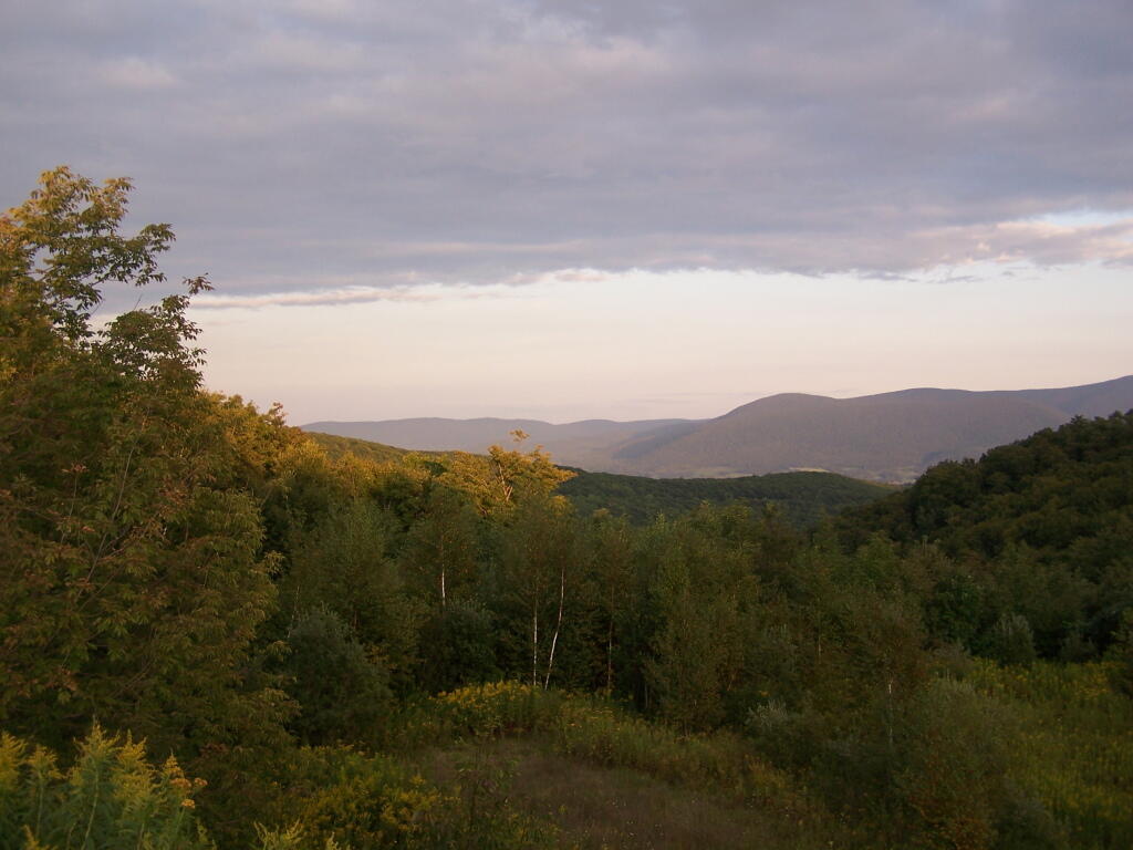
Good evening! Partly clear and 79 degrees at the Finger Lakes National Forest. There is a west-northwest breeze at 6 mph. ๐Ÿƒ. The dew point is 66 degrees. The muggy weather ends tomorrow around 11 pm. ๐Ÿ˜“ Kind of buggy with the heat and humidity, though I expect things to improve come tomorrow. The real question is how wet will tomorrow be. Not sure, the Finger Lakes this year haven’t been as wet as Albany but not quitgy dry spell like Western New York. Seasonably wet you might say.
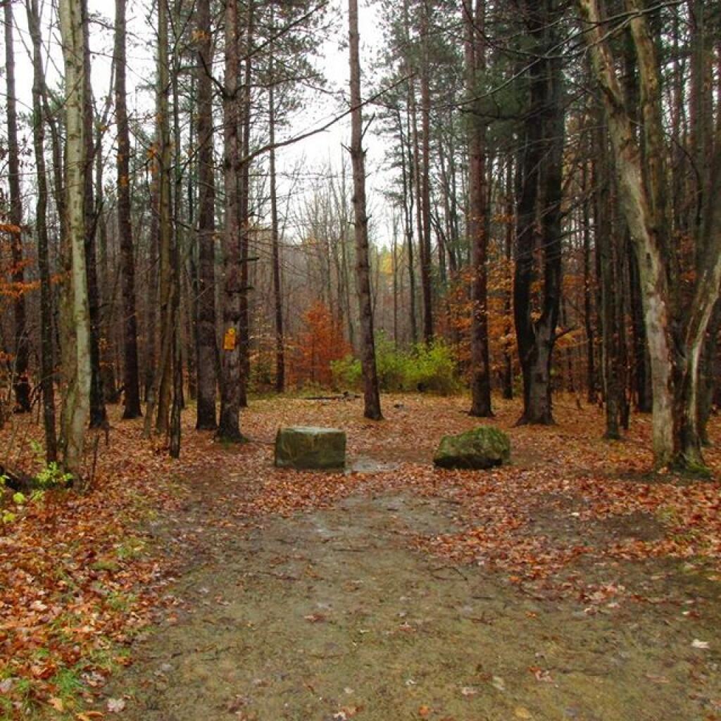
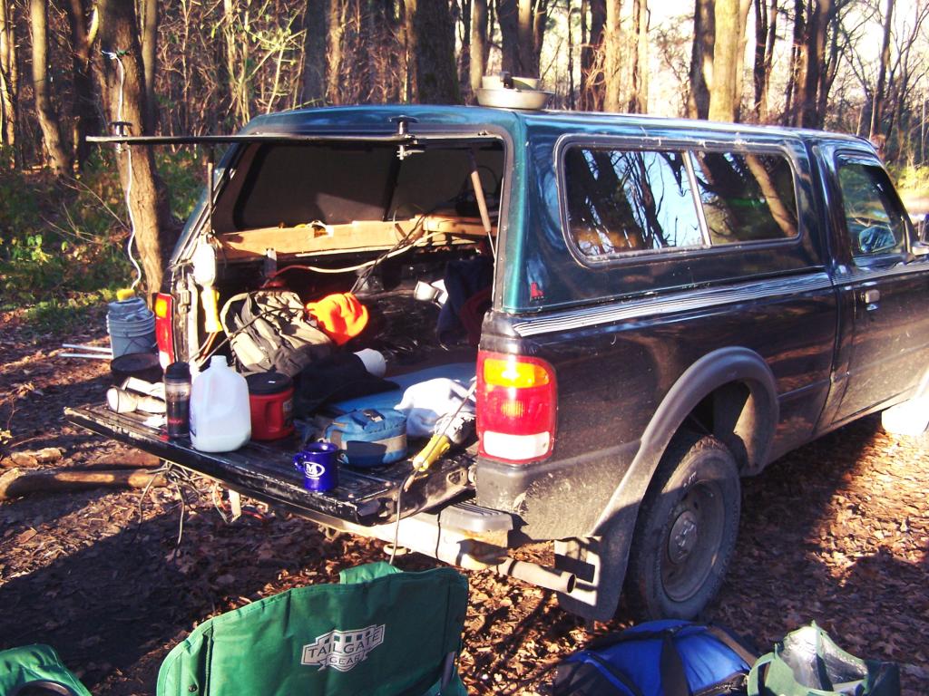
Got the big ol campsite โ›บ I wanted on Potomac Road. I admit I kind of raced the last two miles up here after a leisurely drive as I wanted to ensure I got the site I really wanted including swerving to dodge a pothole on the road and maybe even cutting off a driver a bit in determination to get the site though I doubt they were looking to camp here. I did see a camper van who was obviously looking for this site around 4 or 5 pm but I was here by 1:45 and it’s first come first serve. I took Friday morning off for a reason, lol. I really like this site as it’s farther off the road, well shaded but also where my truck is parked in a sunny field. No cell service at camp ๐Ÿ”• but I look at that as a benefit because I like the quiet ๐Ÿคซ. And my radio ๐Ÿ“ป is broke so no endless hours of talking heads ๐Ÿ‘ฅ discussing Jason Aldean’s Try that in a Small Town. I don’t need that crap or the endless stream of emails ๐Ÿ“ง and notifications on vacation. ๐Ÿ–

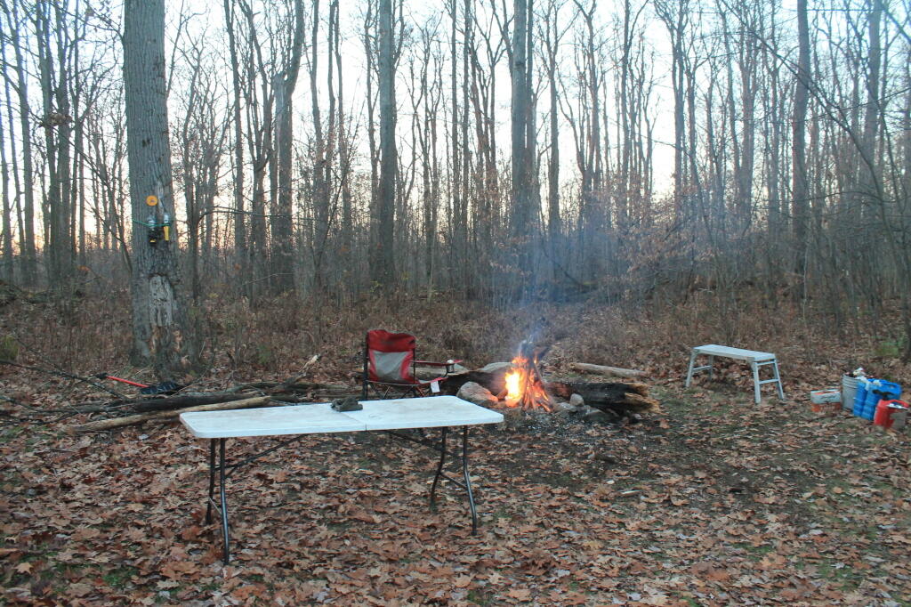
Spent the balance of the afternoon unpacking, organizing and setting up camp ๐Ÿ’ผ so everything will be perfect ๐Ÿ‘Œ for the next nine days. Did a lot of cooking – chicken, potatoes, onions, peppers and other things for lunch, then a similar thing with frozen samon for dinner. ๐Ÿ  I have so much good food to eat it’s hard to know where to start. Diet, lol. ๐Ÿ˜‚ Actually truth be told, I don’t have any cookies or junk food, just solid quality minimal whole fruits and vegetables ๐Ÿ that I’m cooking and eating this week. Had a beer ๐Ÿป but only one and no more then two each day if that all. Had some fresh squeezed lemonade ๐Ÿ‹ with stevia and used the rest of the lemon with the salmon. Yum, I’m eating good. ๐Ÿ˜‹

Tonight will be mostly cloudy ๐ŸŒƒ , with a low of 67 degrees at 6am. Four degrees above normal. Maximum dew point of 67 at 9pm. Northwest wind around 7 mph becoming south in the evening. In 2022, we had partly cloudy skies. It was somewhat humid. It got down to 68 degrees. The record low of 47 occurred back in 1987.

My phone shows a chance of rain โ˜” late this evening, so I’ll put away anything I don’t want to get wet before bed like my hammock and store my clean clothes in the cab of my truck to ensure they stay dry. I have a tent ๐ŸŽช set up for the dirty clothes, boxes and other camp supplies I’m not immediately using, mostly for organizational purposes. I think I need to get some crates for storing food, like I use on the back of my bicycle ๐Ÿšฒ especially as I have so much fresh stuff that I am not keeping in the cooler as I don’t have the space and I don’t think it strictly necessary but I worry about bruising and disorder in the reusable shopping bags ๐Ÿ›.

Tonight will have a Waxing Gibbous ๐ŸŒ” Moon with 82% illuminated. At 8 PM, the moon was in the south-southeast (158ยฐ) at an altitude of 17ยฐ from the horizon, some 233,176 miles away from where you are looking up from the earth. ๐Ÿš€ At the state speed limit of 55 mph, you’ll make it there by January 21st. Buckle up for safety! ๐Ÿ’บ The Strugeon ๐Ÿก Moon is on Tuesday, August 1. The darkest hour is at 1:14 am, followed by dawn at 5:23 am, and sun starting to rise at 5:56 am in the east-northeast (63ยฐ) and last for 3 minutes and 15 seconds. Sunrise is 59 seconds later than yesterday. ๐ŸŒ„ The golden hour ends at 6:36 am with sun in the east-northeast (70ยฐ). Tonight will have 9 hours and 21 minutes of darkness, an increase of 2 minutes and 3 seconds over last night.

Tomorrow will have showers and thunderstorms, mainly before 3pm. ๐ŸŒฆ High of 73 degrees at 12pm. Nine degrees below normal, which is similar to a typical day around September 14th. Maximum dew point of 71 at 12pm. ๐Ÿ–๏ธ West wind 9 to 15 mph becoming north in the afternoon. Chance of precipitation is 90%. New rainfall amounts between a half and three quarters of an inch possible. A year ago, we had cloudy skies in the morning, which became mostly sunny by afternoon. It was sticky. The high last year was 89 degrees. The record high of 97 was set in 1894.

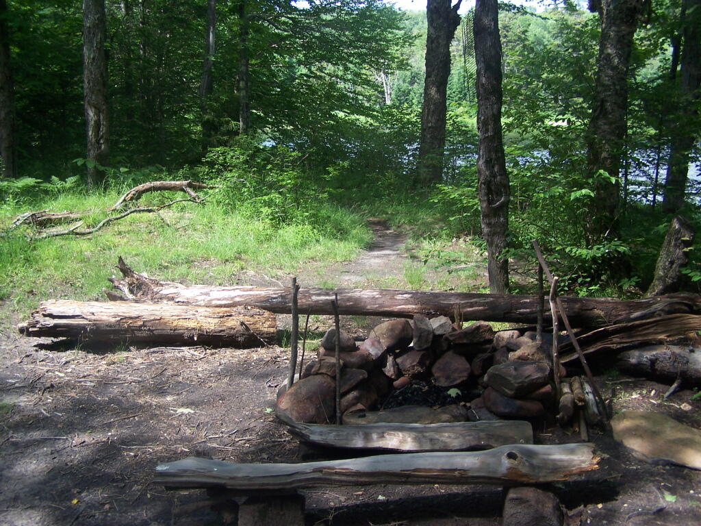
I am not expecting a real nice day tomorrow ๐ŸŒง๏ธ but I got books to read ๐Ÿ“– and podcasts to listen to and I’ll spend a relaxed day around camp doing some good cooking ๐Ÿง‘โ€๐Ÿณ healthy ingredients from the bounty I got at Walmart and that farmers market. ๐ŸŒฝ I have a ton of delicious Vadella onions ๐Ÿง…and lemons, ๐Ÿ‹ and so much else from grapes ๐Ÿ‡ to strawberries ๐Ÿ“ that I won’t go hungry and if I do I have more salmon, fresh spinach, rice ๐Ÿš beans ๐Ÿฑ and hot peppers ๐ŸŒถ๏ธ. Nice days I’ll head into town or other activities, ๐ŸŠโ€โ™‚๏ธ rainier stormy days, I’ll tool around the National Forest with Blackie my mountain bike ๐Ÿšต, hike into the back country and do some fishing ๐ŸŽฃ.

In four weeks on August 25 the sun will be setting in the west-northwest (286ยฐ) at 7:55 pm,๐ŸŒ„ which is 38 minutes and 26 seconds earlier then today. In 2022 on that day, we had hot, humid, mostly sunny, rain showers and temperatures between 87 and 60 degrees. Typically, you have temperatures between 81 and 60 degrees. The record high of 99 degrees was set back in 1947. Too soon, I’m not willing to think about summer coming to an end on vacation, lol.

Looking ahead, Average High 70 ๐ŸŽ‘ is in 5 weeks, September ๐ŸŽ is in 5 weeks, Labor Day Weekend Begins ๐Ÿ‘จโ€๐Ÿญ is in 5 weeks, Autumn ๐Ÿ‚ is in 8 weeks, Buy Nothing Day ๐Ÿ›๏ธ is in 17 weeks, December ๐ŸŽ„ is in 18 weeks, Bill of Rights Day ๐Ÿ“œ is in 20 weeks, Days are Getting Longer โ˜€๏ธ is in 21 weeks and 4:30 PM Sunset ๐ŸŒ† is in 5 months.

Summer day

Campsites and Lean-Tos in the Pharaoh Lake Wilderness ๐Ÿ•

Name

Asset

Latitude

Longitude

Pharaoh Lake #6 Lean-To

Lean-To

43.7968645799076

-73.6453393000723

Pharaoh Lake #1 Lean-To

Lean-To

43.7945783124509

-73.6458567829525

Pharaoh Lake #2 Lean-To

Lean-To

43.7966550549719

-73.6403349621639

Pharaoh Lake #5 Lean-To

Lean-To

43.8021964675395

-73.6391689121333

Pharaoh Lake #3 Lean-To

Lean-To

43.8049450667974

-73.624008537146

Pharaoh Lake #4 Lean-To

Lean-To

43.8138781587361

-73.6298196296567

Grizzle Ocean Lean-To

Lean-To

43.8223693680754

-73.5906397884625

Berrymill Pond Lean-To

Lean-To

43.8145480146987

-73.5808194788279

Clear Pond Lean-To

Lean-To

43.8384100123378

-73.5916749096727

Lillypad Pond Lean-To

Lean-To

43.8492027144111

-73.6180024104682

Little Rock Pond Lean-To

Lean-To

43.8500028765659

-73.5895397841294

Rock Pond Lean-To

Lean-To

43.8505590668051

-73.592294909266

Tubmill Marsh Lean-To

Lean-To

43.8581713274059

-73.6264837116145

Oxshoe Pond Lean-To

Lean-To

43.8405296775845

-73.6501782299231

Primitive Campsite

Primitive Tent Site

43.7948836587562

-73.6474883666327

Primitive Campsite

Primitive Tent Site

43.7999648334882

-73.6434422391773


Primitive Tent Site

43.8010952837628

-73.6408309573217


Primitive Tent Site

43.8117705334837

-73.6375426391986


Primitive Tent Site

43.8121707849735

-73.6341143149531


Primitive Tent Site

43.8136706560322

-73.633048112762


Primitive Tent Site

43.8030516237735

-73.6297348572877


Primitive Tent Site

43.8193354996829

-73.65747804896


Primitive Tent Site

43.8556083933363

-73.6526454340756


Primitive Tent Site

43.8553560492636

-73.6434934209565


Primitive Tent Site

43.853420940198

-73.6443087043536


Primitive Tent Site

43.8516091992566

-73.6525115349884


Primitive Tent Site

43.8483564865511

-73.6561304820428


Primitive Tent Site

43.8486433463009

-73.6598563784851


Primitive Tent Site

43.850773876634

-73.6595722738751


Primitive Tent Site

43.8507194001727

-73.6618378580291


Primitive Tent Site

43.8331021423051

-73.7097323540105


Primitive Tent Site

43.8124799577657

-73.7050524609


Primitive Tent Site

43.7747284324473

-73.6589052716234


Primitive Tent Site

43.7956403917561

-73.6485369956501


Primitive Tent Site

43.7885754431502

-73.5936825866447


Primitive Tent Site

43.7885154200448

-73.5981036241442


Primitive Tent Site

43.8266003548121

-73.5455675180987

Mill Brook Site #2

Primitive Tent Site

43.7731745678092

-73.6873067700498

Mill Brook Site #1

Primitive Tent Site

43.7741611592771

-73.6880013816841


Primitive Tent Site

43.8566601341087

-73.6484122890764


Primitive Tent Site

43.8151061584018

-73.6321296287074


Primitive Tent Site

43.8159091584052

-73.6297756291354

Primitive Campsite

Primitive Tent Site

43.7981027995837

-73.639049610409

Primitive Campsite

Primitive Tent Site

43.7993326475457

-73.637242399798


Primitive Tent Site

43.8435148029027

-73.6820672971608


Primitive Tent Site

43.8433169752042

-73.6795131679241


Primitive Tent Site

43.8433308551291

-73.676555649628


Primitive Tent Site

43.8272204500655

-73.5436849973277


Primitive Tent Site

43.8225268634159

-73.5417697318413

 Crane Pond

 Pharoah Lake

Oxbow Pond LeanTo

Outhouse Along NY 28/Boreas Camping Area

One good thing about Vanderwhacker Wild Forest, much like Moose River Plains, is most of the campsites have outhouses, which helps keep things cleaner. Many of them seemed to be in decent shape, unlike the fire pits and picnic tables (where they existed), which where rotten and in serious disrepair.

Taken on Saturday May 21, 2011 at Vanderwhacker Mountain Wild Forest.